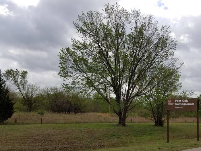
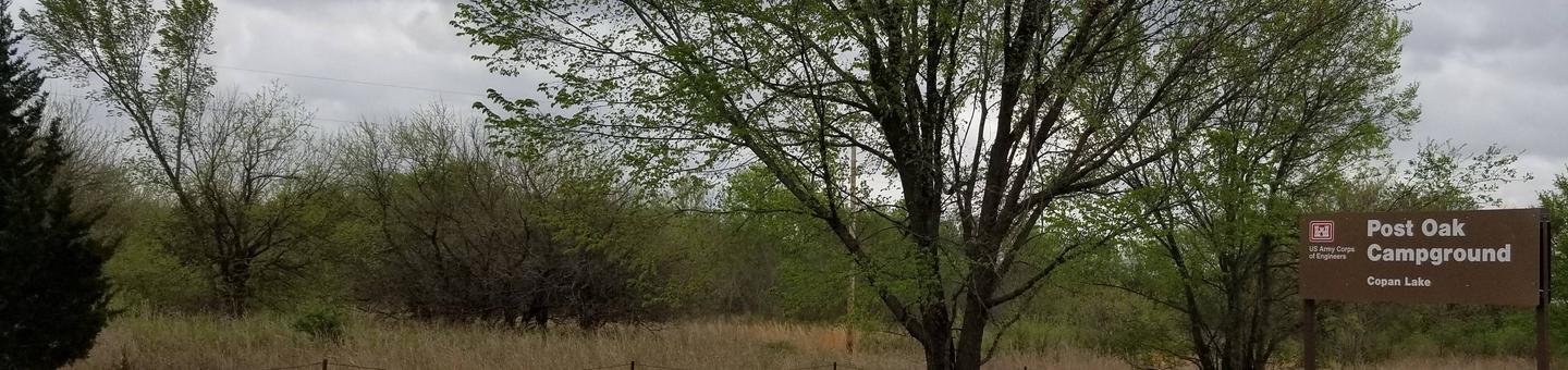
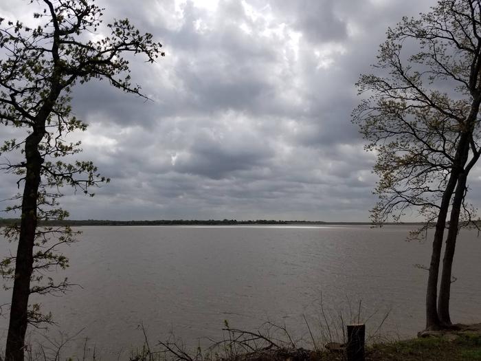
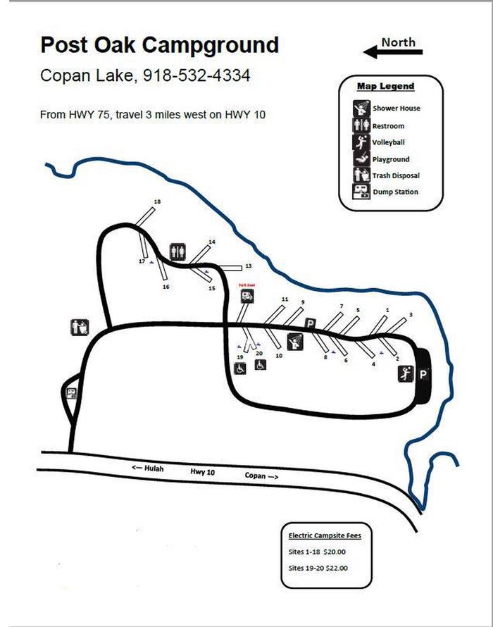
Post Oak is located on the banks of Copan Lake in Oklahoma’s Green Country. Camping, boating, picnicking, hunting and fishing are popular activities here.
Recreation
Copan Lake offers its visitors extensive opportunities for a memorable outdoor recreation experience. The lake is home to many species of game fish, including largemouth bass, white crappie, channel and flathead catfish, and various species of sunfish.
Hikers and horseback riders enjoy exploring the area on 3 miles of trails that wind through the wooded and open meadows of the lake shore.
11,000 acres of land around the lake have been set aside for wildlife management. These lands are open for public hunting of deer, waterfowl, bobwhite quail, turkey, cottontail rabbit, and squirrel.
Facilities
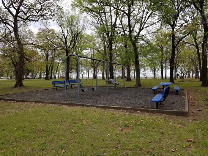
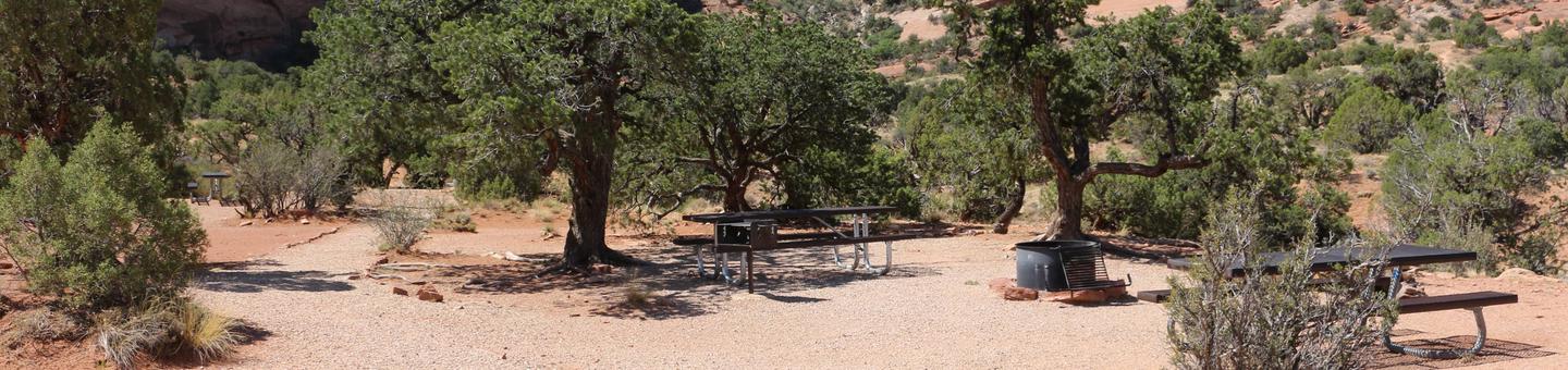
This campground offers 19 sites with electric hookups. Amenities include flush and pit toilets, showers, drinking water, and a dump station.
Natural Features
The 4,850-acre lake sits on the Little Caney River among a prairie landscape of grasslands and croplands.
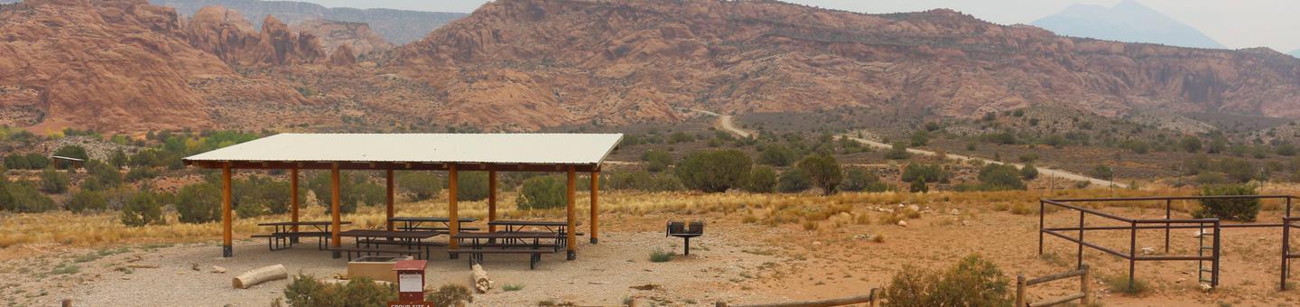
The Windwhistle Group Site is ideal for small gatherings looking for a quiet retreat. The parking is limited and you must walk in to the site. Within close proximity to national parks and open space, outdoor enthusiasts will enjoy hiking, mountain biking, and beautiful scenic overlooks. The towns of Moab and Monticello are approximately 45 minutes away and have dining, shopping, sports rentals, tour companies and museums.
Recreation
Situated on the road to the Needles Overlook, this area abounds in hiking, off-highway vehicle and mountain biking options. You are close to the Needles District of Canyonlands where there are numerous hiking and 4WD trails.
Facilities
The group area has a fire ring with grate, picnic tables and a nearby vault toilet. This group site does not have a shade shelter, a dump station or electric hook-ups. Water is typically available seasonally (May-September) The group site at Windwhistle is located at the lower end of the campground and is a walk-in site. Parking is limited and not appropriate for large vehicles,RV/motorhomes, pull campers and trailers. Please call the Moab Field Office for more information on vehicle limitations 432-259-2100.
Natural Features
Windwhistle is a wonderful hideaway tucked in the beautiful red rock. This isolated campground is surrounded by cliffs and canyons with great access to viewpoints, vistas and backcountry exploration.
Nearby Attractions
Windwhistle is on the road to the Needles Overlook and Hatch Point. It is close to the Needles District of Canyonlands and the Indian Creek climing area. Wilson Arch, Ken’s Lake and the La Sal Mountain Loop road are all between Windwhistle and Moab.
Nearby Activities
Auto touring
Camping
Star gazing
Gallery
Directions
From Moab, drive 32 miles south on 191 to the junction with the Needles Overlook road. Turn right and travel 6 miles on this road. The campground is on the left hand side of the road.
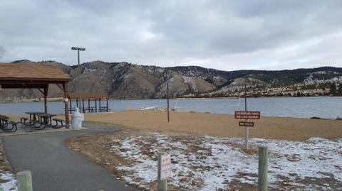
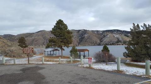
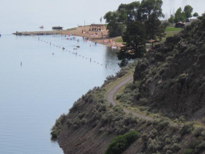
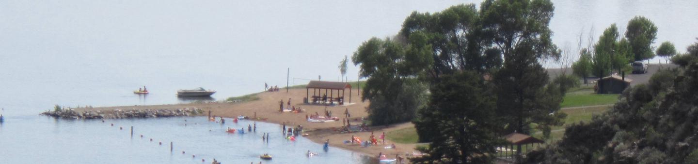
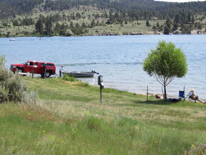
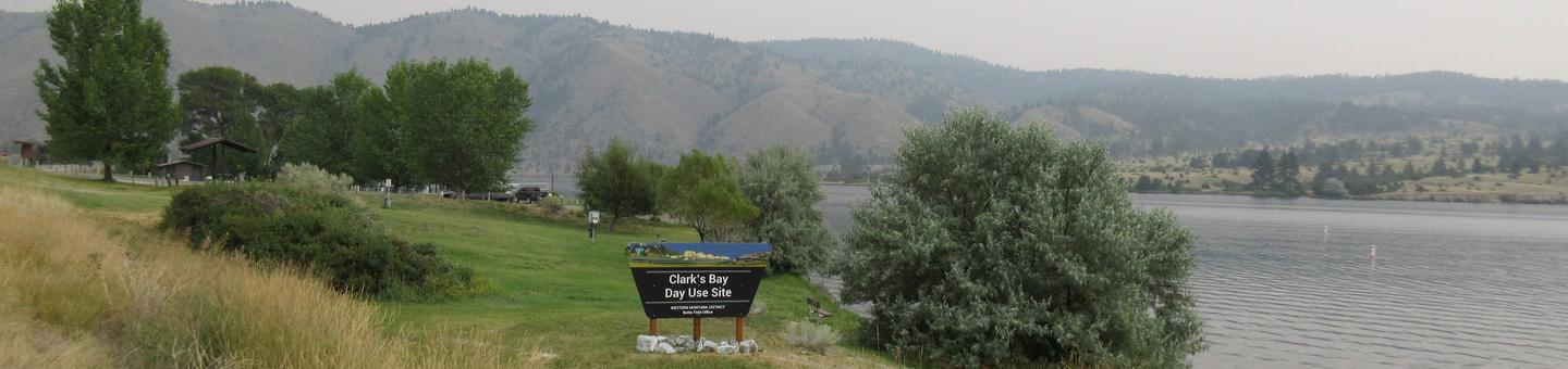
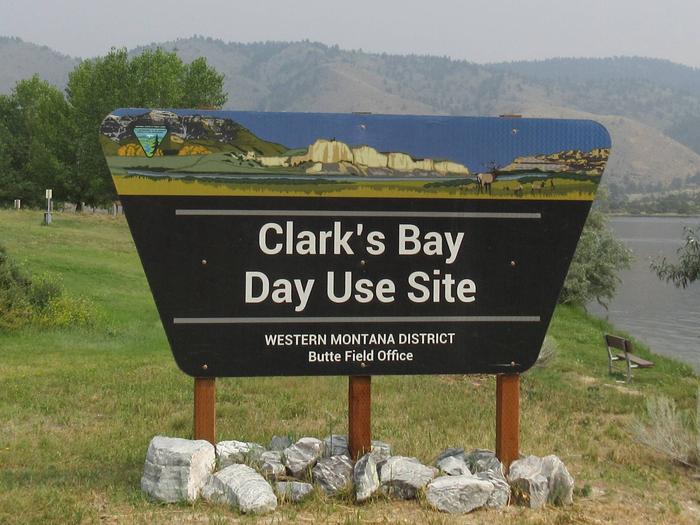
Clark’s Bay Day Use Area is situated on the picturesque “Devil’s Elbow” and Clark’s Bay of Hauser Lake. Just a short drive from Helena, this area offers stunning views of the Big Belt and Elkhorn Mountains. The area is overflowing with outdoor adventure opportunities. Whether you’re into fishing, hunting, wildlife viewing, hiking, mountain biking, boating or all of the above; all of these things are immediately accessed from (the greater) Hauser Lake Recreation Area. There is surely an activity for everyone! While just a short drive from Helena, the state capital; the feeling of seclusion and abundant nature is sure to impress.
Recreation
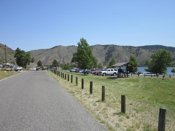
Clark’s Bay offers excellent recreational access. Clark’s Bay offers a large, approximately quarter-mile long manicured beach with a volleyball court, pavilions with picnic tables, power and lights. There are vault toilets located in convenient locations throughout the areas. There is a network of non-motorized, dirt, gravel and paved trails throughout Devil’s Elbow, Two Camps Vista and Clark’s Bay that allow you to walk or bike around the area without contending with vehicles. There are multiple trails within the larger Hauser Lake Recreation area, as well as multiple fishing access sites, hunting access, wildlife viewing and of course boating. World class mountain biking trails abound in the area as well. The recreation opportunities in the area are boundless.
Facilities
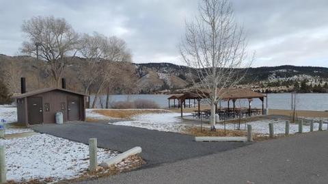
Clark’s Bay offers several amenities that will make your day enjoyable and comfortable. At Clark’s Bay there are two sets of vault toilets located near the beach and parking areas. There is potable water provided throughout the day use area, as well as garbage dumpsters. There are also picnic tables and small pavilions throughout the areas and benches along the lake and trails to take in the views. There is a small marina, general store with gas and a bar/restaurant just a half mile away.
Natural Features
The day use area is situated in a shrub-steppe landscape, mostly comprised of sage brush and bunch grasses. The entire day use area has a view of the lake and mountains. While there are some ponderosa pine and deciduous trees throughout the area, they are scarce and do not provide a large amount of shade, but the lake does help keep the temperatures down a bit on those hot summer days.
Nearby Attractions
Clark’s Bay is located in a prime location to get out and recreate outdoors, or within the capital of Montana. There are hundreds of miles of trails, Bureau of Land Management and Forest Service lands, state parks, the Lewis and Clark Trail and so much more.
Helena (only a short drive away) has all the amenities of a large city with small town charm. There are great restaurants, museums, the capitol building, old mining settlements, Last Chance Gulch, Reeder’s Alley and a vibrant downtown with a walking mall area.
Charges & Cancellations
Reservation cancellations must be done through recreation.gov.
Nearby Activities
Biking
Boating
Climbing
Historic & cultural site
Camping
Fishing
Hiking
Hunting
Winter sports
Visitor center
Water sports
Wildlife viewing
Swimming site
Other recreation concession site
Gallery
Directions
Clark’s Bay Day Use Area is located at 5700 York Road, Helena, Montana 59601. From Interstate 90 driving from Bozeman, exit at Exit: 274 US 287 Helena/Ennis, Right turn to continue North on 287 and continue for 57 miles. Turn right onto Lake Helena Drive, then turn right in 450 feet to stay on Lake Helena Drive. Continue for 4 miles through the roundabout. Turn right onto York Road and drive 5.7 miles to Clark’s Bay Day Use Area. From Helena/Butte/Great Falls: Drive to (or exit from I-15 onto) Custer Avenue, Head East on Custer Ave. Take left turn onto York Road. Continue on for 15 miles to Clark’s Bay Day Use Area.
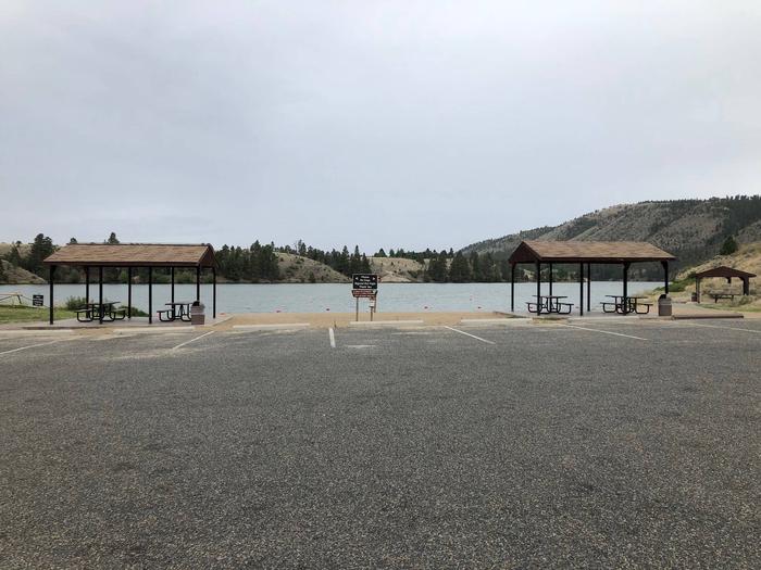
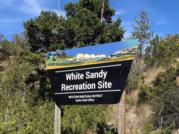
White Sandy is located on the west side of Hauser Lake at the confluence of Prickly Pear creek. White Sandy faces Eldorado Bar and the beautiful Big Belt mountains. It is in an ideal location for outdoor recreation, wildlife watching, water sports, camping and swimming.
Recreation
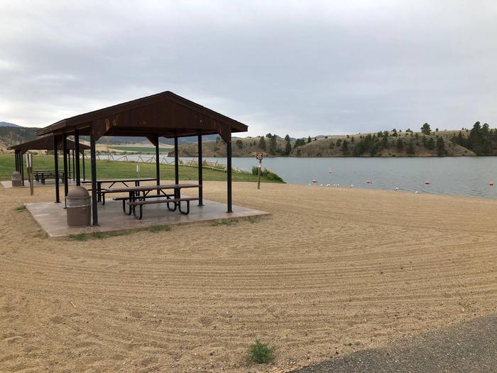
White Sandy offers excellent recreational access. There is a beach area, picnic areas, as well as a ramada/pavilion with power and lights, available by advanced reservation. There are vault toilets located in convenient locations throughout the site. There are trails throughout White Sandy as well as in the surrounding area. Additionally, there are multiple trails within the larger Hauser Lake Recreation area, as well as multiple fishing access sites, hunting access, wildlife viewing and of course, boating. World class mountain biking trails abound in the area as well. The recreation opportunities are truly boundless.
Facilities
White Sandy offers several amenities that will make your stay enjoyable and comfortable. White Sandy is a 32-site campground that has spacious and level gravel parking pads that accommodate RVs, travel trailers and tents. Reservations are available for Loop A (Lake Side) and Group Site-Loop C, which accommodate both RVs and tents. Each campsite is large enough to accommodate any size RV or camper trailer in addition to extra room for tents and parking.
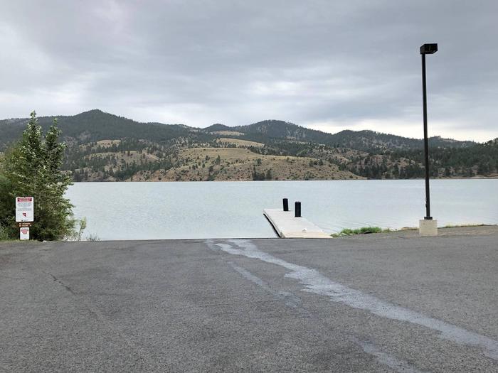
White Sandy features a large concrete boat launch with a courtesy dock, as well as areas to beach your vessel. A fish cleaning station is available near the day-use parking at White Sandy. There are vault toilets located in each loop of the campground as well as near the boat launch and beach area. There is potable water provided throughout the campground and day use areas as well as garbage dumpsters. Every campsite contains a fire ring with a grill grate in addition to a picnic table. There are also picnic tables and small pavilions throughout the area. There is a small general store across from the entrance to White Sandy, additionally, Black Sandy state park is located just 1/4 mile up the road, which offers an RV dump station which is free to use if you are staying at White Sandy.
Natural Features
The campground and day use areas are situated in a shrub-steppe landscape, mostly comprised of sage brush and bunch grasses. Every campsite has a view of the lake and mountains. While there are some ponderosa pine and deciduous trees throughout the area, they are scarce and do not provide a large amount of shade, but the lake does help keep the temperatures down a bit on those hot summer days.
Nearby Attractions
White Sandy is located in a prime location to get out and recreate outdoors, or within the capital of Montana. There are hundreds of miles of trails, Bureau of Land Management and Forest Service lands, state parks, the Lewis and Clark Trail and so much more.
Helena (only a short drive away) has all the amenities of a large city with small town charm. There are great restaurants, museums, the capitol building, old mining settlements, Last Chance Gulch, Reeder’s Alley and a vibrant downtown with a walking mall area.
Charges & Cancellations
Must be submitted through recreation.gov customer service.
Nearby Activities
Biking
Boating
Camping
Fishing
Hiking
Picnicking
Winter sports
Water sports
Wildlife viewing
Day use area
Information site
Photography
Swimming
Motor boat
Ranger station
Paddle boating
Water activities
Kayaking
Canoeing
Birding
Water access
Jet skiing
Water skiing
Windsurfing
Whale watching
Tubing
Ice fishing
Gallery
Directions
From Helena drive north, from Great Falls drive south on I-15 to the Lincoln Road exit, turn east on Lincoln Rd and continue to the T-intersection with Hauser Dam Rd, turn left (North) and continue about 4 miles until you reach White Sandy Recreation Area directly in front of you on the right hand side of the road. If you get to Black Sandy state park, you have gone too far.
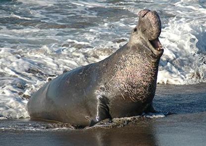
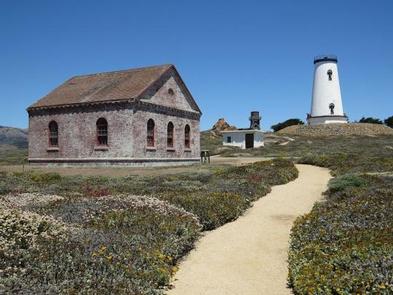
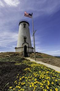
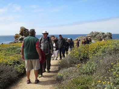
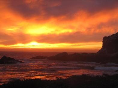
The Piedras Blancas Light Station is a historic landmark on California’s central cost. Located on a rugged windswept point of land six miles north of Hearst Castle along California’s scenic Highway One, the Lighthouse was first illuminated in 1875 and today beckons the visitor for respite from the modern world.
The Light Station is named for the distinctive white rocks that loom just offshore. These rocks and the rugged shoreline are home to seabirds, sea lions and elephant seals. Over 70 native plant species can be found on the 19 acres surrounding the Light Station.
Over the years, earthquakes have caused damage to the lighthouse. An earthquake on the last day of 1948 resulted in the upper part of the lighthouse being declared structurally unsound. In 1949, the upper three levels (fourth landing, watch room and lantern) were removed.
The Bureau of Land Management manages the Piedras Blancas Light Station as a historic park and wildlife sanctuary.
Access to Piedras Blancas by guided tours only. Tours are offered year-round and feature cultural and natural history, as well as spectacular scenery.
Piedras Blancas Light Station tours available:
June 15 – August 31 ( Mondays, Tuesdays, Thursdays, Fridays and Saturdays. )
September 1 – June 14 ( Tuesdays, Thursdays and Saturdays for the rest of the year. )
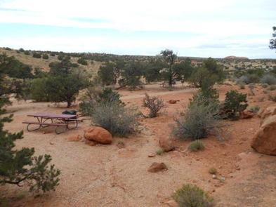
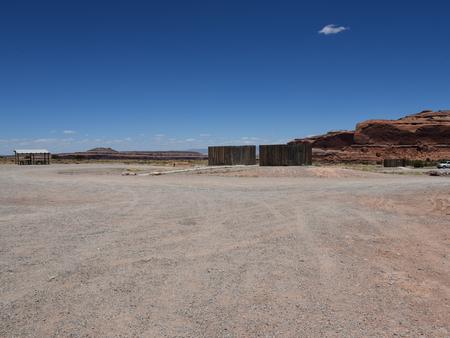
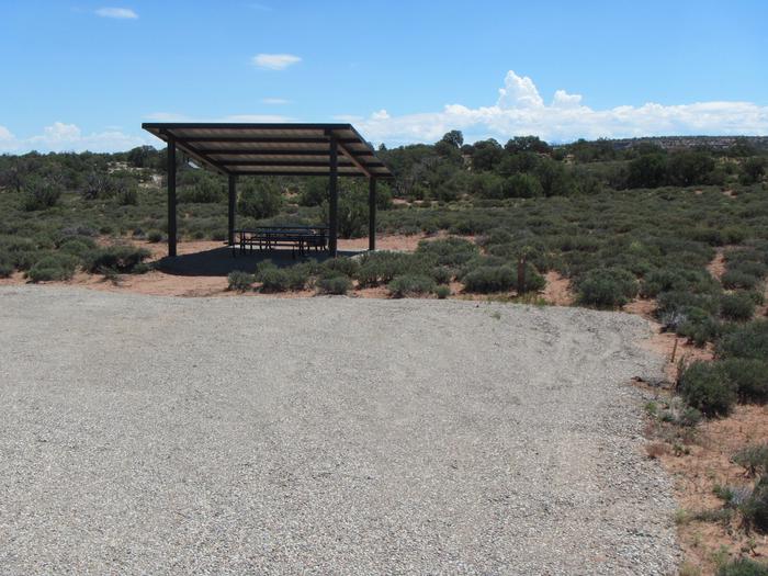
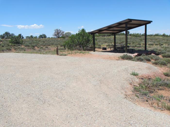
Lone Mesa Group Sites are ideal for large gatherings such as school groups or family reunions. Within close proximity to national parks and open space, outdoor enthusiasts will enjoy hiking, mountain biking, whitewater rafting, and four-wheel drive tours in the surrounding area. Lone Mesa is 1,000 feet higher in elevation than Moab, which can mean slightly cooler temperatures. The town of Moab is approximately 30 minutes away and has dining, shopping, sports rentals, tour companies and museums.
Recreation
From Lone Mesa there are multiple options for mountain biking, hiking, scenic tours, backcountry off-highway vehicle driving and photography. The area has many four-wheel drive roads leading to canyons and vistas. Nearby Canyonlands and Dead Horse Point State Park have many trails for hiking, biking and OHV driving.
Facilities
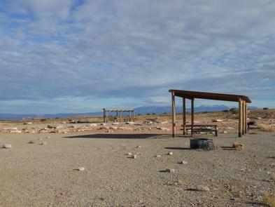
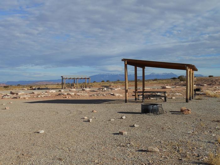
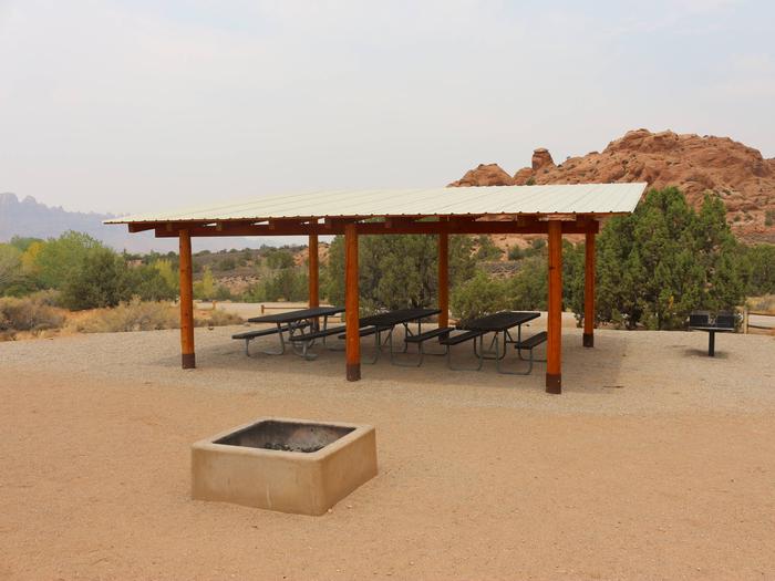
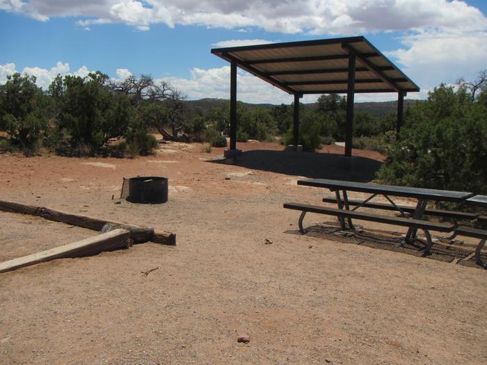
The group areas have fire grates, picnic tables, vault toilets, shade shelters and large parking areas. The group sites do not have water, dump stations or electric hook-ups. Larger vehicles fit well at this site.
Natural Features
The views from Lone Mesa will set you on the path to explore the nearby canyons and mesas. You are close to Arches and Canyonlands National Parks, Dead Horse Point State Park, Gemini Bridges, the White Rim trail and the Green River.
Nearby Attractions
Arches and Canyonlands National Parks, Dead Horse Point State Park, Gemini Bridges Road and trails, and Mineral Bottom (the Green River boat ramp) are all within close proximity. Groups heading into Canyonlands National Park to ride the White Rim trail often use this site for camping before and after their trip. L
Nearby Activities
Biking
Camping
Off highway vehicle
Recreational vehicles
Horse camping
Mountain biking
Off road vehicle trails
Gallery
Directions
From Moab, drive nine miles north on Hwy 191 to the intersection with Hwy 313. Turn west on Hwy 313 and drive eight miles then turn right on the Dubinky Road and go approximately 200 yards to the campground entrance road. Turn right and proceed up a small hill to the site.
The Ken’s Lake Group Sites are ideal for those wishing to be close to Moab, but away from the local highways. The lake offers swimming, paddle-boarding, limited boating and fishing. Hiking and 4WD roads are accessible from the campground. Within close proximity to national parks and open space, outdoor enthusiasts will enjoy hiking, mountain biking, whitewater rafting, and four-wheel drive tours in the surrounding area. The town of Moab is approximately 15-20 minutes away and has dining, shopping, sports rentals, tour companies and museums.
Recreation
The town of Moab is a hub for recreation. Tour operators offer guided hikes, rentals and evening entertainment. The area abounds with trails, dirt roads and canyons waiting to be explored.
Facilities
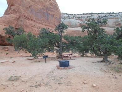
The group sites have fire grates, picnic tables, shade shelter and vault toilets. Group Site A has a horse corral. The group sites do not have water, dump stations or electric hook-ups. Site A is on the right as you enter the first loop and Site B is near the end on the left in the second loop.
Natural Features
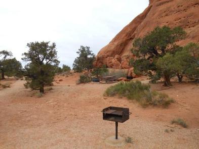
Situated near Ken’s Lake, these group sites offer beautiful views of the Moab Valley and access to nearby swimming, boating and hiking opportunities. From the group sites, it is a short hike over to the lake or up to a man-made waterfall. Hiking trails from the campground and nearby four-wheel drive roads allow visitors to explore the beautiful red rock canyons.
Nearby Attractions
Arches and Canyonlands National Parks and Hovenweep and Natural Bridges National Monuments are nearby. Also in the area are the Manti-La Sal National Forest and the La Sal Mountain Loop Road, which provide interesting exploration opportunities and cooler temperatures during the summer months.
Nearby Activities
Auto touring
Boating
Camping
Fishing
Hiking
Off highway vehicle
Recreational vehicles
Water sports
Day use area
Swimming site
Swimming
Horse camping
Off road vehicle trails
Water activities
Canoeing
Star gazing
Water access
Gallery
Directions
From Moab, drive south on Highway 191 until you see signs for Ken’s Lake, approximately 8 miles. Turn left off the highway and follow signs to the lake. The campground is just beyond the turn to the lake. Group Site A is in the first campground loop and B is on the second loop.
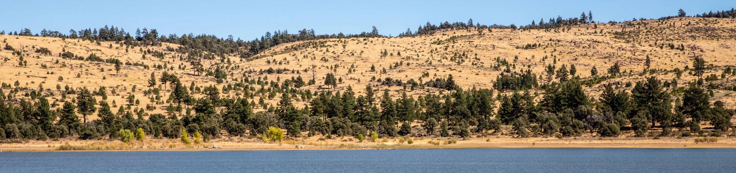
Indian Creek Campground is nestled in the eastern foothills of the Sierra Nevada between the California towns of Woodfords and Markleeville. Elevation in the area ranges from 5,600 feet at the reservoir to 6,400 feet in the surrounding foothills. Pine trees and sagebrush dot the landscape. Summers are generally warm and dry with daytime temperatures occasionally reaching 90 degrees Fahrenheit, while evenings are cool and comfortable. Sunny and dry days prevail, interspersed with periods of spectacular thunderstorms in the mid-summer months.
Recreation
Many recreational opportunities are available at Indian Creek Campground and the surrounding area including fishing, camping, picnicking, hiking, sailing, mountain biking, nature study, rock collecting, sightseeing, wildlife viewing, bicycling, white-water rafting and photography.
Fishing is by far the most popular activity. Trout are stocked in the reservoir and the river; the nearby East Fork of the Carson River is managed as a trophy fishery.
Facilities
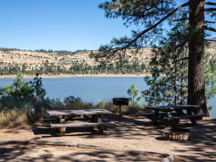
A campground with 30 sites is situated next to Indian Creek Reservoir. The campground has an RV/tent loop, a tent walk-to loop and group camp area. The RV/tent loop has 19 sites that are suitable for recreational vehicles up to 34 feet in length or tents. The walk-to tent loop has 10 sites with parking nearby. A group campsite (tents only) is available for groups of up to 40 campers. The main restrooms located in the RV/tent loop have flush toilets and hot showers. Drinking water is provided.
A day use area has four picnic sites, a boat ramp, large parking lot and restrooms with flush toilets.
Natural Features
Indian Creek Campground is spread over 160 acres in a forest of ponderosa, Jeffrey and pinyon pines. The campground is located on the west bank of Indian Creek Reservoir. Several campsites have reservoir views through the trees.
Nearby Attractions
Opportunities to view beautiful waterfalls, snow-capped peaks and rushing mountain streams abound throughout this landscape. Consider the following: whitewater raft or kayak the East Fork of the Carson River; fish the East or West forks of the Carson River; explore South Lake Tahoe; hike along the Tahoe Rim Trail; explore off-highway vehicle routes around Hope Valley; drive out to Blue Lakes for fishing, hiking, and horseback riding; hike into the Mokelumne Wilderness; follow the Emigrant trail up from Hope Valley over Carson Pass; mountain bike along a network of logging roads; fish and boat on Silver Lake and Caples Lake; enjoy a meal at Kit Carson Lodge or Caples Lake Resort; discover the beauty of Hope Valley and visit famous Sorensen’s Resort for lodging, meals and activities.
Nearby Activities
Auto touring
Biking
Boating
Camping
Fishing
Hiking
Hunting
Picnicking
Day use area
Photography
Paddling
Swimming
Motor boat
Water activities
Kayaking
Canoeing
Star gazing
Birding
Non-motorized boating
Water access
Scenic drive
Amphitheater
Ice fishing
Gallery
Directions
From Woodfords, California, travel Hwy 89 south approximately four (4) miles to Airport Road. Turn left or east on Airport Road and travel another four miles on paved surface to the campground entrance located just south of Indian Creek Reservoir.
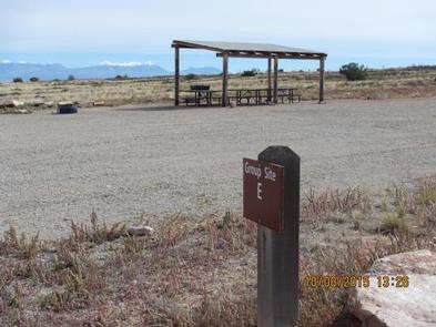
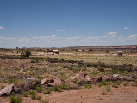
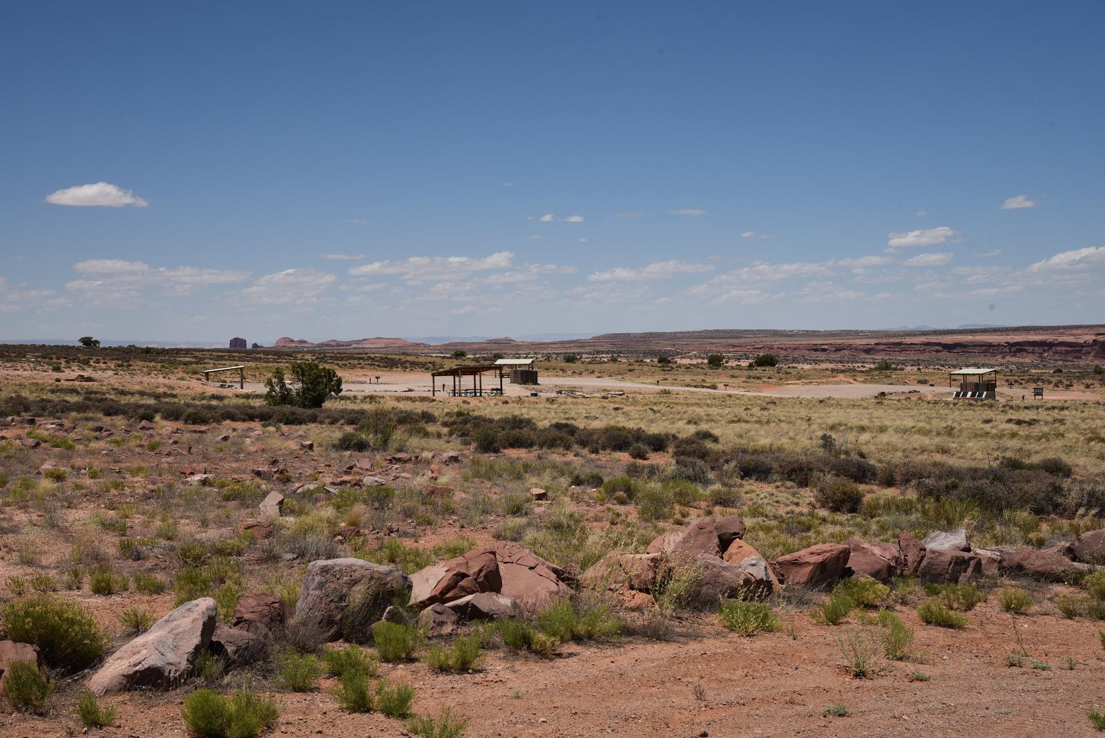
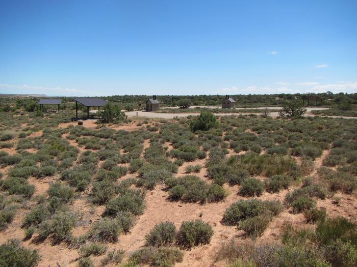
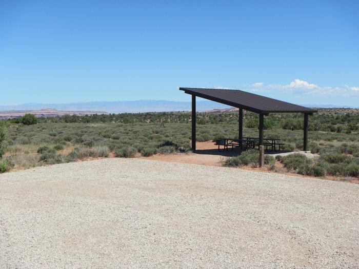
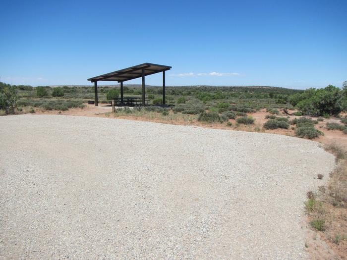
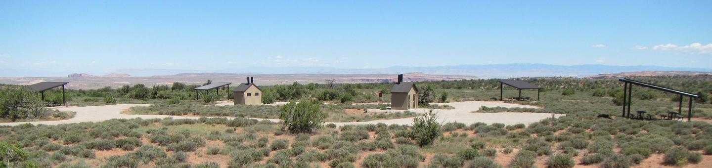
The five reservable Horsethief Group Sites are ideal for smaller gatherings (10-20 people & 6 sedans/trucks/vans only—no trailers or RVs). Group Site #39 is located in the main campground and Group Sites A, B, C, D are located in the adjacent campground which is designed to accomodate tent and van campers only. Horsethief Campground is ideal for those wishing to be close to The Island in the Sky District of Canyonlands National Park and Dead Horse Point State Park. The area also offers outdoor enthusiasts many options for hiking, mountain & road biking and four-wheel drive tours. The town of Moab is 25 minutes away and has dining, shopping, sports rentals, tour companies and museums.
Recreation
From Horsethief Campground, there are multiple options for mountain & road biking, hiking, scenic tours, four-wheeling and photography. The area has many mountian bike trails and four-wheel drive roads leading to canyons and vistas. Nearby Canyonlands National Park and Dead Horse Point State Park have many scenic overlooks and trails for hiking, biking and exploring.
Facilities
The group areas have shade shelters, picnic tables, a fire rings with grate and nearby vault toilet. These are relatively small group sites with limited parking and cannot accomodate RV/motorhomes, campers or trailers (parking accomodates up to six sedans or small vans only). (RVs, campers and trailers should use Lone Mesa Group Sites on SR 313, just six miles back towards Hwy. 191.) The group site does not have water, a dump station or electric hook-ups.
Natural Features
Tucked among pinyon and juniper trees on a high mesa west of Moab, Horsethief Campground offers open vistas with great sunrises and sunsets. The higher elevation (5500 feet) allows for slightly cooler temperatures in the summer.
Nearby Attractions
Arches and Canyonlands National Parks as well as Dead Horse Point State Park are within a 15-minute drive. Groups heading into Canyonlands to ride the White Rim trail often use this site for camping before and after their trip. Horsethief Campground is also near the Gemini Bridges Road and the Mineral Bottom Boat Ramp.
Nearby Activities
Auto touring
Biking
Camping
Hiking
Photography
Mountain biking
Star gazing
Scenic drive
Gallery
Directions
From Moab, drive 9 miles north on Highway 191, turn west on Highway 313. Drive 12 miles and then turn right and drive in the short entrance road to the campground.
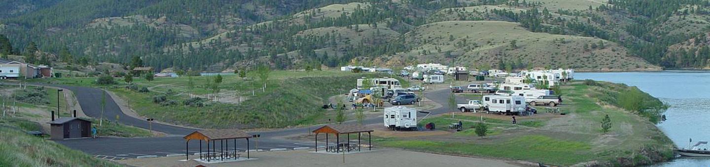
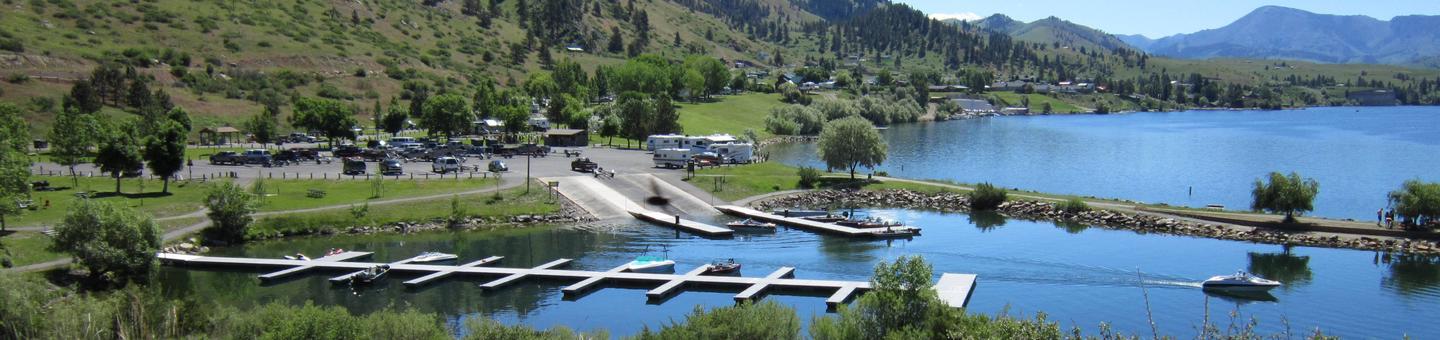
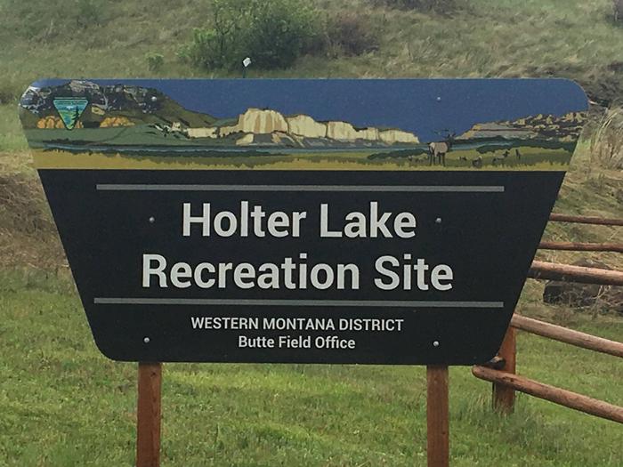
Holter Lake Campground is situated on the picturesque Holter Lake in west central Montana. The site is located approximately 45 north of Helena, Montana along the Missouri River. The area offers stunning views of Sleeping Giant Wilderness Study Area. Gates of the Mountain is in close proximity of the campground which is accessible via a watercraft. The area is overflowing with outdoor adventure opportunities. Whether you’re into fishing, hunting, wildlife viewing, hiking, boating, water skiing or all of the above; all of these activities are in close proximity to Holter Lake Campground. There is surely an activity for everyone!
Recreation
Holter Lake Campground offers excellent recreational opportunities. Activities in the area include: camping, boating (motorized and non-motorized), fishing water skiing, hiking, scenic/wildlife photography, wildlife viewing, and bird watching. Holter Lake Campground has a small beach area, picnic areas, and a ramada/pavilion with power and lights. (The ramada use is first-come, first-served). There are vault toilets located in convenient locations throughout the area. There are trails within the general vicinity, as well as multiple fishing access sites and hunting access points. The recreation opportunities in the area are truly boundless.
Facilities
Holter Lake Campground offers several amenities that will make your stay enjoyable and comfortable. Holter Lake Campground is a 52-site campground that has spacious and level gravel parking pads that accomodates RVs, camper trailers and tents. 42 sites will take RVs and all sites accomodate tents. There are 9 tent only sites. 49 of the campsites have the capability of accomodating up to 2 RVs or tents per site. Each RV or tent is considered a camping unit and must pay accordingly. Holter Lake Campground is open year-round. However, fees are only collected from May 1st to Columbus Day. There are 7-day camping stay limits at Holter Lake Campground. Of the 52 sites, 33 sites are reservation only within Loop A. The remaining sites are first-come, first-served and the tent only sites (44-52) are within the first-come, first-serve regulation.
Holter lake Campground features a large concrete boat launch with a courtesy dock as well as day-use and overnight dock slips for those camping in the campground. The docks are first-come, first-served with no assigned slips. A fish cleaning station is available near the entrance/booth at Holter Lake Campground. There is potable water provided throughout the campground and day-use areas, as well as garbage dumpsters. There are no hook-ups available. The reservation loop and tent area sites contain a fire ring with a grill grate in addition to a picnic table. There are also picnic tables and benches along the lake to take in the views.
Natural Features
Every campsite has a view of the lake and mountains. The campground and day-use area has poplar and green ash trees throughout the campground which provide shade during the height of the summer. The site is situated in a shrub-steppe landscape, mostly comprised of sage brush and bunch grasses. The campground is surrounded by sparsely wooded hills.
Nearby Attractions
Holter Lake Campground is located in a prime location to get out and recreate outdoors. There is access to public lands where multiple recreation opportunities and experiences are available. The campground is adjacent to the Missouri River, which was also the historical travel corridor for The Lewis and Clark Trail. Holter Lake Campground is situated between Helena and Great Falls.
In Helena, there are great restaurants, museums, the capitol building, old mining settlements, Last Chance Gulch, Reeder’s Alley and a vibrant downtown area. In or near Great Falls, there is the First People’s Buffalo Jump and Interpretive Center, Charlie Russell museum, Lewis and Clark Interpretive Center, Giant Springs Fish Hatchery and State Park, Tower Rock State Park and the Continental Divide Trail is nearby.
Nearby Activities
Boating
Historic & cultural site
Camping
Fishing
Hiking
Picnicking
Water sports
Wildlife viewing
Day use area
Swimming site
Information site
Photography
Paddling
Swimming
Mountain biking
Paddle boating
Water activities
Kayaking
Canoeing
Birding
Water access
Jet skiing
Water skiing
Scenic drive
Rafting
Ice fishing
Gallery
Directions
From Great Falls, Montana take Interstate-15 South towards Helena. Take exit 234 to Craig. Turn left heading to Craig and cross river. Will come to a “T” and then take a right on Recreation Road. Travel approximately 5 miles. Before crossing the river/steel bridge, turn left onto Beartooth Road. Continue 2.3 miles to Holter Lake Campground. The Campground will be on your right.
From Helena, Montana take Interstate-15 north towards Great Falls. Take exit 226 to Wolf Creek. Turn right towards Recreation Road and cross the railroad tracks. Turn left onto Recreation Road. After crossing the river/steel bridge, turn right onto Beartooth Road. Continue 2.3 miles to Holter Lake Campground. The Campground will be on your right.