Categories
Uncategorized

Red Mountain (MT)

Overview

Red Mountain Campground is adjacent to the lower Madison River and provides good access for camping, fishing and floating. The campground has 19 camp sites, 11 available for reservations. The campground has a volunteer seasonal campground host. There is no boat launch available at this site, but there are several in the vicinity. The campground serves as a great central location to access the lower Madison River. During peak season you can expect the campground to be full on weekends with lighter use during the work week. 

Recreation

The Madison River is well known for its robust trout fishery. The lower Madison River is a very popular destination for non-angling floaters (tubers) during the warm summer months. Red Mountain sits roughly half way between Warm Springs boat launch and Black’s Ford Fishing Access Site. 

Facilities

19 campsites, 3 accessible vault toilets, drinking water, horseshoe pit, and picnic tables. Firewood is available for purchase when the volunteer campground host is present. 

Natural Features

Madison River

Nearby Attractions

Lower Madison River, Bear Trap Canyon unit of the Lee Metcalf Wilderness Area, Norris Hot Springs

Charges & Cancellations

Failing to arrive on the first night of your reservation will result in a forfeiture of your reservation and your site may be made available to someone else. 

Nearby Activities

  • Boating
  • Camping
  • Fishing
  • Non-motorized boating
  • Scenic drive
  • Tubing

Directions

From Bozeman; Head west on MT Hwy 84 (Norris Road). Continue on MT Hwy 84 for 20.5 miles. Turn right (North) at South Bear Trap Canyon Road. If you cross the Madison River you have just passed the turn. 

From Norris; Head East on MT Hwy 84 (Norris Road) travel for 8 miles and turn left at South Bear Trap Canyon Road after you cross the Madison River. 

GPS Coordinates

Latitude 45° 36′ 33.8184″ N

Longitude 111° 34′ 11.0028″ W

Categories
Uncategorized

Trapper Springs (MT)

Overview

Trapper Springs Campground is adjacent to the lower Madison River and provides good access for camping, fishing and floating. The campground has 15 camp sites, 9 available for reservations. There is no boat launch available at this site, but there are several in the vicinity. The campground serves as a great central location to access the lower Madison River. 

The day use area has a large pavilion with parking for 20 vehicles. The pavilion can be reserved for groups ($50/day). The day use area also offers a wheelchair accessible trail to the river. The campground has 15 camping sites with two accessible vault toilets. Organized Group permits are required for groups larger than 15 people.

Recreation

The Madison River is well known for its robust trout fishery. The lower Madison River is a very popular destination for non-angling floaters (tubers) during the warm summer months. Trapper Springs sits roughly half way between Warm Springs boat launch and Black’s Ford Fishing Access Site.

Facilities

15 campsites, 3 accessible vault toilets, drinking water, group use pavilion, fire pits, and picnic tables. Firewood is available for purchase at Red Mountain Campground, when the volunteer campground host is present. ADA accessible trail to the Madison River. 

Natural Features

Madison River

Nearby Attractions

Lower Madison River, Bear Trap Canyon unit of the Lee Metcalf Wilderness Area, Norris Hot Springs

Charges & Cancellations

Failing to arrive on the first night of your reservation will result in a forfeiture of your reservation and your site may be made available to someone else.

Nearby Activities

  • Boating
  • Camping
  • Fishing
  • Picnicking
  • Day use area
  • Tubing
  • Accessible swimming

Directions

From Bozeman; Head west on MT Hwy 84 (Norris Road). Continue on MT Hwy 84 for 20.5 miles. Turn left (south) at South Bear Trap Canyon Road. If you cross the Madison River you have just passed the turn. 

From Norris; Head East on MT Hwy 84 (Norris Road) travel for 8 miles and turn right (south) at South Bear Trap Canyon Road after you cross the Madison River.

GPS Coordinates

Latitude 45° 36′ 24.6528″ N

Longitude 111° 34′ 5.3292″ W

Categories
Uncategorized

Henneberry House

Overview

This historic cabin, built in 1905, is located approximately 14 miles south of Dillon, Montana, on the banks of the Beaverhead River. The cabin provides access to a variety of outdoor recreational activities on adjacent public lands. The cabin and surrounding lands are managed by the Bureau of Land Management.

Recreation

Recreation opportunities are right outside the door with world-class trout fishing on the Beaverhead River. There may also be opportunities for waterfowl hunting. Nearby opportunities for hunting, hiking, fishing, and 4WD touring through the mountains are plentiful.

Facilities

The cabin sleeps a maximum of eight people on two queen size fold-out futons, and four bunk beds; bedding is not provided. A propane stove/oven, lights, and small refrigerator, wood cook stove, wood stove, outhouse, non-potable water pump, and basic cooking and eating utensils are provided. No potable water is available. Firewood and propane are provided.

Natural Features

The Beaverhead River flows alongside the cabin across from Gallagher Creek and beneath Gallagher Mountain.

Nearby Attractions

The Beaverhead River, Clark Canyon Reservoir, Lewis and Clark National Historic Trail, Bannack State Park, and Virginia City are all opportunities for additional exploration in the surrounding area.

Nearby Activities

  • Camping
  • Fishing

Gallery

Directions

Access to the cabin is a short distance off I-15 south of Dillon. From Dillon, take the Dalys exit (#51) and turn left under the interstate, then right on the frontage road approximately 1/4 mile to an access gate and parking area on your left. You will need a combination to open the locked gate, and should lock the gate behind you to prevent other unauthorized vehicle use on this road. From here, the cabin is only 1/4 mile ahead on a lightly maintained gravel road.

GPS Coordinates

Latitude 45° 4′ 35.0000″ N

Longitude 112° 47′ 25.0001″ W

Categories
Uncategorized

EDSON CREEK GROUP CAMPGROUND

Overview

Edson Creek Campground features open meadow style camping. It is located near a beautiful meandering creek that flows into the Sixes River.

Recreation

Camping, fishing, boating, site-seeing, and water play are all popular activities at the campground. A day use area and boat ramp are located across the road from the main campground, providing a place to launch boats and fish the Sixes River.

Facilities

Edson Creek provides 27 campsites and 5 group sites. All five of the group sites are reservable. Four of the group sites are located across the creek from the main campground via a seasonal bridge, group site A is near the main campground. This provides a private camping area for groups of 25 in each site.

Campground includes picnic tables, fire rings, and accessible toilets.

Natural Features

Tall alder and myrtle trees flank the open meadows at Edson. The water and forest that surrounds the campground are home to many fish and wildlife species.

Nearby Attractions

The area provides warm temperatures and easy access to nearby coastal attractions. Cape Blanco Lighthouse, Oregon State Parks, and several coastal beaches are nearby.

Nearby Activities

  • Boating
  • Camping
  • Fishing
  • Day use area
  • Swimming

Gallery

Directions

Edson Creek campground is located off of Highway 101 between Bandon and Port Orford, Oregon. From U.S. Highway 101, turn east onto Sixes River Road. Travel approximately four miles, and turn left into the campground just before you cross the Edson Creek Bridge.

GPS Coordinates

Latitude 42° 48′ 54.7200″ N

Longitude 124° 24′ 39.3401″ W

Categories
Uncategorized

DEVIL’S ELBOW RECREATION AREA

Overview

Devil’s Elbow Recreation Area is situated on the picturesque “Devil’s Elbow” of Hauser Lake. Just a short drive from Helena, the area offers stunning views of the Big Belt and Elkhorn mountains. The area is overflowing with outdoor adventure opportunities. Whether you’re into fishing, hunting, wildlife viewing, hiking, mountain biking, boating or all of the above; all of these things are immediately accessed from (the greater) Hauser Lake Recreation Area. There is surely an activity for everyone! While just a short drive from Helena, the state capital; the feeling of seclusion and abundant nature is sure to impress.

Recreation

Devil’s Elbow offers excellent recreational access. Devil’s Elbow has a small beach area, picnic areas, as well as a ramada/pavilion with power and lights, available by advanced reservation. There are vault toilets located in convenient locations throughout the area. There is a network of non-motorized dirt, gravel and paved trails throughout Devil’s Elbow, Two Camps Vista and Clark’s Bay that allow you to walk or bike around the area without contending with vehicles. There are multiple trails within the larger Hauser Lake Recreation area, as well as multiple fishing access sites, hunting access, wildlife viewing and of course, boating. There are several world class mountain biking trails in the area as well. The recreation opportunities in the area are truly boundless.

Facilities

Devil’s Elbow offers several amenities that will make your stay enjoyable and comfortable. Devil’s Elbow is a 48-site campground that has spacious and level gravel parking pads that accommodate RVs, camper trailers and tents. Of the 48 sites, there are five sites that are specifically designated for tents. Reservations are available for Loop A and Group Site-Loop C, which accommodate both RVs and tents. Each campsite is large enough to accommodate any size RV or camper trailer in addition to extra room for tents and parking.

Devil’s Elbow features a large concrete boat launch with a courtesy dock, as well as day use and overnight dock slips for campers. The docks are first-come, first-served with no assigned slips. A fish cleaning station is available near the day-use parking at Devil’s Elbow. There are men’s and women’s vault toilets located in each loop of the campground as well as near the boat launch. There is potable water provided throughout the campground and day use areas, as well as garbage dumpsters. Every campsite contains a fire ring with a grill grate in addition to a picnic table. There are also picnic tables and small pavilions throughout the areas and benches along the lake to take in the views. There is a small marina, general store with gas and a bar/restaurant just a half mile away.

Natural Features

The campground and day use areas are situated in a shrub-steppe landscape, mostly comprised of sage brush and bunch grasses. Every campsite has a view of the lake and mountains. While there are some ponderosa pine and deciduous trees throughout the area, they are scarce and do not provide a large amount of shade, but the lake does help keep the temperatures down a bit on those hot summer days.

Nearby Attractions

Devil’s Elbow is located in a prime location to get out and recreate outdoors, or within the capital of Montana. There are hundreds of miles of trails, Bureau of Land Management and Forest Service lands, state parks, the Lewis and Clark Trail and so much more.

Helena (only a short drive away) has all the amenities of a large city with small town charm. There are great restaurants, museums, the capitol building, old mining settlements, Last Chance Gulch, Reeder’s Alley and a vibrant downtown with a walking mall area.

Nearby Activities

  • Biking
  • Boating
  • Climbing
  • Historic & cultural site
  • Camping
  • Interpretive programs
  • Fishing
  • Hiking
  • Hunting
  • Picnicking
  • Winter sports
  • Visitor center
  • Water sports
  • Wildlife viewing
  • Swimming site
  • Other recreation concession site

Gallery

Directions

Devil’s Elbow Campground is located at 5965 York Road, Helena, Montana 59601. From Interstate 90 driving from Bozeman, exit at Exit: 274 US 287 Helena/Ennis; right turn to continue north on 287 and continue for 57 miles. Turn right onto Lake Helena Drive, then turn right in 450 feet to stay on Lake Helena Drive. Continue for 4 miles through the roundabout. Turn right onto York Road and drive 6.2 miles to Devil’s Elbow Recreation Area. From Helena/Butte/Great Falls: Drive to (or exit from I-15 onto) Custer Avenue, head east on Custer Ave. Take left turn onto York Road. Continue on for 16 miles to Devil’s Elbow Recreation Area; or take the Lincoln RD exit on I-15, Head East on Lincoln Road until it intersects with Lake Helena Dr (T-Intersection). Take a right (South) on Lake Helena Dr (this route contains portions of dirt and gravel roads) and continue until the road turns back into pavement, take a left (East) on Deal Lane and follow the road until it terminates at York Road. Take a left (North) on York Road and continue for about 2 miles to Devil’s Elbow.

GPS Coordinates

Latitude 46° 42′ 5.7301″ N

Longitude 111° 48′ 34.1798″ W

Categories
Uncategorized

Clay Creek Recreation Site

Overview

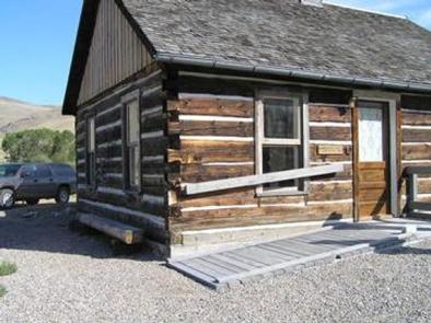
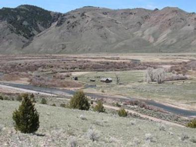
Clay Clay Creek Recreation Site is nestled in the Coast Range of Oregon between Eugene and the Oregon coast at an elevation of 436-492 feet. Located at the confluence of Clay Creek and the Siuslaw River, this recreation site offers a wealth of activities including forest hiking, fishing, wildlife viewing, picnicking and camping. The Springfield Office of the Northwest Oregon District of the Bureau of Land Management (BLM) manages the Clay Creek Recreation Site.

Recreation

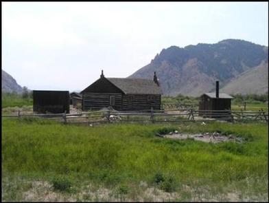
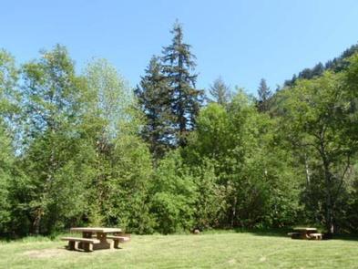
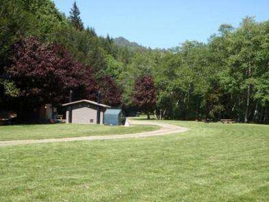
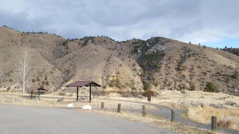
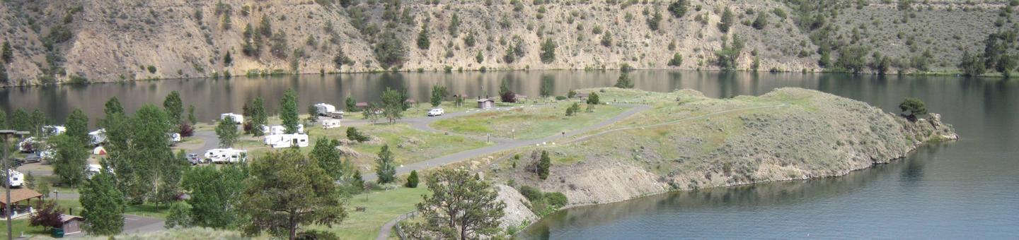
This quiet family oriented recreation site is a favorite if you enjoy riverside camping with an interpretive trail to old-growth timber. Spacious campsites with paved parking pads, mossy vine-maple tangles, and tall straight firs make up this camping area. The recreation site also boasts large group shelters available by reservation for group outings, weddings, or other events.

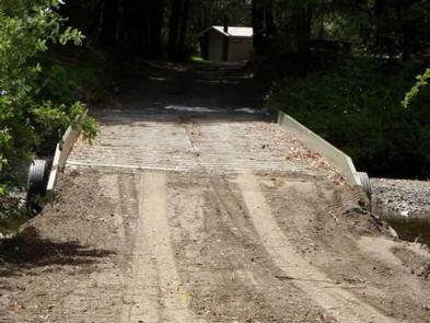
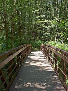
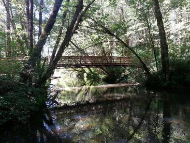
The Clay Creek Trail, created in 1991 for hiking, provides access to a stand of Douglas fir high above the campground and the Siuslaw River. The site’s Clay Creek Trail ascends a ridge above the campground to a remnant old-growth stand. From camp, you cross the concrete bridge on Clay Creek Road and river to begin the hike.

Facilities

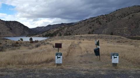
Clay Creek offers 21 individual campsites to accommodate 32 feet of RV, truck and trailer, or tents. Most sites contain fire ring, barbeque grill, picnic table, and tent pad. In addition, the site contains vault toilets, a summer swimming area with dressing rooms nearby, individual picnic sites, a children’s play area, horseshoe pits, potable water, volleyball area (bring your net and ball), and a ball field.

Natural Features

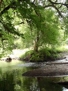
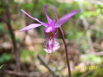
Clay Creek campground and the surrounding area are home to large canopy trees such as Douglas fir, western hemlock, red cedar, red alder and big leaf maple. The forest understory features a host of native plants like rhododendron, salal, various fern species, salmonberry and vine maple. On the forest floor, oxalis, Calypso orchids and mosses compliment the scenery. A diverse variety of bird life, from the seldom seen pileated woodpecker, northern spotted owl and marbled murrelet to the ever-present Oregon junco, frequent this area. Signs of larger animals, such as raccoon, mink, bear, elk, deer and beaver are evident.

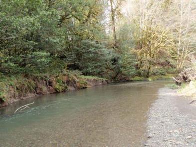
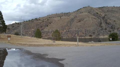
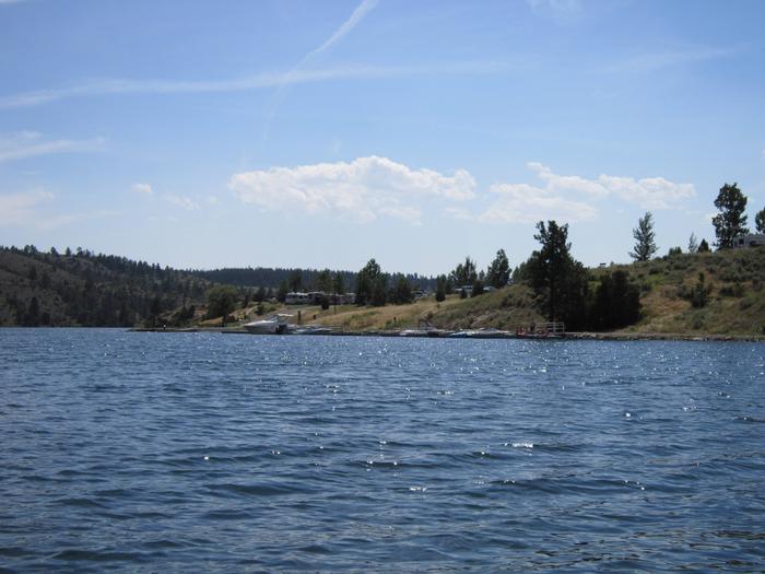
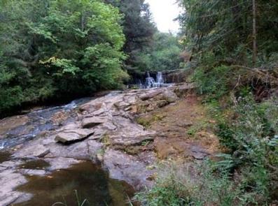
Clay Creek is part of the Siuslaw River watershed that drains water from the Coast Range to the Pacific Ocean. The river flows broad, cloudy, and green and calls to anglers; check current fishing regulations before casting your line. The Siuslaw River is a salmon watch site that runs fast and cold during the winter months, where you can observe spawning Coho and Chinook salmon in the river’s exceptional habitat during the fall and winter.

Nearby Attractions

Put-ins for the river downstream, along the Siuslaw River Road. No permit required to paddle the 6.5 mile river, with Class II – III rapids.

Whittaker Creek Recreation Site

(Florence) Alder Dune Campground

(Florence) Archie Knowles Campground

(Florence) B & E Wayside Mobile and RV Park

(Cottage Grove) Baker Bay Campground

(Dorena) Baker Bay County Park

(Westfir) Bedrock Camp

Nearby Activities

  • Camping
  • Fishing
  • Hiking
  • Picnicking
  • Day use area
  • Swimming
  • Non-motorized boating
  • Water access
  • Softball fields

Directions

From Eugene (valley): From Interstate 5 go west on Beltline Road to West 11th Avenue. Turn right onto West 11th Avenue (Highway OR-126). Follow Highway 126 about 29 miles to Siuslaw River Road just west of Walton. Turn left on Siuslaw River Road and follow about 10 miles to the intersection of BLM Road 19-7-20.1. Keep left on Siuslaw River Road for about 6 miles. The main entrance to the recreation site is located on the right.

From Florence (coast): Take Highway OR-126 east about 14 miles to Mapleton. Turn right and follow Highway 126 for about 12 miles to Siuslaw River Road. Turn right on Siuslaw River Road and follow about 16 miles to the intersection of BLM Road 19-7-20.1. Keep left on Siuslaw River Road for about 6 miles. The main entrance to the recreation site is located on the right.

GPS Coordinates

Latitude 43° 54′ 18.2880″ N

Longitude 123° 34′ 5.9880″ W

Categories
Uncategorized

Alsea Falls Recreation Site

Overview

Alsea Falls Recreation Site is located along a Bureau of Land Management National Back Country Byway, located in the Oregon Coast Range, 13 miles west of Monroe, Oregon, in Benton County. Alsea Falls is open for camping May 1 through September 30 of each year. The South Fork of the Alsea River flows through the Alsea Falls Recreation Site, cascading down 30 feet to form Alsea Falls in the day use area.

Recreation

The beautiful surroundings of Alsea Falls can be enjoyed by exploring the trails that wander through the area and lead to the picnic grounds and beyond. On a warm day, Alsea Falls Recreation Site offers cool relief along the river.

During the winter months, the South Fork of the Alsea River provides excellent salmon and steelhead fishing. Be sure to check with the Oregon Department of Fish and Wildlife for current fishing regulations.

Facilities

This recreation area contains a variety campsites to accommodate all types of visitors, including group and single campsites. Amenities within the campground include drinking water and vault toilets. Several campsites can accommodate large RVs or trailers; up to 32 feet long.

Natural Features

Forests in all stages of growth line South Fork Alsea National Back Country Byway. The nearby South Fork Alsea River offers painters and photographers endless opportunities to capture the natural beauty of Alsea Falls and the surrounding area. Old growth Douglas fir and western red cedar forests can be seen on the nearby ridges, while younger Douglas fir and vine maples provide a pleasant atmosphere at the Alsea Falls Recreation Site.

Nearby Attractions

The Fall Creek Day-Use Trailhead offers 12 plus miles of mountain bike specific trails. Hikers can use these trails as well.

Green Peak Falls with a drop of 45 feet is accessed by road or trail through the private campground of McBee Park. Follow the markers along the trail and road.

Alsea Trout Hatchery is north of the town of Alsea.

Nearby Activities

  • Biking
  • Camping
  • Fishing
  • Hiking
  • Hunting
  • Day use area
  • Photography
  • Mountain biking

Gallery

Directions

From Corvallis: Take Hwy 99W south about 15 miles. Turn right on Alpine Road, follow for approximately 9 miles. Alpine Road turns into South Fork Road. Follow about 4 miles to the Alsea Falls Campground on the right.

From Alsea: Travel south from the town Alsea on Alsea-Deadwood Hwy for about 1 mile. Turn left on the South Fork Road and follow for approximately 8.5 miles (stay on main paved road). Pass the Alsea Falls Day-Use about 0.5 miles and turn left into the Alsea Falls Campground Entrance.

GPS Coordinates

Latitude 44° 19′ 14.0200″ N

Longitude 123° 29′ 16.1599″ W

Categories
Uncategorized

Cripple Creek Campground

Overnight camping, a riverside day-use area, and fishing access are available, including some universal design campsites and several walk-in tent sites near the Chatanika River.

A class I-II float trip to the Upper Chatanika State Recreation Site at milepost 39 is approximately 25 miles (40 km) long. Occasional low water may require some boat dragging. First come, first serve. Fee site ($6/night or $3/night with Senior Pass).

Nearby Activities

  • Camping
  • Fishing
  • Hiking
  • Hunting
  • Wildlife viewing
  • Photography
  • Paddling

Directions

Blacktop highway accessible. Campground is at mile 60 on the Steese Highway, northeast of Fairbanks, Alaska.

GPS Coordinates

Latitude 65° 16′ 33.6000″ N

Longitude 146° 23′ 24.0000″ W

Categories
Uncategorized

Ophir Creek Campground

The Ophir Creek Campground is one of two campgrounds located at either end of the Nome Creek Valley, on the southern edge of the White Mountains NRA. Nestled in tall white spruce trees on the bank of Nome Creek, the campground includes 20 campsites, including one group site.

From here you can enjoy fishing in Nome Creek or take a short day-hike over to Beaver Creek. Also nearby is the 3-mile loop trail to Table Top Mountain, with awesome views of the higher peaks in the White Mountains. Ophir Creek Campground also provides river access to Nome Creek for paddlers headed to Beaver Creek Wild and Scenic River.

The campground is maintained during the summer season (June thru mid-September) and have hand pump wells, trash cans, and outhouse-style toilets. Each campsite has a parking area, picnic tables, and fire rings. Firewood is not provided. The nearest RV dump station is in Fairbanks.

Nearby Activities

  • Historic & cultural site
  • Camping
  • Fishing
  • Hiking
  • Horseback riding
  • Hunting
  • Wildlife viewing
  • Photography
  • Paddling

Directions

To reach Nome Creek from Fairbanks, take the Steese Highway to mile 57 and follow the U.S. Creek Road for seven miles to the Nome Creek Road. Taking a left at the junction, it is 12 miles to lower Nome Creek, the Ophir Creek Campground and the put-in for floating Beaver Creek National Wild River.

GPS Coordinates

Latitude 65° 22′ 7.4964″ N

Longitude 147° 5′ 3.0840″ W

Categories
Uncategorized

Mount Prindle Campground

The Mount Prindle Campground is one of two campgrounds located at either end of the Nome Creek Valley, on the southern edge of the White Mountains NRA. The campground’s 13 sites, are situated among tall willow shrubs, below expansive alpine tundra meadows and Mount Prindle (5,286 feet), making it the ideal spot to begin a trip into the high country. From here you can enjoy gold panning in Nome Creek or explore the nearby Quartz Creek Trail.

Campgrounds are maintained during the summer season (June thru mid-September) and have hand pump wells, trash cans, and outhouse-style toilets. Each campsite has a parking area, picnic tables, and fire rings. Firewood is not provided. The nearest RV dump station is in Fairbanks.

Nearby Activities

  • Camping
  • Hiking
  • Hunting
  • Wildlife viewing
  • Photography

Directions

To reach Nome Creek from Fairbanks, take the Steese Highway to mile 57 and follow the U.S. Creek Road for seven miles to the Nome Creek Road. Taking a right at the junction, it is 4 miles to the upper end of Nome Creek Valley, the Quartz Creek Trailhead, and the Mount Prindle Campground.

GPS Coordinates

Latitude 65° 22′ 1.3620″ N

Longitude 146° 35′ 41.8020″ W