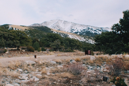
Zapata Falls is a Bureau of Land Management Special Recreation Management Area (SRMA). There are 23 single campsites, one group site, and one campsite host. The campground is located on BLM road 5415, seven miles southwest of the Great Sand Dunes National Park. The campground sits at 9,000 feet at the foot of the Sangre de Cristo Mountains. It offers sweeping views of the San Luis Valley, the San Juan Mountains and nearby Great Sand Dunes National Park—plus spectacular sunrises, sunsets and night skies.
A new trailhead in the campground supplies a link to the South Zapata Creek Trail # 852, and the Sangre de Cristo Wilderness. A second trail, North Fork South Zapata Trail # 868, just above the campground in the day-use area, leads visitors on a mildly steep half-mile hike to the falls that give the campground its name.
Getting to the falls is an adventure in itself, involving a wade through cold creek water and a climb over slick boulders. The falls are located on land owned by the Colorado State Land Board, and people who visit them need to be cautious and realize that the climb can be risky.
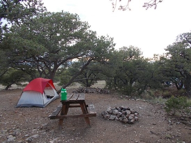
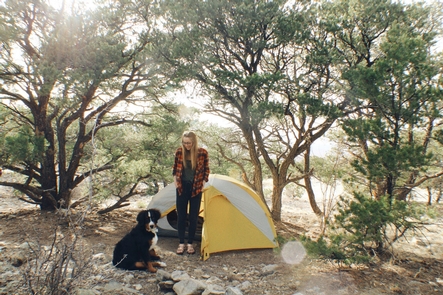
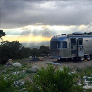
Zapata Falls campsites, one group site and one camp host site are spaced around two, one-mile-long loops. The sites on one loop are designed for tent campers. Parking spurs on the second loop vary a little in length but in general can handle RVs, towed campers or other configurations of vehicles up to about 50 feet long. Each single site has a picnic table, fire grate, parking and tent pads and a bear-proof food locker. The accessible group site has three picnic tables, three tent pads and a group fire ring. The campground is open year round but access in the winter can be difficult – call ahead for conditions. QUIET HOURS & no generator use 10 pm – 7 am. For more information, please contact the San Luis Valley Field Office.
Nearby Activities
- Camping
- Hiking
Gallery
Directions
To reach Zapata Falls Campground: From Highway 160, about 5 miles west of Blanca, turn north on Highway 150 and travel about 10.5 miles to BLM road 5415; turn east and travel another 2.5 miles to the campground entrance.
To reach the road to the campground from the Great Sand Dunes National Park, travel about 7 miles southwest on Highway 150. The unpaved road from the highway to the campgrounds gains 1,000 feet in 3.6 miles and is rough in places. Passenger cars and RVs can navigate the road, but it may be too challenging for some vehicles
GPS Coordinates
Latitude 37° 37′ 42.8520″ N
Longitude 105° 35′ 42.4680″ W