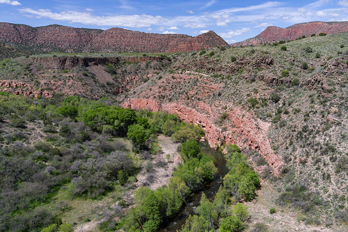
![[photo] Verde River from Beasley Flats side on the Prescott NF](http://www.fs.usda.gov/Internet/FSE_MEDIA/stelprdb5261160.jpg) The Verde River is one of Arizona’s only two Wild and Scenic Rivers, yet it remains relatively undiscovered as a recreational resource. That doesn’t mean this clear desert stream has little to offer. It’s an excellent place to fish for a number of species including trout, which the Arizona Game and Fish Department has begun stocking on a put and take basis. The Verde is also becoming more and more popular for recreational boating. Some stretches provide scenic canoeing among long pools and manageable riffles. Other sections become exciting whitewater runs during the spring snowmelt or after late summer thunderstorms.
The Verde River is one of Arizona’s only two Wild and Scenic Rivers, yet it remains relatively undiscovered as a recreational resource. That doesn’t mean this clear desert stream has little to offer. It’s an excellent place to fish for a number of species including trout, which the Arizona Game and Fish Department has begun stocking on a put and take basis. The Verde is also becoming more and more popular for recreational boating. Some stretches provide scenic canoeing among long pools and manageable riffles. Other sections become exciting whitewater runs during the spring snowmelt or after late summer thunderstorms.
- Overview/Background: Additional Verde River resources
- Permits & Regulations Online regulations, map, Forest Order for the Verde River
There are several recreation sites and ways to access and enjoy the Verde River:
- White Bridge Picnic Area
- Childs Dispersed Camping Area
- Sycamore Canyon Road (Google Maps)
- Find more Verde River recreation sites on the Prescott National Forest
Directions
Location: 50 miles south of Flagstaff on paved and gravel roads. Elevation is a warm 3,000 feet.
Access: Drive south 50 miles from Flagstaff on I-17 to Camp Verde and turn east on State Highway 260 (the General Crook Highway). Major river access points are at the White Bridge where State Highway 260 crosses the river east of Camp Verde, at Beasley Flats via FR 574 and FR 529, and near the Childs Power Plant via FR 708 and FR 502. The route into Childs is steep and winding. It can become very soft and slippery when wet.
Verde River Coridor Map: This map covers from Tapco to Beasley Flat, and Hwy 89A to Sedona. It shows river access points, parks, campgrounds, and major roads in the area.
Verde River access points map (click thumbnail to view larger image)
GPS Coordinates
Latitude 0° 0′ 0.0000″ S
Longitude 0° 0′ 0.0000″ W


