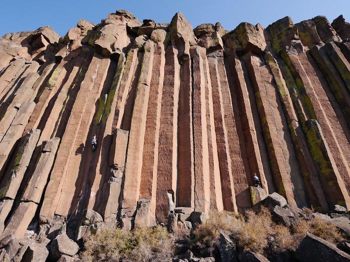
The Trout Creek Climbing Area has an annual closure to protect nesting golden eagles. The closure runs from January 15 -August 31 each year. During the closure, visitors to the area can use the Trout Creek campground and hike along the trail that follows the Lower Deschutes River to the south; however, they cannot leave the trail and head uphill toward the climbing area. This closure restricts access to all uses including hiking, climbing, or mountain biking.
Trout Creek is located in north-central Oregon, about 45 minutes north of Smith Rock State Park.
Gallery
Directions
From the city of Madras: Take Highway 97 North (NE 6th Street) past Safeway and out of town. Turn left (west) on NE Cora Drive (about 3 miles from town) which will shortly turn into NE Clark Drive. Continue into the town of Gateway, Oregon. After crossing the railroad tracks, take a right following signs to Trout Creek Recreational Area.
From the day-use area at the up-stream end of the campground, follow the trail/road up stream for about 10 minutes. There are currently two trails up to the crag.
GPS Coordinates
Latitude 44° 48′ 21.1320″ N
Longitude 121° 6′ 52.7400″ W

