Overview
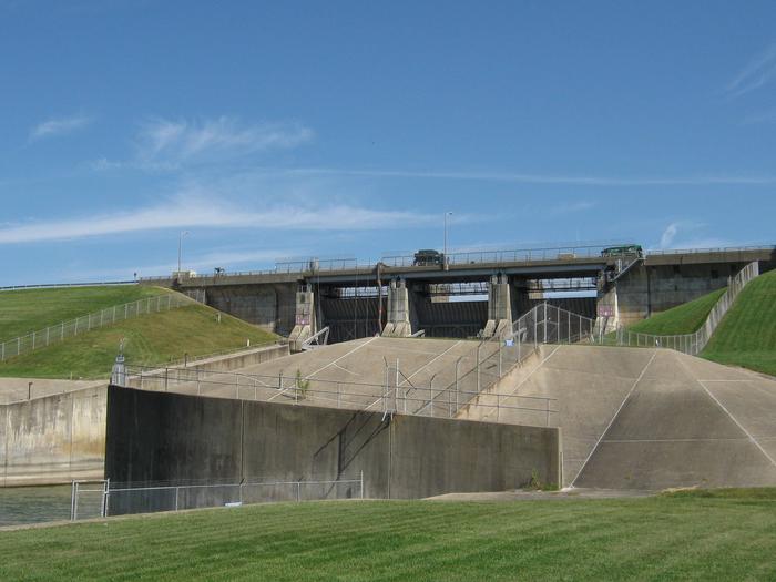
This day use area sits just below the Lake Shelbyville Dam on the southern end of Lake Shelbyville in the heart of central Illinois. This facility is a popular location for fishing, picnicking, and walking trails.
Recreation
This area is a prime location for shoreline and kayak fishing, and features a fish cleaning station and handicap accessible fishing pier. Some of the local fish in the lake are catfish, crappie, largemouth bass, muskie, walleye, white bass, and bluegill. The General Dacey Trail is located in the area and is a multi-use biking and walking trail which extends through the south end of the lake, spillway, the dam, and into the city park. There is an on-site playground for children, and several picnic areas for a family cookout or a perfect spot to eat for a lunch break.
Facilities
There are two reservable picnic shelters. Spillway Picnic Shelter #1 has 6 picnic tables, 1 group grill and fireplace, flushable restrooms attached to the shelter, overhead lights, 4 electrical outlets, and parking. The playground and river access is located across the street from the picnic shelter. Spillway Picnic Shelter #2 does not have electricity, but has 6 picnic tables and 1 group grill. The playground is next to the shelter; flushable restrooms down the sidewalk, south of the shelter. The shelter is right next to the spillway and has a perfect view of the dam.
Natural Features
The day use area has an excellent view of the Lake Shelbyville Dam which connects the lake to the Kaskaskia River. Numerous species of songbirds, shorebirds, waterfowl and raptors inhabit the lake area, as do mammals such as cottontail rabbit, white-tail deer, gray and fox squirrel, muskrat and mink.
Nearby Attractions
The Lake Shelbyville Dam and the Lake Shelbyville Visitor Center is located north of the day use area. West of the day use area is the town of Shelbyville which offers small town boutiques as well as eateries to explore.
Gallery
Directions
From Shelbyville, Illinois, go half a mile east of Shelbyville on State Route 16 to Spillway Recreation Area road. Turn left into Spillway Recreation Area.
GPS Coordinates
Latitude 0° 0′ 0.0000″ S
Longitude 0° 0′ 0.0000″ W


