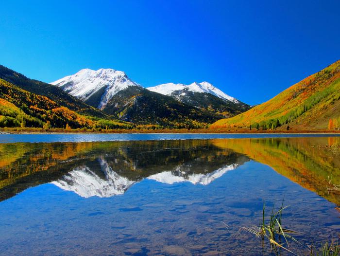
Overview
The San Juan National Forest includes approximately 1.8 million acres of federal lands administered by the U.S. Forest Service in Southwestern Colorado. The scenery ranges from high desert mesas and canyons to high alpine peaks and meadows. The area features a National Forest scenic byway, the San Juan Skyway and a Bureau of Land Management 4WD scenic byway, Alpine Loop Backcountry Byway.
Visitors can enjoy a variety of outdoor activities including hiking, mountain biking, hunting, fishing, alpine and nordic skiing, horseback riding, and camping. Come and enjoy the natural splendor of the San Juan Mountains and your public lands!
The San Juan National Forest shares management of three designated Wilderness areas: the Weminuche Wilderness, The Lizard Head Wilderness and the South San Juan Wilderness. For more information visit our Wilderness page.
To order maps and guide books, or for information on educational and volunteer programs, please visit the San Juan Mountains Association website at www.sjma.org.
Use the sidebar menus, on the left or right, to find information on a specific area or activity.
The San Juan National Forest has released a draft Recreation Site Analysis and Plan of Work for public review and feedback.
Recreation Site Analysis Page
Reservations
Attractions
Campgrounds/Day Use
- CHRIS PARK
- HOUSE CREEK
- MCPHEE RECREATION COMPLEX
- FLORIDA CAMPGROUND (CO)
- GRAHAM CREEK CAMPGROUND
- CAYTON CAMPGROUND
- WEST DOLORES CAMPGROUND
- HAVILAND LAKE CAMPGROUND
- NORTH CANYON CAMPGROUND
- WEST FORK CAMPGROUND
- EAST FORK CAMPGROUND
- PINE POINT CAMPGROUND
- BLANCO RIVER GROUP CAMPGROUND
- PALISADES HORSE CAMP
- TARGET TREE CAMPGROUND
- JUNCTION CREEK CAMPGROUND
- VALLECITO CAMPGROUND
- MAVREESO CAMPGROUND
- TRANSFER GROUP CAMPGROUND
- CHIMNEY ROCK NATIONAL MONUMENT
- Alpine Loop
- Pagosa RD
- Columbine RD
- Dolores RD
- BLANCO RIVER Group Picnic Site
- Buckles Lake Trailhead
- Coal Creek Trailhead
- Cross Mountain Trailhead
- East Fork Road Information Station
- First Fork Trailhead
- Fish Creek Trailhead
- Fourmile Trailhead
- House Creek Boating Site
- Kroeger Campground
- Jackson Mountain Trailhead
- Leche Creek Trailhead
- Lower Piedra Campground
- Middle Fork Traihead
- Miller Creek Boating Site
- Old Timers Day Use Area
- Opal Lake Trailhead
- Piedra Falls Trailhead
- Piedra Picnic Site
- Piedra Road Information Station
- Pine River Trailhead
- Poison Park Trailhead
- San Juan Overlook
- Sand Creek Trailhead
- Sig Creek Campground
- Sheep Creek Trailhead
- Silver Falls Guard Station
- South Mineral Campground
- Silver Falls Trailhead
- Teal Boat Ramp
- Teal Campground
- Transfer Park Campground
- Turkey Springs Trailhead
- West Fork Trailhead
- Williams Creek Trailhead
- Wolf Creek Interpretive Site
- Jersey Jim Lookout
- San Juan Skyway
- Weminuche Wilderness: San Juan
- Lizard Head Wilderness: San Juan
- Wilderness areas
- Hermosa Wilderness
- WILLIAMS CREEK CAMPGROUND
- Hermosa Creek Special Management Area
Nearby Activities
- Biking
- Camping
- Hiking
- Horseback riding
- Off highway vehicle
- Picnicking
- Winter sports
- Wildlife viewing
- Horse camping
Gallery

Getting Here
GPS Coordinates
Latitude 37° 32′ 4.9200″ N
Longitude 107° 48′ 21.2400″ W