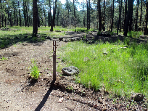
Pumphouse Wash (Forest Road 237) is a popular dispersed camping area in the ponderosa pine forest along SR 89A, midway between Flagstaff and Sedona, Arizona. The area is conveniently located near Oak Creek Canyon, Sedona, Flagstaff, Woody Mountain Road, Lake Mary, and a variety of recreation sites. It is a popular alternative to traditional campgrounds for visitors to Oak Creek Canyon and the Flagstaff area.
There are four campsite loops, each containing between 11 and 26 signed and numbered sites. The site offers excellent camping opportunities for large groups as well as families and individuals. Most sites offer partial to full shade beneath towering ponderosa pine trees, and are generally flat, making it easy to set up tents or campers. Each site has parking and a campfire ring. There is no trash service, so if you pack it in, pack it out. There are no restroom facilities. Portable toilets are highly recommended.
FR 237 and the camping loop roads are well maintained and suitable for passenger cars.
Photo tour from this site [Flickr].
Directions
Location: Pumphouse Wash area 11 miles south of Flagstaff, 5 miles north of Oak Creek Canyon, and 18 miles north of Sedona.
Access:
- From Flagstaff: Take I-17 south to the SR 89A turnoff to Sedona. Head south (left) through the round-about. Drive approximately 8 miles to FR 237 on the left.
- From Sedona: Take SR 89A north approximately 18 miles to FR 237 on the right.
GPS (Map): 35°03’15.5″N 111°43’35.1″W
Maps
- Forest Service Topo Map (FSTopo Geo-enable PDF):
- More Maps:
- USDA FSGeodata Clearinghouse: Arizona FSTopo Maps available for download in Geo-enabled PDF and GeoTIFF formats. Note: USGS 7.5 Minute (1:24K) Topo Maps and FSTopo Maps use the same title.
- USFS Store: Map Locator & Downloader purchase or download USGS topographic maps. Note: USGS 7.5 Minute (1:24K) Topo Maps and 1:24K FSTopo Maps use the same title.
FR 237 Dispersed Camping Map and Guide (PDF, 910 kB)
GPS Coordinates
Latitude 35° 3′ 15.3324″ N
Longitude 111° 43′ 35.1696″ W


