This recreation area is part of Barkley Lake
Directions
GPS Coordinates
Latitude 37° 0′ 22.2516″ N
Longitude 88° 1′ 3.0144″ W
This recreation area is part of Barkley Lake
Latitude 37° 0′ 22.2516″ N
Longitude 88° 1′ 3.0144″ W
This recreation area is part of Barkley Lake
Latitude 37° 2′ 30.0637″ N
Longitude 88° 8′ 35.5308″ W
This recreation area is part of Barkley Lake
Latitude 37° 0′ 29.0993″ N
Longitude 88° 13′ 35.3288″ W
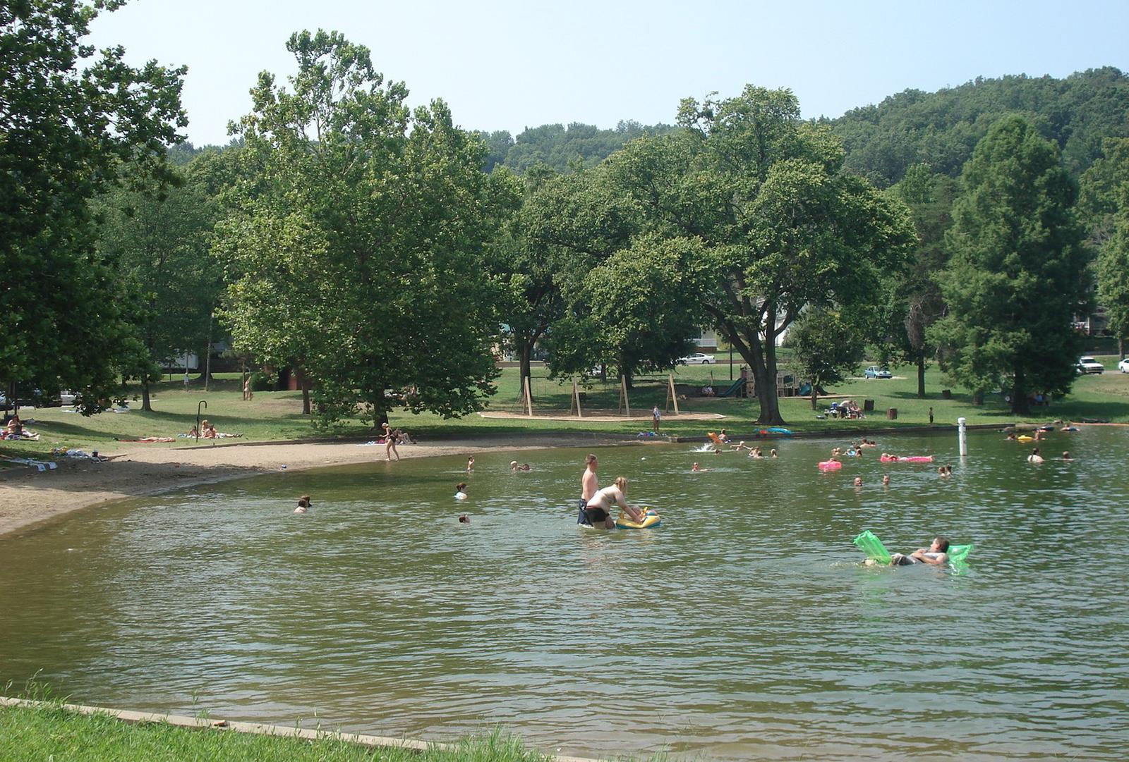
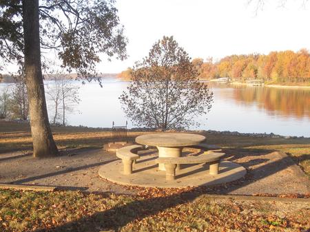
Old Kuttawa Recreation Area is on the northern shores of Lake Barkley, near the narrow canal linking it to Kentucky Lake. Together, these two reservoirs combine to create one of the greatest freshwater recreation areas in the country.
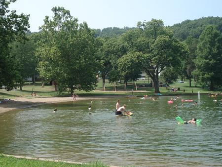
Take pleasure in a day of picnicking or soak up the sun at the swimming beach, either way Old Kuttawa provides an ideal setting to enjoy nature at its best.
The half-mile Anderson Woodland Trail is an enjoyable footpath for birding and viewing the great tall trees of the region. Other activities include swimming, fishing and boating.
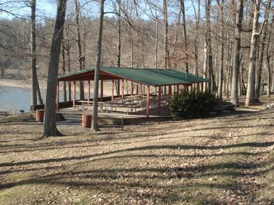
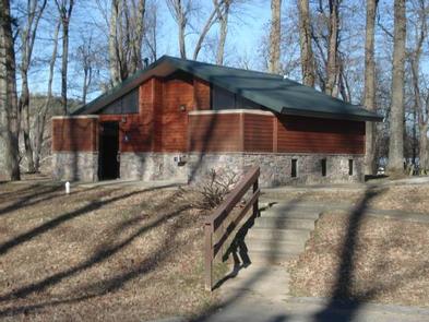
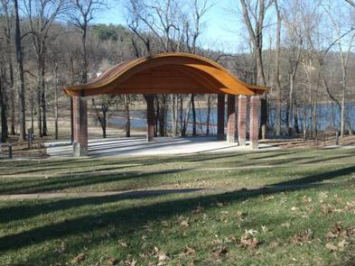
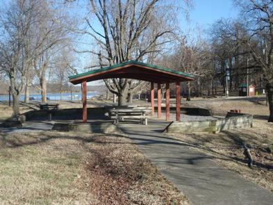
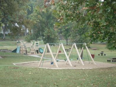
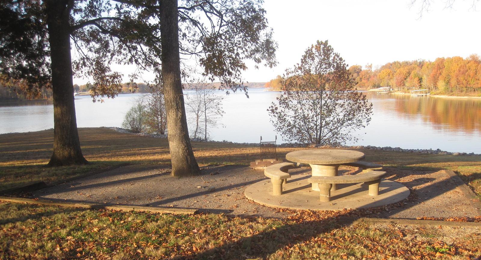
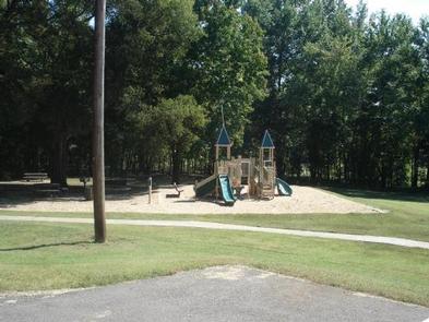
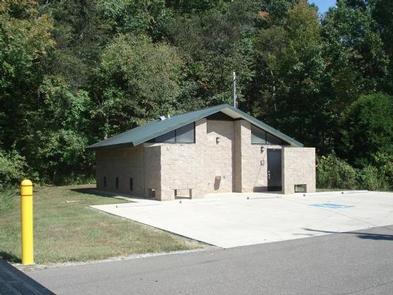
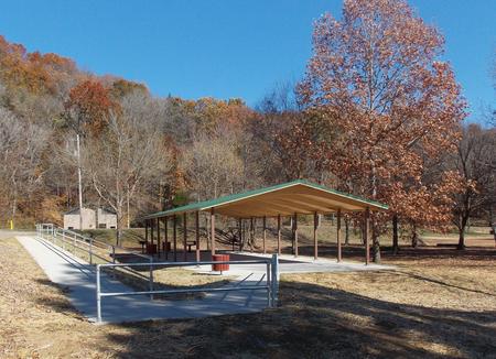
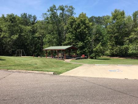
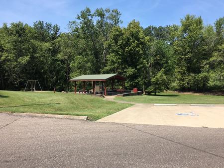
Two large picnic pavilions, an ampitheater, a playground, restrooms and paved parking are available. Plenty of picnic tables and grills are scattered around the recreation area, with ample shade for sunny summer days.
**In order to reserve the ampitheater, you must reserve site 1 (large shelter).
Lake Barkley spans 57,900 acres with 1,004 miles of shoreline and offers warm water temperatures during summer months that make for comfortable recreation.
Running parallel to Barkley Lake is its neighbor, Kentucky Lake, with the Land Between the Lakes National Recreation Area nestled between.
See the astonishing Floodwall Murals in the town of Paducah. It is a gallery that captures Paduca’s rich history.
From Nashville, take I-24 West to Exit 40. Turn left on 62 and then
right on Highway 295. Follow Highway 295 to recreation area entrance.
Latitude 37° 3′ 25.8502″ N
Longitude 88° 6′ 44.7998″ W
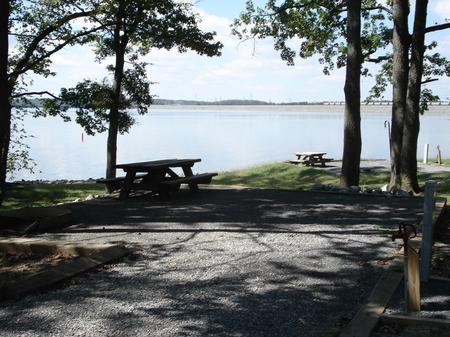
Linton Recreation area is a day-use haven that sits on Lake Barkley near wooded rolling hills and abundant wildlife. Whether it’s a gathering of family or friends, visitors can enjoy the the excellent atmosphere beautiful scenery.
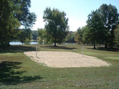
Boating and fishing are a big hit, as is swimming in the designated sandy swimming area and playing sports like soccer or Frisbee in the grassy open fields.
The accessible picnic shelter fits 100 guests and 50 vehicles. Other perks include a flush toilet, playground, grills and swimming beach. No electric hookups are available.
The recreation area is on the shores of Lake Barkley, nestled in the wooded, rolling hills of southwestern Kentucky, very close to the border with Tennessee.
Lake Barkley covers 57,900 acres with 1,004 miles of shoreline and offers warm water temperatures for comfortable recreation during summer months.
Visit Fort Donelson National Battlefield, where the Union Army won its first battle in the Civil War.
Land Between the Lakes National Recreation Area is just across the lake and features more than 170,000 acres of public land with numerous historical and outdoor attractions.

From Nashville take I-24 west to Cadiz, exit 65. Make a left onto
Highway 68 for 8 miles to Highway 139. Make a left on Highway 139
and go 6 miles to Highway 164. Make a right on Highway 164 and the
day use area is 8 miles from there.
Latitude 36° 41′ 15.2902″ N
Longitude 87° 54′ 38.1600″ W
Hurricane Creek Campground sits along the beautiful Lake Barkley, providing plenty of fresh air and recreation opportunities.
While away the hours boating or hiking on shore. Anglers a plenty come in search of catfish and trophy bass. Wildlife spotting includes white-tailed deer and raccoons.
From water sports to wildlife viewing to hiking and biking, Hurricane Creek is the perfect setting for outdoor activities.
The campground offers 51 sites with water and electric hookups. Six of these are walk-to sites. Hot showers, laundry facilities and a playground are available.
The campground is nestled in the wooded, rolling hills of southwestern Kentucky. Lake Barkley covers 57,900 acres with 1,004 miles of shoreline and offers comfortable and refreshing water temperatures in summer months.
The three-mile Lake Barkley State Park Trail is highly recommended. Plus the Lyon County Museum, listed on the National Register of Historic Places, makes for an enjoyable visit. Items in the museum highlight the area’s immigration history dating back to 1865.
From Paducah, Kentucky: Take I-24 east to exit 45. Turn right on Highway 293
west and go 0.3 miles. Turn left on Highway 93 south, go 5.3 miles. Turn
right on Highway 274 south, go 5.7 miles. Turn right on Hurricane camp
road. Campground on left.
From Nashville, Tenn.: Take I-24 west to Exit 56. Turn left on Highway 139
north and go approximately one mile. Turn right on Highway 276, go eight miles.
Turn right on Highway 274 and drive one mile. Turn left on Hurricane Camp Road;
campground is on left.
Latitude 36° 55′ 12.0000″ N
Longitude 87° 58′ 32.9999″ W
Eureka Campground sits on Lake Barkley among wooded rolling hills and abundant wildlife. Fishing is a well-loved sport here; Kentucky’s largest yellow bass was caught in these waters, and anglers flock with hopes of breaking the record.
Hikers and bikers are fans of the 2.5 mile Chestnut Oaks Trail that starts here. Other activities include boating, fishing and swimming.
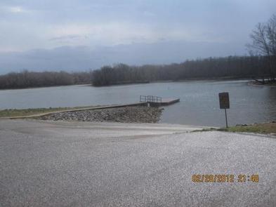
The campground offers 26 sites with water and electric hookups. Additional amenities include hot showers, playground, boat ramp and swimming area. A picnic shelter is available for groups up to 100 guests. Electric hookups are available.
Lake Barkley, the western-most lake on the Cumberland River is connected by a canal to Kentucky Lake, forming one of the nation’s greatest freshwater recreation complexes.
Between the two lakes is Land Between the Lakes National Recreation Area, featuring miles of hiking trails and opportunities for off-road vehicle riding.
Visit Fort Donelson National Battlefield, where the Union Army won their first battle of the Civil War. Another great destination in the Land Between the Lakes National Recreation Area, with more than 170,000 acres of public land to explore.

From Nashville, Tennessee take I-24 West to Exit 40. Turn left onto Highway 62 West for 2.9 miles then turn left onto Highway 810. Go 0.7 miles then turn right onto State Route 1271. Continue onto 1271 for 1.8 miles. The road leads directly into the campground.
Latitude 37° 1′ 30.5000″ N
Longitude 88° 11′ 38.4400″ W
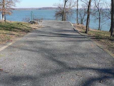
Dyer’s Creek boasts fantastic views of on the sparkling Lake Barkley in the wooded rolling hills of Tennessee. Whether it’s a family picnic and a BBQ with friends, the recreation area provides the perfect setting for a relaxing get-together.
Visitors here enjoy boating, fishing, wildlife watching and swimming.
Bring the binoculars and search for wildlife like the white-tailed deer, raccoons and bald eagles. Fishing is popular, and during warm months bass and catfish are abundant.
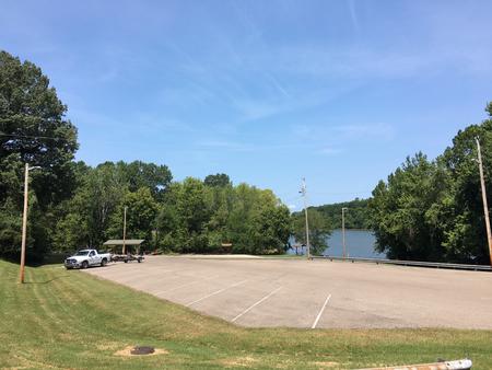
The park provides a playground, volleyball court, flush toilets and a boat ramp. The shelter accommodates up to 100 people and 50 vehicles. Ample paved parking is also available.
Lake Barkley, the westernmost lake on the Cumberland River is connected by canal to Kentucky Lake, forming one of the greatest freshwater recreation complexes in the country.
Between both lakes sits the Land Between the Lakes National Recreation Area, the largest inland peninsula in the United States. Here visitors have access to boat ramps, many miles of hiking trails, wildlife viewing and off highway vehicle riding.
Visit the Lake Barkley State Resort Park for miles of hiking trails and horseback riding stables.
From Nashville, Tenn, take I-24 West to the Clarksville Exit 8. Take US-79S for 46 miles to Dyers Creek Recreation Area.
Latitude 36° 30′ 5.0000″ N
Longitude 87° 49′ 59.9999″ W
Dover is a day-use area that overlooks the lovely Lake Barkley. Whether it’s a gathering of family or friends, visitors can enjoy nature at its best in one of the country’s greatest freshwater recreational complexes.
Boating, fishing and picnicking are popular activities at Dover day-use area. Wildlife including the occasional deer, raccoon or golden eagle, are commonly spotted in the area.
The group picnic shelter accomidates about 35 people and 10 vehicles. The facility has lights and electricity and a water spigot.
Lake Barkley, the westernmost lake on the Cumberland River, sits among wooded rolling hills. The lake is connected by canal to Kentucky Lake, a reservoir that stems from the Tennessee River.
Dover is close to Fort Donelson National Battlefield, where the Union Army won their first battle of the Civil War.
Shopping, grocery stores and gas stations are conveniently located nearby.

From Nashville, or St.Louis , take I-24 Clarksville, take Exit 8 for TN 237 W. 2.4 Mi., Right onto Warfield Blvd 1.6 Mi. continue onto 101st Airborne PKWY for 6.3 Mi. contine onto TN 347 -PKWY for 4.5 Mi. Turn right onto US 79 S. for 24.2 Mi. Turn right on W. Spring St. for 466 feet, Turn right at the 1st cross street onto Hood ST. for 500 feet. Turn right on to Forrest St 200 FT.
Latitude 36° 29′ 25.0001″ N
Longitude 87° 50′ 35.0002″ W
Situated along a peninsula between the lush shorelines of Lake Barkley and Kentucky Lake, Canal Campground offers modern camping and provides the ideal setting to enjoy nature at its best with family and friends.
Visitors can enjoy a stunning view of the Barkley Dam and boats traveling through the canal from the comfort of their campsite. The campground faces Barkley Lake, and the shore of Kentucky Lake is a brisk one-mile walk across the canal.
From water sports to wildlife viewing to hiking and biking, Canal Campground is the perfect setting for outdoor activities. Eagle nests can be spotted throughout the grounds, and its not unlikely for visitors to encounter deer and other wildlife. A short hiking trail allows campers to enjoy the outdoor scenery at their leisure.
Fishing is also a popular pastime, and during warm months bass and catfish are plentiful in both lakes.
A designated swimming beach and a boat ramp help campers enjoy the lake. Picnic pavilions and a playground create a perfect setting for a party or family get-together. For group camping, several sites surrounding the pavilion can be reserved, and a fishing float nearby allows groups to go out on the lake together.
Electric hook-ups, showers and flush restrooms create a comfortable camping experience.
Lake Barkley, as part of a dam project at the Cumberland River, spans 134 miles along the Kentucky landscape, offering countless recreational activities to visitors. The canal connects Lake Barley with Kentucky Lake, forming one of the greatest freshwater recreational complexes in the country.
Grand Rivers, a short drive from the campground, has several restaurants and two public marinas.
From Interstate I-24, take Grand Rivers Exit 31. Drive south on Highway 453 for approximately 4 miles. Turn left onto J.H. O’Bryan Avenue for .1 miles. Turn right onto Canal Campground Road for .5 miles.
Latitude 36° 59′ 44.0002″ N
Longitude 88° 12′ 34.9999″ W