This recreation area is part of Center Hill Lake
Directions
GPS Coordinates
Latitude 35° 48′ 56.8913″ N
Longitude 85° 38′ 44.5531″ W
This recreation area is part of Center Hill Lake
Latitude 35° 48′ 56.8913″ N
Longitude 85° 38′ 44.5531″ W
This recreation area is part of Center Hill Lake
Latitude 35° 49′ 30.5304″ N
Longitude 85° 40′ 36.9677″ W
This recreation area is part of Center Hill Lake
Latitude 36° 5′ 13.6284″ N
Longitude 85° 48′ 44.6904″ W
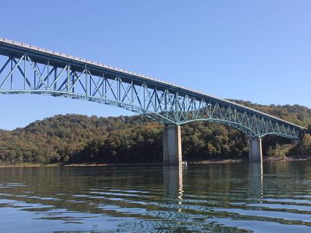
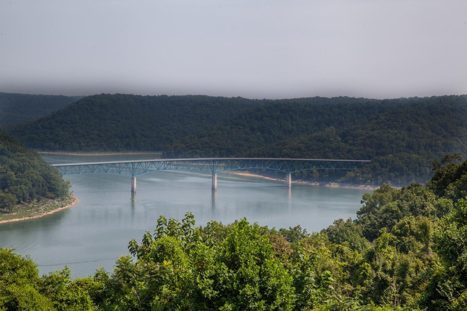
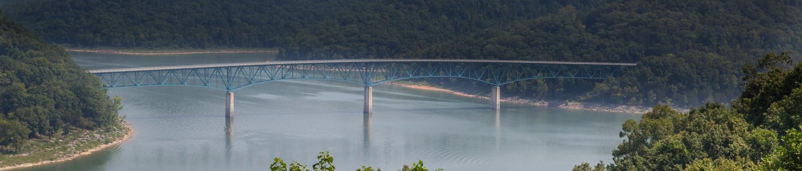
Hurricane Bridge Recreation Area is located on the shores of the scenic Center Hill Lake on central Tennessee’s Highland Rim.
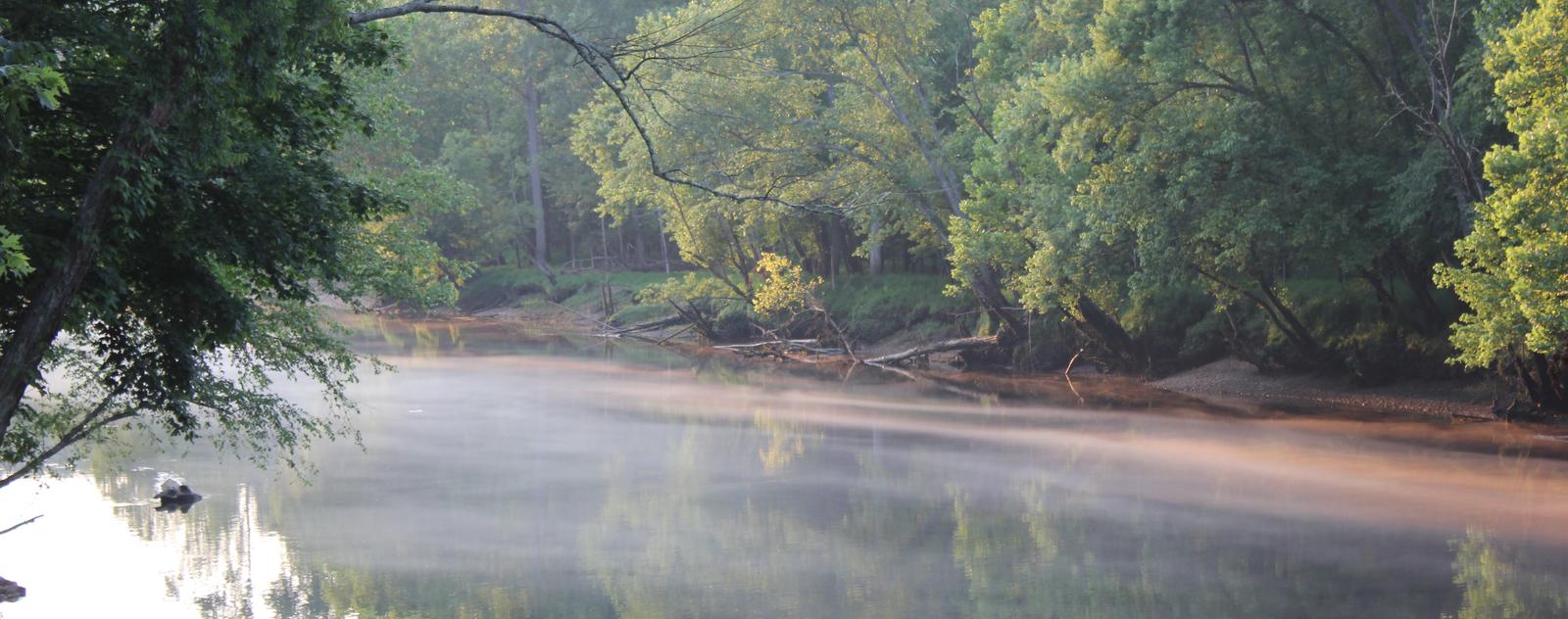
The lake stretches 64 miles up the Caney Fork River, where visitors come to enjoy boating, fishing and water sports. The 415 miles of forested shoreline provide excellent hiking, hunting and camping opportunities.
Boating, water skiing, canoeing and fishing are popular activities on the water.
Anglers will find bream, walleye, smallmouth bass, crappie, catfish and white bass. Below the dam, the Caney Fork River is one of the most productive trout fisheries in the state.
Nine miles of hiking trails meander around the lake. The OId 56 Trail is located in the recreation area, and provides 0.9 miles of a paved walking trail.
This large day-use picnic shelter can accommodate up to 125 guests. Water and 15-amp electric hookups are provided, as are flush toilets and drinking water. Two boat ramps and a dock are located on-site.
Center Hill Lake is surrounded by lush mixed hardwood forests in the hilly Highland Rim region. Whitetail deer, wild turkey, squirrels and rabbits roam the wooded hills around the lake.
Hurricane Bridge is located on a peninsula, providing sweeping lake views on three sides of the picnic area.
Edgar Evins State Park, about 20 minutes from Hurricane Bridge, sits on the shores of the lake. An observation tower at the Visitor Center offers a spectacular view of Center Hill Lake and the surrounding hillsides.
Burgess Falls State Park is a 30 minute drive from the campground. Here, the Falling Water River drops approximately 250 feet, creating numerous breathtaking waterfalls. Hiking trails and overlooks help visitors enjoy the scenery. The large Native Butterfly Garden is a popular attraction within the park.
From I-40, take exit 273. Merge onto US-56 south and continue for approximately 7 miles to the Hurricane Bridge Recreation Area entrance on the right.
Latitude 36° 1′ 44.0000″ N
Longitude 85° 44′ 51.0000″ W
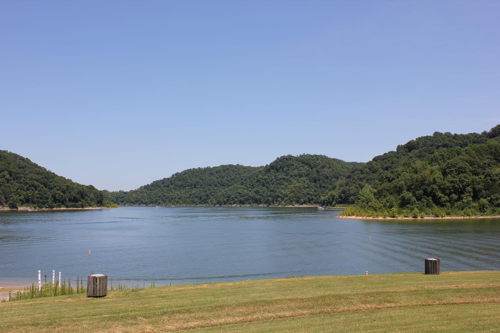
Ragland Bottom Campground is located on the shores of the scenic Center Hill Lake on central Tennessee’s Highland Rim.
The lake stretches 64 miles up the Caney Fork River, where visitors come to enjoy boating, fishing and water sports. The 415 miles of forested shoreline provide excellent hiking, hunting and camping opportunities.
Boating, waterskiing, canoeing and fishing are popular activities on the water.
Anglers will find bream, walleye, smallmouth bass, crappie, catfish and white bass. Below the dam, the Caney Fork River is one of the most productive trout fisheries in the state.
Nine miles of hiking trails meander around the lake. The Red Post Trail is a short, but steep, two-mile trail that loops above the campground. Hikers who brave the moderately difficult climb are rewarded with beautiful overlooks of the lake and nearby Sligo Bridge and Marina.
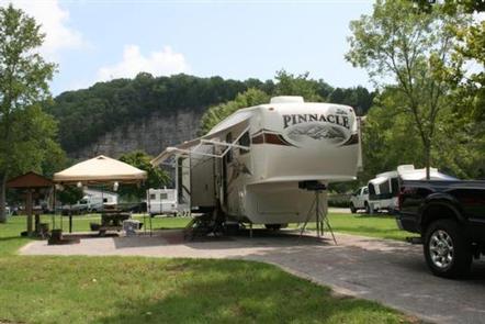
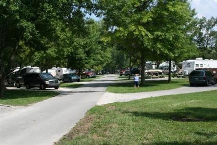
This waterfront campground offers 40 sites with water and electric hookups, as well as 16 primitive tent sites. A large group day-use picnic area is available as well, with water and 15-amp electric hookups.
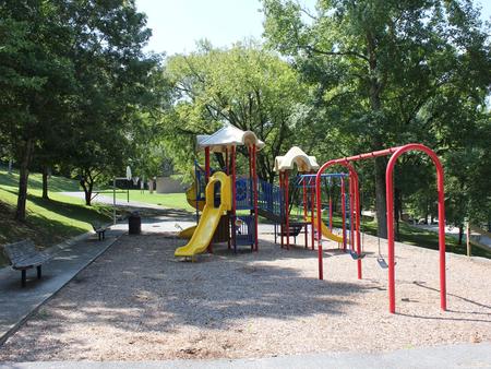
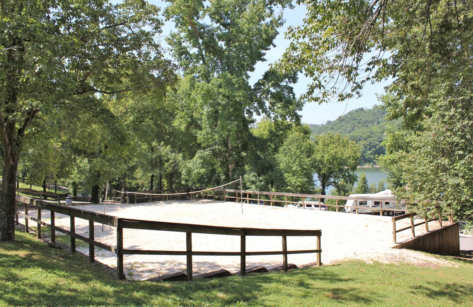
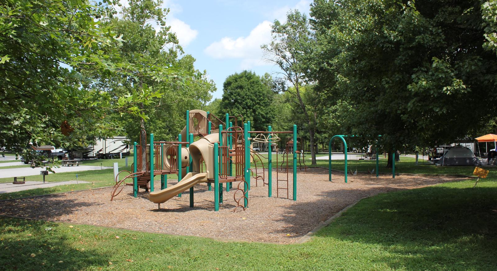
Amenities like flush toilets, showers and drinking water are provided, creating a comfortable camping experience for guests. A boat ramp, volleyball court, basketball goal, playground and hiking trail are all conveniently located within the campground. The adjacent day-use area has a group picnic shelter, boat ramp, and swimming beach.
Center Hill Lake is surrounded by lush mixed hardwood forests in the hilly Highland Rim region. Beautiful dogwoods bloom in the campground in springtime. Whitetail deer, wild turkey, squirrels and rabbits roam the wooded hills around the lake.
Burgess Falls State Park is a 25-minute drive from the campground. Here, the Falling Water River drops approximately 250 feet, creating numerous breathtaking waterfalls. Hiking trails and overlooks help visitors enjoy the scenery. The large Native Butterfly Garden is a popular attraction within the park.
From Smithville, Tennessee, take US-70 east for 8 miles. Turn left on Ragland Bottom Road and follow signs to the campground, located one mile from Sligo Bridge.
Latitude 35° 58′ 38.6400″ N
Longitude 85° 43′ 15.1201″ W
Long Branch Campground is located below Center Hill Dam on the scenic Caney Fork River in central Tennessee’s Highland Rim.
Above the dam, the lake stretches 64 miles up the river, where visitors come to enjoy boating, fishing and water sports. The 415 miles of forested shoreline provide excellent hiking, hunting and camping opportunities.
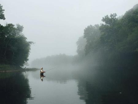
Fishermen come to Long Branch to experience trophy trout fishing on the river, which is stocked with rainbow and brown trout. Fly fishers and spin fishers alike enjoy this beautiful river and its abundant fish.
Canoeing and kayaking on the Caney Fork River has become a favorite pastime for campers and sightseers alike.
The Buffalo Valley Nature Trail is located just across the river from the campground. It provides access to the Caney Fork and is a very popular area for trout fishermen. The area has great wildlife viewing opportunities.
Boating, water skiing and canoeing are popular activities above the dam on Center Hill Lake.
The campground offers 60 campsites with water and 50-amp electric hookups. A large, day-use group picnic shelter is also available, with water and electric hookup.
Amenities like flush toilets, showers and drinking water are provided, creating a comfortable camping experience for guests. A boat ramp, fish cleaning station and playground are all conveniently located within the campground.
Long Branch is surrounded by the lush mixed hardwood forests of the hilly Highland Rim region. Whitetail deer, wild turkey, squirrels and rabbits roam the wooded hills in the area.
The Center Hill Lake Resource Managers Office is located across the river next to the Buffalo Valley Recreation Area. Edgar Evins State Park sits on the lake shore about 5 minutes from Long Branch. An observation tower at the Visitor Center offers a spectacular view of Center Hill Lake and the surrounding hillsides.
From I-40, take exit 268 and merge onto US-96 west. Continue for 5 miles to the end of Center Hill Dam, then turn right on SR-141. Follow signs into campground.
Latitude 36° 5′ 56.5001″ N
Longitude 85° 49′ 54.3500″ W
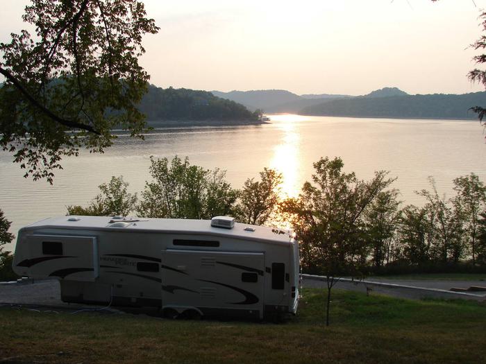
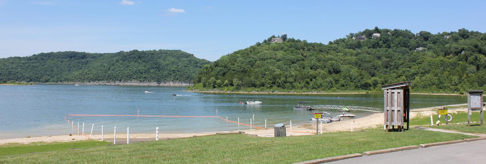
Floating Mill Park is located on the shores of the scenic Center Hill Lake on central Tennessee’s Highland Rim.
The lake stretches 64 miles up the Caney Fork River, where visitors come to enjoy boating, fishing and water sports. The 415 miles of forested shoreline provide excellent hiking, hunting and camping opportunities.
Boating, waterskiing, canoeing and fishing are popular activities on the water.
Anglers will find bream, walleye, smallmouth bass, crappie, catfish and white bass. Below the dam, the Caney Fork River is one of the most productive trout fisheries in the state.
Nine miles of hiking trails meander around the lake. The Lost Springs Trail loops for two miles above the campground and Hurricane Marina.
This large campground provides a wide variety of campsites, most of which have electric and water hookups. Several tent-only sites are provided, several of which are beautiful lakefront sites.
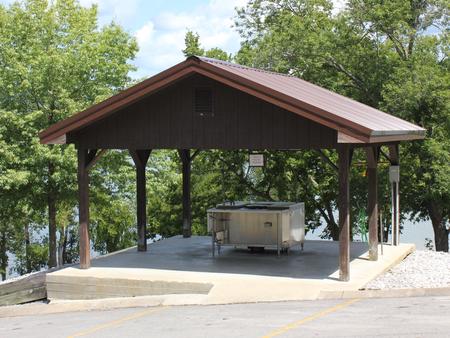
A day-use group picnic area is available for reservations. It can accommodate up to 125 guests, with a large shelter and picnic tables. Water and 30-amp electric hookups are included.
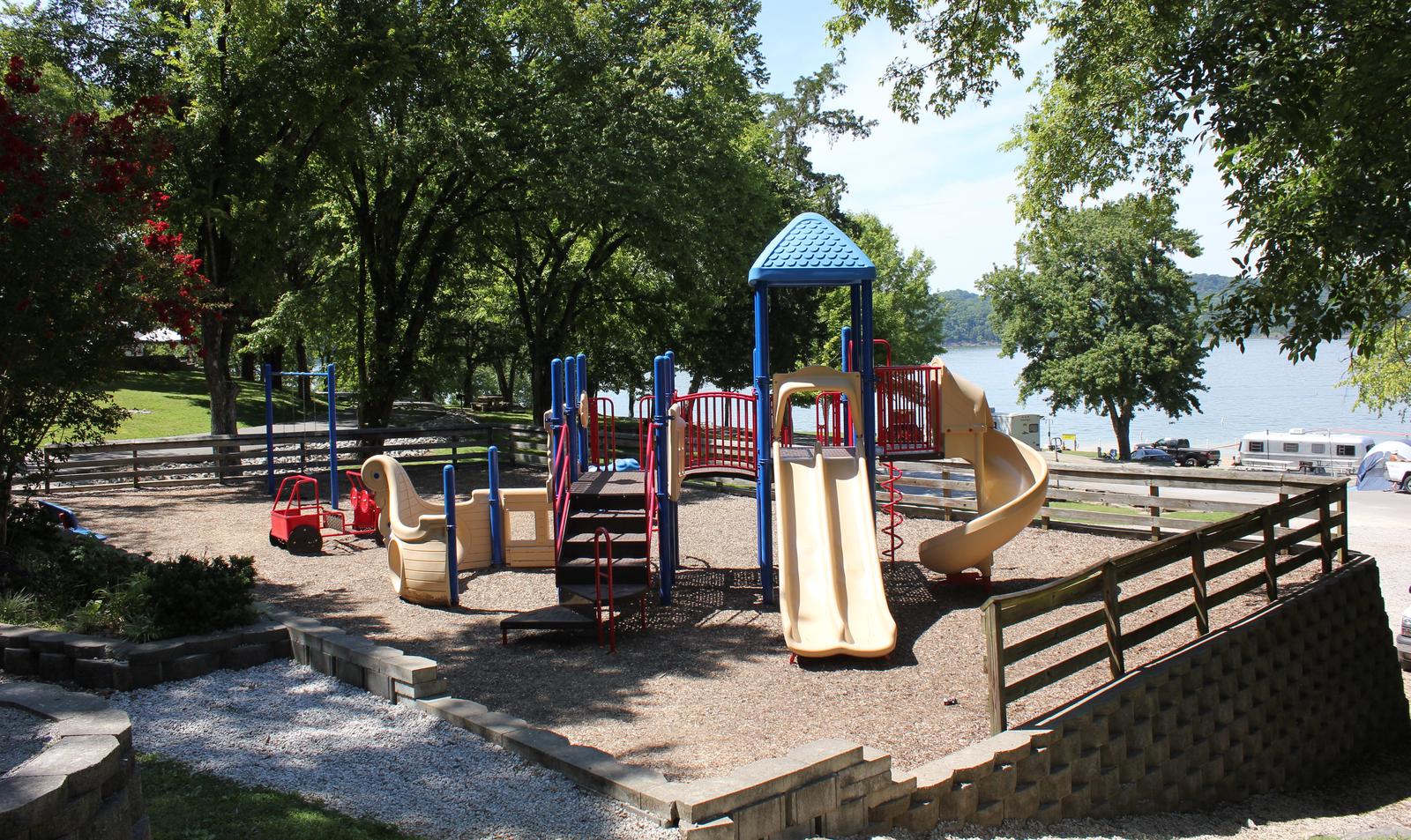
Amenities like flush toilets, showers and drinking water are provided, creating a comfortable camping experience for guests. A boat ramp, fish cleaning station, playground and hiking trail are all conveniently located within the campground.
Center Hill Lake is surrounded by lush mixed hardwood forests in the hilly Highland Rim region. Whitetail deer, wild turkey, squirrels and rabbits roam the wooded hills around the lake.
Floating Mill Park is surrounded by the lake on three sides, providing sweeping waterfront views.
Edgar Evins State Park, about 25 minutes from Floating Mill, sits on the shores of the lake. An observation tower at the Visitor Center offers a spectacular view of Center Hill Lake and the surrounding hillsides.
Burgess Falls State Park is a 35-minute drive from the campground. Here, the Falling Water River drops approximately 250 feet, creating numerous breathtaking waterfalls. Hiking trails and overlooks help visitors enjoy the scenery. The large Native Butterfly Garden is a popular attraction within the park.
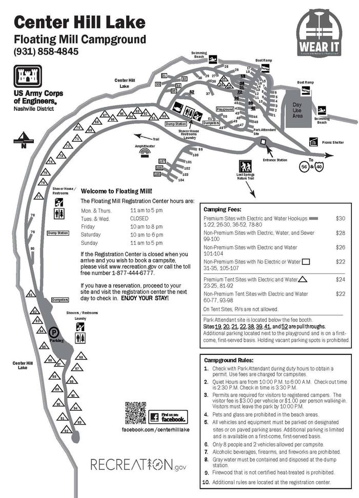

From I-40, take exit 273. Merge onto US-56 south and continue for 3.5 miles to Floating Mill Road. After about a mile, turn right to stay on Floating Mill Road, and follow signs into the campground.
Latitude 36° 2′ 41.5900″ N
Longitude 85° 45′ 48.4898″ W
This recreation area is part of Barkley Lake
Latitude 36° 37′ 22.0476″ N
Longitude 87° 53′ 2.6124″ W
This recreation area is part of Barkley Lake
Latitude 36° 54′ 38.9610″ N
Longitude 87° 59′ 26.2616″ W
This recreation area is part of Barkley Lake
Latitude 36° 50′ 22.6068″ N
Longitude 87° 55′ 14.7828″ W