This recreation area is part of Lake Cumberland
Directions
GPS Coordinates
Latitude 36° 58′ 37.0560″ N
Longitude 84° 36′ 8.9496″ W
This recreation area is part of Lake Cumberland
Latitude 36° 58′ 37.0560″ N
Longitude 84° 36′ 8.9496″ W
This recreation area is part of Lake Cumberland
Latitude 36° 49′ 23.6191″ N
Longitude 85° 7′ 22.9757″ W
This recreation area is part of Lake Cumberland
Latitude 36° 54′ 46.8396″ N
Longitude 85° 2′ 55.6224″ W
This recreation area is part of Lake Cumberland
Latitude 36° 59′ 21.5979″ N
Longitude 84° 55′ 40.0224″ W
Mill Springs Mill is located at 9135 Highway 1275 North, Monticello, KY and is a day-use facility located on the shores of Lake Cumberland, overlooking the main body of the lake. There is NO overnight camping allowed in the area.
Click here for the Lake Cumberland virtual tour.
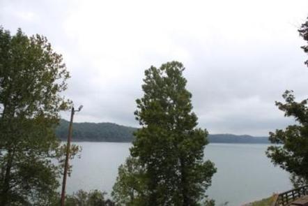
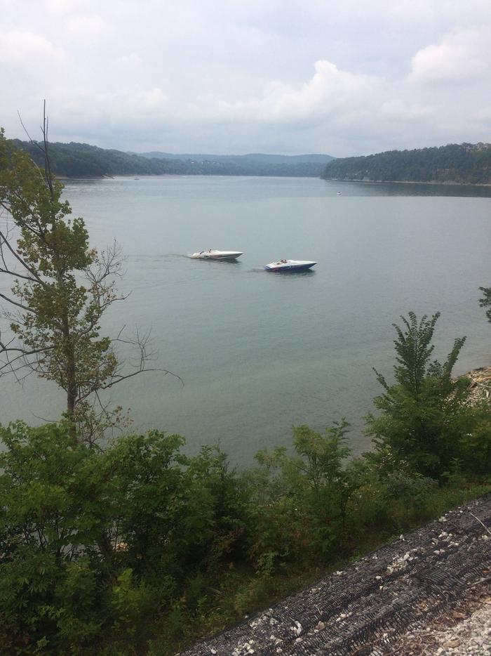
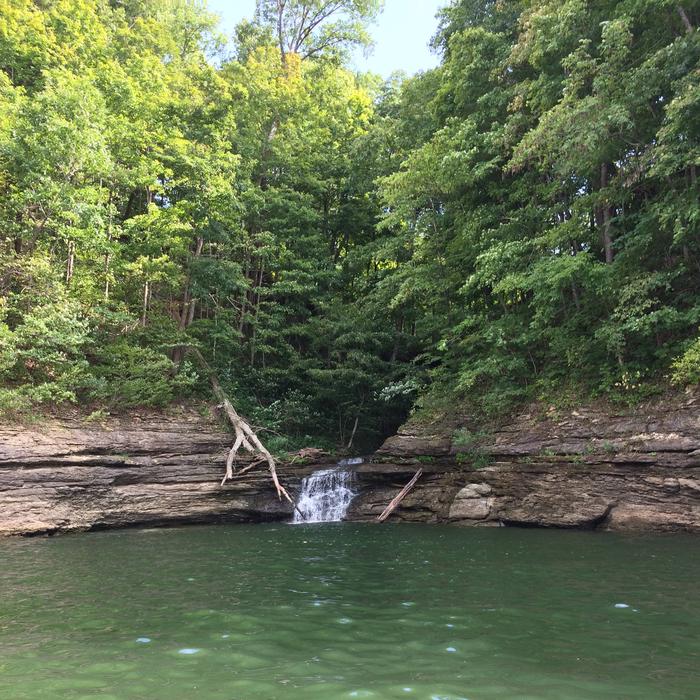
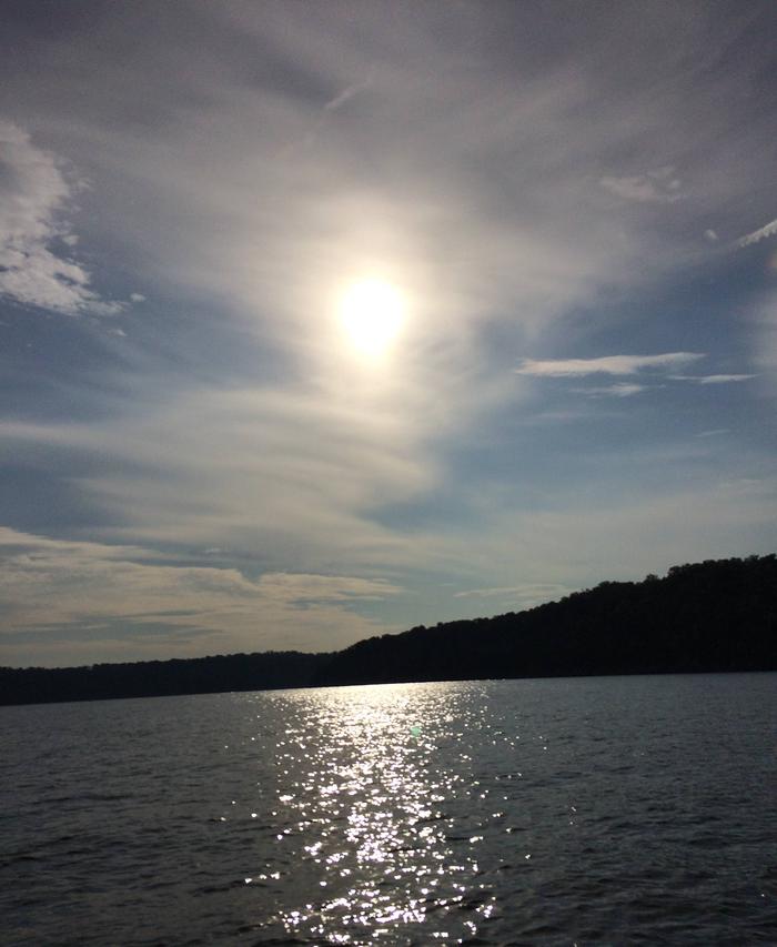
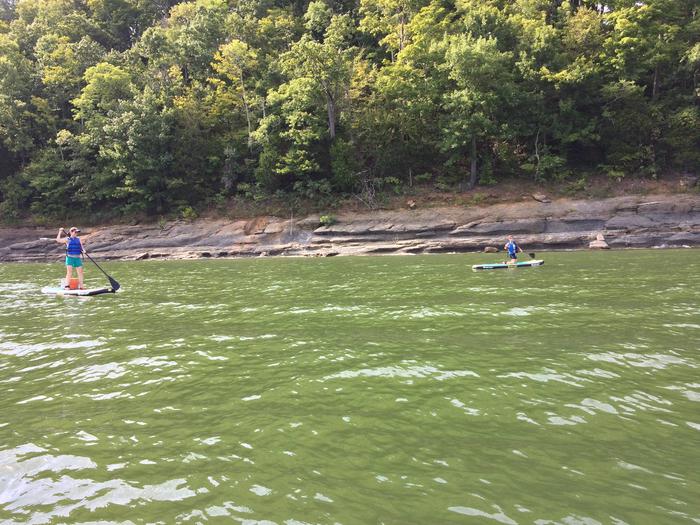
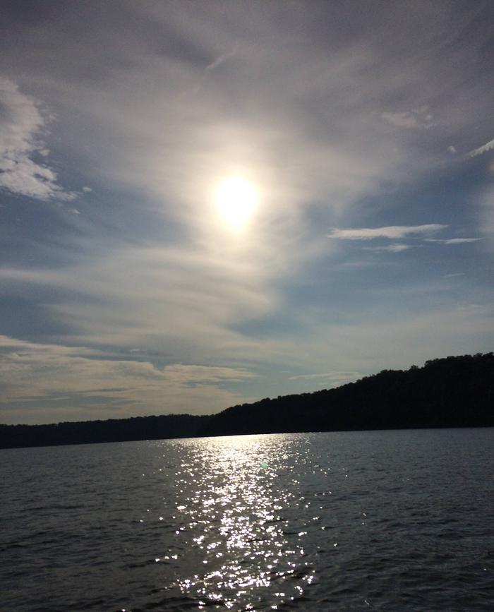
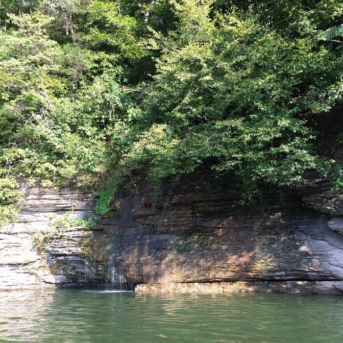
Lake Cumberland is the largest man-made lake east of the Mississippi River. Its large surface acreage and over 1,200 miles of shoreline provide a myriad of recreational opportunities. The lake has an abundance of largemouth, smallmouth, white and Kentucky bass, bluegill, crappie, rockfish, and walleye making it a favorite among anglers.
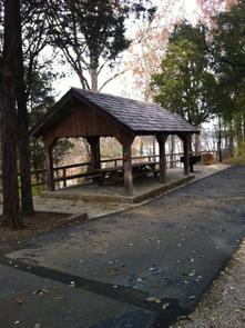
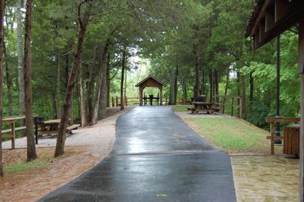
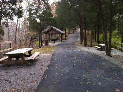
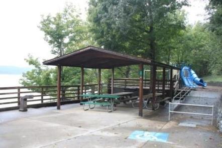
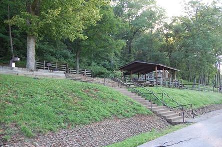
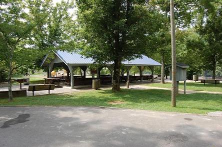
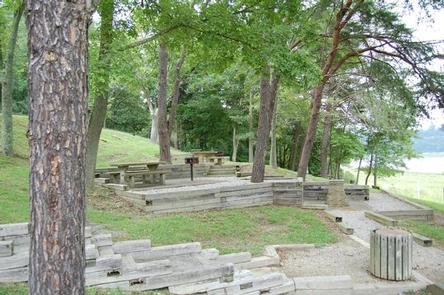
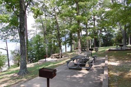
Mill Springs Mill offers a small reservable group picnic shelter and six picnic sites with tables and grills. Flush toilets, drinking water and a courtesy tie-up boat slip are also provided.
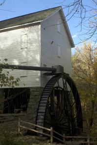
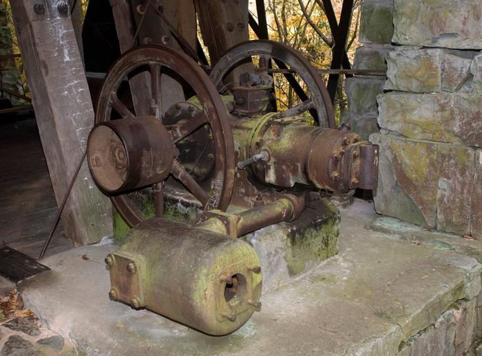
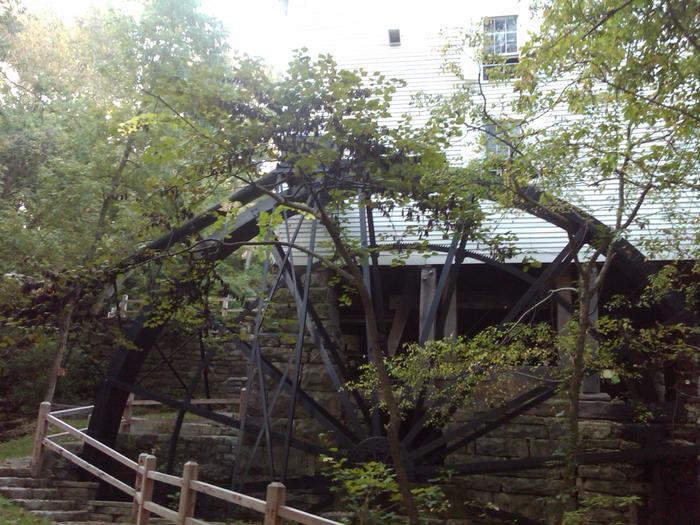
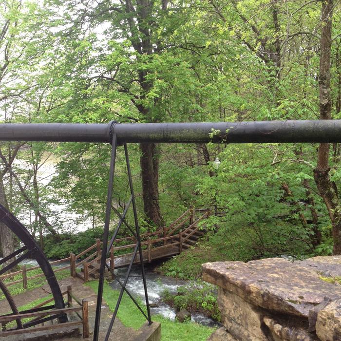
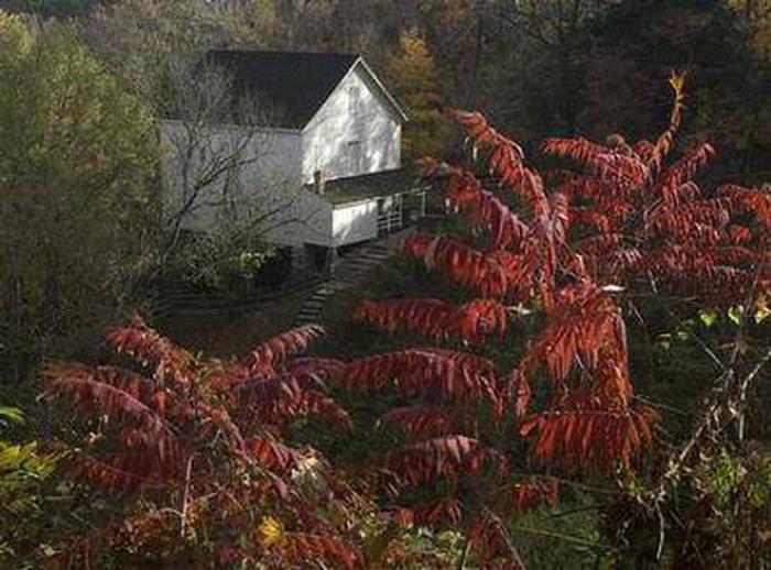
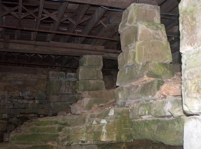
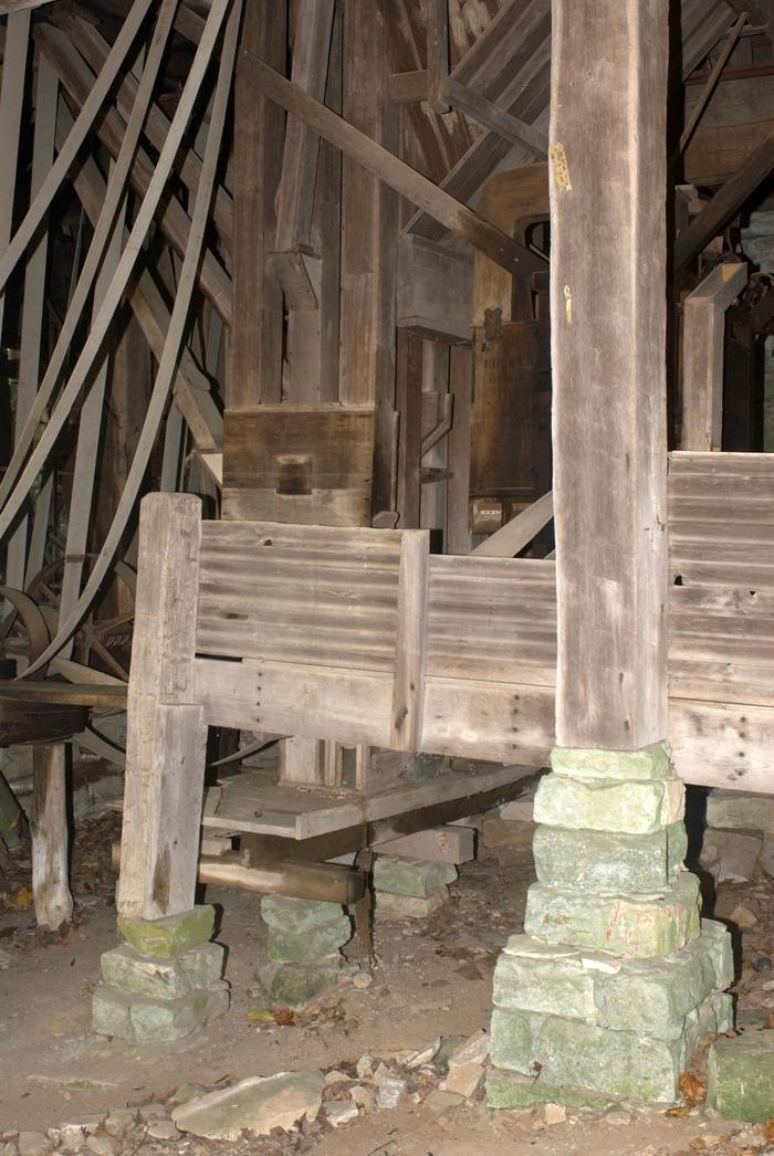
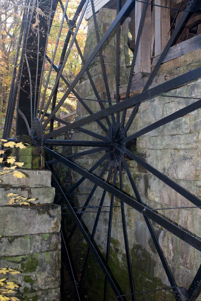
Mill Springs Mill, a water-powered grist mill listed on the National Register of Historic Places, was built in 1877 and is on the public lands of Lake Cumberland. Its 40-foot overshot water wheel is one of the largest in the world and probably the largest water wheel currently operating. The mill and water wheel were restored as a bicentennial project in 1976, and are now operated by the U.S. Army Corps of Engineers as an interpretive demonstration. Tours of the mill are conducted for the public during the recreation season.
While visiting the Mill you can tour the historic Millers home, the Brown-Lanier house (ca.1830-1860) that was used as a headquarters and hospital during the Civil War battle of Mill Springs. Conley Bottom Marina is 10 minutes away with a campground, boat rentals, a restaurant and general store.

From downtown Monticello, Kentucky: Head east on South Main Street, cross Hwy 90/Hwy 1275, continue to follow Hwy 1275, approximately 6.6 miles, 14 minutes.
Latitude 36° 55′ 54.9998″ N
Longitude 84° 46′ 48.0000″ W
Fall Creek Campground is located at 1144 New Fall Creek Road, Monticello and is situated along the shores of the vast Lake Cumberland in southern Kentucky.
Click here for the Lake Cumberland virtual tour.
Lake Cumberland is the largest man-made lake east of the Mississippi River. Its large surface acreage and over 1,200 miles of shoreline provide a myriad of recreational activities.
The lake has an abundance of largemouth, smallmouth, white and Kentucky bass, bluegill, crappie, rockfish and walleye, making it a favorite among anglers.
Visitors enjoy the 10-acre site and its 10 shaded campsites. All of these sites are waterfront, making them prime locations for weekend recreation. Fall Creek has a day-use area, picnic shelter and public parking.
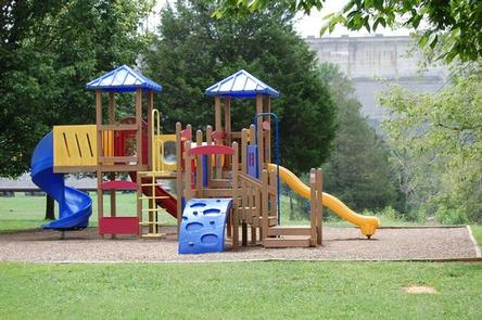
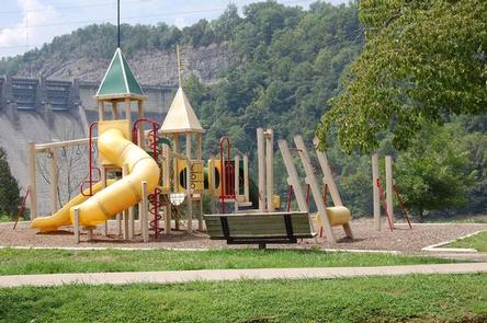
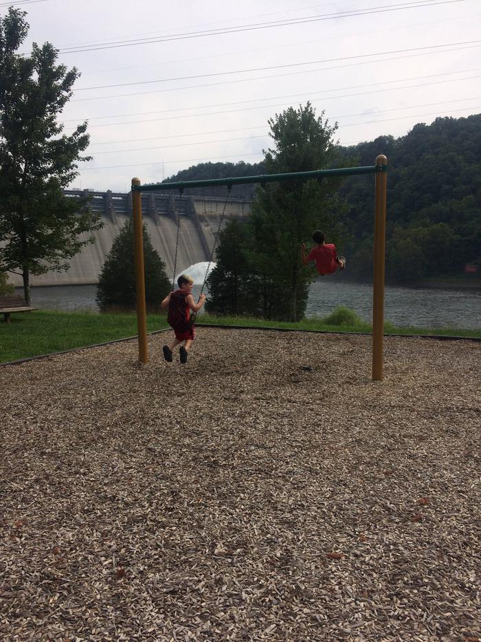
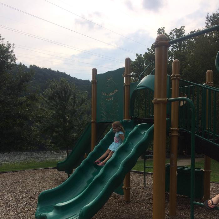
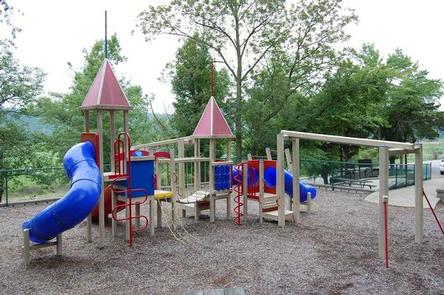
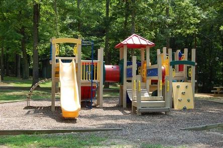
Amenities include flush toilets, showers, drinking water and a dump station. A boat ramp and playground are located within the park.
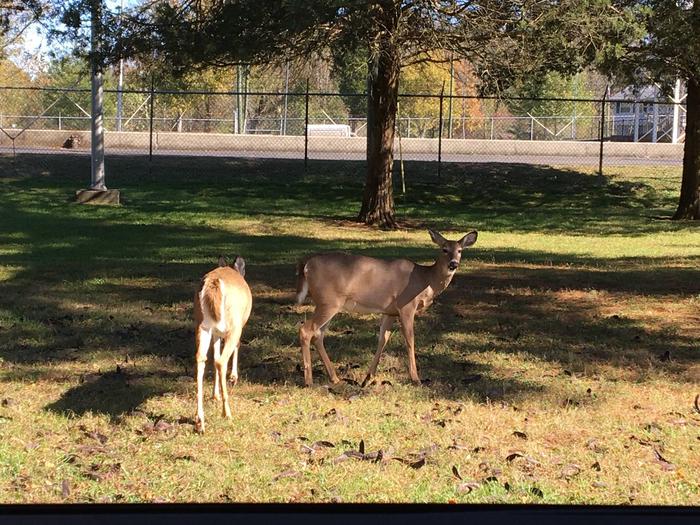
The campground overlooks the main body of the lake, offering sweeping scenic views. Dense stands of mature hardwoods forest the area, offering pleasant shade and wildlife habitat.
Due to the temperate climate and relatively long recreation season, the lake provides varied outdoor recreational opportunities for millions of visitors each year.
The Mill Springs Mill Park is just a 15-minute drive from the campground. This historic mill site offers interpretive tours and grinding on the weekends and holidays, picnic sites and a gift shop. Grinding is at 2:00pm Saturday, Sunday and Holidays. Interpretive tours of the mill are given Saturday, Sunday and Holidays during the recreation season.


From Monticello: KY 90, Turn onto KY 1275, light #1, Travel approximately 3.5 miles, Turn onto Hwy 2393, travel approximately 2 miles,
Turn left at Fall Creek sign, Road ends at campground.
Latitude 36° 56′ 11.0000″ N
Longitude 84° 50′ 25.0001″ W
Waitsboro Campground is at 500 Waitsboro Road and is situated on beautiful Lake Cumberland in southern Kentucky.
Click here for the Lake Cumberland virtual tour.
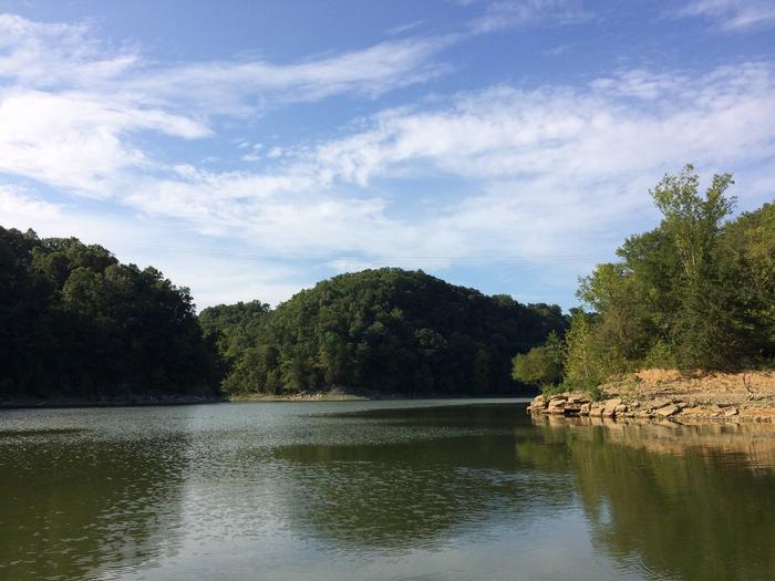
Lake Cumberland is the largest man-made lake east of the Mississippi River. Its large surface acreage and over 1,200 miles of shoreline provide a myriad of recreational activities.
The lake has an abundance of largemouth, smallmouth, white and Kentucky bass, bluegill, crappie, rockfish and walleye, making it a favorite among anglers.
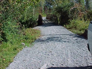
The Black Walnut Nature Trail, located near the lake office, is a self-guided educational trail. The trail is open Monday through Friday 8:00am to 4pm EST.
The campground offers 17 RV sites, all with electric hookups, and five tent-only sites. Eight of Waitsboro’s sites are on the waterfront, making them prime locations for weekend recreation.
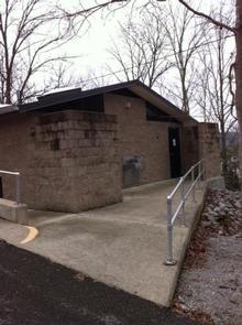
Amenities include flush toilets, showers, drinking water, laundry facilities and a dump station. A day-use area with a group picnic shelter and a parking area is also available.
The campground overlooks the main body of the lake, offering sweeping scenic views. Dense stands of mature hardwoods forest the site, offering scenic views, pleasant shade and wildlife habitat.
Because of the temperate climate and relatively long recreation season, the lake provides varied outdoor recreational opportunities for millions of visitors each year.
General Burnside Island State Park is nearby. It was named after Civil War General Ambrose Burnside, who led patrols along the Cumberland River, circling this 400-acre island to keep watch for Confederate soldiers. Visitors come today to enjoy boating, fishing, golfing and picnicking on Kentucky’s only island state park.
Burnside Marina is 10 minutes away, with boat rentals, a restaurant and general store.


From Somerset Kentucky, take Highway 27 south for 5 miles. Turn right on Waitsboro Road and follow signs to the campground.
Latitude 37° 0′ 13.0000″ N
Longitude 84° 37′ 23.0002″ W
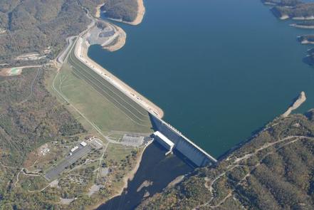
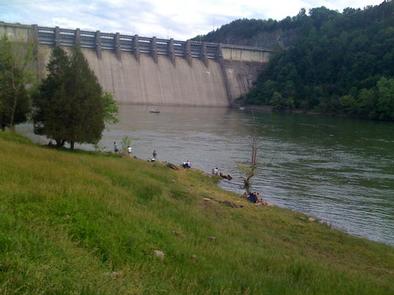
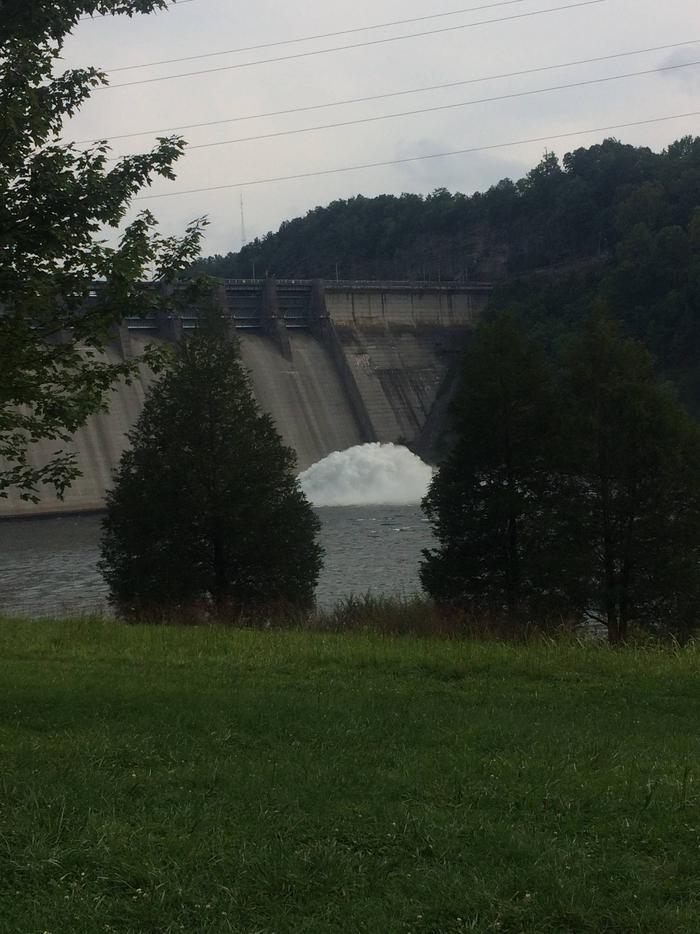
Kendall Campground is located at 80 Kendall Road, south of Jamestown, Kentucky, just below Wolf Creek Dam, which forms beautiful Lake Cumberland.
Click here for the Lake Cumberland virtual tour.
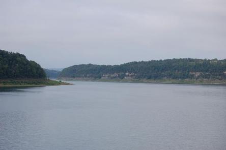
Lake Cumberland is the largest man-made lake east of the Mississippi River. Its large surface acreage and over 1,200 miles of shoreline provide a myriad of recreational activities.
Kendall Campground offers visitors convenient access to a cold water trout stream, making it a popular fishing destination. The stream is well-stocked with rainbow, brook and brown trout.
Whispering Pines Trail, located within the campground, is a non-strenuous trail approximately half a mile long.
The campground is a multi-use recreation area, consisting of 70 acres and 116 reservable campsites, all of which have water and electric hookups.
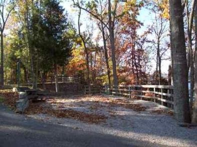
Each campsite has a picnic table, fire ring/grill and lantern post. A group day-use picnic shelter with water and electric hookups is available as well.
A boat ramp, fish cleaning station, basketball court, horseshoe pit, hiking trail and playgrounds are located within the park.
The campground overlooks the river, offering sweeping scenic views. Dense stands of mature hardwoods forest the site, offering scenic views, pleasant shade and wildlife habitat.
Because of the temperate climate and relatively long recreation season, the lake provides varied outdoor recreational opportunities for millions of visitors each year.
Wolf Creek Dam National Fish Hatchery is within walking distance of the campground. It is open year-round and offers free tours to the public and an excellent Environmental Education Center. Click here for more information.
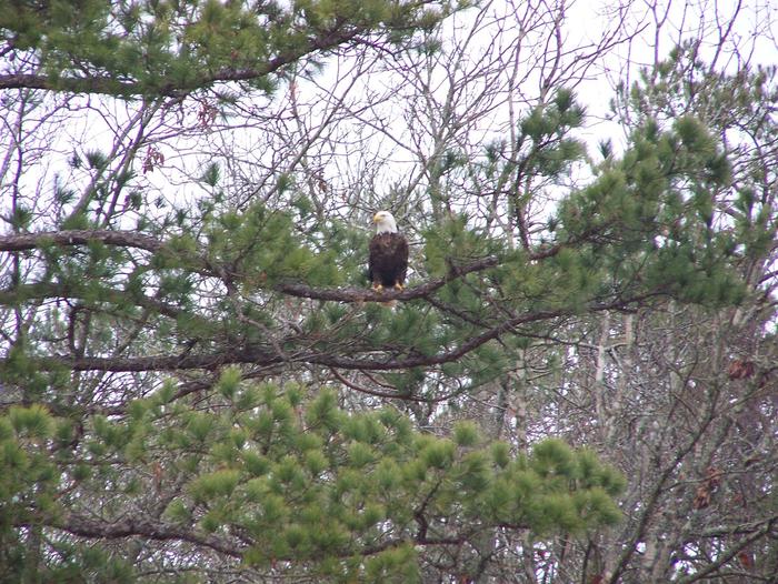
Lake Cumberland State Park is just 6.5 miles from the campground. This beautiful park offers fishing, hiking, horseback riding, mini golf, disc golf and boat rentals. Birders enjoy the park for its exceptional viewing prospects of raptors, songbirds and waterfowl.
Grider Hill Marina and Resort is 25 minutes away, with boat rentals, a restaurant and general store.
Jamestown Marina & Resort is 25 minutes away, with boat rentals, a restaurant and general store.
State Dock Marina is 8 miles away, with boat rentals, snack bar and general store.


From Jamestown, Kentucky, take US Highway 127 south for 10 miles and turn right just before crossing the dam. Campground is on Kendall Road.
Latitude 36° 52′ 21.0000″ N
Longitude 85° 8′ 48.0001″ W
Fishing Creek Campground is located at 1598 E. Highway 1248 just west of Somerset, Kentucky. Fishing Creek is part of beautiful Lake Cumberland, where visitors enjoy boating, fishing and hunting.
Click here for the Lake Cumberland virtual tour.
Lake Cumberland is the largest man-made lake east of the Mississippi River. Its large surface acreage and over 1,200 miles of shoreline provide a myriad of recreational activities.
The lake has an abundance of largemouth, smallmouth, white and Kentucky bass, bluegill, crappie, rockfish and walleye, making it a favorite among anglers.
The campground offers 26 RV sites and 20 tent-only sites, all with water and electric hookups and picnic table, fire pit/grill and lantern post.
Amenities include flush toilets, showers, drinking water, washer/dryer, boat ramp and a dump station.
Fishing Creek also has a day-use area, picnic sites and a playground, making it an ideal spot for large parties and family functions.
The campground is situated above the shore of Fishing Creek on Lake Cumberland. Dense stands of mature hardwoods forest the site, offering scenic views, pleasant shade and wildlife habitat.
Because of the temperate climate and relatively long recreation season, the lake provides varied outdoor recreational opportunities for millions of visitors each year.
Lee’s Ford Resort Marina is less than 10 minutes from the campground. It offers boat rentals, a general store, restaurant and lodging.
The Mill Springs Battlefield Park is just a 15-minute drive from Fishing Creek. This historic Civil War site offers interpretive exhibits, a gift shop and driving tour. Special events are held throughout the year, including educational programs and a thrilling reenactment.


From Somerset, Kentucky, take Highway 80 west for 5 miles. Turn right on East Highway 1248 and continue for 2 miles. The recreation area entrance will be on the left side of the road at the bottom of the hill.
Latitude 37° 4′ 17.0000″ N
Longitude 84° 41′ 21.0001″ W
Cumberland Point Campground is situated along the shores of the vast Lake Cumberland in southern Kentucky.
Click here for the Lake Cumberland virtual tour.
Lake Cumberland is the largest man-made lake east of the Mississippi River. Its large surface acreage and over 1,200 miles of shoreline provide a myriad of recreational activities.
The lake has an abundance of largemouth, smallmouth, white and Kentucky bass, bluegill, crappie, rockfish and walleye, making it a favorite among anglers.
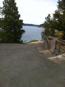
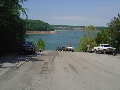
Visitors enjoy the 30-acre site and its 30 shaded campsites. Fourteen of these sites are waterfront, making them prime locations for weekend recreation. Cumberland Point has a day-use area, picnic shelter and public parking.
Amenities include flush toilets, showers, drinking water and a dump station. A boat ramp and playground are located within the park.
The entrance and exit roads have a moderate to severe grade.
The campground overlooks the main body of the lake, offering sweeping scenic views. Dense stands of mature hardwoods forest the site, offering scenic views, pleasant shade and wildlife habitat.
Because of the temperate climate and relatively long recreation season, the lake provides varied outdoor recreational opportunities for millions of visitors each year.
The Mill Springs Battlefield Park is just a 20-minute drive from the campground. This historic Civil War site offers interpretive exhibits, a gift shop and driving tour. Special events are held throughout the year.


From Nancy, Kentucky, take Highway 235 south for a mile to Highway 761. Turn right and travel 9 miles to the campground entrance.
Latitude 36° 57′ 56.0002″ N
Longitude 84° 50′ 31.9999″ W