Categories
Uncategorized

Shenango Lake Shenango Lakeside Picnic Shelter

Overview

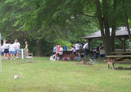
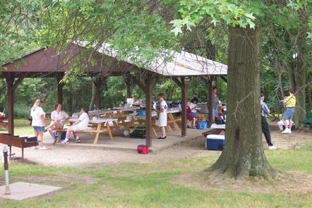
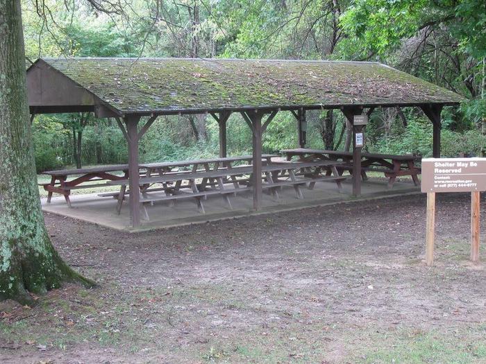
Situated within the suburban Shenango Valley, Shenango Lake provides an attractive setting where visitors can spend the day picnicking, camping, fishing, boating, or enjoying nature’s beauty at one of the lake’s many recreation areas. The Shenango Recreation Area Day Use is located within the Shenango Rec Area, adjacent to the campground and provides one covered group picnic shelter (Lakeside Shelter) with electric as well as a basketball hoop and volleyball court nearby.

Recreation

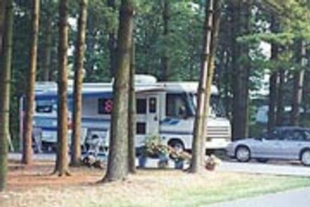
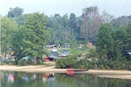
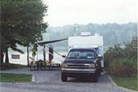
Come explore and enjoy the outdoors! The lake provides a variety of recreational opportunities, including, but not limited to, picnicking, camping, fishing, boating, swimming, hiking, viewing wildlife and hunting. Picnickers can rent, for a fee, one of our seven picnic pavilions located within four different recreation areas. Boating is a popular activity where areas are provided on the lake for unlimited horsepower operation, as well as restricted horsepower and minimum wake operation. Many fishing enthusiasts are attracted to the waters of Shenango for the crappie, bass, walleye, catfish and muskellunge that inhabit the river, lake and tailwaters. Campers visiting the lake will enjoy spacious facilities at our 330-site campground.

Facilities

The Shenango Rec Area Day Use offers one group picnic shelter (Lakeside Shelter) that can accommodate between 42-56 people, depending upon the use of 6-8 people per table. Electric is available at the shelter with a paid reservation only, grills are available on site, and flush toilets and drinking water are provided at the nearby restroom by the boat launch (seasonal). A children’s swing set, volleyball court, and basketball hoop, as well as plenty of open fields, are located on site. Overnight camping is available at the adjacent Shenango Recreation Area Campground.**Any person requesting the Lakeside Pavilion for a Sunday: there is a church group that meets there from 10 a.m.-11 a.m., so access to the shelter is only available after the church service.

Natural Features

Shenango Lake stretches 11 miles up its namesake river, covering over 11,000 acres. The shore is lined with a northern hardwood forest of shady and colorful trees such as black cherry, beech, maple, and hemlock. Deer, turkey and other small game animals are plentiful, with excellent opportunities to observe osprey and eagles in the area.

Nearby Attractions

The Shenango Water Trail provides 7.5 miles of scenic river corridor for paddlers, with three access points between Kidds Mill Park and Big Bend. Life jackets must be worn on all canoes and kayaks. The historic Kidds Mill Covered Bridge features the unique “Smith-Truss” design from the 1800s. Remnants of the Erie Extension Canal can be found nearby in Sharpsville below the Shenango Dam. The Shenango and Mahaney Recreations Areas feature restoration chestnut tree orchards that are managed through a partnership with the American Chestnut Foundation for research and education, with the goal of developing blight resistant American chestnut trees.

Nearby Activities

  • Camping

Gallery

Directions

Take Exit 4B off of I-80 and follow Route 18 north for about 8 miles until you cross the lake’s causeway. The park is on the left, but this is a divided highway. Continue north for about 1/4 mile, exit to the right at Birchwood Drive, make the turn-around, and go south on Route 18. Before you cross the causeway again, make a right onto West Lake Road and travel approximately 1/4 mile to the park entrance on the left. There is an entrance booth where you will be directed towards the shelter. If no one is manning the booth, take a left after the booth. There are several large parking lots ahead. Make a right at the next stop sign, then a left at the last parking lot, then another right. This will bring you to a looped parking lot where the picnic shelter and parking is located.

GPS Coordinates

Latitude 41° 17′ 43.0001″ N

Longitude 80° 26′ 4.9999″ W

Categories
Uncategorized

Shenango Trail Access Area

This recreation area is part of Shenango River Lake

Directions

GPS Coordinates

Latitude 0° 0′ 0.0000″ S

Longitude 0° 0′ 0.0000″ W

Categories
Uncategorized

Rt 87 Access

This recreation area is part of Shenango River Lake

Directions

GPS Coordinates

Latitude 0° 0′ 0.0000″ S

Longitude 0° 0′ 0.0000″ W

Categories
Uncategorized

Orangeville Community Park

This recreation area is part of Shenango River Lake

Directions

GPS Coordinates

Latitude 0° 0′ 0.0000″ S

Longitude 0° 0′ 0.0000″ W

Categories
Uncategorized

Old Carlisle Road Access Area

This recreation area is part of Shenango River Lake

Directions

GPS Coordinates

Latitude 0° 0′ 0.0000″ S

Longitude 0° 0′ 0.0000″ W

Categories
Uncategorized

Old Boy Scout Camp

This recreation area is part of Shenango River Lake

Directions

GPS Coordinates

Latitude 0° 0′ 0.0000″ S

Longitude 0° 0′ 0.0000″ W

Categories
Uncategorized

New Hamburg Access Area

This recreation area is part of Shenango River Lake

Directions

GPS Coordinates

Latitude 0° 0′ 0.0000″ S

Longitude 0° 0′ 0.0000″ W

Categories
Uncategorized

SHENANGO REC AREA CAMPGROUND

Overview

The Shenango Recreation Area is situated within the broad, flat, meandering valleys of the Shenango River and Pymatuning Creek.
Sharon, Pennsylvania is approximately 7 miles southwest and Youngstown, Ohio is about 21 miles west. Visitors to the area enjoy camping, boating and fishing.

Recreation

The lake provides an attractive setting for picnicking, camping, boating or simply enjoying nature’s beauty. Anglers fish for bass, walleye, muskellunge and a variety of panfish.

The lake is shallow and water levels generally drop throughout the summer, especially after the Fourth of July, depending upon rainfall.

The Coonie Trail is one-half mile in length. This self-guided interpretive nature trail invites visitors not only to experience the beauty of Shenango River Lake but also to learn about its varied habitats and relationships between plants, animals and humans.

Shenango Lake is an unlimited horsepower lake and has six free boat launches for access.

The Lakeside Picnic Shelter is located on site and can be reserved for reunions or other large gatherings.

Facilities

This large campground contains over 300 campsites, many of which have electric hookups.
Flush toilets, drinking water, showers and a dump station are provided. Playgrounds, a horseshoe pit and boat ramp are on-site.
The campground is reservation only. Reservations can be be made on the day of arrival. 

Natural Features

Shenango River Lake stretches 11 miles up its namesake river, covering over 11,000 acres. The shore is lined with a northern hardwood forest of shady and colorful trees such as Black Cherry, Beech, Maple and Hemlock.

Deer, turkey and other small game animals are plentiful, with excellent opportunities to observe osprey and eagles in the area.

Nearby Attractions

The Shenango Water Trail provides 7.5 miles of scenic river corridor for paddlers, with three access points between Kidds Mill Park and Big Bend. Personal Floatation Devices must be worn on all canoes and kayaks.
The historic Kidds Mill Covered Bridge features the unique “Smith-Truss” design from the 1800s.
Remnants of the Erie Extension Canal can be found nearby in Sharpsville below the Shenango Dam.
The Shenango and Mahaney Recreation Areas feature restoration chestnut tree orchards that are managed through a partnership with the American Chestnut Foundation for research and education, with the goal of developing blight resistant American chestnut trees.
The nearby Bayview Off-Road Vehicle Area provides over 200 acres of riding trails for ATV’s and dirt bikes (3.5 miles from the campground)
The Chestnut Run Swim Beach is only 3 miles from the campground and offers a great area for swimming and sunbathing (NOTE: no lifeguard on duty)
“The Pines” Disc Golf Course in the nearby Mahaney Recreation Area (6 miles from the campground) offers a challenging course that hosts PDGA sanctioned events
The nearby Trout Island Trail in Sharpsville is a 5 mile paved trail that accomodates walking, running and cycling
The Shenango Hiking Trail, on the east end of the lake, is 7.5 miles through wooded areas adjacent to the Shenango River
Boat Rentals are available at the nearby RC’s Marina in Clark, Pa. (1.4 miles)
An ADA Fishing Pier is available in Clark, Pa. 1.4 miles from the campground.

Charges & Cancellations

A $10.00 service fee will be charged if you change or cancel a reservation.

If a customer does not arrive at the campground by check-out time the day after arrival or does not cancel the reservation by the day before or day of arrival, the customer will be considered a “no-show” and may be assessed a $20.00 service fee and also forfeit use fees.

If a customer cancels a reservation the day before or day of arrival they will be charged a $10.00 service fee and forfeit the first night’s use fee (not to exceed the total paid for the original reservation). Cancellation for a single night’s reservation will forfeit the entire use fee but not be charged the $10.00 service fee.

For more information on cancellations or refunds, please visit the recreation.gov site or call 877-644-8777.

Nearby Activities

  • Boating
  • Camping
  • Fishing
  • Day use area
  • Kayaking
  • Canoeing
  • Amphitheater

Gallery

Directions

Take Exit 4B (formerly Exit 1) off I-80 and follow Route 18 north about 6 miles until you cross the lake’s causeway. The park is on the left, but this is a divided highway. Continue north about 1/4 mile, take the Birchwood Drive exit, make the turn-around and go south on Route 18. Before you cross the causeway again, make a right onto West Lake Road and travel approximately 1/4 mile to the park entrance on the left. Shenango Recreation Area address: 492 West Lake Road, Transfer, Pa. 16154

GPS Coordinates

Latitude 41° 17′ 20.0000″ N

Longitude 80° 26′ 17.9999″ W

Categories
Uncategorized

Mosquito State Park

This recreation area is part of Mosquito Creek Lake

Directions

GPS Coordinates

Latitude 41° 23′ 22.9128″ N

Longitude 80° 44′ 19.8672″ W

Categories
Uncategorized

Milton Loop Campground

This recreation area is part of Mahoning Creek Lake

Nearby Activities

  • Camping
  • Playground park specialized sport site
  • Other recreation concession site
  • Hotel/lodge/resort privately owned

Directions

GPS Coordinates

Latitude 40° 54′ 9.3888″ N

Longitude 79° 13′ 25.0860″ W