Categories
Uncategorized

MILL RUN RECREATION AREA

Overview

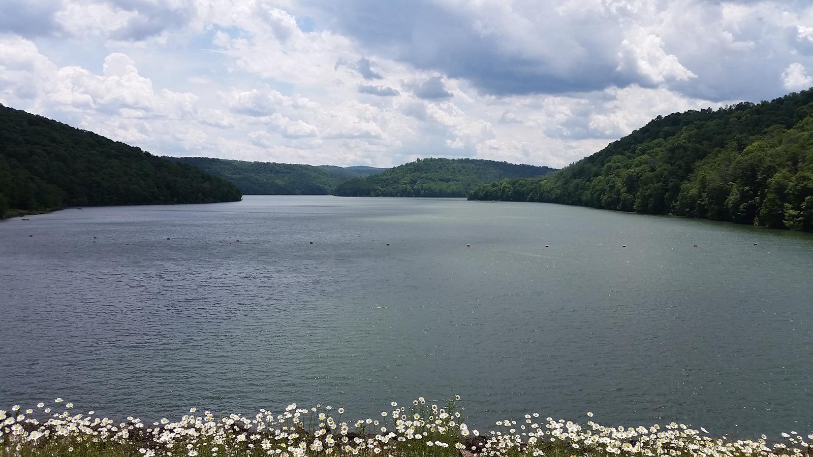
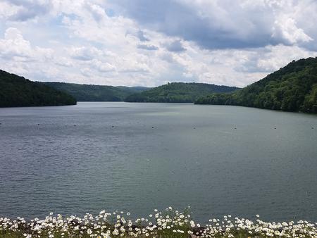
The Mill Run Camping Area is located on Youghiogheny River Lake in the heart of the Laurel Highlands. The lake spans the Mason-Dixon Line between Pennsylvania and Maryland. Clean waters, forested mountains and steep-sided valleys provide an unsurpassed setting for recreational opportunities.

Recreation

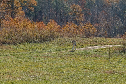
Camping, fishing, boating, water skiing, hiking, biking, picnicking and sightseeing are the area’s most popular activities. Boaters consider Youghiogheny River Lake, with its 16-mile length and channels up to one-half mile wide, the best powerboating and water skiing lake in southwestern Pennsylvania.

Facilities

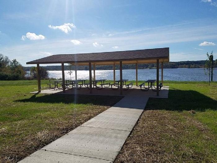
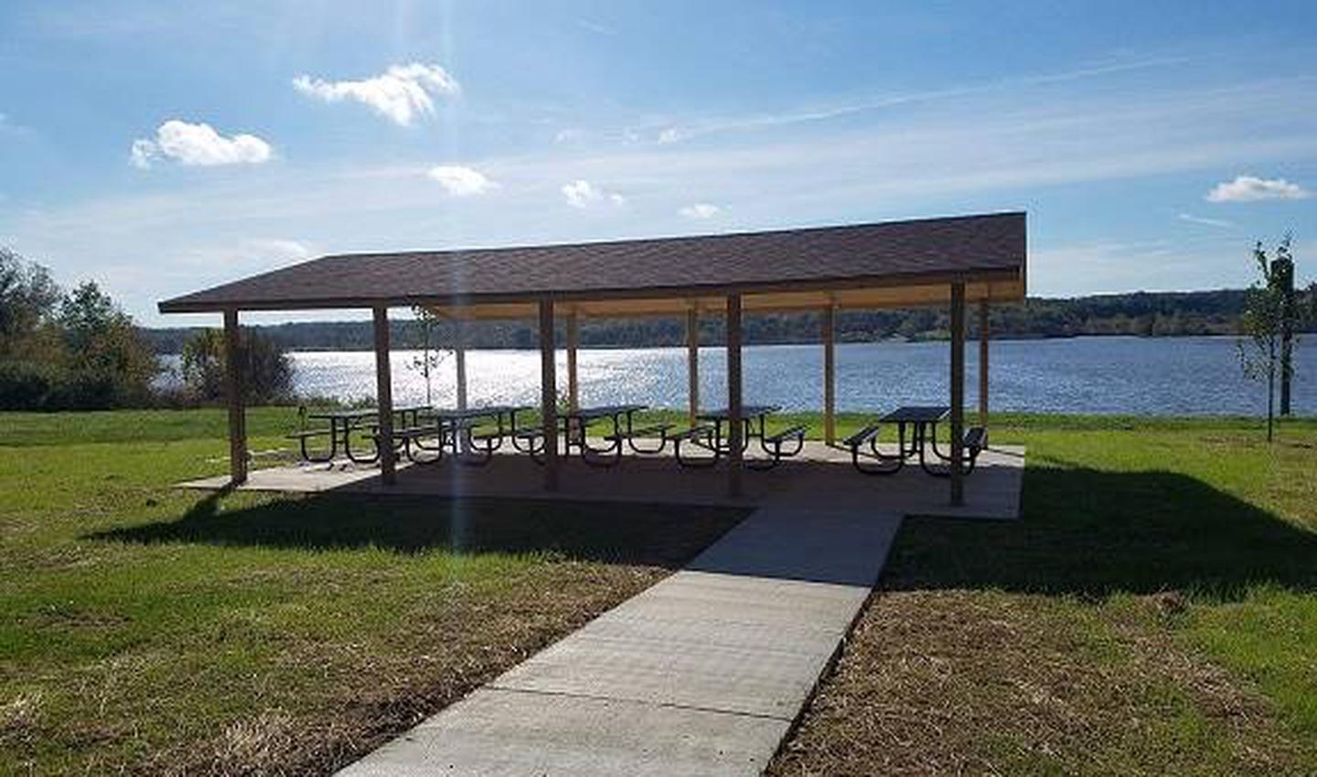
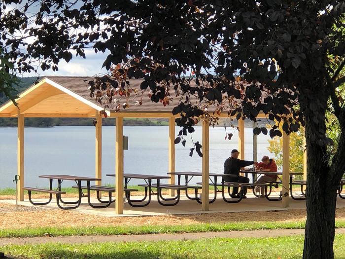
The campground contains 30 sites that are all self-contained. Flush toilets, drinking water and a dump station are available. There is also a beach, boat launch and children’s play area located in the campground.

Natural Features

The country surrounding the lake is made up of narrow valleys and high rounded hills with steep slopes. Much of the land is covered with northern hardwoods including beech, sugar maple, white ash, yellow poplar and basswood. A variety of wildlife makes its home around Youghiogheny River Lake, including deer, turkey, grouse, rabbit and squirrel.

Nearby Attractions

Some of Pennsylvania and Maryland’s finest state parks surround Youghiogheny Lake. Ohiopyle State Park is known for some of the best whitewater in the East and is often the location of national kayaking competitions.

Gallery

Directions

From Route 40 East, turn right onto Friendsville Addison Road for approximately 3 miles then turn right onto Mill Run Road and follow the road until reaching the campground. From Route 40 West, turn left onto Friendsville Addison Road for approximately 3 miles then turn right onto Mill Run Road and follow the road until reaching the campground.

GPS Coordinates

Latitude 39° 42′ 55.6999″ N

Longitude 79° 23′ 6.2002″ W

Categories
Uncategorized

Somerfield North Recreation Area

Overview

Reservable Pavillion that has picnic tables, grills, close to the restrooms and located on the lake. There is also a launch ramp and courtesy dock.

Recreation

Swimming, boating, kayaking, and paddle boarding

Natural Features

The pavillion is lakeside

Nearby Attractions

Yough Lake Marina offers rentals of paddle boards, kayaks and pontoon boats

Directions

Latitude 39.7564, Longitude -79.3935

Located on Rt 40 in Addison across the road from Yough Lake Marina

GPS Coordinates

Latitude 39° 45′ 23.7600″ N

Longitude 79° 23′ 37.3200″ W

Categories
Uncategorized

Washington-Rochambeau Revolutionary Route National Historic Trail

Journey through early American history and walk in the footsteps of our nation’s founding fathers as you explore the Washington-Rochambeau Revolutionary Route. This National Historic Trail commemorates over 680 miles of land and water trails followed by the allied armies of General George Washington and the French Lieutenant General Comte Jean de Rochambeau. During their 1781 march from Newport, Rhode Island to Yorktown, Virginia, the French army established an encampment on what is now the Meadowood Special Recreation Management Area (SRMA). A segment of this trail connects with a BLM system of trails crossing the SRMA on the historic Mason Neck Peninsula, just a short drive from the nation’s capital. At Meadowood, the trail transects open meadows, enters into mature hardwood forests, and crosses riparian wetlands.
While in the area, visit Gunston Hall, the home of Founding Father George Mason, a strong supporter of individual liberties and the author of the Virginia Declaration of Rights. Many of the concepts in that document found embodiment in the first ten amendments to the U.S. Constitution, the Bill of Rights.

Gallery

Directions

From Interstate 95 South: Exit 163 to Lorton. Turn left onto Lorton Rd, continue under second overpass and turn right onto Lorton Market St. Continue approximately 1.5 mile U.S. Route 1. Proceed straight through intersection with Route 1, when the road name changes to Gunston Rd. Continue for Ѕ miles; the Mason Neck Gateway is on the right. The trailhead for the route begins at the gateway.

From Interstate 95 North: Take exit 161 to Lorton, U.S. Route 1 North. Proceed about 1.5 miles to first stop light. Turn right onto Gunston Rd. Go about Ѕ miles, and the entrance on right.

GPS Coordinates

Latitude 38° 40′ 48.0828″ N

Longitude 77° 13′ 29.2368″ W

Categories
Uncategorized

Potomac Heritage National Scenic Trail

The Potomac Heritage National Scenic Trail is a network of locally managed trails in a corridor through the many contrasting landscapes in the region between the mouth of the Potomac River and the Allegheny Highlands. Over 830 miles of existing and planned trails are recognized as segments of this National Scenic Trail. The BLM Eastern States manages sections of the trail as it crosses Douglas Point in St. Charles County, Maryland, and the Meadowood Special Recreation Management Area (SRMA) on the historic Mason Neck Peninsula in Northern Virginia. These areas located near to the Maryland and Virginia shorelines of the Potomac River, and host diverse plant and animal populations among historic sites dating back to the 18th century. The trail itself is a history lesson.
A boundary between northern and southern states, the Potomac Heritage National Scenic Trail also pierced the west into the North American interior. This trail has been a crossroads of opportunity, diversity, and conflict, including portions of the Underground Railroad, which carried escaped slaves across the Potomac River into freedom.

Directions

From Interstate 95 South: Exit 163 to Lorton. Turn left onto Lorton Rd, continue under second overpass and turn right onto Lorton Market St. Continue approximately 1.5 mile U.S. Route 1. Proceed straight through intersection with Route 1, when the road name changes to Gunston Rd. Continue for Ѕ miles; the Mason Neck Gateway is on the right, which contains the Potomac Heritage trailhead.

From Interstate 95 North: Take exit 161 to Lorton, U.S. Route 1 North. Proceed about 1.5 miles to first stop light. Turn right onto Gunston Rd. Go about Ѕ miles, and the entrance on right.

GPS Coordinates

Latitude 38° 27′ 28.5804″ N

Longitude 77° 15′ 4.7520″ W

Categories
Uncategorized

Dixon Road Access Area

This recreation area is part of Woodcock Creek Lake

Directions

GPS Coordinates

Latitude 0° 0′ 0.0000″ S

Longitude 0° 0′ 0.0000″ W

Categories
Uncategorized

Woodcock Creek Lake Park & Campground

This recreation area is part of Woodcock Creek Lake

Nearby Activities

  • Boating
  • Camping
  • Picnicking
  • Winter sports
  • Water sports
  • Playground park specialized sport site

Directions

GPS Coordinates

Latitude 41° 41′ 26.7032″ N

Longitude 80° 5′ 14.9274″ W

Categories
Uncategorized

Overlook Recreation Area

Overview

Woodcock Creek Lake is operated by the U.S. Army Corps of Engineers. Woodcock Creek Lake provides visitors with the chance to enjoy a number of outdoor recreational opportunities. There is a new, reservable picnic shelter located in the Overlook Recreation Area. The shelter is reservable for a $50 fee but is also available as first-come-first-serve with no fees attached. The US Army Corps of Engineers Recreation Areas and facilities are Day Use Only

Recreation

Woodcock Creek Lake provides walking/hiking trails, swimming, canoeing, kayaking, walking across the 1 mile long dam, disc golf course, picnic shelter and picnic tables/grills, playground and fishing both in the lake (9hp limit) and in the Ourflow Recreation Area stocked stream. Other recreational activities are managed by our partners. Crawford County Conservation District manages Stainbrook Park below the dam. They have reservable picnic shelters, walking paths, a visitor center with interpretive programs. Woodcock Lake Park, on the South side of the lake is managed by Crawford County Commissioners. Woodcock Lake Park manages a campground with shower/restroom facilities, playground, reservable picnic shelters, swim beach and boat launch (9 hp limit). The park also has walking/hiking paths that connect to the Dams paths.

Facilities

Picnic shelter that will accommodate 30-40 people. There is drinking water from a hydrant and electricity at the shelter. There is a restroom nearby and a large, paved parking lot. The picnic shelter, sidewalks and restrooms and parking lot are all accessible.

Natural Features

Woodcock Creek Lake is located in NW Pennsylvania offering rolling hills, beautiful woodlands and a beautiful lake.

Nearby Attractions

Nearby communities include Sagertown, Meadville, Cambridge Springs, Conneaut Lake, Edinboro and Erie. We are just minutes from I-79 and easy to get to.

Nearby Activities

  • Biking
  • Boating
  • Camping
  • Fishing
  • Hunting
  • Visitor center
  • Day use area
  • Environmental education
  • Kayaking
  • Canoeing
  • Birding
  • Antiquing
  • Disc golf

Gallery

Directions

From I-79 take Exit 154 proceed on route 198 for 7 miles East through Saegertown to Woodcock Creek Lake Dam. The Overlook Recreation Area and picnic shelter are approximately 1/4 mile past the dam, on the right. From Meadville take route 86 North for approximately 4 miles and turn right on Route 198. From Cambridge Springs take Route 86 South for approximately 8 miles left on Route 198. 

GPS Coordinates

Latitude 0° 0′ 0.0000″ S

Longitude 0° 0′ 0.0000″ W

Categories
Uncategorized

Fisherman’s Trail Lot

This recreation area is part of Michael J Kirwan Lake

Directions

GPS Coordinates

Latitude 0° 0′ 0.0000″ S

Longitude 0° 0′ 0.0000″ W

Categories
Uncategorized

Discovery Nature Trail Access Area

This recreation area is part of Michael J Kirwan Lake

Directions

GPS Coordinates

Latitude 0° 0′ 0.0000″ S

Longitude 0° 0′ 0.0000″ W

Categories
Uncategorized

West Branch State Park

This recreation area is part of Michael J Kirwan Lake

Directions

GPS Coordinates

Latitude 41° 8′ 10.7301″ N

Longitude 81° 6′ 13.5122″ W