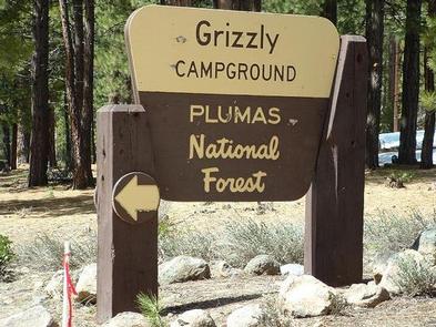
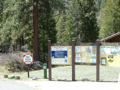
Categories
Uncategorized

LONG POINT (CA)

Overview

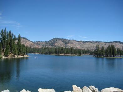
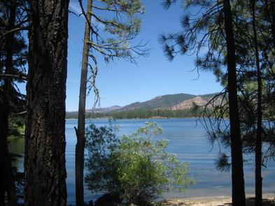
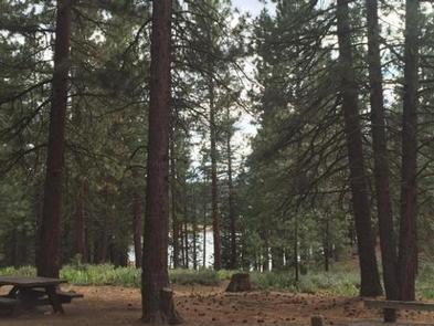
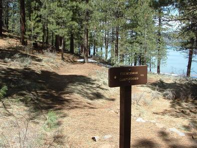
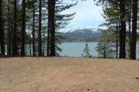
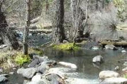
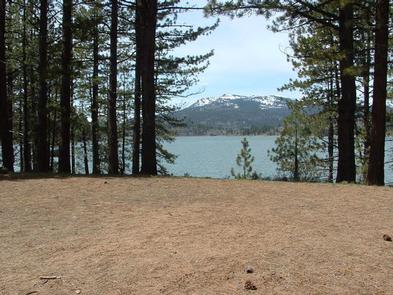
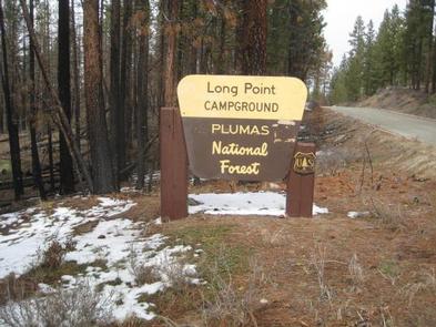
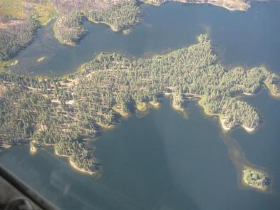
Long Point Campground is one of three in the Antelope Lake Recreation Area. It is situated on the lake’s southwestern side, providing clear water views at nearly every location within the campground.

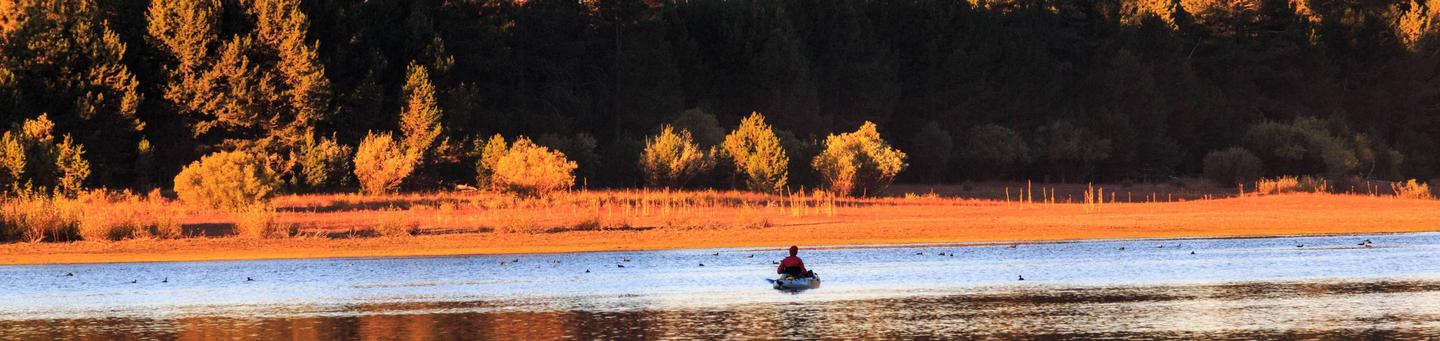
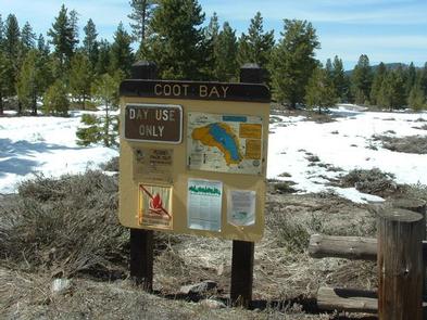
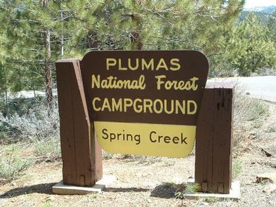
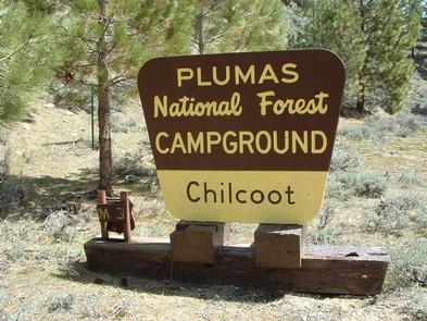
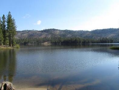
Antelope Lake is one of the more remote, quiet lakes in the Sierra Nevada’s Plumas National Forest, making it a popular destination for anglers and explorers of all abilities.

Recreation

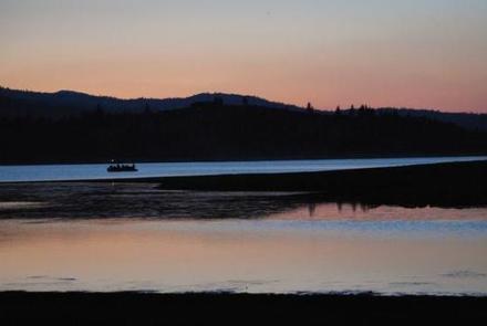
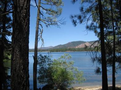
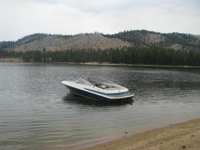
Due to its prime location on the lake, Long Point is known for great bass fishing. Sailing and other boating activities are also popular at Antelope Lake.

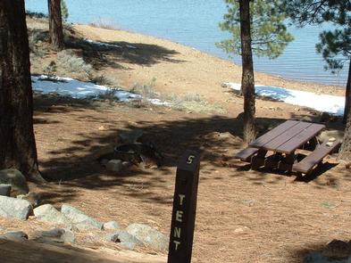
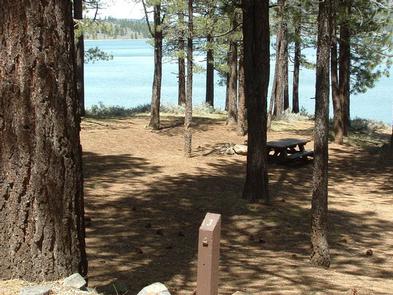
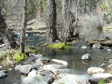
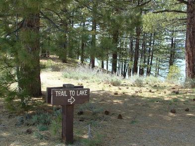
Some sites are very near to shallow water and are ideal for wading near the campground; other sites are near deeper water, allowing visitors the opportunity to anchor their boats nearby.

Facilities

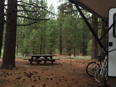
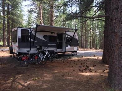
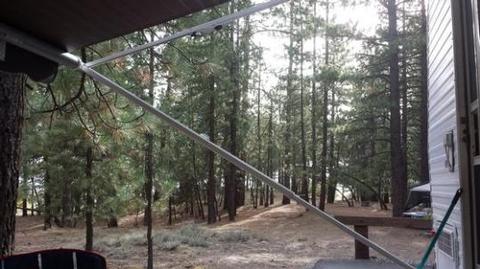
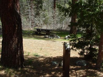
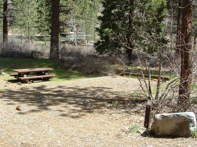
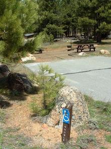
The campground offers multiple single-family and larger group campsites, accommodating both tent and RV camping. With Antelope Lake adjacent to the campground on three sides, most sites have a view of the water.

Tables and campfire rings with grills are provided, as well as vault toilets and drinking water.

Natural Features

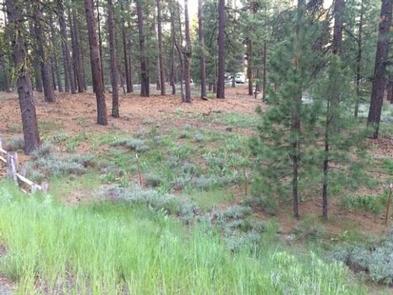
The campground is situated at an elevation of 5,000 ft. and is shaded with plentiful pine and fir trees. It is nestled in the beautiful northern Sierra Nevada mountain range, offering forested woods and scenic vistas as far as the eye can see.

Nearby Attractions

Campground is located about 30 miles from the small town of Taylorsville.
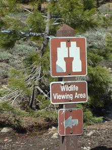
Nearby Activities

  • Biking
  • Camping
  • Fishing
  • Swimming site

Gallery

Directions

Located 30 miles northeast of Taylorsville, on the Genesee-Antelope Lake Road. From Janesville, take County Road 208 for 4 miles and turn onto Forest Service road 28N01 for 9 miles, then turn right on Forest Service road 28N03 and continue for 2 miles.

GPS Coordinates

Latitude 40° 10′ 41.9999″ N

Longitude 120° 34′ 41.9999″ W

Categories
Uncategorized

LONE ROCK (CA)

Overview

Lone Rock Campground is one of three in the Antelope Lake Recreation Area. Nestled in the beautiful northern Sierra Nevada mountain range, it offers forested woods and scenic vistas as far as the eye can see.

Antelope Lake is one of the more remote, quiet lakes in the Plumas National Forest, making it a popular destination for anglers and explorers of all abilities.

Recreation

The campground’s close proximity to the lake provides visitors with access to fishing, swimming, boating, water skiing and other water-related recreation activities. Anglers can look forward to a well-stocked trout, bass and catfish population.

Educational programs are offered at the campground’s amphitheater. Hiking and mountain biking opportunities abound. The Sunset Point trail begins near the campground.

Facilities

The campground offers multiple sites for both tent and RV camping, several of them adjacent to the lake, providing views of the lake. Space allows for two vehicles at each site; extra vehicles can be parked in nearby overflow parking at no extra charge.

Tables and campfire rings with grills are provided, as well as vault toilets and drinking water.

Natural Features

Tall pine and fir trees provide plentiful shade to the area, which is situated at an elevation of 5,000 feet.

Nearby Attractions

The campground is 30 miles from the small town of Taylorsville. The drive along Janesville Grade has some terrific views.

Nearby Activities

  • Biking
  • Boating
  • Camping
  • Interpretive programs
  • Fishing
  • Swimming site

Gallery

Directions

Take Arlington Road off Highway 89 (near Crescent Mills) to Taylorsville Road, continuing on Genesee Road and Indian Creek Road to Antelope Lake.

GPS Coordinates

Latitude 40° 11′ 43.0001″ N

Longitude 120° 37′ 1.9999″ W

Categories
Uncategorized

GRIZZLY

Overview

Grizzly Campground (5,777 feet) is one of three family-friendly campgrounds located in the Lake Davis Recreation Area. The recreation area and its namesake lake, Lake Davis provides the classic lake fishing experience. For example, there are four boat launching facilities and many fishing access points around the lake. Water skiing and jet skiing are not allowed on this lake. That makes it a quieter location for that peaceful leisurely camping experience you’re looking for.

Recreation

In addition to camping, the area offers a wide variety of popular water-related activities, including fishing, boating and swimming. Numerous fishing access points are located around the perimeter of the lake and anglers will find rainbow and brown trout, bass and catfish. A boat ramp is available a half-mile north of the campground. Mountain biking, hiking, hunting and wildlife viewing are also available in the area. 

Facilities

The campground offers dozens of single-family sites, two of which are accessible, for tent and RV camping. A large portion of the campsites are available on a first-come, first-served basis. Utility hookups are not provided.

Each site is equipped with picnic table, campfire ring with grill, and can accommodate up to two vehicles. Campground host, accessible flush toilets, and drinking water are provided. Campers are welcome to take advantage of the coin-operated showers half a mile away at Grasshopper Flat Campground.

Natural Features

Lake Davis covers 4,000 acres and was created in 1967 for recreational opportunities, as well as to rejuvenate fish populations in nearby rivers and supply water to the town of Portola. The lake offers 32 miles of shoreline and is surrounded by tall pine trees. The campground is on the eastern shore and just a few campsites have lake views. The trees provide ample shade for the campground, however privacy is limited by a lack of understory.

Smith Peak State Game Refuge borders the lake to the east and south, creating prime habitat for a variety of wildlife and birds. Rich meadow rangeland combines with pine forest in every direction around the lake. Many lovely stands of aspen show add their richness to area fall color.

Nearby Attractions

The closest town is Portola, California, which is about 9 miles from the campground. 

Portola is home to one of the largest railroad museums in the western United States. 

Visit Smith Peak Fire Lookout when lightning is not expected.

Explore the many forest roads in this area. Take along a map, full tank and a dependable vehicle.

Nearby Activities

  • Biking
  • Boating
  • Historic & cultural site
  • Camping
  • Fishing
  • Hiking
  • Hunting
  • Wildlife viewing
  • Swimming site

Gallery

Directions

From Reno, travel north on Highway 395 to Highway 70 and turn west to Portola. From Portola, take County Road 126 north for 7 miles, then County Road 112 to the east side of Lake Davis. Continue approximately 1 mile to the campground, which is on the left.

GPS Coordinates

Latitude 39° 53′ 13.9999″ N

Longitude 120° 28′ 21.0000″ W

Categories
Uncategorized

LIGHTNING TREE

Overview

Lightning Tree Campground (5,800 feet) is one of three family-friendly campgrounds located in the Lake Davis Recreation Area. The lake was formed by damming Grizzly Creek in 1967. The purpose of the lake was to provide water for the town of Portola, improve area fishing and provide recreation opportunities. The 32 miles of shoreline has several boat launch facilities and fishing access points. Lightning Tree Campground is a great place to serve as hub for family fun and recreation. At the end of the day return to this home away from home to relax around the campfire. 

Recreation

In addition to camping, the area offers a wide variety of popular water-related activities, including fishing, boating and swimming. Numerous fishing access points are located around the perimeter of the lake and anglers will find rainbow and brown trout, bass and catfish. A boat ramp is located nearby.

Mountain biking, hiking, hunting and wildlife viewing are also available in the area. During winter months, visitors enjoy ice fishing, snowmobiling and cross-country skiing.

Facilities

The campground offers more than three dozen single and double capacity campsites, available for tent and RV camping. Some accessible campsites are available. Most sites are available on a first come basis and the rest are open for reservation up to six months in advance. Coin-operated showers are available 4 miles away at Grasshopper Flat Campground.

Natural Features

Lake Davis is situated in the hills north of the town of Portola in the Plumas National Forest. Smith Peak State Game Refuge to the south and west of the lake is a great place for bird watching, nature viewing, photography and exploring. Large sheep herding ranches used this area before the dam was build. Today, cattle trek across the rangeland meadows. Get a panoramic view of Lake Davis, Sierra Valley and peaks of the Sierra Nevada and Cascade Ranges from Smith Peak Fire Lookout.

Nearby Attractions

Restaraunts, stores and services are available in Portola, CA

Visit the largest railroad museum in the Western United States located in Portola. 

The old Basque style sheepherder bread oven at Jenkins Point has been restored

Visit Smith Peak Fire Lookout

Nearby Activities

  • Biking
  • Boating
  • Camping
  • Fishing
  • Hiking
  • Hunting
  • Winter sports
  • Wildlife viewing
  • Swimming site

Gallery

Directions

From Reno, travel north on Highway 395 to Highway 70 and turn west to Portola. From Portola, take County Road 126 north for 7 miles, then County Road 112 to the east side of Lake Davis. Continue approximately 5 miles to the campground, which is on the left.

GPS Coordinates

Latitude 39° 55′ 31.6402″ N

Longitude 120° 30′ 37.7798″ W

Categories
Uncategorized

GRASSHOPPER FLAT

Overview

Grasshopper Flat Campground (7,777 feet) is one of three family campgrounds located in the Lake Davis Recreation Area. Campground loops around in the hills overlooking the lake providing most campsites with sweeping views of the lake’s crystal blue water. Pine forest gives most campsites plenty of afternoon shade. A boat ramp and RV dump station are nearby. A trailhead for 7 mile long Lake Davis Trail is less than half a mile away.

Recreation

In addition to camping, the area offers a wide variety of popular water-related activities, including fishing, boating and swimming. Numerous fishing access points are located around the perimeter of the lake. Free trout fishing days are hosted by state agencies in June and September.

Mountain biking, hunting and wildlife viewing are also available in the area. During winter months visitors enjoy ice fishing, snowmobiling and cross-country skiing.

Facilities

There are multiple single-family tent and RV campsites, as well as one large group site. All campsites are equipped with picnic table, campfire rings and grill. Each site can accommodate up to two vehicles on a paved pad. The campground has paved roads. In peak season there is a campground host, drinking water, coin operated showers, flush toilets and trash service.

Natural Features

The 4,000-acre Lake Davis was created in 1967 for recreational opportunities, as well as to rejuvenate fish populations in nearby rivers and supply water to the town of Portola. The lake offers 32 miles of shoreline and is surrounded by tall pine trees. A variety of wildlife make its home near the campground. Tall mountain peaks offer backdrop to lake views.

Nearby Attractions

The closest town is Portola, California, which is home to one of the largest railroad museums in the western United States. A state game refuge borders the lake to the east and the south.

Nearby Activities

  • Biking
  • Boating
  • Camping
  • Fishing
  • Hiking
  • Swimming site
  • Photography
  • Birding
  • Sailing
  • Sailboarding

Gallery

Directions

From Reno, travel north on Highway 395 to Highway 70 and turn west to Portola. From Portola, take County road 126 north for seven miles, then County road 112 to the east side of Lake Davis. It is approximately one mile to the campground.

GPS Coordinates

Latitude 39° 53′ 26.0002″ N

Longitude 120° 28′ 36.9998″ W

Categories
Uncategorized

SPRING CREEK

Overview

Spring Creek Campground (5,800 feet) is just minutes away from the clear waters of the Frenchman Lake. The landscape provides a magnificent backdrop for a variety of recreational activities. The campground offers 35 camp sites with 12 sites available for reservation. 

Recreation

During summer, the campground offers a variety of outdoor experiences including hiking, biking, picnicking and hunting. The nearby lake provides ample opportunities for swimming, boating, water skiing and jet skiing. The expansive road system in Plumas National Forest is a great location for exploration and sightseeing. 

Facilities

The campground offers single-family campsites for tent and RV camping, including one accessible site (#23). The campground has paved roads and paved parking pads. Host, water and garbage service are provided during peak camping season. Two group campsites are available. All campsites are equipped with tables and campfire rings with grills. Bear resistant lockers are not provided. Campground host, paved roads Vault toilets and drinking water are provided.

Natural Features

This campground is at the interface between mountains and high desert and between the Sierra Nevada and Cascade mountain ranges. Ancient lava that flowed across the land has been eroded by creeks forming interesting landscapes. 

Nearby Attractions

Little Last Chance Canyon Scenic Area

Sierra Valley – Largest valley in the Sierra Nevada

Stores and services in the towns of Chilcoot and Loyalton

Nearby Activities

  • Boating
  • Camping
  • Fishing
  • Hiking
  • Hunting
  • Water sports
  • Wildlife viewing
  • Swimming site

Gallery

Directions

From Reno, travel north on Highway 395. Turn west on Highway 70 and travel 5 miles to Chilcoot. Turn north on Highway 284, travel 8 miles to the Frenchman Lake Reservoir, turn right, cross the dam, and travel 2 miles to the Spring Creek Campground.

GPS Coordinates

Latitude 39° 53′ 44.9999″ N

Longitude 120° 10′ 35.0000″ W

Categories
Uncategorized

COTTONWOOD (CA)

Overview

Cottonwood Springs Campground (5,700) is located on the southwest side of Frenchman Lake. The surrounding pine forest provides ample shade during summers’ hot afternoons. The lake, recreation area and surrounding forest and rangeland offer a wide variety of recreational opportunities and adventures.
Two group sites provide families and other groups the location to get together for you special outdoor experience. Hunting, fishing, boating, water sports and nature viewing are just some of the possibilities.  

Recreation

The nearby 1,580-acre Frenchman Lake provides ample opportunities for swimming, boating, water skiing, jet skiing and fishing. California sponsors two free fishing days every year, in April and September. There is also an accessible fishing trail within the campground. Public forest and range lands are open for you to visit. Plumas national Forest has an extensive road system for you to explore. Make sure you take a map, extra provisions dependable vehicle and plenty of fuel.

Facilities

Cottonwood Springs Campground has 20 single-family campsites available for both tent and RV camping. Need a location for your family or group get together? There are two reservation group sites here. Group site B can accommodate up to 25 guests and six vehicles and Group site D up to 50 guests and 12 vehicles. Lunker Point Boat Launch Facility is about two miles away. An RV dump station is just outside the campground. All sites are equipped with paved parking, tables, campfire rings and grills. The campground has paved roads, hosts, accessible flush toilets and drinking water are also provided.

Natural Features

Frenchman Lake Recreation Area is located in the northeast corner of the Sierra Nevada. The area is characterized by a blending of desert and mountain ecosystems. For example, draught tolerant plants co-mingle with pine forest. There is less precipitation here than what areas to the west receive, more than areas to the east. Erosion and lava flows in the area tell the story of recent geologic activity.

Nearby Attractions

 Little Last Chance Canyon Scenic Area

Sierra Valley – Largest valley in the Sierra Nevada

Stores and services in the towns of Chilcoot and Loyalton

Many forest roads to explore – take along a extra water, food, map, full tank and dependable vehicle.

Nearby Activities

  • Boating
  • Camping
  • Fishing
  • Hiking
  • Hunting
  • Water sports
  • Wildlife viewing
  • Swimming site
  • Water access
  • Water skiing
  • Scenic drive

Gallery

Directions

From Reno, Nevada, travel north on Highway 395, then merge onto Highway 70 west and travel 5 miles to Chilcoot. Turn north on Highway 284 and continue for 8 miles to the Frenchman Lake Reservoir, then turn left before crossing the dam and travel 2.5 miles to the Cottonwood Campground.

GPS Coordinates

Latitude 39° 53′ 4.9999″ N

Longitude 120° 14′ 12.0001″ W

Categories
Uncategorized

CHILCOOT

Overview

Chilcoot Campground (5,100 feet) is located just downstream from Frenchman Lake alongside Last Chance Creek. The sound of flowing water along with shade from the surrounding pine and cottonwood forest are key features making this a great place to relax and enjoy the outdoors. Chilcoot Campground is one of five campgrounds in the popular Frenchman Lake Recreation Area of Northeastern California’s Plumas National Forest. The campground is far enough away from the lake that visitors can experience the serene sense of solitude that the remote mountain setting provides.

Recreation

Frenchman Recreation Area offers a wide variety of recreational opportunities. Water sports including fishing, skiing, jet skiing, swimming are readily available supported by two boat launch facilities, several fishing access points and day use areas. Camping, picnicking hiking and exploring forest roads can each provide the type of adventure you are looking for. Dispersed camping (camping outside developed campgrounds) is not allowed in the recreation area. Winter activities range from snowmobiling to ice fishing and cross-country skiing.

Facilities

The campground has 40 single-family tent and RV camp sites. Some sites are available for tent camping only. Fifteen campsites are available for reservations during peak camping season. All other campsites are available as ‘First Come’ sites as long as the campground is open. Paved roads, paved campsite parking, water, flush toilets, host, firewood and trash service are available during peak camping season. Tables, campfire rings and bear resistant containers are provided at each campsite

Natural Features

This campground is situated at the southern end of Last Chance Scenic Area. The scenic area is the result of Little Last Chance Creek cutting through ancient lava flows. This is the interface of desert and mountain climates characterized by less precipitation than areas to the west and more than areas to the east. Desert scrub grows alongside pine forest. A variety of wildlife make this area home.  

Nearby Attractions

Chilcoot Campground is one of five campgrounds in the Frenchman Recreation Area. 

Little Last Chance Scenic Area

Frenchman Lake is less than three miles from the campground.

Sierra Valley – Largest valley in the Sierra Nevada.

Stores and services in the towns of Chilcoot and Loyalton.

Nearby Activities

  • Boating
  • Camping
  • Fishing
  • Hiking
  • Water sports
  • Swimming site

Gallery

Directions

From Reno, Nevada, travel north on Highway 395. Merge onto Highway 70 west and continue 5 miles to Chilcoot. Turn north on Highway 284 and continue 5 miles to the campground.

GPS Coordinates

Latitude 39° 51′ 56.0002″ N

Longitude 120° 9′ 58.0000″ W

Categories
Uncategorized

BIG COVE

Overview

Big Cove Campground (5,700 feet) is located near the shores of Frenchman Lake in Northeastern California. Some families have been returning here for more than thirty years. Situated at the interface between the wild Sierra and the high desert, it’s a perfect place to serve as hub for a wide range of recreation opportunities. Plumas National Forest has many back roads open for exploration. Take advantage of the beautiful blue waters of Frenchman Lake for boating, fishing and other water sports. Tell stories around your campfire. 

Recreation

Little Last Chance Creek offers plenty of streamside recreation including fishing, nature viewing, photography and just relaxing. Frenchman Lake provides the perfect location for swimming, boating, lake fishing, skiing, jet skiing, paddle boarding and canoeing. The entire recreation area and surrounding National Forest is available for nature viewing, photography, picnicking, hunting, biking or exploring forest roads.
Disbursed camping is not allowed in the recreation area.

Facilities

The campground offers single and double family campsites for tent and RV camping. Accessible campsites are available. Fifteen of the 38 campsites can be reserved during peak season. All other campsites may be taken as ‘First Come’ sites. All ‘First Come’ sites must be occupied on the first night rented.

Big Cove Campground also offers coin operated showers, accessible flush toilets, drinking water, trash bins and paved roads during peak camping season. An RV dump station is located nearby, at Cottonwood Springs Campground.

Natural Features

Just experiencing the drive into the Frenchman Lake Recreation Area is worth the trip. Little Last Chance Creek has eroded through ancient lava flows to produce this very scenic canyon known as the Little Last Chance Scenic Area.

At the interface of desert and mountain climates, this area gets less precipitation than areas to the west and more precipitation than areas east. Desert scrub grows alongside pine forest.

Some campsites overlook the lake’s blue waters and nearby meadows.

Nearby Attractions

Little Last Chance Canyon Scenic Area.
Sierra Valley – Largest valley in the Sierra Nevada.
Stores and services in the towns of Chilcoot and Loyalton.
Many forest roads to explore – take along a map and a full gas tank.

Charges & Cancellations

America the Beautiful Senior and Access Passes are accepted for single family sites and not for double sites.

Nearby Activities

  • Biking
  • Boating
  • Camping
  • Fishing
  • Hunting
  • Picnicking
  • Water sports
  • Swimming site
  • Swimming
  • Paddle boating
  • Water activities
  • Jet skiing
  • Water skiing

Gallery

Directions

From Reno, Nevada, take Highway 395 north for 24 miles. Merge onto State Rout 70 west and continue for 5 miles to the town of Chilcoot. Turn right on State Rout 284 and continue for 8 miles to Frenchman Lake. Cross the dam and proceed 2 miles to the campground.

GPS Coordinates

Latitude 39° 54′ 6.9998″ N

Longitude 120° 10′ 21.0000″ W

Categories
Uncategorized

RED FEATHER CALIFORNIA

Overview

Red Feather Campground is located on the eastern shore of Little Grass Valley Reservoir, providing visitors with ample opportunity to fish, swim, boat, and enjoy nature. It is one of eight campgrounds in the area, providing access to a beautiful mountain lake and various hiking trails that meander through the scenic hills and valleys.

Recreation

The 1,615-acre lake provides ample opportunities for visitors to fish, boat, swim, and water ski. Anglers can expect a catch of a variety of trout and kokanee salmon, among other species of fish. Fishing licenses are required.

The Lakeshore Trail, which loops 13.5 miles around the lake, is available for hiking, mountain biking and horseback riding. The trail connects to the Pacific Crest National Scenic Trail, which stretches from 2,650 miles, across three states from Canada to Mexico. The Lakeshore Trail is popular among day hikers.

Facilities

The campground offers dozens of single-family campsites, available for tent and RV camping. More than a handful of the sites overlook the beautiful lake, while others are surrounded by characteristic mixed-conifer forest and alpine meadows. The Maidu boat launch ramp is located nearby, adjacent to Little Beaver Campground and the Maidu Amphitheater.

Campsites are equipped with tables and campfire rings with grills. Flush toilets and drinking water are provided. Utility hookups are not available. All sites have paved parking spurs. Bear-resistant trash collection bins are located throughout the campground.

Natural Features

The campground is located in the Northern Sierra Nevada Mountains of northern California at an elevation of about 5,100 feet. It is on the eastern shore of the Little Grass Valley Reservoir, which was formed by dam construction and subsequent flooding of the valley in the 1960s. The campground and the lake are surrounded by thick stands of pine and fir trees.

Several public campgrounds are located around the lake, as well as private cabins on the south side.

Nearby Attractions

About 12 miles northeast of the lake at an elevation of 5,446 feet lies a small, natural lily pond, called Fowler Lake. This beautiful site is perfect for day hikes and picnics.

Nearby Activities

  • Biking
  • Boating
  • Camping
  • Fishing
  • Hiking
  • Water sports
  • Swimming site

Directions

From Oroville, California, travel east on Highway 162 to Olive Highway. Turn right and continue 5 miles to Forbestown Road. Turn right and go 16 miles to La Porte Road. Turn left and travel 27 miles to La Porte, then 2 miles to signs for the recreation area. Turn right and continue just over 2 miles to the campground.

GPS Coordinates

Latitude 39° 44′ 7.0001″ N

Longitude 120° 57′ 11.0002″ W