Located 32 miles west of Quincy on Hwy 70, Gansner Bar, North Fork, and Queen Lily campgrounds are located on the west branch of the north fork of the Feather River along Caribou Road. Hallstead is located along the Feather River on Hwy 70 just 17 miles west of Quincy. Supplies are available in Belden, Twain, and Quincy.
This location is closed (Affected reservations have been cancelled and refunds have been issued.) Local managers are committed to the health and safety of recreational visitors and our staff. We are following the guidelines from our department and the CDC regarding COVID-19, closely monitoring the situation and responding to current conditions.
On the shore of Bucks Lake, 22 units, first come, first served. Bear box on site. Popular campground with boating and swimming.
Nearby Activities
Biking
Boating
Camping
Fishing
Hiking
Wildlife viewing
Swimming
Directions
From downtown Quincy, take the Bucks Lake Rd. for 17 miles. From Oroville,there are two routes. Take Hwy 70 east through the Feather River Canyon to Quincy, then follow the Bucks lake Rd. to the lake. Or, from Oroville, take Orville Dam Blvd., turn right on Olive/Hwy 162 and follow it to the lake. this route is only open during the summer months after the road is plowed. Call ahead for road status.
Five developed units are available for overnight campgin on a first come, first-served basis. Each campsite is equipped with a table and a fire ring. Two bear-proof trash bins are available for use at the trailhead. If these bins are full, please pack out your trash. The Feather Falls area is bear habitat, and bears are attracted to trash and food. Please help keep yourself and your fellow campers safe, and store all food and dispose of all waste properly.
From Oroville, take Oro Dam Boulevard to Olive Highway and turn right. Take Olive Highway approximately five miles to Forbestown Road, turn right and go seven miles. Turn left on Lumpkin Road, continue 12 miles to the trailhead turn off and turn left. Go 1.5 miles to the parking area. Camp units are located at the southwest side of the parking area; the Feather Falls trailhead is located on the northeast side of the parking area, adjacent to the restrooms.
This site is a dispersed beach with river access to the North Fork Feather River, just east of Jarbo Gap. The site has year-round access, however is busiest during the summer months. Access to the parking area from Highway 70 is difficult and re-entry onto the highway is dangerous. Take care when entering the roadway in the westbound direction.
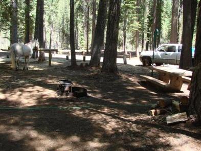
Whitehorse campground is located within three miles of Bucks Lake in the northern Sierra Mountains on the Plumas National Forest. The Bucks Lake area offers year-round recreation activities including fishing, hiking, snowmobiling, skiing,snowshoeing and horseback riding.
Recreation
Bucks Lake provides fishing, boating, and canoeing. There are walking trails to the lake. A hiking trail runs from the campground and provides access to Buck Wilderness and the Pacific Crest Trail which runs adjacent to the campground.
Facilities
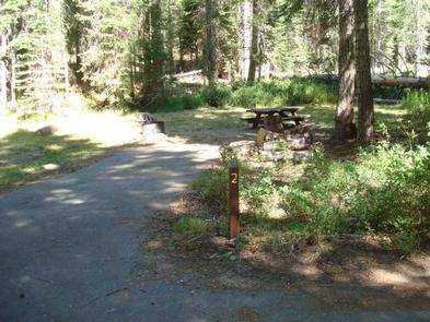
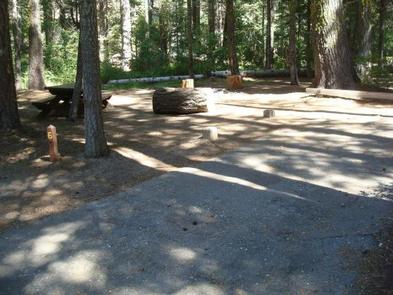
There are 19 total campsites suitable for RV and tent camping, 16 of which are standard non-electric sites and three are equestrian non-electric sites. Each site has a fire ring and picnic table. There are vault toilets and drinking water is available. Sites are walk-up May 24, 2019 thru June 30, 2019. Sites may be reserved July 1, 2019 thru September 8, 2019.
Natural Features
Whitehorse is set in fir and pine trees offering shade during the warm summer months. Situated at 5,500 feet in elevation, the campground is settled along a small creek that feeds into Bucks Lake.
Nearby Attractions
The nearby Bucks Lake Lodge has a bar, restaurant and store offering fishing supplies and groceries.
Nearby Activities
Boating
Camping
Gallery
Directions
Physical Address:
Plumas NF – MT. Hough Road
39696 State Highway 70
Quincy, CA 95971
From Quincy: Take Oroville-Quincy Hwy west 15 miles to the campground which will be on your left. If you have a large RV you will need to take Oroville-Quincy Hwy, left onto Big Creek Road, right on Bucks Lake Road, and the campground will be on your right.
From Oroville: Take Oroville-Quincy Hwy 162 East. Left on Bucks Lake Road and campground will be on your right.
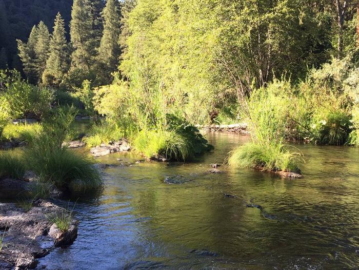
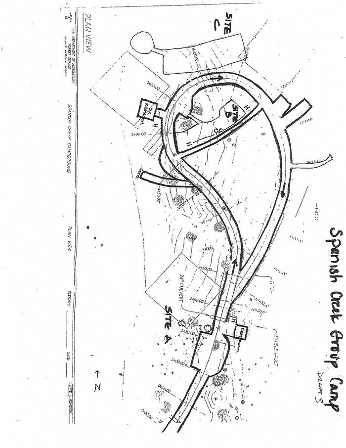
Spanish Creek Campground is located on Highway 70 just east of the Highway 89 intersection; just east of where Banish Creek and Indian Creek merge together to create the east branch of the North Fork Feather River. The campground is right on Spanish Creek with a very popular swimming hole. Although the campground has been recently upgraded, it still holds the charm that it did in years past.
Recreation
Anglers enjoy a healthy supply of rainbow trout in the nearby Feather River, which is within walking distance from the campground. The river and nearby Spanish Creek are also popular for swimming and wading activities.
Facilities
Spanish Creek campground offers several single-family campsites that accommodate both tent and RV camping, however hookups are not available.
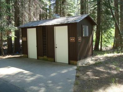
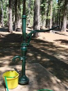
Each site is equipped with tables and campfire rings with grills. Vault toilets and drinking water are also provided. A full-service store, gas and phone service is available less than 10 miles away.
Natural Features
This campground is located in the Plumas National Forest, which is attractive to outdoor enthusiasts because of its many streams and lakes, beautiful deep canyons, rich mountain valleys, meadows, and lofty peaks. Spanish Creek is in the Feather River Canyon, at an elevation of 2,000 feet.
Nearby Attractions
Within the Plumas National Forest, Spanish Creek campground is just a few short miles from Indian Falls. This is one attraction not to miss. Some have said that the mist created by the falls resembles a feather — thus naming the Feather River. Just southeast on Highway 70 from Spanish Creek Campground is the quaint high Sierra town of Quincy. We recommend walking around the town if you get a chance. Very close to the campground is the Butterfly Valley Botanical Area. This is also a neat spot to explore. Before you get to the town of Quincy you will pass the Mount Hough Ranger District – a wonderful stop to discover more information about local area attractions.
Nearby Activities
Camping
Fishing
Hiking
Water sports
Swimming site
Gallery
Directions
From Oroville, travel east on Highway 70 for 75 miles. The turnoff to the campground is two miles past Highway 89. From Quincy, travel west on Highway 70 for 8 miles. Campground is across the Spanish Creek bridge.
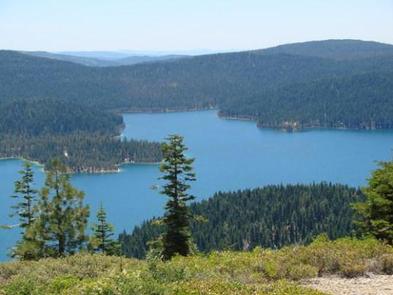
Horse Camp is located on the eastern shore of the Little Grass Valley Reservoir, giving visitors ample opportunity to fish, swim, boat and enjoy nature.
The camp is one of eight campgrounds in the area, but the only one equipped to handle equestrian campers. It provides access to a beautiful, adjacent mountain lake and various hiking, mountain biking and horseback riding trails that meander through the scenic hills and valleys.
Recreation
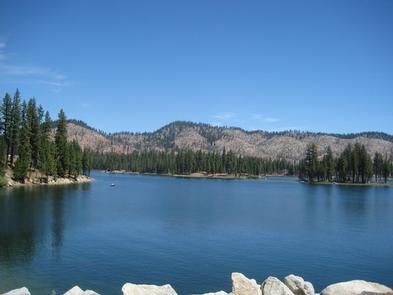
The 1,615-acre lake provides ample opportunities for visitors to fish, boat, swim and water ski. Anglers can expect a catch of a variety of trout and kokanee salmon, among other species of fish, however, fishing licenses are required to participate.
The Lakeshore Trail, which loops 14.5 miles around the lake, is available for hiking, mountain biking and horseback riding. The trail connects to the Pacific Crest National Scenic Trail, which stretches from 2,650 miles from Canada to Mexico, across three states. A variety of day hikes can be done on portions of the trail.
Facilities
The campground offers 10, single-family equestrian campsites, available for tent and RV camping. Eight of these sites are available to reserve online. Hookups are not available and the parking surfaces are gravel. Lantern posts and hitching posts are provided at each site.
Each site is also equipped with a table and a campfire ring with a grill. Accessible vault toilets are provided. An on-site host may be available.
Natural Features
The campground is located in the Northern Sierra Nevada Mountains, in northern California, at an elevation of about 5,060 feet. It is on the eastern shore of the Little Grass Valley Reservoir, which was formed by flooding in the 1960s. The campground and the lake are surrounded by thick stands of pine and fir trees.
There are several campgrounds located around the lake as well as cabins on the south side. The campground is also the center of a popular snowmobiling area during winter months.
Nearby Attractions
About 12 miles northeast of the lake at an elevation of 5,446 feet lies a small, natural lily pond, called Fowler Lake. This beautiful site is perfect for day hikes and picnics.
Nearby Activities
Biking
Boating
Camping
Fishing
Hiking
Water sports
Swimming site
Gallery
Directions
From Oroville, California, travel east on Oro Dam Boulevard to Highway 162/Olive Highway. Continue on Highway 162/Olive Highway for 5 miles to Forbestown Road. Turn right and go 16 miles to La Porte Road. Turn left and travel 27 miles to La Porte, then 2 miles to signs for the recreation area. Turn right and continue just over 3 miles to the campground.
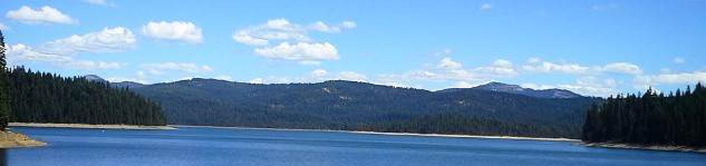
Running Deer Campground is located on the eastern shore of the Little Grass Valley Reservoir, giving visitors ample opportunity to fish, swim, boat and enjoy nature. It is one of eight campgrounds in the area, providing access to a beautiful mountain lake and various hiking, mountain biking and horseback riding trails that meander through the scenic hills and valleys.
Recreation
The 1,615-acre lake provides ample opportunities for visitors to fish, boat, swim and water ski. Anglers can expect a catch of a variety of trout and kokanee salmon, among other species of fish.
The Lakeshore Trail, which loops 14.5 miles around the lake, is available for hiking, mountain biking and horseback riding. The trail connects to the Pacific Crest National Scenic Trail, which stretches from 2,650 miles from Canada to Mexico, across three states. A variety of day hikes can be done on portions of the trail.
Facilities
The campground offers dozens of single-family campsites, available for tent and RV camping. More than a handful of the sites overlook the beautiful lake, while others are surrounded by various trees and shrubbery. A boat ramp is available within the site.
Campsites are equipped with tables and campfire rings with grills. Flush toilets and drinking water are provided. Utility hookups are not available and all sites have paved parking spurs. Trash collection bins are available throughout the campground.
Natural Features
The campground is located in the Northern Sierra Nevada Mountains of northern California at an elevation of about 5,000 feet. It is adjacent to the Little Grass Valley Reservoir, which was formed by flooding in the 1960s. The campground and the lake are surrounded by thick stands of pine and fir trees.
There are multiple campgrounds located around the lake as well as cabins on the south side. The campground is also the center of a popular snowmobiling area during winter months.
Nearby Attractions
About 12 miles northeast of the lake lies a small, natural lily pond, called Fowler Lake. It sits at an altitude of 5,446 feet and is a beautiful sight.
Charges & Cancellations
$23/site per night
Nearby Activities
Biking
Boating
Camping
Fishing
Hiking
Swimming site
Directions
From Oroville, California, travel east on Highway 162 to Olive Highway. Turn right and continue 5 miles to Forbestown Road. Turn right and go 16 miles to La Porte Road. Turn left and travel 27 miles to La Porte, then 2 miles to signs for the recreation area. Turn right and continue just over 2 miles to the campground.
This facility has been closed for the 2019 season. This is due to the Walker Fire.
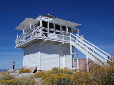
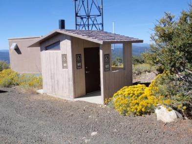
Black Mountain Lookout is located on the eastern edge of the Beckwourth Ranger District, 10 miles from Highway 395, near Milford, California.
The lookout was constructed in 1934 and is a great example of Civilian Conservation Corps (CCC) architecture. The C-3-type lookout is situated on a single story 10 foot tower and is extremely well-preserved.
The lookout tower is available for Memorial Day weekend through October, offering guests a unique lodging experience in Plumas National Forest.
Recreation
Hiking, birding, stargazing and wildlife viewing are popular among guests of the lookout. On a clear night, visitors can gaze upon the expansive sky as it unfolds with a dazzling display of stars.
Facilities
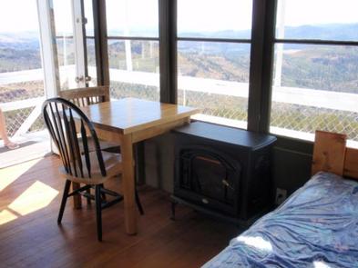
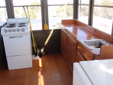
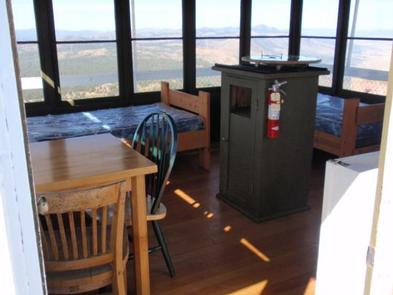
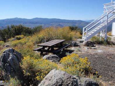
The one-room lookout cabin is set on a tower, rising 10 feet above the ground. It is furnished with two single beds with mattresses, but can accommodate up to four people. There is also space for tent camping adjacent to the lookout, for up to four visitors.
The cabin has a small table and chairs, a refrigerator, a small stove, heater, and lights, all powered with electricity. A picnic table and vault toilet are also on site.
Although the lookout provides a few amenities, guests must bring several of their own, including food, cooking utensils, sleeping bags, towels, dish soap and garbage bags.
No water is available at this facility, so guests must bring their own water for drinking, cooking and washing. Packing an additional light source is also recommended.
Natural Features
The Plumas National Forest is defined by its unique land features and pleasant climate. Outdoor enthusiasts are attracted to the many streams and lakes, beautiful deep canyons, rich mountain valleys, meadows and lofty peaks.
Guests at Black Mountain Lookout are treated to striking views of Honey Lake to the north, and Last Chance Creek to the south.
Diverse vegetation provides a habitat for wildlife including deer, coyotes, bald eagles and osprey.
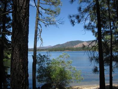
Frenchman Lake is within a 30-minute drive from the lookout. This lake is popular for swimming, water skiing, fishing and camping.
Nearby Activities
Camping
Interpretive programs
Hiking
Wildlife viewing
Gallery
Directions
Access to the lookout is by a dirt road; high clearance vehicles are recommended. Visitors should be aware that access is subject to inclement weather during the early and late season.
Black Mountain Lookout is located on the eastern edge of the Beckwourth Ranger District, 10 miles from Highway 395, near Milford, California.
From Highway 395 at Milford take County Road 336 to Milford Grade. Turn right onto Milford Grade (also named County Road 336 and Forest Rd. 26N70. Turn left on Forest Road 26N80 and continue on this road to lookout.
Boulder Creek Campground is located in the northern Sierra Nevada Mountains, where ancient glaciers gave way to numerous mountain lakes and vast granite peaks. Year round, outdoor enthusiasts are attracted to the area’s many streams and lakes, beautiful deep canyons, rich mountain valleys, meadows and lofty peaks.
Recreation
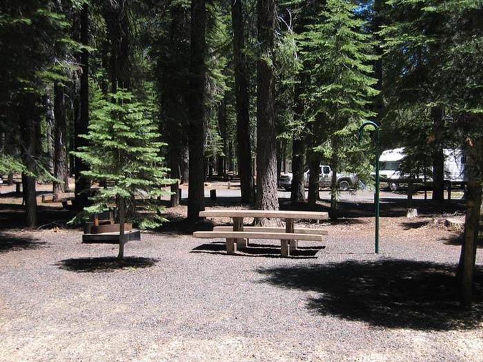
The campground provides educational campfire programs at the amphitheater. It offers several single-family campsites and while none are directly on the lake, a few sites have a limited view of the water.
Antelope Lake provides ample opportunities for swimming, canoeing, kayaking, boating and water skiing. A multi-lane boat ramp is available less than two miles from the campground. Anglers enjoy fishing for large and smallmouth bass, bluegill and a variety of trout.
The rugged terrain and dusty mountain trails are perfect for mountain biking, but offer limited opportunities for hiking near the campground.
Facilities
The campground offers several single-family sites open to both tent and RV camping, a short walk from the lake. Several sites are also available on a first-come, first-served basis. Tables and campfire rings are provided, as well as vault toilets and drinking water.
Natural Features
The campground is located near Antelope Lake, which is a small, remote lake with about 15 miles of forested shoreline. Surrounding the lake are mountains blanketed with Jeffrey and lodgepole pines and fir trees. Protected coves around the lake attract several species of migratory birds. The site sits at an elevation of 5,000 feet.
Nearby Attractions
Fishing is also plentiful in Indian Creek, below the spillway at nearby Antelope Dam. The nearest gas and phone is 25 miles from the campground in Taylorsville, CA.
Nearby Activities
Biking
Boating
Camping
Interpretive programs
Fishing
Water sports
Day use area
Swimming site
Other recreation concession site
Gallery
Directions
From Oroville, take Highway 70 and head east 72 miles to Highway 89. Turn left and go 8 miles. Turn right on Road A22 (Arlington). Go 7 miles through Taylorsville to a "T" at the rodeo grounds. Turn right and head 20 miles to Antelope Lake. Follow the signs to the campground.
 Five developed units are available for overnight campgin on a first come, first-served basis. Each campsite is equipped with a table and a fire ring. Two bear-proof trash bins are available for use at the trailhead. If these bins are full, please pack out your trash. The Feather Falls area is bear habitat, and bears are attracted to trash and food. Please help keep yourself and your fellow campers safe, and store all food and dispose of all waste properly.