Categories
Uncategorized

Big Meadow Campground

Overview

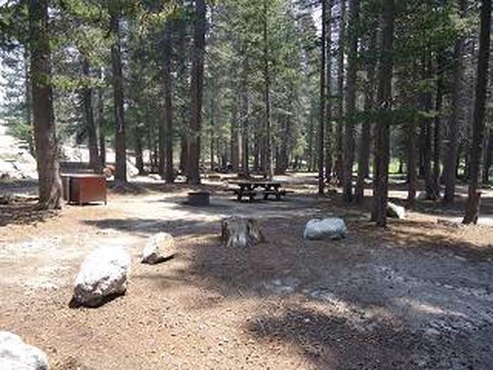
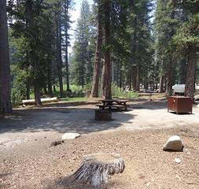
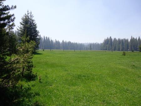
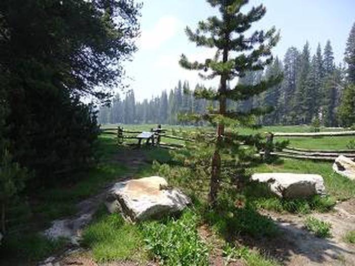
Big Meadows Campground is located 75 miles east of Fresno, California, in the Sequoia National Forest and Sequoia National Monument. The campground sits at an elevation of 7,500 feet and has views of the meadow and surrounding mountains. 

Please note, this campground IS NOT within Shenandoah National Park.

Recreation

Hiking into the Jennie Lakes Wilderness and fly fishing in Big Meadows Creek are popular options.

Horseback riders have access to the nearby Horse Corral Pack Station. Numerous trailheads provide access to popular wilderness areas including Jennie Lakes, Monarch and National Park wilderness destinations.

Guests looking for water activities can visit Hume Lake, only 15 miles away.

Facilities

The campground offers 43 single campsites and one double-family campsite. Picnic tables and campfire rings are provided, as are vault toilets.

Natural Features

An open meadow that is surrounded by a variety of pines, including lodgepole, Jeffery and red fir. A creek runs through the meadow.

A trailhead nearby leads into the Jennie Lakes Wilderness.

Buck Rock Lookout, perched at an elevation of 8,500 feet, is a short drive away. Hume Lake is approximately 15 miles from the campground.

Nearby Activities

  • Camping
  • Fishing
  • Wildlife viewing
  • Swimming site

Gallery

Directions

Take Highway 180 east to the Kings Canyon National Park entrance, where you will be required to purchase a forest/park permit. After entering the park, continue 2 miles where you will stay to the right as though you were going to Sequoia National Park. Continue on the General’s Highway approximately 6 miles to the turn off to Big Meadows. The Big Meadows Road (Forest Road 14S11) is located on the left-hand side of the road. Follow this road approximately 5 miles, where you will find the campground on right side of the road. Please refer to the small scale map, or contact the Hume Lake District office for more specific directions.

GPS Coordinates

Latitude 36° 43′ 5.3000″ N

Longitude 118° 49′ 59.0002″ W

Categories
Uncategorized

TEN MILE CAMPGROUND (CA)

Overview

Ten Mile Campground is a primitive campground located 5 miles from Hume Lake on Ten Mile Road. A beautiful stream runs through the campground.

Nearby Hume Lake is one of Sequoia National Forest’s most visited destinations. The area offers year-round recreational opportunities, including fishing, canoeing, hiking, biking, snowmobiling, snowshoeing and cross-country skiing.

Recreation

Nearby Hume Lake is a year-round recreation destination. During warmer months, visitors can enjoy fishing, non-motorized boating, hiking and mountain biking.

During the winter, the area is popular for snowshoeing, cross country skiing and snowmobiling.

Facilities

The campground offers single and double-family campsites, picnic tables and campfire rings are provided, as are vault toilets.

Natural Features

The campground is adjacent to Ten Mile Creek, a creek popular with anglers and hunters and dwarfed by towering sequoia and Jeffrey pines at an elevation of 5,294 feet.

Sequoia National Forest is located at the southern end of the Sierra Nevada in central California and named for the giant sequoia, the world’s largest tree, which grows in more than 30 groves on the forest’s lower slopes.

The forest comprises about 1.1 million acres. Elevations range from about 1,000 to 12,000 feet, creating precipitous canyons and mountain streams with spectacular waterfalls such as Salmon Creek Falls and Grizzly Falls.

Nearby Attractions

Bearskin Grove offers the rare opportunity to photograph an entire mature sequoia in one frame. Hiking through the grove, visitors will find a mix of young and old sequoias, including about 50 trees that measure over six feet in diameter. Take Tenmile Road (Forest Road 13S09) to Forest Road 13S02, then 13S98 to enter the grove.

Visitors enjoy making day trips to Sequoia & Kings Canyon National Parks and Giant Sequoia National Monument.

Nearby Activities

  • Camping
  • Fishing
  • Hiking
  • Hunting
  • Wildlife viewing
  • Swimming site

Directions

From Fresno, take Highway 180 east to the Park entrance, turn right on Generals Highway. Turn left on Ten Mile Road, campground approximately five miles on left.

GPS Coordinates

Latitude 36° 47′ 39.0001″ N

Longitude 118° 54′ 28.0001″ W

Categories
Uncategorized

Pacific Crest Trail from Kennedy Meadows Trailhead

The Pacific Crest trail is 33.5 miles long. It begins at the Forest Boundry near Kennedy Meadows and ends at Bird Springs Pass. The trail is open for the following uses: Hiking, Backpacking

Directions

GPS Coordinates

Latitude 0° 0′ 0.0000″ S

Longitude 0° 0′ 0.0000″ W

Categories
Uncategorized

Sherman Pass Road

Sherman Pass Road (22S05) provides access to the Kern Plateau. This scenic route stretches from the North Fork of the Kern River in the west, east to the high desert, connecting to Highway 395. The road is open from late May or early June, depending on snow, until the snow falls in late fall or winter. From the west, this road climbs out of the Upper Kern River Canyon to Sherman Pass and falls to the east side of the Kern Plateau and then to the Mojave Desert. At the summit of Sherman Pass, visitors can enjoy stunning views of the Sierra Crest and Mount Whitney, the tallest mountain in the lower 48 states. As
the road winds downward across the plateau on the east side, the forest changes from red fir to mixed conifer and to pinyon pine. The road is closed during the winter to passenger vehicles.

Directions

GPS Coordinates

Latitude 0° 0′ 0.0000″ S

Longitude 0° 0′ 0.0000″ W

Categories
Uncategorized

Tule River Canyon

The Middle Fork of the Tule River flows through the southern portion of the monument. The landscape is characterized by steep canyon walls, dramatic rock features, and views to high elevation ridgelines. The river forms a series of cascades, waterfalls, and deep pools carved from granite bedrock that are popular for day trips. Camping is allowed at higher elevations in
developed campgrounds.

Tule RiverTule River. Three forks of the Tule River drain the high mountain tops of the Great Western Divide to form Lake Success, a reservoir managed by the Army corps of Engineers located five miles above the city of Porterville. The North and the Middle Fork split above the foothill community of Springville. Highway 190 travels alongside the Middle Fork Tule River and Balch Park Road follows the North Fork.


The North and Middle Forks of the Tule River offer visitors great fishing, hiking, camping, and picnicking opportunities in a ruggedly beautiful canyon setting. In the lower canyon, Lower and Upper Coffee Camp day use areas provide parking, restrooms, and picnic sites. Overnight camping is allowed at developed campgrounds; Wishon, Belknap, and Coy Flat.

Wishon Canyon map


Belknap Grove Complex lines the upper reaches of the Middle fork of the Tule River and is easy to reach by car from May through mid-November. It includes the Wheel Meadow, McIntyre, and Belknap Groves with beautiful old-growth sequoias. The Nelson Trail (Forest Trail 31E30) travels along the river from Belknap Campground to Quaking Aspen where the Middle Fork of the Tule River originates.

Directions

GPS Coordinates

Latitude 0° 0′ 0.0000″ S

Longitude 0° 0′ 0.0000″ W

Categories
Uncategorized

Rivers and Lakes

To be updated

Directions

GPS Coordinates

Latitude 0° 0′ 0.0000″ S

Longitude 0° 0′ 0.0000″ W

Categories
Uncategorized

Boole Tree

The Boole Tree (GPS NAD 83: 36.823889, -118.949167) is regarded as the 6th largest giant sequoia tree in the world.  The tree was named around 1895 by A.H. Sweeny, a Fresno doctor, after Franklin A. Boole, a supervisor of the logging operation that spared the tree's life due to its great size. Before 1931, it was thought to be the largest tree in the world, but it's now known as the largest tree within the U.S. Forest Service. It is located in the Converse Basin grove in Sequoia National Forest, on the edge of Kings Canyon, 5 miles (8 km) from Grant Grove in Kings Canyon National Park in the Sierra Nevada in eastern California. Converse Basin was once a large grove, but was logged of most of its giant sequoias between 1892 and 1918. Now only perhaps 60 large specimens survive out of thousands. This grove is the largest contiguous grove in the world.

Directions

GPS Coordinates

Latitude 36° 49′ 26.0040″ N

Longitude 118° 56′ 57.0120″ W

Categories
Uncategorized

Kings Wild and Scenic River

To be updated

Directions

GPS Coordinates

Latitude 0° 0′ 0.0000″ S

Longitude 0° 0′ 0.0000″ W

Categories
Uncategorized

Cherry Gap OHV Staging Area

Cherry Gap is an undeveloped staging area with dispersed camping nearby and no facilities. Trailhead provides access to Hoist Ridge & Verplank Ridge to the west and access to Huckleberry & Park Ridge to the east.  Both areas have out & back and loop routes. Abbot Creek road connects to Cherry Gap and allows riding in Millwood OHV area.  Access to Cherry Gap is via Highway 180 (east).

Directions

GPS Coordinates

Latitude 36° 46′ 40.0800″ N

Longitude 118° 57′ 35.1720″ W

Categories
Uncategorized

Kings Canyon Scenic Byway

The Kings Canyon Scenic Byway (Highway 180) provides the only vehicle route into Kings Canyon, one of the deepest canyons in North America. Travel through many of the southern Sierra life zones, and experience the spectacular geology of Kings Canyon. The route begins near the Hume Lake Ranger Station in the western foothills of the Sierra Nevada at 1,800 feet in elevation and climbs to 6,400 feet. At Kings Canyon National
Park, stop at the visitor center, or take a short hike to the General Grant Tree. The byway descends 2,700 feet to the Wild and Scenic Kings River. Take a guided tour of Boyden Cave, a magnificent limestone cavern beneath the massive 2,000-foot marble walls of the famous Portals of the Kings. Grizzly Falls is a great spot for a picnic lunch with a beautiful waterfall close to the road. The road ends at Cedar Grove in Kings Canyon National Park. Travel time is about 2-3 hours. The section of the
byway just below the turn-off to Hume Lake closes for the winter, so plan your tour of Kings Canyon mid-May to mid-October.

Kings Canyon Scenic Byway is the only vehicle route into the Kings Canyon, one of the deepest canyons in North America. For 50 miles you will travel through many of the Southern Sierra life zones including several giant sequoia groves, and experience the spectacular geology of Kings Canyon. The route begins at the Hume Lake Ranger Station in the western foothills of the Sierra Nevada and climbs 4,000 feet to Kings Canyon National Park where you can stop at the visitor center and take a short hike to the General Grant tree. The byway descends 2,700 feet to the wild and scenic Kings River. The section of the byway just below the turn off to Hume Lake closes for the winter so plan your tour mid May to mid October. The road ends at Cedar Grove in Kings Canyon National Park.

Kings Canyon Scenic Byway map

Converse Basin Grove. This grove is the largest contiguous grove in the world. It includes Boole Tree, one of the largest giant sequoia living, and Stump Meadow and Chicago Stump, all stark reminders of the late 1800s when the grove was privately owned. Among the stumps is the next generation of sequoias demonstrating the resilience of the species. Forest Roads 13S55 and 13S03 are dirt roads providing access to the Converse Basin. Visit in the summer when the road is dry or in winter visit the area by cross-country skis or snowshoes.

Hike the 3-mile trail to the Boole Tree. This tree was spared during the historic logging period because of its breath-taking size. This tree stands today as the largest sequoia in any National Forest and the 8th largest known sequoia in the world.

Indian Basin Grove. A paved, accessible interpretive trail leads the visitor through what was once a grove of ancient giants. The trail winds past enormous stumps left from an historic logging operation and the grove of young sequoias that have replaced the fallen giants. Princess campground is located next to the trail along Highway 180.

Millwood was once the location of a historic mill town. Today it serves as a staging area for Off Highway Vehicle enthusiasts. Remember not to disturb or remove historic and prehistoric artifacts. They are protected by law.

Directions

GPS Coordinates

Latitude 0° 0′ 0.0000″ S

Longitude 0° 0′ 0.0000″ W