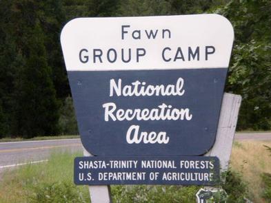
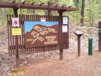
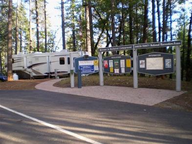
Categories
Uncategorized

BUSHYTAIL

Overview

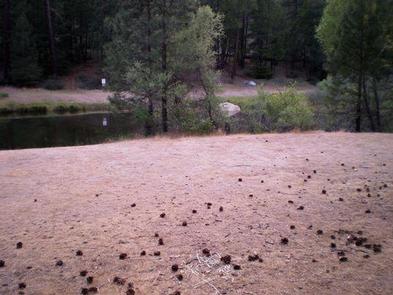
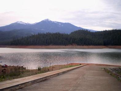
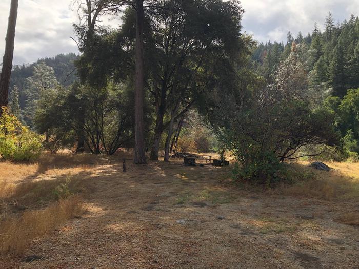
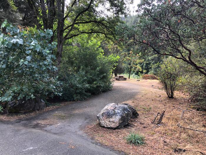
Bushytail Campground is nestled in a grove of tall Douglas firs and Ponderosa Pines, just a short distance from Trinity Lake.

This campground makes an excellent base for enjoying a variety of water sports, sightseeing and other activities and is ideal for single families and small groups.

Recreation

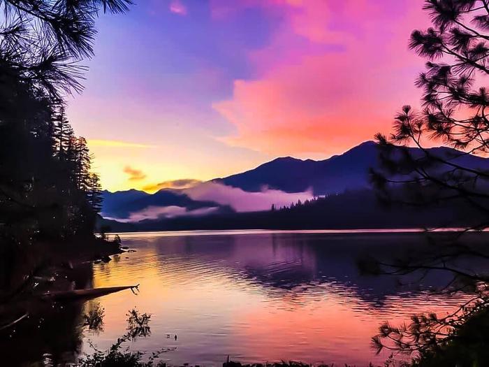
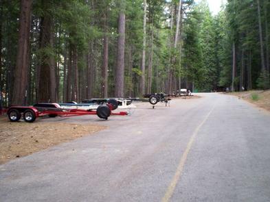
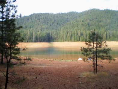
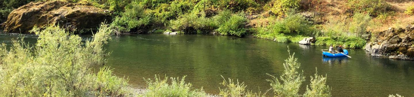
Trinity Lake offers a variety of recreational opportunities, including boating, water skiing, sailing, swimming and fishing. Anglers can catch catfish, in addition to a variety of salmon, trout and bass.

The Clark Springs Public Boat Ramp is less than a mile from Bushytail Campground.

Hikers may be interested in the 4-mile Trinity Lakeshore Trail, which starts at the nearby Clark Springs Campground.
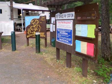
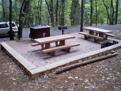
Facilities

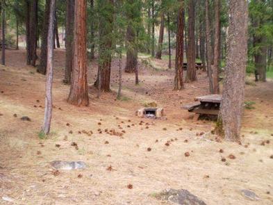
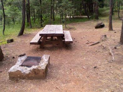
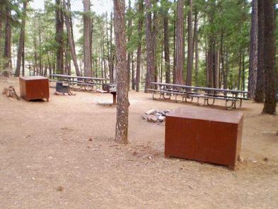
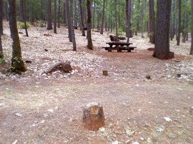
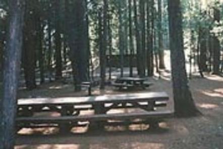
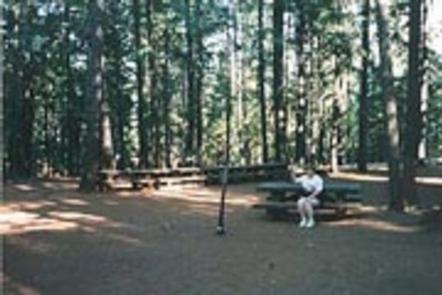
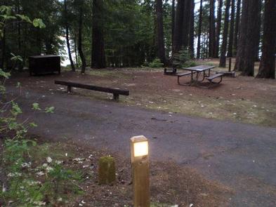
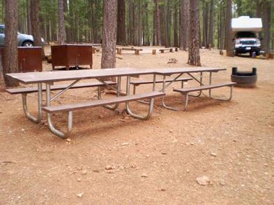
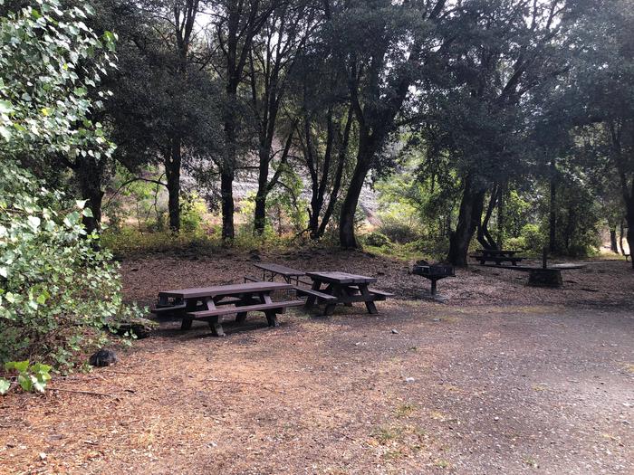
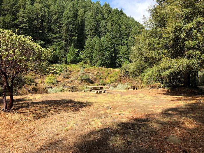
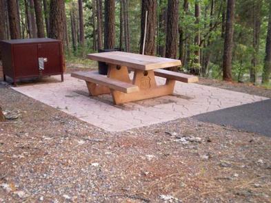
Bushytail offers single, double, triple and quad sites. All sites have grills, bear-proof food lockers, campfire rings and picnic tables.

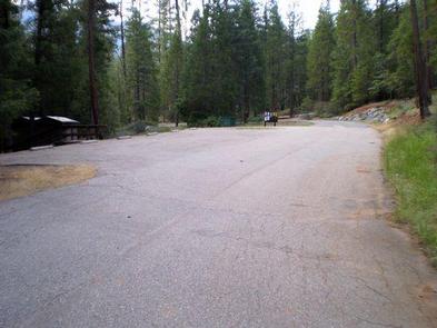
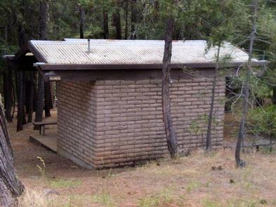
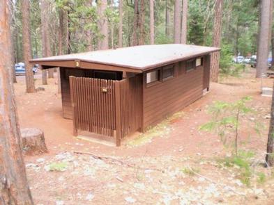
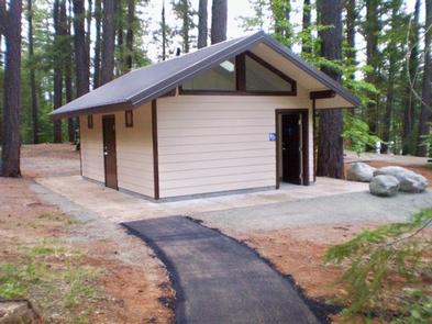
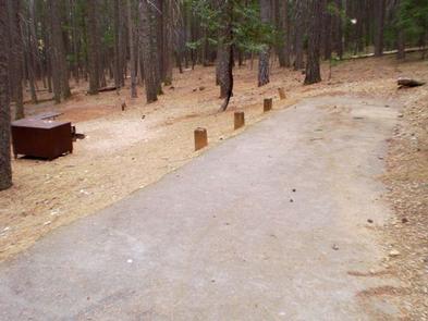
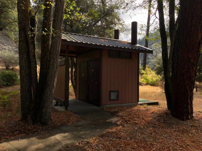
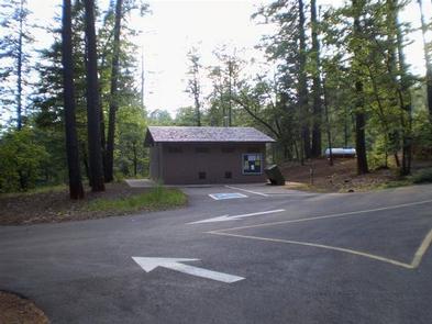
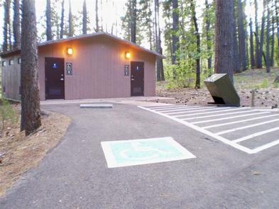
This campground has electric and water hookups in most sites and paved parking spurs. Flush toilets and drinking water are available. There are 2 coin-operated showers.

Natural Features

Shasta-Trinity is the largest national forest in California with a diverse landscape encompassing five wilderness areas, hundreds of mountain lakes and 6,278 miles of streams and rivers.

Bushytail Campground is part of the Whiskeytown-Shasta-Trinity National Recreation Area. Nearby Trinity Lake sits at an elevation of 2,370 feet and is surrounded by the Trinity Alps.

Black bears are frequently spotted in the area, as well as bobcats, mountain lions and a variety of bird species.

Nearby Attractions

The nearby town of Weaverville is listed on the National Register of Historic Places. This former mining town offers restaurants, shopping and self-guided walking tours.

Nearby Activities

  • Boating
  • Camping
  • Fishing
  • Hiking
  • Water sports
  • Swimming site

Gallery

Directions

From I-5, take 299 west to Weaverville. Then take State Highway 3 north for 16 miles. Turn right at Minersville/Bushytail, then turn left into campground.

GPS Coordinates

Latitude 40° 51′ 18.0000″ N

Longitude 122° 49′ 8.0000″ W

Categories
Uncategorized

STONEY GROUP SHASTA-TRINITY

Overview

Stoney Group Campground is nestled on the banks of Stoney Creek on the Stuart Fork Arm of Trinity Lake. This group camp can accommodate up to 60 people with tents. The sites are given some shade from tall trees, and two popular recreation areas on Trinity Lake are located nearby.

Recreation

The campground is adjacent to the popular Stoney Creek Swim Area, which offers a beach and picnic tables. A boat ramp and marina are located less than a mile away.

Popular activities in the area include power and non-motorized boating, fishing and water skiing. Anglers can cast for catfish, as well as a variety of bass, trout and salmon.

Facilities

There are flush toilets, drinking water, group pedestal grill, fire ring, several tables and bear-proof food lockers.

Natural Features

Trinity Lake sits at an elevation of 2,370 feet and is surrounded by the Trinity Alps. Black bears are frequently spotted in the area, as well as bobcats, mountain lions and a variety of bird species.

Shasta-Trinity is the largest national forest in California with a diverse landscape encompassing five wilderness areas, hundreds of mountain lakes and 6,278 miles of streams and rivers.

Nearby Attractions

The nearby town of Weaverville is listed on the National Register of Historic Places. The former mining town offers restaurants, shopping and self-guided walking tours.

Nearby Activities

  • Boating
  • Camping
  • Fishing
  • Water sports
  • Swimming site

Gallery

Directions

From I-5 in Redding, California, take 299 west to Weaverville. Go north on State Highway 3 for 14 miles. The campground is on the left.

GPS Coordinates

Latitude 40° 51′ 5.0000″ N

Longitude 122° 51′ 1.0001″ W

Categories
Uncategorized

FAWN

Overview

Located on the Stuart Fork Arm of Trinity Lake, Fawn Group Campground is the most popular group site in the area. Well-shaded by oaks, Douglas firs and pines, this campground provides direct lake access and is conveniently located near other recreational sites.

Recreation

A boat ramp and marina are 1 mile away. Nearby Stoney Creek Swim Area is popular spot, offering a beach and picnic area.

Popular activities include lakeside camping, hiking, fishing, swimming, boating and other watersports.

Facilities

Each group loop is equipped with bear-proof food lockers, several tables and group fire grills. Each loop contains 19 separate campsites with their own tables and grills.

Loop B and Loop C accommodate up to 100 people each. The unpaved spurs will handle tents and RVs between 30-40 feet. The campground roads are paved.

Flush toilets and drinking water are provided.

Natural Features

Shasta-Trinity is the largest national forest in California with a diverse landscape encompassing five wilderness areas, hundreds of mountain lakes and 6,278 miles of streams and rivers.

Lake Shasta sits at an elevation of 1,067 feet, with 365 miles of shoreline punctuated by steep mountains blanketed in manzanita and evergreens. A snow-capped Mount Shasta, the second-tallest mountain in the Cascade Range, looms in the distance.

Nearby Attractions

The town of Weaverville is listed on the National Register of Historic Places and is only a 20 minute drive from the campground. This former mining town offers restaurants, shopping and self-guided walking tours.

Nearby Activities

  • Boating
  • Camping
  • Swimming site

Gallery

Directions

From I-5 in Redding, take California State Highway 299 West to State
Highway 3 at Weaverville. Go north on Highway 3 for 14.5 miles.
Campground is on the right.

GPS Coordinates

Latitude 40° 50′ 39.9998″ N

Longitude 122° 50′ 35.9999″ W

Categories
Uncategorized

TANNERY

Overview

Tannery Gulch Campground offers four loops of sites shaded by a mix of conifer and deciduous trees on the shores of Trinity Lake. Three of the four loops offer scenic lake views.

Campers at Tannery Gulch have access to a wide range of recreational activities, and an on-site amphitheater offers programs during the summer.

Recreation

Hikers can access the half-mile Trail of the Trees from the campground. Tannery Gulch also features a boat ramp and swim beach that are only open for use by campers at the facility.

Popular activities on Trinity Lake include power and non-motorized boating, fishing, sailing and water skiing. Anglers can cast for catfish, as well as a variety of bass, trout and salmon.

Facilities

Each site has a paved parking spur, picnic table and fire pit. Some also have bear-proof food lockers. Drinking water and flush toilets are provided.

Natural Features

Trinity Lake sits at an elevation of 2,370 feet and is surrounded by the Trinity Alps. Black bears are frequently spotted in the area, as well as bobcats, mountain lions and a variety of bird species.

Shasta-Trinity is the largest national forest in California with a diverse landscape encompassing five wilderness areas, hundreds of mountain lakes and 6,278 miles of streams and rivers.

Nearby Attractions

The nearby town of Weaverville is listed on the National Register of Historic Places. The former mining town offers restaurants, shopping and self-guided
walking tours.

Nearby Activities

  • Boating
  • Camping
  • Interpretive programs
  • Fishing
  • Hiking
  • Water sports
  • Day use area
  • Swimming site

Gallery

Directions

Take I-5 to Redding, take 299 west to Weaverville, take a right on
Highway 3 and go about 11 miles. The campground sign is on the left,
but turn right to enter.

Take 101 to Eureka, take 299 east to Weaverville, take a left on Highway 3
and go about 11 miles. The campground is on left, but turn right to enter.

GPS Coordinates

Latitude 40° 50′ 12.0001″ N

Longitude 122° 50′ 53.0002″ W

Categories
Uncategorized

HAYWARD FLAT

Overview

Hayward Flat is one of the most popular campgrounds on Trinity Lake, offering excellent lake access and plenty of shade from Ponderosa pines and Douglas firs. Located on one of the best arms of the lake for water skiing, Hayward is favored by visitors interested in water sports.

Relics from the area’s Placer mining history are scattered throughout the campground, with interpretive signs providing explanations.

Recreation

A boat ramp and marina are located 3 miles away, but mooring may be available at the campground. Popular activities include power and non-motorized
boating, fishing, swimming and water skiing.

Anglers can fish for catfish, as well as a variety of bass, trout and salmon.

Facilities

The 98-unit family campground is comprised of 5 loops. The Dogwood and Elderberry loops provide lake views and informal mooring for boats.

Every campsite has a paved spur, table and campfire ring. Most campsites also provide a bear-proof food storage locker. Additional amenities include flush toilets and drinking water.

The site also offers an amphitheater with educational interpretive programs offered seasonally. Program dates and times will be posted at the campground.

Natural Features

The Shasta-Trinity is the largest national forest in California with a diverse landscape ranging from 1,000 to 14,162 feet. The 2.1 million acre forest encompasses five wilderness areas, hundreds of mountain lakes and 6,278 miles of streams and rivers.

Trinity Lake sits at an elevation of 2,370 feet and is surrounded by the Trinity Alps. Black bears are frequently spotted in the area, as well as bobcats,
mountain lions and a variety of bird species.

Nearby Attractions

The nearby town of Weaverville is listed on the National Register of Historic Places. This former mining town offers restaurants, shopping and self-guided walking tours.

Nearby Activities

  • Boating
  • Camping
  • Interpretive programs
  • Fishing
  • Water sports
  • Day use area
  • Swimming site

Gallery

Directions

From Redding, CA: Go west on Highway 299 to Weaverville, then north on Highway 3 for 15 miles. Turn right at Hayward sign and travel approximately 2 miles to campground entrance.

From Eureka, CA: Go east on Highway 299 to Weaverville, then north on Highway 3 for 15 miles. Turn right at Hayward sign and travel approximately 2 miles to campground entrance.

GPS Coordinates

Latitude 40° 52′ 27.9998″ N

Longitude 122° 46′ 9.0001″ W

Categories
Uncategorized

Skunk Point Group Campground

Overview

Skunk Point Group Campground is located 1.9 miles east of Big Bar, CA along CA Highway 299 at an elevation of 1200′. Located on the Wild and Scenic portion of the Trinity River, this campground is a wonderful place to camp when enjoying all the river has to offer.  

Recreation

The Trinity River offers fun-filled hours of fishing, swimming, floating, rafting, kayaking and boating. River access is available at this location for boats that can be carried by hand. Nearby tributaries to the Trinity River offer beautiful spots to swim and spend the day. 

Generally, Pigeon Point to Big Flat is too dangerous for tuber and family canoeists. Boating is no advisted from Cedar Flat to Grays Falls except for expert boaters.  Several commercial guides operate on the Trinity River under Forest Service Special Use permits. They provide quality guided raft and white water instruction and can be found on the Shasta-Trinity NF website.   

**Please note that the Trinity River is subject to periodic changes in flow conditions from releases from Lewiston Dam. Current flows (CFS) can be obtained by calling (530) 246-7594.  

Facilities

There is one group site located at this campground. There are picnic tables, fire rings and vault toilets. No potable water is available.  

Natural Features

Located on the Wild and Scenic portion of the Trinity River, this campground has a beautiful view of the river.  

Gallery

Directions

Skunk Point Group Campground is located on the south side of CA Highway 299 1.9 miles east of Big Bar, CA.

To get to Skunk Point Group Campground from Redding, CA: Travel West on CA Highway 299, through Weaverville, CA, for approximately 65 miles.

To get to Skunk Point Group Campground from Arcata, CA: Travel East on CA Highway 299 for approximately 75 miles.  

GPS Coordinates

Latitude 0° 0′ 0.0000″ S

Longitude 0° 0′ 0.0000″ W

Categories
Uncategorized

Lake Isabella Visitor Center

The Lake Isabella this visitor center is now located in the town of Lake Isabella at 4875 Ponderosa Drive and open Monday through Friday 8:00 am to 4:30 pm.

It offers visitor information, interpretive displays, fire permits, Kern river permits, woodcutting permits, Southern Sierra passes, and information about the many recreational opportunities in the Kern River Valley.

For more information, call 760-379-5646.

Directions

GPS Coordinates

Latitude 35° 38′ 40.6572″ N

Longitude 118° 28′ 37.6176″ W

Categories
Uncategorized

Black Gulch South Dispersed Camping

Black Gulch South is a dispersed camping or day use site on the Lower Kern River. There are vault toilets available and seasonal trash bins.

Restrictions – No Camping or Campfires are allowed within 25 feet of the water’s edge

Directions

GPS Coordinates

Latitude 0° 0′ 0.0000″ S

Longitude 0° 0′ 0.0000″ W

Categories
Uncategorized

Old Goldledge Campground

Old Goldledge is a dispersed camping or day use site open year round. There are vault toilets available and seasonal trash bins. Old Goldledge is a great spot for fishing.

Restrictions – No Camping or Campfires are allowed within 25 feet of the water’s edge.

Parking at Old Goldlege is available in the dispersed area.

Free Holiday Use Permit Required

The Sequoia National Forest, Kern River Ranger District is continuing efforts to balance the needs of recreationists with impacts to the land along the Upper Kern Wild and Scenic River. In 2019 a Pilot Program is being implemented at Old Goldledge Campground in order to more closely align the number of visitors and vehicles with the physical capacity of the camping area.  This free permit program will only be in place during high use Holiday weekends.

Dates Permits will be required:

  • Memorial Day Weekend: May 23-27 (Thursday – Monday)
  • July 4th Weekend: July 3 – 7 (Wednesday – Sunday)
  • Labor Day Weekend: August 29 – September 2 (Thursday – Monday)

Application Periods for 2019:

  • For Memorial Day Weekend Permits: Requests must be received between April 19 and May 3, 2019. Lottery drawing and notifications will take place by May 6, 2019.
  • For July 4th Weekend Permits: Requests must be received between April 29 and May 28, 2019. Lottery drawing and notifications will take place by May 31, 2019.
  • For Labor Day Weekend Permits: Requests must be received between July 1 and July 29, 2019. Lottery drawing and notifications will take place by August 2, 2019.

For Additional Information please contact the Kern River Ranger District Office at 760-376-3781.

Directions

GPS Coordinates

Latitude 0° 0′ 0.0000″ S

Longitude 0° 0′ 0.0000″ W

Categories
Uncategorized

Lookout Peak Trailhead

Lookout Peak is on the border of Sequoia National Forest and Kings Canyon National Park. Immediately to the north and east of Lookout Peak is the glacially carved Kings Canyon. From the top of Lookout Peak you have a splendid view looking right down into Kings Canyon.  Elevation: 8531 ft / 2600 m.  
 

Directions

GPS Coordinates

Latitude 36° 46′ 8.4000″ N

Longitude 118° 43′ 1.2000″ W