Categories
Uncategorized

EAST WEAVER GROUP CAMPGROUND

Overview

This is a rustic campground with plenty of trees located in the Weaverville area at the end of East Weaver Road, on the banks of East Weaver Creek.
The road is paved and the spurs are dirt.

Recreation

Multiple Trail heads leading into the Trinity Alps Wilderness are within a short walk from this campground.

Facilities

The East Weaver Campground offers 9 sites, picnic tables, fire rings and a vault toilet. Each campsite has a table and a stove/grill. Fuel, groceries, bait and restaurants can be found 1.5 miles away in Weaverville.

Natural Features

Nestled among the trees East Weaver Group Camp offers a great place to camp for avid hiking groups as it sits near several trail heads with access to the Trinity Alps Wilderness.

Nearby Activities

  • Biking
  • Camping
  • Hiking

Directions

From Weaverville, take Hwy 3 north for 2 miles. Turn left on Road 228. Campground is 1.5 miles on the left.

GPS Coordinates

Latitude 40° 46′ 22.8000″ N

Longitude 122° 55′ 15.5600″ W

Categories
Uncategorized

GREGORY CREEK GROUP CAMPGROUND

Overview

The campground is a single loop and is moderately to thickly wooded with a mix of oak and pine trees that provide plenty of shade during the summer (80% + cover). The understory, which consists of manzanita, blackberries, poison oak, tree fern, wild grape and a variety of native grasses and forbs provide limited privacy between campsites. When the lake level is high, the bank is moderately sloped to provide access to the water. As the lake level drops, it exposes a steep drop off to the water, especially on the side of the campground nearest Gregory Beach. There is a boat ramp nearby at Antlers. Lake activities include fishing, swimming, motorized and non-motorized boating, and watersports.
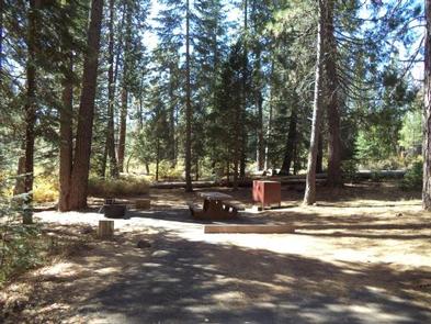
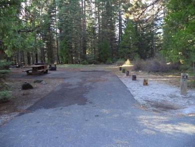
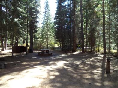
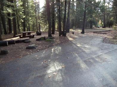
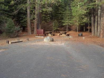
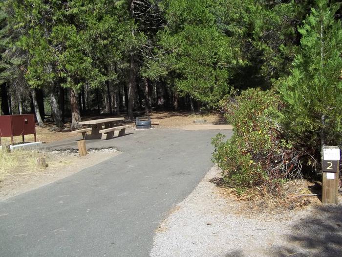
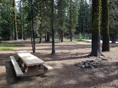
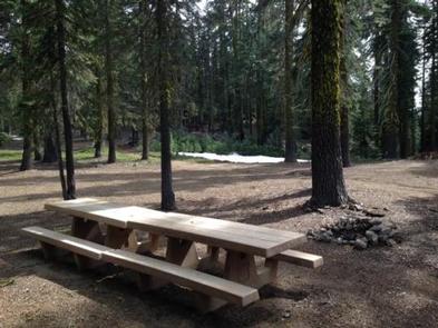
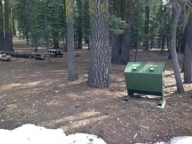
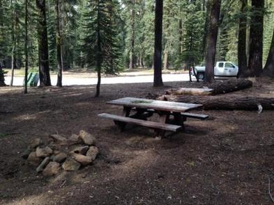
Each site has a picnic table, and a fire ring.

Recreation

Shasta Lake provides a variety of water sports, such as power boating, non-motorized boating and water skiing. A public boat ramp is provided near the campground.

Anglers can fish for trout, catfish, Chinook salmon, crappie, bluegill, white sturgeon, brown bullhead and bass.

Facilities

Each site has a picnic table, fire rings, grills, and tent pads. Sites at this campground can accommodate both tents and RVs, however there are no electric/water hookups or dump stations.

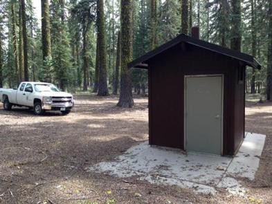
There are flush toilets at this campground but no showers are available. Drinking water is provided.

Natural Features

The Shasta-Trinity is the largest national forest in California with a diverse landscape, encompassing five wilderness areas, hundreds of mountain lakes and 6,278 miles of streams and rivers.

Lake Shasta sits at an elevation of 1,067 feet and has 365 miles of shoreline punctuated by steep mountains blanketed in Manzanita and evergreens. Snow-capped Mount Shasta, the second-tallest mountain in the Cascade Range, looms in the distance.

Nearby Attractions

Tours are available at the nearby Lake Shasta Caverns. Antlers is located within the town of Lakehead, which offers restaurants and shopping.

Nearby Activities

  • Camping

Directions

Located adjacent to Gregory Beach dispersed area along the Upper Sacramento River Arm of Shasta Lake, 15 miles northeast of I-5 on Gilman Road. From I-5, take exit 698 Salt Creek/Gilman Road. Turn left at end of off ramp and follow Salt Creek Road (also known as Gregory Creek Road) for 4 miles.

GPS Coordinates

Latitude 40° 53′ 16.6999″ N

Longitude 122° 22′ 5.3400″ W

Categories
Uncategorized

Beegum Gorge Campground

This tiny, tents only campground is located near Beegum Creek. Partially shaded, this is a great home base for your adventures! Be aware – there are vault toilets available, but no water.

Nearby Activities

  • Camping

Directions

GPS Coordinates

Latitude 40° 18′ 49.6190″ N

Longitude 122° 56′ 0.0823″ W

Categories
Uncategorized

Timber Lake

Species present: Rainbow and Brook Trout.

Seasons: Open all year. Bag limit: 5 per day, 10 in possession.

Date of usual ice out: June 1 (6,000′ elevation)

Access trails: This lake is located in Section 27, T39N, R5W. Access it via the South Fork Road (Road 26) from the W.A. Barr Road. About 6 miles up Road 26, at the wooden bridge, take road 40N43 to the left across the wooden bridge, go about 500′ and turn right onto road 39N45. Go about 1.5 miles to road 39N44 and turn left. These roads are very rocky and are not suitable for low clearance vehicles. At the end of road 39N44, the Gray Rock Lake Trail (5W07) goes to Gray Rock Lake. It is an almost level 0.3 mile southeast hike to reach Timber Lake from Grey Rock Lake.

Camping: One poor site in heavy timber.

Surface acres: 2 acres and 15′ deep.

Comments: Swampy, brush and steep shores, but good fishing for small Brook Trout. The lake has no inlet, but has a fair outlet, due to springs. This lake is on National Forest land.

Directions

GPS Coordinates

Latitude 0° 0′ 0.0000″ S

Longitude 0° 0′ 0.0000″ W

Categories
Uncategorized

Porcupine Lake

Species present: Rainbow and Brook Trout

Seasons: Open all year. Bag limit: 5 per day, 10 in possession.

Date of usual ice out: July 1 (7,250′ elevation)

Access trails: This lake is located in Section 1 and 2, T39N, R6W. Access is via the South Fork Road (Road 26) from the W.A. Barr Road. About 2.5 miles up Road 26, just past the concrete bridge, take road 41N53 to the right. About 0.5 up this road, turn to the left on road 40N64 and continue until you reach the Toad Lake cabin site. The last half mile of this road is very rocky and is not recommended for anything other than high clearance vehicles. From the cabin site, 5W05 goes up the old jeep trail (no vehicles allowed) to Toad Lake. To access Porcupine Lake, use 5W05 around the north shore of Toad Lake, and then up the hill to the junction with the Pacific Crest Trail at the divide. Take the PCT south to the junction with the Porcupine Lake Trail (5W05A) which goes directly to the lake. This is about a mile hike from Toad Lake.

Camping: 1 poor site. Poor firewood availability.

Surface acres: 8 acres and 50′ deep.

Comments: This lake is well down in a depression resembling a crater. The surface never rises high enough to overflow. The shore is generally a jumble of granite rocks. Reportedly has very big Rainbow Trout, but overall, the fishing is fair to poor. This lake is on National Forest land.

Directions

GPS Coordinates

Latitude 0° 0′ 0.0000″ S

Longitude 0° 0′ 0.0000″ W

Categories
Uncategorized

Castle Crags Wilderness

The Castle Crags Wilderness was established in 1984 with the passage of the California Wilderness Act. This 10,500 acre addition to the National Wilderness Preservation System, along with lands within Castle Crags State Park, contains towering granite spires, steep sided canyons, and a few alpine lakes. Most of the area is covered by high brushfields and rocky outcrops with a few wet meadows in the creek headwaters. Mixed conifer forests can be found on the north, east and west facing slopes.

Geology

Castle Crags is actually a part of the vast Klamath Mountains Geological Province that includes much of northwestern California and Southwestern Oregon. Rocks within the province consist predominantly of volcanic and sedimentary types. However, large granitic bodies called plutons intruded into many parts of the province during the Jurassic around 65 million years ago. Castle Crags is one of these plutons.

Directions

GPS Coordinates

Latitude 0° 0′ 0.0000″ S

Longitude 0° 0′ 0.0000″ W

Categories
Uncategorized

Trinity River

The Trinity River is classified as a Wild & Scenic River.  It is a major tributary of California’s Klamath River begins in the rugged Trinity Alps and makes its way through wilderness before meeting up with the mighty Klamath at Weitchpec. The Trinity is noted for its salmon and steelhead fishery resources, as well as its attraction to rafters, kayakers and canoeists. The North and South Forks of the Trinity and the New River are included in the Wild and Scenic designation. The Trinity River offers a wide variety of opportunities for fun, family and fishing.

The natural beauty of the Trinity River has been one of the most popular sights for visitors to the north coast. Scenic Highway 299 makes easy access to many points of interest. Rafts, canoes and kayaks frequent the rapids in the springtime, and tubers enjoy summertime flows.

The Trinity is legendary for its salmon and steelhead fishing by drift boat or walk-in riverside spots, as well as for trophy brown trout. Chinook salmon are the most sought-after gamefish in the Trinity River system. Spring-run salmon begin to enter the river in May and provide trophy fishing through November. Although brown trout are not native, they were heavily stocked until the late 1970s. Today, a self-sustaining population remains in the upper river, providing fly and bait fishing.

Species Present: In the Trinity River above Trinity Lake, there are Rainbow and Brown Trout. In the Trinity River below Lewiston Dam, there will be Steelhead (summer and winter runs), Chinook (spring and fall runs), Coho Salmon and Brown Trout.

Seasons: On the California Department of Fish and Game website, please see the “Body of Water” table and “6. Trinity River and tributaries” for detailed rules.

Access: There are three parts to this river. The Trinity River above Trinity Lake is easily accessed from Highway 3. The fly fishing section is well-roaded in and above the town of Lewiston. The lower Trinity River is paralleled by Highway 299.

Directions

GPS Coordinates

Latitude 0° 0′ 0.0000″ S

Longitude 0° 0′ 0.0000″ W

Categories
Uncategorized

FOWLERS CAMPGROUND

Overview

Fowlers Campground is located on the Upper McCloud River five miles east of McCloud, California. The campground is nestled in a mixed conifer and oak woodland. The campground offers paved parking spurs, running water and vault restrooms.

Recreation

A river-side trail from the campground provides access to the falls. It is approximately three miles round trip to see all three. Swimming and fishing are other popular activities. This section of river has no special restrictions for fishing. The McCloud River Loop, a paved road approximately 10 miles in length provides access to the Middle Falls and Upper Falls parking lots and overlooks if you do not wish to hike the trail.

Facilities

The campground has 35 regular campsites and two double campsites with tables, fire-rings, vault toilets and piped drinking water. Some sites are equipped with bear resistant food storage lockers. Sites are suitable for tents and mid-sized RVs or trailers. Large RVs are not recommended. Campground is typically staffed with a resident host.

Natural Features

Fowlers Campground is located on the eastside of majestic Mt. Shasta (14,179 foot summit) at an elevation of 3,300 feet. This area is at the southern tip of the Cascade Mountain Range. The area hosts abundant botanical and wildlife species. This campground is mostly known for the nearby McCloud River waterfalls. The McCloud Falls can be accessed via the McCloud River Trail or by road. The waterfalls vary in height from 15 to 50 feet.

Nearby Attractions

The Lower, Middle and Upper McCloud water falls, Lakin Dam Fishing Area, Cattle Camp Swimming Hole, McCloud Reservoir, Medicine Lake Highlands and the towns of McCloud (10 mins.) and Mt. Shasta (20 mins.) are nearby.

Charges & Cancellations

A $10.00 service fee will apply if you change or cancel your reservation. Late cancellations are subject to additional fees. For full details see NRRS Reservation Policy

Nearby Activities

  • Camping
  • Visitor center

Gallery

Directions

From McCloud, California, go east on Highway 89. Drive 5 miles and look for the Fowlers/Lower Falls Sign. Turn right just after the sign and drive approximately 1 mile. Once you cross the River Loop Road take the left fork into the campground. The right fork will take you to the day use/parking area for Lower Falls and the beginning of the River Trail.

GPS Coordinates

Latitude 41° 14′ 41.4802″ N

Longitude 122° 1′ 23.7202″ W

Categories
Uncategorized

Pilgrim Creek Snowmobile Park

The McCloud Snowmobile Park is your staging area for winter fun or for camping during the rest of the year. There is a ramp for unloading and loading snowmobiles, a warming hut with woodstove, and vault toilets. To get there you travel 3 miles southeast of McCloud along Hwy 89 and turn left on Pilgrim Creek Road. Drive 5 miles down the paved road and the Snowmobile Park will be on your left. There are many miles of groomed trails (depending on snow depth) that cover the upper and eastern parts of the district as well as into the Modoc and Klamath area. Please remember no snowmobiles allowed in the wilderness area on the mountain.

* The warming hut is there for everyone to use. If you can leave a little wood each time you use it, there will always be wood for winter recreationists to stay warm.

If you camp at the Snowmobile Park, please follow all forest rules and guidlines about camp fires, stay limits (2 weeks unless otherwise approved), and coutesy to others (to include noise levels). Enjoy.

Current Report from our Groomers: Lots of fresh snow and miles of groomed trails!  With the past storm surge, we received significant rain/wet snow throughout the trail system. The Ash Creek Butte Loop looked the best with 1.5 feet of fresh snow  at the top (6,200ft). Weekend activity was moderate with the majority of traffic coming out of Deer Mountain.  A fair amount of storm damage has placed large drifts, rocks and trees in the trails. Much of our time has been spent mitigating these hazards to increase trail safely and rider flow. User reports are positive with visitors speaking of enjoyable trail and snow conditions.

Directions

GPS Coordinates

Latitude 0° 0′ 0.0000″ S

Longitude 0° 0′ 0.0000″ W

Categories
Uncategorized

RED FIR FLAT GROUP CAMPGROUND

Overview

Red Fir Flat Group Campground is located on the southern slope of Mt. Shasta at 6,400 feet in elevation. Snowpack in this location may extend into late June on heavy snow years, and usually sees late season snowfall in early November, possibly October. It is a popular site for meditation/retreat groups. Maximum stay limit is 7 days per group and or indvidual(s)

Recreation

Most visitors enjoy the peace and solitude of the forest setting. Several hiking trails are located nearby, including the trail to the historic stone cabin at timberline owned and operated by the Sierra Club Foundation. Also within a few miles are Upper and Lower Panther Meadows, the access trail to South Gate Meadows and the trail to Gray Butte.

Facilities

Facilities include several picnic tables, an established fire ring, bear proof trash recepticles and vault toilet. Limited garbage service is provided and visitors are asked to pack out what they can. There is no water at this site; please bring your own. Campfires are allowed with a California Campfire Permit. Gathering of dead and down firewood is allowed for use while in the campground.

Natural Features

The campground is situated in an old growth forest of Shasta red fir. The forest provides plenty of shade and has open sunny spots as well. There is no view of the upper mountain from this location; however, views to the west and south include the Trinity Alps, Mount Eddy, and Castle Crags.

Nearby Attractions

The area offers hiking trails, mountain bike trails, and climbing routes to the summit of Mt. Shasta. Mt. Shasta City is 10 miles away and provides full services including grocery stores and restaurants.

Charges & Cancellations

A $10.00 service fee will apply if you change or cancel your reservation. Late cancellations are subject to additional fees. For full details see NRRS Reservation Policy.

Nearby Activities

  • Camping
  • Hiking
  • Visitor center

Gallery

Directions

From Interstate 5, take exit number 738. Head east through the town of Mt. Shasta on Lake Street. Lake Street becomes the Everitt Memorial Highway as it ascends the mountain. At about milepost 9, look for the campground entrance sign on the left.

GPS Coordinates

Latitude 41° 20′ 38.0000″ N

Longitude 122° 15′ 11.9999″ W