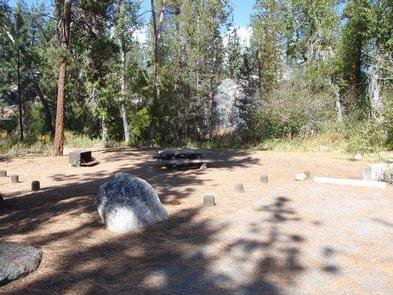
Mono Hot Springs Campground sits above Kaiser Pass in the High Sierra, on the South Fork of the San Joaquin River in an area known for its hot mineral baths. The camp is divided into two sections that are separated by Mono Hot Springs Resort, and some sites are shaded by aspen and lodgepole pine.
The campground sits at an elevation of 6,700 feet with many cliffs in the area. It makes a great base for exploring the nearby Ansel Adams and John Muir Wilderness areas or for simply relaxing and enjoying the scenery.
Recreation
The Mono Hot Springs area provides opportunities for fishing, birding, mountain biking, hiking and relaxing in the hot springs. Interpretive programs are offered at the campground on Friday nights during the summer.
Wading is permitted in the San Joaquin River, which is known for its excellent fly fishing.
Trailheads in the area include Devil’s Table (5 miles) and Doris Lake (2 miles). The Mono Creek Trail connects Mono Hot Springs to Edison Lake, a hike of about 10 miles round-trip.
Facilities
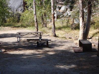
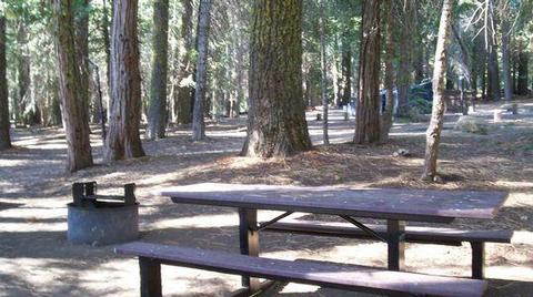
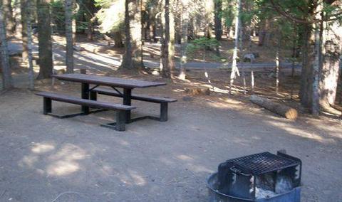
Each campsite has a picnic table, grill and bear-proof food storage locker. Vault toilets are provided. Drinking water is not available at the camp but can be acquired along with other supplies at the general store at Mono Hot Springs Resort.
Natural Features
The Sierra National Forest, located on the western slope of the central Sierra Nevada, is known for its spectacular mountain scenery and abundant natural resources.
The terrain includes rolling, oak-covered foothills, heavily forested middle elevation slopes and the starkly beautiful alpine landscape of the High Sierra.
Nearby Attractions
Edison Lake is a popular recreation area nearby offering boating, fishing and horseback riding. From this area, hikers and horseback riders can access the John Muir Wilderness, and the Pacific Crest Trail, which extends from Mexico to Canada.
Nearby Activities
Biking
Camping
Interpretive programs
Fishing
Hiking
Wildlife viewing
Gallery
Directions
From Clovis, California, take Highway 168 north 70 miles to Huntington Lake
Campground office at Eastwood. Take Kaiser Pass Road to Mono Hot
Springs Campground.
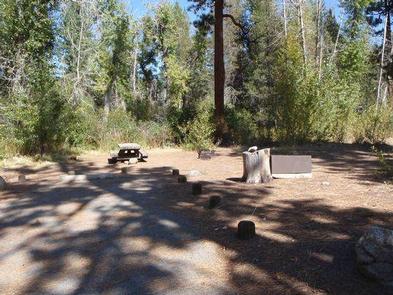
Mono Creek Campground is located in the High Sierras above Kaiser Pass. This quiet, remote campground is situated in a peaceful meadow near Mono Hot Springs at an elevation of 7,500 feet. Visitors enjoy hiking, fishing, boating and horseback riding.
Recreation
Most recreational activities are centered around nearby Edison Lake and Mono Hot Springs. Interpretive programs, hiking, trout fishing, boating and horseback riding are popular pastimes. Hot mineral baths can be enjoyed at Mono Hot Springs.
Facilities
Each campsite has a picnic table, grill and bear-proof food storage locker. No water source is available on-site, but potable water is available at the High Sierra Ranger Station. Accessible vault toilets are provided.
Natural Features
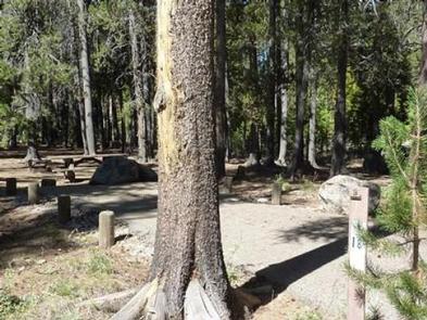
Campsites are spacious, private and shaded by mature Ponderosa pines within the Sierra National Forest on the western slope of the central Sierra Nevada. The forest is known for its spectacular mountain scenery and abundant natural resources.
The terrain includes rolling, oak-covered foothills, heavily forested middle elevation slopes and the starkly beautiful alpine landscape of the High Sierra.
Nearby Attractions
The Mono Creek Trail, which can be accessed at Edison Lake, leads hikers and horseback riders to the network of trails within the John Muir Wilderness. This includes the scenic Pacific Crest Trail, which spans from Mexico to Canada.
Nearby Activities
Boating
Camping
Interpretive programs
Fishing
Hiking
Horseback riding
Gallery
Directions
From Clovis, California, take Highway 168 north 70 miles to Huntington Lake
Campground office at Eastwood. Take Kaiser Pass Road to Mono Creek
Campground.
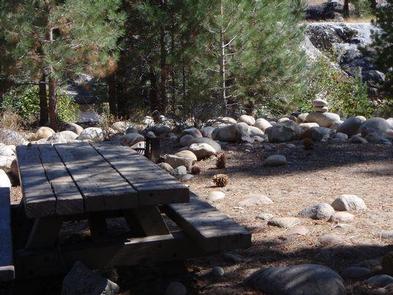
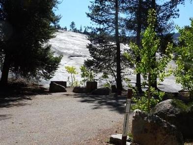
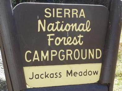
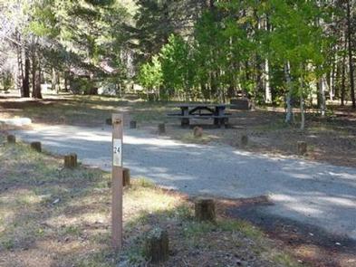
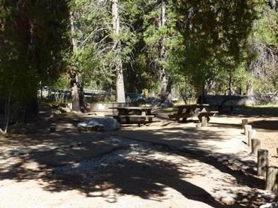
Jackass Meadow Campground is situated below Florence Lake on the San Joaquin River, surrounded by the craggy peaks of the John Muir Wilderness.
Jackass Meadow is shaded by a stand of Aspen and Lodgepole Pine, and the South Fork of the San Joaquin runs through the campground. This camp is located near several Native American archaeological sites.
Recreation
There is a .7 mile accessible hiking trail near the campground. Nature walks are held every Saturday during the summer.
Most of the recreation opportunities here can be found in and around Florence Lake. There is a boat ramp and boat rentals at the Florence Lake Store.
Facilities
Each campsite has a table, fire ring and grill. Bear-proof food lockers, water and accessible vault toilets are provided.
Supplies and groceries can be purchased half a mile from the campground at the Florence Lake Store.
Natural Features
The Sierra National Forest, located on the western slope of the central Sierra Nevada, is known for its spectacular mountain scenery and abundant natural resources.
The terrain includes rolling, oak-covered foothills, heavily forested middle elevation slopes and the starkly beautiful alpine landscape of the High Sierra.
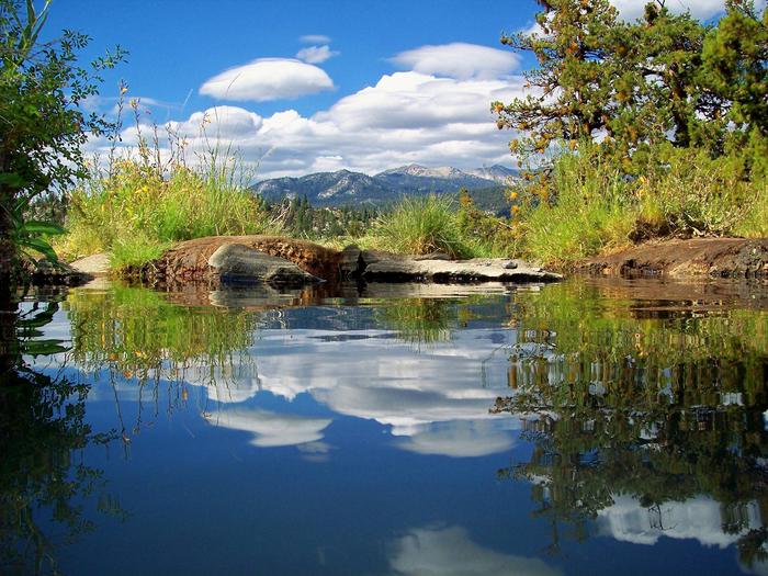
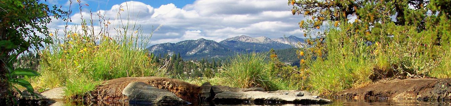
The John Muir Wilderness stretches for 100 miles along the crest of the Sierra. It is a land of lofty snow-capped mountains, deep canyons and vast expanses of glacially carved terrain.
Nearby Attractions
A popular activity is to take a ferry from Florence Lake to the John Muir Trail, which is part of the Pacific Crest Trail, which stretches from Mexico to Canada. Ferry tickets can be purchased at the Florence Lake Store.
Nearby Activities
Boating
Historic & cultural site
Camping
Fishing
Hiking
Horseback riding
Day use area
Gallery
Directions
From Clovis, California: Take Hwy 168 north for 70 miles to Huntington
Lake Campground office at Eastwood. Turn right and follow Kaiser Pass Road
approximately 21 miles to Jackass Meadow campground.
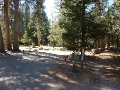
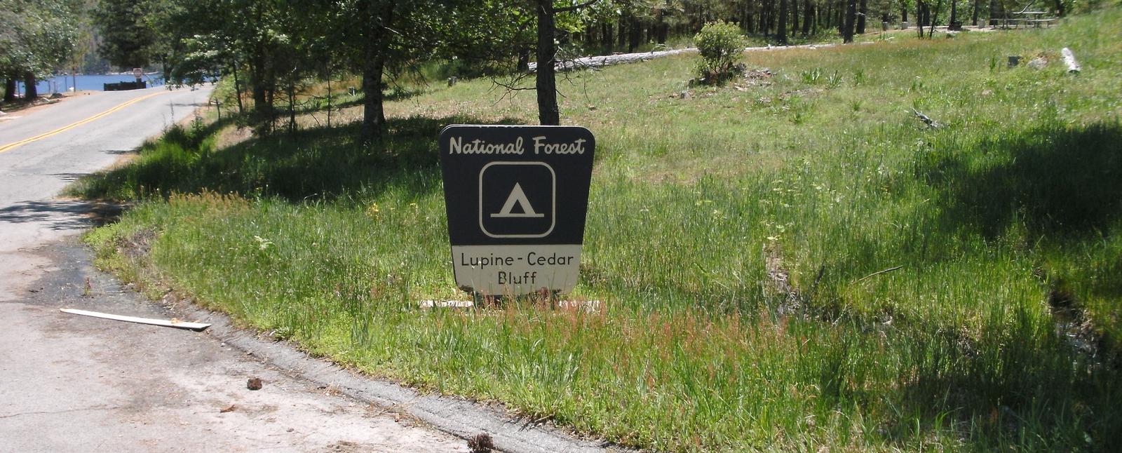
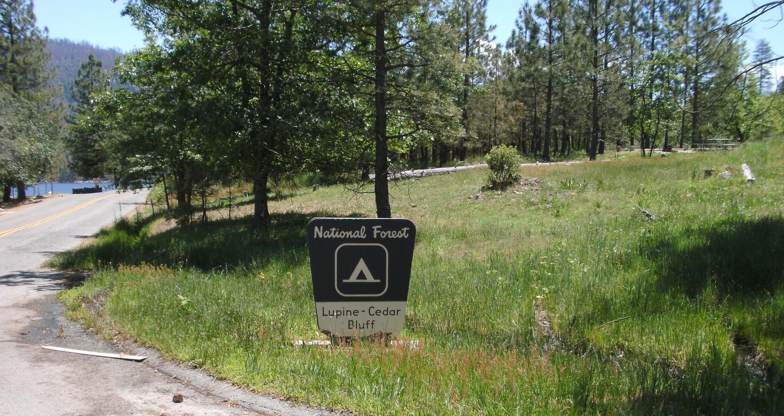
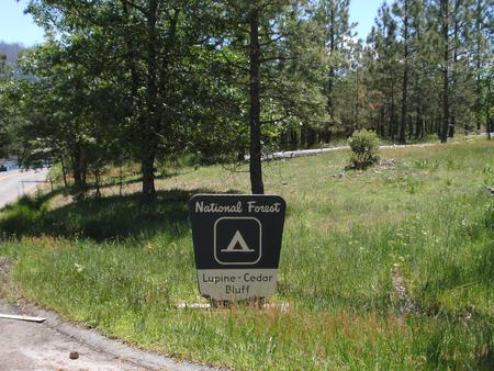
Lupine Campground is located next to Bass Lake. Cedar Bluff Campground is adjacent to Lupine.
Lupine is quieter and set further back from the lake than Cedar Bluff, and each site offers more privacy.
Recreation
Bass Lake offers a beach and boat ramp. Popular activities include swimming, motorized boating, canoeing, kayaking, water skiing, sailing and fishing for bass, trout, bluegill and catfish.
Nearby hiking trails include Willow Creek, Goat Mountain, Spring Cove and Way-of-the-Mono Interpretive Trail. A variety of educational programs are offered on weekends during the summer.
Facilities
Each campsite has a picnic table, grill, campfire ring and paved parking spur. Lupine Campground provides accessible flush toilets and drinking water. Most parking spurs are large enough to accommodate boat trailers.
Natural Features
Huge Ponderosa pines create a majestic setting for this camp, which is situated within the Sierra National Forest on the western slope of the central Sierra Nevada. The forest is known for its spectacular mountain scenery and abundant natural resources.
The terrain includes rolling, oak-covered foothills, heavily forested middle elevation slopes and the starkly beautiful alpine landscape of the High Sierra.
Lupine Campground is located in the Bass Lake Ranger District at an elevation of 3,400 feet. Bass Lake is a very popular area known for its variety of fish, as well as the bald and golden eagles that make their home here.
Nearby Attractions
Lupine is located 24 miles from the entrance of Yosemite National Park’s South Entrance.
Charges & Cancellations
Rules & Reservation Policies
As you make travel plans that include reservations on Recreation.gov, there are standard policies that apply to most locations of which you should be aware. Do keep in mind, however, that there are many exceptions, so it is best to review reservation information listed on individual facility pages for those policies and procedures that pertain to your specific locations.
Any location or activity requiring a permit or lottery will have unique requirements and policies. Please check individual facility pages for pertinent information for those sites.
Booking Window
For most locations, you can reserve six months in advance of your stay for individual sites and 12 months in advance for group sites. There are some exceptions, so it is best to check with each facility.
Change and Cancellation Policies and Fees
Overnight and Day Use Facilities: To ensure fairness, reservation arrival or departure dates may not be changed beyond the booking window until 18 days after booking the reservation.
Camping / Day Use: A $10.00 service fee will apply if you change or cancel your reservation (including campsites, cabins, lookouts, group facilities, etc.). The $10.00 service fee will be deducted from the refund amount.
You can cancel or change reservations through Recreation.gov or by calling 1-877-444-6777.
Tours & Tickets: You may request changes to tour dates at no cost before the arrival date. If you cancel before your tour date, you may be eligible for a refund. Cancellation fees apply. Please check the tour facility description details page for cancellation policies.
Permits: Varies by location. Please check the permit details for the permit location.
Late Cancellations
Overnight and Day Use Facilities: Late cancellations are those cancelled between 12:01 a.m. (Eastern) on the day before arrival and check out time on the day after arrival.
Individual Campsites: If a customer cancels a reservation the day before or on the day of arrival they will be charged a $10.00 service fee and will also forfeit the first night’s use fee (not to exceed the total paid for the original reservation). Cancellations for a single night’s reservation will forfeit the entire use fee but no cancellation fee will apply.
Cabins / Lookouts: Customers will be charged a $10.00 cancellation fee and forfeit the first night’s use fee if a cabin or lookout reservation is cancelled within 14 days of the scheduled arrival date. Cancellations for a single night’s use will not be assessed a service fee.
Group Facility: If a customer cancels a group overnight facility reservation within 14 days of the scheduled arrival date they will be charged the $10.00 service fee and forfeit the first night’s use fee. Cancellations for a single night’s use will not be assessed a service fee.
Group Day Use Area: If a customer cancels a group day use facility reservation within 14 days of the scheduled arrival date, they will forfeit the total day use fee with no service fee charge.
No-Shows
Camping / Day Use: A camping no-show customer is one who does not arrive at a campground and does not cancel the reservation by check-out time on the day after the scheduled arrival date. Reserved campsites and group overnight facilities will be held until check-out time on the day following your scheduled arrival. Group day-use facilities will be held until check-in time on your scheduled arrival date.
If a customer does not arrive at the campground or group facility by check-out time the day after arrival or does not cancel the reservation by the times listed under “Late Cancellations” above, the customer may be assessed a $20.00 service fee and forfeit use fees.
Tours: A tour or ticket no-show is one who does not cancel a ticket before arrival and does not arrive for the tour. Tour no-shows are not entitled to a refund.
Refunds
Customers must request refunds no later than 14 days after the scheduled departure date. Recreation.gov will not grant refund requests after 14 days of departure.
Reservation Fee: For some facilities, tours or permits an additional reservation fee is charged. For some overnight and day-use facilities, an additional non-refundable reservation fee may apply. The non-refundable reservation fee for tours and tickets is $1.00. The non-refundable reservation fee for permits varies by location.
Refunds for Bankcard Purchases: Refunds for bank card payments will be issued as a credit to the original bank card.
Refunds for Check or Cash Purchases: Refunds for Recreation.gov payments made by check or money order, and cash payments at selected campgrounds will be issued a check refund. A refund will be processed within 30 days of receipt and approval. Please Note: Refund requests made during or after departure can only be processed when approved by the facility management staff based upon local policy.
Refunds for Emergency Closures: In the event of an emergency closure, the Recreation.gov team will attempt to notify users and offer alternate dates (as appropriate). If this is not possible, reservations will be cancelled and all fees paid will be refunded. Reservation fees for free tickets are non-refundable in the event of an emergency closure.
Recreation.gov Billing Information
Reservation transaction will appear on customer’s credit card statements as “Recreation.gov 877-444-6777.”
Changes to Policies and Procedures
Recreation.gov reserves the right, when necessary, to modify reservation policies. These policies were last updated July
Nearby Activities
Boating
Camping
Interpretive programs
Fishing
Hiking
Water sports
Swimming site
Gallery
Directions
From Highway 41, take Bass Lake turnoff, head southeast approximately 3.5
miles to the Bass Lake office. Continue approximately 2.75 miles to the
Lupine Cedar Bluff Campground.
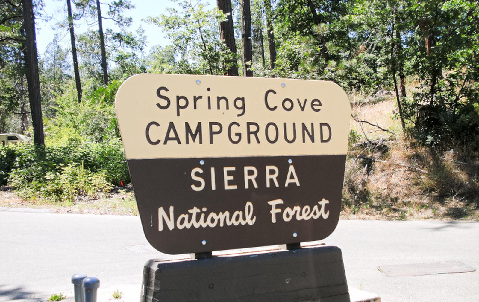
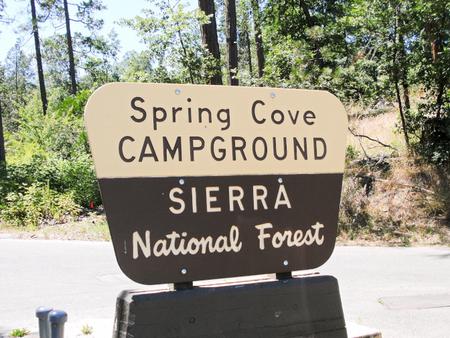
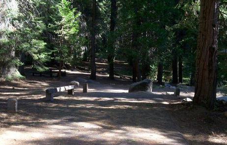
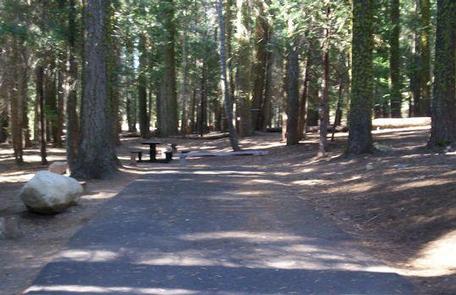
Spring Cove Campground is located across the street from Bass Lake in a grove of oak, pine and cedar, and is well suited for tents or small RVs. The sites are shaded and clustered close together. Bass Lake offers many recreational activities and is a popular summer destination.
Recreation
Bass Lake offers a beach and boat ramp. Popular activities include swimming, motorized boating, canoeing, kayaking, water skiing, sailing and fishing for bass, trout, bluegill and catfish.
The 2.6-mile Spring Cove Trail can be accessed within the camp. Other hiking trails in the area include Willow Creek (2.7 miles), Goat Mountain (2.6 miles) and the Way-of-the-Mono Interpretive Trail (1 mile).
A variety of educational programs are offered on weekends during the summer.
Facilities
Each campsite has a picnic table and campfire ring. Drinking water and accessible flush toilets are provided. The facility’s short parking spurs are paved and dirt-surfaced. Due to tight turns and configurations, this camp is not suitable for large travel trailers or RVs.
Natural Features
The Sierra National Forest, located on the western slope of the central Sierra Nevada, is known for its spectacular mountain scenery and abundant natural resources. The terrain includes rolling, oak-covered foothills, heavily forested middle elevation slopes and the starkly beautiful alpine landscape of the High Sierra.
Spring Cove Campground is located in the Bass Lake Ranger District at an elevation of 3,400 feet. Bass Lake is a very popular area that’s known for its variety of fish, as well as the bald and golden eagles that make their home here.
Nearby Attractions
Yosemite National Park can be reached in under an hour, making it an ideal day trip from Bass Lake.
Charges & Cancellations
Rules & Reservation Policies
As you make travel plans that include reservations on Recreation.gov, there are standard policies that apply to most locations of which you should be aware. Do keep in mind, however, that there are many exceptions, so it is best to review reservation information listed on individual facility pages for those policies and procedures that pertain to your specific locations.
Any location or activity requiring a permit or lottery will have unique requirements and policies. Please check individual facility pages for pertinent information for those sites.
Booking Window
For most locations, you can reserve six months in advance of your stay for individual sites and 12 months in advance for group sites. There are some exceptions, so it is best to check with each facility.
Change and Cancellation Policies and Fees
Overnight and Day Use Facilities: To ensure fairness, reservation arrival or departure dates may not be changed beyond the booking window until 18 days after booking the reservation.
Camping / Day Use: A $10.00 service fee will apply if you change or cancel your reservation (including campsites, cabins, lookouts, group facilities, etc.). The $10.00 service fee will be deducted from the refund amount.
You can cancel or change reservations through Recreation.gov or by calling 1-877-444-6777.
Tours & Tickets: You may request changes to tour dates at no cost before the arrival date. If you cancel before your tour date, you may be eligible for a refund. Cancellation fees apply. Please check the tour facility description details page for cancellation policies.
Permits: Varies by location. Please check the permit details for the permit location.
Late Cancellations
Overnight and Day Use Facilities: Late cancellations are those cancelled between 12:01 a.m. (Eastern) on the day before arrival and check out time on the day after arrival.
Individual Campsites: If a customer cancels a reservation the day before or on the day of arrival they will be charged a $10.00 service fee and will also forfeit the first night’s use fee (not to exceed the total paid for the original reservation). Cancellations for a single night’s reservation will forfeit the entire use fee but no cancellation fee will apply.
Cabins / Lookouts: Customers will be charged a $10.00 cancellation fee and forfeit the first night’s use fee if a cabin or lookout reservation is cancelled within 14 days of the scheduled arrival date. Cancellations for a single night’s use will not be assessed a service fee.
Group Facility: If a customer cancels a group overnight facility reservation within 14 days of the scheduled arrival date they will be charged the $10.00 service fee and forfeit the first night’s use fee. Cancellations for a single night’s use will not be assessed a service fee.
Group Day Use Area: If a customer cancels a group day use facility reservation within 14 days of the scheduled arrival date, they will forfeit the total day use fee with no service fee charge.
No-Shows
Camping / Day Use: A camping no-show customer is one who does not arrive at a campground and does not cancel the reservation by check-out time on the day after the scheduled arrival date. Reserved campsites and group overnight facilities will be held until check-out time on the day following your scheduled arrival. Group day-use facilities will be held until check-in time on your scheduled arrival date.
If a customer does not arrive at the campground or group facility by check-out time the day after arrival or does not cancel the reservation by the times listed under “Late Cancellations” above, the customer may be assessed a $20.00 service fee and forfeit use fees.
Tours: A tour or ticket no-show is one who does not cancel a ticket before arrival and does not arrive for the tour. Tour no-shows are not entitled to a refund.
Refunds
Customers must request refunds no later than 14 days after the scheduled departure date. Recreation.gov will not grant refund requests after 14 days of departure.
Reservation Fee: For some facilities, tours or permits an additional reservation fee is charged. For some overnight and day-use facilities, an additional non-refundable reservation fee may apply. The non-refundable reservation fee for tours and tickets is $1.00. The non-refundable reservation fee for permits varies by location.
Refunds for Bankcard Purchases: Refunds for bank card payments will be issued as a credit to the original bank card.
Refunds for Check or Cash Purchases: Refunds for Recreation.gov payments made by check or money order, and cash payments at selected campgrounds will be issued a check refund. A refund will be processed within 30 days of receipt and approval. Please Note: Refund requests made during or after departure can only be processed when approved by the facility management staff based upon local policy.
Refunds for Emergency Closures: In the event of an emergency closure, the Recreation.gov team will attempt to notify users and offer alternate dates (as appropriate). If this is not possible, reservations will be cancelled and all fees paid will be refunded. Reservation fees for free tickets are non-refundable in the event of an emergency closure.
Recreation.gov Billing Information
Reservation transaction will appear on customer’s credit card statements as “Recreation.gov 877-444-6777.”
Changes to Policies and Procedures
Recreation.gov reserves the right, when necessary, to modify reservation policies. These policies were last updated July
Nearby Activities
Boating
Camping
Interpretive programs
Fishing
Hiking
Water sports
Swimming site
Gallery
Directions
Spring Cove is located about 20 miles south of Yosemite National Park. From Highway 41, take Bass Lake turn-off (Road 222). Head southeast about 3.5 miles to the Bass Lake Campground registration office for check-in (keep to right). The
campground is southeast another 4 miles.
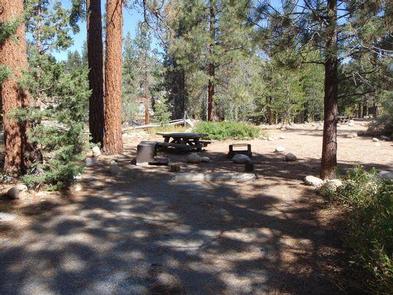
Dinkey Creek is spread out along the banks of its namesake creek in a thick forest of Ponderosa pines and cedars. The facility’s high country setting with trees, streams and open space, make it a scenic destination for all types of visitors.
Recreation
Dinkey Creek has 2 swimming areas: The Slicks and Honeymoon Pool, both of which contain pools carved out of granite. Anglers can fish Dinkey Creek for brown and rainbow trout.
Hikers can walk the Dinkey Creek Trail. Mountain bikers also have trail access in this area.
Facilities
There is a group site that can accommodate up to 50 people. The rest are a mix of standard or tent-only single sites.
An on-site amphitheater offers educational programs on summer weekends. There is a picnic site located on large sandy flat above the creek at the north end of the campground.
All sites have paved spurs, picnic tables and fire grills; accessible sites are available. Drinking water and both vault and flush toilets are provided.
Natural Features
The Sierra National Forest, located on the western slope of the central Sierra Nevada, is known for its spectacular mountain scenery and abundant natural
resources.
The terrain includes rolling, oak-covered foothills, heavily forested middle elevation slopes and the starkly beautiful alpine landscape of the High Sierra.
Nearby Attractions
McKinley Grove is 6 miles away. Famous for its giant Redwoods, the area offers leisurely hikes and picnicking opportunities.
Charges & Cancellations
Rules & Reservation Policies
As you make travel plans that include reservations on Recreation.gov, there are standard policies that apply to most locations of which you should be aware. Do keep in mind, however, that there are many exceptions, so it is best to review reservation information listed on individual facility pages for those policies and procedures that pertain to your specific locations.
Any location or activity requiring a permit or lottery will have unique requirements and policies. Please check individual facility pages for pertinent information for those sites.
Booking Window
For most locations, you can reserve six months in advance of your stay for individual sites and 12 months in advance for group sites. There are some exceptions, so it is best to check with each facility.
Change and Cancellation Policies and Fees
Overnight and Day Use Facilities: To ensure fairness, reservation arrival or departure dates may not be changed beyond the booking window until 18 days after booking the reservation.
Camping / Day Use: A $10.00 service fee will apply if you change or cancel your reservation (including campsites, cabins, lookouts, group facilities, etc.). The $10.00 service fee will be deducted from the refund amount.
You can cancel or change reservations through Recreation.gov or by calling 1-877-444-6777.
Tours & Tickets: You may request changes to tour dates at no cost before the arrival date. If you cancel before your tour date, you may be eligible for a refund. Cancellation fees apply. Please check the tour facility description details page for cancellation policies.
Permits: Varies by location. Please check the permit details for the permit location.
Late Cancellations
Overnight and Day Use Facilities: Late cancellations are those cancelled between 12:01 a.m. (Eastern) on the day before arrival and check out time on the day after arrival.
Individual Campsites: If a customer cancels a reservation the day before or on the day of arrival they will be charged a $10.00 service fee and will also forfeit the first night’s use fee (not to exceed the total paid for the original reservation). Cancellations for a single night’s reservation will forfeit the entire use fee but no cancellation fee will apply.
Cabins / Lookouts: Customers will be charged a $10.00 cancellation fee and forfeit the first night’s use fee if a cabin or lookout reservation is cancelled within 14 days of the scheduled arrival date. Cancellations for a single night’s use will not be assessed a service fee.
Group Facility: If a customer cancels a group overnight facility reservation within 14 days of the scheduled arrival date they will be charged the $10.00 service fee and forfeit the first night’s use fee. Cancellations for a single night’s use will not be assessed a service fee.
Group Day Use Area: If a customer cancels a group day use facility reservation within 14 days of the scheduled arrival date, they will forfeit the total day use fee with no service fee charge.
No-Shows
Camping / Day Use: A camping no-show customer is one who does not arrive at a campground and does not cancel the reservation by check-out time on the day after the scheduled arrival date. Reserved campsites and group overnight facilities will be held until check-out time on the day following your scheduled arrival. Group day-use facilities will be held until check-in time on your scheduled arrival date.
If a customer does not arrive at the campground or group facility by check-out time the day after arrival or does not cancel the reservation by the times listed under “Late Cancellations” above, the customer may be assessed a $20.00 service fee and forfeit use fees.
Tours: A tour or ticket no-show is one who does not cancel a ticket before arrival and does not arrive for the tour. Tour no-shows are not entitled to a refund.
Refunds
Customers must request refunds no later than 14 days after the scheduled departure date. Recreation.gov will not grant refund requests after 14 days of departure.
Reservation Fee: For some facilities, tours or permits an additional reservation fee is charged. For some overnight and day-use facilities, an additional non-refundable reservation fee may apply. The non-refundable reservation fee for tours and tickets is $1.00. The non-refundable reservation fee for permits varies by location.
Refunds for Bankcard Purchases: Refunds for bank card payments will be issued as a credit to the original bank card.
Refunds for Check or Cash Purchases: Refunds for Recreation.gov payments made by check or money order, and cash payments at selected campgrounds will be issued a check refund. A refund will be processed within 30 days of receipt and approval. Please Note: Refund requests made during or after departure can only be processed when approved by the facility management staff based upon local policy.
Refunds for Emergency Closures: In the event of an emergency closure, the Recreation.gov team will attempt to notify users and offer alternate dates (as appropriate). If this is not possible, reservations will be cancelled and all fees paid will be refunded. Reservation fees for free tickets are non-refundable in the event of an emergency closure.
Recreation.gov Billing Information
Reservation transaction will appear on customer’s credit card statements as “Recreation.gov 877-444-6777.”
Changes to Policies and Procedures
Recreation.gov reserves the right, when necessary, to modify reservation policies. These policies were last updated July
Nearby Activities
Biking
Camping
Interpretive programs
Fishing
Hiking
Day use area
Swimming site
Gallery
Directions
From Clovis, California, travel east on Highway 168 to Shaver Lake.
Turn southeast onto Dinkey Creek Road and travel 13 miles to the campground.
This is Bass Lake Complex in the Sierra National Forest, California.It is 20 miles south of Yosemite National Park, off Hwy. 41, near Oakhurst, California.
For details and reservations in the Bass Lake Complex please select any of the following campgrounds:
From Fresno, take Highway 41 north through Oakhurst. Turn right on Road 222 toward Bass Lake. Keep right for 3.5 miles to the campground office for check-in. Enter across from office through gate at Recreation Point.
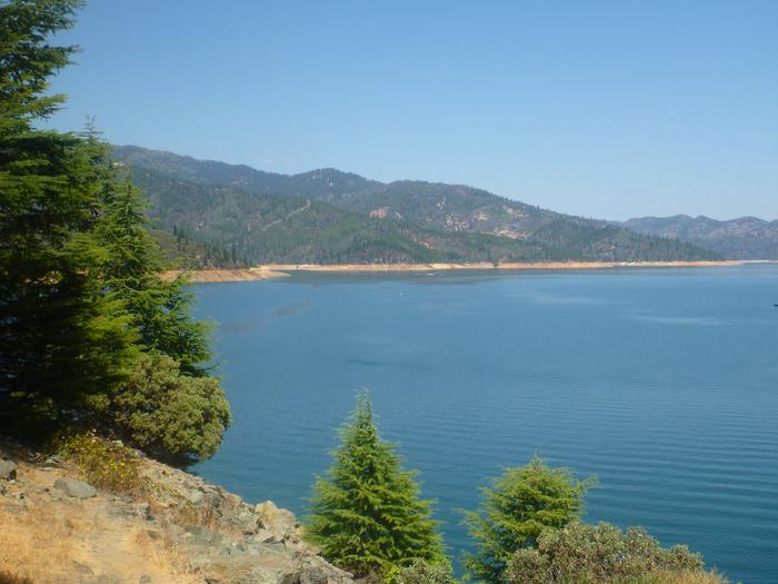
Mariners Point Campground is located where the Pit and Squaw arm of Shasta Lake come together and offers sites to both tent and RV campers. Visitors to this area can enjoy boating and fishing at the nearby Shasta Lake or hiking around the Shasta-Trinity National Forest.
Recreation
The nearest public boat ramp is six miles away in Jones Valley. Nearby lakeside resorts offer boat rentals and fuel. Shasta Lake is popular for power and non-motorized boating, fishing and water skiing. Anglers can fish for trout, catfish, Chinook salmon, crappie, bluegill, white sturgeon, brown bullhead and bass.
Facilities
All campsites have picnic tables, grills, fire rings, and parking spurs. Portable toilets are provided.
Natural Features
Shasta-Trinity is the largest national forest in California with a diverse landscape encompassing five wilderness areas, hundreds of mountain lakes and 6,278 miles of streams and rivers.
Lake Shasta sits at an elevation of 1,067 feet, with 365 miles of shoreline punctuated by steep mountains blanketed in manzanita and evergreens. A snow-capped Mount Shasta, the second-tallest mountain in the Cascade Range, looms in the distance.
Nearby Activities
Boating
Camping
Fishing
Gallery
Directions
From I-5 take the Mountain Gate/Wonderland Blvd. Exit and go east to Bear Mountain Road. At Dry Creek Road go left to Silverthorn Road (take left Y) Follow Silverthorn Road toward the resort and take the left turn prior to entering resort. Campground is behind gate.
Located on the shores of Lewiston Lake, approximately 4 miles north of Lewiston on County Road 105, and 17 miles from Weaverville. This campground is on the water’s edge and is a favorite for fisherman, and for launching kayaks or canoes.
Recreation
The area offers excellent opportunities for fishing, kayaking, hiking and wildlife viewing. Pine Cove boat ramp is within 4 miles, and Fairview launching area on Trinity Lake is 9 miles north. Motorized boats are limited to ten miles per hour.
Rainbow trout are abundant, and brown and brook trout are common. This is a good lake for a float tube and excellent fly fishing. The area offers wonderful wildlife viewing opportunities.
Facilities
There are five paved campsites, furnished with a table and fire ring. The Cooper Gulch day use area has five parking spaces for people to fish and/or to hike on the Baker Gulch Trail.
Natural Features
The campsites are tucked into a mixed forest of conifer and deciduous trees, surrounded by abundant wildflowers. Every site offers a view of Lewiston Lake.
Lewiston Lake is about 5 miles long, about 70 feet deep, and sits at an elevation of 1,902 feet in elevation. It is a favorite among anglers and paddlers.
Nearby Attractions
The campground is located 3 miles from the historic town of Lewiston, California.
Nearby Activities
Boating
Camping
Directions
From Weaverville, take Hwy 3 north for 7 miles. Turn right on Rush Creek Road for 9 miles. Turn left on Trinity Dam Blvd for 2.5 miles. Then right on Cooper Gulch exit.
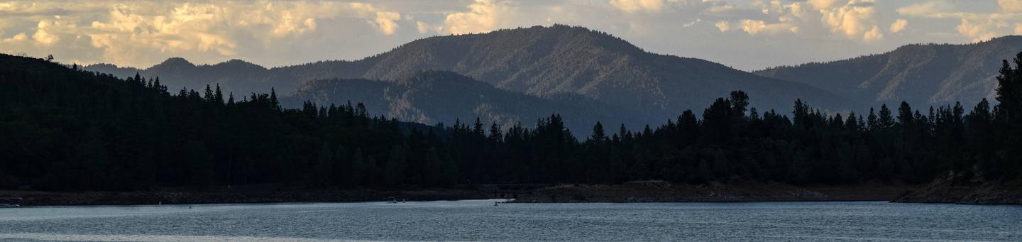
Hirz Cabin is nestled among manzanita and oak trees on a hilltop overlooking the McCloud Arm of Shasta Lake. The scenic location offers a variety of recreational activities, including a nearby boat ramp for water sports and a hiking trail.
Recreation
The nearest boat launch is about one mile away at Hirz Bay. Resorts on the lake have watercraft rentals and marinas with fuel.
Popular water activities include power and non-motorized boating, fishing and water skiing. Lake Shasta offers excellent fishing for trout, catfish, Chinook salmon, crappie, bluegill, white sturgeon, brown bullhead and bass.
Hikers can access the two-mile Hirz Bay Trail from the campground.
Facilities
Hirz cabin has all the typical amenities needed for cooking and cleaning. There is a full kitchen and laundry facility. The cabin has 3 bedrooms ( 2 upstairs and 1 downstairs) and 2 Bathrooms. The cabin is powered by a solar panel including a power meter on the wall to indicate power usage. The Solar Panel creates about 2-3 hours of minimal electricity (Only lights & ceiling fans) after dark. There is also generator power which runs from 6 A.M. to 8 A.M. and then runs again at 6 P.M. to 9 P.M. ( Dishes and Laundry should be done within “The Generator Power hours.”)
There are ceiling fans over each bed. No Air Conditoning or Internet. There are beds but no bedding. The two queen beds and two twin beds will sleep six people. There is plenty of room for inflatable mattresses on the main floor of the cabin. There is a dining room table with four chairs, a sofa and a large deck for your lawn chairs. The parking area will accommodate one boat with tow vehicle and four cars.
Natural Features
Shasta-Trinity is the largest national forest in California with a diverse landscape encompassing five wilderness areas, hundreds of mountain lakes and 6,278 miles of streams and rivers.
Lake Shasta sits at an elevation of 1,067 feet, with 365 miles of shoreline punctuated by steep mountains blanketed in manzanita and evergreens. A snow-capped Mount Shasta, the second-tallest mountain in the Cascade Range, looms in the distance.
Nearby Attractions
Lake Shasta Caverns are also located on the McCloud Arm of Shasta Lake in an area known as the Grey Rocks. Tours are given daily at this privately-owned facility.
The nearby Hirz Mountain Lookout offers panoramic views of Mt. Shasta, Mt. Lassen and the surrounding area at an elevation of 3,500 feet.
Nearby Activities
Camping
Directions
From Redding, CA, remain on I-5 to Gilman Road. (From the north, take Salt Creek exit to Gilman Road). Take Gilman Road east for 11 miles to entrance of Hirz Bay.