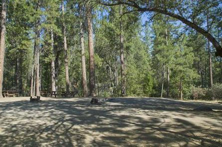
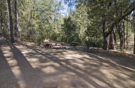
Crane Valley will be closed the entire 2019 – 2022 camping season due to a massive hazard tree removal
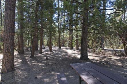
Crane Valley Group Campground is located adjacent to Bass Lake and can accommodate up to 7 groups with tents and RVs. The facility is shaded by a dense forest of oak, cedar and pine trees, and although none of the sites offer direct views of the lake, the campground offers convenient access to the many recreational activities and attractions in the area.
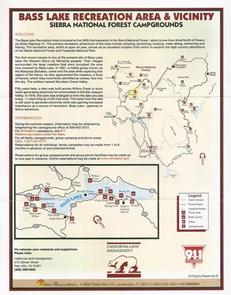
Recreation
Activities on Bass Lake include motorized and non-motorized boating, fishing, swimming, hiking, sailing and water skiing. California Land Management sponsors
a variety of interpretive programs throughout the summer at several locations in the Bass Lake area.
Facilities
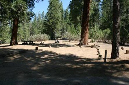
This group campground has 7 sites that can accommodate between 12 to 30 people each. Each site has grills, fire rings and tables. Portable toilets are provided, but campers must bring drinking water.
Natural Features
The Sierra National Forest, located on the western slope of the central Sierra Nevada, is known for its spectacular mountain scenery and abundant natural
resources.
The terrain includes rolling, oak-covered foothills, heavily forested middle elevation slopes and the starkly beautiful alpine landscape of the High Sierra.
Nearby Attractions
Yosemite National Park is under an hour away and makes an ideal day trip from Crane Valley Campground.
Nearby Activities
Boating
Camping
Interpretive programs
Fishing
Hiking
Water sports
Swimming site
Gallery
Directions
From Fresno, California, take Highway 41 north through Oakhurst. Turn
right on Forest Road 222, towards Bass Lake. Keep right for 3.5 miles to
the campground.
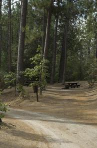
Lower Billy Creek Campground is located on Huntington Lake near the Kaiser Wilderness. The adjacent Billy Creek Guard Station Museum provides historical overviews of Huntington Lake, Native Americans and the Forest Service.
Every site at Lower Billy Creek offers scenic lake views. The location of this camp makes it possible to discover all the activities and attractions at Huntington Lake, and it’s an excellent base for further exploration of the Kaiser Wilderness.
Recreation
Many hiking trails are in the area, including Rancheria Falls, Indian Pools and Black Point. Hikers and horseback riders can access the 12-mile Kaiser Loop Trail, which connects to a network of trails within the Kaiser Wilderness.
Huntington Lake offers swimming, sailing, boating, canoeing, kayaking, fishing and water skiing. Additionally, California Land Management sponsors a variety of interpretive programs and nature walks throughout the summer at several locations in the area.
Facilities
The campground has paved parking spurs, but it can be difficult to maneuver RVs due to tight spaces and the close proximity of the trees. Each site has a picnic table, food storage locker and campfire ring. Vault toilets and drinking water are provided.
Natural Features
This small campground is nestled among fir and pine trees within the Sierra National Forest on the western slope of the central Sierra Nevada. The forest is known for its spectacular mountain scenery and abundant natural resources.
The terrain includes rolling, oak-covered foothills, heavily forested middle elevation slopes and the starkly beautiful alpine landscape of the High Sierra.
Nearby Attractions
The 84-mile Sierra Vista Scenic Byway (Highway 168) makes a great day trip from the Huntington Lake area.
Charges & Cancellations
Rules & Reservation Policies
As you make travel plans that include reservations on Recreation.gov, there are standard policies that apply to most locations of which you should be aware. Do keep in mind, however, that there are many exceptions, so it is best to review reservation information listed on individual facility pages for those policies and procedures that pertain to your specific locations.
Any location or activity requiring a permit or lottery will have unique requirements and policies. Please check individual facility pages for pertinent information for those sites.
Booking Window
For most locations, you can reserve six months in advance of your stay for individual sites and 12 months in advance for group sites. There are some exceptions, so it is best to check with each facility.
Change and Cancellation Policies and Fees
Overnight and Day Use Facilities: To ensure fairness, reservation arrival or departure dates may not be changed beyond the booking window until 18 days after booking the reservation.
Camping / Day Use: A $10.00 service fee will apply if you change or cancel your reservation (including campsites, cabins, lookouts, group facilities, etc.). The $10.00 service fee will be deducted from the refund amount.
You can cancel or change reservations through Recreation.gov or by calling 1-877-444-6777.
Tours & Tickets: You may request changes to tour dates at no cost before the arrival date. If you cancel before your tour date, you may be eligible for a refund. Cancellation fees apply. Please check the tour facility description details page for cancellation policies.
Permits: Varies by location. Please check the permit details for the permit location.
Late Cancellations
Overnight and Day Use Facilities: Late cancellations are those cancelled between 12:01 a.m. (Eastern) on the day before arrival and check out time on the day after arrival.
Individual Campsites: If a customer cancels a reservation the day before or on the day of arrival they will be charged a $10.00 service fee and will also forfeit the first night’s use fee (not to exceed the total paid for the original reservation). Cancellations for a single night’s reservation will forfeit the entire use fee but no cancellation fee will apply.
Cabins / Lookouts: Customers will be charged a $10.00 cancellation fee and forfeit the first night’s use fee if a cabin or lookout reservation is cancelled within 14 days of the scheduled arrival date. Cancellations for a single night’s use will not be assessed a service fee.
Group Facility: If a customer cancels a group overnight facility reservation within 14 days of the scheduled arrival date they will be charged the $10.00 service fee and forfeit the first night’s use fee. Cancellations for a single night’s use will not be assessed a service fee.
Group Day Use Area: If a customer cancels a group day use facility reservation within 14 days of the scheduled arrival date, they will forfeit the total day use fee with no service fee charge.
No-Shows
Camping / Day Use: A camping no-show customer is one who does not arrive at a campground and does not cancel the reservation by check-out time on the day after the scheduled arrival date. Reserved campsites and group overnight facilities will be held until check-out time on the day following your scheduled arrival. Group day-use facilities will be held until check-in time on your scheduled arrival date.
If a customer does not arrive at the campground or group facility by check-out time the day after arrival or does not cancel the reservation by the times listed under “Late Cancellations” above, the customer may be assessed a $20.00 service fee and forfeit use fees.
Tours: A tour or ticket no-show is one who does not cancel a ticket before arrival and does not arrive for the tour. Tour no-shows are not entitled to a refund.
Refunds
Customers must request refunds no later than 14 days after the scheduled departure date. Recreation.gov will not grant refund requests after 14 days of departure.
Reservation Fee: For some facilities, tours or permits an additional reservation fee is charged. For some overnight and day-use facilities, an additional non-refundable reservation fee may apply. The non-refundable reservation fee for tours and tickets is $1.00. The non-refundable reservation fee for permits varies by location.
Refunds for Bankcard Purchases: Refunds for bank card payments will be issued as a credit to the original bank card.
Refunds for Check or Cash Purchases: Refunds for Recreation.gov payments made by check or money order, and cash payments at selected campgrounds will be issued a check refund. A refund will be processed within 30 days of receipt and approval. Please Note: Refund requests made during or after departure can only be processed when approved by the facility management staff based upon local policy.
Refunds for Emergency Closures: In the event of an emergency closure, the Recreation.gov team will attempt to notify users and offer alternate dates (as appropriate). If this is not possible, reservations will be cancelled and all fees paid will be refunded. Reservation fees for free tickets are non-refundable in the event of an emergency closure.
Recreation.gov Billing Information
Reservation transaction will appear on customer’s credit card statements as “Recreation.gov 877-444-6777.”
Changes to Policies and Procedures
Recreation.gov reserves the right, when necessary, to modify reservation policies. These policies were last updated July
Nearby Activities
Boating
Historic & cultural site
Camping
Interpretive programs
Fishing
Hiking
Water sports
Day use area
Swimming site
Gallery
Directions
From Clovis, take Highway 168 north 70 miles to Huntington Lake Campground office at Eastwood. Check-in at office prior to setting up camp.
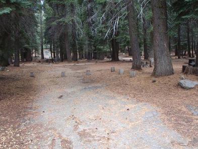
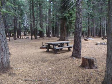
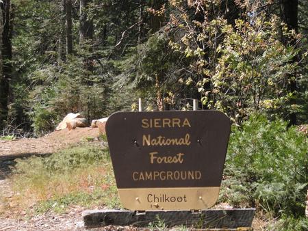
Chilkoot is named for the creek that runs by the campground. The facility is shaded by a grove of Ponderosa pine, fir and cedar, and offers ample space for tent or RV camping.
This campground is located at an elevation of approximately 4,600 feet, providing a comfortable camping experience during the hottest days of summer.
Recreation
A popular recreation and resort area is a few miles away at Bass Lake. Activities here include motorized and non-motorized boating, fishing, swimming, hiking, sailing and water skiing.
Anglers can fish in Chilkoot Creek for channel catfish, sucker and brown trout. Other nearby activities include hiking the Buena Vista trail and paddling on Willow Creek.
Facilities
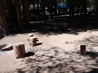
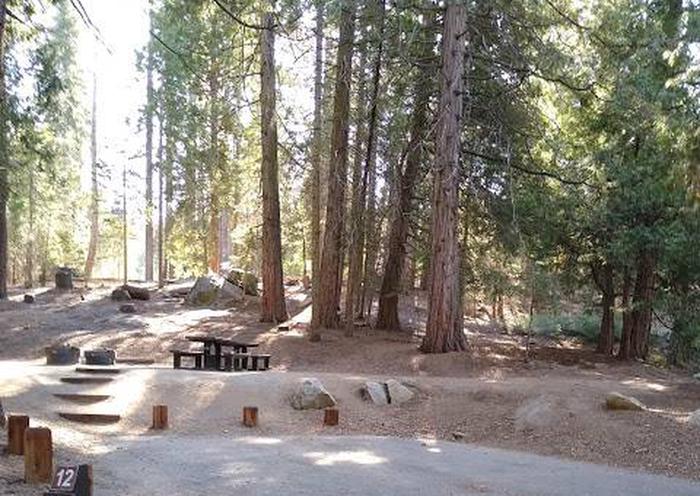
This rustic campground provides a host and vault toilets but no water. Each unit has a gravel parking spur, picnic table and fire ring. Some sites are located on slopes and are not suitable for tents, while other sites are tent only.
Natural Features
The Sierra National Forest, located on the western slope of the central Sierra Nevada, is known for its spectacular mountain scenery and abundant natural
resources.
The terrain includes rolling, oak-covered foothills, heavily forested middle elevation slopes and the starkly beautiful alpine landscape of the High Sierra.
Nearby Attractions
Yosemite National Park can be reached in under an hour from Chilkoot Campground. The South Fork of the Merced River is also nearby, which is popular for whitewater rafting.
Nearby Activities
Boating
Camping
Fishing
Hiking
Water sports
Swimming site
Gallery
Directions
Directions from Fresno: Take Highway 41 through Oakhurst, California. Turn east on Forest Road
222 (Bass Lake turnoff) and continue on for 7 miles. Turn left onto Beashore Road, follow Beashore Road for 4 miles to the Chilkoot Campground.
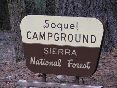
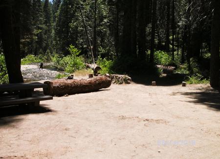
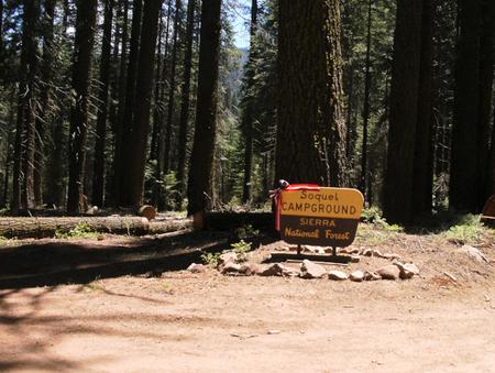
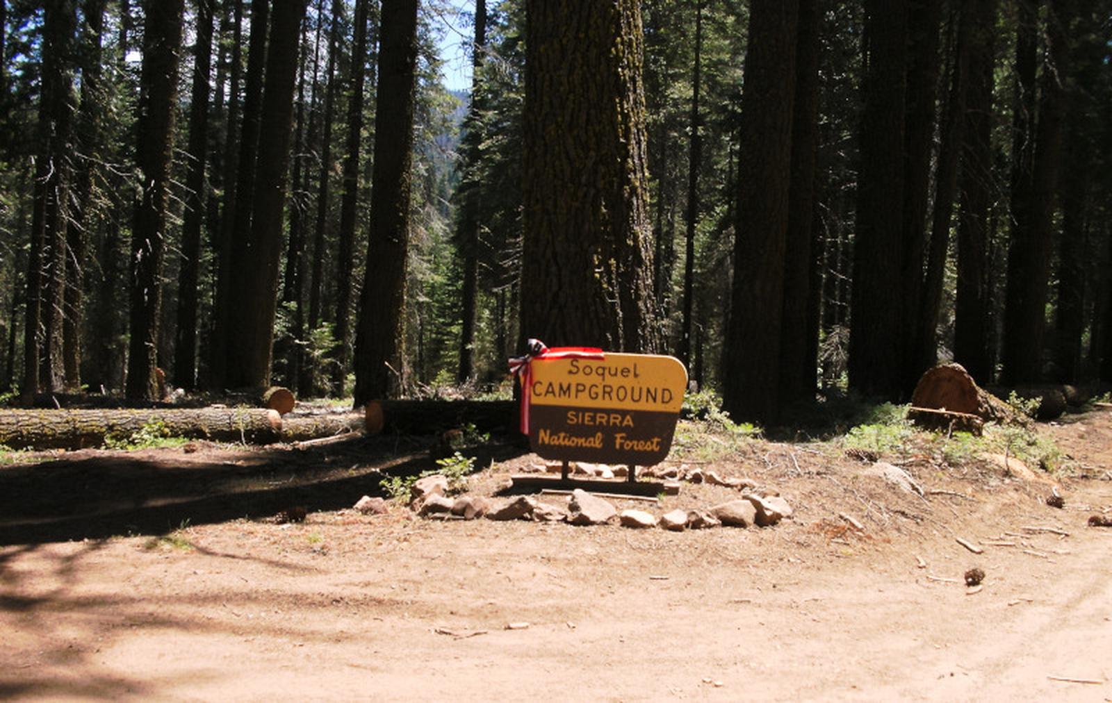
Soquel Campground consists of two loops on the banks of Willow Creek. The primitive sites are well-shaded by pine and fir trees and can accommodate small trailers and tents.
Recreation
Trails can be found off Highway 41 west of the campground, including the 3.7-mile Lewis Creek National Recreation Trail and the Miami Motorcycle Trails, a network of forest roads and trails for dirt bikes and off-road vehicles.
The Shadow of the Giants, a grove of giant sequoias, is popular 1-mile hike just a short drive north of the campground.
Facilities
Each site has a dirt parking spur, picnic table, campfire ring and grill. Vault toilets are provided, but drinking water is not available. Campers must bring their own supply.
Natural Features
The Sierra National Forest, located on the western slope of the central Sierra Nevada, is known for its spectacular mountain scenery and abundant natural resources. The terrain includes rolling, oak-covered foothills, heavily forested middle elevation slopes and the starkly beautiful alpine landscape of the High Sierra.
Soquel Campground is located in the Highway 41 Corridor of the Bass Lake Ranger District. This area is known for the Nelder Grove of giant sequoias.
Nearby Attractions
Yosemite National Park is a popular day trip from the area. The historic logging train at Yosemite Mountain Sugar Pine Railroad is a little closer to the campground.
Soquel Campground is just off the Sierra Vista Scenic Byway (Sky Ranch Road), an 83-mile drive past many highlights of Sierra National Forest.
Nearby Activities
Camping
Hiking
Gallery
Directions
From Fresno, take Highway 41 north through town of Oakhurst. Take the Sky Ranch Road (Road 632) east for 7 miles, turn southeast on Forest Road 6S40, and travel 1 mile to Soquel Campground.
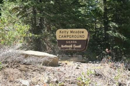
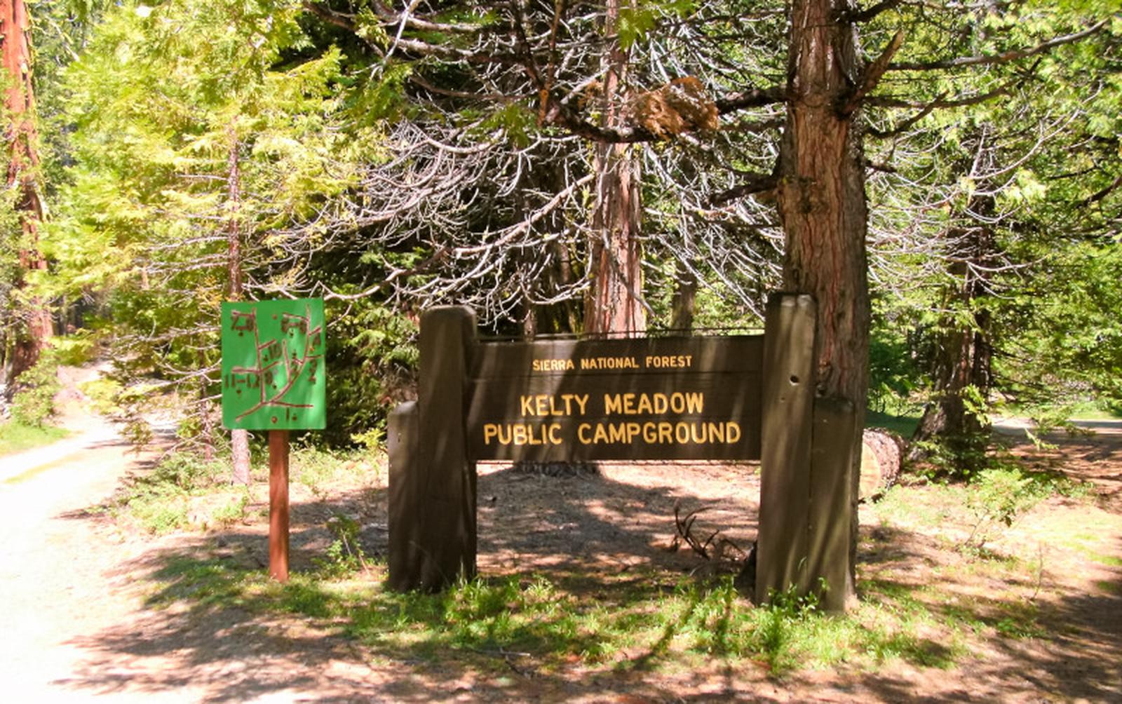
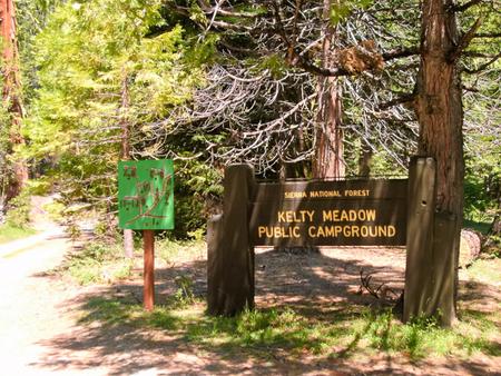
Kelty Meadow Campground is located in a mountainous area near Bass Lake. This horse-friendly camp is shaded by pine and cedar trees alongside Kelty Creek, with campsites wide and open enough to accommodate small horse trailers, slide-ins, tent trailers or tents.
Recreation
Visitors enjoy horseback riding on logging and forest roads in the surrounding area. Most other recreational activities in the area are centered around Bass Lake.
Bass Lake offers a beach and boat ramp. Popular activities include hiking, swimming, motorized boating, canoeing, kayaking, water skiing, sailing and fishing for bass, trout, bluegill and catfish.
Facilities
Each campsite is equipped with a picnic table, campfire ring and grill. Some sites have hitching posts.
Vault toilets are available. Drinking water is not provided, but a stock water supply is available from the creek.
Natural Features
The Sierra National Forest, located on the western slope of the central Sierra Nevada, is known for its spectacular mountain scenery and abundant natural resources. The terrain includes rolling, oak-covered foothills, heavily forested middle elevation slopes and the starkly beautiful alpine landscape of the High Sierra.
Kelty Meadow Campground is located in the Bass Lake Ranger District at an elevation of 3,400 feet. Bass Lake is a very popular area known for its variety of fish, as well as the bald and golden eagles that make their home here.
Nearby Attractions
A trailhead for the Shadow of the Giants National Recreation Trail is a few miles south of the campground. This 1-mile interpretive trail gives visitors the opportunity to learn about giant sequoias that grow in this forest.
Nearby Activities
Camping
Hiking
Gallery
Directions
Traveling north on Highway 41, approximately 3 miles out of Oakhurst, take Road 632
(aka Sky Ranch Road) 8 miles to the Y junction of 632 and 6S40. Stay left at the Y
and go 3 miles to Kelty Meadow Campground on the left
side of the road.
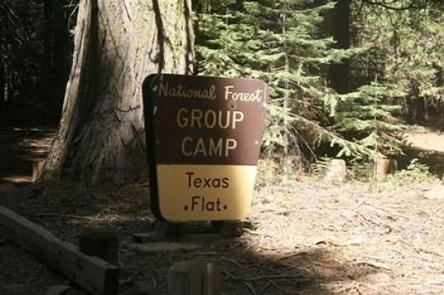
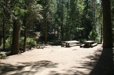
Texas Flats Campground is a horse-friendly group camp situated on the banks of McGilvery Creek. It is split into 4 sections named manzanita, red fir, white fir and cedar.
Recreation
Nearby logging and forest roads can be used as equestrian trails. The Shadow of the Giants, a popular 1-mile hike through a grove of giant sequoias, is just a short drive northwest of the campground.
Facilities
Each campsite can accommodate between 20-30 people and has picnic tables and campfire rings. Vault toilets are provided, but campers need to bring drinking water. This campground does not have facilities or corrals for horses.
Natural Features
The Sierra National Forest, located on the western slope of the central Sierra Nevada, is known for its spectacular mountain scenery and abundant natural resources. The terrain includes rolling, oak-covered foothills, heavily forested middle elevation slopes and the starkly beautiful alpine landscape of the High Sierra.
Texas Flat Campground is located in the Highway 41 Corridor of the Bass Lake Ranger District. This area is known for the Nelder Grove of giant sequoias.
Nearby Attractions
Yosemite National Park is a popular day trip. Visitors can also take a ride on the historic logging train at Yosemite Mountain Sugar Pine Railroad.
The Sierra Vista Scenic Byway (Sky Ranch Road), an 83-mile drive past some of the highlights of Sierra National Forest, runs nearby.
Nearby Activities
Camping
Hiking
Gallery
Directions
Take Highway 41 north through Oakhurst past Rd. 222 (aka Bass Lake turn off), to Road 632 (aka Sky Ranch Road).
Turn right, travel 7 miles, and turn right on FS6S40 towards Soquel Campground.
Travel for 1 mile, turn left on 6S08, cross the bridge and continue left through Greys Mt. Campground.
Travel for 1 mile, turn left on 6S38, and continue for 2 miles to Texas Flat Campground. (Distances approximate).
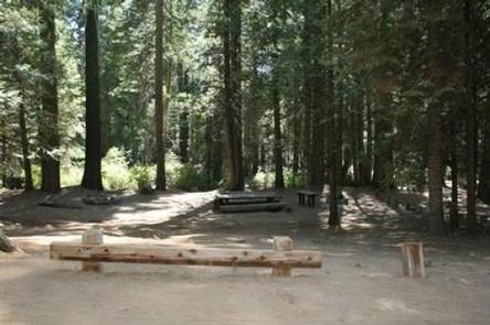
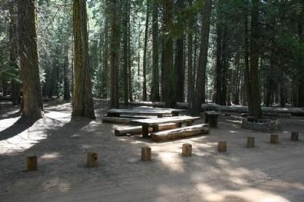
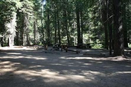
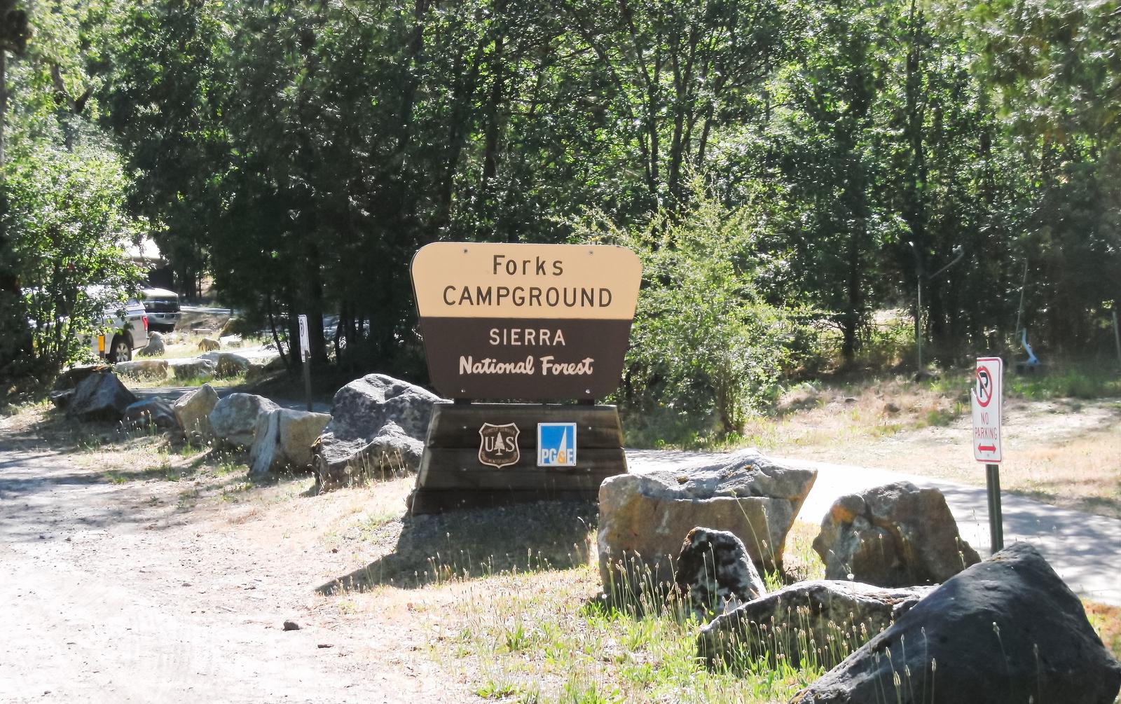
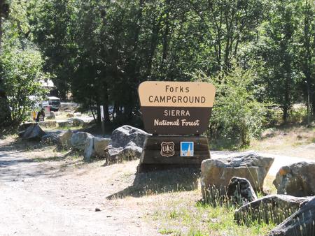
Forks campground is located on a hillside overlooking Bass Lake. The camp is forested with cedar, ponderosa pine and oak trees and offers a few sites with limited lake views, while others are adjacent to the creek.
Recreation
Bass Lake offers a beach and boat ramp. Popular activities include swimming, motorized boating, non-motorized boating, water skiing, sailing and fishing for bass,
trout, bluegill and catfish.
Goat Mountain Trail (2.6 miles) can be accessed directly from this camp. Other foot trails in the area include Willow Creek (2.7 miles), Spring Cove (2.6 miles) and
Way-of-the-Mono Interpretive Trail (1 mile).
A variety of educational programs are offered on weekends during the summer.
Facilities
Each unit has a picnic table, pedestal grill, stone fire ring and paved parking spur. Forks Campground provides flush toilets (including ones that meet accessibility standards) and
drinking water.
The parking spurs here are not large enough to fit boat trailers.
Natural Features
Forks Campground is located in the Bass Lake Ranger District at an elevation of 3,400 feet. Bass Lake is a very popular area known for its variety of fish, as well as the bald and golden eagles that make their home here.
The Sierra National Forest, located on the western slope of the central Sierra Nevada, is known for its spectacular mountain scenery and abundant natural resources. The terrain includes rolling, oak-covered foothills, heavily forested middle elevation slopes and the starkly beautiful alpine landscape of the High Sierra.
Nearby Attractions
Forks Campground is located approximately 24 miles from the entrance of Yosemite National Park.
Charges & Cancellations
Rules & Reservation Policies
As you make travel plans that include reservations on Recreation.gov, there are standard policies that apply to most locations of which you should be aware. Do keep in mind, however, that there are many exceptions, so it is best to review reservation information listed on individual facility pages for those policies and procedures that pertain to your specific locations.
Any location or activity requiring a permit or lottery will have unique requirements and policies. Please check individual facility pages for pertinent information for those sites.
Booking Window
For most locations, you can reserve six months in advance of your stay for individual sites and 12 months in advance for group sites. There are some exceptions, so it is best to check with each facility.
Change and Cancellation Policies and Fees
Overnight and Day Use Facilities: To ensure fairness, reservation arrival or departure dates may not be changed beyond the booking window until 18 days after booking the reservation.
Camping / Day Use: A $10.00 service fee will apply if you change or cancel your reservation (including campsites, cabins, lookouts, group facilities, etc.). The $10.00 service fee will be deducted from the refund amount.
You can cancel or change reservations through Recreation.gov or by calling 1-877-444-6777.
Tours & Tickets: You may request changes to tour dates at no cost before the arrival date. If you cancel before your tour date, you may be eligible for a refund. Cancellation fees apply. Please check the tour facility description details page for cancellation policies.
Permits: Varies by location. Please check the permit details for the permit location.
Late Cancellations
Overnight and Day Use Facilities: Late cancellations are those cancelled between 12:01 a.m. (Eastern) on the day before arrival and check out time on the day after arrival.
Individual Campsites: If a customer cancels a reservation the day before or on the day of arrival they will be charged a $10.00 service fee and will also forfeit the first night’s use fee (not to exceed the total paid for the original reservation). Cancellations for a single night’s reservation will forfeit the entire use fee but no cancellation fee will apply.
Cabins / Lookouts: Customers will be charged a $10.00 cancellation fee and forfeit the first night’s use fee if a cabin or lookout reservation is cancelled within 14 days of the scheduled arrival date. Cancellations for a single night’s use will not be assessed a service fee.
Group Facility: If a customer cancels a group overnight facility reservation within 14 days of the scheduled arrival date they will be charged the $10.00 service fee and forfeit the first night’s use fee. Cancellations for a single night’s use will not be assessed a service fee.
Group Day Use Area: If a customer cancels a group day use facility reservation within 14 days of the scheduled arrival date, they will forfeit the total day use fee with no service fee charge.
No-Shows
Camping / Day Use: A camping no-show customer is one who does not arrive at a campground and does not cancel the reservation by check-out time on the day after the scheduled arrival date. Reserved campsites and group overnight facilities will be held until check-out time on the day following your scheduled arrival. Group day-use facilities will be held until check-in time on your scheduled arrival date.
If a customer does not arrive at the campground or group facility by check-out time the day after arrival or does not cancel the reservation by the times listed under “Late Cancellations” above, the customer may be assessed a $20.00 service fee and forfeit use fees.
Tours: A tour or ticket no-show is one who does not cancel a ticket before arrival and does not arrive for the tour. Tour no-shows are not entitled to a refund.
Refunds
Customers must request refunds no later than 14 days after the scheduled departure date. Recreation.gov will not grant refund requests after 14 days of departure.
Reservation Fee: For some facilities, tours or permits an additional reservation fee is charged. For some overnight and day-use facilities, an additional non-refundable reservation fee may apply. The non-refundable reservation fee for tours and tickets is $1.00. The non-refundable reservation fee for permits varies by location.
Refunds for Bankcard Purchases: Refunds for bank card payments will be issued as a credit to the original bank card.
Refunds for Check or Cash Purchases: Refunds for Recreation.gov payments made by check or money order, and cash payments at selected campgrounds will be issued a check refund. A refund will be processed within 30 days of receipt and approval. Please Note: Refund requests made during or after departure can only be processed when approved by the facility management staff based upon local policy.
Refunds for Emergency Closures: In the event of an emergency closure, the Recreation.gov team will attempt to notify users and offer alternate dates (as appropriate). If this is not possible, reservations will be cancelled and all fees paid will be refunded. Reservation fees for free tickets are non-refundable in the event of an emergency closure.
Recreation.gov Billing Information
Reservation transaction will appear on customer’s credit card statements as “Recreation.gov 877-444-6777.”
Changes to Policies and Procedures
Recreation.gov reserves the right, when necessary, to modify reservation policies. These policies were last updated July
Nearby Activities
Boating
Camping
Fishing
Hiking
Water sports
Swimming site
Gallery
Directions
From Fresno, California: Take Highway 41 north through Oakhurst. Turn right on Forest Road 222 (toward Bass Lake), keep right for 3.5 miles to the Bass Lake Campground office. After registering, continue on for approximately 1.25 miles to the Forks Campground.
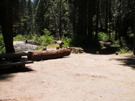
Sweetwater Campground is laid out in a single loop along Chiquito Creek, shaded by pine, oak and cedar trees. Most sites overlook the creek or a brook that also runs by the campground.
Recreation
The campground attracts visitors primarily for its fishing and swimming holes. Many recreational activities are available at Mammoth Pool, including boating, trout fishing, hiking and swimming.
Facilities
Each campsite contains a picnic table, grill and campfire ring. Vault toilets are provided. Campers must bring drinking water. Supplies are available nearby at Wagner’s Mammoth Pool Resort.
Parking spurs are dirt and paved, but tight turns and trees at the edge of interior roads make this camp most ideal for pop-up tent trailers, slide-ins and tent campers.
Natural Features
The Sierra National Forest, located on the western slope of the central Sierra Nevada, is known for its spectacular mountain scenery and abundant natural resources. The terrain includes rolling, oak-covered foothills, heavily forested middle elevation slopes and the starkly beautiful alpine landscape of the High Sierra.
Sweetwater Campground is located close to Mammoth Pool Reservoir near the Ansel Adams Wilderness. This area is known for its jagged peaks, including 13,157-foot Mt. Ritter, and numerous lakes and streams.
Nearby Attractions
A popular pastime in the area is taking a drive on the 83-mile Sierra Vista Scenic Byway.
Nearby Activities
Boating
Camping
Fishing
Hiking
Swimming site
Gallery
Directions
From Fresno, California, take Highway 41 north. Turn northeast on Forest Road 200 and pass through North Fork. Take Minarets Road east and follow it 37 miles. Turn right on Mammoth Pool Road and follow it 2 miles to Sweetwater Campground.
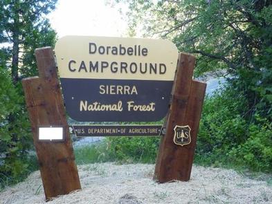
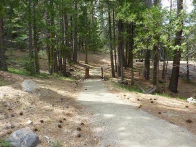
Dorabelle Campground is a popular family camping destination above Shaver Lake. Some sites are shaded by a thick stand of fir, cedar and pine trees, while other sites are more open.
This camp is a great base for experiencing the wide variety of recreational activities in the area. Boats can be moored nearby and some sites offer views of the lake.
Recreation
Hikers can access 5 trails from the campground: Dinkey Road (.5 miles), Musick Meadow (.75 miles), Peninsula Loop (1 mile), Burr Meadow (1.5 miles) and Osprey
Cove (2 miles). Horseback riding is also offered nearby.
Popular activities at Shaver Lake include swimming, motorized boating, canoeing, kayaking, water skiing, jet skiing, windsurfing, sailing and fishing. Anglers can fish for kokanee salmon, rainbow trout, brown trout, smallmouth bass, catfish and bluegill.
Facilities
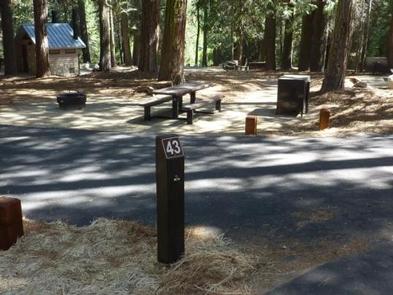
Each site has a dirt parking spur, table, fire ring, and grill. Drinking water and vault toilets are provided.
Natural Features
Surrounded by dense pine forest, Shaver Lake is a popular destination within the High Sierra Ranger District. It sits at an elevation of 5,500 feet and is known for its variety of fish.
The Sierra National Forest, located on the western slope of the central Sierra Nevada, is known for its spectacular mountain scenery and abundant natural resources.
The terrain includes rolling, oak-covered foothills, heavily forested middle elevation slopes and the starkly beautiful alpine landscape of the High Sierra.
Nearby Attractions
The picturesque town of Shaver Lake is nearby, offering restaurants and shopping.
Nearby Activities
Boating
Camping
Fishing
Hiking
Water sports
Swimming site
Gallery
Directions
From Clovis: Take Highway 168 north for 49 miles to the town of Shaver Lake.
Turn right on Dorabelle Road and go .5 miles to the campground.
Campground registration information is at the campground entry station.
Fish Creek Campground is a small, primitive camp offering standard and tent-only sites. The campground is surrounded by mountains and tucked into a shady spot beneath oaks and pines. Sites are located along Fish Creek.
Recreation
Hikers can access the nearby French Trail, a 12.7 mile foot trail that extends from Squaw Dome Trailhead to Logan Meadow Trailhead. Other activities include hunting in designated areas and fishing.
Facilities
Each unit has a picnic table, grill and fire ring. Vault toilets are provided, but campers must bring drinking water.
Natural Features
Fish Creek Campground is located in the Bass Lake Ranger District. At an elevation of 3,400 feet, Bass Lake is a very popular area known for its variety of fish, as well as the bald and golden eagles that make their home here.
The Sierra National Forest, located on the western slope of the central Sierra Nevada, is known for its spectacular mountain scenery and abundant natural
resources.
The terrain includes rolling, oak-covered foothills, heavily forested middle elevation slopes and the starkly beautiful alpine landscape of the High Sierra.
Nearby Attractions
Nearby Mammoth Pool Reservoir offers a variety of recreational activities, including fishing, boating, hiking and wildlife viewing. Campers can use a pay phone, as well as get gas and supplies at Wagner’s Mammoth Pool Resort.
A popular pastime in the area is to take a drive on the 83-mile Sierra Vista Scenic Byway.
Nearby Activities
Boating
Camping
Fishing
Hiking
Swimming site
Directions
From Fresno, California: Take Highway 41 north, turn northeast on Forest
Road 200 and pass through North Fork. Take Minarets Road (heading east out
of North Fork) for 19 miles to the Fish Creek Campground.