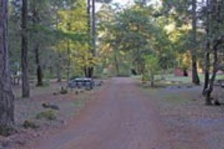
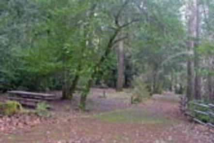
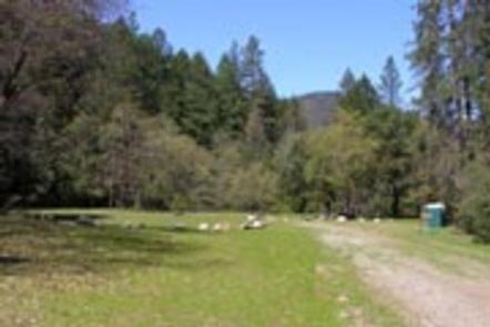
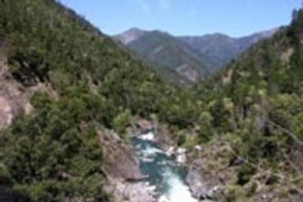
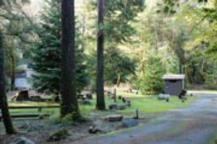
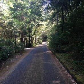
Pearch Creek Campground lies just north of the small town of Orleans in the Klamath river valley of the Six Rivers National Forest. Lush foliage provides welcome shade and relative privacy for each of the campground’s sites.
Recreation
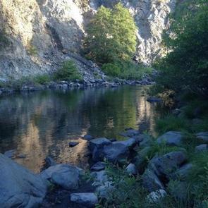
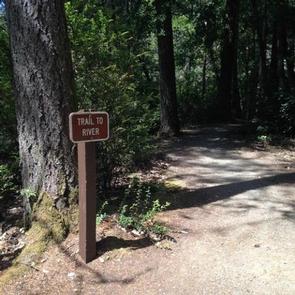
Salmon and steelhead fishing in the nearby Klamath River is considered some of the best in northern California. Both Kalamath and Salmon Rivers are popular destinations for whitewater rafting, swimming and kayaking. Both are within a short drive.
Facilities
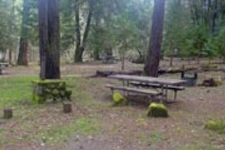
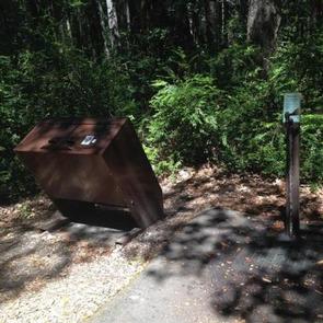
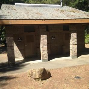
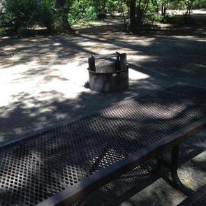
The campground offers several single-family campsites, suitable for both tent and RV-style camping. Each site has picnic tables and campfire rings with grills. Many have rock camp stoves as well. Vault toilets and drinking water are provided.
Natural Features
The campground is located in a mature Douglas fir and hardwood forest. The sound of nearby Pearch Creek can be heard from most sites and the campground remains shady and cool during hot summer days. Moss-covered rocks and tree trunks add to the cooling atmosphere of Pearch Creek.
Nearby Attractions
Trailheads to the Marble Mountain Wilderness
Nearby Activities
Biking
Boating
Camping
Fishing
Hiking
Hunting
Visitor center
Water sports
Wildlife viewing
Swimming site
Gallery
Directions
From Orleans, California, follow State Highway 96 north approximately 1.5 miles to the campground.
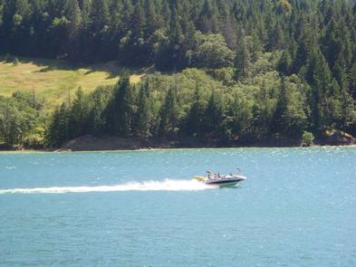
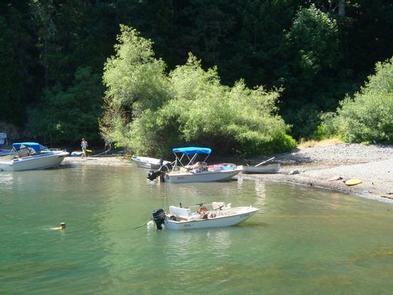
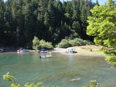
Nordheimer Group Sites sit near the Salmon River in the expansive Klamath National Forest of northern California. Visitors enjoy whitewater rafting, fishing and boating activities.
Recreation
The Salmon River is a popular area for swimming and sunbathing, rafting and kayaking. The region is also popular for hiking and biking. The Orleans Mountain Trail begins nearby.
Facilities
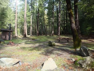
The campground offers four group sites, each able to accommodate up to 50 guests. The sites are equipped with picnic tables, campfire circles and grills. Vault toilets are within walking distance from each site. Roads and parking areas are gravel.
Natural Features
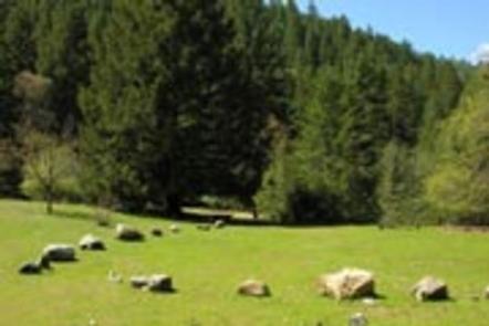
The campground is located in a Douglas fir and hardwood forest, which provides partial shade throughout the day. A few fruit trees remain from past homesteading activities. A variety of wildlife makes its home around the Salmon River area.
Sites A, B, and C have large grassy meadows, surrounded by forest. Site D overlooks the Salmon River with easy walking access for boaters and swimmers.
The Klamath National Forest lies northeast of Eureka in northeastern California, stretching southward from the Oregon border. The Marble Mountain wilderness is located nearby with beautiful views of the mountains and numerous trailheads to access them.
Nearby Attractions
The Marble Mountain Wilderness Area is adjacent to the campground, with ample hiking and horseback riding opportunities available, as well as high country fishing in any of the area’s 89 lakes.
Nearby Activities
Biking
Boating
Camping
Fishing
Hiking
Swimming site
Gallery
Directions
From Highway 96, turn onto Salmon River Road/Forest Highway 93 and continue about 13 miles to the campground.
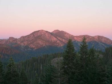
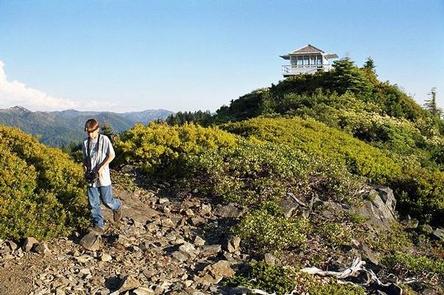
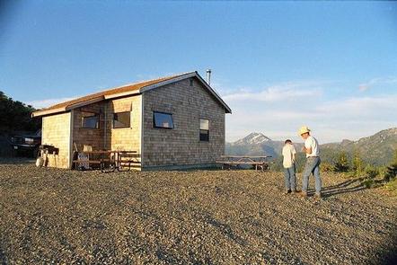
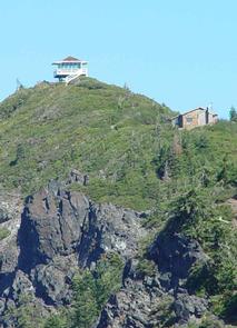
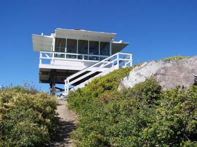
On a high, narrow mountain ridge at 5,280 feet, Bear Basin Lookout and Pierson Cabin offer visitors an awe-inspiring experience and a quiet haven away from crowds. Excellent views of the Siskiyou Wilderness to the east and the Pacific Ocean to the west are why visitors love staying in the heart of the Six Rivers National Forest of northern California.
The current lookout building was previously situated at Camp Six, where it was used to spot forest fires. That structure was moved from Camp Six to Bear Basin Butte in 1996. The original Bear Basin Butte lookout existed in the 1930s.
During the summer and early fall months (July 1 – September 30), the rental includes both the lookout tower and a modern 1930s-style cabin built in the 1990s.
This is a remote location. Access to the cabin is variable and the road is not maintained for winter use. High-clearance, four-wheel drive vehicles are recommended, and guests are also advised to carry chains and a shovel. Guests should note that even during the summer, the paved portion of the road (South Fork Road) frequently has numerous rocks and debris. The last half mile of the access is on a steep gravel road. Quality tires and high-clearance vehicles are recommended. Guests are responsible for their own travel arrangements and safety, and must bring several of their own amenities.
Recreation
Bird watching is available, as well as great hiking opportunities in the nearby Siskiyou Wilderness. Please don’t forget to pick up a Siskiyou Wilderness Map at your nearest Forest Service Visitor Center or local outdoor store before venturing into the wilderness. Horseback riding trails may be accessed nearby, and wildlife viewers may catch a glimpse of deer or bears, which make their home in the area.
Facilities
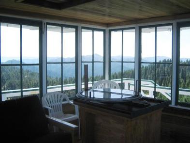
The lookout and cabin can accommodate up to eight guests, but up to 12 guests are permitted for an extra fee. The cabin has an entry room with a countertop suitable for organizing supplies and preparing food. Three double beds are provided (one of which is a bunk above the other) in the cabin and a futon in the lookout. The cabin also has a four-seat dining table, three chairs, a bench, a book case, and a wood-burning stove (firewood is provided).
Board games and various books may be available for use. A vault toilet, picnic tables and a campfire ring are outside. No water or electricity is available. Guests should bring plenty of water, food, bedding, flashlights and other basic camp gear (click here for more cabin details).
Nearby Attractions
The Smith River National Recreation Area Visitor Center is about 21 miles, or roughly one hour by vehicle, from the lookout.
Doe Flat and Island Lake Trailheads, which access the Siskiyou Wilderness, are within three miles of the lookout.
Nearby Activities
Biking
Camping
Hiking
Winter sports
Wildlife viewing
Gallery
Directions
Note: Due to Road 17N05 being closed from damage this winter, all access must be obtained via South Fork Road and 16N02 over Ship Mountain. This route is approximately 2 hrs. one way. This is the only access to this facility at this time until road can be repaired. Approximately 18 miles of this route is not paved and has areas of washout. High clearance vehicles or 4×4 is advised.
From Crescent City, head north on Highway 101 and turn right (east) on Hwy 199. Go throught the town of Hiouchi and turn right on county road 427 (South Fork Road) and continue driving 14 miles. Pavement ends and this road becomes Forest Service Road 16N02. Follow this road for 18 miles. You will see an access road (with a sign) on your left with a gate. Following the access road, it is 0.5 miles from the gate to the cabin.
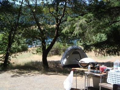
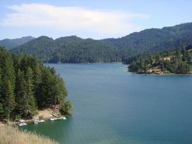
Fir Cove Campground is located on beautiful Ruth Lake, a 13,800-acre jewel situated in the thickly forested mountains of northern California. A variety of recreational
opportunities abound.
It is one of three campgrounds in the region, and one of two on the lake. Bailey Canyon Campground is the companion to Fir Cove. It is located east of Fir Cove and is
first-come, first-serve.
Recreation
The lake provides boating, water skiing, fishing and countless other recreation opportunities.
Anglers can enjoy a catch of small and largemouth bass, catfish, rainbow trout, Kokonee salmon, bluegill and crappie.
Forested peaks and valleys offer ample opportunities for hunting, hiking and off-road vehicle use. The Bailey Vista and Lakeview Trailheads start from Fir Cove, and the Picket Peak Trailhead starts from Bailey Canyon.
Facilities
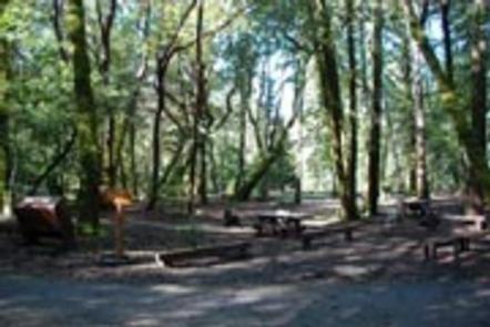
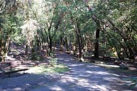
The campground offers several tent-only and multiple combined sites, many of them overlooking the lake. All sites are within a short walk from Ruth Lake. Sites 11 and 12 are companion sites.
Tables and campfire rings with grills are provided, as well as accessible vault toilets and drinking water.
Natural Features
The campground straddles a seasonal creek that empties into Ruth Lake. It is nestled in a mixture of mature Douglas fir, oak, pine and cedar trees at an elevation of about 2,700 feet.
The Six Rivers National Forest lies east of Eureka in northwestern California, stretching southward from the Oregon border for about 140 miles. U.S. 101, the famed "Redwood Highway," parallels the inland Forest along the coastline. The Forest is just east of the Redwood National Park.
Nearby Activities
Boating
Camping
Fishing
Hiking
Water sports
Wildlife viewing
Gallery
Directions
When traveling north on Highway 101, do not turn off at the Zenia Road exit at Garberville. This will result in a 2-hour delay driving on winding back roads. Instead,
continue north until you reach the Hwy 36 exit near Fortuna. Turn right, heading east for approximately an hour until you reach the town of Mad River. After you cross
the bridge at the Mad River, look for the Mad River Road turn-off on the right. The sign will say Ruth Lake. Continue for 20 minutes to reach Fir Cove campground.
If traveling on Interstate 5, turn at Hwy 36 at Red Bluff and head west for 2 hours until you see the sign for Ruth Lake
at Mad River Road.
Boise Creek Campground is nestled between Brush Mountain and Brannan Mountain in northern California’s vast Six Rivers National Forest.
The campground sits under a canopy of large Pacific madrone evergreen, Douglas fir and California bay trees, less than two miles from the small mountain town of Willow Creek, known as the Bigfoot capital of the world.
Fishing, swimming and whitewater rafting are all close by in the popular Trinity River.
Recreation
Fishing, swimming and whitewater rafting are all available in the Trinity River. The area also provides opportunities for biking, hiking and horseback activities, as well as fishing for migratory salmon and steelhead trout.
Campers can walk the 1/2-mile trail from the campground to the nearby Boise Creek and find a swimming hole or explore native plants and wildlife. A drive on the nearby Trinity Scenic Byway is a favorite activity of many visitors.
Facilities
The campground offers several single-family campsites, three of which are for tent camping only. All campsites are furnished with tables and campfire rings with grills. Vault toilets and drinking water are provided.
Natural Features
The campground sits at a 680-foot elevation and provides several shady campsites on a creek about two miles west of the Trinity River. A forest of conifers covers the campground, and stands of oak woodland dot the landscape, providing habitat for eight threatened and endangered species, including the bald eagle and the peregrine falcon.
The Six Rivers National Forest lies east of Eureka in northwestern California, stretching southward from the Oregon border for about 140 miles. U.S. 101, the famed “Redwood Highway,” parallels the inland Forest along the coastline. The Forest is just east of the Redwood National Park.
Nearby Attractions
Boise Creek Campground is located less than two miles west of Willow Creek, where most services are available, including fuel, propane, medical services, restaurants, groceries and laundry facilities.
Visitors can also check out the town’s 18-hole public disc golf course or participate in the area’s numerous cultural and social events, like the annual Bigfoot Days on Labor Day weekend.
Three miles southwest of Willow Creek lies the Brush Mountain Lookout tower, which, at 3,988 feet, provides a 360-degree view of the forest’s sweeping canyons and valleys.
Nearby Activities
Biking
Boating
Historic & cultural site
Camping
Fishing
Hiking
Hunting
Visitor center
Water sports
Wildlife viewing
Swimming site
Gallery
Directions
From Willow Creek, California, take State Route 299 for 2 miles west. Enter the campground directly from the highway.
Panther Flat Campground sits in the vast Six Rivers National Forest in northern California. This shady, secluded campground is just steps from the Smith River, which is famous for its bright blue waters and scenic pathway through the forest.
Recreation
Popular activities include swimming, sunbathing, rafting and fishing in the Smith River. Anglers enjoy healthy fishing populations of salmon, steelhead and cutthroat trout.
Visitors also enjoy hiking, horseback riding and biking in the area. There are no trailheads in the campground, but Elk Camp Ridge, High Dome and French Hill trailheads are all within 10 miles of the site. A Botanical trail to a unique Darlingtonia bog is just a mile away.
Facilities
The campground offers multiple single-family sites and at least one double site, available for tent and RV camping. It is one of the most modern campgrounds in the area and has some of the largest parking aprons. Some sites are available on a first-come, first-served basis.
Campsites are equipped with tables and campfire rings with grills. Accessible flush toilets, coin-operated hot showers and drinking water are provided. The Visitor Center at the Gasquet Ranger Station provides free maps and brochures of the area.
Natural Features
Set in a mature forest of Douglas fir, cedar and Pacific madrone trees, the campground is a short walk from the pristine Smith River. The river boasts up to Class 5 whitewater rapids. The region, thick with vegetation, is also freckled with huckleberry shrubs.
The Six Rivers National Forest lies east of Eureka in northwestern California, stretching southward from the Oregon border for about 140 miles. U.S. 101, the famed "Redwood Highway," parallels the inland Forest along the coastline. The Forest is just east of the Redwood National Park.
Nearby Attractions
California’s Redwood National Park and the Pacific Ocean are within 20 miles of the campground.
Annual events include Gasquet Raft Race in July and Del Norte County Fair in August.
Nearby Activities
Camping
Fishing
Swimming site
Gallery
Directions
From Highway 101 north of Crescent City, California, take highway 199 east for 16 miles to the campground.
Patrick Creek Campground sits at the confluence of Patrick Creek and the middle fork of Smith River in the vast Six Rivers National Forest of northern California.
The campground has a special charm, with steps, rock walls, restrooms and sunken campfire circles built in the 1930s by the Civilian Conservation Corps.
Recreation
Popular activities include swimming, sunbathing, rafting and fishing in the Smith River, which is just adjacent to the campground. Anglers can expect healthy fishing populations of salmon, steelhead and cutthroat trout.
Visitors also enjoy hiking, horseback riding and biking in the area. There are no trailheads in the campground, but Elk Camp Ridge, High Dome and French Hill trailheads are all within 10 miles of the site.
Facilities
The campground offers multiple single-family accessible campsites, available for tent and RV camping. Tables and campfire rings with grills are provided. Accessible flush toilets and drinking water are also available.
Natural Features
Patrick Creek is located in a mature forest of Douglas firs in the northernmost part of California. A popular historic lodge and restaurant lie just across the highway from the campground.
The Six Rivers National Forest lies east of Eureka in northwestern California, stretching southward from the Oregon border for about 140 miles. U.S. 101, the famed “Redwood Highway,” parallels the inland Forest along the coastline. The Forest is just east of the Redwood National Park.
Nearby Activities
Biking
Historic & cultural site
Camping
Fishing
Hiking
Swimming site
Directions
From Highway 101, north of Crescent City, California, travel east on Highway 199 for 22 miles to the campground.
Grassy Flat Campground borders California’s northern Redwood Highway in the expansive Six Rivers National Forest.
This shady campground provides ample sightseeing and recreation opportunities and is just steps away from the wild whitewater of the Smith River, which is famous for its bright blue waters and scenic pathway through the forest.
Recreation
Popular activities include swimming and sunbathing, rafting and fishing in the Smith River, which is just steps from the campground. Anglers enjoy healthy fishing populations of salmon, steelhead and cutthroat trout.
Visitors also enjoy hiking, horseback riding and biking in the area. There are no trailheads in the campground, but Elk Camp Ridge, High Dome and French Hill trailheads are all within 10 miles of the site.
Facilities
The campground provides multiple single-family sites for tent or RV camping. Some sites are available on a first-come, first-served basis. Each site is equipped with tables and campfire rings with grills. Accessible vault toilets are provided. Water is not available at this facility.
Natural Features
Grassy Flat is located in a Douglas fir and hardwood forest. Smith River boasts up to Class 5 whitewater rapids. The region, thick with vegetation, is also freckled with huckleberry shrubs.
The Six Rivers National Forest lies east of Eureka in northwestern California, stretching southward from the Oregon border for about 140 miles. U.S. 101, the famed "Redwood Highway," parallels the inland Forest along the coastline. The Forest is just east of the Redwood National Park.
Nearby Attractions
Madrone Flat, located across the bridge, provides excellent river access. Various state parks, providing scenic exploration opportunities, are just a short drive from the campground.
Annual events in the area include the Gasquet Raft Race in July and the Del Norte County Fair in August. A small airport is about 6 miles away, in the town of Gasquet.
Nearby Activities
Boating
Camping
Fishing
Hiking
Swimming site
Directions
From Highway 101 north of Crescent City, California, take Highway 199 east for 18
miles to Grassy Flat Campground.