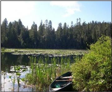
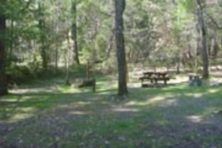
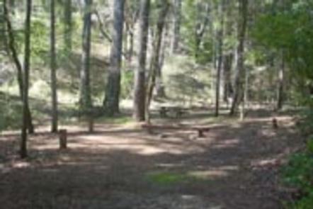
Surrounded by oaks and firs, Muslatt Lake only encompasses a little over 1 acre.
Directions
GPS Coordinates
Latitude 41° 43′ 54.2568″ N
Longitude 123° 41′ 59.5284″ W
Surrounded by oaks and firs, Muslatt Lake only encompasses a little over 1 acre.
Latitude 41° 43′ 54.2568″ N
Longitude 123° 41′ 59.5284″ W
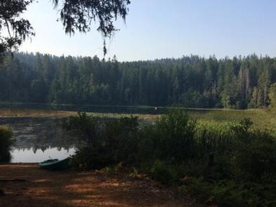
Island Lake encompasses 4 acres. Exposed granite, willows and alders contribute to the tranquil scenery. The lake is currently stocked with rainbow trout.
Latitude 41° 45′ 36.4284″ N
Longitude 123° 41′ 46.7520″ W
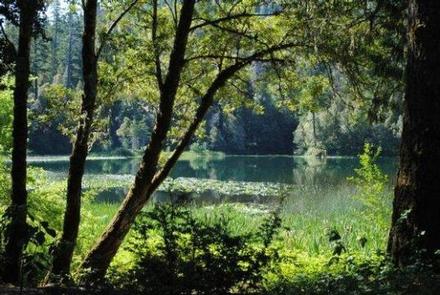
Dry Lake, encompassing 3.25 acres, lies in a quiet setting of willow, alder, oaks, firs, and myrtles (bay). The lake is currently stocked with rainbow trout. Maximum depth is nine feet. Dry lake is located off of County Road 405.
Latitude 41° 44′ 30.6132″ N
Longitude 123° 52′ 32.7900″ W
Originally a pack train trail between Crescent City, CA and the gold mines of the Illinois Valley in Oregon, this scenic trail presents panoramic views of high mountain peaks, the Pacific Ocean, and the North and Middle Forks of the Smith River. The first half-mile from the lower trailhead was burned over in the Panther Fire of 1996. Parts of the trail were burned over in the Panther Fire of 1996 and and the Biscuit Fire of 2002. The trail was last maintained in 2011.
Latitude 41° 53′ 14.7804″ N
Longitude 123° 53′ 55.5432″ W
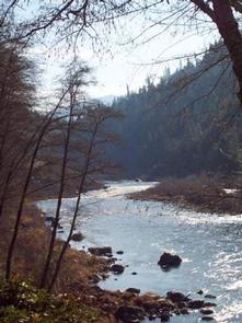
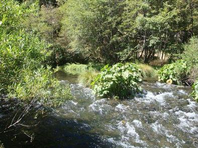
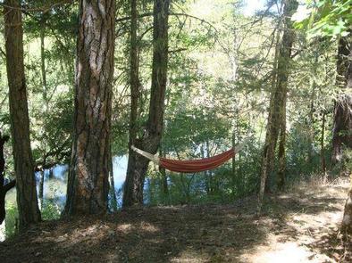
North Fork Campground is a quiet, semi-shaded, remote campground bordered by the North Fork of the Smith River. This is a perfect place to “get away from it all” and to stay before rafting the Wild North Fork. The campground is also popular with four-wheel-drive groups who enjoy driving the jeep trails and back roads of the area.
The landscape surrounding the campground is dramatically steep and rocky. The vegetation is sparse due to the serpentine soil which stunts plant growth. The Biscuit Fire swept through the area in 2002, burning much of the vegetation in the surrounding area.
Spring and early summer bring beautiful wildflowers to the area including the fragrant western azalea and beautiful blue brodiaeas. The campground is within the North Fork Smith River botanical area, which harbors many rare plants adapted to the serpentine soil.
Access to the North Fork of the Smith River is ¼ mile west of the campground at the North Fork river access (also known as Brown’s Flat and Major Moore’s). There are some nice pools but the water is very chilly and the shoreline is very cobbled except for a small patch of sand at the upstream end. It is a good place to sit on a rock and soak your feet on a hot day.
Click on the “Photos and Multimedia” link on the right sidebar to view a photo of the North Fork river access.
It is a 2-hour drive over rocky gravel roads to reach the campground. High clearance is not required but large motorhomes are not advised.
From the Visitor Center travel west on Highway 199 for 2.6 miles; turn right onto Forest Road 17N49 and travel 7.7 miles; turn right onto County Road 305 (Low Divide Road) and travel east 15 miles to Forest Road 18N28 which is just past the North Fork Bridge. Follow 18N28 to the Campground.
The campground can also be accessed off of Highway 197 (North Bank Road) via County Road 305 (Low Divide Road) or from Highway 101 near the town of Smith River via County Road 308 (Rowdy Creek Road).
Latitude 41° 58′ 44.6304″ N
Longitude 123° 57′ 38.5704″ W
Recreational activities abound in the Smith River NRA. The beautiful Smith River offers fishing for steelhead, trout, and salmon. During the summer months, the pure, clean waters of the Smith River are perfect for swimming, rafting, or fishing and the forested mountainsides present occasions for hiking, bird watching, wildflower walks, or perhaps just lounging in the sun.
Winter temperatures drop into the 40s and 50s, with an occasional snow storm. The rainy season normally runs from October through April with an average annual rainfall of 92.55 inches. Summers are dry with highs in the 80-100 degree range. Contact the National Recreation Area Headquarters at the Gasquet Ranger Station for current weather conditions.
Latitude 41° 46′ 43.8816″ N
Longitude 123° 53′ 48.9912″ W
Dillon Creek Campground sits along its namesake creek in the lush forests of northern California. Visitors enjoy a variety of water sports on the nearby Klamath River.
The Klamath and Salmon Rivers offer excellent fishing, swimming and whitewater rafting opportunities.
Fishing for salmon and steelhead during the fall and early winter months is considered the finest in California. Hunting is also a popular pastime, with game including blacktail deer, black bear, blue grouse and quail.
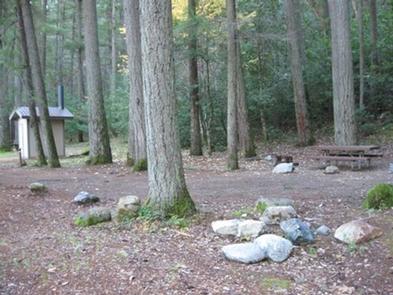
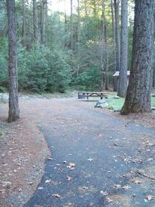
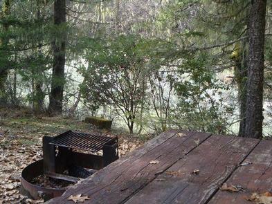
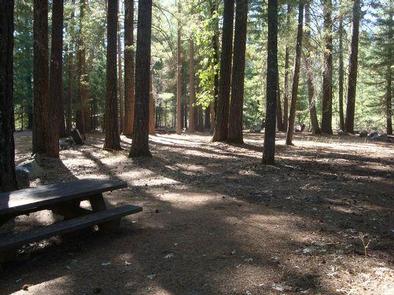
This campground has several single-family campsites, all equipped with picnic tables and campfire rings with grills. Vault toilets and drinking water are provided. A host may be on-site, and roads throughout the campground are paved.
The campground is situated in a forest of mixed hardwoods and conifers at an elevation of 1,780 feet. The Klamath River, a popular site for salmon fishing, runs alongside the site.
From State Route 299 in Willow Creek, take State Route 96 north for 60.2 miles. The campground will be on the left side.
From Interstate 5 in northern California, take State Route 96 southwest, past Happy Camp, for 85.7 miles. The campground will be on the right side.
Latitude 41° 34′ 23.9999″ N
Longitude 123° 32′ 35.0002″ W
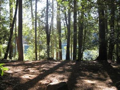
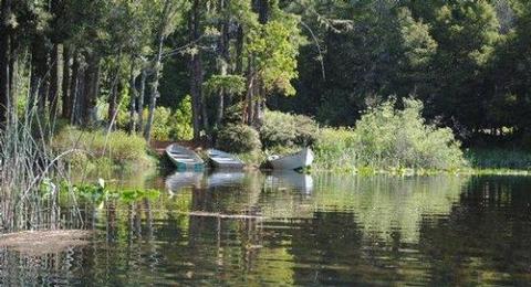
Fish Lake Campground lies on the shore of its namesake at the northwestern edge of Six Rivers National Forest. Lily pads thrive on the lake, and Douglas fir and cedar trees provide ample shade and a secluded camping experience.
Canoeing and swimming are popular activities on the lake. The kayaking, whitewater rafting and fishing at the nearby Klamath, Trinity and Salmon Rivers is considered some of the best in northern California.
Campers can hike a system of trails, including the Blue Lake, Red Lake and Fish Lake trails, all of which have trailheads in the campground.
Visitors also enjoy fishing for trout, bluegill, and bass in the lake or explore native plants and wildlife throughout the lush region.
Most sites are suitable for both tent and RV camping. Vault toilets, drinking water, tables and combination fire ring grills are provided.
Located about 1,780 feet above sea level, the campground is nestled in a mixed hardwood and conifer forest with fir and Port Orford cedar trees that provide low-level shade and friendly midsummer breezes.
Fish Lake is believed to be the second-largest freshwater lake in California’s Humboldt County. Some campsites offer sweeping lake views, while others are within a short walk of the water.
Weitchpec, California, located about 12 miles north of the campground, is home to a Native American Yurok tribe, and Yurok tribal offices, a community center, a small grocery store and gas station are available.
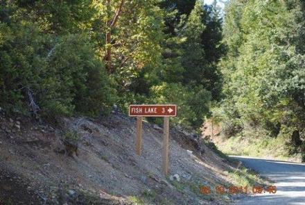
From Orleans, California, take State Route 96 south for about 8 miles. Turn north on Bluff Creek Road and continue about 4.7 miles to Forest Road. Turn right and continue almost 3 miles to the campground.
Latitude 41° 15′ 51.0001″ N
Longitude 123° 41′ 3.9998″ W
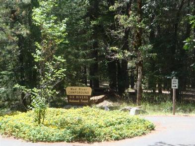
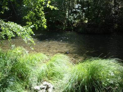
Mad River Campground is located on banks of its namesake river, about two miles south of Ruth Lake in the thickly forested mountains of northern California.
Fishing is a popular activity and anglers can expect to catch a variety of trout in the Mad River. Nearby Ruth Lake is open for boating, swimming and other water-related activities. A marina and boat ramp are available for easy lake access, and maps and directions to the marina are located on the information boards in the campground.
The campground offers multiple single-family campsites, available for tent and RV camping. Some sites are available on a first-come, first-served basis. A majority of the sites are adjacent to the Mad River.
Tables and campfire rings are available at each site. Accessible vault toilets and drinking water are also provided.
The campground is situated on a bluff overlooking the river among a forested area of oak trees and evergreen shrubs. Portions of the campground are capped with tall Douglas fir trees, providing ample shade.
The Six Rivers National Forest lies east of Eureka in northwestern California, stretching southward from the Oregon border for about 140 miles. U.S. 101, the famed "Redwood Highway," parallels the inland Forest along the coastline. The Forest is just east of the Redwood National Park.
The 13,800-acre Ruth Lake is about three miles south of the campground.
When traveling north on Hwy 101, do not turn off at the Zenia Road exit at Garberville. This will result in a 2-hour delay driving on winding back roads. Instead,
continue north until you reach the Hwy 36 exit near Fortuna. Turn right, heading east for approximately an hour until you reach the town of Mad River. After you cross
the bridge at the Mad River, look for the Mad River Road turn-off on the right. The sign will say Ruth Lake. Continue for 10 minutes to reach the Mad River Campground.
If traveling on Interstate 5, turn at Hwy 36 at Red Bluff and head west for 2 hours until you see the sign for Ruth Lake at Mad River Road.
Latitude 40° 24′ 13.0000″ N
Longitude 123° 28′ 1.9999″ W
THIS IS NOT OAK BOTTOM CAMPROUND AT WHISKEYTOWN NATIONAL RECREATION AREA!!! CALL 530-359-2269 FOR INFO.
Oak Bottom Campground is located on a gently sloping hillside in the expansive Six Rivers National Forest in northwest California. It offers a peaceful camping environment, far from road noise and other distractions.
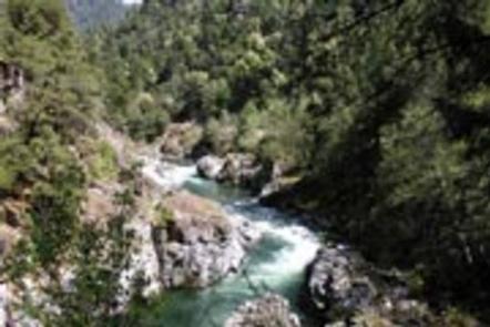
Located near California’s Salmon River, the campground is popular with whitewater enthusiasts in the spring. Many challenging rapids ranging from class 3 to 5 are available.
Swimming is also popular in the summer and numerous river access areas are a short drive or walk from the campground.
In the fall, salmon and steelhead trout fishing in the nearby Klamath River is known to be some of the best in the state.
The campground offers several single-family sites. Each site is equipped with a table and grill, and vault toilets and drinking water are provided. A campground host may be available to answer any questions or provide information.
The campground loops around a forested hillside of mixed Douglas fir and hardwood forest at a 700-foot elevation. Large deciduous trees provide ample shading for multiple sites within the campground, and a variety of wildlife makes its home in the area.
The small town of Somes Bar is 2.5 miles from the campground, where propane, groceries, a post office and tackle are available at a general store.
From Highway 96, take Salmon River Road/Forest Highway 93 for 2.3 miles to Oak Bottom Campground.
Latitude 41° 22′ 37.9999″ N
Longitude 123° 27′ 5.0000″ W