The BLM information centers are located around the periphery of the Monument. BLM personnel at these centers can provide visitors with essential and detailed information.
Grand Staircase-Escalante Visitor Center in Kanab, UT has a focus on “traces in time” which includes both geology and archaeology. The walk-in lottery for permits into Vermillion Cliffs National Monument at North Coyote Buttes (The Wave) and South Coyote Buttes will be conducted at 8:30 a.m. during days of operation. The centers also offer books and maps for purchase through our cooperating interpretive associations.
Directions
The Kanab Visitor Center is located on Highway 89, 1 mile east of junction with alternate 89.
Cottonwood Recreation Area is a day-use facility located in the tailwater area below Saylorville Dam. The 26,000-acre Saylorville Lake Project stretches over 50 miles up the Des Moines River Valley. The lake provides a wide variety of recreational activities, including boating, swimming, fishing, hiking and hunting.
Recreation
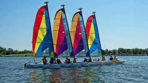
Visitors come to Saylorville Lake for its great boating, sailing, water skiing, windsurfing and swimming opportunities. Anglers fish for walleye, wiper, largemouth bass, catfish, crappie and northern pike.
The paved Neal Smith Trail winds 24 miles from Des Moines to Big Creek State Park and connects the campgrounds on the east side of the lake. It is designated as a National Recreation Trail and is used for biking, hiking, jogging, walking and in-line skating.
Facilities
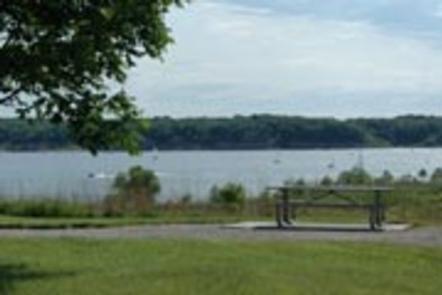
The day-use area offers nine group picnic areas with water and electric hookups. Amenities include flush toilets, a volleyball court, playground and hiking trails.
Natural Features
Cottonwood covers a large open and flat lowland area bordering the east side of the Des Moines River.
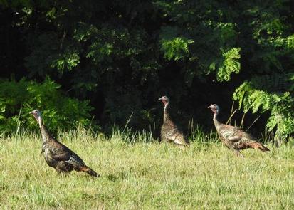
Wildlife is abundant throughout the project. White-tailed deer, turkeys, pheasants, waterfowl, and other small game animals roam the lands around the lake.
Nearby Activities
Biking
Camping
Fishing
Hiking
Wildlife viewing
Directions
Utilize address 7400 NW 37th Street Ankeny IA 50023 (Not a valid mailing address).
From I-35, take Exit 90 in Ankeny and head approxmately 3.5 miles west to NW 84th Ave. Turn Left on 84th Ave and head south apprximately 1.5 miles to Cottonwood Recreation Area on the right.
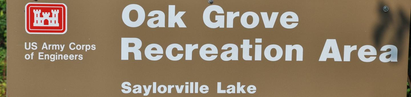
Oak Grove Picnic Area is a day-use facility located on the 26,000-acre Saylorville Lake Project, which stretches over 50 miles up the Des Moines River Valley. The lake provides a wide variety of recreational activities, including boating, swimming, fishing, hiking and hunting.
Recreation
Visitors come to Saylorville Lake for its great boating, sailing, water skiing, windsurfing and swimming opportunities. Anglers fish for walleye, wiper, largemouth bass, catfish, crappie and northern pike.
The paved Neal Smith Trail winds 24 miles from Des Moines to Big Creek State Park and connects the campgrounds on the east side of the lake. It is designated as a National Recreation Trail and is used for biking, hiking, jogging, walking and in-line skating.
Facilities
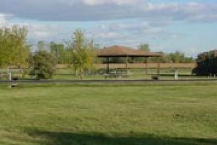
This day-use area offers two group picnic shelters with electric and water hookups. Amenities include flush toilets, a playground, volleyball court and hiking trails.
Natural Features
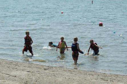
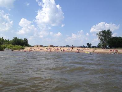
Oak Grove lies among a heavily wooded forest of stately oak trees on the east side of the lake. A large beach is within walking distance.
Wildlife is abundant throughout the project. White-tailed deer, turkeys, pheasants, waterfowl, and other small game animals roam the lands around the lake.
Nearby Activities
Biking
Camping
Fishing
Hiking
Wildlife viewing
Swimming site
Gallery
Directions
Physical Address: 4801 NW 98th Ave, Polk City, IA 50226
From Ankeny, travel 3.4 miles west on 1st Street. Turn right onto HWY 415 for 0.9 miles, then left onto NW 44th street, which turns slightly right and becomes NW 98th Ave. Picnic area is on the right.
Sandpiper Recreation Area is a day-use facility located on the 26,000-acre Saylorville Lake Project, which stretches over 50 miles up the Des Moines River Valley. The lake provides a wide variety of recreational activities, including boating, swimming, fishing, hiking and hunting.
Recreation
Visitors come to Saylorville Lake for its great boating, sailing, water skiing, windsurfing and swimming opportunities. Anglers fish for walleye, wiper, largemouth bass, catfish, crappie and northern pike.
The paved Neal Smith Trail winds 24 miles from Des Moines to Big Creek State Park and connects the campgrounds on the east side of the lake. It is designated as a National Recreation Trail and is used for biking, hiking, jogging, walking and in-line skating.
Facilities
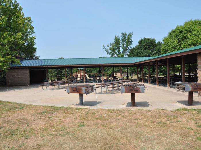
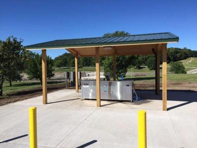
This day-use area contains one large group picnic shelter that can accommodate up to 500 people. Amenities include water and electricity, flush toilets, a playground, large beach, boat ramp and access to hiking and biking trails. A marina is nearby.
Natural Features
Sandpiper is situated in a broad, open area on the northeast side of the lake. Dense timber stands surround the recreation area, but shade is limited within the site.
Wildlife is abundant throughout the project. White-tailed deer, turkeys, pheasants, waterfowl, and other small game animals roam the lands around the lake.
Nearby Activities
Biking
Camping
Fishing
Hiking
Wildlife viewing
Gallery
Directions
Physical Address: 7101 NW Polk City Drive Polk City, IA 50226
From I-35, take Exit 92 and go east on First Street approximately 5 miles to HWY 415. Turn right (north) and travel approximately 3 miles to recreation area on the right.
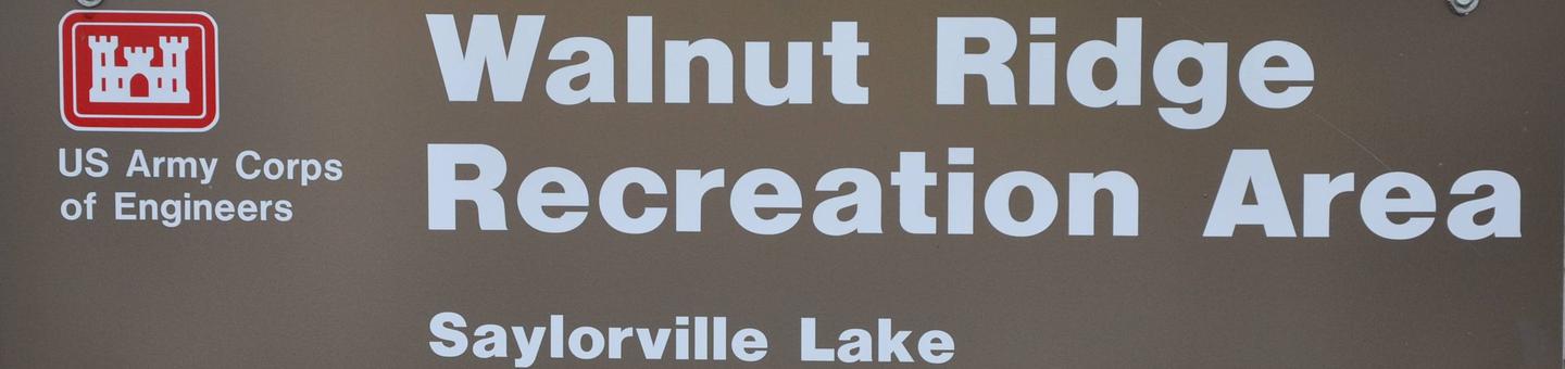
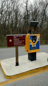
Walnut Ridge Recreation Area is a day-use facility located on the 26,000-acre Saylorville Lake Project, which stretches over 50 miles up the Des Moines River Valley. The lake provides a wide variety of recreational activities, including boating, swimming, fishing, hiking and hunting.
Recreation
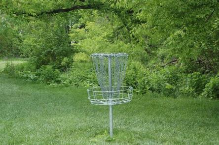
The 18-hole Walnut Ridge Disc Golf Course runs throughout the recreation area. The beautifully manicured course contains both open and wooded fairways with blind pins and tunnel shots.
Visitors come to Saylorville Lake for its great boating, sailing and swimming opportunities. Anglers fish for walleye, wiper, largemouth bass, catfish, crappie and northern pike.
The paved Neal Smith Trail winds 24 miles from Des Moines to Big Creek State Park and connects the campgrounds on the east side of the lake. It is designated as a National Recreation Trail and is used for biking, hiking, jogging, walking and in-line skating.
Facilities
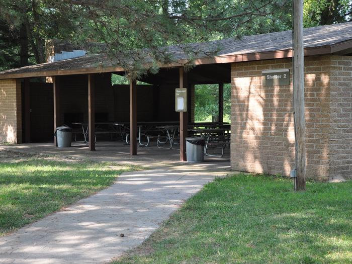
This day-use area offers three group picnic shelters with water and electricity. Amenities include flush toilets, a playground, and hiking trails.
Natural Features
The area is situated on a wooded ridgeland on the west side of Saylorville Lake. Large shade trees cover the area.
Wildlife is abundant throughout the project. White-tailed deer, turkeys, pheasants, waterfowl, and other small game animals roam the lands around the lake.
Nearby Activities
Biking
Camping
Fishing
Hiking
Wildlife viewing
Gallery
Directions
Use address 9125 NW Beave Drive, Johnston IA 50131. From I-35/80 north of Des Moines, take Johnston/Saylorville Lake Exit (131). Go north on Merle Hay Rd for 2.7 miles, then turn left onto NW Beaver Drive for 3.1 miles. Recreation area is 0.3 miles ahead on the right.
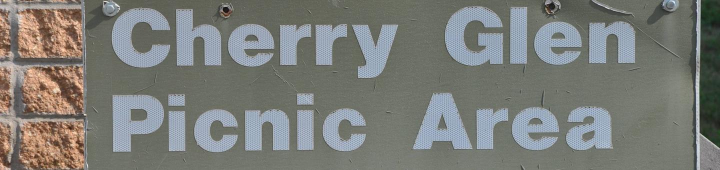
Cherry Glen Picnic Area is a day-use facility located on the 26,000-acre Saylorville Lake Project, which stretches over 50 miles up the Des Moines River Valley. The lake provides a wide variety of recreational activities, including boating, swimming, fishing, hiking and hunting.
Recreation
Visitors come to Saylorville Lake for its great boating, sailing, water skiing, windsurfing and swimming opportunities. Anglers fish for walleye, wiper, largemouth bass, catfish, crappie and northern pike.
The paved Neal Smith Trail winds 24 miles from Des Moines to Big Creek State Park and connects the campgrounds on the east side of the lake. It is designated as a National Recreation Trail and is used for biking, hiking, jogging, walking and in-line skating.
Facilities
This day-use area offers six group picnic shelters, all with electric hookups. Amenities include flush toilets, a playground and hiking trails. Cherry Glen Campground is adjacent as well as Cherry Glen Boat Ramp.
Natural Features
Cherry Glen is nestled on a compact 13-acre wooded ridge. Visiting with family and friends while relaxing in the shade of one of the area’s many trees is a popular pastime.
Wildlife is abundant throughout the project. White-tailed deer, turkeys, pheasants, waterfowl, and other small game animals roam the lands around the lake.
Nearby Attractions
Cherry Glen Campground and Cherry Glen Boat Ramp.
Nearby Activities
Biking
Camping
Fishing
Hiking
Wildlife viewing
Gallery
Directions
Utilize address 4586 NW 94th Avenue Polk City IA 50223 (Not a valid mailing address).
From I-35, take Exit 92 in Ankeny and turn right on East 1st Street. Travel approximately 5 miles west to NW 94th Ave. Continue across HWY 415 approximately .5 miles to Cherry Glen Picnic Area on your right.
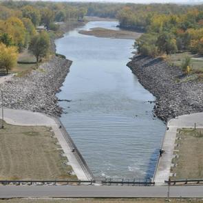
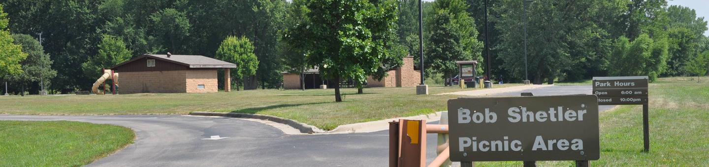
Bob Shetler Picnic Area is a day-use facility located in the tailwater area below Saylorville Dam, and is a popular destination for shoreline fishermen.
The 26,000-acre Saylorville Lake Project stretches over 50 miles up the Des Moines River Valley. The lake provides a wide variety of recreational activities, including boating, swimming, fishing, hiking and hunting.
Recreation
Visitors come to Saylorville Lake for its great boating, sailing, water skiing, windsurfing and swimming opportunities. Anglers fish for walleye, wiper, largemouth bass, catfish, crappie and northern pike.
The paved Neal Smith Trail winds 24 miles from Des Moines to Big Creek State Park and connects the campgrounds on the east side of the lake. It is designated as a National Recreation Trail and is used for biking, hiking, jogging, walking and in-line skating.
Facilities
The day-use area offers two large group picnic areas with water and electric hookups. Amenities include flush toilets, a volleyball court, playground and hiking trails.
Natural Features
Large shade trees dot the open grassy land around the picnic area, which offers pleasant views of the Des Moines River.
Wildlife is abundant throughout the project. White-tailed deer, turkeys, pheasants, waterfowl, and other small game animals roam the lands around the lake.
Nearby Activities
Biking
Camping
Fishing
Hiking
Wildlife viewing
Gallery
Directions
From I-35, take the Ankeny Exit #90 (Oralabor Road) and go west 4.8 miles; the road turns into HWY 415. Turn left (west) onto NW 37th Street and go 0.3 mile, then turn right onto NW Horseshoe Rd. Turn right and drive across the Saylorville Lake Dam to the campground.
From I-80, take Exit #135 (2nd Avenue/Highway 415) exit and go north 3.5 miles. Turn left (west) onto Oralabor Road (Highway 415) and go 2.6 miles. Turn left (west) onto NW 37th Street and go 0.3 mile, then turn right onto NW Horseshoe Rd. Turn right and drive across the Saylorville Lake Dam to the campground.
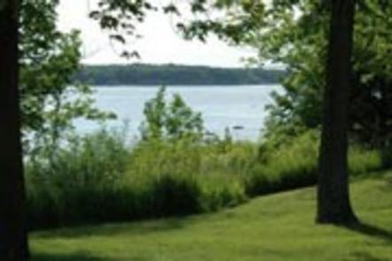
Prairie Flower Recreation Area is located on the 26,000-acre Saylorville Lake Project, which stretches more than 50 miles up the Des Moines River Valley.
The lake provides a wide variety of recreational activities, including boating, swimming, fishing, hiking and hunting.
Recreation
Visitors enjoy Saylorville Lake for its excellent boating, sailing, water skiing, windsurfing and swimming opportunities. Anglers will find walleye, wiper, largemouth bass, catfish, crappie and northern pike.
The paved Neal Smith Trail winds 24 miles from Des Moines to Big Creek State Park and connects the campgrounds on the east side of the lake. It is designated as a National Recreation Trail and is used for biking, hiking, jogging, walking and in-line skating.
Facilities
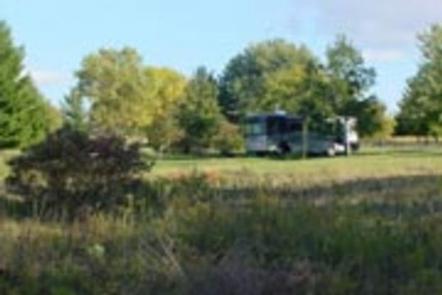
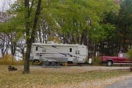
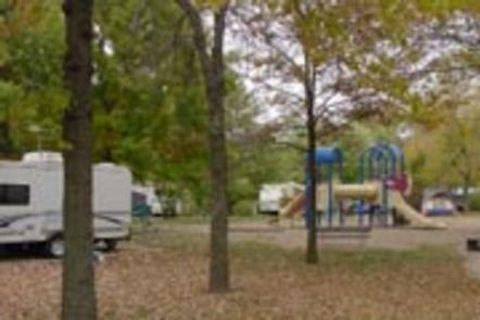
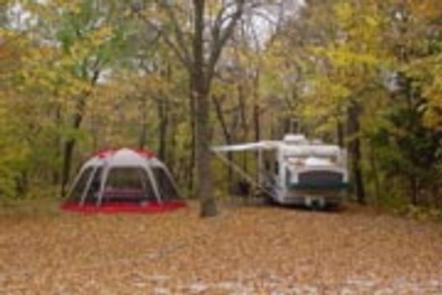
Prairie Flower is a large, open campground covering more than 60 acres. It offers 153 family sites and 10 group sites, all with electric hookups. Many of the family sites in the south end offer a pleasant view of the 6000-acre lake. The north end is made up of mostly group sites in a circle-the-wagon design.
Amenities include flush toilets, showers, drinking water and a dump station. The campground also provides educational programs, group shelters, playgrounds and a swimming beach.
Nearby amenities include a visitor center, hiking trail, volleyball courts and a disc golf course. Boat ramps and a fishing dock are also close by.
Natural Features
Iowa’s prairie heritage is celebrated in more than 40 acres of prairie plantings throughout the campground. The wide variety of grass and flowers provides vivid colors from mid-summer to fall.
Wildlife is abundant throughout the project. White-tailed deer, turkeys, waterfowl and other small game animals roam the lands around the lake.
Nearby Activities
Biking
Boating
Camping
Fishing
Hiking
Hunting
Water sports
Swimming site
Gallery
Directions
From I-35, take exit 90 to Ankeny/Oralabor Road and go west for 4.8 miles. The road turns into Highway 415, continue and follow signs to the campground.
Cherry Glen Campground is located on the 26,000-acre Saylorville Lake Project, which stretches more than 50 miles up the Des Moines River Valley.
The lake provides a wide variety of recreational activities, including boating, swimming, fishing, hiking and hunting.
Recreation
Visitors enjoy Saylorville Lake for its excellent boating, sailing, water skiing, windsurfing and swimming opportunities. Anglers will find walleye, wiper, largemouth bass, catfish, crappie and northern pike.
The paved Neal Smith Trail winds 24 miles from Des Moines to Big Creek State Park and connects the campgrounds on the east side of the lake. It is designated as a National Recreation Trail and is used for biking, hiking, jogging, walking and in-line skating.
Facilities
This large campground offers 125 family sites, all with electric hookups. Amenities include flush toilets, showers, drinking water and a dump station.
Educational programs, group shelters, playgrounds, and a boat ramp all provide additional recreation opportunities for guests.
Nearby amenities include a visitor center, hiking trail and a disc golf course.
Natural Features
Cherry Glen, the oldest and most popular campground on the lake, is nestled on a compact 13-acre wooded ridge.
Wildlife is abundant throughout the project. White-tailed deer, turkeys, waterfowl and other small game animals roam the lands around the lake.
Nearby Activities
Biking
Boating
Camping
Interpretive programs
Fishing
Hiking
Hunting
Water sports
Wildlife viewing
Swimming site
Gallery
Directions
From I-35, take exit 90 to Ankeny Industrial Parkway. Continue onto Highway 160 west for 4.8 miles. The road turns into Highway 415. Continue for another 4 miles and follow signs into the campground.