Categories
Uncategorized

Hidden Canyon Trail

Recommended Users: Mountain Bikers, Hikers. Singletrack trail. 1.9 miles in length. Difficulty: Most Difficult. Hidden Canyon is aptly named. The trail is a mix of dirt and slick rock that winds though and around a maze of sandstone hills. In addition to narrow passages and slots, there are plenty of domes and bowls.

Directions

White Trailhead – From City of St. George travel north on Interstate 15. Take exit 16 to Hurricane City. Turn right on Main Street. Take the first left onto State Route 59. Travel 14.4 miles on SR 59 and turn left on Smithsonian Butte National Backcountry Byway. At 2.8 miles from the SR 59, turn left and travel northwest 3.3 miles until reaching the Gooseberry Trailhead. Turn left at the Gooseberry Trailhead and travel west for 1.3 miles to reach the White Trailhead.

GPS Coordinates

Latitude 37° 8′ 19.2244″ N

Longitude 113° 11′ 45.9456″ W

Categories
Uncategorized

Connector Trail

Recommended Users: Mountain Bikers, Hikers. Singletack trail. 0.08 miles in length. Difficulty: Easiest. The Connector Trail is used as a bail-out route from the North Rim Trail. Conversely it offers quick access to the North Rim Trail from the White Trail.

Directions

White Trailhead – From City of St. George travel north on Interstate 15. Take exit 16 to Hurricane City. Turn right on Main Street. Take the first left onto State Route 59. Turn left on Smithsonian Butte National Backcountry Byway. At 2.8 miles from the SR 59, turn left and travel northwest 3.3 miles until reaching the Gooseberry Trailhead. Turn left at the Gooseberry Trailhead and travel west for 1.3 miles to reach the White Trailhead.

GPS Coordinates

Latitude 37° 8′ 20.2452″ N

Longitude 113° 11′ 39.8544″ W

Categories
Uncategorized

Bowls and Ledges Trail

Recommended Users: Mountain Bikers, Hikers. Singletrack trail. 1.1 miles in length. Difficulty: More Difficult. : The name of the trail speaks to what you will find here: bowls and ledges. Use caution. Although this trail is rated More Difficult, more advanced skills are required in some sections.

Directions

White Trailhead – From City of St. George travel north on Interstate 15. Take exit 16 to Hurricane City. Turn right on Main Street. Take the first left onto State Route 59. Turn left on Smithsonian Butte National Backcountry Byway. At 2.8 miles from the SR 59, turn left and travel northwest 3.3 miles until reaching the Gooseberry Trailhead. Turn left at the Gooseberry Trailhead and travel west for 1.3 miles to reach the White Trailhead.

GPS Coordinates

Latitude 37° 8′ 39.8921″ N

Longitude 113° 10′ 37.9844″ W

Categories
Uncategorized

Westwater Canyon River Permits

Westwater Canyon is the first whitewater stretch on the Colorado River in Utah. The canyon is 17 miles long and includes Class IV rapids, is challenging at all water levels, and is only recommended for experienced boaters. As with any remote river section, Westwater can be a very humbling and dangerous place if not treated with proper respect and ability. Due to heavy recreational demand and to protect the primitive nature of the Canyon, permits are required year-round for private and commercial use. Between April 1st and September 30th, private use is limited to five permits or 75 people (whichever occurs first) per day; commercial use is limited to 75 passengers per day. From October 1st through March 31st, use is limited to seven permits or 150 people per day. Permit fees are NON-REFUNDABLE.

Gallery

Directions

Westwater Ranger Station (the put-in): From Interstate 70, take exit 227. Turn south at the stop sign and proceed for nine miles to the Ranger Station. Alternate Route: From I-70, take exit 221. Turn north at the stop sign. Turn right onto the road paralleling I-70. Turn left shortly after passing over Westwater Creek. Follow this road for 4.5 miles to the Ranger Station. Do not attempt this route during or shortly after inclement weather. The section of the road under the Interstate becomes impassable when wet.

GPS Coordinates

Latitude 39° 5′ 10.9680″ N

Longitude 109° 6′ 5.1120″ W

Categories
Uncategorized

Westwater Group Site (Ranger Station)

Overview

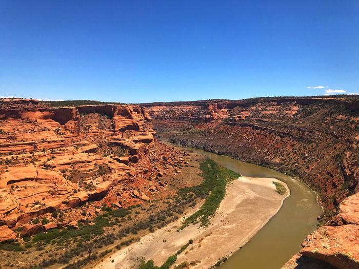
Welcome to the wild and remote canyons and rivers of Eastern Utah, where approximately 10,000 people float the Westwater Canyon section of the Colorado River each year. This 17-mile stretch of the Colorado River is surrounded by the Westwater Wilderness Study Area. 

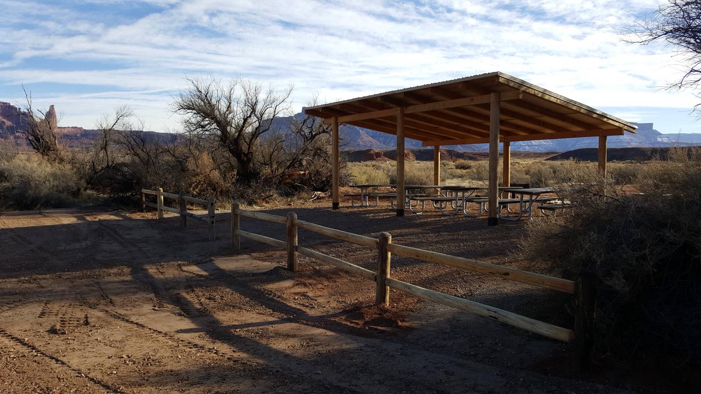
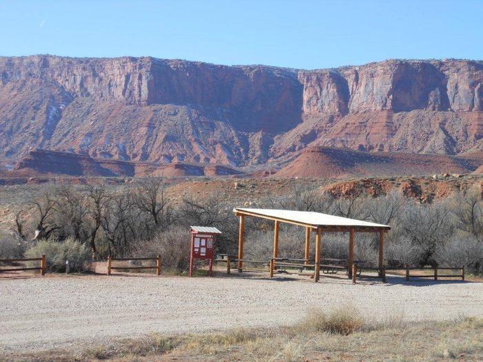
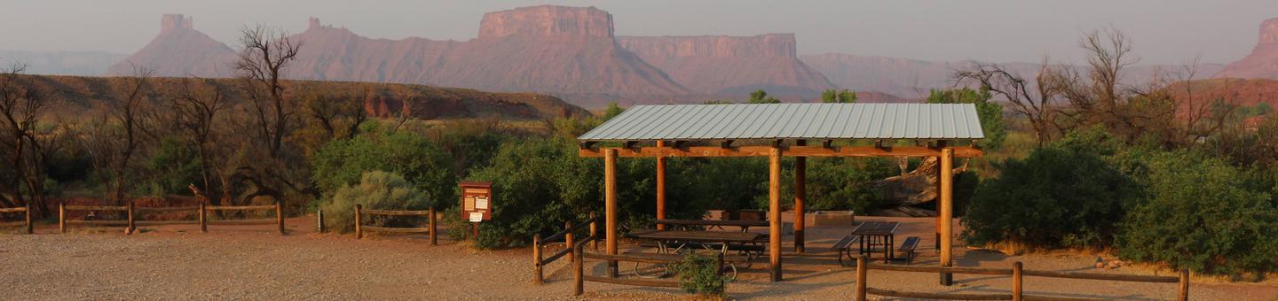
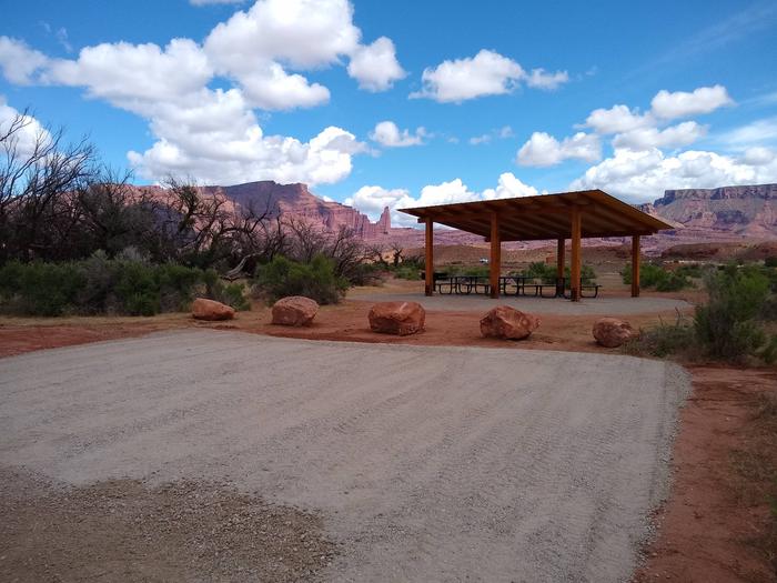
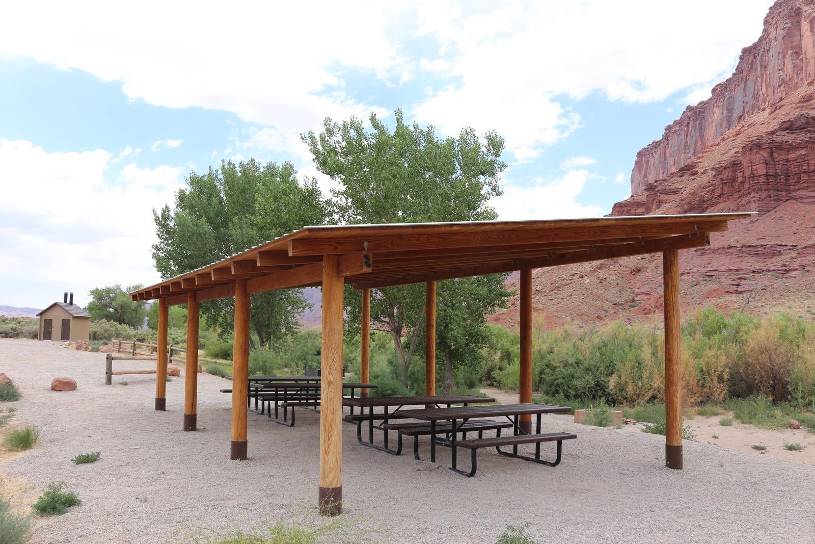
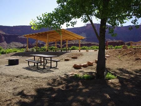
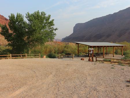
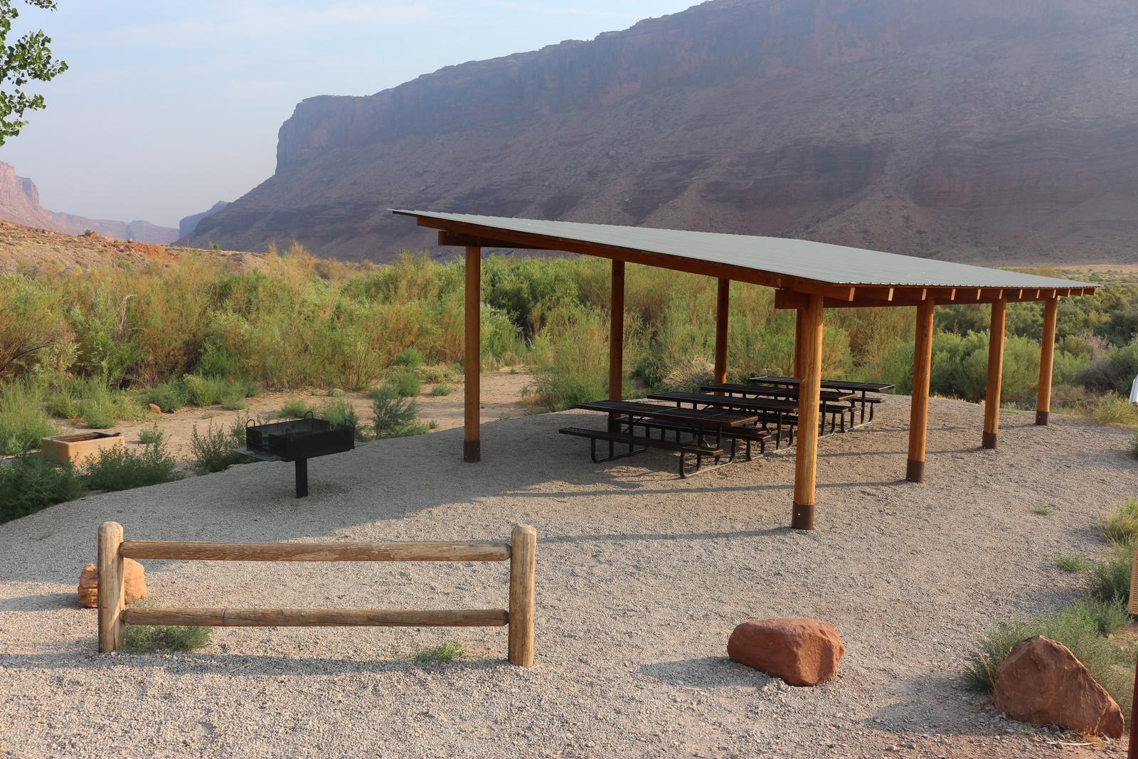
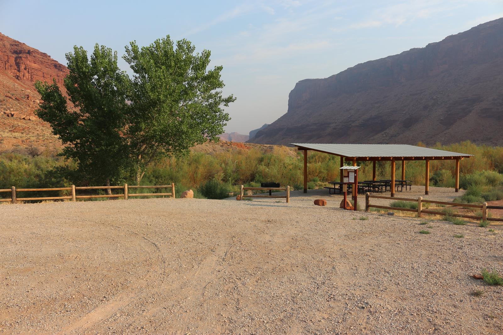
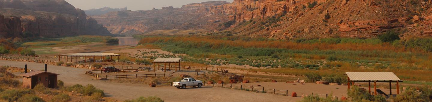
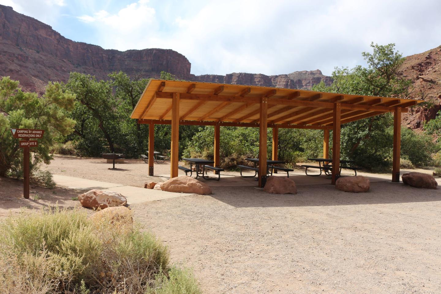
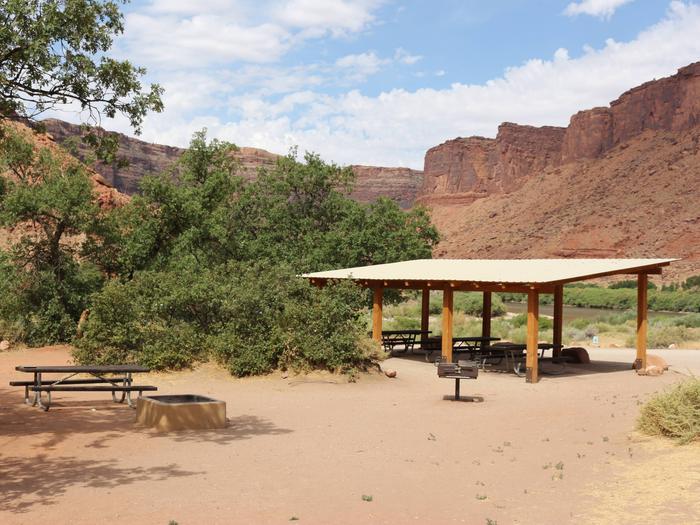
The Westwater Group Site is located near the ranger station and put-in. This site is ideal for large groups looking to camp along the river. 

Recreation

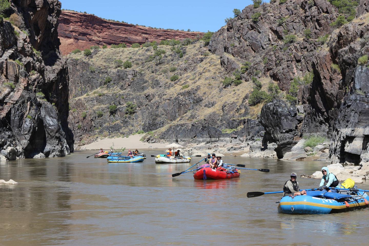
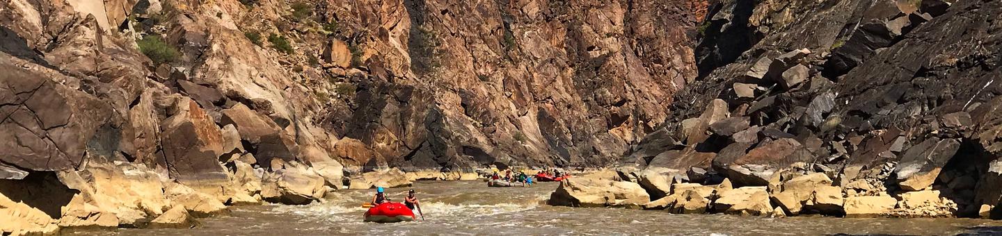
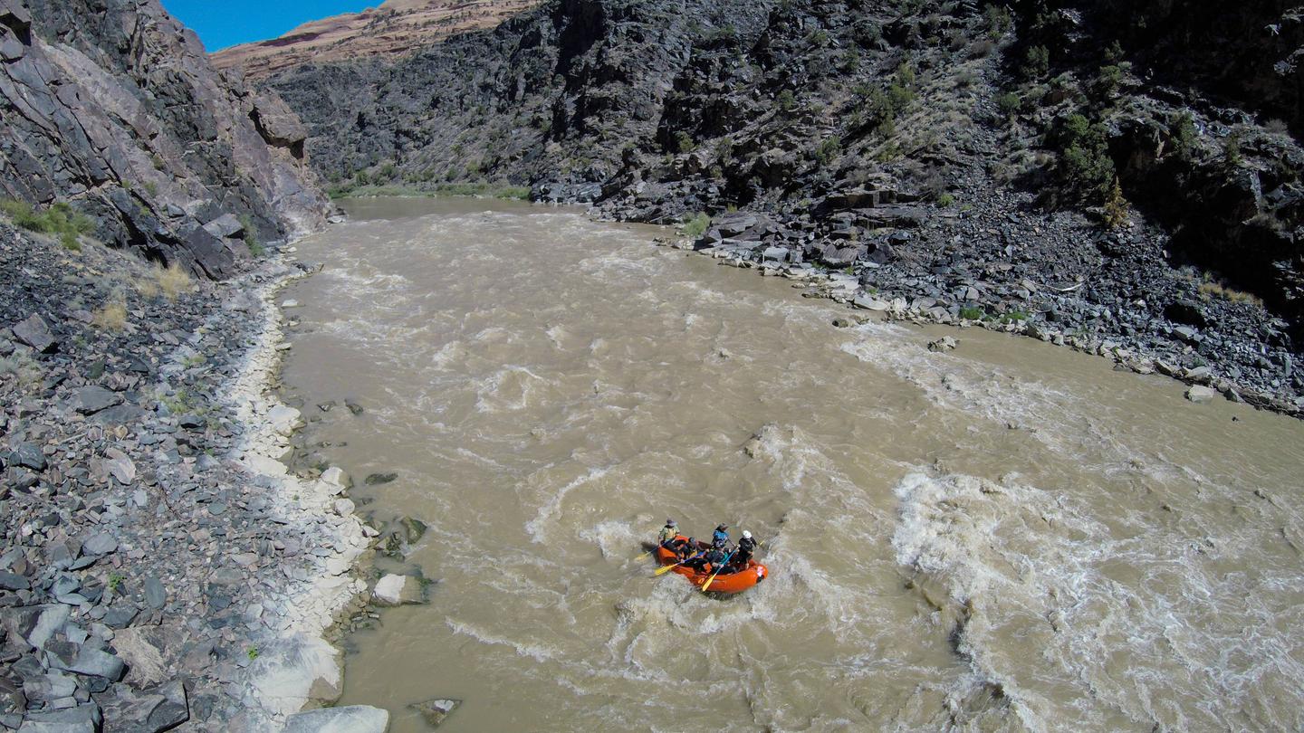
The Colorado River is known world-wide for extraordinary whitewater trips from the Ruby-Horsethief section up river of Westwater Canyon to Cataract Canyon and the Grand Canyon downstream. Westwater Canyon offers boating excitement for experienced adventurers to test their skills navigating the 11 named rapids ranging in difficulty from class I to class IV. 

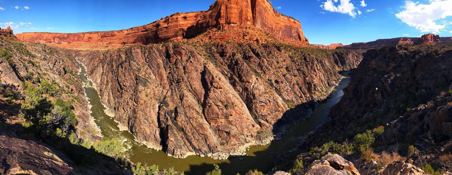
While rafting down the canyon, the area offers views of incredible geology, hiking with glimpses of abandoned settler cabins and caves, as well as opportunities for camping. Just north of the site, many motorized and non-motorized trails can be found paralleling the rim of canyons and traversing technical slick rock. 

Westwater Canyon employs a permit system to protect it from excessive human impacts. This area is extremely remote and rugged, and it’s important to keep it this way. To help protect the purity of the area and as a part of the protection plan, we ask that you learn and practice “Leave No Trace” Ethics. 

Facilities

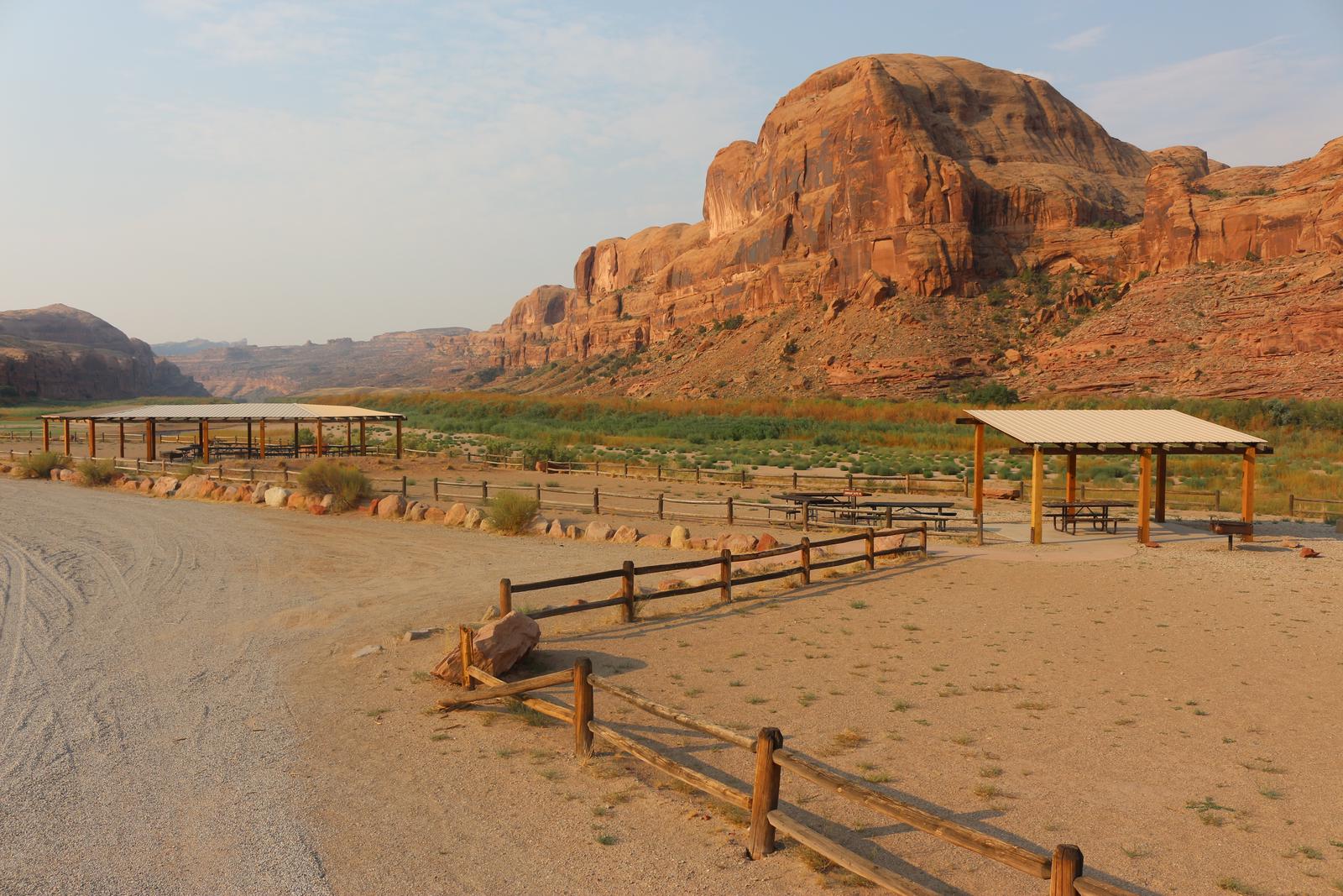
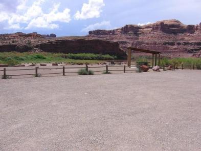
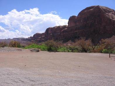
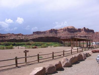
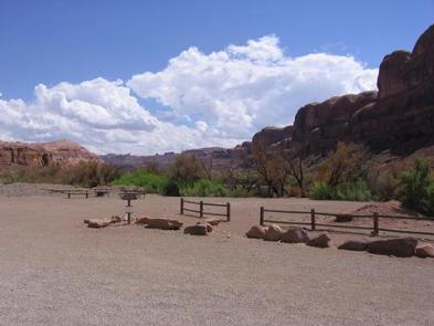
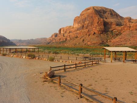
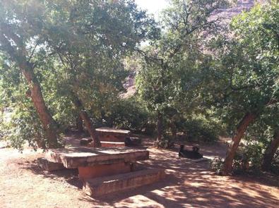
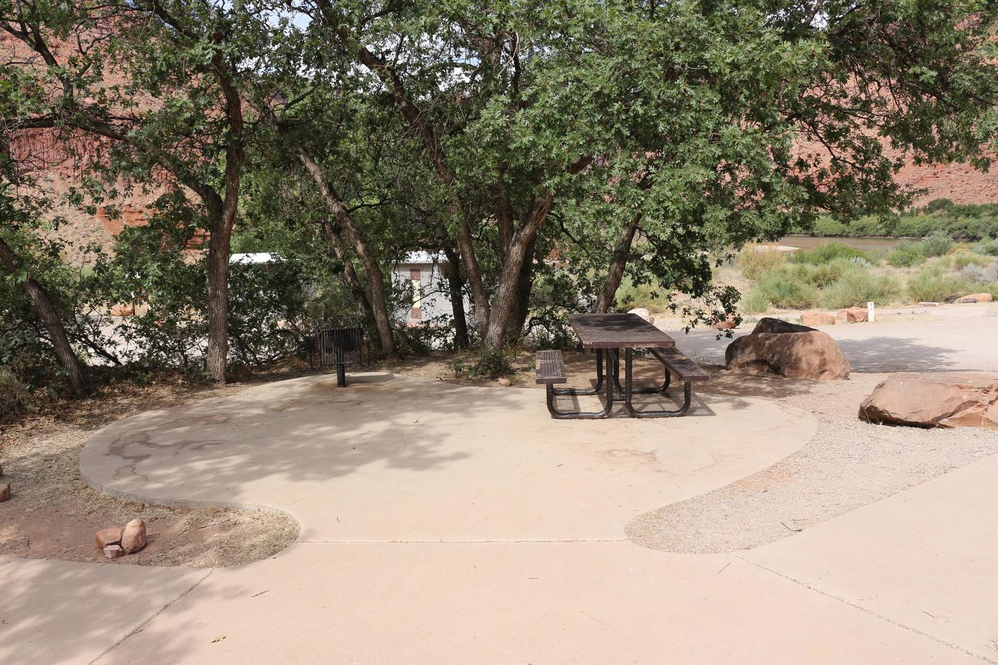
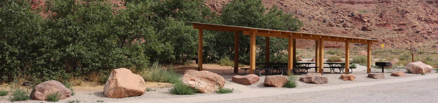
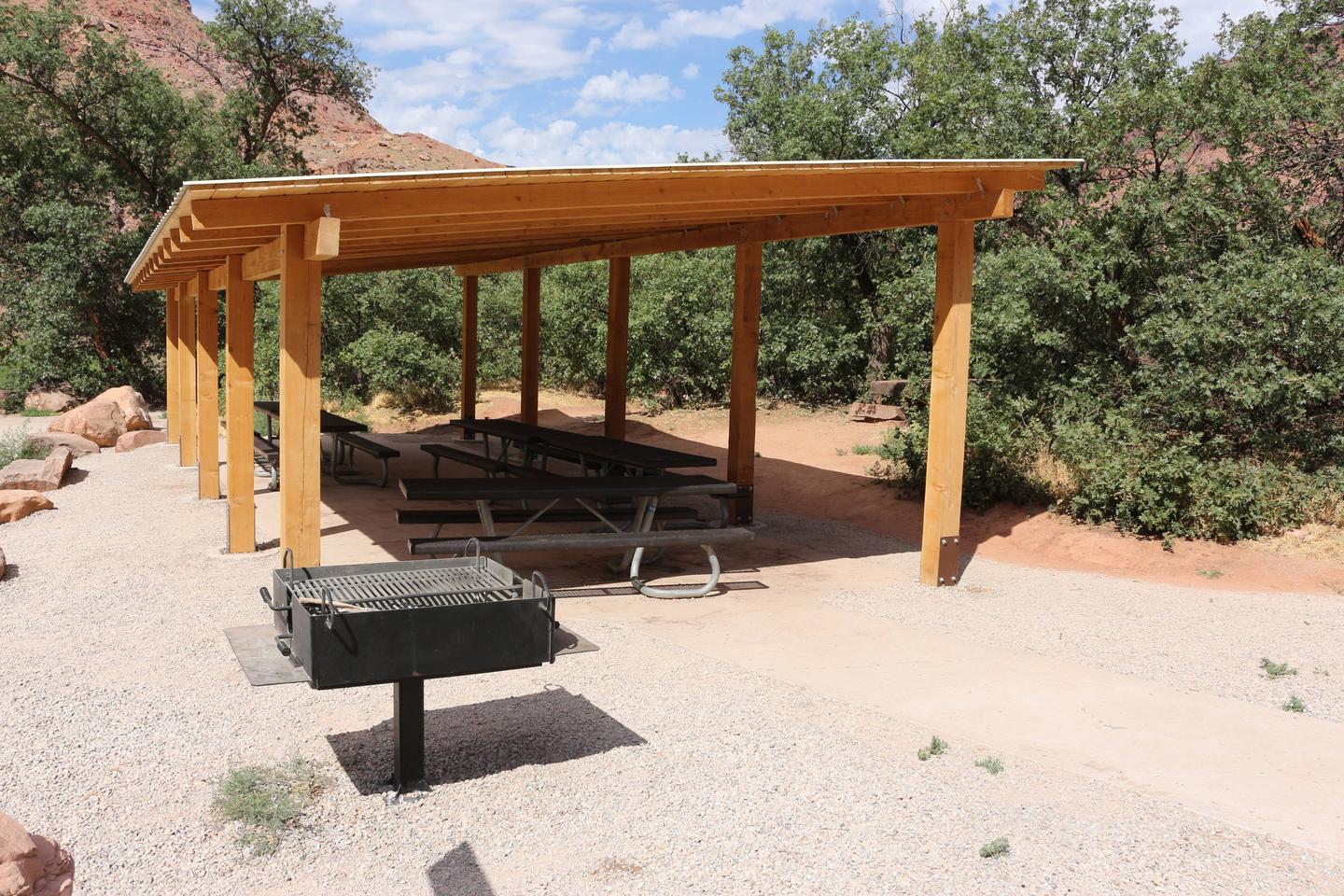
The group site includes a shade shelter with picnic tables and a fire ring where large groups of up to 30 people can gather. Parking spaces for up to 10 vehicles are provided as well as a vault toilet. 

Natural Features

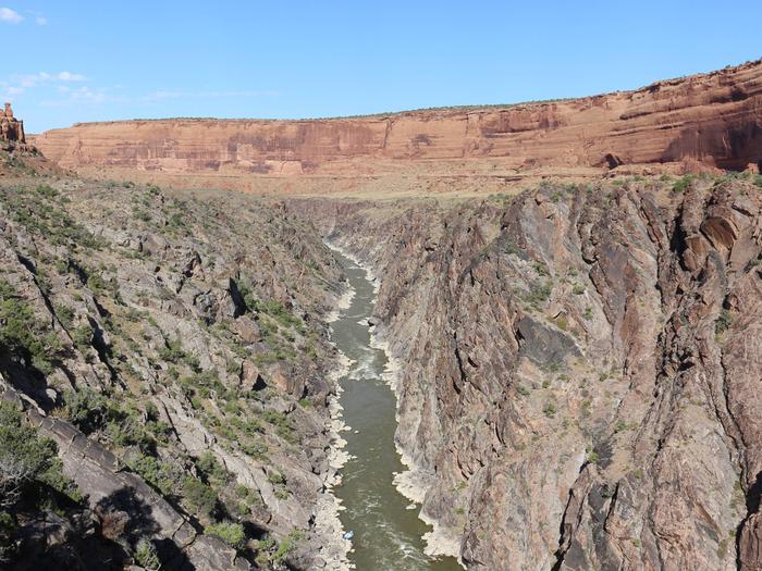
The site is adjacent to the Colorado River as it meanders through a valley. Views of Navajo Sandstone walls surrounding the valley can be seen from the site. 

Nearby Attractions

Moab, UT is located 70 miles southwest, where Arches and Canyonlands National Parks are nearby. Grand Junction, CO is located 35 miles east, where McInnis Canyon and Colorado National Monuments are nearby.

Nearby Activities

  • Boating
  • Camping
  • Ranger station
  • Rafting
  • Whitewater rafting

Directions

From Grand Junction Colorado (westbound traffic):

Take I-70 from Grand Junction for approximately 35 miles to exit 227. Turn south at the stop sign and proceed for nine miles to the Ranger Station and put-in.

From the west (eastbound traffic):

Take exit 227 on I-70, then head south at the stop sign. Proceed for nine miles to the Ranger Station and put-in. 

GPS Coordinates

Latitude 39° 5′ 19.5720″ N

Longitude 109° 6′ 14.2920″ W

Categories
Uncategorized

Hittle Bottom Recreation Site

Hittle Bottom Recreation Site is located along the banks of the Colorado River, offering sweeping vistas of the river canyon, Fisher Towers, and striking red rock formations. The area is a popular launch site for Moab Daily river trips down the Colorado River. The campground has 15 individual campsites and one group campsite. The campground accommodates large RVs, as well as, tents. The site is ideal for small family or group gatherings. Visitors also enjoy the historic homestead on site.

Within close proximity to national parks and open space, outdoor enthusiasts will enjoy hiking, mountain biking, whitewater rafting, and four-wheel drive tours in the surrounding area. The town of Moab is approximately 45 minutes away and has dining, shopping, sports rentals, tour companies and museums.

Recreation:


This site a popular launch site for river running and close to hiking, mountain biking and four-wheel driving opportunities. The river corridor is filled with canyons, trails and scenic vistas. Arches and Canyonlands National Parks are nearby and have many hiking trails and four-wheel drive roads.

Campground:


Campsites are located along the banks of the Colorado River offering sweeping vistas of Fisher Towers and Castle Valley. Individual sites are available on a first-come, first-serve basis. One group site is available for reservation through Recreation.gov. This campground is a very popular put-in for the Colorado “Daily” rafting trip. It has a boat ramp and is near popular dirt roads, rock climbing, hiking and rafting opportunities. (Do not enter the river without the required life jackets; it has dangerous under currents.)

Group Site:


There is one group campsite, which is reservable on recreation.gov. The group site has fire grates, picnic tables, vault toilets and a shade shelter. The group site does not have water, dump stations or electric hook ups.

Directions

From the junction of Hwy. 191 & Hwy 128, drive east 23 miles along the Colorado River on Highway 128. The campground is on the left.

GPS Coordinates

Latitude 38° 45′ 33.3972″ N

Longitude 109° 19′ 26.3100″ W

Categories
Uncategorized

Lower Onion Creek Group Sites

Overview

The Lower Onion Creek Group Sites are located along the banks of the Colorado River. The sites are ideal for small family or group gatherings of 15-30 people (parking is limited and can accomodate only one large RV or truck w/trailer). Lower Onion is also a launch site for river trips. Within close proximity to national parks and open space, outdoor enthusiasts will enjoy hiking, mountain biking, whitewater rafting and four-wheel drive tours in the surrounding area. The town of Moab is approximately 40 minutes away and has dining, shopping, sports rentals, tour companies and museums.

Recreation

This location is close to hiking, mountain biking and four-wheel driving opportunities and is a launch site for river running on the Colorado River.

Facilities

Group sites have fire grates, picnic tables, vault toilets and shade shelters. The group sites do not have water, dump stations or electric hook-ups. A boat ramp is in the campground and near the group sites.

Natural Features

The group sites are located along the Colorado River offering spectacular view of the red rock canyons, buttes, mesas and spires against the backdrop of the nearby La Sal Mountains. A dry creek runs along the back of Group Site A (watch for flash-flooding)!

Nearby Attractions

There are many hiking, mountain biking and four-wheel drive trails along Hwy. 128. The Fisher Towers area offers hiking, rock climbing and scenic vistas. Lower Onion Creek is about 40 minutes from Arches National Park and one hour from Canyonlands National Park.

Nearby Activities

  • Camping
  • Off highway vehicle
  • Recreational vehicles
  • Off road vehicle trails
  • Star gazing
  • Rafting
  • Whitewater rafting

Gallery

Directions

From Moab drive north to the junction with Highway 128. Drive 22 miles on Highway 128 to the entrance to Lower Onion Creek campground, then 1.5 miles north on the gravel road. The group sites are located on the southwest side of the campground.

GPS Coordinates

Latitude 38° 44′ 17.8400″ N

Longitude 109° 21′ 6.3698″ W

Categories
Uncategorized

Hittle Bottom Group Site

Overview

Hittle Bottom Campground is located on the banks of the Colorado River and is a popular launch site for river trips. The group site is ideal for small family or school gatherings. Within close proximity to national parks and open space, outdoor enthusiasts will enjoy hiking, mountain biking, whitewater rafting, and four-wheel drive tours in the surrounding area. The town of Moab is approximately 45 minutes away and has dining, shopping, sports rentals, tour companies and museums.

Recreation

This site is a popular launch site for river running and close to hiking, mountain biking and four-wheel driving opportunities. The river corridor is filled with canyons, trails and scenic vistas. Arches and Canyonlands National Parks are nearby and have many hiking trails and four-wheel drive roads.

Facilities

The group site has fire grates, picnic tables, vault toilets and a shade shelter. The group site does not have water, dump stations or electric hook ups. A boat ramp is in the main campground.

Natural Features

Hittle Bottom is located along scenic Highway 128. The views from the campsite are striking and include Fisher Towers, Professor Valley and the Colorado River.

Nearby Attractions

There are many hiking, mountain biking and four-wheel drive trails along Hwy. 128. The Fisher Towers area offers hiking, rock climbing, and scenic vistas. Hittle Bottom is about 45 minutes from Arches National park and one hour from Canyonlands National Park.

Nearby Activities

  • Biking
  • Boating
  • Camping
  • Hiking
  • Photography
  • Paddling
  • Water activities
  • Kayaking
  • Canoeing
  • Star gazing
  • Non-motorized boating
  • Water access
  • Scenic drive
  • Rafting
  • River trips
  • Whitewater rafting

Gallery

Directions

From Moab, drive north to the junction with Highway 128. Drive 23 miles on highway 128 to the entrance to Hittle Bottom campground. The group site is located on the north end of the campground, just past the main entrance.

GPS Coordinates

Latitude 38° 45′ 33.1898″ N

Longitude 109° 19′ 26.5400″ W

Categories
Uncategorized

Gold Bar Group Sites

Overview

The four group sites at Gold Bar are located along the Colorado River and are ideal for large gatherings such as school groups or family reunions. Within close proximity to national parks and open space, outdoor enthusiasts will enjoy hiking, mountain biking, whitewater rafting, and four-wheel drive tours in the surrounding area. The town of Moab is approximately 15 minutes away and has dining, shopping, sports rentals, tour companies and museums.

Recreation

There is a boat ramp located at Gold Bar giving access to the Colorado River. The group sites are close to the trailhead for Corona Arch and numerous hiking and four-wheel drive roads. Both Arches and Canyonlands National Parks are nearby.

Facilities

Group areas have fire grates, picnic tables, vault toilets and sites A, B, and C have shade shelters. Site D does not have a shade shelter, but is ideal for groups with motorhomes. The group sites do not have water, dump stations or electric hook-ups. Trailer and RV Parking is limited as sites are meant for tent camping.

Natural Features

The group sites at Gold Bar are located on the Colorado River and provide for striking views of the red rock canyons and mesas.

Nearby Attractions

Scenic Highway 279 parallels the Colorado River and there are multiple opportunities for hiking, biking and four-wheeling. Arches and Canyonlands National Parks and Dead Horse State Park are nearby as well as the Manti-La Sal National Forest and the La Sal Mountain Loop Road which offer cooler temperatures.

Nearby Activities

  • Biking
  • Boating
  • Climbing
  • Camping
  • Hiking
  • Off highway vehicle
  • Recreational vehicles
  • Photography
  • Paddling
  • Mountain biking
  • Off road vehicle trails
  • Water activities
  • Canoeing
  • Non-motorized boating
  • Water access
  • Scenic drive
  • Rafting
  • River trips
  • Rock climbing

Gallery

Directions

From Moab, drive five miles north on Hwy 191 to the intersection with Hwy 279. Turn left/west on Hwy 279 and drive ten miles to the campground entrance road.

GPS Coordinates

Latitude 38° 34′ 32.7000″ N

Longitude 109° 38′ 0.2800″ W

Categories
Uncategorized

Big Bend Group Sites

Overview

Families and large groups will enjoy the three reservable group sites at Big Bend. Group sites A and B are located within the main campground along the Colorado River. Group Site C is located across SR 128 and up a small canyon offering a more secluded location. Outdoor enthusiasts will enjoy hiking, mountain biking, whitewater rafting, and four-wheel drive tours in the surrounding parks and public lands. The town of Moab is approximately 30 minutes away and has dining, shopping, sports rentals, tour companies and museums.

Recreation

Big Bend Campground is a great base camp for mountain biking, hiking, rafting, taking scenic tours, and exploring the area’s backcountry roads. Those looking to relax enjoy sitting under the cottonwoods at the group site or on the small beach nearby.

Facilities

The Big Bend group areas have fire rings with grates, picnic tables, vault toilets, shade shelters, and trash removal. Sites A and B are near the river. Site C is in a side canyon, allowing for privacy. Water, dump stations and electricity are not available. Trailer and RV parking is limited. (Multiple trailers and RVs can be accommodated at the Lone Mesa Group Sites along SR 313.) Please call the Moab Field Office for more information on vehicle limitations 435-259-2100.

Natural Features

Big Bend group sites A and B offer shade and access to the Colorado River. Site C is across SR 128 and in a side canyon with no river access. All three sites have spectacular canyon views.

Nearby Attractions

Big Bend is near Arches National Park, Canyonlands National Park, and Dead Horse Point State Park. The “daily” section of the Colorado River offers half and full day river activities suitable for the whole family. The Manti-La Sal National Forest and the La Sal Mountain Loop Road provide cooler explorations during the hot summer months.

Nearby Activities

  • Auto touring
  • Biking
  • Camping
  • Photography
  • Mountain biking
  • Scenic drive

Gallery

Directions

From Moab, drive north to the junction with Highway 128. Turn right and travel 8 miles along the river road. Group sites A and B are in the main campground, site C is up the dirt road directly across from the main campground.

GPS Coordinates

Latitude 38° 38′ 55.1000″ N

Longitude 109° 28′ 47.1299″ W