The Main Payette River is a classic Class III, pool-drop river. Chief Parrish is located about half way along the Main Payette River between Banks and Beehive Bend. This site is used as a launch or take-out spot primarily used by kayakers. The site is also a popular picnicking site. The facilities include a small, gravel parking area, vault toilet, and three picnic tables. This is a fee parking area – $3.00/day or $20.00 season pass for the Payette River System. Day passes are available on-site.
Directions
Chief Parrish is about two miles north of Beehive Bend Take-out Site and approximately eight miles north of Horseshoe Bend on Highway 55. Highway signs point out the location.
The Main Payette River is a classic Class III, pool-drop river. Beehive Bend serves as a take-out point primarily for the Main Payette River but can also be used for longer trips starting on the South Fork of the Payette. Most boaters put in at the USFS ramp at Banks, Idaho (the confluence of the North Fork and South Fork Payette Rivers). Beehive Bend has a gravel parking area, two vault toilets, a changing room, trash receptacles, and a concrete raft drying area. Ideal flows for this section is between 2,000-10,000 cfs. This is a fee parking area – $3.00/day or $20.00 season pass for the Payette River System. Day passes are available on-site.
Directions
Beehive Bend is located about 30 miles north of Boise, Idaho and about six miles north of Horseshoe Bend, Idaho on Highway 55.
The Superbowl Group Site at Superbowl Campground is ideal for larger groups (10 to 30 people) wishing to recreate in the Indian Creek area and the Bears Ears National Monument Indian Creek Unit, or camp close to the Canyonlands National Park – Needles District. The Indian Creek area is generally primitive and undeveloped, with few services. The Indian Creek area is a popular filming area because of its classical “western” look. Both commercial advertisements and major motion pictures have been filmed in the area.
Recreation
The Indian Creek area and the Bears Ears National Monument – Indian Creek Unit has gained international recognition for its extraordinary natural beauty and numerous recreational opportunities. Spectacular landscapes, along with rich archeological resources, provide visitors with an abundance of recreational opportunities. These opportunities include: hiking, biking, cultural resource viewing, camping, off-highway vehicle (OHV) use, rock climbing, horseback riding, wildlife viewing, sightseeing and scenic photography. These features attract visitors from around the world, who recreate both privately and by hiring commercial outfitters.
Facilities
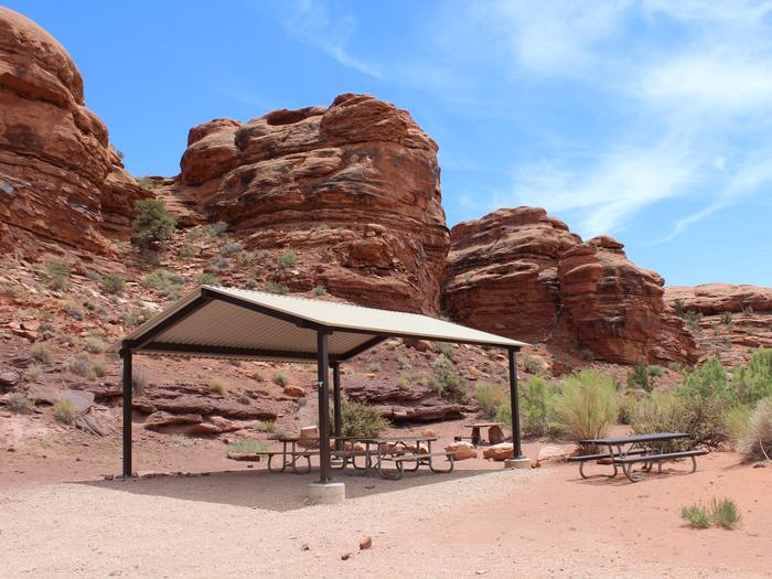
The Superbowl Group Site is located in the northeastern corner of Superbowl Campground and features tent and trailer space, picnic tables, a fire ring, vault toilets, and a shade structure. The site can hold approximately 10 vehicles, with a vehicle and trailer counting as two vehicles. There is no drinking water provided.
Natural Features
Indian Creek consists of a broad, gently rolling valley bracketed by the sheer sandstone cliffs of Harts Point to the northeast and Bridger Jack Mesa to the southwest. The valley is bisected by both the major thoroughfare of Highway 211 and Indian Creek itself. From Highway 211, the interior of the valley is a classic western landscape with panoramic vistas, towering sandstone cliffs and spires, and rolling grasslands.
Nearby Attractions
Superbowl Campground is in the Bears Ears National Monument Indian Creek Unit and close to Newspaper Rock and the Needles District of Canyonlands National Park.
Nearby Activities
Historic & cultural site
Camping
Photography
Mountain biking
Scenic drive
Rock climbing
Off highway vehicle trails
Gallery
Directions
Turn west off US 191 onto Highway 211 and travel approximately 26 miles. The turn off to the campground is on the south side of the highway. The campground is located approximately 8.5 miles east of Canyonlands National Park and 13.5 miles northwest of Newspaper Rock. The group site is in the northeastern corner of the campground.
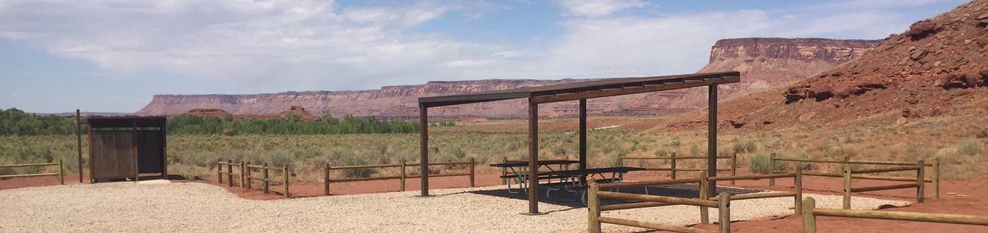
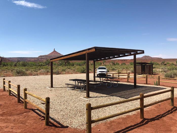
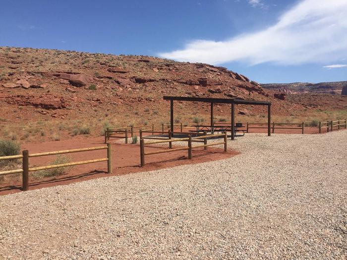
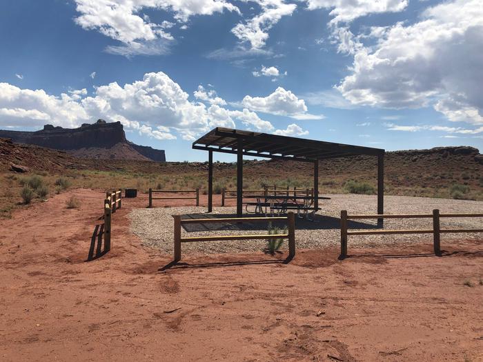
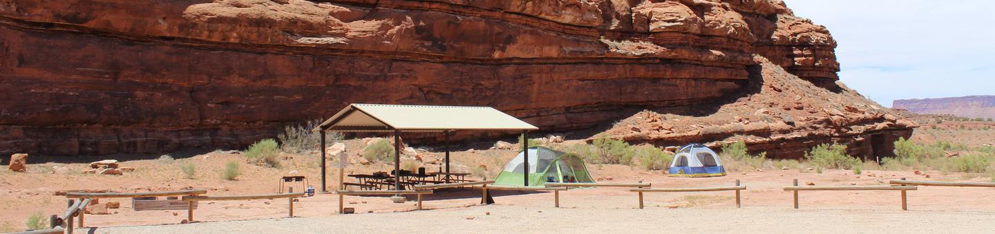
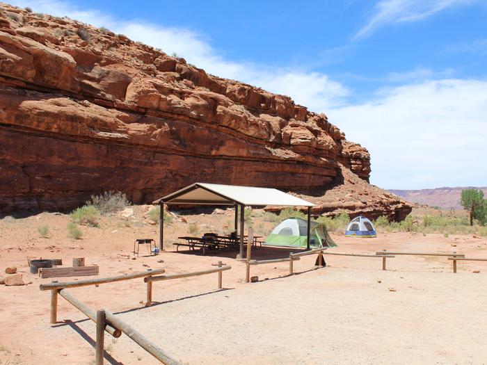
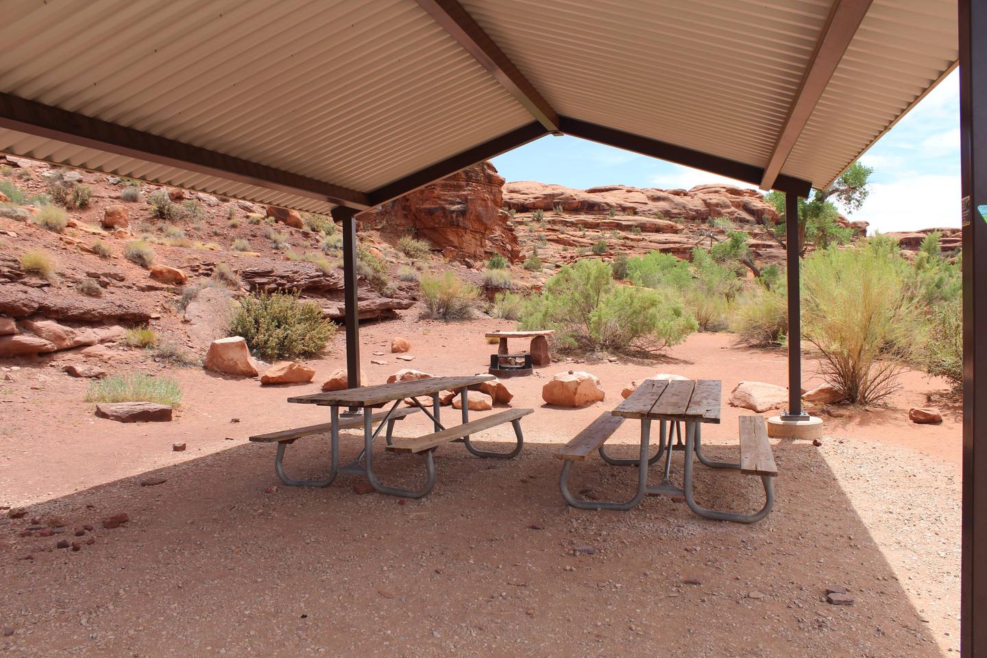
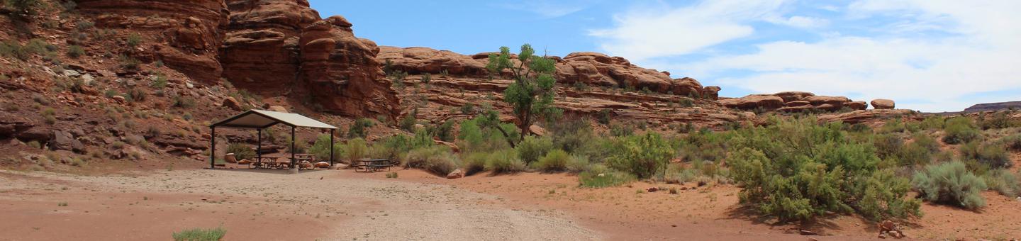
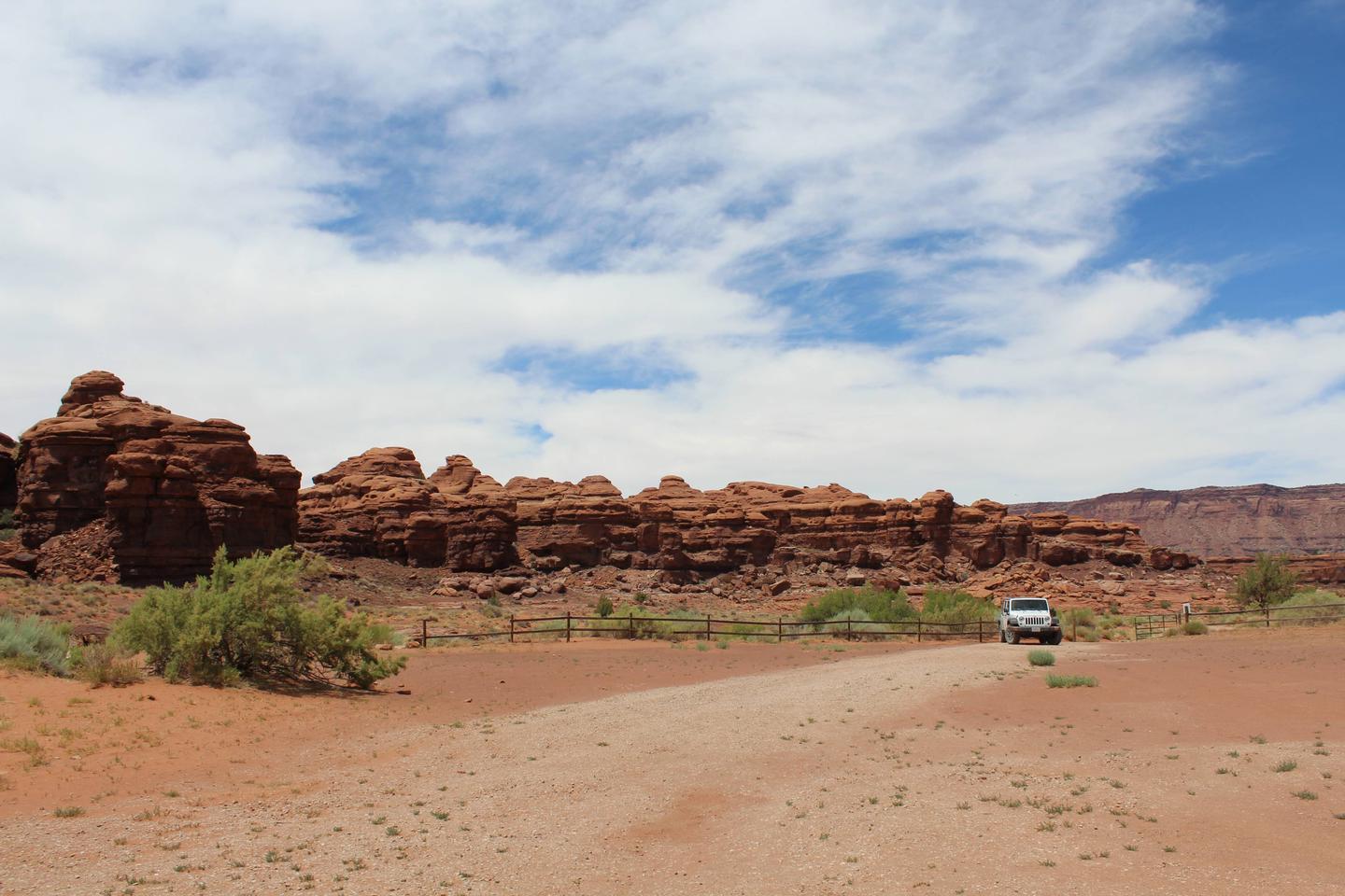
The Creek Pasture Group Site at Creek Pasture Campground is ideal for large groups wishing to recreate in the Indian Creek area, or camp close to the Bears Ears National Monument Indian Creek Unit of the Needles District of Canyonlands National Park. The Indian Creek area is generally primitive and undeveloped, with few services. The Indian Creek area is a popular filming area because of its classical “western” look. Both commercial advertisements and major motion pictures have been filmed in the area.
Recreation
The Indian Creek area has gained international recognition for its extraordinary natural beauty and numerous recreational opportunities. Spectacular landscapes along with rich archeological resources provide visitors with an abundance of recreational opportunities. These opportunities include: hiking, biking, cultural resource viewing, camping, off-highway vehicle (OHV) use, rock climbing, horseback riding, wildlife viewing, sightseeing and scenic photography. These features attract visitors from around the world, who recreate both privately and by hiring commercial outfitters.
Facilities
The Creek Pasture Group Site is located along the northwestern edge of the Creek Pasture Campground and features tent and trailer space, picnic tables, a fire ring, a vault toilet, and a shade structure. The site can hold approximately 20 vehicles, with a vehicle and trailer counting as two vehicles. There is no drinking water provided.
Natural Features
Indian Creek consists of a broad, gently rolling valley bracketed by the sandstone cliffs of Harts Point to the northeast and Bridger Jack Mesa to the southwest. The valley is bisected by both the major thoroughfare of Highway 211 and Indian Creek itself. From Highway 211 the interior of the valley is a classic western landscape with panoramic vistas, towering sandstone cliffs and spires, and rolling grasslands.
Nearby Attractions
Creek Pasture is close to the Needles District of Canyonlands National Park and the Bears Ears National Monument Indian Creek Unit.
Nearby Activities
Historic & cultural site
Camping
Off highway vehicle
Photography
Mountain biking
Scenic drive
Rock climbing
Gallery
Directions
Turn west off US 191 onto Highway 211 and travel approximately 27 miles. The turn off to the campground is on the north side of the highway. It is located approximately 7.5 miles southeast of the Canyonlands National Park visitor’s center and 14.5 miles northwest of Newspaper Rock. The group site is on the north end of the campground.
The Indian Creek Falls Group Site is ideal for groups wishing to recreate in the Indian Creek Corridor or to be close to Canyonlands National Park. The site is situated in a small bowl just above the terrace of Indian Creek. Except for three Bureau of Land Management developed recreational facilities and the Dugout Ranch, the Indian Creek Corridor is generally primitive and undeveloped. The Indian Creek area is a popular filming area because of its classical western look. Both commercial advertisements and major motion pictures have been filmed in the area.
Recreation
The Indian Creek Corridor has gained international recognition for its extraordinary natural beauty and numerous recreational opportunities. Spectacular landscapes along with rich archeological resources provide visitors with an abundance of recreational opportunities. These opportunities include: hiking, biking, cultural resource viewing, camping, off-highway vehicle (OHV) use, rock climbing, horseback riding, wildlife viewing, sightseeing and scenic photography. These features attract visitors from around the world, who recreate both privately and by hiring commercial outfitters.
Facilities
The group site is located near Indian Creek Falls and features tent/trailer space, picnic tables, a fire ring, and a vault toilet. The site can hold approximately 10 vehicles, with a vehicle and trailer counting as two vehicles. There is no water.
Natural Features
Indian Creek consists of a broad, gently rolling valley bracketed by the sandstone cliffs of Harts Point to the northeast and Bridger Jack Mesa to the southwest. The valley is bisected by both the major thoroughfare of Highway 211 and Indian Creek itself. From Highway 211 interior of the valley is a classic western landscape with panoramic vistas, towering sandstone cliffs and spires, and rolling grasslands.
Nearby Attractions
Indian Creek Falls is close to the Needles District of Canyonlands National Park and Bears Ears National Moument (Indian Creek Unit).
Nearby Activities
Historic & cultural site
Camping
Off highway vehicle
Photography
Mountain biking
Scenic drive
Rock climbing
Gallery
Directions
Turn west off US 191 onto Highway 211 and travel approximately 23 miles. Take the turn off to the north for Lockhart Basin / Hamburger Rock Campground. Travel approximately 2.2 miles and the destination will be on the west side of the road. It is located approximately 3 miles southeast of Canyonlands National Park and 17 miles northwest of Newspaper Rock.
Recommended Trail Users: Hikers. Singletrack. 0.03 miles in length. Difficulty: Moderate.The south entrance trail is a short but steep and rocky trail that leads from the Kiosk near the parking area and heads south to the south entrance of Bloomington Cave. This trail provides sweeping and dramatic view of the St. George basin, Pine Valley Mountains and Zion National Park.
Directions
This route from the east follows the Curley Hollow Wash. It is not maintained and can be narrow and rugged. A 4WD vehicle is recommended. Travel to the Bloomington area of St. George (Exit 4 off I-15). Drive through the roundabout and take Pioneer Road south (I-15 will be on your left). Turn right on Man-O-War Road. Turn right onto Bloomington Drive at the end of Man-O-War. Continue on Bloomington Drive until reaching Navajo Drive and turn right. Follow Navajo Drive until the pavement ends. From the end of the pavement, travel 1.6 miles and turn right into Curley Hollow Wash (intersection is signed). At 6.8 miles, the route diverts from the wash so take the left fork, staying on the main road (intersection is signed). At 7.9 miles, turn left (intersection is signed). At 8.4 miles take the right fork in the road. Travel another .2 miles to the parking area for a total distance of 8.6 miles since leaving the pavement. From Santa Clara or Ivins: This route, although longer, is partially on maintained roads with no travel in washes. It is usually passable by passenger vehicles, but 4WD is recommended. Head west on Old Highway 91 past Ivins. Travel to the turnoff to Gunlock Reservoir. Stay on Old Hwy 91 and at 1.9 miles past the Gunlock Reservoir intersection turn left on the Mojave Desert Joshua Tree Road Scenic Backway. This is the road to the Apex Mine. At 9.6 miles turn left off the Backway (intersection is signed). At 11.8 miles turn right (intersection is signed). At 12.2 miles take the right fork in the road. Travel another .2 miles to the parking area for a total distance of 12.4 miles. NOTE: All backcountry travel routes may be impassable when wet.
Recommended Users: Hikers. Singletrack trail. 0.07 miles in length. Difficulty: Moderate. The North entrance trail is a short but steep trail that leads from the Kiosk near the parking area and heads north to the north entrance of Bloomington Cave. This trail provides sweeping and dramatic view of the St. George basin, Pine Valley Mountains and Zion National Park.
Directions
This route from the east follows the Curley Hollow Wash. It is not maintained and can be narrow and rugged. A 4WD vehicle is recommended. Travel to the Bloomington area of St. George (Exit 4 off I-15). Drive through the roundabout and take Pioneer Road south (I-15 will be on your left). Turn right on Man-O-War Road. Turn right onto Bloomington Drive at the end of Man-O-War. Continue on Bloomington Drive until reaching Navajo Drive and turn right. Follow Navajo Drive until the pavement ends. From the end of the pavement, travel 1.6 miles and turn right into Curley Hollow Wash (intersection is signed). At 6.8 miles, the route diverts from the wash so take the left fork, staying on the main road (intersection is signed). At 7.9 miles, turn left (intersection is signed). At 8.4 miles take the right fork in the road. Travel another .2 miles to the parking area for a total distance of 8.6 miles since leaving the pavement. From Santa Clara or Ivins: This route, although longer, is partially on maintained roads with no travel in washes. It is usually passable by passenger vehicles, but 4WD is recommended. Head west on Old Highway 91 past Ivins. Travel to the turnoff to Gunlock Reservoir. Stay on Old Hwy 91 and at 1.9 miles past the Gunlock Reservoir intersection turn left on the Mojave Desert Joshua Tree Road Scenic Backway. This is the road to the Apex Mine. At 9.6 miles turn left off the Backway (intersection is signed). At 11.8 miles turn right (intersection is signed). At 12.2 miles take the right fork in the road. Travel another .2 miles to the parking area for a total distance of 12.4 miles. NOTE: All backcountry travel routes may be impassable when wet.
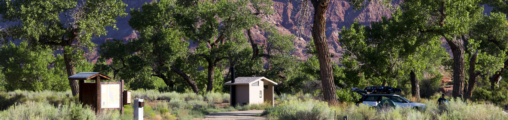
Creek Pasture Campground is ideal for groups wishing to recreate in the Indian Creek area or to be close to the Canyonlands National Park Needles District and the Bears Ears National Monument Indian Creek Unit. The campground is located north off the Needles Highway (accessed from Highway 211), approximately 5 miles southeast of Canyonlands National Park and 15 miles northwest of Newspaper Rock. The large one-loop campground provides 32 campsites that each feature a tent/trailer space, a picnic table, a fire ring, and vault toilets. Each campsite can hold 10 people and 2 vehicles. There is no water at the campground. Campsites are $15 per night and are “first come, first served” and self-register at the site. There is a group site for larger groups, which may be reserved in advance on this site. Search for “Creek Pasture Group Site” for more information and to make a reservation.
Nearby Activities
Auto touring
Camping
Wildlife viewing
Photography
Gallery
Directions
Turn west off US 191 onto Highway 211 and travel approximately 21 miles. The turn off to the campground is on the north side of the highway. It is located approximately 5 miles southeast of Canyonlands National Park and 15 miles northwest of Newspaper Rock.
An overlook of the Needles section of Canyonlands National Park.
Directions
Drive 32 miles south from Moab and turn west on the Canyon Rims Road. Drive 17 miles west on this paved road. The Needles Overlook is at the end of the pavement.
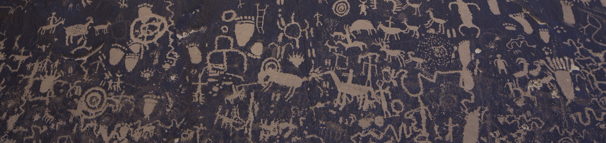
Newspaper Rock is an impressive petroglyph site located alongIndian Creek in Southeastern Utah. This panel displays multiple periods of rock art from cultures dating to 1500 years ago to this century. The older art is attributed to the ancient Puebloan people who inhabited this region for approximately two thousand years, from 100 B.C. to 1540 A.D.. The more recent art (lighter in color) is attributed to the Ute people who still live in the Four Corners area. This day-use site has toilet facilities and ample paved parking, including pull through sites for larger vehicles and RVs.
Gallery
Directions
Newspaper Rock is located on Highway 211, which starts 15 miles north of Monticello, Utah. Drive 13 miles west on Highway 211. The site is well signed.