This recreation area is part of Ashtabula Lake
Directions
GPS Coordinates
Latitude 47° 9′ 39.4321″ N
Longitude 98° 0′ 32.9936″ W
This recreation area is part of Ashtabula Lake
Latitude 47° 9′ 39.4321″ N
Longitude 98° 0′ 32.9936″ W
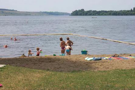
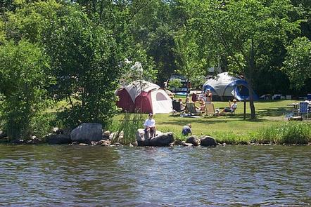
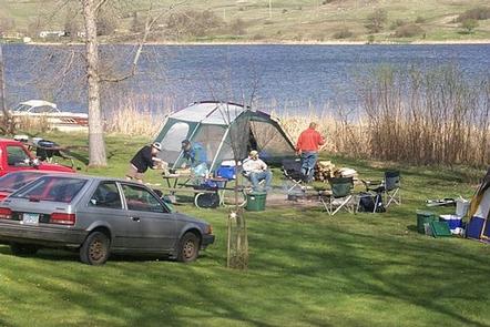
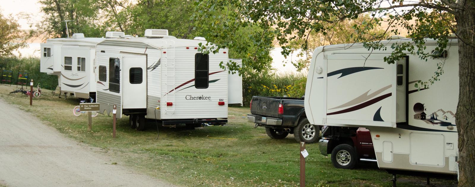
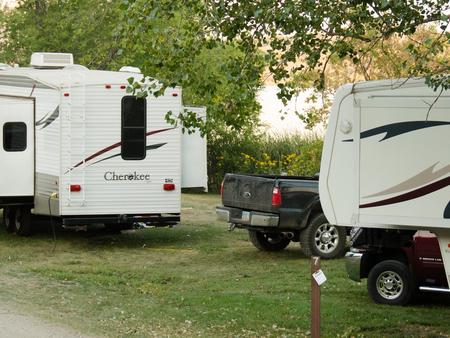
The Eggerts Landing Campground is located on Lake Ashtabula in eastern North Dakota. With thick forests, secluded sites and lake access, it is the most popular campground in the area.
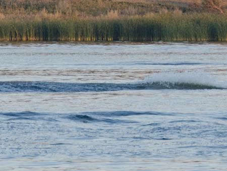
Lake Ashtabula was created by the construction of the Baldhill Dam on the Sheyenne River in 1944, and is situated in one of the most scenic river valleys in the region, offering visitors a wide range of recreation opportunities year-round.
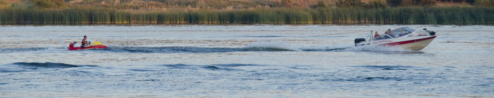
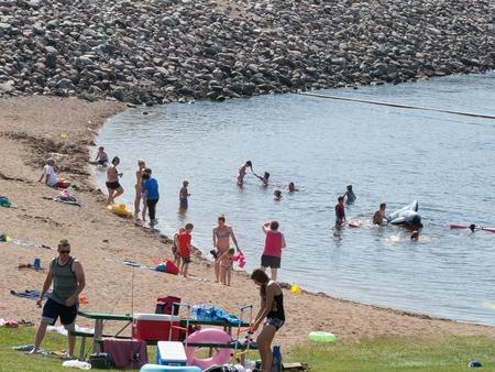
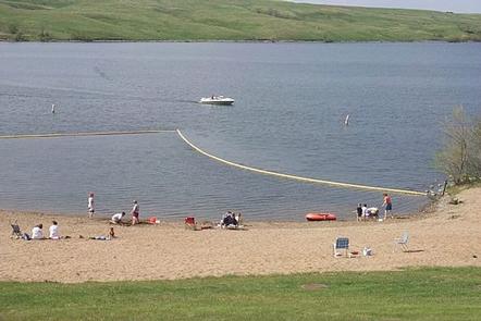
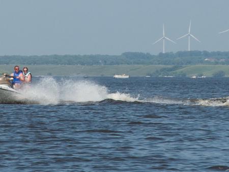
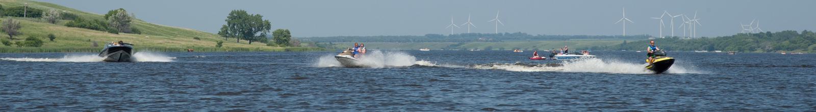
Summer activities include fishing, boating, swimming and picnicking, while Ice fishing and cross-country skiing are popular during winter months.
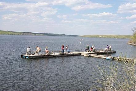
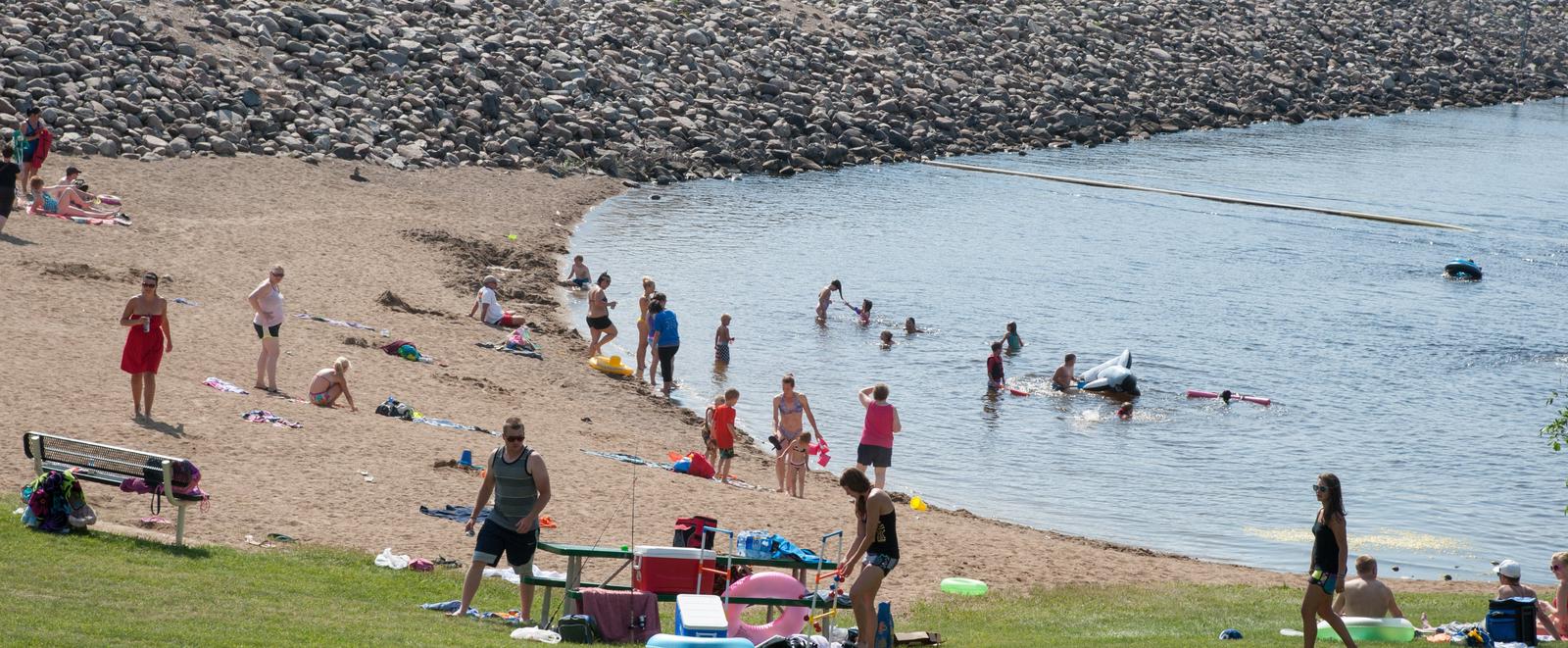
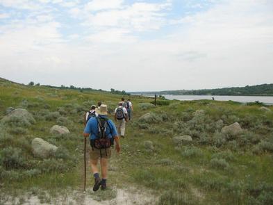
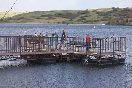
There is no shortage of recreation opportunities and outdoor fun in and around the lake. Visitors can swim, picnic and hike within the campground. A fishing pier is a short walk away.
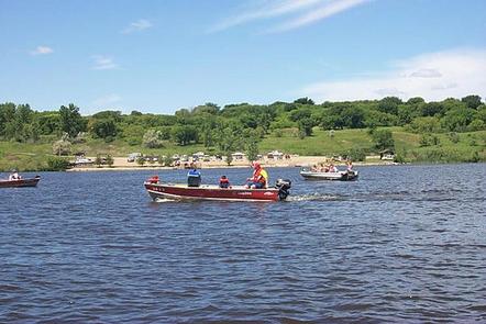
The name “Ashtabula” is a Native American word meaning “Fish River,” which suits the lake’s fish population; popular species include walleye, northern pike, white bass, yellow perch and black bullhead. With seven boat ramps, three accessible fishing piers and four automated fish cleaning stations, the lake is very convenient for anglers.
Nearly 3,000 acres of land around the lake is managed as wildlife habitat by the Corps of Engineers and open to the public for wildlife viewing, birding, hiking and hunting. Hunters and anglers should contact the North Dakota Game and Fish Department for seasons, restrictions and licenses; fishing licenses and bait may be purchased from concessionaires around the lake.
Campers can also reach the 63-mile Sheyenne River Valley National Scenic Byway and access nearly 35 miles of the North Country National Scenic Trail within a short drive.
There are 41 campsites with 37 of the sites offering electrical service. Other features of the campground include a swimming beach, flush toilets, playground and hiking trail.
A dump station, fishing pier, boat ramp, restaurant and additional hiking trails are within walking distance. The nearest town is Valley City, 10 miles away.
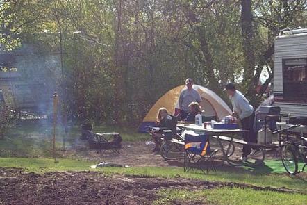
The campground is heavily wooded offering shade and privacy for most sites. The lake area lies amidst the ‘prairie potholes’ region of glacially-carved lakes in North Dakota.
Spring and fall bring bountiful views of migratory water birds to Lake Ashtabula, including the unique white pelican, which can be seen in large flocks during summer.
The region also provides habitat for white-tailed deer, sharptail grouse, wild turkey and gray partridge.

The main route to the park is via Interstate 94 to Valley City exit 292. Follow the signs through Valley City and follow County Road 21 north from Valley City for 10 miles.
Latitude 47° 5′ 50.8200″ N
Longitude 98° 0′ 36.2902″ W
The Mel Rieman Campground and Recreation Area is a 70-acre facility on the shoreline of Lake Ashtabula in eastern North Dakota. The campground is known for its spectacular sunset views. It is close to the Baldhill Dam and within walking distance of the Mel Rieman day-use area, where visitors can swim, fish and picnic.
Lake Ashtabula was created by the construction of the Baldhill Dam on the Sheyenne River in 1944, and is situated in one of the most scenic river valleys in the region. Visitors can choose from a wide range of recreation opportunities year-round, including ice fishing and cross-country skiing during winter months.
There is no shortage of recreation opportunities and outdoor fun in and around the lake. The day-use area is adjacent to the campground and has a visitor center, playgrounds, picnic facilities, concessions, fishing spots and a boat ramp.
The name “Ashtabula” is a Native American word meaning “Fish River,” which suits the lake’s fish population; popular species include walleye, northern pike, white bass, yellow perch and black bullhead. With seven boat ramps, two accessible fishing piers and four automated fish cleaning stations, the lake is very convenient for anglers.
Nearly 3,000 acres of land around the lake is managed as wildlife habitat by the Corps of Engineers and open to the public for wildlife viewing, birding, hiking and hunting. Hunters and anglers should contact the North Dakota Game and Fish Department for seasons, restrictions and licenses; fishing licenses and bait may be purchased from concessionaires around the lake.
Campers can also reach the 63-mile Sheyenne River Valley National Scenic Byway and access nearly 35 miles of the North Country National Scenic Trail within a short drive.
Mel Rieman Campground has 27 campsites, 15 of which offer electric hookups. The facility also provides drinking water, showers and flush toilets. The nearest town is Valley City, 10 miles away.
The lake area lies amidst the ‘prairie potholes’ region of glacially-carved lakes in North Dakota. Bountiful migratory water birds flock to Lake Ashtabula, including the unique white pelican, which can be seen in large quantities during summer. The region also provides habitat for white-tailed deer, sharptail grouse, wild turkey and gray partridge.


The main route to the park is via Interstate 94 to Valley City exit 292. Follow the signs through Valley City and turn left onto County Road 19. Travel for 10 miles.
Latitude 47° 2′ 15.0000″ N
Longitude 98° 4′ 59.9999″ W
The East Ashtabula Crossing Campground is located on 12 developed acres adjacent to Lake Ashtabula in eastern North Dakota. It is one of the most popular campgrounds in the area.
Lake Ashtabula was created by the construction of the Baldhill Dam on the Sheyenne River in 1944, and is situated in one of the most scenic river valleys in the region, offering visitors a wide range of recreation opportunities year-round.
Summer activities include fishing, boating, swimming and picnicking, while Ice fishing and cross-country skiing are popular during winter months.
The name “Ashtabula” is a Native American word meaning “Fish River,” which suits the lake’s fish population; popular species include walleye, northern pike, white bass, yellow perch and black bullhead. With seven boat ramps, three accessible fishing piers and four automated fish cleaning stations, the lake is very convenient for anglers.
Nearly 3,000 acres of land around the lake is managed as wildlife habitat by the Corps of Engineers and open to the public for wildlife viewing, birding, hiking and hunting. Hunters and anglers should contact the North Dakota Game and Fish Department for seasons, restrictions and licenses; fishing licenses and bait may be purchased from concessionaires around the lake.
Campers can also drive the 63-mile Sheyenne River Valley National Scenic Byway and access nearly 35 miles of the North Country National Scenic Trail nearby.
East Ashtabula Crossing has 38 campsites, 32 of which offer electric hookups. The facility also features a swimming beach, drinking water, flush toilets, a playground and a picnic shelter.
Within walking distance campers will find a dump station, fishing pier, boat ramp, restaurant and hiking trails. The nearest town is Valley City, less than 15 miles away.
The campground is on a wooded hillside offering shade for most sites. It lies amidst the ‘prairie potholes’ region of glacially-carved lakes in North Dakota.
Spring and fall bring bountiful views of migratory water birds to Lake Ashtabula, including the unique white pelican, which can be seen in large flocks during summer.
The lake region also provides habitat for white-tailed deer, sharptail grouse, wild turkey and gray partridge.

The main route to the park is via Interstate 94 to Valley City exit 292. Follow the signs through Valley City and follow County Road 21 north for 15 miles.
Latitude 47° 8′ 15.0000″ N
Longitude 98° 0′ 0.0000″ W
West Ashtabula Crossing Campground is located on 23 developed acres adjacent to Lake Ashtabula in eastern North Dakota. It is very popular and fills up on most weekends.
Lake Ashtabula was created by the construction of the Baldhill Dam on the Sheyenne River in 1944, and is situated in one of the most scenic river valleys in the region, offering visitors a wide range of recreation opportunities year-round.
Summer activities include fishing, boating, swimming and picnicking, while Ice fishing and cross-country skiing are popular during winter months.
The name “Ashtabula” is a Native American word meaning “Fish River,” which suits the lake’s fish population; popular species include walleye, northern pike, white bass, yellow perch and black bullhead. With seven boat ramps, three accessible fishing piers and four automated fish cleaning stations, the lake is very convenient for anglers.
Nearly 3,000 acres of land around the lake is managed as wildlife habitat by the Corps of Engineers and open to the public for wildlife viewing, birding, hiking and hunting. Hunters and anglers should contact the North Dakota Game and Fish Department for seasons, restrictions and licenses; fishing licenses and bait may be purchased from concessionaires around the lake.
Campers can also reach the 63-mile Sheyenne River Valley National Scenic Byway nearby and access the North Country National Scenic Trail from the campground.
West Ashtabula Crossing has 38 campsites, 26 of which offer electric hookups. The facility also features a boat launch, dump station, fishing pier, fish cleaning station and picnic shelter.
Campers will find a swimming beach, playground and restaurant less than one mile away. The nearest town is Valley City, 15 miles south.
The campground is on a wooded hillside offering shade for most sites. It lies amidst the ‘prairie potholes’ region of glacially-carved lakes in North Dakota.
Spring and fall bring bountiful views of migratory water birds to Lake Ashtabula, including the unique white pelican, which can be seen in large flocks during summer.
The lake region also provides habitat for white-tailed deer, sharptail grouse, wild turkey and gray partridge.


The main route to the park is via Interstate 94 to Valley City exit 292. Follow the signs through Valley City to County Road 21. Travel North for 15 miles.
Latitude 47° 9′ 38.0002″ N
Longitude 98° 0′ 37.0001″ W
The BLM Cottonwood Recreation Site sits among groves of cottonwoods along the scenic Salmon River and provides a beautiful setting for fishing and camping. It also has a boat ramp, allows RVs, provides accessible campsites and includes a day use area with barbecues, tent sites and group camp sites. 15 camp sites total.
This is one of a number of sites on the Upper Salmon River. The headwaters of the Salmon River are in the Sawtooth National Recreation Area. BLM recreation sites along this stretch start at the East Fork confluence, followed downstream by Deadman Hole, Bayhorse Campground, Challis Bridge, and Cottonwood Campground.
Travel north of Challis, Idaho on Highway 93 for approximately 14 miles. The recreation site will be on your left between the highway and the Salmon River.
Latitude 44° 40′ 4.0000″ N
Longitude 114° 4′ 45.9998″ W
The headwaters of the Salmon River are in the Sawtooth National Recreation Area. BLM recreation sites along this stretch start at the East Fork confluence, followed downstream by Bayhorse, Deadman Hole, Challis Bridge, Cottonwood, Kilpatrick, Gold Bug Hot Springs, Elevenmile, Eightmile, Shoup Bridge, Morgan Bar and Tower Rock.
Bayhorse Campground is at 5400-foot elevation and is ten miles south of Challis on Highway 75. Named for a historic mining district, Bayhorse Campground has 11 campsites along the Salmon River offering plentiful fishing. Anglers come for the resident cutthroat and rainbow trout, steelhead and whitefish. Visitors can take the road west to Bayhorse Lake, which is near a number of historic mines. The entire area is rich in mining history, and this is a comfortable base camp for exploring the Land of the Yankee Fork.
Amenities Include:
11 campsites with picnic tables and fire rings; Seasonal Campground Hosts;
Potable Water (beware of the sprinkler system if tenting); Vault toilets;
Boat ramp and day use parking area; drinking water, restrooms;
Plenty of hiking trails and interpretive sites to explore.
Approximately 10 miles southwest of Challis, Idaho: travel south from Challis on Highway 93 for 2 miles, turn right onto Highway 75 and drive southwest for approximately 8 miles. The recreation site is on your right between the highway and the Salmon River.
Latitude 44° 23′ 8.0000″ N
Longitude 114° 15′ 37.0001″ W
ALERT – The Swirly Canyon segment of the South Fork Payette River stretch offers opportunities for camping and fishing in a scenic mountain area. The BLM’s South Fork Recreation Site is an undeveloped camping spot along the river.
The South Fork Recreation Site is located three miles east of Garden Valley, Idaho. Turn south on Alder Creek Road and just after crossing the Payette River turn left on the South Fork Road. The site is about 1/2 mile on the left.
Latitude 44° 4′ 0.0000″ N
Longitude 115° 56′ 22.9999″ W
The South Fork Payette River is a classic pool-drop river. Deer Creek launch is a main put-in spot for the Class III-IV, “Staircase” section of the South Fork Payette River. many boaters will launch here to avoid the three miles of calm water from the Confluence Site. The site is essentially a very broad gravel area adjacent to the Banks-Lowman Highway. The facilities include a steep, steel and wood boat ramp, portable toilet, and information kiosk. This is a fee parking area – $3.00/day or $20.00 season pass for the Payette River System. Day passes are available on-site.
Deer Creek Launch Site is located along the Banks-Lowman Highway four miles east of Banks, Idaho and six miles west of Garden Valley, Idaho.
Latitude 44° 5′ 32.0000″ N
Longitude 116° 1′ 57.0000″ W
The South Fork Payette River is a classic pool-drop river. The Confluence recreation site is just downstream from the confluence of the Middle Fork and South Fork Payette Rivers. This site serves as a take-out point for boaters floating the Class II “Swirley Canyon” section or as a put-in for boaters tackling the Class IV “Staircase” section. The facilities include a gravel boat ramp and parking area, information kiosk, and vault toilet. This is a fee parking area – $3.00/day or $20.00 season pass for the Payette River System. Day passes are available on-site.
The Confluence recreation site is located along the Banks-Lowman Highway three miles west of Garden Valley, Idaho and eight miles east of Banks, Idaho.
Latitude 44° 6′ 9.0000″ N
Longitude 116° 0′ 20.0002″ W