Categories
Uncategorized

NFD campground

The North Fruita Desert campground is a mountain biker’s paradise with campsites situated at the heart of miles of well-maintained trails. There are 35 campsites, each with a fire ring, picnic table and parking, but it is a more challenging environment. While there are four vault toilets within walking distance of each campsite, there is no water, electricity or garbage services available. Additionally, campers will need to bring their own firewood. The campground is open from March through November. There are 2 Group Sites.

Nearby Activities

  • Biking
  • Camping

Directions

Take Interstate 70 west to Fruita (exit 19). Turn north onto Cherry Street and take the first right onto Aspen Avenue. Go through the roundabout and continue on Aspen to Maple Street. Take a left on Maple Street and then travel north. The street will turn into 17.5 road. Take a right on N.3 Road and then a left on 18 Road. Travel approximately 7 miles on 18 Road to the campground.

GPS Coordinates

Latitude 39° 20′ 2.4000″ N

Longitude 108° 42′ 14.4000″ W

Categories
Uncategorized

Stiffel Creek Trailhead

Trailhead to the 12,000 acre King Mountain Recreation Area. The area offers excellent opportunities for wildlife viewing and has beautiful scenery. Hiking, horseback riding, hunting, and camping in an uncrowded area is possible. The area is most busy during hunting season. For more information, please contact the Colorado River Valley Field Office.

Directions

Take the Dotsero exit off I-70 (exit 133). Head north on the Colorado River Road for 28.5 miles. Turn right on Antelope Creek Road (County Road 1). Travel 1.4 miles to the unimproved parking area on the west side of the road. For more information, please contact the Colorado River Valley Field Office.

GPS Coordinates

Latitude 39° 55′ 4.1880″ N

Longitude 106° 48′ 7.9200″ W

Categories
Uncategorized

King Mountain Trailhead 131

The Trailhead leads to the 12,000 acre King Mountain Recreation Area. The area offers excellent opportunities for wildlife viewing and has beautiful scenery. Hiking, horseback riding, hunting, and camping in an uncrowded area is possible. The area is most busy during hunting season. For more information, please contact the Colorado River Valley Field Office.

Directions

Take I-70 to the Wolcott exit and travel north on highway 131 about 30.5 miles. There is a parking area on the left.

GPS Coordinates

Latitude 40° 1′ 53.5440″ N

Longitude 106° 46′ 54.2280″ W

Categories
Uncategorized

King Creek Trailhead

Trailhead to the 12,000 acre King Mountain Recreation Area. The area offers excellent opportunities for wildlife viewing and has beautiful scenery. Hiking, horseback riding, hunting, and camping in an uncrowded area is possible. The area is most busy during hunting season. For any more information, please contact the Colorado River Field Office.

Directions

Take I-70 to Wolcott and travel north on highway 131 toward the community of Toponas. Just before Toponas at the old school house, turn left and go west on Routt County Road 5. Travel approximately 2 miles and make a left on Road 5A. Travel south on 5A about one mile to the parking area. The trailhead provides access to the 12,000 acre King Mountain Area, which has scenic vistas, and offers hiking, horseback riding, hunting, and camping in an uncrowded setting.

GPS Coordinates

Latitude 40° 1′ 54.1200″ N

Longitude 106° 50′ 47.1120″ W

Categories
Uncategorized

Dolores River Overlook

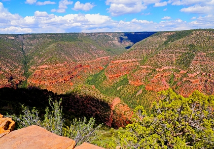
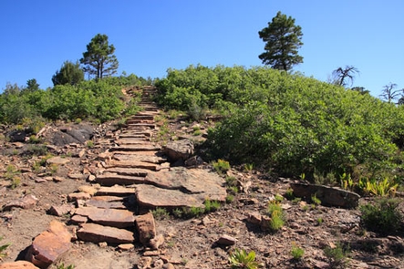
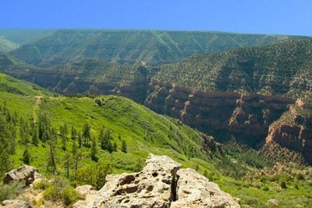
The Dolores River Overlook has 6 individual walk-in camp/picnic sites, as well as one walk-in group site (3 tables and rings). There is a vault restroom at the parking area and no other camping facilities. The views of the Dolores River Canyon from this Ponderosa Pine dominated site are amazing. A short walk to down the overlook trail (includes rock steps) to the end of the ridge is well worth the effort!

There is no fee at this site, and camping is on a first come, first served basis. The main use of this recreation site is for day use, though it is well suited to tent camping. While never busy, hunting season is when this site is visited most often. For more information, please contact the Tres Rios Field Office.

Gallery

Directions

When traveling US Highway 491, turn east on CR J, just south of Dove Creek. Stay left on Road J at a “Y” in the road (at about 2.4 miles from highway). Two miles from the “Y”, stay straight on Road J as it becomes a dirt road. Turn north (left) off of Road J after 2 Ѕ mils on the dirt road (there is a small reservoir/stock pond here, and the Montezuma County Road Map shows this as Road 15). The overlook is at the end of this 3 Ѕ mile road.

GPS Coordinates

Latitude 37° 48′ 18.9000″ N

Longitude 108° 47′ 37.5720″ W

Categories
Uncategorized

Mountain Sheep Point Rec Site

Mountain Sheep Point Rec Site, also known as ‘Dove Creek Pumps’ is approximately 19 miles downriver from Bradfield is the Mountain Sheep Point Recreation Site, which can be accessed by driving about 6 miles east from Dove Creek along gravel and dirt county roads. This site is used primarily as a river access point during ‘boatable releases’ on the Lower Dolores River and can be extremely busy during those periods. The rest of the year this site serves as a small day use site located with an extremely scenic portion of the Dolores River Canyon. Sheer Redrock cliffs and frequent appearances by bighorn sheep make this a great place to have a picnic lunch and dip your toes in the river. The site consists of a boat ramp, vault toilet, two picnic tables, one fire ring, interpretive panel, and parking. For more information, please contact the Tres Rios Field Office.

Directions

When traveling US Highway 491, turn east on CR J, just south of Dove Creek. Then turn north on CR 9, east on H, then north again on CR 10. Veer left at the ‘Y’ and follow the county road down into the canyon.

GPS Coordinates

Latitude 37° 47′ 50.3520″ N

Longitude 108° 49′ 36.1200″ W

Categories
Uncategorized

Box Elder

BLM’s Box Elder Campground is located within the Dolores River Canyon 6 miles NE of Dove Creek. The campground has 11 campsites with fire rings and picnic tables along with two vault toilets. Towering canyon walls cut by the Dolores River dominate this site, and when combined with the shade of the box elder grove and the proximity of the river, provide an element of relief from the summer heat.

There is no fee at this site, and camping is on a first come, first served basis. The busiest time of year is when there is a ‘boatable release’ on the lower Dolores from McPhee Reservoir, generally mid-April to mid-June. Holiday weekends during the summer can also fill up this small campground. For more information, please contact the Tres Rios Field Office.

Directions

When traveling US Highway 491, turn east on CR J, just south of Dove Creek. Then turn north on CR 9, east on H, then north again on CR 10. Veer left at the ‘Y’ and follow the county road down into the canyon. After passing the Mt. Sheep Point (the Pumps) boat access, you’ll arrive at the campground in less than Ѕ mile.

GPS Coordinates

Latitude 37° 48′ 4.5252″ N

Longitude 108° 49′ 27.8472″ W

Categories
Uncategorized

Bradfield Recreation Site

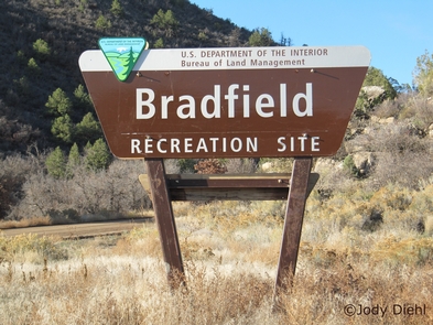
Bradfield is a large, open campground with a day use area and boat ramp. There are 17 designated camping spurs with picnic tables and fire rings. Ten of the sites have shade structures and one site is fully accessible for those with disabilities. There are two vault restrooms and two potable water hand pumps (seasonally operational, generally April 1st -Sept 30th). There is also an additional camping loop geared toward more dispersed camping for equestrian users (a rustic and un-maintained non-motorized trail leads downriver from here for about 8 miles, with several river crossings). The day use area has three picnic tables and shade trees. There is an $8/night camping fee on a first come first served basis. The busiest time of year is when there is a ‘boatable release’ on the lower Dolores from McPhee Reservoir, generally mid-April to mid-June. For more information, please contact the Tres Rios Field Office.

Gallery

Directions

Take Colorado Highway 184 NE from Dolores to US Highway 491. North of Pleasant View, turn east on CR T, north on CR 16, then east again on CR S down to the Dolores River.

GPS Coordinates

Latitude 37° 39′ 0.5400″ N

Longitude 108° 44′ 11.9760″ W

Categories
Uncategorized

Bocco Mountain Trailhead

Trailhead for Bocco Mountain Recreation Area. Bocco Mountain Recreation Area is a small motorcycle riding area north of I-70 at Wolcott. This riding area offers 20 miles of difficult motorcycle trails through rugged terrain and scattered piсon-juniper woodlands. It
is popular with experienced riders in the spring before the snow melts in the high country. The staging area is small but easily accessible.

Directions

The Trail head is located exiting Highway 70 at the Wolcott exit. AT the “T” intersection, take a left urn and drive along the river and then turn right and drive across the river bridge. Follow this road north up a canyon to a road intersection which goes west. It is signed. Take this road to the trailhead, which is on the left side of the road. It is located right before crossing under the large power lines. there are no facilities. There is additional parking at the Castle Creek Parking lot a slight distance further down the road.

GPS Coordinates

Latitude 39° 44′ 34.9080″ N

Longitude 106° 42′ 17.5680″ W

Categories
Uncategorized

Wolford Reservoir Dam Site

The Ritchard Dam holds the 1,500 surface-acre Wolford Mountain Reservoir. Parking and restrooms support access to the dam and shoreline, popular with fishermen. Anglers can also access Muddy creek for fishing below the dam and spillway.

Directions

It is located approximately 4.5 miles north of Kremmling and East of Highway 40. Follow U.S. 40 west from Kremmling, turning East at the Wolford Mountain Dam Road. A designated parking area is provided with a vault restroom and picnic shelter.

GPS Coordinates

Latitude 40° 6′ 41.1120″ N

Longitude 106° 25′ 9.5520″ W