Categories
Uncategorized

Dry Creek Climbing Area

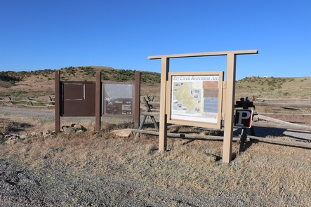
Dry Creek Recreation Area is a locally known climbing area located about 14 miles west of Montrose Colorado. Dry Creek Canyon has a remote desert feel just minutes from town. Sandstone cliffs about 30 to 50 feet high with many incut holds provide a great finger workout. There is also a bouldering area 300 feet below the cliffs, at the bottom of the canyon. The easiest way to get to the boulders is to go down one of the descent gullies and hike down the slope.The routes range from 5.5 to 5.13. There is something for everyone.

Dry Creek is a designated route system that allows access to access the climbing area, hiking, and biking roads. The Dry Creek Section begins in the Shavano Valley near Montrose and stretches for almost 16 miles to the Transfer Road. The first 3 miles of the trail follows the Rim Road. From there the route drops down into Dry Creek Canyon and begins a lengthy climb up to the Uncompahgre Plateau. This follows to the mountain bike route which includes several short sections of single-track. For more information, please contact the Uncompahgre Field Office.
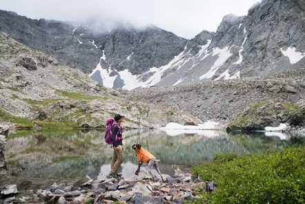
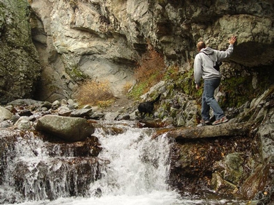
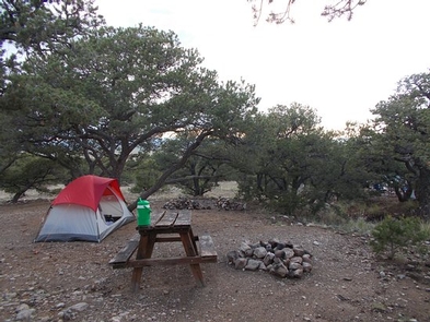
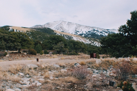
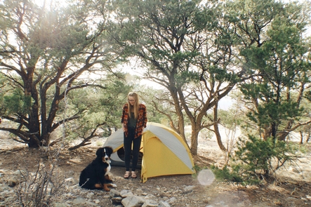
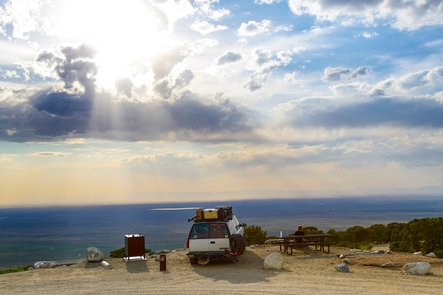
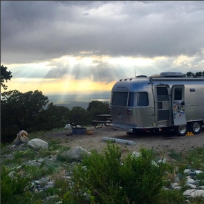
Gallery

Directions

Follow Main St. straight west out of town. This same road changes its name to Spring Creek Road. After just over 6 miles, turn right (north) on 58.75 Rd. Follow 58.75 Rd. 3 miles north. The road descends off a mesa.
Near the base of the descent, turn left (west) on Kiowa Rd. Follow Kiowa west about a mile. The road crosses a canal and heads south, changing its name to Shavano Valley Rd. Go south one-quarter mile, then head right (west) up Rim Rd. There is a large trailhead parking lot for the Tabaguache Trail here.
Follow Rim Road about 2 miles to the third BLM-designated open road on the right (AFTER you cross under the wooden power poles, and just BEFORE you pass under the metal powerline structures). This 4WD road is about a mile in length and leads you to the top of the canyon rim above the climbing area. Go right at the first fork, and left at the second fork. There is a technical 4WD step just before the second fork. After making this left, go about 100 yards to the cliff. The roads described here are all legal, open routes designated with an arrow symbol on a sign.
Ignore unmarked or closed roads or these directions won’t work.

GPS Coordinates

Latitude 38° 30′ 53.1576″ N

Longitude 107° 0′ 38.7576″ W

Categories
Uncategorized

Specie Creek Boat Launch

Specie Creek is primarily a Boat launch and day-use area with parking spaces. This site marks the beginning of the Specie Creek to Beaver Creek run and the end of the Down Valley Park to Specie Creek run. This section has a number of blind corners adding a little zip to the whitewater. For more information, please contact the Uncompahgre Field Office.

Directions

Specie Creek Recreation site can be accessed from Colorado Hwy 145 (Unaweep/Tabeguache Scenic and Historic Byway) and turning south onto M44 Rd.

GPS Coordinates

Latitude 38° 1′ 48.2520″ N

Longitude 108° 6′ 39.3480″ W

Categories
Uncategorized

Lower Beaver Rec. Site

The campground is located between CO 145 and the San Miguel River about 0.4 miles downriver from the Beaver Creek Boat Ramp. There are three tent sites with tables and grills. Two parking areas will accommodate a few small RVs. A toilet and hand-carry boat launch is present. For more information, please contact the Uncompahgre Field Office.

Gallery

Directions

Lower Beaver Campground can be accessed off Colorado Hwy 145 which is also called the Unaweep/Tabeguache Scenic and Historic Byway. From Norwood, go east on CO145 about 5.5 miles. Entrance is on the right (south).

GPS Coordinates

Latitude 38° 6′ 40.8600″ N

Longitude 108° 11′ 23.2800″ W

Categories
Uncategorized

Ledges Rockhouse Area

Ledges Rockhouse Campground is one of several recreation sites along the river. The site includes a restroom, 12 RV and 12 tent camping sites, cabanas, picnic tables, grills, and a boat ramp. During wet weather, the narrow, one-lane road along the river may become slick and impassable. The site is open all year. For more information, please contact the Uncompahgre Field Office.

Directions

Ledges Rockhouse Campground is located off Montrose County road BB36. BB36 road can be accessed off Hwy 90 near Nucla, CO. From Naturita, go about 2 miles east on CO 141 to CR 90 on the left (north). Go north 1.1 miles on CR 90 toward the power plant. At the “Y” near the power plant, keep right on CR 90 toward Montrose. Go another 6.8 miles to the bridge over the San Miguel River (unsigned).

GPS Coordinates

Latitude 38° 14′ 6.2484″ N

Longitude 108° 22′ 8.0580″ W

Categories
Uncategorized

Ledges Cottonwood Area

Located in groves of cottonwoods along the San Miguel River. Cottonwood campground has 14 campsites. RV and tent sites, a few cabanas, picnic tables, grills, toilets, and hand-carry boat ramps. No drinking water or trash services. The river in this section flows over sandstone bedrock where rock ledges form large holes creating rapids during high water. For more information, please contact the Uncompahgre Field Office.

Directions

From Naturita, go about 2 miles east on CO 141 to CR 90 on the left (north). Go north 1.1 miles on CR 90 toward the power plant. At the “Y” near the power plant, keep right on CR 90 toward Montrose. Go another 6.8 miles to the bridge over the San Miguel River (unsigned). Immediately after crossing the bridge, turn hard right onto the unsigned road that parallels the river. Cottonwood campground is about 2 miles from the bridge.

GPS Coordinates

Latitude 38° 14′ 49.3692″ N

Longitude 108° 22′ 8.0580″ W

Categories
Uncategorized

Beaver Creek Boat Launch

The San Miguel river offers the whitewater boater a variety of runs, all within the class II+ to III range. Upper Beaver Creek site is a day use site for boat launching. The site includes a restroom, cabanas, picnic tables, and a boat ramp.

Directions

Upper Beaver Creek Recreation Site is located along Colorado Hwy 145 which is also known as the Unaweep/Tabeguache Scenic and Historic Byway. Beaver Creek, (turn off easy to miss) turn left off of Hwy 145 approximately 9.5 miles after Specie Creek. If you cross Norwood Bridge turn around – it’s behind you.

GPS Coordinates

Latitude 38° 6′ 25.2000″ N

Longitude 108° 11′ 9.6000″ W

Categories
Uncategorized

Caddis Flats

This campground and boat launch is located between the Unaweep/Tabeguache Scenic and Historic Byway (CO145) and the San Miguel River. The canyon in this area makes the transition from forest to high desert and is quite scenic. The campground has three developed campsites, one with a cabana. Four parking areas will accommodate large RVs and boat trailer parking. There is a toilet but no drinking water. There is a hand-carry boat launch. For more information, please contact the Uncompahgre Field Office.

Gallery

Directions

From Placerville (Jct. CO 145 & CO 62), go west on CO 145 1.8 miles. Entrance is on the left (south). From Norwood, go east on CO 145 about 16.5 miles. Entrance is on the right (south).

GPS Coordinates

Latitude 38° 1′ 39.6120″ N

Longitude 108° 22′ 50.7720″ W

Categories
Uncategorized

Garnet Ghost Town

One thousand people called Garnet home in the 1890s as they scoured the mountains for gold. Largely abandoned 20 years later when the gold ran out, today the town is well-preserved and offers a glimpse into the struggles of those early miners and homesteaders. The visitor center has information about 19th century life here. Two rental cabins are available December through April; arrangements need to be made in advance by calling the Missoula Field Office BLM. Depending on weather, the visitor center is open daily from late May through September from 10:00 am to 4:30 pm.

Directions

From State Highway 200, about 30 miles east of Missoula, turn south between mile markers 22 and 23. From Interstate 90, take either the Drummond or Bearmouth exit and follow old U.S. 10 to the Bear Gulch Road. Follow signs up Bear Gulch for 11 miles to Garnet. This route is steep, narrow and rough. It is not recommended for trailers or RVs. Winter access from either direction is only by snowmobile, snow shoes, or cross-country skis.

GPS Coordinates

Latitude 46° 49′ 32.1240″ N

Longitude 113° 20′ 22.0200″ W

Categories
Uncategorized

Zapata Falls Day Use Area

A short, yet slippery hike leads to the view of a 25-foot waterfall at Zapata Falls Recreation Area. During the summer months, the falls provide a cooling oasis, but during the winter months, the waterfall freezes into an enormous column of ice, perfect for the experienced ice climber. Travelers along Los Caminos Antiguos Scenic and Historic Byway can stop for an overnight stay at one of 24 campsites in Zapata Falls. For more information, please contact the San Luis Valley Field Office.

Gallery

Directions

From the community of Alamosa Colorado, drive east on Highway 160. At the intersection with Highway 150 turn north on Highway 150. Follow this road north to the Zapata falls Road (gravel), on the east (right side) of highway 150. Take this road to the Recreation Area (approximately 2 miles). The day use parking is on the left and the campground is on the right. The trail head to the falls is in the Day Use parking lot.

GPS Coordinates

Latitude 37° 37′ 8.0123″ N

Longitude 105° 33′ 11.0473″ W

Categories
Uncategorized

Zapata Falls Campground

Zapata Falls is a Bureau of Land Management Special Recreation Management Area (SRMA). There are 23 single campsites, one group site, and one campsite host. The campground is located on BLM road 5415, seven miles southwest of the Great Sand Dunes National Park. The campground sits at 9,000 feet at the foot of the Sangre de Cristo Mountains. It offers sweeping views of the San Luis Valley, the San Juan Mountains and nearby Great Sand Dunes National Park—plus spectacular sunrises, sunsets and night skies.

A new trailhead in the campground supplies a link to the South Zapata Creek Trail # 852, and the Sangre de Cristo Wilderness. A second trail, North Fork South Zapata Trail # 868, just above the campground in the day-use area, leads visitors on a mildly steep half-mile hike to the falls that give the campground its name.

Getting to the falls is an adventure in itself, involving a wade through cold creek water and a climb over slick boulders. The falls are located on land owned by the Colorado State Land Board, and people who visit them need to be cautious and realize that the climb can be risky.

Zapata Falls campsites, one group site and one camp host site are spaced around two, one-mile-long loops. The sites on one loop are designed for tent campers. Parking spurs on the second loop vary a little in length but in general can handle RVs, towed campers or other configurations of vehicles up to about 50 feet long. Each single site has a picnic table, fire grate, parking and tent pads and a bear-proof food locker. The accessible group site has three picnic tables, three tent pads and a group fire ring. The campground is open year round but access in the winter can be difficult – call ahead for conditions. QUIET HOURS & no generator use 10 pm – 7 am. For more information, please contact the San Luis Valley Field Office.

Nearby Activities

  • Camping
  • Hiking

Gallery

Directions

To reach Zapata Falls Campground: From Highway 160, about 5 miles west of Blanca, turn north on Highway 150 and travel about 10.5 miles to BLM road 5415; turn east and travel another 2.5 miles to the campground entrance.

To reach the road to the campground from the Great Sand Dunes National Park, travel about 7 miles southwest on Highway 150. The unpaved road from the highway to the campgrounds gains 1,000 feet in 3.6 miles and is rough in places. Passenger cars and RVs can navigate the road, but it may be too challenging for some vehicles

GPS Coordinates

Latitude 37° 37′ 42.8520″ N

Longitude 105° 35′ 42.4680″ W