Categories
Uncategorized

Three Peaks Equestrain Trailhead

Notice: Three Peaks Recreation Area will be temporarily closed on Saturday, September 19th, 2020 and Saturday, October 10th, 2020 for the Utah High School Cycling League regional races. Activities that will be effected: mountain biking, OHV riding, horseback riding, disc golf, RC racing, model aviation, hiking, and camping.

The Equestrian Trailhead in Three Peaks contains a large parking lot, restrooms, water, a covered picnic area, and corrals. The variable terrain and soil type make this an attractive location for equestrians year round. Despite equestrian use not being permitted on the mountain bike trails, there are many miles of OHV trail and cross country trail open area for equestrians to use.

Directions

From I-15 take exit 59 for UT-56 toward Cedar City. Head west on UT-56/W 200 N. Turn right on Lund Highway/N 3100 W. Next turn left on W 4800 N/W Midvalley Rd. Turn right on the Three Peaks Loop/Shooting Range Rd. and the trailhead will be on the right hand side.

GPS Coordinates

Latitude 37° 46′ 0.7176″ N

Longitude 113° 9′ 18.6084″ W

Categories
Uncategorized

Three Peaks RC Track

Notice: Three Peaks Recreation Area will be temporarily closed on Saturday, September 19th, 2020 and Saturday, October 10th, 2020 for the Utah High School Cycling League regional races. Activities that will be effected: mountain biking, OHV riding, horseback riding, disc golf, RC racing, model aviation, hiking, and camping.

The Three Peaks RC Track is currently being developed. Facility will have a ADA Track Stand and three remote control car tracks at the facility; one maze track, one oval track and a kid’s course. Area is equipped with a bathroom, pavilion, picnic table, information kiosk and water.

Directions

From I-15 take exit 59 for UT-56 toward Cedar City. Head west on UT-56/W 200 N. Turn right on Lund Highway/N 3100 W. Next turn left on W 4800 N/W Midvalley Rd. The Mountain Bike Trailhead will be on the right hand side of the road.

GPS Coordinates

Latitude 37° 45′ 56.4588″ N

Longitude 113° 10′ 12.5270″ W

Categories
Uncategorized

Thunderbird Gardens Trailhead

Thunderbird Garden is a trailhead for mountain biking, OHV riding, horseback riding and hiking. Visitors also enjoy repelling, climbing and canyoneering.

Directions

GPS Coordinates

Latitude 37° 41′ 25.0440″ N

Longitude 113° 2′ 35.7072″ W

Categories
Uncategorized

Upper Rogue River (Wild & Scenic)

From the Crater Lake National Park boundary downstream to Prospect, this section of the Rogue is paralleled by a major highway and tourist route: The Rogue-Umpqua Scenic Byway! Its diverse landscape includes pumice flats, deep gorges and chutes, and unique ecological systems.

The Upper Rogue River is fed by snowmelt and springs originating on the peaks of the Cascade Range, including the slopes of Mt. Mazama—the volcanic caldera that contains Crater Lake. Along the uppermost portion of the Upper Rogue, the river is narrow and shallow, but very swift. Numerous moss-draped snags of lodgepole pines and other trees that have fallen across the river slow its pace only a little. The river has, for a two-mile stretch, carved more than 200 feet down into the Mazama pumice (which was deposited about 8,000 years ago during the explosion that created Crater Lake). This sheer, white-walled canyon, with the whitewater river glinting in the sunlight far below, is a favorite sight for travelers along Highway 230.

Downstream, the Upper Rogue passes through the narrow, turbulent Rogue Gorge of black lava and soon plunges entirely underground (into a lava tube) for about 250 feet at Natural Bridge. Interpretive trails at both of these places provide good views of the river, with signs that explain the natural history. Fed by tributaries, such as Union Creek and Flat Creek, the river subsequently flows through rugged Takelma Gorge, well out of sight of any road. The Upper Rogue features several waterfalls, although the more spectacular falls are located on tributaries National Creek and Muir Creek.

The entire length of the Upper Rogue Wild and Scenic River is closely followed by the Upper Rogue River Trail, designated a National Recreation Trail. Because of the various road crossings, much of this hiker-only trail (open to equestrians for short sections near Hamaker Campground) is easily traveled for short segments at a time.

In addition to its clear, clean water and scenic beauty, the Upper Rogue is notable for its history. Parallel to Highway 62 between Farewell Bend and Natural Bridge, it passes through part of the Union Creek Historic District, listed on the National Register of Historic Places for the rustic 1920s-30s buildings at Union Creek Resort and the nearby former ranger station. At Union Creek Wayside, a traveler’s comfort station along Highway 62, an interpretive kiosk tells the history of Union Creek.

The Upper Rogue is considered extremely hazardous for whitewater boating due to its gorges, chutes and many obstructions, ranging from “sweeper” logs across the river to the underground section at Natural Bridge. For the entire wild section of the Upper Rogue and some portions of the scenic sections, we recommend no boating due to ever-changing instream hazards. Certain portions of the main scenic section of the Upper Rogue can be floated, with hard-shell kayaks being the most appropriate and preferred craft on this challenging section with always changing instream hazards. This is a river for experienced-to-expert boaters.

Directions

GPS Coordinates

Latitude 0° 0′ 0.0000″ S

Longitude 0° 0′ 0.0000″ W

Categories
Uncategorized

Sam Brown Campground

Sam Brown Campground is centered around a large meadow that has a colorful history of the earlier miner and homesteader to the area. Trails are located throughout the area, as well, with options for hiking, mountain biking, horseback riding, and motorcylces, including Elkhorn Mine Jeep Road.

Nearby trail opportunities include:

The size of this campground, and nature of the landscape, lends itself to large group camping, with 2 picnic shelters, and and amphitheater. The meadow is great for group activities, and is also a great place to wildlife watch: deer, elk, and a plethora of bird species frequent the area. Briggs Creek flows through the area before passing on to the Illinois River.

Campsites are suitable for tents, small trailers, or campers. This campground is close to Sam Brown Horse Camp.

Facilities

  • 19 campsites with picnic tables, and fire pits
  • No drinking water
  • 3 vault toilets

Please pack out what you pack in, as this site does not have trash removal service.

Nearby Activities

  • Camping
  • Hiking

Directions

From Interstate 5, take the Merlin Exit to Merlin / Galice Road approximately 12 miles to the Briggs Valley Road (Forest Road 2500). Follow Forest Road 2500 approximately 15 miles to Forest Road 2512, turn right and the campground will be on your left about 0.5 mile up the road.

Access to the area restricts vehicle size, due to the narrow winding steep road to the Briggs Valley area.

GPS Coordinates

Latitude 42° 26′ 35.1023″ N

Longitude 123° 41′ 20.2056″ W

Categories
Uncategorized

Aquila Vista Education Area

Overview:

Aquila Vista Recreation Site is available for overnight group camping for up to 30 people by obtaining a special recreation permit. The site is located in the heart of the forest next to a large beaver pond. There is plenty of hiking and natural beauty to see at Aquila Vista including a small waterfall. Amenities include vault toilet, two group picnic shelters with multiple picnic tables and a metal fire ring. There is no running water at Aquila Vista; ensure that you bring plenty of drinking, cooking and sanitation water. There is no firewood at the site or firewood collection allowed, please bring your own firewood if you wish to have a fire. The campsite can have mosquitoes in the summer; bring bug repellent. Make reservations no sooner than 14 days in advance of your stay to enable permit processing. Interested groups should contact the BLM Northwest Oregon District Office by sending an email to blm_or_srp@blm.gov.

Know Before You Go:

  • Camping within a quarter mile of the Molalla River is limited to the Three Bears and Cedar Grove Campgrounds.
  • Fires are limited to the steel fire rings or BBQ grills provided.
  • No firewood collection is allowed; bring your own local firewood.
  • Pack-it in, pack-it out.
  • There is no cell phone service within the Molalla River drainage.
  • Caution: Watch out for log trucks that frequently use the road.

Point of Interest:

Molalla Recreation Area is the gateway to Table Rock Wilderness.
Explore Oregon Recreation: Molalla River Corridor

Directions

The Molalla River is located approximately 10 miles southeast of Molalla in Clackamas County. From the town of Molalla, drive east on Main St/OR 211. Veer right at the OR 211/Mathias Road intersection, follow signs for Feyrer Park. Once past Feyrer Park, cross over the Molalla River, turn right, and follow signs for Dickey Prairie Rd. Continue south on Dickey Prairie Rd, keeping the Dickey Prairie Store on your left. At 3.7 miles past the store, turn right on Molalla Forest Rd and cross Glen Avon Bridge.

GPS Coordinates

Latitude 44° 57′ 58.6440″ N

Longitude 122° 28′ 3.3600″ W

Categories
Uncategorized

Cedar Grove Recreation Site

Overview:

Cedar Grove Recreation Site is available for walk-in tent camping on a first-come, first-served basis. Situated in a picturesque grove of western red cedar 6 miles south of Glen Avon Bridge, the site has 11 tent campsites, each equipped with a tent pad, metal fire ring, BBQ grill, and picnic table. The campground also has vault toilets and river access.

Know Before You Go:

  • Camping within a quarter mile of the Molalla River is limited to the Three Bears and Cedar Grove Campgrounds.
  • Fires are limited to the steel fire rings or BBQ grills provided.
  • No firewood collection is allowed; bring your own local firewood.
  • Pack-it in, pack-it out.
  • There is no cell phone service within the Molalla River drainage.
  • Caution: Watch out for log trucks that frequently use the road.

Point of Interest:

Molalla Recreation Area is the gateway to Table Rock Wilderness.
Explore Oregon Recreation: Molalla River Corridor

Directions

The Molalla River is located approximately 10 miles southeast of Molalla in Clackamas County. From the town of Molalla, drive east on Main St/OR 211. Veer right at the OR 211/Mathias Road intersection, follow signs for Feyrer Park. Once past Feyrer Park, cross over the Molalla River, turn right, and follow signs for Dickey Prairie Rd. Continue south on Dickey Prairie Rd, keeping the Dickey Prairie Store on your left. At 3.7 miles past the store, turn right on Molalla Forest Rd and cross Glen Avon Bridge.

GPS Coordinates

Latitude 44° 57′ 58.6440″ N

Longitude 122° 28′ 3.3600″ W

Categories
Uncategorized

Three Bears Recreation Site

Overview:

Three Bears Recreation Site is available for walk-in tent camping on a first-come, first-served basis. Situated on a scenic stretch of the Molalla River 4 miles south of Glen Avon Bridge, the site has 15 campsites, each equipped with a tent pad, metal fire ring, BBQ grill, and picnic table. The campground also has vault toilets and access to a beautiful cobble beach and swimming hole.

Know Before You Go:

  • Camping within a quarter mile of the Molalla River is limited to the Three Bears and Cedar Grove Campgrounds.
  • Fires are limited to the steel fire rings or BBQ grills provided.
  • No firewood collection is allowed; bring your own local firewood.
  • Pack-it in, pack-it out.
  • There is no cell phone service within the Molalla River drainage.
  • Caution: Watch out for log trucks that frequently use the road.

Point of Interest:

Molalla Recreation Area is the gateway to Table Rock Wilderness.
Explore Oregon Recreation: Molalla River Corridor

Directions

The Molalla River is located approximately 10 miles southeast of Molalla in Clackamas County. From the town of Molalla, drive east on Main St/OR 211. Veer right at the OR 211/Mathias Road intersection, follow signs for Feyrer Park. Once past Feyrer Park, cross over the Molalla River, turn right, and follow signs for Dickey Prairie Rd. Continue south on Dickey Prairie Rd, keeping the Dickey Prairie Store on your left. At 3.7 miles past the store, turn right on Molalla Forest Rd and cross Glen Avon Bridge.

GPS Coordinates

Latitude 44° 57′ 58.6440″ N

Longitude 122° 28′ 3.3600″ W

Categories
Uncategorized

South Maricopa Mountains Wilderness Area

The 60,100-acre South Maricopa Mountains Wilderness is located in southwestern Maricopa County, 16 miles east of Gila Bend and 30 miles southwest of Phoenix, Arizona.

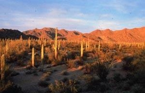
This wilderness includes 13 miles of the Maricopa Mountain range, a low elevation Sonoran Desert range, and extensive desert plains. The eastern part of the wilderness has an isolated and screened mountainous interior, formed by long ridges and isolated peaks, separated by plains and washes. The western part is dominated by desert flats fronting the east-west trending Maricopa Mountains ridgeline.

This area’s large size, varied landforms, and wildness provide outstanding opportunities for solitude and primitive recreation. Hiking, backpacking, horseback riding, camping, wildlife observation and photography are some activities both experienced and family-oriented outdoor enthusiasts can enjoy. Desert bighorn sheep, desert tortoise, coyotes, bobcat, fox, deer, Gambel’s quail and various raptors also inhabit the wilderness. Saguaro, cholla, and ocotillo, paloverde and mesquite are among the many plant species.

Gallery

Directions

This wilderness area is a two-hour drive from metropolitan Phoenix, but access is difficult. Because road conditions vary, high-clearance and four wheel-drive vehicles are recommended. Interstate Highway 8 parallels the south boundary of the wilderness, but offers no access to the wilderness. The north boundary can be accessed from primitive dirt roads south of Maricopa Road, but active railroad tracks and rights-of-way restrict public crossings. No roads lead to the western and eastern boundaries of the wilderness.

GPS Coordinates

Latitude 32° 55′ 31.0778″ N

Longitude 112° 23′ 54.0413″ W

Categories
Uncategorized

Gunsight Wash

Dispersed camping near Why, AZ in the Sonoran Desert.

Directions

Approximately 1.2 miles south of intersection of hwy 85 and 86 in Why on right side of road BLM land. Entrance just south of bridge over wash, through gate.

GPS Coordinates

Latitude 32° 14′ 22.1280″ N

Longitude 112° 45′ 2.2680″ W