Overview
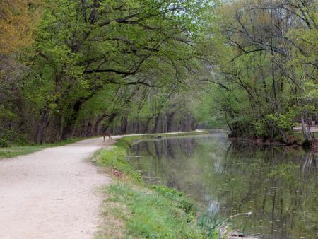
The Marsden Tract Group Campground was built by scouts to provide access to larger campsites within easy commuting distance of the D.C. Metro area. It is located at Mile 11.5 on the C&O Canal Towpath, between the Carderock Recreation Area and Anglers Inn. The group campsites are nestled in the woods between the Canal and the Potomac River and they are a short distance from many recreational opportunities. Fishing, rock climbing, paddling and hiking are but a few possibilities while staying at Marsden Tract.
Recreation
The most popular activity for Marsden Tract campers is hiking the three sections (A, B and C) of the Billy Goat Trail, one of the most popular and challenging rock hikes in the east. There are also many woodland trails for beginners and experts alike. Fishing is also a popular pastime in both the C&O Canal and the Potomac River. Be sure to acquire a Maryland fishing license for those age 16 or older. Virginia licenses are approved for fishing in the Potomac only.
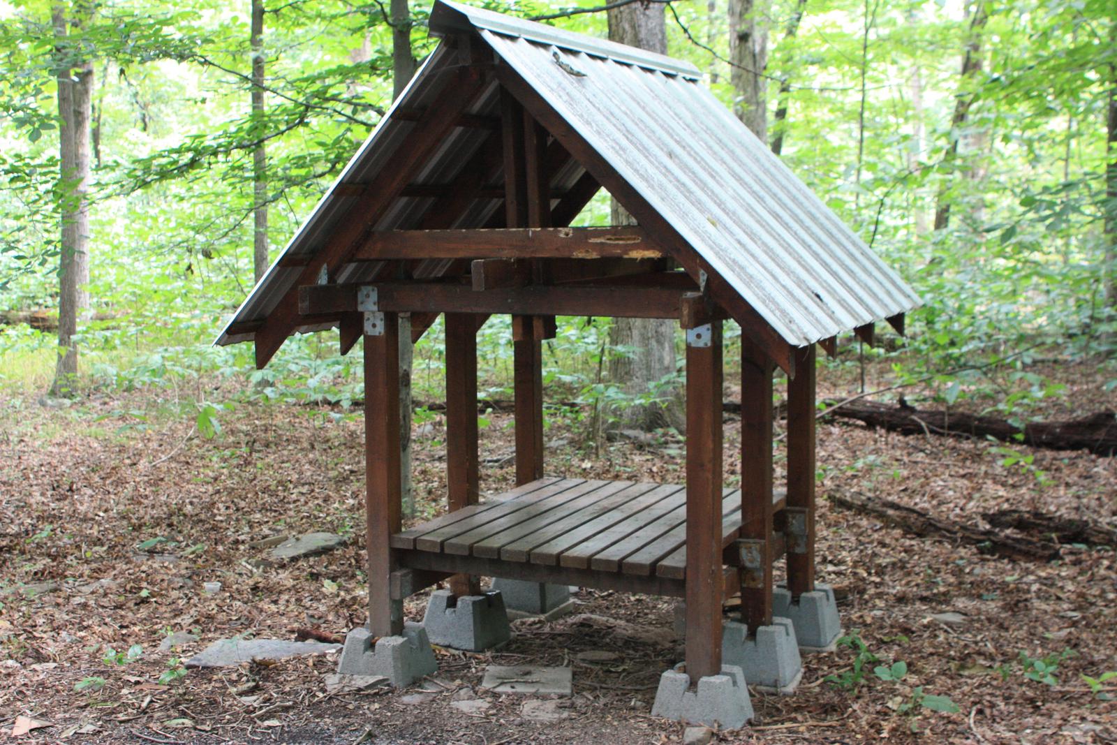
Facilities
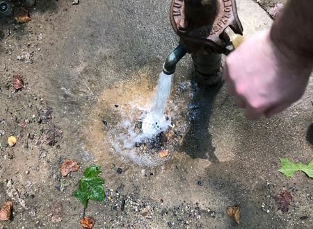
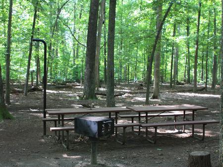
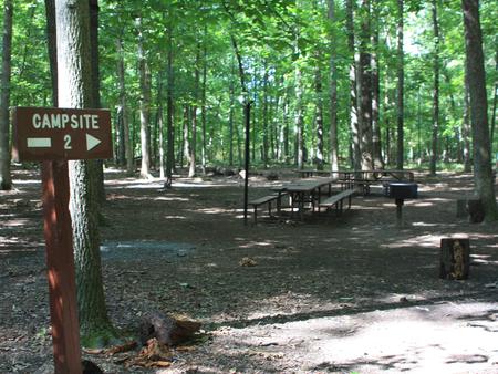
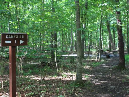
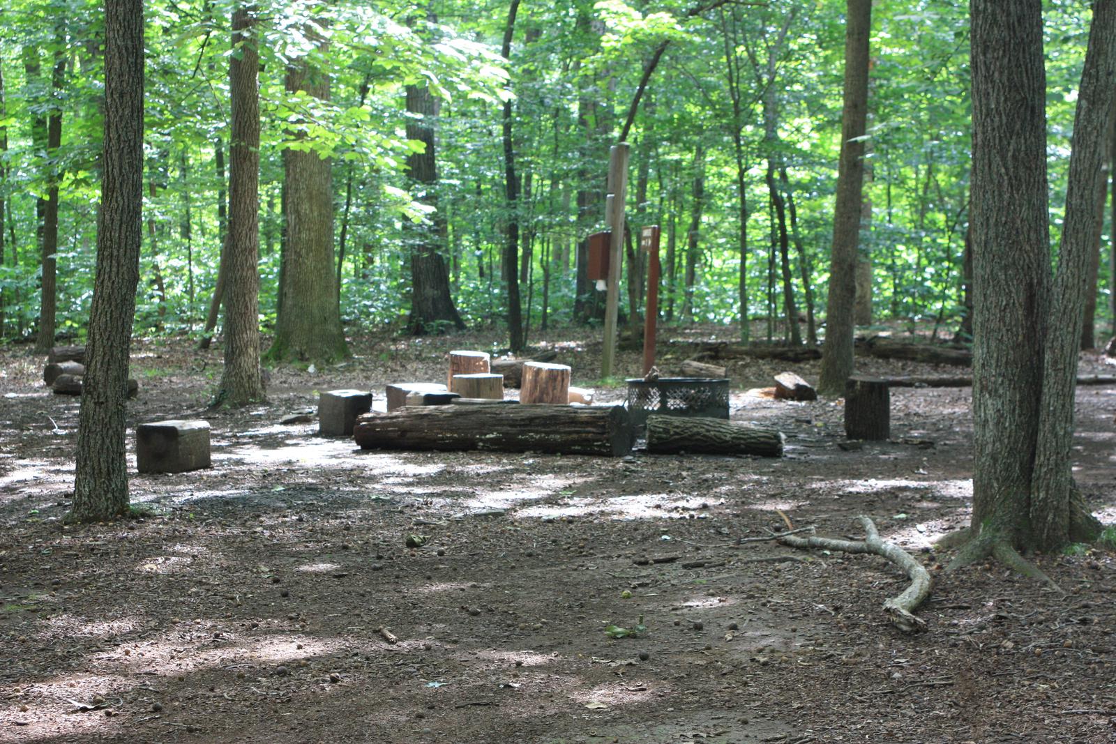
The campground has six group campsites; all will accommodate up to 30 campers at each site. Each campsite has a picnic table and a fire ring. Portable toilets are located between group campsite #1 and group campsite #2. Potable water is a short walk up the towpath and across the footbridge (may not be available during cold winter months). No vehicle traffic is allowed on the towpath and access to the campsites is by foot only. Carderock Recreation Area or Angler’s Inn are the two closest parking areas. Each is a one-mile walk respectively. There is a footbridge over the towpath off of MacArthur Blvd. near the interesection of Brickyard Rd. This area may be used to off-load gear and be walked down the hill, however overnight parking in this area is not permitted.
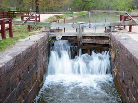
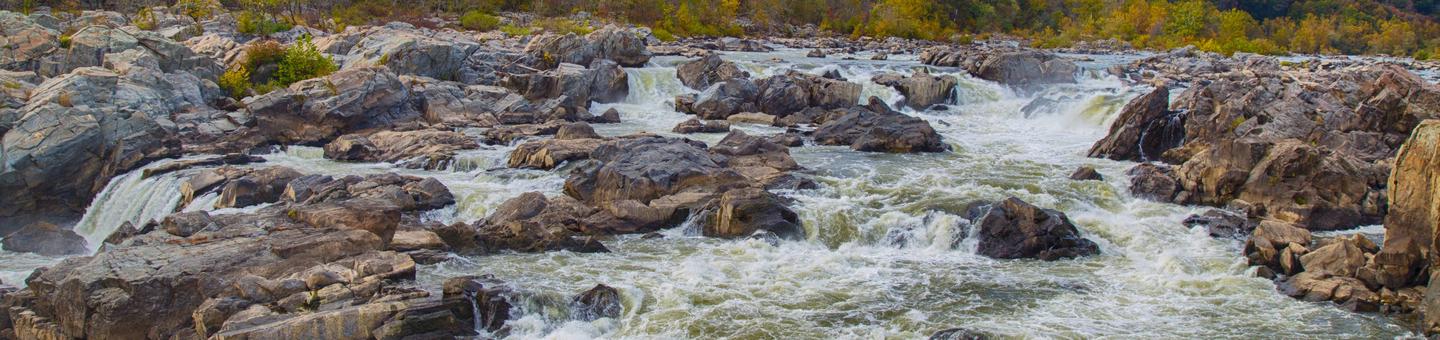
Natural Features
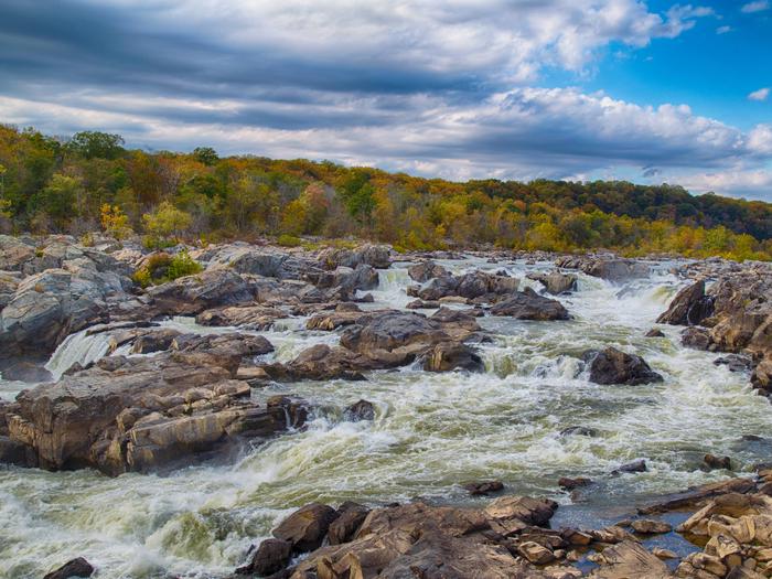
Marsden Tract Group Campsite is just south of the Great Falls of the Potomac and Mather Gorge. These two stunning features provide an excellent example of local geology while showing the sheer force and power of nature.
Nearby Attractions
Marsden Tract Group Campsite is located about 14 miles outside of Washington, D.C., providing affordable camping near the nation’s capital. Many campers will base out of Marsden to see the sites such as the Smithsonian Institution, National Mall, Capitol and The White House.
Nearby Activities
- Biking
- Camping
- Hiking
Gallery
Directions
You may park at either the Carderock Recreation Area or the gravel lots across from the Anglers Inn Restaurant. We recommend Carderock as it is slightly closer to walk the towpath to the campsite from there. Search “Billy Goat Trail C – North Parking Lot” on Google Maps for the best directions.
- From I-495 in Maryland:
1. Take Exit 41 toward Carderock/Great Falls.
2. Merge onto the Clara Barton Pkwy and continue 1 mile to the Carderock exit (on the right is the David Taylor Model Basin-9500 MacArthur Blvd., West Bethesda, MD 20817).
3. Take the Carderock exit and at the stop sign, turn left to cross over the Clara Barton Pkwy. Follow the road until you reach a second stop sign.
4. Turn right right and continue to the last parking lot. Take the short walking path to the canal. Turn upstream and hike about a 1/2 mile.
- From I-495 in Virginia:
1. Take Exit 41 (Carderock/Glen Echo) from the American Legion Bridge and at the fork, bear left toward Great Falls/Carderock.
2. Merge onto the Clara Barton Pkwy and continue 1 mile to the Carderock exit (on the right is the David Taylor Model Basin 9500 MacArthur Blvd., West Bethesda, MD 20817).
3. Take the Carderock exit and at the stop sign, turn left to cross over the Clara Barton Pkwy. Follow the road until you reach a second stop sign.
4. Turn right right and continue to the last parking lot. Take the short walking path to the canal. Turn upstream and hike about a 1/2 mile. - From Washington (Georgetown):
1. From the intersection of Street and Key Bridge, go west for approximately .5 miles and bear left onto Canal Road.
2. Stay straight on Canal Road which turns into the Clara Barton Pkwy and follow the Clara Barton Pkwy for approximately 9 miles to the Carderock exit (on the right is the David Taylor Model Basin -9500 MacArthur Blvd., West Bethesda, MD 20817).
3. Take the Carderock exit and at the stop sign, turn left to cross over the Clara Barton Pkwy. Follow the road until you reach a second stop sign.
4. Turn right right and continue to the last parking lot. Take the short walking path to the canal. Turn upstream and hike about a 1/2 mile. - Directions from I-270 on reverse side.
From I-270:
1. Take I-270 South toward Washington.
2. Keep right to take I-270 Spur South toward I-270/Washington/I-495 /Northern Virginia.
3. I-270 Spur South becomes I-495 South/Capital Beltway.
4. Take Exit 41 toward Carderock/Great Falls.
5. Merge onto the Clara Barton Pkwy and continue 1 mile to the Carderock exit (on the right is the David Taylor Model Basin 9500 MacArthur Blvd., West Bethesda, MD 20817).
6. Take the Carderock exit and at the stop sign, turn left to cross over the Clara Barton Pkwy. Follow the road until you reach a second stop sign.
7. Turn right right and continue to the last parking lot. Take the short walking path to the canal. Turn upstream and hike about a 1/2 mile.Park Emergencies: (866) 677-6677 or 911
GPS Coordinates
Latitude 38° 58′ 43.2401″ N
Longitude 77° 12′ 57.8599″ W