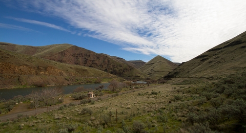
The Macks Canyon archaeological site is a large, prehistoric village locale overlooking the Deschutes River in north-central Oregon. The site is characterized by shallow, circular, semi-subterranean house depressions, surface artifacts, and riverine shell deposits. Limited excavations conducted in the late 1960’s indicate that the site was the location of a winter village occupied by Sahaptin-speaking people of the Columbia Plateau. Although the main period of occupation appears to have occurred within the last 2,000 years, the site may have been occupied as early as 5,000 BC. A campground and boat ramp are situated at the end of the Access Road along the east bank of the Lower Deschutes River. The area is popular with boaters and fishermen. The route to Macks Canyon is also a National Back Country Byway.
Gallery
Directions
From Maupin City Park in Maupin, Oregon, proceed a short distance north to the junction of Bakeoven Road and the BLM Access Road.Turn left onto BLM Access Road and drive 7.0 miles.Continue onto Deschutes River Road for one mile. Turn right onto OR-216 E (signs for Grass Valley) and proceed for 0.5 mile. Turn left onto BLM Access Road and drive 17.4 miles to the road’s end.
GPS Coordinates
Latitude 45° 23′ 25.4400″ N
Longitude 120° 52′ 43.2120″ W

