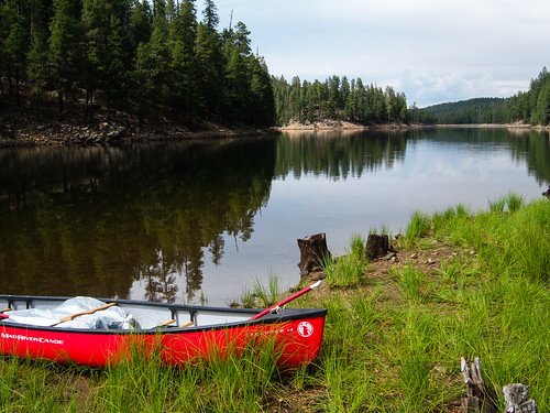
This secluded forest lake attracts visitors for a number of reasons. Surrounded by ponderosa pines, with a picturesque island in its middle, Knoll Lake provides a scenic setting in which to enjoy your canoe or other small boat. Fishing is good here too, offering rainbow, brown and brook trout.
If the fish aren’t biting, you’ll definitely want to take a tour of the nearby Mogollon Rim. This two thousand foot escarpment marks the southern edge of the Colorado Plateau and drops from cool highlands to low deserts in a picturesque, stomach wrenching plunge.
The lake covers approximately 75 acres and is about 50 feet deep.
Directions
Location: 108 miles southeast of Flagstaff on paved and graveled Forest Roads. Elevation is 7,340 feet.
GPS (Map): 34°25’53.4″N 111°05’09.8″W
Access: From Flagstaff take Hwy 3 (Lake Mary Rd) south 55 miles to Clints Well. Turn left (north east) on Hwy 87, go 10 miles to FR 95 which is just past the Blue Ridge office of the Mogollon Rim Ranger District. Turn right and go 6 miles to FR 96 veering left and travel 2 miles to FR 321. Turn right and drive 10 miles to FR 300. Turn left (east) and go 4 miles to FR 295E. Turn left again and drive to Knoll Lake.
Click on map thumbnail for larger view.
GPS Coordinates
Latitude 34° 25′ 53.3964″ N
Longitude 111° 5′ 9.8088″ W

![[photo] Knoll Lake - Click for Larger view](http://www.fs.usda.gov/Internet/FSE_MEDIA/stelprdb5301074.jpg)

