Overview
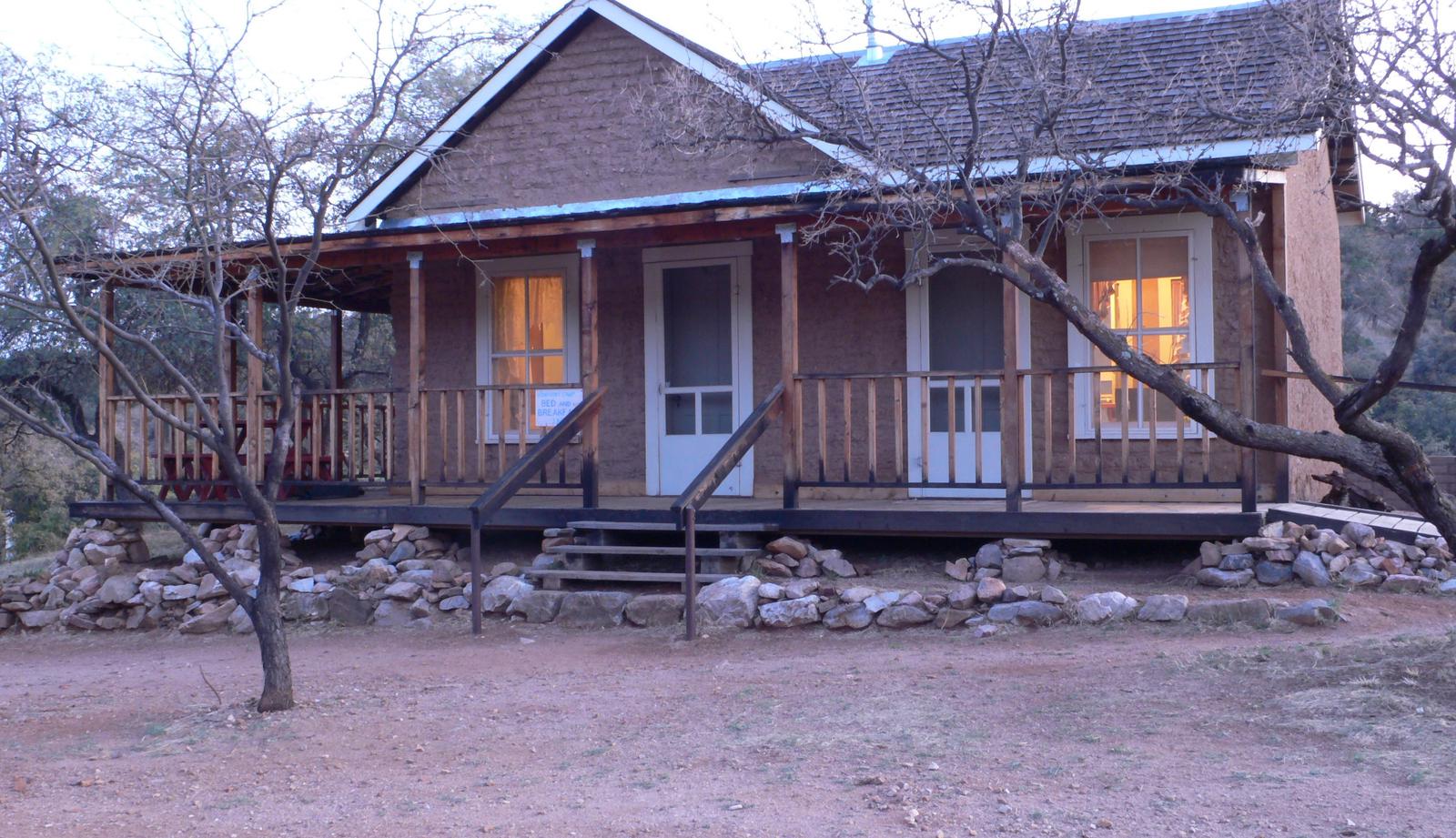
Kentucky Camp Cabin and Headquarters is located in the Santa Rita Mountains near Sonoita, Arizona in the Coronado National Forest. The five adobe buildings originally served as headquarters for the Santa Rita Water and Mining Company from 1902 to 1906. The facility also served as a cattle ranch from the 1920s through the 1960s. The Forest Service acquired the land in 1989 and it has since become an ideal location for guests seeking a unique lodging experience, rich in mining and ranching history.
Recreation
The area has popular hiking, mountain biking, and horseback riding trails which range from gentle walking paths, to steep, strenuous trails leading to the top of 9,453-foot Mt. Wrightson and other nearby peaks. The Arizona Trail runs through Kentucky Camp. Two-track and dirt roads are available for off-highway vehicle travel around Kentucky Camp; however, off-highway vehicles may not be ridden within the site’s boundaries.
Birders congregate in southeastern Arizona as it is touted as one of the country’s most revered birding areas. With fifteen species of hummingbirds, 36 species of wood warblers, and over 256 documented bird species, the area is a birder’s paradise.
Facilities
This facility consists of a cabin and headquarters building. The cabin can accommodate up to five people, and is equipped with two twin beds, a twin bunkbed and a full-sized futon. The kitchen has basic amenities including a small refrigerator, microwave, hot plate, coffee pot, dishes, utensils, cookware, and a table and chairs. The cabin has propane heat. Outside, there is a grill and picnic table for outdoor dining. A vault toilet, stall for solar showers, and an outdoor sink are located on site. The cabin has electricity, but no indoor running water. Guests must bring their own food, sleeping bags, linens, towels, dish soap, matches, a first aid kit, toilet paper and garbage bags.
The headquarters building is a day-use area only, and can accommodate up to 50 people. The building is available for meetings, retreats, weddings, and family reunions. Amenities in this building include tables and chairs, couches, rocking chairs, and a large wrap-around porch with four Adirondack chairs. A small kitchenette is equipped with a refrigerator, microwave, coffee pot, crockpot, dishes, utensils, and some cookware. Outside are a charcoal grill and two picnic tables. This building also has electricity, but no heat or indoor plumbing.
Natural Features
Spanning four life zones and several ecosystems between the Sonoran desert and the “Sky Island” mountain peaks, the area surrounding the camp and cabin supports abundant and biologically diverse plant and animal communities.
Mountain peaks, high desert grasslands, and seasonal streams provide diverse habitat for the area’s abundant wildlife. White-tailed and mule deer, rabbits, wild turkeys, and squirrels are commonly seen, along with numerous bird species. While black bear, Coati, foxes, ring-tailed cats, bobcats and mountain lions are more elusive.
Nearby Attractions
Numerous attractions are available nearby in Madera Canyon. Attractions within a one-hour drive include the Mining Museum, Titan Missile Museum, Whipple Observatory, Arizona-Sonora Desert Museum, San Xavier Mission, the Amerind Foundation, and Tumacacori National Historical Park.
Nearby Activities
- Camping
- Hiking
- Hunting
- Wildlife viewing
- Mountain biking
- Birding
- Historic sites
- Winery tours
Gallery
Directions
From Tucson, take I-10 east to Exit #281 (Highway 83 – Sonoita/Patagonia). Travel south on Highway 83 for approximately 21 miles to the signed turnoff for Gardner Canyon Road. Turn right on Gardner Canyon Road and continue 0.9 mile to Forest Service Road 163. Turn right on Forest Service Road 163 and continue approximately 5 miles to the entrance to Kentucky Camp. Stay to the left and continue to the parking lot and gate that marks the entrance to Kentucky Camp. There are signs to Kentucky Camp from Highway 83.
GPS Coordinates
Latitude 31° 43′ 59.9999″ N
Longitude 110° 43′ 0.0001″ W

