This 11,550 acre Wilderness boasts one of the most diverse riparian areas in Arizona. Over 30 species of trees and shrubs, and over a 100 species of birds have been observed in this unique habitat. The lushness of the riparian area strikes a sharp contrast to the brittle desert that surrounds it. Read more…
View Fossil Creek & Fossil Springs Wilderness photo gallery [Flickr]

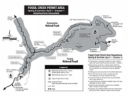
Permits Required April 1 to October 1

Spring-Summer Guide
April 1 – October 1
(PDF, 1.7 MB)
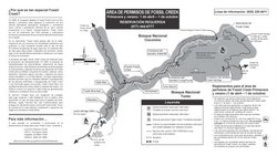
Mapa y guía de área de permisos de Fossil Creek (Español)
(PDF, 400 kB)
No more fighting the crowds at Fossil Creek! Visitors proclaim the new permit system is a roaring success.
Spring-Summer Season (April 1 – October 1): A reserved, printed permit is required. Reserve a parking spot at Recreation.gov for any of the parking areas in the Fossil Creek area. During the Spring-Summer Season, the Fossil Creek and Springs area is day use only. Camping, campfires, and glass containers are prohibited.
See Fossil Creek Reservation System Information for videos, news, and more!
For current conditions, call the
Fossil Creek Hotline 928-226-4611
Directions
Location: Fossil Creek is located about 22 miles southeast of Camp Verde (86 miles south of Flagstaff) off paved and dirt roads. Fossil Creek Rd. (FR 708) and Childs Rd. (FR 502) are steep and very rough. These roads may be extremely muddy, slippery, and treacherous after it rains.
GPS (Map): 34°24’24.3″N 111°34’06.4″W
Access via Camp Verde: From Interstate 17, exit 287, turn east on State Route 260 towards Payson and travel 10 miles. Between mile 228 and 229, Forest Road 708 (Fossil Creek Road) will intersect SR 260 on the right, signed as Fossil Creek/Verde River. Travel 14 miles down this rough dirt road (high-clearance 4WD vehicles recommended) to the intersection with Forest Road 502 (Childs Road).
Download seasonal recreation guides for Fossil Creek and Fossil Springs Wilderness

Spring-Summer Guide
April 1 – October 1
(PDF, 1.7 MB)

Fall-Winter Guide
October 2 – March 31
(PDF, 1.6 MB)
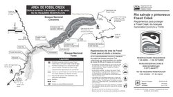
Mapas y guías de área de permisos de Fossil Creek (Español)

Guía para la primavera y el verano
1 de abril – 1 de octubre
(PDF, 220 kB)

Guía para el otoño e invierno
2 de octubre – 31 de marzo
(PDF, 250 kB)
GPS Coordinates
Latitude 34° 26′ 55.3092″ N
Longitude 111° 32′ 37.8312″ W

