Overview:
Welcome to the river permit lottery application site for Dinosaur National Monument-home to the Green and Yampa Rivers, two of the west’s premier whitewater rivers.
Green River: Gates of Lodore
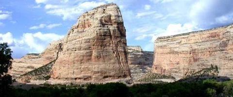
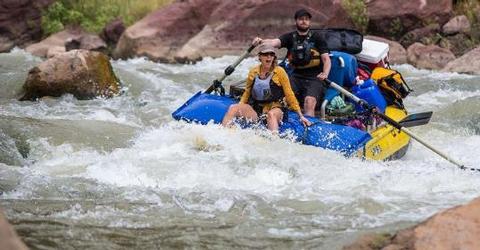
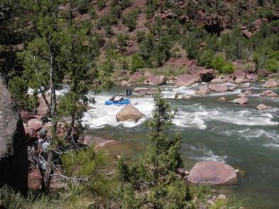
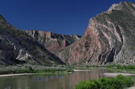
The Green River flows south out of Browns Park into Dinosaur National Monument and cuts through the Uinta Mountains, the largest east-west extending mountain range in the lower 48 states. Within the monument and along this stretch of the Green River lies the imposing Canyon of Lodore, which received its name from John Wesley Powell’s expedition in 1869. Three of the rapids so impressed Powell that he named them Disaster Falls, Triplet Falls and Hell’s Half Mile.
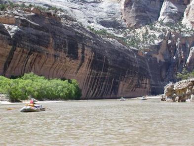
The 19-mile run down the Green River from the Gates of Lodore to Echo Park is different today than in Powell’s time, largely because of the dam at Flaming Gorge which regulates the flow. This allows for a longer rafting season, but one that is not much affected by spring run-off. However, there are many named and unnamed rapids, well-spaced as in most pool-drop rivers and plenty of beautiful river side campsites and hikes, dominated by the almost 2,000 feet high red cliffs.
Yampa River
The Yampa River begins at Deerlodge Park and rushes downstream 44-miles to join the Green River at Echo Park. Boaters continue downstream on the Green River to the take-out at the Split Mountain boat ramp. The Yampa is the largest free-flowing tributary within the Colorado River system. As such, it has a shorter season marked by fluctuations in water level resulting from snow received in the winter. It is characterized by such famous rapids as Teepee, Big Joe and Warm Springs.
Below the Confluence of the Yampa and the Green River
All trips continue downstream on the Green River from Echo Park through the 17-miles that is Whirlpool Canyon. It was named by Powell because of the squirrelly and unpredictable water the explorers experienced here.
The last section of the Green River is the nine miles of Split Mountain Canyon beginning at the Rainbow Park boat ramp flowing swiftly downstream, punctuated by four named rapids and assorted riffles before reaching the take-out at the Split Mountain boat ramp.
The river corridors within Dinosaur National Monument, with the exception of Echo Park, are proposed wilderness and consequently managed as such. This means you will not hear or see motors or vehicles anywhere along your trip with the possible exception of Echo Park where a dirt road comes down to the water’s edge.
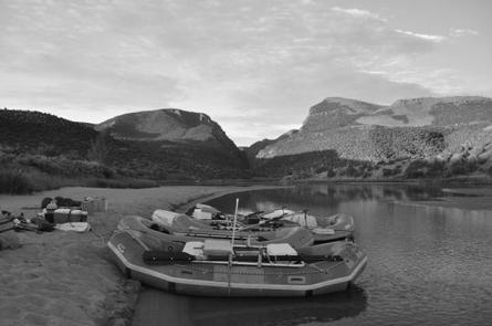
Camping facilities exist at the Lodore and Deerlodge launch sites. Each has campsites, water available seasonally, an information station, staffed ranger station and vault toilets. These remote sites do not provide trash receptacles because of issues with bears.
The launch locations have been kept fairly primitive to help the visitor transition to the wilderness environment of the canyon. Due to the remoteness of the area and long drive times, many groups camp at their launch site the night before their river launch.
At the Split Mountain take-out, there are reservable group campsites (flush toilets seasonally, no showers) as well as vault toilets year-round and a seasonally operational groover dump site. Nearby is the world famous dinosaur quarry where you can see 149 million year old dinosaur bones encased in the rock.
Dinosaur National Monument: Green and Yampa Rivers Map
Gallery
Directions
Lodore:
From Craig, CO: drive west on US Hwy 40 to Maybell, CO (appr. 30 miles). Just east of Maybell, turn right (north) onto CO 318. Follow CO 318 approximately 60 miles. Turn left onto CR 34N. At intersection of CR 34N and CR 34, turn left again. Stay on CR 34 until you reach the boat ramp. It is 7 miles from CO 318 to the boat ramp on dirt roads.
From park headquarters in Dinosaur, CO:drive east on US Hwy 40 approximately 55 miles until you reach CO 318 just prior to Maybell, CO. Turn left onto CO 318 and follow rest of directions. You will not find Gates of Lodore on a GPS mapping device.
Deerlodge Park on the Yampa River: drive east from Dinosaur CO on highway 40 forty-one miles to the turn-off marked "Deerlodge Park". Turn left onto the road and travel 12 miles north to the boatramp at the end of the road.
Rainbow Park boatramp: from Jensen travel 4 miles north on cty rd 149 to Brush Creek Rd. Turn left on this road and follow it to the end, where you will turn right. Follow this partially paved gravelly road for several miles until you see a right hand turn marked with a small sign that reads ‘Rainbow Park’. Turn right onto this road and travel to the end.
Split Mountain boatramp: turn north from highway 40 onto county road 149 and travel 10 miles north into Dinosaur National Monument. At the ten mile marker, there will be a sign pointing to the left for the split mountain boatramp/campground. Turn left and follow this road to the end.
GPS Coordinates
Latitude 40° 43′ 30.0000″ N
Longitude 108° 53′ 30.0001″ W

