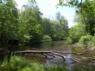
Diamond Point campground is surrounded by white pine forest. The most common use for the site is for canoe launching, particularly on weekends.
Directions
From Fremont –
- Travel west on M-82 for 5 miles. M-82 becomes Skeels Rd.
- Continue on Skeels Rd. for 8.75 miles.
- Turn left and travel south on Nichols Rd. for .5 miles.
- Turn right and travel west on Fruitvale Rd./B-86 for .75 miles.
- Turn right and travel north on Kops Rd. for .5 miles.
- Turn left and travel west on FR 9304.
- The site is located on the right.
GPS Coordinates
Latitude 43° 28′ 29.1864″ N
Longitude 86° 12′ 41.3244″ W