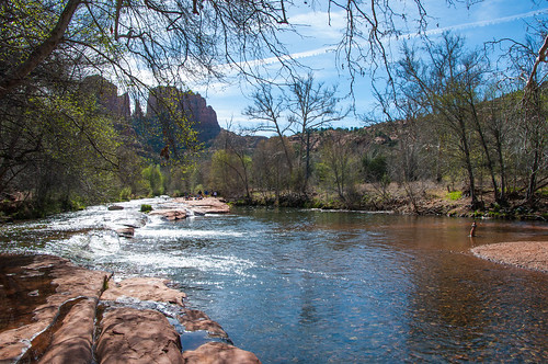
One of the most photographed scenes in the southwest is towering Cathedral Rock reflected in the waters of Oak Creek at Red Rock Crossing. It should come as no surprise, then, that the picnic area located at that same site is as popular as it is beautiful. People come here to fish, swim, and wade in the creek, as well as to picnic and photograph the scenery. At times it can become quite crowded. But if you come early in the morning or on a weekday, it’s possible to have the world class beauty of Red Rock Crossing all to yourself, or nearly so.
Fourth graders! The Every Kid in a Park 4th Grade Pass will be honored through 2018!
Attractions: Picnicking, waterplay, wildlife watching, photography, and fishing.
Directions
Location: 37 miles south of Flagstaff, 7 miles southwest of Sedona. Elevation is 4,000 feet.
GPS (Map): 34°49’35.7″N 111°48’25.5″W
Access: Drive west from Sedona on US 89A. Just outside town, turn south on FR 216 (Upper Red Rock Loop Road). Drive about 1.5 miles and follow the signs to Red Rock Crossing. All roads except the short segment leading from Red Rock Crossing Road to the picnic area are paved.
Maps
- Red Rock Country Maps: Download Red Rock Country trail maps and find other Sedona recreation resources. See the Sedona Southwest map for this trail.
- The Digital Travel Map: Whether you’re driving, hiking, riding, or exploring, you will find this full-color, GPS-enabled map a handy reference to have on your mobile device. The map show trails, recreation sites, major landmarks, and forest roads.
- Printed Maps: A variety of printed recreation maps for Sedona and Oak Creek Canyon can be purchased in our local offices and visitor centers, or ordered by phone.
Click map thumbnail for a larger view.
GPS Coordinates
Latitude 34° 49′ 35.7312″ N
Longitude 111° 48′ 25.5204″ W


