This recreation area is part of Lake Sidney Lanier
Directions
GPS Coordinates
Latitude 34° 13′ 14.5528″ N
Longitude 83° 56′ 53.8393″ W
This recreation area is part of Lake Sidney Lanier
Latitude 34° 13′ 14.5528″ N
Longitude 83° 56′ 53.8393″ W
This recreation area is part of Lake Sidney Lanier
Latitude 34° 11′ 0.6432″ N
Longitude 84° 1′ 45.0012″ W
This recreation area is part of Lake Sidney Lanier
Latitude 34° 17′ 17.8620″ N
Longitude 83° 54′ 16.3188″ W
This recreation area is part of Lake Sidney Lanier
Latitude 34° 10′ 58.3320″ N
Longitude 83° 59′ 16.5048″ W
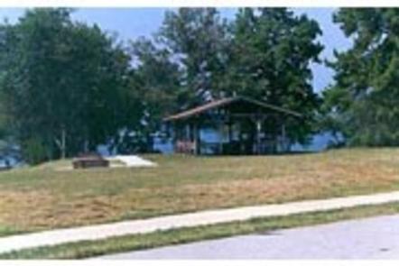
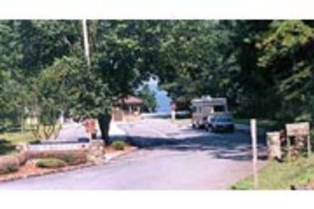
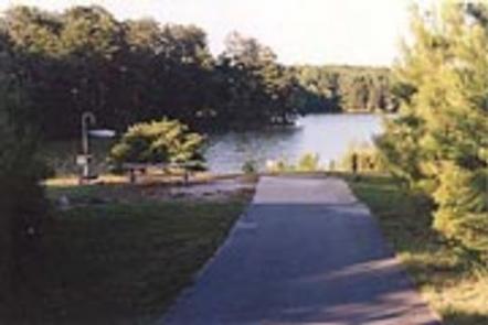
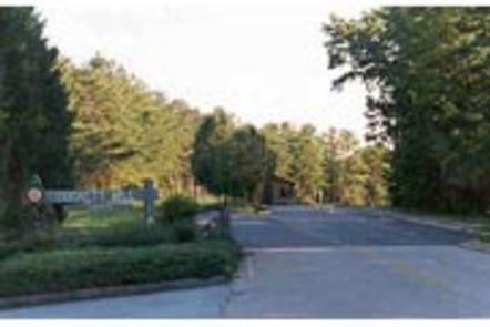
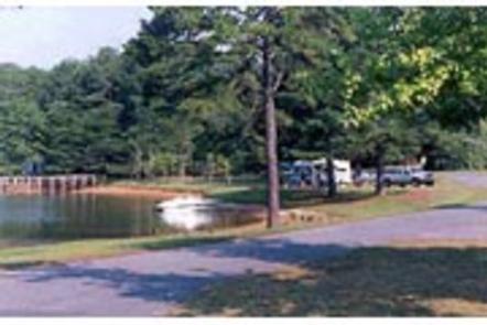
Van Pugh South Campground lies on the banks of Lake Sidney Lanier in the foothills of the Blue Ridge Mountains of Northern Georgia.
The popular lake boasts nearly 700 miles of shoreline and over 100 small islands, providing over 11 million annual visitors with limitless recreation opportunities.
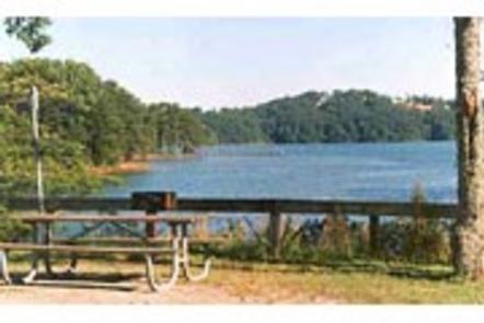
Lake Lanier offers excellent boating, fishing and swimming. The lake offers additional opportunities for kayaking, wake boarding and much more.
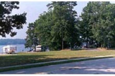
The campground contains 37 sites with water and electric hookups and 18 primitive tent-only sites. Amenities include accessible flush toilets and showers, drinking water, laundry facilities and a dump station. An accessible boat ramp is on-site.
The reservoir was created in 1956 with the completion of Buford Dam on the Chattahoochee River, and today spans 38,000 acres of water in the lush foothills of the Blue Ridge Mountains. Dense forests of oak, hickory and pine cover the region, providing shade in the campground and abundant wildlife habitat.
Lake Lanier Islands is within driving distance and along with other parks provides many opportunities for outdoor recreation.
There are several towns within driving distance that provide opportinuties to explore.
Cancellations must be made via the online/phone reservation system or in person at the gatehouse. Cancellation calls to the gatehouse will not be honored.
Take I-85 north to I-985, take Exit 8, turn left on Highway 347/Friendship Road. Turn right on McEver Road, then left on Gaines Ferry Road and follow signs to the campground.
Latitude 34° 11′ 3.9998″ N
Longitude 83° 59′ 26.0002″ W
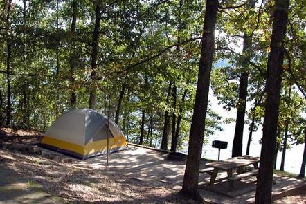
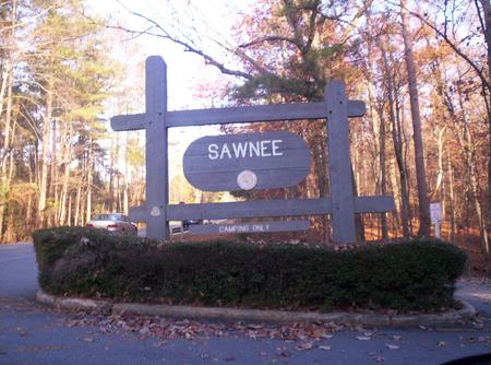
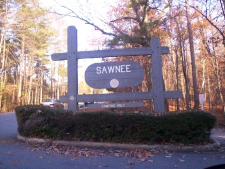
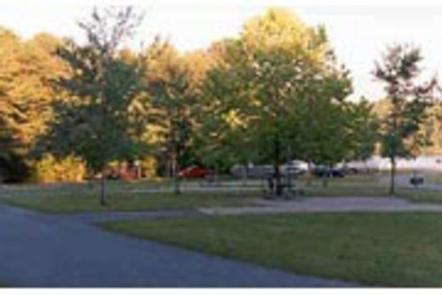
Sawnee Campground lies just north of the Buford Dam on Lake Sidney Lanier. The campground features beautiful views of the lake as well as excellent access to boating and swimming.
The lake, named for the poet, Sidney Lanier, is well known for its aqua-blue colored water, spectacular scenery and variety of recreational activities. Each year, over 11 million people come to visit.
Sawnee Campground offers many outdoor recreation opportunities including fishing and swimming. On the lake there are opportunities for wake boarding, kayaking, boating and much more.
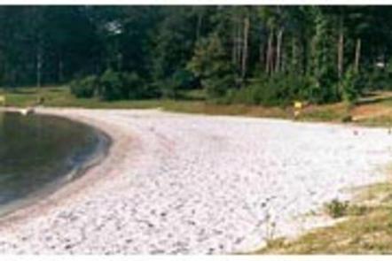
There’s also a swimming beach, playground and boat ramp available for campers.
Sawnee Campground offers 43 campsites with electric and water hookups (no sewer), 5 tent walk-in campsites with water and electric hookups, and 11 walk-in campsites without hookups. Additional amenities include restrooms/bathouses, laundry facilities, a playground and sandy swimming beach.
Lake Lanier boasts 38,000 surface water acres, 690 miles of shoreline and over 100 small islands. Its location in the forested foothills of the Georgia Blue Ridge Mountains, makes for a beautiful backdrop to any activity.
The reservior was created in 1956 with the completion of Buford Dam on the Chattahoochee River.
Take in views of the dam at the nearby Westbank Overlook, or head northwest of the campground for scenic drives and wildlife spotting opportunities at the Sawnee Mountain Preserve.
The city of Cumming is nearby and has shopping, restuarants, a fairground and much more.
Cancellations must be made via the online/phone reservation system or in person at the gatehouse. Cancellation calls to the gatehouse will not be honored.
Take US 400 north exit 14, turn right on Highway 20 east, turn left onto Sanders Rd, at first stop sign turn right on Buford Dam Rd. Campground is on the left.
Latitude 34° 10′ 36.0001″ N
Longitude 84° 4′ 31.0001″ W
Old Federal Campground lies on the eastern banks of Lake Sidney Lanier in Northern Georgia.
Popular for its aqua-blue waters and spectacular scenery, Lake Sidney Lanier hosts over 11 million visitors annually for fantastic fishing and boating opportunities.
Old Federal Campground offers many outdoor recreation opportunities including fishing, swimming, picnicking and bike riding. On the lake there are opportunities for wake boarding, kayaking, boating and much more.
There’s also a swimming beach and boat ramp available for campers.
There are 65 campsites that have electric and water hookups (no sewer) and 12 primitive tent-only campsites. There are also 7 walk-in sites for those who don’t mind leaving their vehicles behind. Campers will have access to restrooms/bathouses, laundry facilities, two picnic shelters and a dump station.
Lake Sidney Lanier is nestled in the foothills of the Georgia Blue Ridge Mountains. The lake features 692 miles of shoreline and spans 38,000 surface water acres and 17,000 acres of lush terrain.
The reservoir was created in 1956 with teh completion of Buford Dam on the Chattahoochee River.
Lake Lanier Islands as well as other nearby Army Corps and county parks provide may different recreation opportunities at the lake.
The nearby city of Gainesville provides many opportunities for those looking to explore the local area.
Cancellations must be made via the online/phone reservation system or in person at the gatehouse. Cancellation calls to the gatehouse will not be honored.
Take I-85 north to I-985, take Exit 8, turn left on Hwy 347/Friendship
Rd., turn right on McEver Rd., turn left on Jim Crow Rd. and follow
signs to the campground.
Latitude 34° 13′ 19.9999″ N
Longitude 83° 56′ 57.9998″ W
Duckett Mill Campground is located on Lake Sidney Lanier. With over 692 miles of shoreline, the lake is well known for its aqua-blue water, spectacular scenery and variety of recreational activities. The lake has over 11 million visitors annually.
Constructed by the U.S. Army Corps of Engineers in the 1950s, Lake Lanier is a multi-purpose lake that provides for flood protection, power production, water supply, navigation, recreation and fish and wildlife management.
Duckett Mill Campground offers many outdoor recreation opportunities including fishing, swimming and bike riding. On the lake there are opportunities for wake boarding, kayaking, boating and much more.
There’s also a swimming beach and a boat ramp (located just outside the campground) avaliable for campers.
The campground boasts 97 sites with water and electric hookup plus 14 tent-only sites. Restrooms/showerhouses, laundry facilities and a playground are among the amenities here.
Lake Lanier’s expansive 38,000 surface water acres touches five counties in northern Georgia. The lake, surrounded by rolling farmland, is just 1 hour from Atlanta.
Head to Don Carter State Park for birding and hiking opportunities, or climb Sawnee Mountain at the Sawnee Mountain Preserve for breathtaking views of the area.
The nearby cities of Dawsonville, Dalonega and Gainesville provide a wide variety of leisure activities.
Cancellations must be made via the online/phone reservation system or in person at the gatehouse. Cancellation calls to the gatehouse will not be honored.
To reach this park take state route 400 north to exit 17, turn right
on Georgia Highway 306, turn right on Georgia Highway 53, turn right on Duckett Mill road. Follow Duckett Mill Road into the campground.
Latitude 34° 18′ 29.4599″ N
Longitude 83° 55′ 52.7401″ W
Bolding Mill Campground is an excellent choice for camping on Lake Sidney Lanier, offering plenty of comfortable amenities in addition to a well-kept facility.
Visitors will enjoy fishing and boating on the lake as well as the lush picnic area and large swimming beach, perfect for families.
The large swimming beach is concrete, which provides a gentle slope and ADA access for visitors. An on-site boat ramp and fishing pier provide access to many water activities.
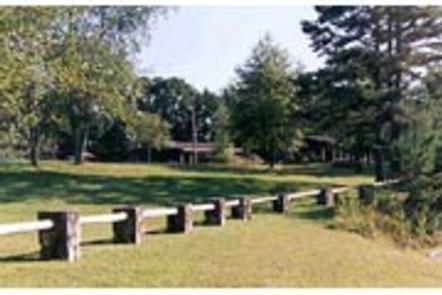
Land-based recreation features picnic shelters and playground area near the front of the park.
The campground offers 88 sites with electric and water hookups (no sewer). There’s also nine tent-only primitive sites. Campground conveniences include a laundry facility, fishing pier, and restroom/showerhouses.
Facilities outside of the campground but within Bolding Mill park include the playground, swim beach and boat ramp. There’s also two dump stations, inside and outside the campground which rotate use per year.
Lake Lanier spans 38,000 surface water acres and 17,000 land acres across five counties in northern Georgia. The reservoir is known for its aqua-blue coloring and spectacular scenery in the forested foothills of the Blue Ridge Mountains.
Bolding Mill campground is on the northwest side of the lake, which has plenty of grass and shade for comfortable camping.
Head to the Don Carter State Park for birding and hiking opportunities. Another idea is the Sawnee Mountain Preserve, with breathtaking scenic overlooks, hiking opportunities and rock climbing.
Nearby Gainesville, Dawsonville and Dalonega provide many different experiences and opportunities.
Cancellations must be made via the online/phone reservation system.
From Atlanta, GA, take SR 400 north to Exit 17, turn right on GA Hwy
306, turn right on GA Hwy 53, turn left on Old Sardis Rd, and turn left
on Chestatee Rd. Follow into campground.
Latitude 34° 20′ 16.5300″ N
Longitude 83° 57′ 4.1198″ W
Bald Ridge Creek Campground is on Lake Sidney Lanier, popular for its aqua-blue waters and spectacular scenery.
Each year, over 11 million visitors travel to Lake Sidney Lanier for fantastic fishing and boating on the beautiful reservoir in northern Georgia.
Bald Ridge Creek Campground offers many outdoor recreation opportunities including fishing, swimming, and bike riding. On the lake there are opportunities for wake boarding, kayaking, boating and much more.
There’s also a swimming beach and boat ramp available for campers.
The 82 campsites come with electric and water hookups (no sewer hookups). Additional conveniences in the well-maintained park include a dump station, laundry facilities, and restrooms/bathouses.
Lake Sidney Lanier is nestled in the foothills of the Georgia Blue Ridge Mountains. The lake features 692 miles of shoreline and spans 38,000 surface water acres and 17,000 acres of lush terrain.
The reservoir was created in 1956 with the completion of Buford Dam on the Chattahoochee River.
By boat, there’s plenty of coves and islands to explore on the lake. For land activities, head to the Sawnee Mountain Preserve for hiking, rock climbing and an interactive visitors center for kids.
The city of Cumming is nearby and has shopping, restuarants, a fairground and much more.
Cancellations must be made via the online/phone reservation system or in person at the gatehouse. Cancellation calls to the gatehouse will not be honored.
From Atlanta, GA, take SR 400 N to Exit 16, turn right on Pilgrim
Mill Rd., turn right on Sinclair Shoals Rd., turn left on Bald Ridge Rd.
Follow signs into campground.
Latitude 34° 12′ 14.0000″ N
Longitude 84° 5′ 10.0000″ W