This recreation area is part of Alabama River Lakes
Directions
GPS Coordinates
Latitude 32° 3′ 21.9024″ N
Longitude 87° 14′ 45.5100″ W
This recreation area is part of Alabama River Lakes
Latitude 32° 3′ 21.9024″ N
Longitude 87° 14′ 45.5100″ W
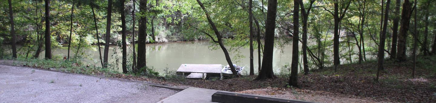
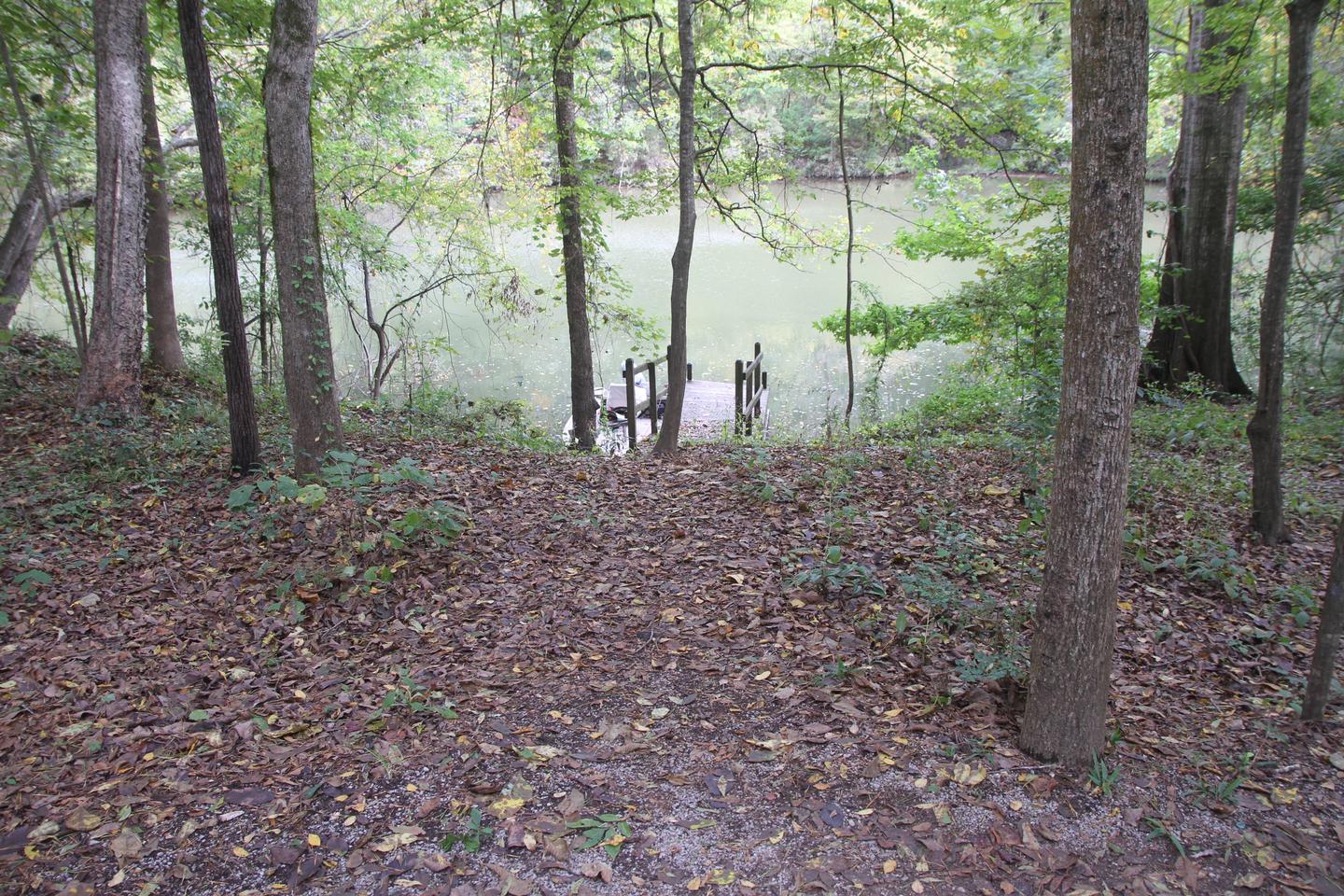
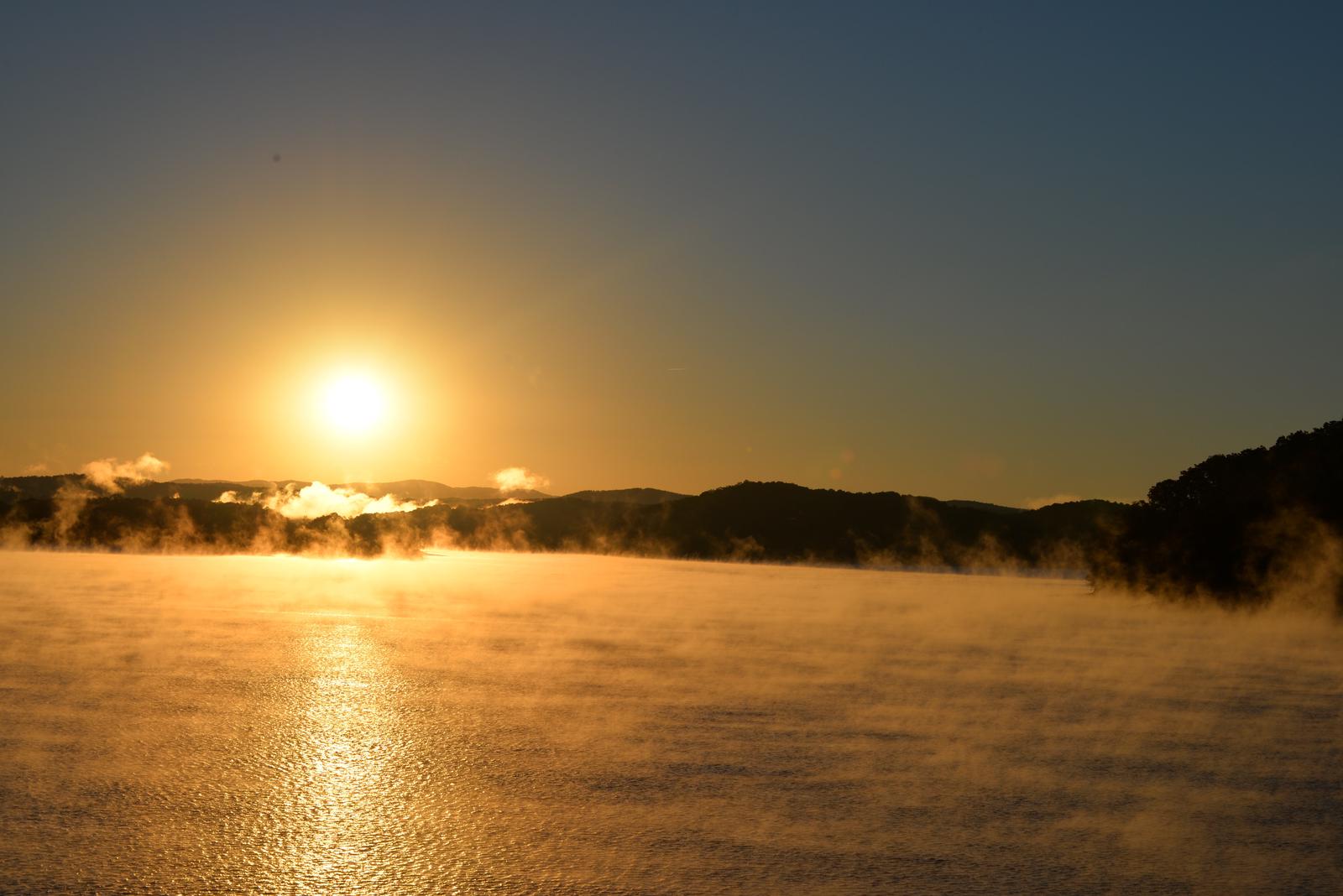
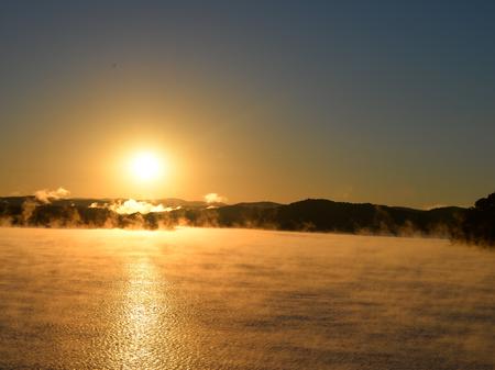
Six Mile Creek Campground is located on its namesake at scenic Dannelly Reservoir in Alabama’s Black Prairie Belt. The reservoir sits on the Alabama River and covers roughly 27 square miles, boasting more than 500 miles of shoreline.
Boating, fishing, hunting and hiking are popular activities.
The creek offers excellent fishing for bass, crappie, bluegill and catfish, and numerous fishing tournaments and annual festivals are held in the immediate area.
Whitetail deer and wild turkeys roam the park, creating excellent bow-hunting opportunities.
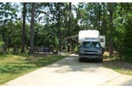
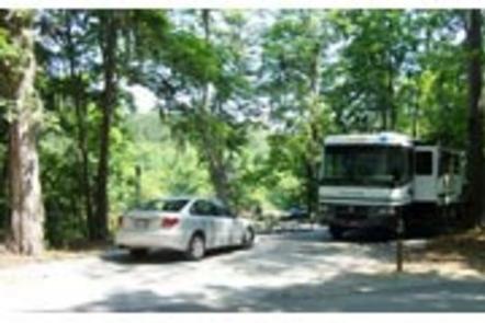
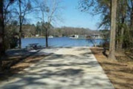
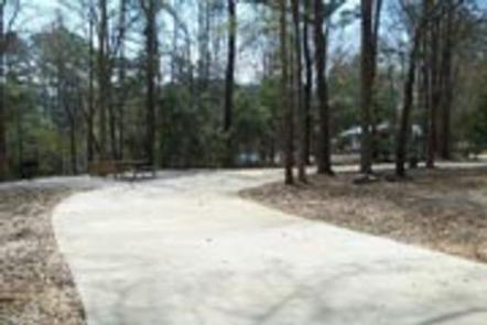
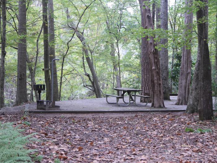
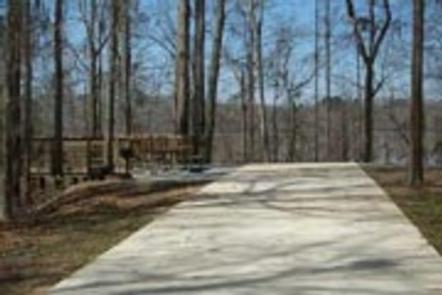
This peaceful waterfront campground is open from April – Labor Day and offers 31 family sites with electric hookups. Amenities include flush toilets, showers, drinking water, a dump station and boat dock.
The Black Prairie Belt is characterized by rich, dark soils and a mosaic of rolling grasslands and dense hardwood and pine forests.
From Selma, Alabama, follow US-41 south for 9 miles. Turn right on County Road 139 and follow the signs into the campground.
Latitude 32° 19′ 27.0001″ N
Longitude 87° 0′ 56.9999″ W
Prairie Creek Campground is situated beneath moss-draped oaks on the banks of Woodruff Lake. The lake is part of the scenic Alabama River in the region’s Black Prairie Belt.
For sportsmen, the campground offers a wonderful opportunity to relax between fishing and hunting trips. Water sports and hiking are also popular activities.
Woodruff Lake offers excellent fishing for bass, crappie, bluegill and catfish.
Boating, jet skiing and other water sports are big draws to the lake, and a boat ramp is provided for easy water access.
The Lowndes Wildlife Management area, located nearby, covers 12,500 acres and provides prime hunting for whitetail deer, wild turkey, hogs and a variety of small game and waterfowl.
This waterfront campground offers 55 family RV sites and seven tent-only sites, all with electric hookups.
Amenities include flush toilets, showers, drinking water, a dump station and laundry facilities.
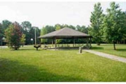
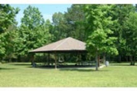
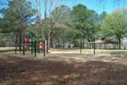
A beach, boat ramp, dock, playground, basketball court and picnic shelter make the campground ideal for families.
The Black Prairie Belt is characterized by rich, dark soils and a mosaic of rolling grasslands and dense hardwood and pine forests.

From Montgomery, Alabama, follow Highway 80 west for approximately 25 miles. Turn right on County Road 29 and follow the signs into the campground.
Latitude 32° 20′ 15.0000″ N
Longitude 86° 46′ 9.9998″ W
Gunter Hill Campground offers a peaceful scene of trees and nature on the backwaters of the Alabama River.
The fishing is excellent, providing challenges for the master angler as well as the occasional cane pole fisherman. Boating, hunting and hiking are popular activities.
The area’s waterways offer excellent fishing for crappie, bass and catfish. A boat ramp is provided for easy river access.
The Lowndes Wildlife Management area, located nearby, covers 12,500 acres and offers prime hunting for whitetail deer, wild turkeys and hogs, and a variety of small game and waterfowl.
The campground provides a basketball court and playground, offering additional recreation opportunities for visitors.
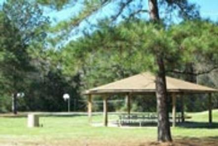
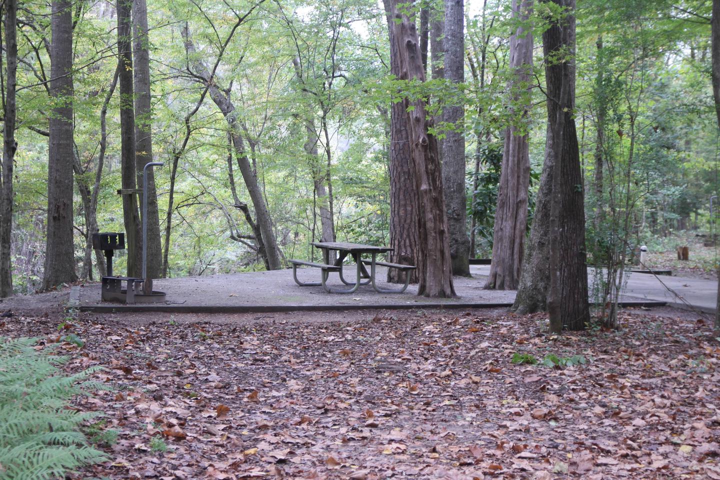
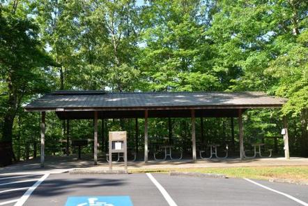
This year-round campground offers 142 sites with electric hookups. Sites 1-75 are newly renovated sites and have concrete pads and sewer. Amenities include flush toilets, showers, drinking water, a dump station and laundry facilities. A picnic shelter is provided for parties and family functions.
The campground is situated on Catoma Creek in a forest of hickory and pine. The region offers a mild climate for year-round camping.

From I-65, take exit 167 onto US-80 west. Continue for 9 miles, then turn right on County Road 7 and follow signs into the campground.
Latitude 32° 22′ 0.0001″ N
Longitude 86° 28′ 0.0001″ W
Millers Ferry Campground, also known as East Bank, is located on scenic Dannelly Reservoir in Alabama’s Black Prairie Belt. The reservoir sits on the Alabama River and covers roughly 27 square miles, boasting more than 500 miles of shoreline.
Boating, fishing, hunting and hiking are popular activities.
The park offers excellent fishing for bass, crappie, bluegill and catfish, and numerous fishing tournaments and annual festivals are held in the immediate area.
Whitetail deer and wild turkeys roam the park, creating excellent bow-hunting opportunities.
This campground offers 42 family sites with electric hookups. Amenities include flush toilets, showers, drinking water, laundry facilities and a dump station.
A fishing dock, boat ramp, fish cleaning stations and playground provide additional recreation opportunities for guests.
The Black Prairie Belt is characterized by rich, dark soils and a mosaic of rolling grasslands and dense hardwood and pine forests.
From Camden, Alabama, take State Route 28 northwest for 12 miles. Turn right before the Lee Long Bridge and follow signs into the campground.
Latitude 32° 6′ 56.9999″ N
Longitude 87° 23′ 22.9999″ W
Isaac Creek Campground is located on Claiborne Lake in Alabama’s southwest Hill Country.
The lake encompasses more than 60 miles of the Alabama River, and Isaac Creek has great appeal to sportsmen, birders, naturalists or those simply wanting to relax in the outdoors.
The area’s waterways offer anglers the opportunity to fish for largemouth bass, crappie, bluegill and catfish.
Boating and water sports are also a main draw to the lake, and a boat ramp is provided for easy water access.
The vast expanse of surrounding land allows for bow and shotgun hunting for game like whitetail deer, wild turkey and hog.
This year-round campground offers 60 sites with electric hookups. Amenities include flush toilets, showers, drinking water, a dump station and laundry facilities.
A boat ramp, dock, fish cleaning stations, basketball court, playground and picnic shelter offer countless recreation opportunities for visitors.
The campground is situated between Isaac Creek and Claiborne Lake, in a forest of hardwood and pine.

From Monroeville, Alabama, take State Route 41 north for 8 miles. Turn west onto County Road 17 and follow signs into the campground.
Latitude 31° 37′ 19.9999″ N
Longitude 87° 33′ 1.0001″ W
Chilatchee Creek Campground is located on its namesake at scenic Dannelly Reservoir in Alabama’s Black Prairie Belt. The reservoir sits on the Alabama River and covers roughly 27 square miles, boasting more than 500 miles of shoreline.
Boating, fishing, hunting and hiking are popular activities.
The park offers excellent fishing for bass, crappie, bluegill and catfish, and numerous fishing tournaments and annual festivals are held in the immediate area.
Whitetail deer and wild turkeys roam the park, creating excellent bow-hunting opportunities.
This waterfront campground contains 33 family sites with electric hookups. Amenities include flush toilets, showers, drinking water, laundry facilities and a dump station.
A fishing dock, boat ramp, fish cleaning stations and a playground offer additional recreation opportunities.
The Black Prairie Belt is characterized by rich, dark soils and a mosaic of rolling grasslands and dense hardwood and pine forests.
From Alberta, Alabama, take State Route 5. Turn onto Wilcox County Road 29 and travel southeast for 11 miles. Make a left on Chilatchee Creek Road and continue for 2 miles to the campground.
Latitude 32° 8′ 29.0000″ N
Longitude 87° 16′ 27.0001″ W
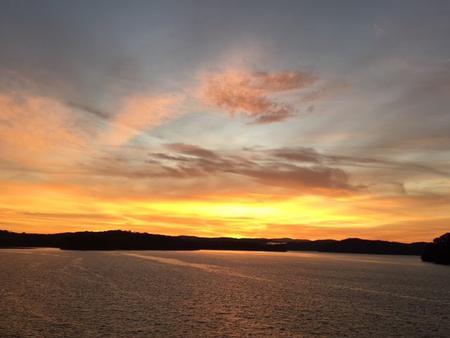
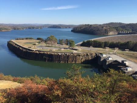
Doll Mountain Day Use Shelter is located in the North Georgia Mountains about 70 miles north of Atlanta on Carters Lake. The sparkling waters and rugged shoreline provide a beautiful surrounding for a variety of outdoor recreational opportunities including camping, hiking, boating, mountain biking, fishing, hunting and picnicking.
Boaters visit Carters Lake to enjoy its solitude and scenic beauty. Whether in a powerboat or sailboat on the open water or paddling along the shoreline in a canoe, Carters Lake offers enjoyable boating experiences for everyone. Fishing is a popular activity on the lake. Major species include bass (largemouth, smallmouth, hybrid, striped and spotted) crappie, walleye, bream and catfish.
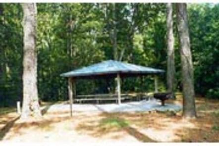
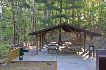
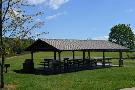
Doll Mountain Day Use Area provides a two lane boat launching ramp, several picnic sites, restrooms and a fishing pier.
Shelter (CL-12) seating capacity is 50 people maximum and parking capacity of 25 vehicles.
Carters Lake embraces a spectacular tract of foothills scenery in the Blue Ridge Mountains of North Georgia. It covers 3,200 surface acres and has 62 miles of undeveloped shoreline.
The City of Ellijay is about 20 minutes away, offering restaurants, grocery stores and fuel, along with other amenities.


From Atlanta: Take Interstate 75 North until Exit 293, turn right onto Georgia Highway 411 North, travel approximately 30 miles; take a right onto Georgia Highway 136 East; proceed approximately 5 miles and turn left onto State Highway 382; continue 3 miles and turn left onto Doll Mountain Road; turn right onto Carters Landing Way and follow road all the way into the park.
Doll Mountain
575 Carters Landing Way
Ellijay, GA 30540
Latitude 34° 36′ 35.3801″ N
Longitude 84° 36′ 48.2501″ W
Damsite Day Use Area is located on Carters Lake in the North Georgia Mountains about 70 miles north of Atlanta. The sparkling waters and rugged shoreline provide a beautiful surrounding for a variety of outdoor recreational opportunities including camping, hiking, boating, mountain biking, fishing, hunting and picnicking.
Boaters visit Carters Lake to enjoy its solitude and scenic beauty. Whether in a powerboat or sailboat on the open water or paddling along the shoreline in a canoe, Carters Lake offers enjoyable boating experiences for everyone. Fishing is a popular activity on the lake. Major species include bass (largemouth, smallmouth, hybrid, striped and spotted) crappie, walleye, bream and catfish.
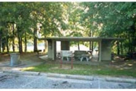
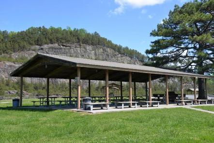
Damsite Day Use Area provides boaters with a launch ramp with three lanes and courtesy dock. The area also provides ample picnic sites and restrooms.
Shelter (CL-10) seating capacity is 30 people maximum and parking capacity of 15 vehicles.
Carters Lake embraces a spectacular tract of foothills scenery in the Blue Ridge Mountains of North Georgia. It covers 3,200 surface acres and has 62 miles of undeveloped shoreline.
The City of Ellijay is about 30 minutes away, offering restaurants, grocery stores and fuel, along with other amenities.

From Atlanta: Take Interstate 75 North until Exit 293, turn right onto Georgia Highway 411 North, travel approximately 30 miles; take a right onto Georgia Highway 136 East; proceed approximately 2 miles and turn left onto Carters Dam Road; turn right onto Marina Road; turn left onto Cove Road and enter park.
Damsite
359 Cove Road
Chatsworth, GA 30705
Latitude 34° 36′ 10.5700″ N
Longitude 84° 39′ 14.1300″ W
Northbank Day Use Area is located in the North Georgia Mountains about 70 miles north of Atlanta on Carters Lake. The sparkling waters and rugged shoreline provide a beautiful surrounding for a variety of outdoor recreational opportunities including camping, hiking, boating, mountain biking, fishing, hunting and picnicking. Norhtbank provides an excellent view of both Carters Lake and the ReReg Lake from its location on top of Carters Dam.
Northbank provides multiple recreation opportunities including fishing, hiking trails, basketball, volleyball and sightseeing.
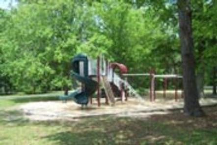
Northbank Day Use Area provides visitors with panoramic views of Carters Lake along with ample picnic sites, restrooms, a playground, volleyball court, basketball court and horseshoe pits.
The large shelter (CL-13) seating capacity is 100 people maximum and parking capacity of 50 vehicles. The small shelter (CL-9) seating capacity is 50 people maximum and parking capacity of 25 vehicles.
Carters Lake embraces a spectacular tract of foothills scenery in the Blue Ridge Mountains of North Georgia. It covers 3,200 surface acres and has 62 miles of undeveloped shoreline. Boaters visit Carters Lake to enjoy its solitude and scenic beauty.
The Cities of Ellijay and Chatsworth are about 30 minutes away offering restaurants, grocery stores and fuel, along with other amenities.
Please review the rules and reservation policies at the bottom of the page.

From Atlanta: Take Interstate 75 North until Exit 293, turn right onto Georgia Highway 411 North, travel approximately 30 miles; take a right onto Georgia Highway 136 East; proceed across approximately 2 miles; turn left onto Carters Dam Road; continue almost 2 miles and proceed straight into Northbank Day Use Area.
Northbank
2800 Carters Dam Road
Chatsworth, GA 30705
Latitude 34° 36′ 28.0501″ N
Longitude 84° 39′ 45.0000″ W