Categories
Uncategorized

FRANKLIN LAKE

Overview

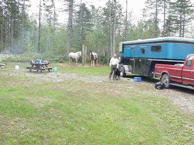
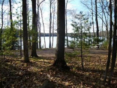
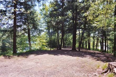
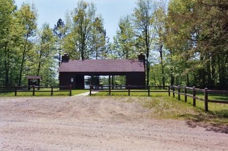
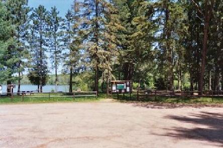
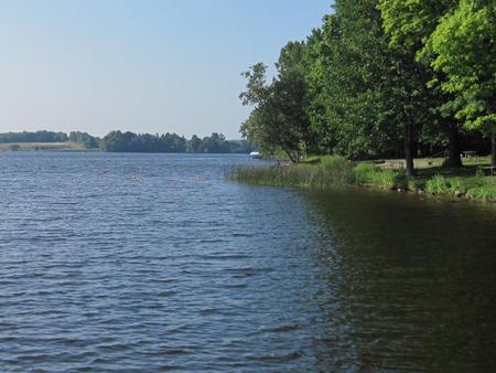
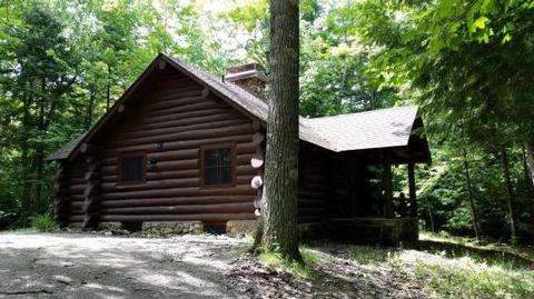
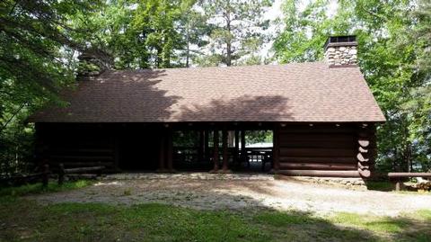
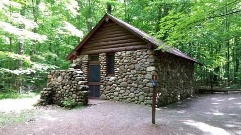
Franklin Lake Campground is one of the most popular camping spots within the Chequamegon-Nicolet National Forest in Northern Wisconsin. Its unique structures built by the CCC land it on the National Register of Historic Places. The campground is in a beautiful setting, among tall pines and hemlocks, perched on the edge of the clear blue waters of Franklin Lake. In addition to its scenic landscape, the campground offers access to a variety of hiking trails.

Recreation

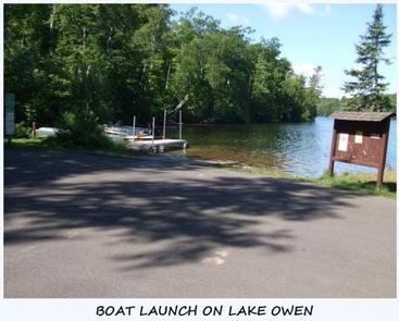
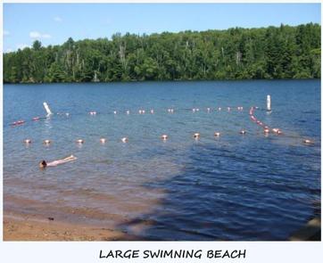
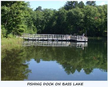
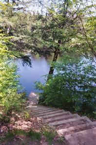
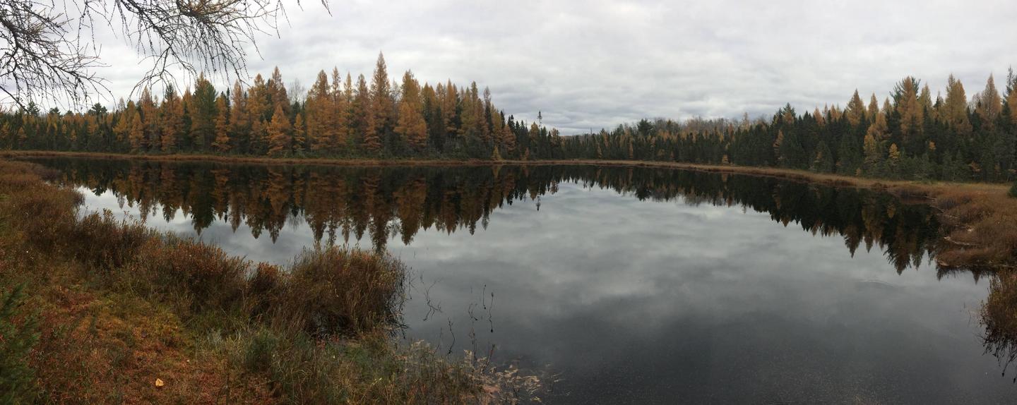
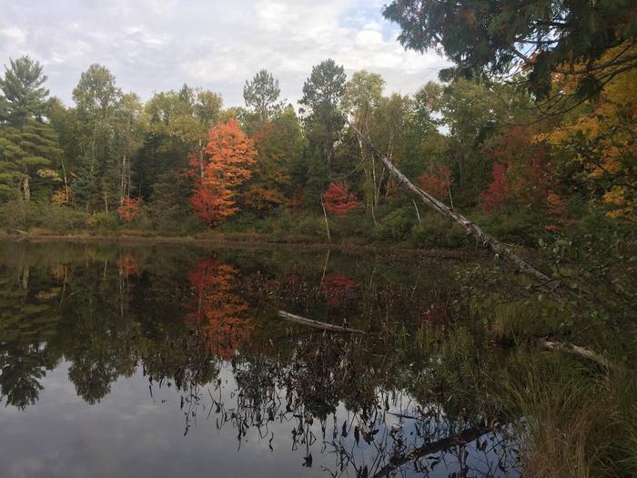
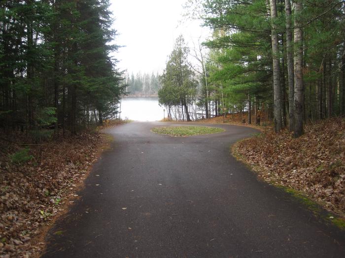
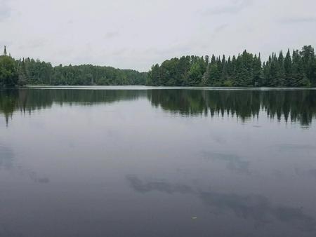
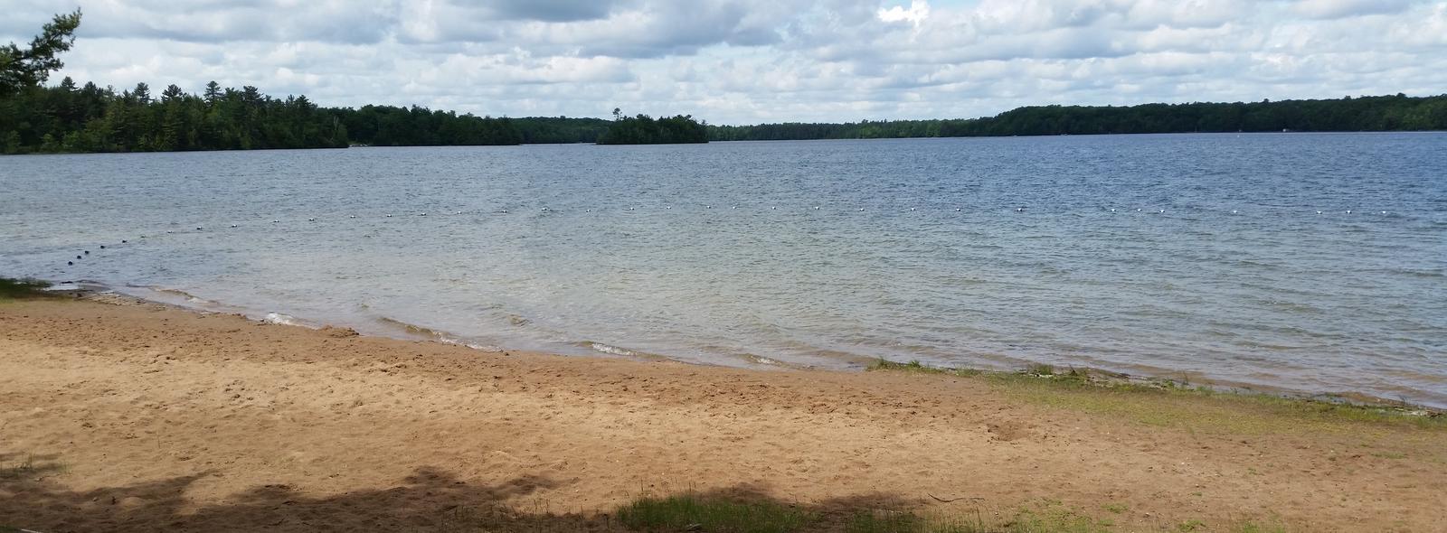
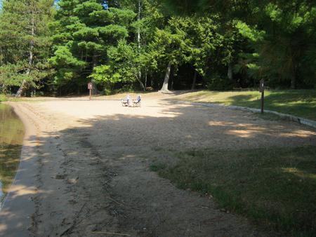
The lake provides visitors with ample opportunities for boating, fishing and swimming. Anglers can expect a catch of walleye, northern pike, large and smallmouth bass, rock bass, perch, and bluegill, among others. The lake is open to all types of boating, motorized and non-motorized.

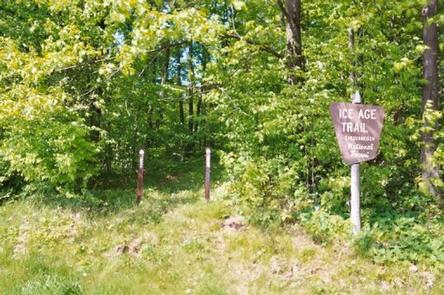
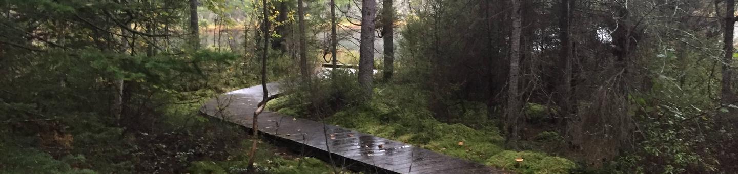
Numerous trails exist in the area, with some beginning within the campground, including a 6-mile hike to nearby Anvil Lake. The 1-mile Franklin Lake interpretive trail is partly accessible and tours the forest of trees, with some over 400 years old. It leads to the 13-mile Hidden Lakes Trail, which loops south, around Butternut Lake, passing several small lakes with scenic vistas and a remarkable stand of old hemlock trees, then back to the campground.

A variety of wildlife make its home in the area and visitors are encouraged to keep watch.

Facilities

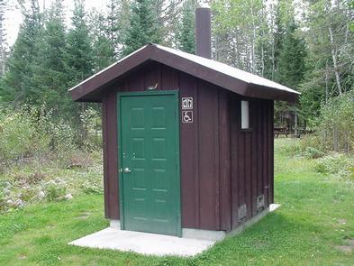
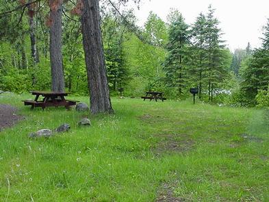
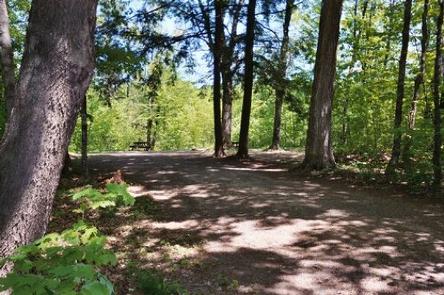
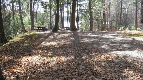
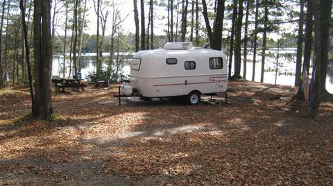
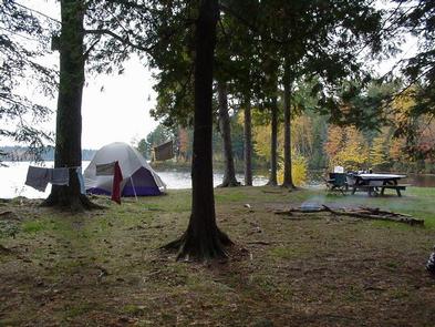
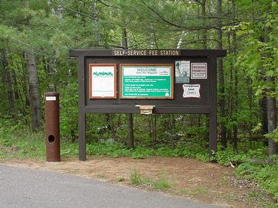
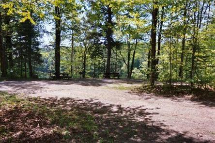
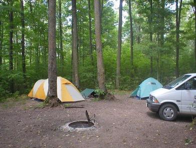
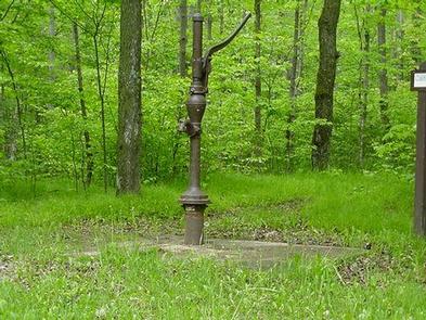
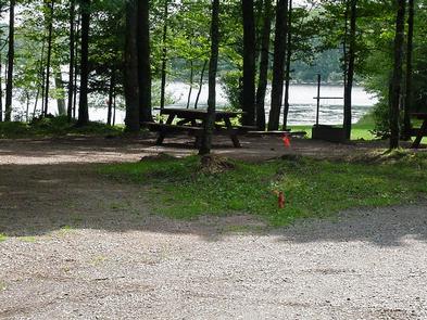
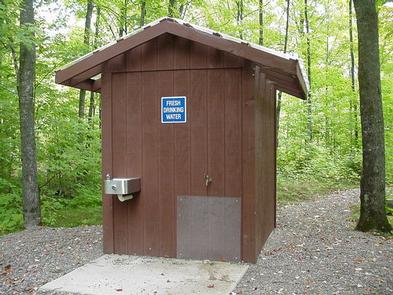
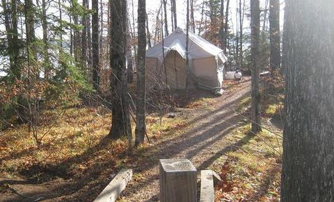
The campground offers 77 single family campsites, available for tent or RV camping. The campground offers both first-come, first-served campsites (34) as well as sites which can be reserved in advance (43). Sites are equipped with tables and fire rings with grills. Accessible flush and vault toilets as well as drinking water, are provided throughout the campground.

Natural Features

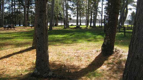
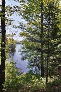
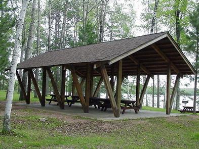
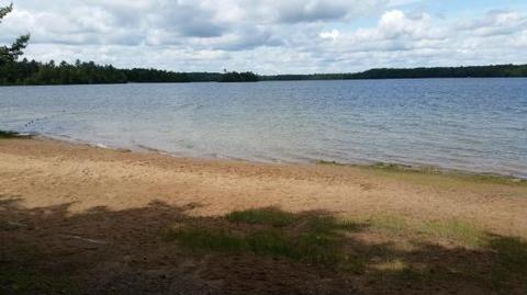
The campground is situated in a lush stand of mature pine and hemlock trees, at an elevation of 1,700 feet. Historic stone and log structures, built by the Civilian Conservation Corps, are scattered throughout the campground. The adjacent Franklin Lake is 892 acres and boasts a beautiful sandy beach.

Nearby Attractions

The City of Eagle River is located about 15 miles west of the campground. A variety of services are offered there.

Nearby Activities

  • Boating
  • Historic & cultural site
  • Camping
  • Interpretive programs
  • Fishing
  • Hiking
  • Wildlife viewing
  • Swimming site
  • Kayaking
  • Canoeing

Gallery

Directions

Drive approximately 8 miles east from Eagle River on Highway 70. Turn south onto Military Road/Forest Road 2178 and continue about 2 miles, to Butternut Lake Road/Forest Road 2181, and continue approximately 4 miles to the campground.

GPS Coordinates

Latitude 45° 55′ 28.9999″ N

Longitude 89° 0′ 29.0002″ W

Categories
Uncategorized

SMITH RAPIDS

Overview

Smith Rapids Campground is located on the South Fork of the Flambeau River. With campsites designated to accommodate equestrians, it is an ideal location for horseback riding. Hiking, river fishing and canoeing are popular activities.

Recreation

The campground is specifically tailored to accommodate horseback riders, providing direct access to the 18.5-mile Smith River Saddle Equestrian Trail. The trails in the area are very rugged and have a limited maintenance schedule, but remain popular with equestrian riders and campers alike.

The fast-flowing South Fork of the Flambeau River is popular among canoeists. A carry-down boat ramp is available at the campground. The river has walleye, smallmouth bass, redhorse, musky and northern pike.

The campground is also in close proximity to the 70-mile Flambeau Trail System, open to off-road vehicles, hiking and mountain biking. The trail is highlighted by rolling terrain, tree-lined corridors, a wooden bridge and vistas overlooking various bogs and lakes. It is a popular snowmobiling location during winter months. Off-road vehicles are not permitted to operate in Smith Rapids Campground.

Facilities

The campground offers single-family sites for tent and RV camping. Several of the sites have extra long parking spurs to accommodate horse trailers. Several sites are equipped with hitching racks. Tables and campfire rings are provided, as are vault toilets and drinking water.

Natural Features

At an elevation of about 1,500 feet, the campground provides shady, wooded sites. Smith Rapids is located on the South Fork of the Flambeau River, with a scenic view of Smith Rapids Covered Bridge. Constructed in 1991, the bridge is the only glue-laminated town lattice covered bridge in Wisconsin.

Nearby Attractions

Park Falls, Wisconsin is approximately 17 miles from the campground and is a full service community.

Nearby Activities

  • Boating
  • Camping
  • Fishing
  • Hiking
  • Horseback riding

Gallery

Directions

From Fifield, travel east on State Highway 70 for a little more than 12 miles and turn left (north) onto Forest Service Road 148. Continue for 2 miles to the campground.

GPS Coordinates

Latitude 45° 54′ 38.0002″ N

Longitude 90° 10′ 26.0000″ W

Categories
Uncategorized

TWO LAKES

Overview

Two Lakes Campground is nestled between Lake Owen and Bass Lake. Campsites are spacious and shaded by pine and mixed hardwoods, and most sites offer sweeping lake views.

Recreation

Campers have access to two swimming beaches, two boat ramps and a fishing pier. Lake Owen and Bass Lake contain panfish, northern pike, walleye, bass and trout.

Lake activities include power boating, sailing, water skiing, canoeing and kayaking. There is a half-mile interpretive trail, as well as access to the North Country
National Scenic Trail.

Facilities

The campground has drinking water, vault toilets and a dump station for RVs. Each site has a picnic table, fire ring and grill.

Natural Features

Two Lakes is adjacent to the Porcupine Lake Wilderness in
Chequamegon National Forest. The forest covers more than 1.5 million acres of Wisconsin’s Northwoods.

Some of the Porcupine Lake Wilderness contains rolling hills covered with oak, maple, hemlock and white pine. The remainder of the area is fairly flat.

Nearby Attractions

The town of Drummond, Wisconsin, is less than 10 miles away for getting supplies, dining out or visiting the historical museum.

Nearby Activities

  • Biking
  • Boating
  • Camping
  • Fishing
  • Hiking
  • Water sports
  • Swimming site

Gallery

Directions

From Drummond follow Forest Road 213 southeast to the intersection of
Forest Road 213 and 216. Veer left (east) and continue on Forest Road 213
for 2 miles. Veer right (south) onto Forest Road 214 and travel 0.5 mile
to the campground.

GPS Coordinates

Latitude 46° 17′ 31.9999″ N

Longitude 91° 11′ 35.9999″ W

Categories
Uncategorized

SPEARHEAD POINT

Overview

Spearhead Point Campground is one of the most popular campgrounds on the scenic Mondeaux Flowage. Unique family-oriented campsites and access to panoramic views of the lake are unprecedented elsewhere in the forest. The campground provides numerous opportunities for recreation and enjoyment of the surrounding area.

Recreation

Boating, swimming and fishing are popular activities. Anglers can expect to find a variety of species, including pike, largemouth bass and bluegill. Boats with and without motors are allowed on the lake, however the lake is quite shallow in some areas.

A portion of the Ice Age National Scenic Trail is easily accessed from the campground. The trail is open to hiking and wanders 1,200 miles along the edge of a historic glacier that once covered the state of Wisconsin and much of North America.

Facilities

The campground offers many single-family sites for tent and RV camping. Some sites are available on a first-come, first-served basis. No hookups are available. Each site is equipped with a table and campfire ring with grill. Accessible vault toilets and drinking water are provided.

A concession stand, coin-operated showers, a boat ramp and pay phone are available at the nearby Mondeaux Picnic Area. Some campsites have small docks which can be used for fishing or landing a boat.

Natural Features

The campground is located within the Chequamegon-Nicolet National Forest in northern Wisconsin at an elevation of 1,140 feet. Shady sites are nestled along the shore of 411-acre Mondeaux Flowage.

Nearby Attractions

The city of Westboro is about 10 miles from the campground.

Nearby Activities

  • Biking
  • Boating
  • Camping
  • Fishing
  • Hiking
  • Wildlife viewing
  • Swimming site
  • Other recreation concession site

Gallery

Directions

From Medford, travel north on State Highway 13 for 4 miles, then turn left (west) onto County Road M and continue for 7 miles. Turn right (north) onto County Highway E and continue about 8 miles, then turn right (east) onto Forest Service Road 1563 and continue for about 1 mile. Turn right (east) onto Forest Service Road 106 and look for the campground entrance sign at the top of the hill.

GPS Coordinates

Latitude 45° 19′ 41.0002″ N

Longitude 90° 26′ 48.9998″ W

Categories
Uncategorized

PICNIC POINT (WI)

Overview

Picnic Point Campground is a quaint campground, where a large group can enjoy a peaceful escape in northern Wisconsin. The rustic nature of the campground draws campers in for a respite from the hustle and bustle of nearby cities and towns.

Recreation

A boat ramp into the 411-acre Mondeaux Flowage is available not far from the campground. The lake, although rather shallow, is popular for swimming and fishing. Anglers fish for musky, pan fish, largemouth bass and pike, among other varieties.

A system of hiking trails is available in the area, including the 1,200-mile Ice Age National Scenic Trail, which traces the edge of a historic glacier that once covered the state of Wisconsin and much of North America.

Facilities

The campground offers one large group campsite for tent camping only. The site can accommodate up to 35 people.

The site is equipped with multiple tables and campfire rings with grills. Vault toilets and drinking water are provided. The campground does not provide trash collection and visitors are required to pack out all garbage.

Natural Features

The campground’s shaded group campsite is nestled under towering pine trees along the western shore of Mondeaux Flowage. Sites sit right on the edge of the scenic lake, where boats can also be anchored.

Nearby Attractions

The city of Medford is located about 18 miles from the campground. A variety of services can be found there.

Nearby Activities

  • Boating
  • Camping
  • Fishing
  • Hiking
  • Swimming site

Gallery

Directions

From Medford, take State Highway 13 north 4 miles. Turn left (west) onto County Highway M for about 7 miles. Turn right (north) onto County Highway E and continue for about 8 miles. Turn right (east) onto Forest Road 1563 and continue for 1 mile, then turn right (south) onto Forest Road 106 for 2 miles.

GPS Coordinates

Latitude 45° 18′ 20.0002″ N

Longitude 90° 26′ 8.9999″ W

Categories
Uncategorized

TWIN LAKES (WI)

Overview

Tucked in a forest of pines, evergreens and hardwoods, Twin Lakes campground overlooks the sparkling blue Twin Lake, offering a secluded oasis for both tent and RV campers.

Recreation

Boating and fishing are popular activities on the lake, with excellent trout and pan fish available.

The area holds many opportunities to encounter rare species of fish, wildlife and plants. Bird watching, nature study programs and viewing the vivid fall foliage are also among popular activities for visitors.

Nearby hunting opportunities for big game, upland game birds, waterfowl and small game, exists across the Chequamegon-Nicolet National Forest. Fishing for trout or other game fish is available in any of the 600 available lakes or 1,200 miles of stream.

For hiking enthusiasts, 800 miles of trails are located throughout the north woods. For those that enjoy quiet places, the forest contains five designated Wilderness areas and several semi-primitive non-motorized areas. Motorized recreation is also available to the public, with approximately 300 miles of designated trail winding through the diverse landscape.

Facilities

Twin Lakes is 19-acres in size and has a boat ramp for activities like canoeing and fishing. The campground is adjacent to the Round Lake Non-motorized area for biking and hiking. Grills, drinking water and vault toilets create an ideal atmosphere for parties and family get-togethers.

Natural Features

The Chequamegon-Nicolet National Forest covers more than 1.5 million acres of Wisconsin’s Northwoods. The sparse population of the area and low visitor use, make the wild and scenic beauty of the forest that much more enjoyable. Hundred of miles of maintained trails make this area a hikers paradise.

The pristine Twin Lake provides a breathtaking backdrop for a traditional camping experience.

Nearby Attractions

Park Falls, located just over 20 miles away, offers historical attractions, museums and restaurants-perfect for a day trip.

Nearby Activities

  • Biking
  • Boating
  • Camping
  • Fishing
  • Hiking
  • Hunting
  • Wildlife viewing
  • Mountain biking
  • Canoeing
  • Star gazing

Gallery

Directions

From Park Falls, travel east on State Highway 182 for about 21 miles. Turn right on Forest Road 144, and after approximately five miles turn left on Forest Road 142. Continue for two miles to the campground entrance.

GPS Coordinates

Latitude 45° 57′ 16.9999″ N

Longitude 90° 4′ 19.9999″ W

Categories
Uncategorized

EASTWOOD

Overview

The Eastwood Campground is a family-friendly campground with access to a beautiful northern Wisconsin recreation area, complete with hiking trails and a scenic lake.

Recreation

A boat ramp into the 411-acre Mondeaux Flowage is available not far from the campground. The lake, although rather shallow, is popular for swimming and fishing. Anglers can expect a catch of musky, pan fish, largemouth bass and pike, among other varieties.

A series of hiking trails is available in the area, including for the 1,200-mile Ice Age National Scenic Trail, which traces the edges of a historic glacier that once covered the state of Wisconsin and much of North America.

Facilities

The campground offers almost two dozen sites for tent or RV camping. No hookups are available.

Each site is equipped with tables and campfire rings with grills. Accessible vault toilets and hand-pump drinking water system are provided. A picnic area, along with concessions and other amenities, is available at the nearby Mondeaux Picnic Area.

Natural Features

The campground sits within the Chequamegon-Nicolet National Forest, near the city of Medford. Shady sites are nestled along the scenic shore of the Mondeaux Flowage, with the Ice Age National Scenic Trail traversing the campground.

Nearby Attractions

The campground is just a couple miles from the popular Mondeaux Picnic Area at the Mondeaux Dam Recreation Area.

Nearby Activities

  • Boating
  • Camping
  • Fishing
  • Hiking
  • Wildlife viewing
  • Swimming site
  • Other recreation concession site

Gallery

Directions

From Medford, Wisconsin, travel north on State Highway 13 for about 15 miles. Turn left on County Road D for about 6 miles, then turn left onto Forest Road 104 for about 2 miles and continue into the campground.

GPS Coordinates

Latitude 45° 19′ 50.9999″ N

Longitude 90° 26′ 38.0000″ W

Categories
Uncategorized

SAILOR LAKE

Overview

Rustic Sailor Lake Campground sits on the northwestern shores of scenic Sailor Lake. Its scenic views and secluded location make it popular for campers and explorers alike. The campground offers access to the lake as well as a beautiful picnic area and access to off-road vehicle trails.

Recreation

Sailor Lake Campground is a favorite among off-road enthusiasts, offering direct access to the 70-mile Flambeau Trail System. The trail is highlighted by rolling terrain, tree-lined corridors, wooden bridges and vistas overlooking various bogs and lakes. It is a popular snowmobiling location during winter months.

The campground is adjacent to 170-acre Sailor Lake, which is popular for boating and fishing. Anglers will find healthy populations of pan fish and northern pike. A boat ramp is located a mile south of the campground at the Sailor Lake Picnic Area. A picnic shelter is also avaialble at the picnic area.

Facilities

The campground offers about two dozen sites for tent or RV camping. There are no hookups available and parking spurs are either grass or gravel. Some sites are available on a first-come, first-served basis.

Each site is equipped with a table and campfire ring. Vault toilets and drinking water are provided. Some sites are secluded by trees and some are situated on the waterfront.

Natural Features

The campground is laid out in two loops and situated on the shores of Sailor Lake at an elevation of about 1,460 feet. The sites are shaded by a mixed hardwood forest.

Nearby Attractions

The campground is located approximately 11 miles southeast of Fifield. The city boasts a variety of tourist attractions, including historic sites, a reconstructed logging dam and a couple of war memorials.

Nearby Activities

  • Boating
  • Camping
  • Fishing
  • Hiking
  • Hunting
  • Wildlife viewing
  • Canoeing
  • Historic sites

Gallery

Directions

From Fifield, follow State Highway 70 east for about 7 miles and turn right (south) on Forest Road 139 and continue for 3 miles.

GPS Coordinates

Latitude 45° 50′ 35.0002″ N

Longitude 90° 16′ 37.9999″ W

Categories
Uncategorized

DAY LAKE

Overview

Day Lake Campground is situated in northwestern Wisconsin, not far from the shores of Lake Superior. The spacious and peaceful Day Lake offers a family-friendly campground with swimming beaches, a boat launch and picnic area. Day Lake is a designated off-road vehicle campground, allowing off-road vehicle use to and from the nearby trails.

Recreation

Located in the elk capital of Wisconsin, the Day Lake area has activities for everyone. Miles of off-road vehicle, hiking and mountain biking trails are nearby on the Dead Horse Run Off-road Vehicle (ATV/UTV) Trail. A half-mile interpretive trail can be accessed from the campground.

A boat ramp and picnic area with beach access are located two miles south of the campground, on County Highway M.

The 640-acre lake is a popular destination for anglers, with musky, bass and panfish available in abundance. The area is also ideal for kayaking, canoeing and swimming. Elk, eagles, loons and other wildlife are often spotted in the area.

Facilities

The campground offers dozens of single-family campsites for tent and RV camping. Only the Paper Birch loop has a paved road, while the remainder of roads within the campground are gravel. The parking aprons are grass and dirt.

Each campsite is equipped with tables and campfire rings with grills. Accessible vault toilets and hand pump drinking water are also provided. Trash collection and recycling bins are available at the campground as well.

Natural Features

The Chequamegon-Nicolet National Forest offers 845,000 acres of lush landscape dotted with lakes, rivers and streams. Pine, spruce, maple, aspen and balsam forests, as well as extensive jack pine plantations, make up the vegetation.

Nearby Attractions

A general store, bait shop, firewood vendor, fuel and restaurants are located in Clam Lake, about a mile from the campground. The local community club hosts an annual July 4th fireworks display.

Nearby Activities

  • Boating
  • Camping
  • Fishing
  • Swimming site

Gallery

Directions

From Clam Lake, Wisconsin, travel a mile north on Highway GG.

GPS Coordinates

Latitude 46° 10′ 35.0000″ N

Longitude 90° 54′ 33.0001″ W

Categories
Uncategorized

NAMEKAGON

Overview

Namekagon campground is a family-friendly campground that runs alongside its namesake lake, at the headwaters of the Namekagon River. It is the perfect spot to kayak, canoe, jet ski, swim or take a boat ride to one of the many restaurants along the shoreline.

With its close proximity to mountain bike trails and the North Country hiking trail, Namekagon campground is an ideal location for making a base camp.

Recreation

Namekagon Lake offers excellent fishing, and anglers will find musky, pike, walleye and bass, among other fish varieties, available in abundance.

The campground is conveniently located near off-highway vehicle, hiking and mountain bike trails. The North Country National Scenic Trail is also nearby. The Namekagon Nature Trail is a one mile interpretive trail which traverses the immediate area and begins in the campground.

Facilities

The campground offers a couple dozen single-family campsites for tent or RV camping. Each site is equipped with tables and campfire rings with grills. Accessible vault toilets, drinking water, trash collection and recycling bins are also provided.

A day-use picnic area is equipped with multiple tables, picnic shelters, a basketball court, beach, boat ramp and fishing piers.

Natural Features

The campground is situated on the 3,227-acre Namekagon Lake that is famous for its fishing potential. It is surrounded by a hardwood and hemlock forest in northwestern Wisconsin.

Nearby Activities

  • Biking
  • Boating
  • Camping
  • Fishing
  • Swimming site

Gallery

Directions

From Cable, Wisconsin, take County Highway M east for 11 miles. Turn left on County Highway D and proceed about 6 miles to Forest Service Road 209. Turn left at the campground sign and drive less than a mile to the campground entrance.

GPS Coordinates

Latitude 46° 21′ 1.0001″ N

Longitude 90° 55′ 25.0000″ W