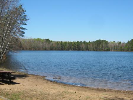
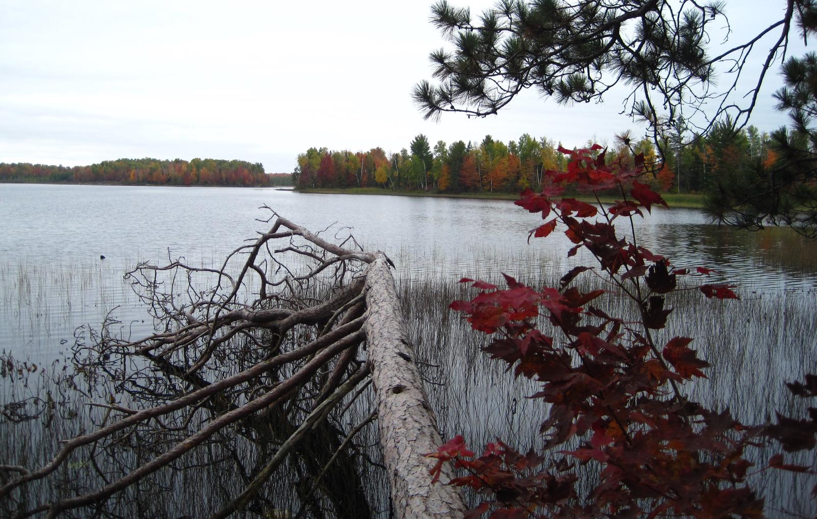
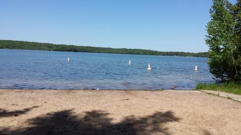
The Morgan Lake Campground and Group Site is a great place for families or a large gathering of people to camp in northern Wisconsin’s Chequamegon-Nicolet National Forest. The campground is comfortably equipped and provides access to a number of recreational opportunities, including fishing, boating, swimming and hiking. A picnic area with beach is available, as well as an adjacent parking area and access to the lake.
Recreation
Proximity to the lake provides visitors with opportunities for fishing, boating and swimming. The clear waters make for a pleasant experience. Largemouth bass are abundant in the lake. Non-motorized boating is permitted as well as electric motors only.
Facilities
In addition to family campsites in the main campground, Morgan Lake Campground offers a single, large-group campsite, available for tent and RV camping. It can accommodate up to 25 people and four vehicles, as well as one RV or trailer. Utility hookups are not available and parking surfaces are gravel. Additional family campsites that may be reserved individually in the main campground include campsite numbers 3,6,9,12,14,16,17, and 18.
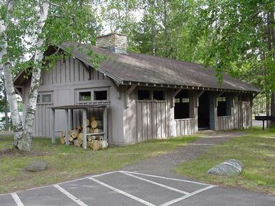
The group campsite is equipped with multiple tables, a campfire circle and grills. Accessible pit toilets and drinking water are provided. Trash collection and recycling bins are also available throughout the campground. The campground area includes a swim beach, picnic area and boat landing. ATV use is allowed but state regulations must be followed along with campground rules.
Natural Features
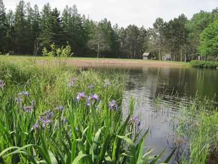
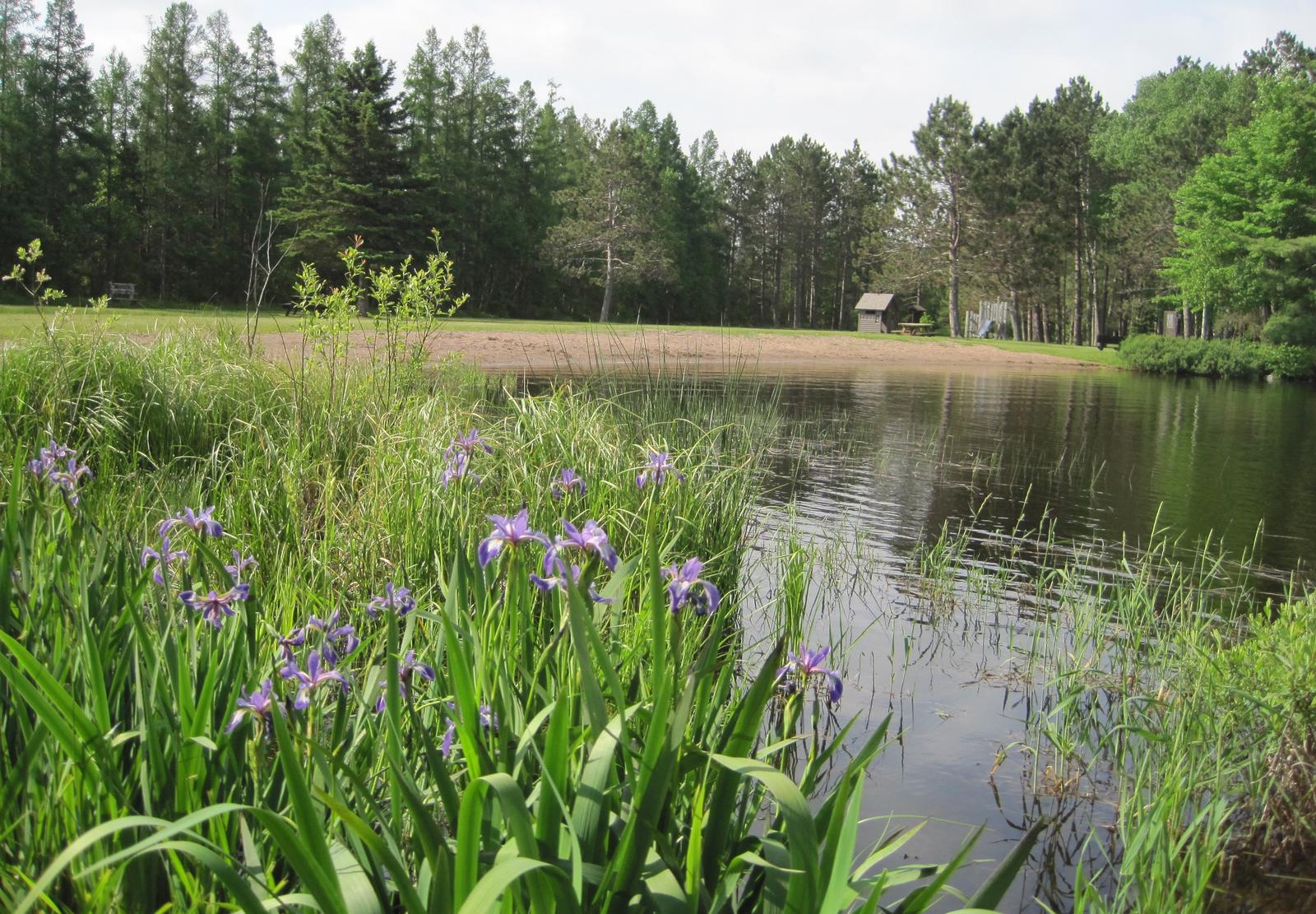
The scenic campground is located in a heavily wooded forest surrounding the 45-acre Morgan Lake. It is situated at an elevation of 1,500 feet. The group campground is located near the general campground, but is separated from the other sites to ensure privacy. A small, sandy beach and boat ramp are located nearby.
Nearby Attractions
The closest town, Long Lake, is located just over 12 miles northwest of the campground. A variety of services are available there.
Nearby Activities
Biking
Boating
Camping
Fishing
Hiking
Swimming site
Gallery
Directions
From the intersection of Highway 8 and Highway 139, about 7 miles north of Laona, drive north on Highway 139 for 11 miles to Forest Road 2159. Turn right (east) and drive about 8 miles to the campground.
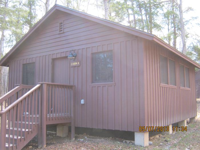
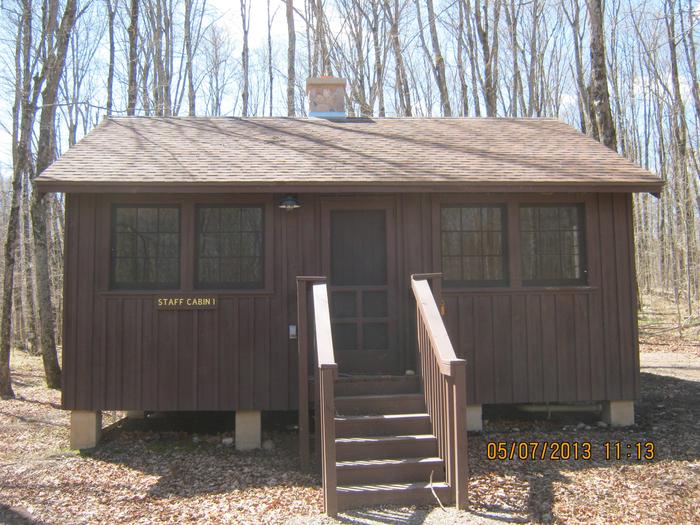
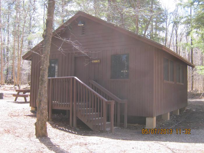
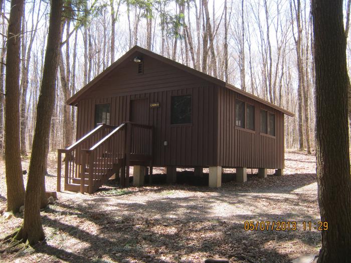
Lost Lake Cabins offers (11) cabins available for rent in the remote forested area situated on the shores of Lost Lake. These cabins are located in a group setting and provide an excellent base for rent by individuals, families, family reunions or any large group. The entire facility can sleep up to 60 people and is a great base for water fun, swimming, non motor boating, fishing, hiking, bird watching, mushrooming, hunting and many day-trip locations into the Upper Peninsula.
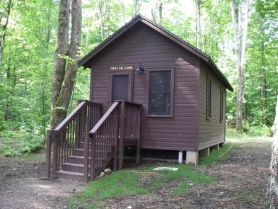
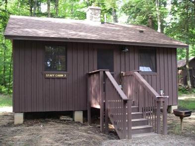
Cabins can be rented from mid-May through mid-October. Rental fees are per cabin, per day whether for one or six persons with an 8 night maximum stay and 2 night minimum stay on the weekend. Cabins can be reserved up to 6 months in advance. Cabins 1 through 8 are located adjacent to and along the shore of the lake, while the First Aid Cabin, Staff Cabin #2 and Staff Cabin #1 are a bit further away from the lake. The Lost Lake Campground located across the lake offers friends and family the opportunity to tent camp or RV camping and still be within a short 1/4 mile walk to the Cabins.
Recreation
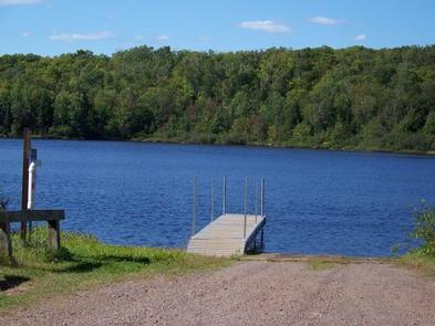
The 92-acre Lost Lake is stocked with perch, brown and rainbow trout and smallmouth bass. No motors are permitted on Lost Lake, but there is a boat access area available at the Lost Lake Campground.
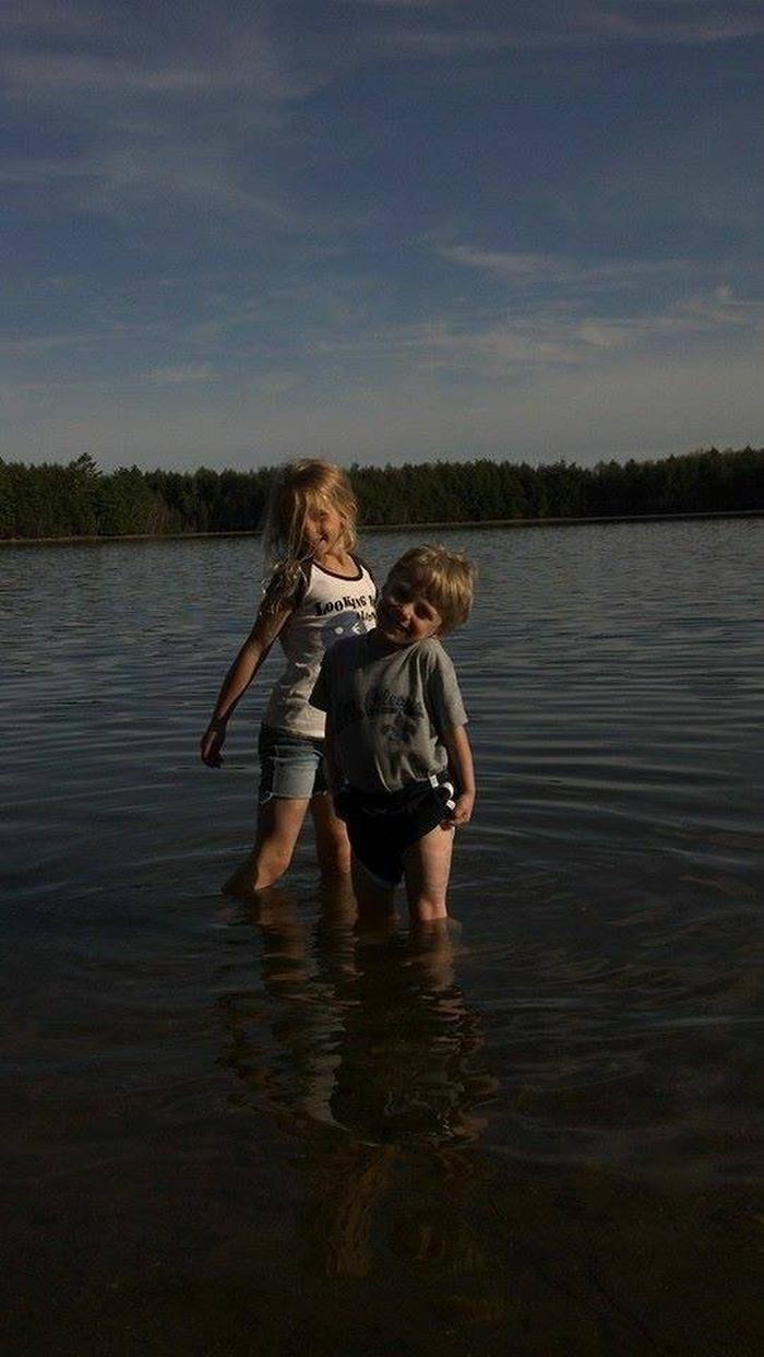
For visitors looking to beat the summer heat with a cool dip in the waters of Lost Lake, there is a small beach located at the cabins. In addition, there is a larger, appealing swimming beach available at the Lost Lake Campground.
The Lost Lake Trail, a 1-mile interpretive trail through a stand of 150-year-old hemlock and pine, is a short walk from the cabins. Trails also connect to the Ridge trail and Assesors trail. the Lauterman National Recreation Trail system is just over 1 mile from the cabins.
Facilities
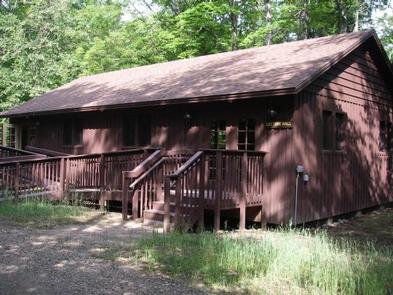
Cabins #1 through #8 and Staff Cabin #2 are simple one-room wood frame structures with three bunk beds that can sleep up to six people.
All cabins have electricity, lights and outlets. Use your imagination and bring a fan, space heater, electric blanket, crockpot, coffee maker… Please bring your own bedding and pillows as these items are not provided. It is glorified camping!
Staff Cabin #1 comfortably sleeps 2. It is furnished with a dining table with chairs and a love seat. This beautiful cabin has a full kitchen with stove, a full bathroom with a shower and baseboard heat to comfort you on those cold evenings.
The First Aid Cabin sleeps 4 and has a kitchenette (no stove), a1/2 bath (no shower) and boasts baseboard heat to stave off the cold while resting up for the next adventure.
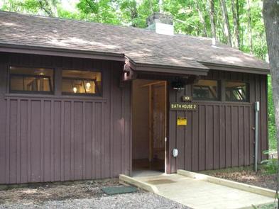
Bathrooms and showers are provided within two central buildings. One Men’s Bath and Shower House and one Women’s Bath and Shower House. Drinking water is provided from a faucet at the back of the well house. There is an artesian well located just one mile away at the Chipmunk Rapids campground. A central recreation hall is also available for group gatherings or other activities and is open to use to anyone at anytime.
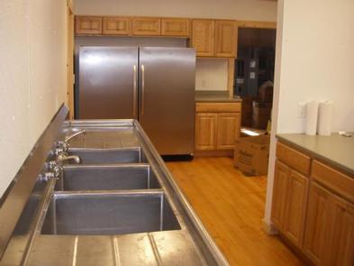
The newly (2012) refurbished kitchen can accommodate weddings, retreats, family reunions, and the whole Lost Lake Camp. It is equipped with a gas range stove and oven as well as a big freezer/refrigerator. THE KITCHEN IS A “FOR RENT” FACILITY ONLY” and must be rented on this site or on-site prior to use. THIS IS A KITCHEN ONLY AND CANNOT BE UTILIZED FOR SLEEPING QUARTERS. A new double sink along with plenty of counter space and pots and pans are provided. Renters must bring their own plates, utensils, and other specialized equipment to ensure a comfortable stay.
There is also a new Lecture Hall available for meetings, training, weddings, retreats, and family reunions. The hall has electricity and is accessible; building capacity is 90 people. Men and women’s bathrooms and showers are provided near by.
Natural Features
The cabins sit amidst a forest of old-growth trees consisting mostly of Hemlock and Maple within walking distance of Lost Lake. The 92-acre lake gets its name from the lack of apparent inflow or outlet of water. The lake is actually fed by springs and the lake is a “No-Motor Lake”. Tall white pines, hemlocks and other evergreens border the lake, Loons can be heard singing across the lake. A watchful eye can catch the resident eagle or osprey as they search the waters for their next meal. The lake is stocked yearly with Brown Trout and Rainbow Trout and also has a good population of Smallmouth Bass and panfish.
The cabins are a short drive to the Whisker Lake Wilderness. Learn more about the wilderness HERE .
Nearby Attractions
Numerous Lakes and Rivers nearby to explore, kayak or canoe. Several trails to hike and only about 10 minutes to the Whisker Lake Wilderness Area off of Highway 70. Great Biking trails located within an hour West near Eagle River, WI. Local Florence County Waterfall Tour and you could take in the Iron Mine Tour about 40 minutes away. From the Lost Lake Cabins you could do day trips to the Sylvania Wilderness, Bond Falls, Porcupine Mountains or Pictured Rocks National Lakeshore on Lake Superios all within a two hour drive in the Upper Peninsula.
Nearby Activities
Auto touring
Biking
Boating
Camping
Interpretive programs
Fishing
Hiking
Hunting
Wildlife viewing
Paddling
Snorkeling
Mountain biking
Paddle boating
Kayaking
Canoeing
Birding
Non-motorized boating
River trips
Backpacking
Mushroom picking
Accessible swimming
Gallery
Directions
Lost Lake rustic cabins are located about 100 yards South of the Lost Lake Campground off of Forest Service Road 2156! From Florence, take Highway 70 for about 20 miles and take a righ onto Forest Service Road 2450, go about 1 mile and continue straight onto Forest Service Road 2156 towards Chipmunk Rapids Campground about three miles, you will have crossed a bridge over the Pine River, drive by the Chipmunk Rapids Campground on your left, go about 1 mile and go past the Lost Lake Campground on your left. Go about 100 yards and take a left into the Driveway to the Lost Lake Cabins. You have been driving on blacktop and if you hit gravel you went too far. Address is 4450 Chipmunk Rapids Road.
Lost Lake is one hour east of Eagle River via State Highway 70 or one hour west of Iron Mountain, Michigan via US Highway 2 and State Highway 70.
We apologize, this campground is currently closed.
Recreation
The lake is home to musky, bass and pan fish and offers an ideal spot to kayak, canoe, swim or enjoy a leisurely boat ride.
The North Country National Scenic Trail is adjacent to the campground, providing opportunities for visitors to enjoy day trips along the trail, which stretches approximately 4,600 miles from New York to North Dakota.
The surrounding area offers miles of off-road vehicle, hiking and mountain biking trails, along with several lakes, ponds and rivers to cast a line or launch a boat. Springbrook, a Class 1 brook trout stream, is nearby, and is popular among anglers.
Facilities
Natural Features
Nearby Attractions
While in the area, visitors are encouraged to visit Morgan Falls, St. Peter’s Dome, and the Penokee Overlook, all of which are just a short drive from the campground.
Nearby Activities
Boating
Camping
Fishing
Hiking
Swimming site
Gallery
Directions
34412 Mineral Lake Rd. (FR 198)
From Mellen, Wisconsin; Take County Highway GG west for about 8 miles. Turn right onto Forest Service Road 187/Mineral Lake Road and continue for 3 miles to the intersection with Forest Service Road 198/Pine Stump Corner. Turn right and continue less than a mile to the campground sign.
We apologize, this campground is currently closed.
Recreation
Boating, swimming and fishing are popular activities among visitors. A boat ramp to the lake is provided off of Forest Service Road 187, about a mile from the campground.
Anglers can expect a catch of a variety of freshwater lake and river species, including musky, bass, walleye and pan fish. Eagle watching is also a popular pastime.
The forest is home to hundreds of miles of off-road vehicle, hiking and mountain biking trails, as well as numerous lakes, ponds and rivers to sink a line or launch a boat. Access to the North Country National Scenic Trail, which traverses thousands of miles from New York to North Dakota, is available nearby.
Facilities
Natural Features
The 256-acre Mineral Lake is surrounded by a mixed hardwoods forest. Several campsites overlook the lake and the area is home to a variety of birds, including eagles, and plentiful wildlife.
Nearby Attractions
Morgan Falls and St. Peter’s Dome, the highest peak in the forest, are both located nearby and make excellent day trips.
Nearby Activities
Biking
Boating
Camping
Fishing
Hiking
Wildlife viewing
Gallery
Directions
From Mellen, Wisconsin, take County Highway GG west for about 9 miles to the campground sign. Turn right and drive less than a mile to the campground.
From Clam Lake, Wisconsin, take County Highway GG north for about 9 miles to the campground sign and turn left.
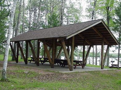
Sailor Lake Pavilion is located near Sailor Lake Campground, both adjacent to scenic Sailor Lake. Its secluded setting makes it a popular location for family and group events.
The pavilion is located on Sailor Lake which is popular for fishing. Nearby off-road vehicle trails are also quite the draw.
Recreation
Sailor Lake Pavilion provides access to the 70-mile Flambeau Trail System. The trail is highlighted by rolling terrain, tree-lined corridors, wooden bridges and vistas overlooking various bogs and lakes. It is a popular snowmobiling location during winter months.
There is a boat ramp with dock in the Sailor Lake Picnic Area, which is where the Pavilion is located. Anglers will find healthy populations of pan fish and northern pike in Sailor Lake.
Facilities
The pavilion is a day-use picnic area that can accommodate groups of up to 30 people. No overnight camping is available at the site. The pavilion is equipped with multiple tables, grills and a campfire circle. Vault toilets and drinking water are provided.
Natural Features
The pavilion is situated on the northwestern shore of Sailor Lake at an elevation of about 1,460 feet. The area is shaded by a mixed hardwood forest.
Nearby Attractions
Sailor Lake is located approximately 11 miles southeast of Fifield. The area boasts a variety of tourist attractions, including historic sites, a reconstructed logging dam and a couple of war memorials.
Nearby Activities
Biking
Boating
Camping
Fishing
Hiking
Wildlife viewing
Swimming
Kayaking
Canoeing
Water access
Ice fishing
Gallery
Directions
From the intersection of Highways 13 and 70 in Fifield, drive about 8 miles east on Highway 70 to Forest Road 139. Turn right (south) and continue on Forest Road 139 about 3 miles to the Sailor Lake Boat Landing and Picnic Area, just past the campground road.
Spearhead Point Shelter is a day-use picnic site for large groups. It is located in one of the most popular areas surrounding Mondeaux Flowage in northern Wisconsin. Nearby, visitors can access the lake and numerous trails.
Recreation
Boating, swimming and fishing are popular activities. Anglers can expect to find a variety of species, including pike, largemouth bass and bluegill. Boats with and without motors are allowed on the lake, however the lake is quite shallow in some areas.
A portion of the Ice Age National Scenic Trail is easily accessed from the campground. The trail is open to hiking and wanders 1,200 miles along the edge of a historic glacier that once covered the state of Wisconsin and much of North America.
Facilities
The accessible picnic shelter can accommodate up to 30 people. It is equipped with picnic tables and grills. Two stone fireplaces are available inside the shelter. Accessible vault toilets and drinking water are also provided.
Overnight camping is not allowed at the shelter but is available at adjacent Spearhead Point Campground.
Natural Features
The shelter is located within the Spearhead Point Campground at an elevation of 1,140 feet. Tall trees surround the shelter, which is nestled along the western shore of 411-acre Mondeaux Flowage.
Nearby Attractions
The city of Westboro is about 10 miles away.
Nearby Activities
Biking
Boating
Camping
Fishing
Hiking
Wildlife viewing
Swimming site
Gallery
Directions
From Medford, travel north on State Highway 13 for 4 miles, then turn left (west) onto County Road M and continue for 7 miles. Turn right (north) onto County Highway E and continue about 8 miles, then turn right (east) onto Forest Service Road 1563 and continue for about 1 mile. Turn right (east) onto Forest Service Road 106 and look for the campground entrance sign at the top of the hill.
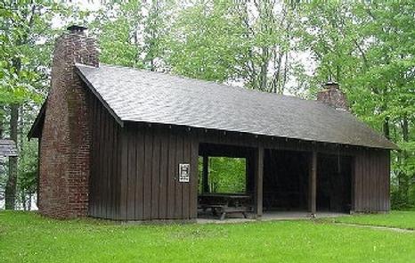
Smith Rapids Pavilion is day-use picnicking area contained within Smith Rapids Campground. Both accommodate equestrians and are situated near a variety of scenic spots in the Chequamegon-Nicolet National Forest in northern Wisconsin. The pavilion is popular for its access to miles of horseback riding trails.
Recreation
Smiths Rapids is specifically tailored to accommodate horseback riders, providing direct access to the 18.5-mile Smith River Saddle Equestrian Trail. The trails in the area are very rugged and have a limited maintenance schedule, but remain popular with equestrian riders and campers alike.
The fast-flowing South Fork of the Flambeau River is popular among canoeists. A carry-down boat ramp is available at the campground. The river is populated with a variety of trout.
The campground is in close proximity to the 70-mile Flambeau Trail System, open to off-road vehicles, hiking and mountain biking. The trail is highlighted by rolling terrain, tree-lined corridors, wooden bridges and vistas overlooking various bogs and lakes. It is a popular snowmobiling location during winter months. Off road vehicles are not allowed to operate in Smith Rapids Campground.
Facilities
The accessible pavilion is a day-use picnic area for groups of up to 30 people. No overnight camping is available at the pavilion. Picnic tables, grills and trash service is provided, as are vault toilets and drinking water.
Natural Features
At an elevation of about 1,500 feet, the pavilion provides a shaded picnic site. Smith Rapids is located on the South Fork of the Flambeau River, with a scenic view of Smith Rapids Covered Bridge. Constructed in 1991, the bridge is the only glue-laminated town lattice covered bridge in Wisconsin.
Nearby Attractions
Park Falls, Wisconsin is approximately 17 miles from the campground and is a full service community.
Nearby Activities
Biking
Boating
Camping
Fishing
Hiking
Horseback riding
Wildlife viewing
Gallery
Directions
From the intersection of Highways 13 and Highway 70 in Fifield, drive about 12 miles east on Highway 70 to Forest Service Road 148. Turn left (north) and continue just over a mile on Forest Service Road 148, to the Smith Rapids Campground entrance.
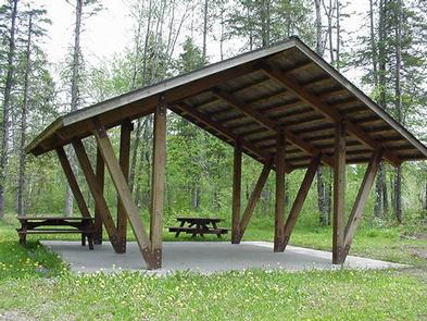
Newman Lake Shelter is a day-use picnicking shelter available for large groups. It is situated within the Newman Lake Recreation Area. A variety of recreational opportunities abound.
Recreation
The recreation area contains a boat ramp, beach, accessible fishing dock, horseshoe pits and a playground for children. Visitors enjoy exploring many hiking and biking trails that are located near the picnic shelter. During the winter months, the trails are popular for cross country skiing.
The beach provides opportunities for swimming, while the lake is a welcome respite for boaters and anglers alike. Fishing is a popular activity and a typical catch might include bluegill, crappie, various bass and perch.
Facilities
The accessible shelter can accommodate up to 50 people. It is equipped with tables, grills and a fire place. Vault toilets and drinking water are provided. Trash collection is also available.
Natural Features
The picnic shelter is located on the southeastern shores of Newman Lake in the Chequamegon-Nicolet National Forest in northern Wisconsin. The cold water lake and neighboring picnic shelter are nestled in a mixed forest of aspen and pine trees. A variety of birds and wildlife also make their home in the area.
Nearby Attractions
Park Falls, Wisconsin is 15 miles from Newman Lake and is a full service community.
Nearby Activities
Biking
Boating
Camping
Fishing
Hiking
Wildlife viewing
Swimming
Canoeing
Birding
Gallery
Directions
From the intersection of Highways 13 and 182 in Park Falls, drive east on Highway 182 for about 13 miles to Forest Road 144. Turn right (south) and continue on Forest Road 144 for 1 mile to Forest Road 1903. Turn left (east) onto Forest Road 1903 and drive 2 miles to the Newman Lake Recreation Area.
Chippewa Campground sits on the eastern shores of the Chequamegon Waters Flowage, where the bass fishing is spectacular. Its location provides visitors of any age with access to a variety of recreation opportunities, including fishing, water sports, hiking and more. Chippewa Campground offers 78 campsties, 28 o f which can be reserved.
Recreation
The campground offers two swimming beaches, a playground and a hiking trail that can be accessed from the campground.
Boating and fishing are popular activities on the lake, and a boat ramp is available. Anglers can expect to find plentiful populations of largemouth bass, pike and bluegill, among other species. Fish cleaning stations are available in the campground.
The 20-mile Perkinstown Motorized Trail is a two-way trail, developed for off-road vehicles and motorcycles as well as hikers of all abilities and experience levels. It is also popular for snowmobiling during the winter months. The trail winds through rolling terrain, woodlands and wetlands as well as over wooden bridges. A great variety of wildlife and vegetation can be found along the trail.
Facilities
The campground offers dozens of single and double campsites for tent and RV camping. Utility hookups are not available, however, the campground is equipped with a dump station and the roads are paved.
Each site is equipped with tables and campfire rings with grills. Accessible flush toilets and showers are available in three loops of the campsites and accessible vault toilets are available in the other loop. Drinking water is provided throughout the campground.
Natural Features
The 1,020-foot elevation campground is situated in northwestern Wisconsin, adjacent to the 2,714-acre lake, under a heavy canopy of mixed hardwood and pine trees.
Nearby Activities
Boating
Camping
Fishing
Hiking
Swimming site
Gallery
Directions
From Medford, Wisconsin, travel north on State Highway 13 for 4 miles. Turn left onto County Road M and continue for about 24 miles then turn left onto Forest Road 1417.
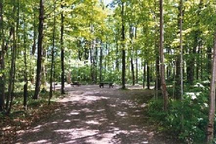
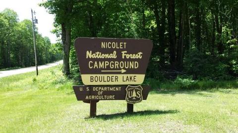
Boulder Lake Campground is conveniently located near Boulder Lake in northern Wisconsin. It is the forest’s largest campground but campsites fill up fast. The campground is home to individual and group sites, making it an ideal location to relax with friends or family. Recreational opportunities abound.
Recreation
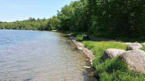
Boulder Lake provides ample opportunities for power boating, water skiing, fishing and swimming. Anglers might catch walleye, northern pike, bass or panfish. Ice fishing is also popular on the lake, and the boat ramp and parking area are plowed during the winter to provide better access to the lake.
Nearby streams are good for trout fishing and in addition, the Wolf River offers whitewater rafting and canoeing opportunities. Educational programs may be offered sporadically at the campground’s amphitheater.
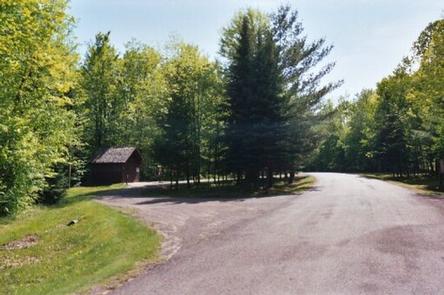
Facilities
The campground offers dozens of accessible, single-family sites for tent and RV camping. Ten accessible group sites are also available for reservation. They can accommodate anywhere from 16 to 30 people.
Campsites are equipped with tables and campfire rings with grills. Accessible vault toilets, showers and drinking water are provided. Some sites offer electric hookup. A dump station is located within the campground. Some campsites are available on a first-come, first-served basis.
Natural Features
The campground lies around the southern end of 362-acre Boulder Lake and is the largest public campground in the Chequamegon-Nicolet National Forest area. It is located in a stand of young hardwoods, overlooking the lake. Some campsites are situated along the water’s edge and others are further away, providing a quieter camping experience. Puddles and damp spots are common throughout the lush campground.
Nearby Attractions
Langlade is the nearest city, about 25 miles west of the campground.
Nearby Activities
Boating
Camping
Fishing
Water sports
Day use area
Swimming site
Gallery
Directions
From Townshed, travel Highway T for about 17 miles to the intersection with Highway W. Turn onto Highway W and continue just over a mile to Forest Road 2116. Turn right and continue to the campground.