Categories
Uncategorized

Kathryn Lake Recreation Area

The Kathryn Lake Campground will remain closed for the 2019 camping season. This closure impacts the campground – there will be reduced services at boat landing and picnic area – no swim buoys or water sampling at the beach, no public water supply available, vehicle access/parking available, toilet building available, picnic grounds, boat landing and accessible fishing pier will be mowed, garbage service available, and day use fees will continue to be charged. Chippewa Campground is a nearby Forest Service campground that is near Kathryn Lake. To find additional camping opportunities in the Medford area please visit http://medfordchamber.org/taylor-county-tourism/.

Nearby Activities

  • Boating
  • Camping
  • Fishing
  • Recreational vehicles

Directions

Travel north from Medford on State Highway 13 for 4 miles, then turn left (west) on County Trunk Highway M for 15 miles. Turn left (south) for 0.5 miles on Forest Road 121 campground entrance. 

GPS Coordinates

Latitude 45° 12′ 1.0800″ N

Longitude 90° 37′ 12.3600″ W

Categories
Uncategorized

Lakewood – Laona District

Come visit the Lakewood – Laona District and enjoy our many campgrounds, trails, lake and rivers! 

Directions

GPS Coordinates

Latitude 45° 33′ 36.3240″ N

Longitude 88° 40′ 44.7600″ W

Categories
Uncategorized

North Twin Lake Recreation Area

The North Twin Campground will remain closed for the 2019 camping season. This closure only impacts the campground the boat landing remains open. Eastwood, Picnic Point, Spearhead Point and Westpoint are all other Forest Service campgrounds near North Twin. To find additional camping opportunities in the Medford area please visit http://medfordchamber.org/taylor-county-tourism/.

Nearby Activities

  • Boating
  • Camping
  • Fishing
  • Picnicking
  • Recreational vehicles

Directions

Travel north from Medford on State Highway 13 for 4 miles. Turn left (west) on County Trunk Highway M for 7 miles, then turn right (north) on County Trunk Highway E for 6 miles. Turn right (east) on forest Road 102 for 1 mile, then turn right (south) on Forest Road 566 for 1 mile to the campground entrance. 

GPS Coordinates

Latitude 45° 16′ 51.9600″ N

Longitude 90° 26′ 37.6800″ W

Categories
Uncategorized

Wabasso Lake Recreation Area

If you are looking to canoe in the glassy waters of Wabasso Lake or enjoy a rustic cozy campground, try the Wabasso Lake Recreation Area off Forest Road 142 west of Lac du Flambeau.

The Wabasso Lake Recreation Area on the Medford-Park Falls Ranger District consists of a campground with five walk/canoe-in campsites equipped with fire grills and picnic tables. Drinking water and toilets are located at the boat landing.

Wabasso Lake Recreation Area is located about one mile west of the Lac du Flambeau and is perfect for primitive camping. Wabasso Lake is 49-acres and has an excellent panfish population and is great for canoeing and fishing.

So, if you like to hike, fish, swim, hike, bike, and picnic, then the Wabasso Lake Recreation Area is the place for you, located 5 minutes west of Lac du Flambeau. The Wabasso Lake Recreation Area is pet friendly; see restrictions below for more information.

Nearby Activities

  • Boating
  • Camping
  • Fishing
  • Picnicking

Directions

From State Highway 70, turn north on Forest Road 509 (Chippewa Trail Road) and then turn Right on Forest Road and left into Wabasso Lake Recreation Area.

GPS Coordinates

Latitude 45° 58′ 21.7200″ N

Longitude 90° 0′ 1.0800″ W

Categories
Uncategorized

Whisker Lake Wilderness

Whisker Lake was designated as a wilderness on October 2, 1978. This 7,500 acre tract is located 11 miles west of Florence, Wis., on the Michigan-Wisconsin border in Florence County. The area got its name from the large pines near the shoreline of Whisker Lake. Old timers called these pines "chin whiskers". These "chin whiskers" somehow escaped being burned by wildfires that ravaged the area after it was railroad-logged in the early 1900’s. The terrain within the Whisker Lake area ranges from rolling upland to beaver flooded wetlands. Trout fishing is available at Riley Lake, Edith Lake, Wakefield Creek and the Brule River. Berry picking, hunting, cross-country skiing and wildlife viewing are just some of the activities you can enjoy during your visit.

Directions

GPS Coordinates

Latitude 45° 57′ 17.6400″ N

Longitude 88° 28′ 1.2000″ W

Categories
Uncategorized

Emily Lake Recreation Area

If you are looking for a base camp to explore area trails or a destination campground with a family friendly atmosphere, try the Emily Lake Recreation Area off Forest Road 142 west of Lac du Flambeau.

The Emily Lake Recreation Area on the Medford-Park Falls Ranger District consists of a campground with 11 campsites equipped with a parking spur, campfire rings with grill, picnic table, vault toilets and drinking water. There are accessible vault toilet facilities at nearby interpretive trail at nearby Round Lake Logging Dam. There is also an accessible fishing pier at nearby Newman Lake.

Day use facilities include a boat ramp with access to the 26 acre Emily Lake, swimming area, paved boat launch, year round fishing with a good panfish population and nearby hiking trails where you can hike, mountain bike and snowshoe in the winter.

So, if you like to hike, fish, swim, boat or enjoy the convenience of being close to town, then the Emily Lake Recreation Area is the place for you, located 5 minutes west of Lac du Flambeau. The Emily Lake Recreation Area is pet friendly; see restrictions below for more information.

Nearby Activities

  • Boating
  • Camping
  • Fishing
  • Recreational vehicles

Directions

From Lac du Flambeau, travel west on Forest Road 142 for 3.5 miles. Turn right (north) on forest Road 1178 to the campground.

GPS Coordinates

Latitude 45° 57′ 52.9200″ N

Longitude 90° 0′ 36.3600″ W

Categories
Uncategorized

Ada Lake Recreation Area

Ada Lake Recreation Area is tucked away from the hustle and bustle of some of the more popular recreation sites on the Lakewood-Laona District.  It has many amenities of the other recreation areas, just not all the crowds.  There are plenty of sites to see on the district and Ada Lake Recreation area can serve as a home base.

Clear water, a sandy beach, and a blue sky are all it takes for many to have a memorable camping experience. Ada Lake Campground offers this and more. The exceptionally clear water makes it great for swimming, and the lake contains northern pike, bass, rainbow trout, and panfish. Another nice feature is the boat landing which makes the lake easily accessible to non-motorized boats.

The Ada Lake Recreation Area is near popular local site-seeing spots Quartz Hill, Jone’s Springs Area, Cathedral Pines and Knowles Creek Interpretive Trail.

So, if you like to camp, swim, boat and fish then the Ada Lake Recreation Area is the place for you, conveniently located just 5 minutes southwest of Wabeno. Ada Lake is one of our dog friendly recreation areas.

Nearby Activities

  • Auto touring
  • Boating
  • Camping
  • Fishing
  • Recreational vehicles
  • Swimming

Directions

• From Wabeno, drive north 0.8 mile on Highway 32 to Highway 52. Turn left (west) on Highway 52 and drive 7.0 miles to FR 2126. Continue straight on FR 2126 for 0.4 mile to FR 2620. Turn left on FR 2620 and drive 1.2 miles to campground.
• From Laona, drive south 8.0 miles on Highway 32 to Highway 52. Turn right (west) on Highway 52 and drive 7.0 miles to FR 2126. Continue straight on FR 2126 for 0.4 mile to FR 2620. Turn left on FR 2620 and drive 1.2 miles to campground.

GPS Coordinates

Latitude 45° 22′ 10.5600″ N

Longitude 88° 43′ 53.4000″ W

Categories
Uncategorized

STOCKFARM BRIDGE

Overview

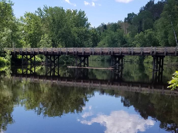
Stockfarm Bridge Campground is located in a red pine forest on the East Fork of the Chippewa River, a candidate wild and scenic river.

Recreation

Located on the edge of the elk capital of Wisconsin, the Stockfarm Bridge Campground area has activities for everyone. Miles of off-road vehicle on the Dead Horse Run Off-road Vehicle Trail (ATV/UTV), canoeing, kayaking, and fishing in the scenic East Fork of the Chippewa River or hunting during the fall small and big game hunting seasons.

Facilities

The campground offers 7 single family campsites and one group site accomodating up to 16 people. There is a hand-pump for potable drinking water, accessible vault toilets, fire rings and picnic tables. Trash collection and recycling bins are available at the campground as well.

Natural Features

The Chequamegon-Nicolet National Forest offers 845,000 acres of lush landscape dotted with lakes, rivers and streams. Pine, spruce, maple, aspen and balsam forests, as well as extensive jack pine plantations, make up the vegetation.

Gallery

Directions

From Loretta, drive north on County Highway GG 10.8 miles to the intersection of FR 164. Turn right (east) and drive 7.8 miles to the campground.

From Glidden, drive south 9.4 miles on Highway 13 to Bear Lake Road (FR 163). Turn right (west) on Bear Lake Road and drive 9 miles to FR 164. Turn right (north) on FR 164 and drive 3 miles to the campground.

GPS Coordinates

Latitude 46° 2′ 17.5200″ N

Longitude 90° 42′ 52.2000″ W

Categories
Uncategorized

Headwaters Wilderness

Officially designated as a wilderness in 1984, this 18,000 plus acre wilderness is located 16 miles southeast of Eagle River, Wis. in Forest County. Portions of this area contain some of the largest and oldest trees in the forest. Kimball Creek, Shelp Lake and the Headwaters of the Pine River are major features within this Wilderness. The terrain is generally flat. Popular recreation uses in this Wilderness are hiking, bird-watching, hunting, fishing and studying nature.

Directions

GPS Coordinates

Latitude 45° 48′ 52.4880″ N

Longitude 88° 56′ 52.4400″ W

Categories
Uncategorized

Rainbow Lake Wilderness

Rainbow Lake was one of the first eastern wildernesses designated in 1975. The total area encompasses 6,583 acres, located 4 miles north of Drummond, Wis., in Bayfield County. Among the unique features of this wilderness are the numerous narrow gauge railroad grades that were used for log hauling in the early 1900s. The North Country National Scenic Trail, which runs the length of the wilderness (north to south), and the Anderson Grade Trail (east to west) follow parts of these old grades.  These trails provide access to a variety of lakes that are great for fishing. 

Interspersed thoughout the wilderness are several scenic lakes and bogs, many of which can be accessed from old grades and the North Country National Scenic Trail.

The terrain in the area is mostly flat to gentle rolling, with some steep hills. Wildlife is abundant, so bring your binoculars and cameras! 

Directions

GPS Coordinates

Latitude 46° 25′ 4.4400″ N

Longitude 91° 18′ 5.0832″ W