Categories
Uncategorized

Bell Rock Pathway / Vista

Red Rock Pass Sold Here!

The Bell Rock Pathway is a 3.6 mile trail. Along this pathway you’ll enjoy fantastic views of Bell Rock, Courthouse Butte, and other landmarks. Most of the pathway has a wide, hard surface, but there are some steep hills too. Some places around Bell Rock are rocky and rough.

There is a popular observation area on the west side of Bell Rock not accessible from the highway.


Directions

Location: 31 miles south of Flagstaff in scenic Red Rock Country.

GPS:

  • North Trailhead (Map): 34°48’19.8″N 111°46’00.5″W
  • South Trailhead (Map): 34°47’29.4″N 111°45’42.7″W

Access: From the junction of Routes 89A and 179 in Sedona, take 179 south 3.6 miles to a paved turnout and trailhead parking on the left (east) at milepost 309.8, .2 miles south of the entrance to the United Methodist Church for the northern trailhead.

For the southern trailhead, from the South Gateway Visitor Center, go 1 mile north to Bell Rock parking area on your right.

Maps

  • Red Rock Country Maps: Download Red Rock Country trail maps and find other Sedona recreation resources. See the Sedona Southeast map for this trail.
  • The Digital Travel Map Whether you’re driving, hiking, riding, or exploring, you will find this full-color, GPS-enabled map a handy reference to have on your mobile device. The map show trails, recreation sites, major landmarks, and forest roads.
  • Forest Service Topo Map (FSTopo Geo-enable PDF)


Click map thumbnail for larger view.

Bell Rock Pathway Map


GPS Coordinates

Latitude 34° 47′ 29.4540″ N

Longitude 111° 45′ 42.6600″ W
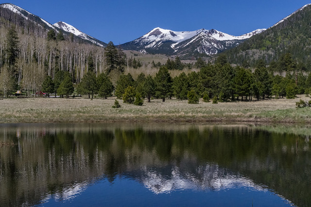
Categories
Uncategorized

Painted Desert Vista/Doney Picnic Areas

These two out-of-the-way picnic areas are located in the most recently active portion of the San Francisco volcano field. That doesn’t mean they’re dangerous, however. The volcanoes in this vicinity have been dormant for 800 years. What it does mean is that this scenery is some of the most unique in Arizona. Cinder cones and lava flows dot the landscape. Hardy desert plants stand in sharp contrast to the dark volcanic soils in which they struggle for survival. On the horizon the pastels of the painted desert add a streak of color. There’s even a guided nature trail at the Doney area to help you get a better perspective on the landscape, history, and culture of this colorful land.

Also located on the same road are Sunset Crater and Wupatki National Monuments. Sunset Crater features a self-guided nature walk through an extensive lava field and interpretive displays on volcanic activity. The centerpiece of Wupatki National Monument is a four story stone apartment house created around 900 years ago. Wupatki also has interpretive displays on the ancient cultures that once thrived in this seemingly inhospitable area.

Directions

Location: Painted Desert Vista is about 20 miles northeast of Flagstaff on paved roads. Doney Picnic Area is about 43 miles northeast. The elevation of both is about 6,000 feet.

GPS:

  • Doney Picnic Area (elevation 5300′, Map): 35°31’55.1″N 111°24’17.5″W 
  • Painted Desert Area (elevation 6201′, Map): 35°23’26.3″N 111°25’55.5″W

Access: From Flagstaff, drive 12 miles northeast on US 89 to the Sunset Crater-Wupatki turnoff (FR 545), and turn east (right) about 8 miles to Painted Desert Vista. Or drive 34 miles on US 89 to the north end of the Wupatki Loop Road and turn east 9.5 miles to the Doney Picnic Area. All roads are paved.


Click map image for PRINTABLE view.

Painted Desert Vista/Doney Picnic Area Map

GPS Coordinates

Latitude 35° 23′ 23.2728″ N

Longitude 111° 25′ 57.0396″ W

Categories
Uncategorized

Lockett Meadow Campground

This primitive campground offers a scenic view of the San Francisco Peaks and dry camping in the cool aspen trees that surround Lockett Meadow. This is a terrific campground for those who cherish a real mountain camping experience and love to hike wilderness trails. You may catch a glimpse of the natural residents, porcupine or elk or thrill to the song of a hermit thrush that sings his best here. Even black bear have been known to stroll right through groups of picnickers without as much as a glance at their lunches.

The San Francisco Peaks are actually the remains of an extinct volcano, which mllions of years ago shattered and reshaped these great peaks, forming four of the highest individual peaks in Arizona and is home to the only region of tundra in Arizona. Inside the now quiet caldera a lush alpine environment has blurred evidence of that cataclysmic event.

The Inner Basin Trail that leads into the heart of the ancient volcano begins in beautiful Lockett Meadow. Starting at this island of emerald, which is ringed with quaking aspen stands and majestic high peaks, it leads into the mountain’s now quiet Inner Basin. The spring and summer wild flowers add a sprinkling of blue, red and yellow to the peaceful scene. While fall turns the extensive stands of aspen, which cover the steep slopes of the caldera, to solid gold, Winter avalanche tracks streak down the talus slopes exposing remnants of old lava flows which bear witness to the mountain’s turbulent heritage.


Hover mouse over photo to display slideshow controls. View album on Flicker

Camping: Lockett Meadow


Nearby Activities

  • Camping
  • Picnicking

Directions

Location: 15 north of Flagstaff in the heart of the San Francisco Peaks.

Directions: Drive northeast of Flagstaff on US Highway 89 for 12.5 miles. Turn left on Forest Road 552, directly across from the Sunset Crater National Monument turnoff. Follow FR 552 for approximately one mile. Turn right at the Lockett Meadow sign and continue to the campground. This dirt road is closed in early spring and late fall due to snow.

This road is not recommended for RVs/trailers due to the very steep, narrow (single lane), and rough road.

GPS (Map): 35°21’33.3″N 111°37’09.7″W


Click map thumbnail for larger view.

Lockett Meadow Map

GPS Coordinates

Latitude 35° 21′ 30.9600″ N

Longitude 111° 37′ 14.8800″ W

Categories
Uncategorized

Kachina Peaks Wilderness

View of the western side of the snow-frosted San Francisco Peaks from the spring green Inner Basin.

View of the San Francisco Peaks from the interior of extinct volcano’s crater, the Inner Basin.


Here’s a wilderness experience that takes you as high as you can get in Arizona. This 18,960 acre roadless area encompasses most of the upper reaches of the San Francisco Peaks including Humphreys Peak, Arizona’s highest point at 12,643 feet. The area is named for the Hopi dieties, or Kachinas, whom that culture’s mythology tells us live here for part of every year. In mid-summer these dieties fly from the top of the peaks to the Hopi mesas as clouds bringing the nourishing rains of the seasonal monsoons.

Not surprisingly, this most prominent feature on the northern Arizona landscape is sacred to all of the area’s indigenous people and has become a source of awe and wonder to its more recently arrived visitors and residents as well.

A number of trails offer access to this mountain which is a dormant volcano that last erupted roughly two million years ago. Some of those trails lead to the top of the several peaks which form the rim of the mountain’s inner basin, a huge caldera which was formed during the mountain’s most recent volcanic cataclysm. That once inhospitable crater now supports a thriving stand of white barked aspens and hardy mixed conifers. Other routes offer access to the forests and meadows which carpet the mountain’s lower slopes. Views from any of these trails are well worth the effort of a visit.

Note: In the winter, a free Backcountry Permit is required when accessing the Kachina Peaks Wilderness from Arizona Snowbowl or Snowbowl Road. It can be obtained from either of the Forest Service offices in Flagstaff during regular business hours, or at Arizona Snowbowl Agassiz Lodge on weekends.

Hover mouse over photo to display slideshow controls. View album on Flicker

Kachina Peaks Wilderness


Directions

Location: 6 miles north of Flagstaff.

Access: Drive north from Flagstaff on U.S. 180 or U.S. 89. From U.S. 180, the Snowbowl Road and FR 418 and FR 420 provide access. From U. S. 89, FR’s 418 and 420 provide access to lower slopes. FR 552 leads to Lockett Meadow and easiest access to the Inner Basin.


Click map image for printable view.

Kachina Peaks Wilderness Map

GPS Coordinates

Latitude 0° 0′ 0.0000″ S

Longitude 0° 0′ 0.0000″ W

Categories
Uncategorized

Abineau-Bear Jaw Loop

From the Abineau (#127) and Bear Jaw (#26) trails, on the north slope of the San Francisco Peaks, you can see the Grand Canyon seventy miles away. These two trails make a scenic loop through forested canyons. Both end at the Waterline Road (FR 146) along the base of a long talus slope topped by Humphreys Peak, Arizona’s highest point. The climb along either two-mile trail is steep and steady through stands of mixed conifer and aspen. The road completes the loop by connecting the top of one trail to the other, ascending 600′ over two miles from the top of Bear Jaw Trail to the top of Abineau Trail. From this high perspective the Grand Canyon cuts a wide gap in a the plateau stretching from the mountain to the horizon. With the almost half-mile connector trail from the trailhead to the loop (where Bear Jaw and Abineau split to follow differnt routes up the mountain), the entire hike is approximately 7 miles long.

This route passes through an area colorful at all seasons of the year. In late spring, alpine wildflowers such as lupine, rocky mountain iris, penstemon and paintbrush splash the trailside meadows. Sunflowers add yellow in summer, and groves of aspen paint the slopes with crimson and gold during the fall.

You may spot a black bear here—perhaps the best chance you’ll have around the Peaks. These big shy animals occasionally show themselves along these trails. Mule deer and elk are also plentiful. Common birds include juncos, Steller’s jays and Clark’s nutcrackers. In spring and early summer the melodious hermit thrush will serenade you.

Early in 2005, a huge avalanche did extensive damage to the trail in Abineau Canyon. Although the trail reopened by that summer, evidence of the avalanche still remains in toppled trees and gouged rock. 


Trails: Abineau-Bear Jaw Loop

Photo tour of this hike on Flickr


Download a slideshow about the Abineau-Bear Jaw Loop (PDF)


Directions

Location: about 25 miles north of Flagstaff on paved and graveled roads.

GPS (Map): 35°23’33.0″N 111°40’12.7″W

Topo Map Quads: White Horse Hills, Humphreys Peak

Access 

  • Western approach from US 180 (high clearance vehicle recommended)Drive northwest of Flagstaff on US 180 for 19.5 miles and turn right on FR 151 (Hart Prairie Rd.). Drive 1.5 mile and turn left on FR 418. Drive 3 miles to  FR 9123J. Turn right (south) on FR 9123J and drive 1.2 miles to the trailhead.
  • Eastern approach from US 89 (high clearance vehicle required): Drive northeast of Flagstaff on US 89 for 12 miles and turn left (west) on FR 552 directly across from the Sunset Crater turnoff. Turn right at Forest Road 418 and go approximately 7 miles to FR 9123J. Turn left (south) on FR 9123J and drive 1.2 miles to the trailhead.


Click map thumbnail for a larger view.

Abineau/Bear Jaw Trails Map


GPS Coordinates

Latitude 35° 23′ 33.0000″ N

Longitude 111° 40′ 12.7200″ W

Categories
Uncategorized

Mormon Lake

Mormon Lake is the largest natural lake in Arizona… sometimes. During droughts it’s frequently not so large, and not so much a lake.  Occasionally it’s even bone dry.

Wet or not, this has an excellent overlook where you can often see wildlife and birds across the lake’s landscape.  There is also a picturesque little resort on the lake’s western shore where you can rent recreational equipment such as mountain bikes, horses to ride, snowmobiles and cross-country skis in season. Or you can drop in at the Mormon Lake Lodge, a famous cowboy steak house where the brands of local ranches are burned into the log walls.

Dairy Springs Campground and Double Springs Campground are located nearby. There, in addition to developed campsites, you’ll find some excellent hiking trails which lead to panoramic overlooks of the lake and the surrounding area.


Directions

Location: 29 miles southeast of Flagstaff on a paved road. Elevation is 7,000 feet.

GPS (Map): 34°57’46.9″N 111°26’15.1″W

Access: Drive south from Flagstaff 25 miles on Forest Highway 3 (Lake Mary Road) to the Forest Road 90 intersection. Turn west on FR 90 and drive about 4 miles to the lake.


Click map thumbnail for larger view.

Mormon Lake Map


GPS Coordinates

Latitude 34° 57′ 46.9116″ N

Longitude 111° 26′ 15.0612″ W

Categories
Uncategorized

Lower Lake Mary Picnic Area


This picnic area is conveniently close to Flagstaff and offers access to a number of different areas where you can enjoy your favorite outdoor recreation. When Lower Lake Mary has water in it, it’s a popular place to fish for catfish and trout, depending on which has been stocked most recently. When it’s dry, it’s a good place to fly a kite. Lake Mary Road has wide paved shoulders and makes an excellent place to bike, roller blade or jog. Not too far away you’ll find the Sandy’s Canyon Trail which leads into an area of picturesque small canyons, big trees, and even bigger views. All this activity has been known to cause forest visitors to work up quite an appetite, hence the need for a picnic area.

See Lake Mary Recreation Corridor for more recreation sites and information about the area.

Directions

Location: 8 miles southeast of Flagstaff on paved roads. Elevation is 7,000 feet.

GPS (Map): 35°06’39.9″N 111°35’01.9″W

Access: Drive 8 miles south from Flagstaff on Forest Highway 3 (Lake Mary Road). The access road to the picnic area is located just south of FR 132.


Click map thumbnail for a larger view.

Lower Lake Mary Picnic Area Map

GPS Coordinates

Latitude 35° 6′ 41.0220″ N

Longitude 111° 35′ 1.6476″ W

Categories
Uncategorized

Forked Pine Campground

See Ashurst Lake Campgrounds for details.

Directions

GPS Coordinates

Latitude 35° 1′ 23.3760″ N

Longitude 111° 23′ 54.2760″ W

Categories
Uncategorized

Ashurst Lake Campgrounds

Ashurst Lake/Forked Pine Campgrounds

Good fishing and excellent views of the San Francisco Peaks characterize these two lakeside campgrounds. Ashurst Lake is stocked with trout, bass, and channel catfish, and boasts enough wind for windsurfing.

Both campgrounds hug the lakeshore with campsites huddled in a picturesque stand of gnarly old juniper trees and pinyon pines. One of Ashurst Lake’s most notable characteristics is it ability to hold a high water level in drought years. That can be very important here in northern Arizona where less resilient lakes sometimes dry up.

In addition to fishing and board sailing, the lake offers excellent opportunities for birdwatching during the spring waterfowl migration. For a special treat look for white-faced ibises grazing in the shallows along with the cinnamon teal, pintails and other ducks. Bald eagles and osprey can also be seen in the area, along with a number of species of hawks and songbirds.

A graveled road to the lake and graveled road that surrounds most of the lake provides convenient access for most passenger vehicles and bicycles. Rustic gravel and “two-track” roads in the area offer some great opportunities to mountain bike or walk out into the surrounding juniper/ponderosa mixed forest for some wildlife viewing and open spaces. The San Francisco Peaks stand majestically on the horizon providing a grand display of Arizona’s volcanic past.


Hover mouse over photo to display slideshow controls. View album on Flicker

Camping: Ashurst Lake


Nearby Activities

  • Camping
  • Picnicking

Directions

Location: About twenty miles southeast of Flagstaff. Elevation is 7,000 feet.

GPS :

  • Boat Ramp (Map): 35°01’16.1″N 111°24’27.1″W
  • Ashurst Campground (Map): 35°01’10.1″N 111°24’31.1″W
  • Forked Pine Campground (Map): 35°01’21.7″N 111°23’51.8″W

Access: Drive south 19 miles from Flagstaff on Forest Highway 3 (Lake Mary Road) then east about 4 miles on Forest Road 82E.


Click map thumbnail for larger view.

Ashurst Lake Campgrounds Map


GPS Coordinates

Latitude 35° 1′ 21.0972″ N

Longitude 111° 24′ 26.9028″ W

Categories
Uncategorized

Soldier / Long Lakes

[photo] Knoll Lake - Click for Larger view

If the fish aren’t biting in one of these lakes, you can always try another. Not only will you be helping your chances by changing location, but each of these bodies of water is known for producing a different species of fish. The three shallow lakes in this group serve forest visitors as places to set up a primitive camp and go fishing. Soldier Lake provides good fishing for bass and catfish. Soldier Annex Lake is better known for its catfish, although blue gill can also be caught here. Long Lake is the only one of the three that is stocked with trout but is also good for walleye and catfish.

Many forest visitors come here to set up primitive camps and enjoy other forest activities besides fishing, such as off highway vehicle riding and wildlife watching. The lakes are located in an area of open grasslands dotted with pinyon and juniper trees.

Campground Season: There are no developed campgrounds at these lakes. The nearest developed campground is Blue Ridge Campground which is open from Memorial Day to Labor Day.

Attractions: Boating/canoeing, fishing, wildlife watching

Facilities: Valut-type toilets and two boat ramps at Long Lake.

Helpful Links from the Arizona Game & Fish Department:

Photos & Multimedia

Directions

Location: 68 miles south of Flagstaff on paved and graded forest roads suitable for passenger vehicles in dry weather. We recommend high clearance vehicles due to rutted and rocky roads. When the road is wet, the clay becomes slick and slimey.

GPS (shore of Long Lake, Map): 34°47’18.1″N 111°12’59.8″W

Access: Drive 48 miles south of Flagstaff on Forest Highway 3 (Lake Mary Road). Turn east (left) on FR 211. Follow FR 211 about 8 miles to FR 82 then turn left (north) 12 miles to Long Lake. Or from Phoenix going north on Hwy 87, turn west (left) on FR 211 about a quarter mile north of the Blue Ridge office (about milepost 300). Turn right about 3.5 miles at the FR 82 intersection and then 12 miles to the lake.


Click map image for PRINTABLE view.

Soldier - Long Lake Map

GPS Coordinates

Latitude 34° 47′ 18.0528″ N

Longitude 111° 12′ 59.8104″ W