This recreation area is part of Hensley Lake
Directions
GPS Coordinates
Latitude 0° 0′ 0.0000″ S
Longitude 0° 0′ 0.0000″ W
This recreation area is part of Hensley Lake
Latitude 0° 0′ 0.0000″ S
Longitude 0° 0′ 0.0000″ W
This recreation area is part of Hensley Lake
Latitude 37° 7′ 9.0602″ N
Longitude 119° 52′ 32.0945″ W
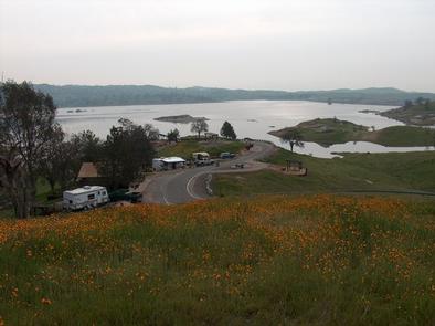
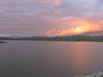
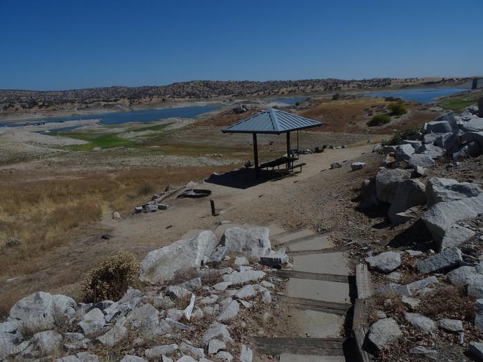
Hidden View Campground is located at Hensley Lake in the foothills of central California, 50 miles north of Fresno. The lake area offers many recreational opportunities, such as swimming, water skiing, fishing and hiking, and attracts a growing number of visitors per year. It is within a short drive to Yosemite, Kings Canyon and Sequoia National Parks, as well as Sierra National Forest.
The 1,500-acre lake was created by the construction of Hidden Dam on the Fresno River. With over 20 miles of shoreline, it is a popular vacation spot for families and those who enjoy water activities.
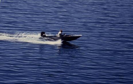
The area is packed with opportunities for outdoor fun. Campers enjoy boating, water skiing and fishing on the water. Bank fishermen have easy access to the lake’s shoreline.
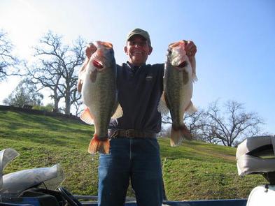
Lake fishing is particularly good in the coves where largemouth black bass, crappie, bluegill and catfish are found in abundance. Rainbow trout are stocked in the lake each winter.
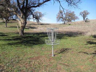
On the other side of the lake, there is a swim beach, a disc golf course and a hiking, mountain biking and equestrian trail. One hiking trail is located within walking distance of the campground.
Educational programs are offered at the campground’s amphitheater every Saturday night during summer months.
Hidden View campground provides 55 campsites including two group campsites. Some sites have electric hookups, and all campsites are located within walking distance of the lake and boat ramp.
Hidden View is located on the shores of Hensley Lake and is surrounded by the oak woodlands of the Sierra Nevada foothills, offering a mixture of sun and shade.
The area has significant historical value as it was once home to the Miwok and Yokut Native American Tribes.
Yosemite National Park is about one hour north, and Sequoia and Kings Canyon National Parks are about 1.5 hours southeast of the facility.
Sequoia and Kings Canyon National Parks

From south of Fresno: Take SR 99 to SR 41 north and go 21 miles to SR 145. Turn left on 145 and go 8.4 miles to Road 33. Turn right on Road 33, and go one mile to Road 400. Take a right onto 400 and go 7.1 miles to Road 603. Turn left and go 1 mile to Road 407. Take a right on 407 and drive 1.7 miles to the campground.
From south of Madera: Take SR 99 north to exit 153B. Bear right onto Madera Ave. and go .3 miles to Gateway. Turn left and drive .2 miles to the traffic light at Yosemite Ave. (SR 145). Turn right and go 7.2 miles to Road 33. Turn left on Road 33, and go 1 mile to Road 400. Take a right onto 400 and go 7.1 miles to Road 603. Turn left and go 1 mile to Road 407. Take a right on 407 and drive 1.7 miles to the campground.
From north of Madera: Take State Route 99 south to exit 153B. Exit onto Olive Ave. Turn left onto Madera Ave. and go .3 miles to Gateway. Turn left and drive .2 miles to the traffic light at Yosemite Ave. (SR 145). Turn right and go 7.2 miles to Road 33. Turn left on Road 33, and go one mile to Road 400. Take a right onto 400 and go 7.1 miles to Road 603. Turn left and go 1 mile to Road 407. Take a right on 407 and drive 1.7 miles to the campground.
Latitude 37° 7′ 28.9999″ N
Longitude 119° 53′ 49.9999″ W
Buck Ridge Park is a group day-use area located at Hensley Lake in the foothills of central California, 50 miles north of Fresno.
The lake area offers many recreational opportunities, such as swimming, water skiing, fishing and hiking, and attracts a growing number of visitors per year. It is within a short drive to Yosemite, Kings Canyon and Sequoia National Parks, as well as Sierra National Forest.
The 1,500-acre lake was created by the construction of Hidden Dam on the Fresno River. With over 20 miles of shoreline, it is a popular vacation spot for families because of its playground, swimming areas and water activities.
The area is packed with opportunities for outdoor fun. The lake area has a swim beach, a disc golf course and a hiking, mountain biking and equestrian trail. On the water, visitors can ski, swim and fish.
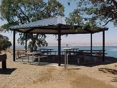
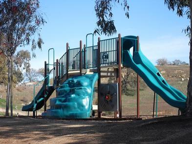
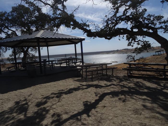
This facility has boat ramps, picnic areas, a group picnic shelter and a playground. Drinking water is provided, and there is a grocery store within a short driving distance.
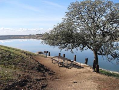
Buck Ridge is located directly on the shore of Hensley Lake and surrounded by the oak woodlands of the Sierra Nevada foothills, offering a mixture of sun and shade.
Yosemite National Park is about one hour north, and Sequoia and Kings Canyon National Parks are about 1.5 hours southeast of the facility.
Sequoia and Kings Canyon National Parks

From south of Fresno: Take State Route 99 to SR 41 north to SR 145. Turn left on 145 and go 8.4 miles to Road 33. Turn right on Road 33, and go 1 mile to Road 400. Turn right on 400, and go 9.7 miles to the Buck Ridge Recreation Area. Follow the signs to the campground and various areas within the park.
From south of Madera: Take SR 99 north to exit 153B. Bear right onto Madera Ave. and go .3 miles to Gateway. Turn left and drive .2 miles to the traffic light at Yosemite Ave. (SR 145). Turn right and go 7.2 miles to Road 33. Turn left on Road 33, and go 1 mile to Road 400. Turn right on 400, and go 9.7 miles to the Buck Ridge Recreation Area. Follow the signs to the campground and various areas within the park.
From north of Madera: Take SR 99 south to exit 153B. Exit onto Olive Ave. Turn left onto Madera Ave. and go .3 miles to Gateway. Turn left and drive .2 miles to the traffic light at Yosemite Ave. (SR 145). Turn right and go 7.2 miles to Road 33. Turn left on Road 33, and go 1 mile to Road 400. Turn right on 400, and go 9.7 miles to the Buck Ridge Recreation Area. Follow the signs to the campground and various areas within the park.
Latitude 37° 7′ 30.0000″ N
Longitude 119° 52′ 30.0000″ W
This recreation area is part of Eastman Lake
Latitude 0° 0′ 0.0000″ S
Longitude 0° 0′ 0.0000″ W
This recreation area is part of Eastman Lake
Latitude 0° 0′ 0.0000″ S
Longitude 0° 0′ 0.0000″ W
This recreation area is part of Eastman Lake
Latitude 37° 12′ 57.3095″ N
Longitude 119° 58′ 6.9370″ W
This recreation area is part of Eastman Lake
Latitude 37° 12′ 40.0747″ N
Longitude 119° 57′ 48.8948″ W
Chowchilla Recreation Day Use Area is located at the beautiful Eastman Lake, surrounded by rugged oak-covered hills. Visitors take advantage of this scenic setting for fishing, boating and hiking. Abundant wildlife in the area includes bobcats, Golden eagles, hawks, Wood ducks and Bald eagles.
With warm summers and mild winters, visitors can take advantage of a range of activities including eight miles of trails available for hikers, mountain bikers or horseback riders.
Eastman is the first lake designated by the California Department of Fish and Game as a Trophy Bass Fishery. Crappie, trout and catfish are also popular catches.
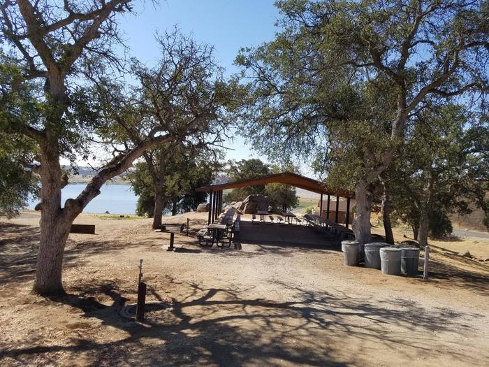
The picnic shelter can be reserved on a day to day basis only. Camping overnight is not allowed. The picnic shelter holds up to 100 people. A playground, horseshoe pits, and flush toilets are also available for use.
Nestled in the foothills of the Sierra Nevada Range, Eastman Lake boasts spectacular views of the surrounding mountains. The 1,780 surface-acre lake is fed by the Chowchilla River, a tributary of the San Joaquin River.
The visitor center is an ideal stopping place to learn about the natural and cultural history of the area.

50 miles north of Fresno, CA. Take Highway 99 north to Ave 17 east, follow to Road 26 north to Avenue 26 east to Road 29 north. Turn left on Road 29 and travel 8 miles to the park entrance. Follow the signs into the campground.
Latitude 37° 13′ 30.0000″ N
Longitude 119° 58′ 59.0002″ W
Codorniz Campground on Eastman Lake is a perfect launchpad for activities like canoeing, birding and hiking. Tucked in the Sierra Nevada foothills, the area attracts abundant wildlife like bobcats, golden eagles, mountain lions, hawks and wood ducks.
Eastman Lake is the first designated Trophy Bass Fishery, by the California Department of Fish and Wildlife. Both young and old anglers will find fishing on Eastman lake a satisfying challenge.
At the campground, visitors can try their hand at disc golf or challenge a group of friends to a game of volleyball. Horseshoe pits are also available for a little friendly competition.
A mix of electric and non-electric campsites are available. Fish cleaning stations are near each boat ramp, and showers are on hand as well. Wireless internet is provided from the campground office and horse camping corrals are available.
The rolling hills around Eastman Lake are surrounded by tall grasses and scattered oak trees, giving way to stunning mountain views.
The lake features 1,780 surface acres, fed by the cool waters of the Chowchilla River.
The Sierra National Forest is a short drive to the east of the campground.
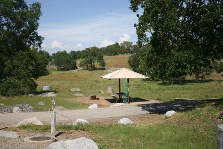
Eastman Lake is 30 miles northeast of Madera, 25 miles east of Chowchilla,
and 50 miles north of Fresno. From Highway 99, travel east on Avenue
26 then north on Rd 29. Follow signs into the campground.
Latitude 37° 12′ 56.9999″ N
Longitude 119° 58′ 7.0000″ W