This recreation area is part of Grapevine Lake
Directions
GPS Coordinates
Latitude 32° 59′ 51.4005″ N
Longitude 97° 5′ 21.2859″ W
This recreation area is part of Grapevine Lake
Latitude 32° 59′ 51.4005″ N
Longitude 97° 5′ 21.2859″ W
This recreation area is part of Grapevine Lake
Latitude 32° 57′ 24.4295″ N
Longitude 97° 4′ 32.7744″ W
Murrell Park offers day use facilities, boat ramp access and primitive camping on scenic Grapevine Lake, in the middle of the Dallas-Fort Worth Metroplex in Texas.
The lake has become a premier recreation destination for the Southwest and offers some of the best camping, fishing and boating in Texas.
This facility is open year-round, but particularly in hot summer months, the cool water provides a refreshing break from the Texas heat.
Murrell Park is popular for picnicking, hiking, mountain biking, boating and fishing. The park is home to the well known Northshore Trail, which welcomes hikers and bikers.
Horses are not permitted on the Northshore Trail or in Murrell Park; however, there are horse trails available on the south side and west end of the lake.
Hunting is not allowed in the park, but is available in some of the surrounding public lands. Anglers can fish along the shoreline or from the water; popular species include black and white crappie, catfish and bass.
This facility offers 22 tent-only campsites along the lakeshore with views of the water. These sites do not have electrical or water hook ups.
All campsites have campfire rings and most have grills; some also offer picnic tables and picnic shelters. Two pit toilets are provided; shower and flush toilet facilities are not available.
Water fountains are available from spring through fall and are shut off during the winter months. It is recommended that campers provide their own water.
The park contains one low water boat ramp as well as a high water boat ramp.
Grapevine is an 7,280 acre recreational lake with 60 miles of rolling shoreline. The area offers a wide variety of wildlife to observe, including white-tailed deer, turkey, squirrel, armadillo, rabbit and numerous birds species.
The nearby city of Grapevine offers many historical attractions as one of the oldest settlements in the county, dating back to 1844, a year before Texas became a part of the United States.
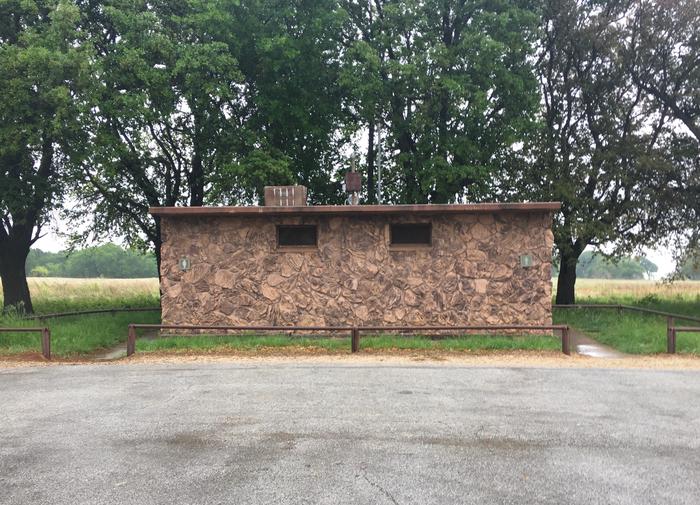
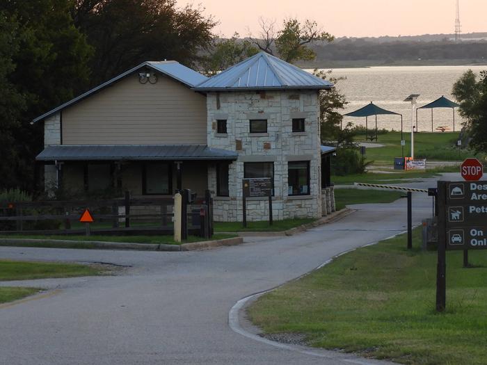

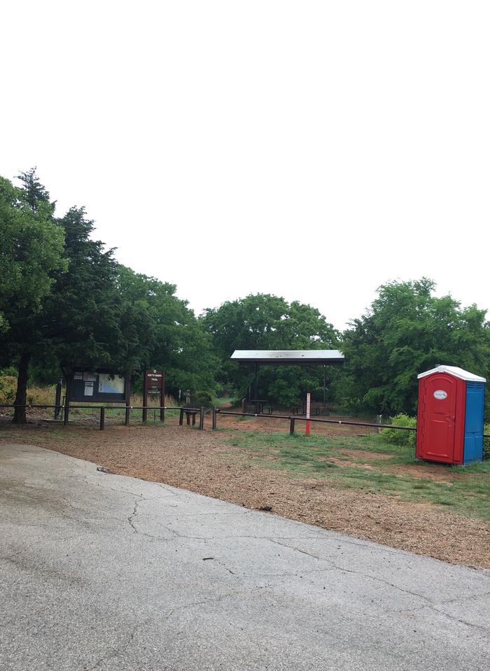
Grapevine Lake is located in the Dallas-Fort Worth Metroplex, south of Denton, Texas. The north side of the lake is almost entirely within the town boundaries of Flower Mound, Texas in Denton county.
The south side of the lake is located in Grapevine, Trophy Club and Southlake, Texas in Tarrant County.
The parks physical address is 880 Simmions Road, Flower Mound, Texas
Latitude 32° 59′ 51.0000″ N
Longitude 97° 5′ 21.0001″ W
This recreation area is part of Lake O’ The Pines
Latitude 32° 47′ 43.9426″ N
Longitude 94° 32′ 40.7770″ W
This recreation area is part of Lake O’ The Pines
Latitude 32° 45′ 43.7253″ N
Longitude 94° 29′ 49.2100″ W
This recreation area is part of Lake O’ The Pines
Latitude 32° 47′ 29.4612″ N
Longitude 94° 32′ 29.9220″ W
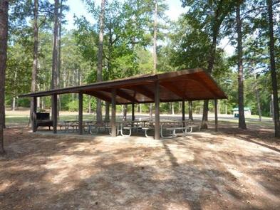
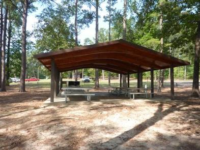
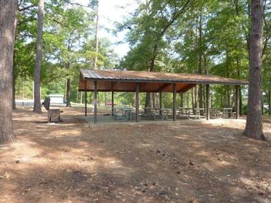
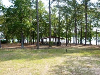
Johnson Creek Day Use Area is situated along the banks of the Lake O’ the Pines in the Ark-La-Tex portion of the Pineywoods of east Texas near the states of Arkansas, Oklahoma, and Louisiana.
Boating, fishing, water sports, and wildlife viewing are all popular pastimes at the campground. Hunting opportunities for white-tailed deer, waterfowl, and small game are available on nearby public lands.
Lake O’ the Pines fishing includes largemouth, spotted, and white bass along with crappie, catfish, and sunfish. In addition to boat fishing there are areas for bank fishing along the shore and below the dam along Big Cypress Bayou.
Birdwatchers are also encouraged to bring their binoculars as numerous resident and migratory bird species inhabit the area. Bald eagle sightings are a common occurrence in fall and winter and they are occasionally sighted in spring and summer. best waterfowl hunting in East Texas.
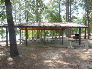
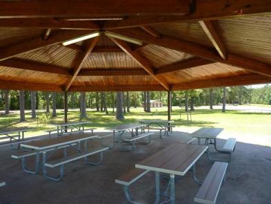
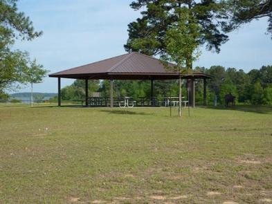
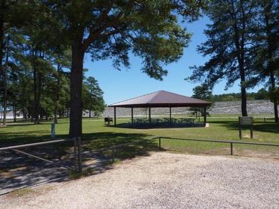
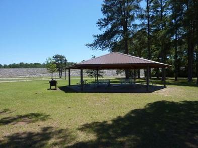
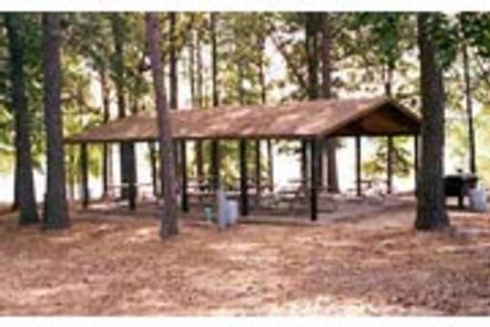
Johnson Creek offers a large group picnic shelter, complete with electric hookups, that can accommodate up to 100 guests.
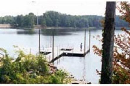
A boat ramp, courtesy dock, fishing dock, volleyball court, and swimming beach are also provided, making the area perfect for large parties or family functions.
Lake O’ the Pines includes about 18,700 acres of water and 9,000 acres of land. The Johnson Creek Day Use Area is located near the confluence of Johnson Creek and Lake O’ the Pines.
The lake was created by the construction of the Ferrell’s Bridge Dam on the Big Cypress Bayou. The reservoir was originally created as part of the overall plan for flood control in the Red River Basin below Denison Dam in Oklahoma, and has now become a recreational oasis for outdoor enthusiasts.
Other historic and tourist attractions are nearby in the towns of Jefferson and Marshall, and Texas Wildflower Trail routes are located along the roads surrounding the lake.
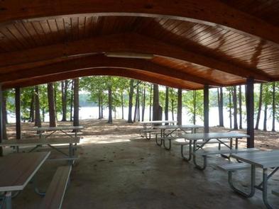
From Jefferson, Texas, travel 3.8 miles northwest on Highway 49. Turn left onto FM 729 and continue for just over 8.5 miles. Park entrance will be on the left.
Latitude 32° 47′ 21.0001″ N
Longitude 94° 32′ 53.0002″ W
Brushy Creek Day Use Area is situated along the banks of Lake O’ the Pines in the Ark-La-Tex portion of the Pineywoods of east Texas near the states of Arkansas, Oklahoma, and Louisiana.
Boating, fishing, water sports, and wildlife viewing are all popular pastimes at the campground. Hunting opportunities for white-tailed deer, waterfowl, and small game are available on nearby public lands.
Lake O’ the Pines fishing includes largemouth, spotted, and white bass along with crappie, catfish, and sunfish. In addition to boat fishing there are areas for bank fishing along the shore and below the dam along Big Cypress Bayou.
Birdwatchers are also encouraged to bring their binoculars as numerous resident and migratory bird species inhabit the area. Bald eagle sightings are a common occurrence in fall and winter and they are occasionally sighted in spring and summer. Boating, fishing, hunting and wildlife viewing are all popular pastimes at Brushy Creek.
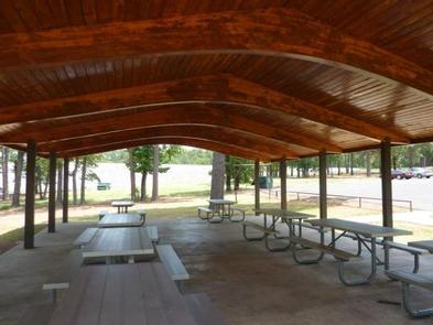
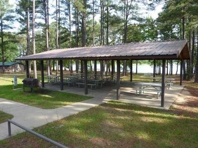
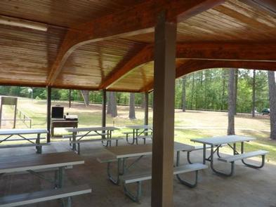
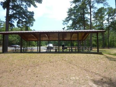
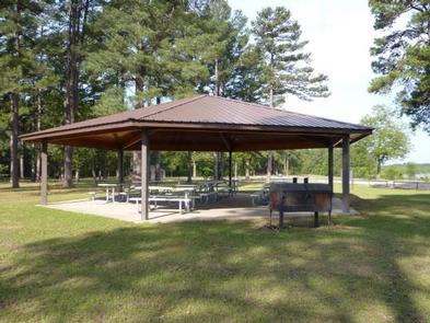
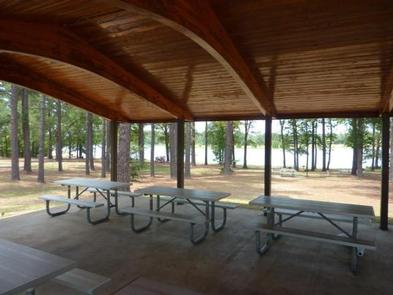
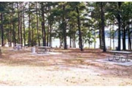
Brushy Creek Day Use area offers one large group picnic shelter, along with 30 smaller, non-reservable picnic sites located in shady areas along the shore. Each site has tables and grills.
A boat ramp, courtesy dock, swimming beach and basketball court are also provided, making the area perfect for large parties or family functions.
Lake O’ the Pines includes about 18,700 acres of water and 9,000 acres of land.
The lake was created by the construction of the Ferrell’s Bridge Dam on the Big Cypress Bayou. The reservoir was originally created as part of the overall plan for flood control in the Red River Basin below Denison Dam in Oklahoma, and has now become a recreational oasis for outdoor enthusiasts.
Other historic and tourist attractions are nearby in the towns of Jefferson and Marshall, and Texas Wildflower Trail routes are located along the roads surrounding the lake.
From Jefferson, Texas, travel 3.8 miles northwest on Highway 49. Turn left onto FM 729 and continue for 3.5 miles, then turn left again onto FM 726. Travel 5.0 miles turn right at the stop sign and follow signs to the park entrance.
Latitude 32° 44′ 17.9999″ N
Longitude 94° 34′ 28.9999″ W
Lakeside Day Use Area is situated along the banks of the Lake O’ the Pines in the Ark-La-Tex portion of the Pineywoods of east Texas near the states of Arkansas, Oklahoma, and Louisiana.
Boating, fishing, water sports, and wildlife viewing are all popular pastimes at the campground. Hunting opportunities for white-tailed deer, waterfowl, and small game are available on nearby public lands.
Lake O’ the Pines fishing includes largemouth, spotted, and white bass along with crappie, catfish, and sunfish. In addition to boat fishing there are areas for bank fishing along the shore and below the dam along Big Cypress Bayou.
Birdwatchers are also encouraged to bring their binoculars as numerous resident and migratory bird species inhabit the area. Bald eagle sightings are a common occurrence in fall and winter and they are occasionally sighted in spring and summer.
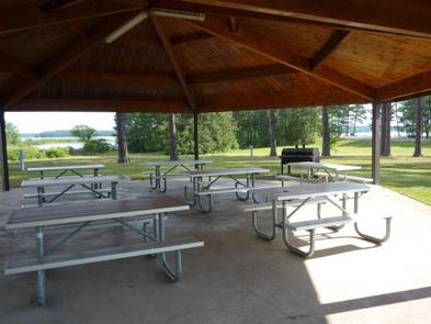
Lakeside Park offers one large group picnic shelter, complete with electric hookups, that can accommodate up to 100 guests.
A boat ramp, dock and swimming beaches, and a volleyball court are also provided, making the area perfect for large parties or family functions.
Lakeside Day use is located near the Ferrell’s Bridge Dam. Lake O’ the Pines includes about 18,700 acres of water and 9,000 acres of land.
The lake was created by the construction of the Ferrell’s Bridge Dam on the Big Cypress Bayou. The reservoir was originally created as part of the overall plan for flood control in the Red River Basin below Denison Dam in Oklahoma, and has now become a recreational oasis for outdoor enthusiasts.
Other historic and tourist attractions are nearby in the towns of Jefferson and Marshall, and Texas Wildflower Trail routes are located along the roads surrounding the lake.
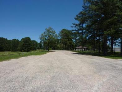
From Jefferson, Texas, travel 3.8 miles northwest on Highway 49. Turn left onto FM 729 and continue for 3.5 miles, then turn left again onto FM 726. Travel 3.5 miles the park entrance will be on the right.
Latitude 32° 44′ 57.0001″ N
Longitude 94° 30′ 43.9999″ W
Johnson Creek Campground is situated along the banks of Lake O’ the Pines in the in the Ark-La-Tex portion of the Pineywoods of east Texas near the states of Arkansas, Oklahoma, and Louisiana.
Boating, fishing, water sports, and wildlife viewing are all popular pastimes at the campground. Hunting opportunities for white-tailed deer, waterfowl, and small game are available on nearby public lands.
Lake O’ the Pines fishing includes largemouth, spotted, and white bass along with crappie, catfish, and sunfish. In addition to boat fishing there are areas for bank fishing along the shore and below the dam along Big Cypress Bayou.
Birdwatchers are also encouraged to bring their binoculars as numerous resident and migratory bird species inhabit the area. Bald eagle sightings are a common occurrence in fall and winter and they are occasionally sighted in spring and summer.
Johnson Creek features 63 RV campsites with water and electric hookups. There are also 22 tent campsites, 10 of these sites have electricity available.
A group camping area is also available which features a covered picnic shelter with restrooms and showers and 12 RV campsites with water and electric hookups.
Restrooms with showers are located in each section of the park.
Trash receptacles are located throuhout the park.
A boat ramp, playground, swimming beach, and sewer dump station are also provided.
Lake O’ the Pines includes about 18,700 acres of water and 9,000 acres of land, encompassing an area so large it spans five counties.
The lake was created by the construction of the Ferrell’s Bridge Dam on the Big Cypress Bayou. The reservoir was originally created as part of the overall plan for flood control in the Red River Basin below Denison Dam in Oklahoma, and has now become a recreational oasis for outdoor enthusiasts.
Other historic and tourist attractions are nearby in the towns of Jefferson and Marshall, and Texas Wildflower Trail routes are located along the roads surrounding the lake.
From Jefferson, Texas, travel 3.8 miles northwest on Highway 49. Turn left onto FM 729 and continue for 8.5 miles to the park entrance on the left..
Latitude 32° 47′ 13.0999″ N
Longitude 94° 33′ 2.4098″ W