Categories
Uncategorized

LAKELAND PAVILION

Overview

Lakeland Pavilion is a pleasant picnic pavilion and large group campground accommodating up to 500 visitors for picnicking, boating and fishing on Lavon Lake.

Recreation

Lavon Lake’s most common catches include largemouth bass, white bass, blue catfish and crappie.

Equestrian and hiking on nearby Trinity Trail is a great way to explore the area.

Facilities

The shelter has 12 picnic tables, four cookers, a campfire ring and electric and water hookups. A flat, open area is available for sports like Frisbee and soccer.

Natural Features

The pavilion is in Lakeland Park on the eastern shores of Lavon Lake.

Lavon Lake, in northern Texas, flows from the East Fork tributary of the Trinity River. Its surface area is 21,400 acres and the maximum lake depth is around 59 ft..

Nearby Attractions

The Heard Natural Science Museum and Wildlife Sanctuary in nearby McKinney, features natural history exhibits and nature trails.

Nearby Activities

  • Boating
  • Camping
  • Fishing
  • Water sports
  • Swimming site

Gallery

Directions

While traveling East on US Highway 380, turn right (South) on State Highway 78 at Farmersville. Go South about 4 miles to CR 550. Turn right on CR 550 and continue about 2 miles to the entrance of the park. The pavilion is inside Lakeland Park.

GPS Coordinates

Latitude 33° 6′ 15.0001″ N

Longitude 96° 26′ 30.0001″ W

Categories
Uncategorized

HACKBERRY PAVILION

Overview

Hackberry Pavilion is an excellent place for visitors to spend the day at Lavon Lake, enjoying the beach, picnicking and boating.

Recreation

Lavon Lake’s most common fish include the largemouth bass, white bass, blue catfish and crappie. Horseback riding and hiking is sublime on the nearby Trinity Trail.

Facilities

The picnic pavilion holds a whopping 500 guests and the sandy swimming beach is a big hit during warm months.

Natural Features

The pavilion is located in Avalon Park, on the south shores of Lavon Lake. The lake is sourced by the East Fork tributary of the Trinity River and spans a surface area of 21,400 acres in northern Texas.

The name "hackberry," refers to the deciduous tree which commonly thrives in warm temperate regions, of Texas, including the area around Lavon Lake.

Nearby Attractions

The town of Wylie is home to a wildlife rescue and education center, where visitors can see lions, leopards, cougars, bobcats and more.

Nearby Activities

  • Camping
  • Fishing
  • Swimming site

Directions

Hackberry Pavilion is located on the east end of Avalon Park.

From Wylie, TX, Go North on State Highway 78, take a left on Eubanks, and a right on Skyview Drive. Avalon Park is on the left side of the road.

From Lavon, go South on State Highway 78 approximately 2 miles, after crossing over the Trinity River, turn right at
Lavon Reservoir sign (CR 384). At the intersection of CR 384 and Skyview Drive, take a left and continue 1/2 mile;
Avalon Park will be on the right.

GPS Coordinates

Latitude 33° 2′ 30.0001″ N

Longitude 96° 30′ 0.0000″ W

Categories
Uncategorized

LAVONIA

Overview

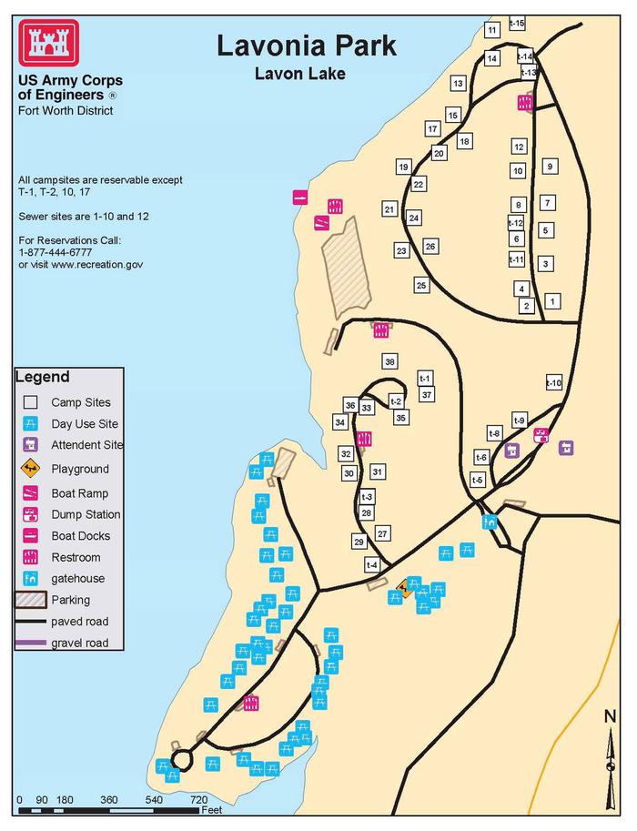
Lavonia Campground is a scenic Texas getaway just beyond the Dallas metropolitan area. Visitors can camp, swim, fish, boat or use the day use area.

Recreation

Visitors of all ages can enjoy activities like camping, fishing, boating and picnicking. Anglers seek species like channel catfish, crappie and striped bass.

Facilities

The campground offers 38 RV sites with water, 30 amp electric and sewer hook-ups. The campground has 15 tent sites. Additional perks include hot showers and a boat launch.

Natural Features

The Lavon Lake, in northern Texas, spans 21,400 acres and stems from the East Fork of the Trinity River.

Nearby Attractions

The paved Sister Groves Trail at Sister Grove Creek is a hot spot for biking and hiking.

Nearby Activities

  • Boating
  • Camping
  • Fishing
  • Swimming site

Gallery

Directions

From Wylie, Texas take State Highway 78 North to Lake Road (County Road 486) located in the city of Lavon. Take a left on Lake Road. Follow signs into the campground by taking a left over the railroad tracks bridge.

GPS Coordinates

Latitude 33° 2′ 16.0001″ N

Longitude 96° 26′ 44.0002″ W

Categories
Uncategorized

EAST FORK (TX)

Overview

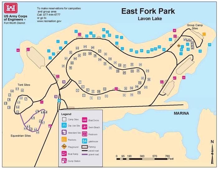
East Fork Campground, on the southern shores of Lavon Lake, is a popular escape for city dwellers in the Dallas, Texas area or for any visitors passing through the Northern Texas region. The campground boasts everything including RV campsites, tent campsites, equestrian campsites, a group shelter and a swimming beach to keep visitors entertained during their stay.

Recreation

Boating and fishing are consistently popular activities for lake-goers. Horseback riding and hiking is great along the Trinity Trail, with a trailhead beginning adjacent to the East Fork campground.

Facilities

The campground offers 50 sites with water and electric hookups, plus 12 tent-only sites. There are not sewer hook-ups at the campsite, but there is a dump station located near the park entrance. It’s the only campground at Lavon Lake with 50-amp electricity. Extra conveniences include hot showers and two boat ramps. The group campground is available year-round and fits 175 guests.

Horses are allowed at the Equestrian Loop, and each equestrian site has a portable horse stall.

Natural Features

Lavon Lake, in northern Texas, flows from the East Fork tributary of the Trinity River. Its surface area spans 21,400 acres and the maximum lake depth of around 59 ft..

Nearby Attractions

The Heard Natural Science Museum and Wildlife Sanctuary features natural history exhibits and nature trails.

Nearby Activities

  • Boating
  • Camping
  • Fishing

Gallery

Directions

From Wylie, TX, take State Highway 78 North to Eubanks Lane. Turn left onto Eubanks, stay to the right at the fork in the road (onto Forrest Ross Road) and continue to the stop sign at the intersection of Forrest Ross Road and Skyview Drive. Continue straight into East Fork Park.

GPS Coordinates

Latitude 33° 2′ 20.0000″ N

Longitude 96° 30′ 37.0001″ W

Categories
Uncategorized

CLEAR LAKE (TX)

Overview

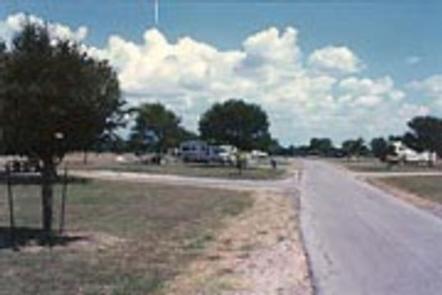
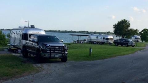
Clear Lake Campground has a prime location on the shores of Lavon Lake. It is the only shaded campground at the lake, and provides a quiet space for anglers, bird watchers and photographers.

The park is just northeast of Dallas, Texas, and just east of the Southfork Ranch, where the hit TV series, “Dallas,” was filmed.

Recreation

Visitors of all ages enjoy outdoor opportunities like fishing, boating, hiking, and picnicking. Anglers often find channel catfish, crappie, striped bass and hybrid bass.

Facilities

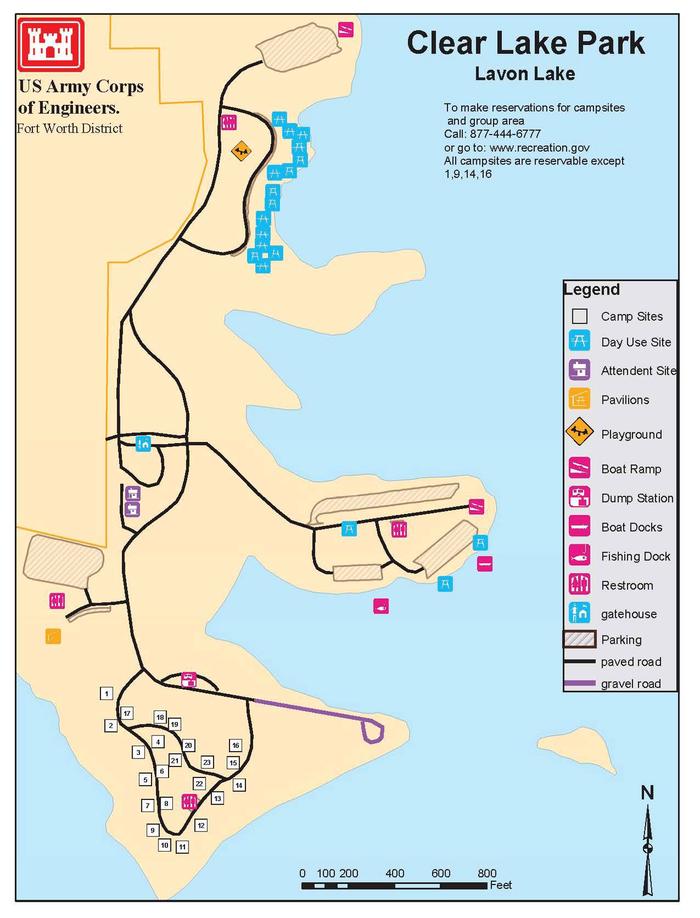
The Clear Lake Campground offers 23 sites with water, sewer and electric hookups. Hot showers, a boat ramp and fishing dock are also available.

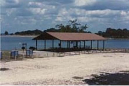
The group campground fits 200 people and has toilets reserved solely for group campers. The picnic shelter at the group site comes with electric and water hookups, four cookers, and a campfire ring. There’s also a large playing field for sports.

Natural Features

Grassy flat fields and leafy shade trees cover the campground.
The Lavon Lake spans 21,400 acres and stems from the East Fork of the Trinity River.

Nearby Attractions

The town of Wylie is home to a wildlife rescue and education center. Visitors can see lions, leopards, cougars, bobcats and more.

Nearby Activities

  • Boating
  • Camping

Gallery

Directions

While traveling on US Highway 380 in Princeton, TX, take South 2nd Street (County Road 982) South. County Road 982
changes into County Road 735. At the 4 way stop sign (just past the Lavon Lake Camp and Conference Center), take a right on County Road 436. Watch for Clear Lake signs. Take County Road 436 and follow into Clear Lake Park.

GPS Coordinates

Latitude 33° 3′ 19.0001″ N

Longitude 96° 28′ 54.9998″ W

Categories
Uncategorized

Loyd

This recreation area is part of Joe Pool Lake

Directions

GPS Coordinates

Latitude 32° 36′ 18.1072″ N

Longitude 97° 4′ 0.1404″ W

Categories
Uncategorized

Cedar Hill State Park

This recreation area is part of Joe Pool Lake

Directions

GPS Coordinates

Latitude 32° 36′ 58.9710″ N

Longitude 96° 59′ 32.6319″ W

Categories
Uncategorized

LAKESIDE (TX)

Overview

The Lakeside Campground and Recreation Area is partially open year-round on the northern side Hords Creek Lake and fully open March 1 through September 30 .

Recreation

Bring your rod for fishing that includes largemouth bass, white crappie, channel and flathead catfish and sunfish. The record largemouth bass caught here is 11 pounds 4 ounces.

Facilities

More than 50 campsites have water and electric hookups, some of which have sewer hookups. Boat ramps, fishing piers and showers can be found throughout the campground. Also, six sites come with screened shelters to aid with windy weather.

Natural Features

The lake is nestled in the middle of Texas, surrounded by gently rolling hills dotted with Live oak trees.

Nearby Attractions

Drive through neighboring Friendship Park and Lakeside Park or for a dose of city conveniences, head to Coleman, just eight miles east of the lake.

Charges & Cancellations

Standard Cancellation Rates Apply.

Nearby Activities

  • Biking
  • Boating
  • Camping
  • Fishing
  • Recreational vehicles
  • Swimming site
  • Paddling
  • Swimming
  • Motor boat
  • Mountain biking
  • Paddle boating
  • Water activities
  • Kayaking
  • Canoeing
  • Non-motorized boating
  • Water access
  • Jet skiing
  • Water skiing
  • Scenic drive
  • Tubing

Gallery

Directions

From Coleman, TX, take Hwy 153 west 8 miles to the main entrance to
Hords Creek Lake. Follow signs into the campground.

GPS Coordinates

Latitude 31° 50′ 48.0001″ N

Longitude 99° 34′ 45.9998″ W

Categories
Uncategorized

FLATROCK (TEXAS)

Overview

Flatrock campground is situated on Hords Creek Lake with nice shade from trees, a fishing dock and gravel swimming areas for beating the Texas heat.

Recreation

Visitors come to Flatrock for fishing, boating and simple relaxation. The popular catches on the lake include largemouth bass, sunfish and white crappie. When water levels are high enough, water skiing is also a fun sport here.

Facilities

More than 50 campsites have water and electric hookups – ten of which have sewer hookups. Seven group shelters are available for day use. The swim beach, open to all overnight campers, is in Flatrock Park in area #1.

Boat ramps, fishing piers and fish cleaning stations are additional amenities at the park.

Natural Features

Hords Creek Lake is in the center of Texas, north of the Texas Hill Country. Gently rolling hills covered with live oaks make Hords Creek Lake a beautiful getaway, despite the sometimes unbearable heat.

Nearby Attractions

Circle the lake to cruise through neighboring Friendship Park and Lakeside Park.

For a dose of city conveniences, head to Coleman, just eight miles east of the lake.

Charges & Cancellations

Standard Cancellation Rates Apply.

Nearby Activities

  • Biking
  • Boating
  • Camping
  • Fishing
  • Recreational vehicles
  • Swimming site
  • Paddling
  • Motor boat
  • Paddle boating
  • Water activities
  • Kayaking
  • Canoeing
  • Non-motorized boating
  • Water access
  • Jet skiing
  • Water skiing

Gallery

Directions

From Coleman, TX, take Highway 153 west for 8 miles to the main
entrance of Hords Creek Lake. Follow signs into the campground.

GPS Coordinates

Latitude 31° 49′ 34.0000″ N

Longitude 99° 33′ 56.9999″ W

Categories
Uncategorized

Twin Coves

This recreation area is part of Grapevine Lake

Directions

GPS Coordinates

Latitude 33° 0′ 20.6829″ N

Longitude 97° 6′ 16.9042″ W