Categories
Uncategorized

CLEAR SPRING

Overview

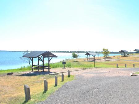
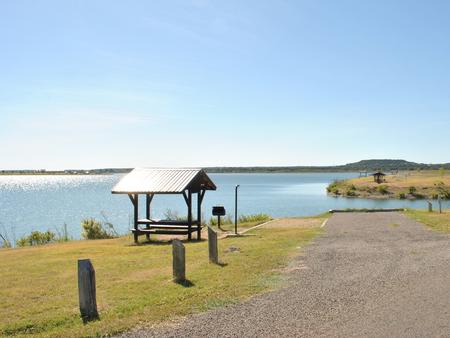
Clear Spring Park sits along the shore of 30,000-acre Wright Patman Lake within the piney woods of northeast Texas. The campground offers full services to campers. With a boat ramp, playground and swimming area, Clear Spring is sure to provide outdoor fun for families, boaters, anglers and hunters alike.

Recreation

Wright Patman Lake hosts a wide range of recreational activities, including camping, swimming, boating, fishing, hunting, hiking, picnicking and wildlife viewing. Boaters flock to the lake and anglers try their luck for largemouth bass, catfish, crappie, sunfish and bass. The campground also offers hiking and nature trails.

Facilities

With a swim beach, volleyball court, basketball court and playground, the facility is well-suited for families. Boaters and anglers have the convenience of a boat ramp with courtesy dock.
Visitors have a variety of sites from which to choose, including 41 with 30 amp electric hook ups and sewer, 22 with 50 amp electric hook ups, 25 with 30 amp electric hook ups , 3 screened shelters for camping, 10 non-electric sites, a group camping area and a day-use group picnic shelter.
The group campsite can accommodate up to 100 people and provides campers with a screened shelter, restrooms and showers, as well as 12 campsites with water and electricity.

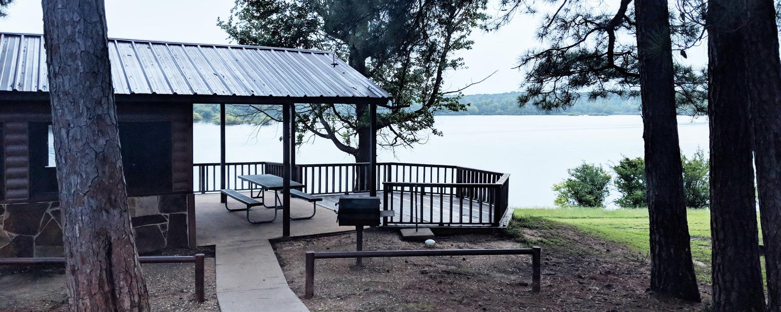
The three screened shelters, all of which have water access and are close to the boat ramp. Each shelter has a ceiling fan, table, campfire ring, grill, covered porch and water. One shelter has a deck right above the waterfront.

Natural Features

The campground is located in a southern pine forest overlooking the lake. Many campsites are on the water’s edge.

The U.S. Army Corps of Engineers manages approximately 55,000 acres of public forestland around the lake, providing habitat for wild turkey, bobwhite quail, squirrel, white-tailed deer, waterfowl and migrating bald eagles, pelicans and ducks. Some poisonous snakes inhabit the area.

Nearby Attractions

The Texarkana region is full of activities such as shopping, movies, restaurants and local historical sites. Shreveport, Louisiana offers river boat gambling, horse races and numerous festivals, including the Four State Fair and Rodeo and the Jump, Jive and Jam Festival.

Nearby Activities

  • Boating
  • Camping
  • Fishing
  • Hunting
  • Swimming site

Gallery

Directions

Physical Address of Clear Springs Park:

64 Clear Springs Park

Texarkana, TX 75501

From Texarkana, take Highway 59 south. Turn right (west) on Farm-to-Market (FM) Road 2148 and follow to Wright Patman Lake entrance. Follow the park road west to the entrance.

GPS Coordinates

Latitude 33° 21′ 29.9999″ N

Longitude 94° 11′ 30.0001″ W

Categories
Uncategorized

UNION GROVE

Overview

Union Grove Park is located on the southwestern shore of Stillhouse Hollow Lake in central Texas. The lake offers a wide variety of recreation opportunities, including water sports, hiking, biking, horseback riding, picnicking, large group pavilions, hunting, fishing and simply enjoying the scenery.

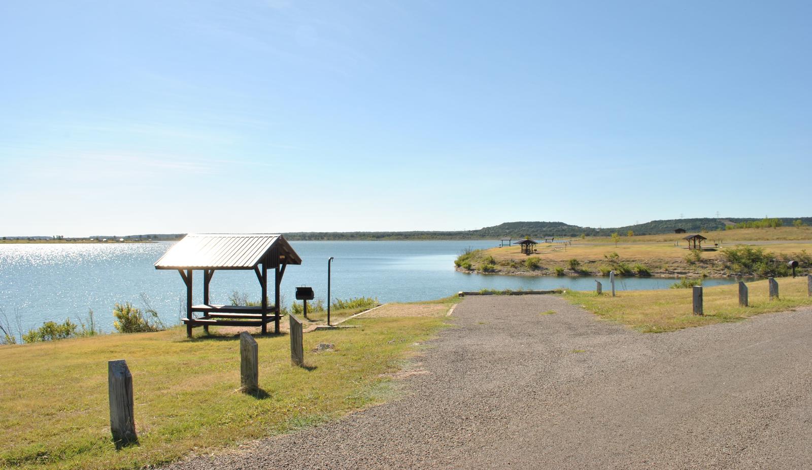
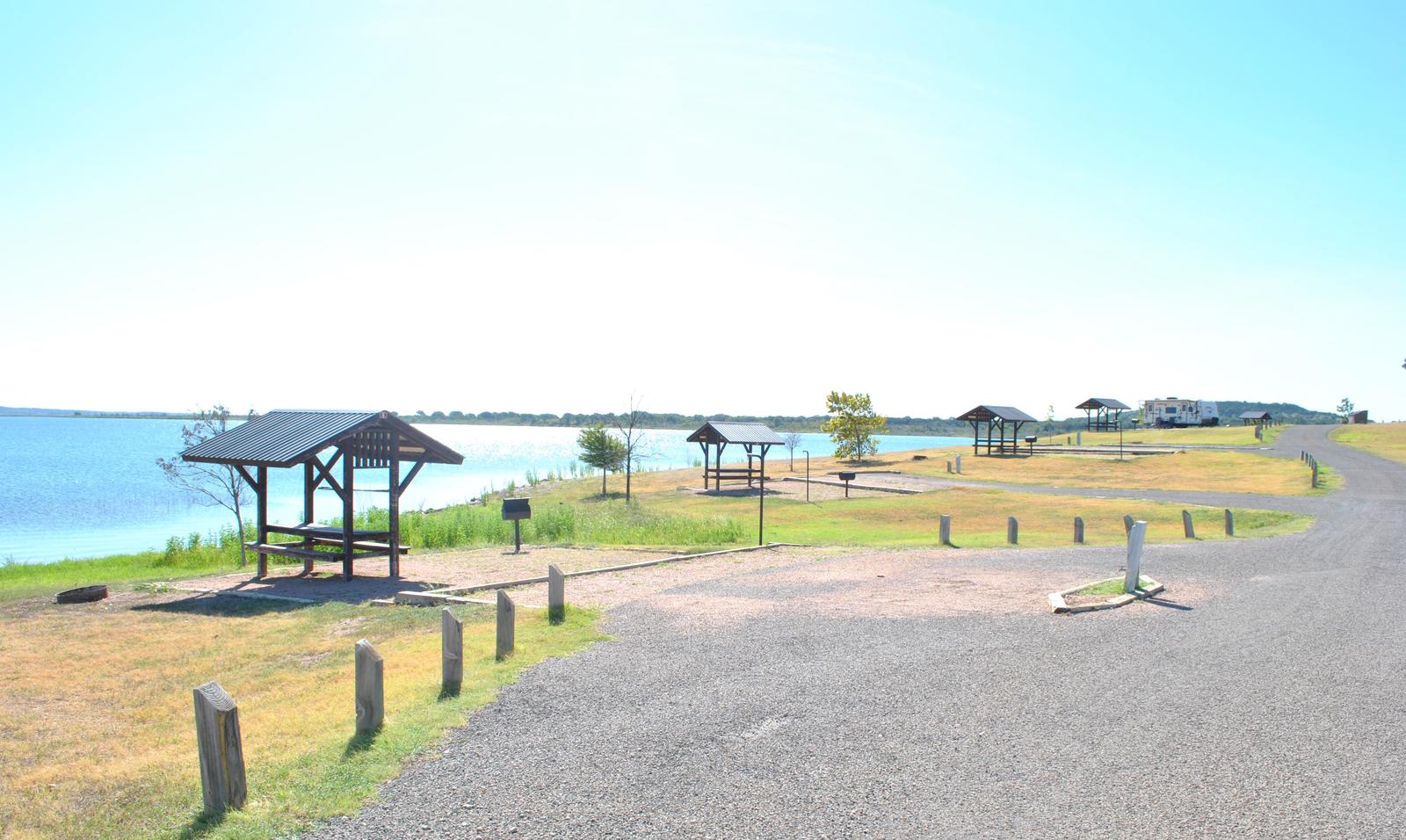
This facility has RV and tent camping sites with water and electric hookups available, as well as three screen shelters available for guests without camping equipment. The facility is one of only two reservable campgrounds on the lake.

Stillhouse Hollow Lake was created by the U.S. Army Corps of Engineers with the construction of Stillhouse Hollow Dam in 1968. The 6,430-acre lake is located 16 miles upstream of the confluence of the Lampasas and Leon Rivers, which flow into the Little River.

Recreation

With 58 miles of shoreline, Stillhouse Hollow Lake is an often uncrowded haven for boaters and fishermen. The campground has a four-lane boat ramp, and visitors who do not have motor boats, canoes or kayaks can rent them nearby.

Families can enjoy soaking up the sun and swimming at the beach within the facility, or hanging out at the playground.

Birding is also a favorite pastime, with hawks, Great Blue herons, ducks, geese, many species of songbirds, bobwhite quail, Rio Grande turkey and even an occasional bald eagle, yielding year-round opportunities for bird sightings.

Facilities

The campground has more than 30 campsites, including RV and tent sites with electric hookups, double sites and screened shelters. The park offers restrooms with flush toilets and hot showers, a swimming beach, fishing dock, playground and boat ramp.

Natural Features

Aside from two campgrounds and a nearby day-use park, very little of the lakeshore is developed. The edges consist of rocky beaches and sandy bluffs. Although much of the lake area is forested, the campground has rolling hills that are mostly open with little to no shade.

Most campsites have a view of the water, with some right along the shoreline and others within a short walking distance.

The lake has noticeably clear and deep water that is inhabited by largemouth bass, smallmouth bass, channel catfish and many birds. A man-made wetland was constructed on the south shore of the lake to provide an additional 10 acres of wildlife habitat in the lake area.

Nearby Attractions

Within a short drive, the Village of Salado offers golf, art galleries and shopping, among other pastimes.

Chalk Ridge Falls Environmental Learning Center is below the Stillhouse Hollow Lake Dam. The center has about five miles of hiking trails, including a one-mile nature trail along the Lampasas River, a spring-fed creek, a waterfall, bridges and several wildlife viewing points.

Stillhouse Hollow Lake is located near the Fort Hood Army Base, which has several points of interest for the military buff.

Nearby Activities

  • Camping
  • Swimming site

Gallery

Directions

From Interstate 35 in Salado, Texas take the Farm-to-Market Road 2484 exit. Travel west on 2484 about five miles to Union Grove Park Road, and turn right into the facility.

GPS Coordinates

Latitude 31° 0′ 38.7101″ N

Longitude 97° 37′ 14.6302″ W

Categories
Uncategorized

STILLHOUSE

Overview

Stillhouse Park is a day use area that has two reservable group pavilions along the shore of Stillhouse Hollow Lake in central Texas. With activities such as picnicking, swimming, basketball and fishing, the park is popular for family gatherings and other large group events.

Stillhouse Hollow Lake was created by the U.S. Army Corps of Engineers with the construction of Stillhouse Hollow Dam in 1968. The 6,430-acre lake is located 16 miles upstream of the confluence of the Lampasas and Leon Rivers, which flow into the Little River.

Recreation

With 58 miles of shoreline, Stillhouse Hollow Lake is an often uncrowded haven for boaters and fishermen. Those who do not have motor boats, canoes or kayaks can rent them nearby.

A variety of land-based activities are also offered, such as volleyball, basketball and horseshoes. Birding is a favorite pastime for many visitors. Hawks, great blue herons, ducks, geese, many species of songbirds, bobwhite quail, Rio Grande turkey and even an occasional bald eagle visit the lake area, yielding year-round opportunities for bird sightings.

Facilities

The lake’s only marina and fuel dock are located within the park. There are two reservable group pavilions, Island View and Tear Drop, which can each hold up to 120 visitors.

There are also nearly 40 individual picnic sites around the beach area, as well as a swimming beach and playground popular with families.

Natural Features

Aside from the park and two nearby campgrounds, very little of the lakeshore is developed. It has rocky beaches and sandy bluffs along the edges, and much of it is forested.

Stillhouse Park has grassy, open areas interspersed with trees. The lake has noticeably clear and deep water inhabited by largemouth bass, smallmouth bass and channel catfish.

A man-made wetland was constructed on the south shore of the lake, providing an additional 10 acres of wildlife habitat in the lake area.

Nearby Attractions

The nearby Village of Salado offers golf, art galleries and shopping, among other activities.

Chalk Ridge Falls Environmental Learning Center is below the Stillhouse Hollow Lake Dam. The center has about five miles of hiking trails, including a one-mile nature trail along the Lampasas River, a spring-fed creek, a waterfall, bridges and several wildlife viewing points.

Stillhouse Hollow Lake is located near the Fort Hood Army Base, which has several points of interest for the military buff.

Nearby Activities

  • Boating
  • Camping
  • Fishing
  • Swimming site

Gallery

Directions

From Interstate 35 in Belton, Texas take State Highway 190 west to the Simmons Road exit. Exit and turn left under 190 onto Simmons Road. Proceed about three miles to the park.

GPS Coordinates

Latitude 31° 2′ 12.0001″ N

Longitude 97° 32′ 3.9998″ W

Categories
Uncategorized

DANA PEAK

Overview

Dana Peak Campground is located on a peninsula on the shoreline of Stillhouse Hollow Lake in central Texas. The lake offers a wide variety of recreation opportunities, including water sports, hiking, biking, horseback riding, picnicking, large group pavilions, hunting, fishing and more.

The facility is one of only two reservable campgrounds on the lake and often fills up on weekends during summer.

Stillhouse Hollow Lake was created by the U.S. Army Corps of Engineers with the construction of Stillhouse Hollow Dam in 1968. The 6,430-acre lake is located 16 miles upstream of the confluence of the Lampasas and Leon Rivers, which flow into the Little River.

Recreation

With 58 miles of shoreline, Stillhouse Hollow Lake is an often uncrowded haven for boaters and fishermen. The campground has a four-lane boat ramp, and visitors who do not have motor boats, canoes or kayaks can rent them nearby.

Families can enjoy soaking up the sun, swimming at the beach or exploring the Dana Peak Trails (located just outside the main entrance to the park) by foot, bike or horseback.

Birding is a favorite pastime for many visitors with hawks, Great Blue herons, ducks, geese, many species of songbirds, bobwhite quail, Rio Grande turkey and even an occasional bald eagle, yielding year-round opportunities for bird sightings.

Facilities

The campground has more than 30 campsites, including RV and tent sites with electric hookups and eight primitive tent sites. The park offers restrooms with flush toilets and showers, a swimming beach, several picnic sites and a boat ramp.

Primitive campsites include a picnic table and a campfire ring with a grill.

A group shelter is available by reservation for up to 80 people at a time.

Natural Features

Aside from two campgrounds and a nearby day-use park, very little of the lakeshore is developed. The edges consist of rocky beaches and sandy bluffs.

Much of the lake area is forested, though the campground is mostly grassy, flat and open with little to no shade. Most campsites are right along the water’s edge; others are within a short walk.

The lake has noticeably clear and deep water inhabited by largemouth bass, smallmouth bass and channel catfish. A man-made wetland was constructed on the south shore of the lake, providing an additional 10 acres of wildlife habitat in the area.

Nearby Attractions

Within a short drive, the Village of Salado offers golf, art galleries and shopping, among other pastimes.

Chalk Ridge Falls Environmental Learning Center is below the Stillhouse Hollow Lake Dam. The center has about five miles of hiking trails, including a one-mile nature trail along the Lampasas River, a spring-fed creek, a waterfall, bridges and several wildlife viewing points.

Stillhouse Hollow Lake is located near the Fort Hood Army Base, which has several points of interest for the military buff.

Nearby Activities

  • Biking
  • Camping
  • Fishing
  • Horseback riding
  • Swimming site

Gallery

Directions

From Interstate 35 in Belton, Texas take Highway 190 west to the Simmons Road exit. Cross under the highway and turn west on Farm-to-Market Road 2410. Turn left (south) on Commanche Gap Road and drive for five miles to reach the park.

GPS Coordinates

Latitude 31° 1′ 44.0000″ N

Longitude 97° 36′ 47.0002″ W

Categories
Uncategorized

Lake Somerville Marina & Campground

This recreation area is part of Somerville Lake

Nearby Activities

  • Boating
  • Camping
  • Picnicking
  • Water sports
  • Playground park specialized sport site
  • Other recreation concession site
  • Hotel/lodge/resort privately owned

Directions

GPS Coordinates

Latitude 30° 18′ 37.3043″ N

Longitude 96° 31′ 1.8978″ W

Categories
Uncategorized

Big Creek Marina

This recreation area is part of Somerville Lake

Directions

GPS Coordinates

Latitude 30° 19′ 52.4539″ N

Longitude 96° 34′ 24.5955″ W

Categories
Uncategorized

Nails Creek State Park

This recreation area is part of Somerville Lake

Directions

GPS Coordinates

Latitude 30° 17′ 33.9449″ N

Longitude 96° 39′ 52.4344″ W

Categories
Uncategorized

Birch Creek State Park

This recreation area is part of Somerville Lake

Directions

GPS Coordinates

Latitude 30° 18′ 32.3027″ N

Longitude 96° 37′ 17.1667″ W

Categories
Uncategorized

Welch Park

This recreation area is part of Somerville Lake

Directions

GPS Coordinates

Latitude 30° 20′ 16.1890″ N

Longitude 96° 33′ 4.4125″ W

Categories
Uncategorized

YEGUA CREEK

Overview

Yegua Creek is located at Somerville Lake near Somerville, Texas. The lake offers various types of recreation such as camping, fishing, boating, nature trails and much more.

Recreation

Somerville Lake offers many opportunities for outdoor recreation. Water sports, hiking and biking are popular activities.

White and hybrid-striped bass, crappie and catfish populate the lake, as well as largemouth bass which can reach 10 or more pounds.

Facilities

Yegua Creek Campground has 82 sites, 65 of which have 50-amp electrical and water hookups.
Flush toilets and showers are provided, as are picnic tables and fire rings. Two boat ramps, an interpretive trail, and dump station are located on-site.

Natural Features

The campground is situated on the shoreline of scenic Somerville Lake. Pelicans and other waterfowl frequent the shoreline.

Nearby Attractions

Rocky Creek Park is nearby, offering additional access to Somerville Lake and all its great water activities.

The city of Somerville, Texas is less than 10 miles from Rocky Creek, offering restaurants and shops.

Nearby Activities

  • Boating
  • Camping
  • Fishing

Gallery

Directions

From Austin, Texas, take US 290 east to Brenham. Follow HWY 36 north 11.5 miles to FM 1948. Turn left and follow FM 1948 2.5 miles. Turn right into park complex, following campground signs.

From Houston, Texas, take HWY 290 west to Brenham. Follow HWY 36 north 11.5 miles to FM 1948. Turn left and follow FM 1948 2.5 miles. Turn right into park complex, following campground signs.

GPS Coordinates

Latitude 30° 18′ 10.0001″ N

Longitude 96° 32′ 40.9999″ W