This recreation area is part of Clearwater Lake
Directions
GPS Coordinates
Latitude 37° 8′ 56.6242″ N
Longitude 90° 48′ 33.2340″ W
This recreation area is part of Clearwater Lake
Latitude 37° 8′ 56.6242″ N
Longitude 90° 48′ 33.2340″ W
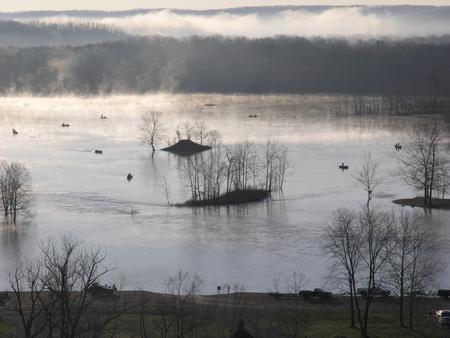
Set on the banks of a calming river, just below the entertaining Clearwater Lake lies River Road Park, known as a jolly ol’ place to camp.
The beautiful area is enhanced each spring by flowering shrubs and trees like the redbud, hawthorn, dogwood and wild plum. And bald eagles stay year-round and are known to nest near the lake.
Look for wildlife and pretty landscapes on the Black River Hike and Bike Trail. The trail starts at River Road Park and connects with the Blue Heron and Bottomland interpretive trails. Wildlife includes wetland waterfowl, fox, deer and geese.
The lake and river below provide excellent fishing, swimming and canoeing.
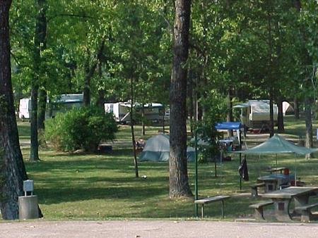
The majority of campsites have electric and water hookups. Additional amenities include a dump station, hot showers, picnic shelters, a boat ramp, and a playground.
Three group picnic shelters are available for reservation, and these also come with electricity.
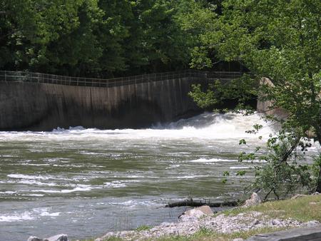
River Road Park near Clearwater Lake lies below the dam on the Black River.
The lake’s shoreline is studded with picturesque bluffs covered in sweet william flowers, indented bays, and serene coves.
In the area, campers enjoy visiting traditional drive-in movie theaters, the Sam A. Baker State Park, local golf courses, and the historic Civil War site at Fort Benton.
From Piedmont, MO, follow state highway HH for 6 miles. Campground will be located just below Clearwater Lake Dam. Follow signs into campground.
Latitude 37° 8′ 1.0000″ N
Longitude 90° 46′ 0.9998″ W
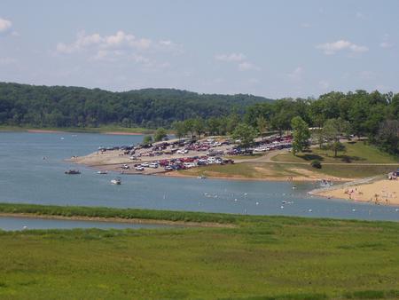
Piedmont Park is a spacious, activity-dense recreation area on the shores of Missouri’s Clearwater Lake. Water sport enthusiasts love the lakes diverse offerings, from boating to jet skiing and canoeing to swimming.
Clearwater is considered a "wilderness lake" because it lacks private boat docks and offers plenty of unspoiled shorelines to explore. The beautiful area is enhanced each spring by flowering shrubs and trees like the redbud, hawthorn, dogwood and wild plum.
Wildlife viewing is popular with wetland waterfowl, fox, deer and geese.
Picnicking is also a favorite pastime, as is lounging on the beach, boating and fishing.
Piedmont Park Campground offers 97 sites, including many with electric and water hookups. Additional amenities include a dump station, hot showers, picnic shelters, a boat ramp, playgrounds and a swimming area.
Visitors can sit under the shade of a sycamore or maple tree and look out across the lake to the lush but rugged terrain of the Ozark foothills.
The vicinity is noted for the grandeur of its hills, natural springs, and general outdoor beauty. The shoreline is studded with high picturesque bluffs covered with sweet williams, indented bays and quiet coves.
In the area, campers enjoy visiting traditional drive-in movie theaters, the Sam A. Baker State Park, local golf courses, and the historic Civil War site at Fort Benton.
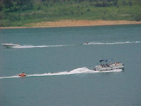
From Piedmont, MO, follow Missouri State Highway HH.
Travel on Highway HH for 6 miles to the top of the dam. Turn right and
follow signs into campground.
Latitude 37° 8′ 33.0000″ N
Longitude 90° 46′ 13.0001″ W
Campers looking to enjoy a scenic stay on the clear waters of the Black River, will enjoy the calming riverside atmosphere at Highway K Park.
Fishing and canoeing are very popular on the river, where campers also enjoy wading out into the clear waters during warmer months.
The campground offers 83 sites, including many with electric hookups and some sites with water hookups. Additional amenities include a dump station, hot showers, a picnic shelter and playground.
Highway K is a few miles upstream of Clearwater Lake on the Black River. Campsites extended over both sides of the river bank, in a lush, wooded area of mixed hardwoods.
The Elephant Rocks State Park, Johnson Shut-ins State Park, and the historic Civil War site at Fort Davidson State Park make for an interesting, scenic day trip.
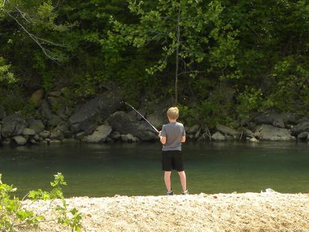
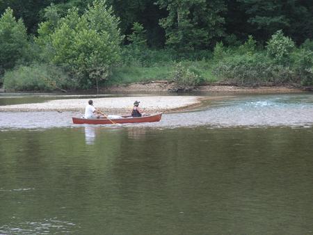
From Annapolis, MO, follow MO Highway K west for 5 miles. The park will be on the left, and is on both sides of the bridge.
Latitude 37° 19′ 27.0001″ N
Longitude 90° 46′ 0.0001″ W
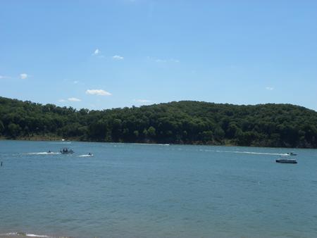
Bluff View Campground on Clearwater Lake greets visitors with excellent camping, fishing, swimming, boating and picnicking opportunities.
Local wildlife includes wetland waterfowl, fox, deer, turkey, and geese. Bald eagles nest at Clearwater, and remain in the area year-round.
A trailhead for the Bluff View Nature Trail begins at the campground. This is a wonderful loop trail to look for wildlife among a mix of towering hardwood trees.
Bluff View Campground offers 60 sites, including many with electric and water hookups. Additional amenities include a dump station, hot showers, boat ramp, playground, interpretive trail, public phones and a swimming area.
The lake, surrounded by the picturesque hills of the Ozarks, is fed by the Black River.
Average temperatures range from 33 to 59 degrees Fahrenheit in March, and 65 to 92 degrees in summer.
In the area, campers enjoy visiting traditional drive-in movie theaters, the Sam A. Baker State Park, local golf courses, and the historic Civil War site at Fort Benton.
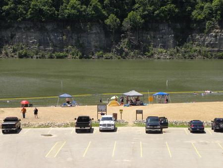
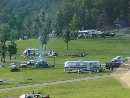
The campground is located 7 miles northwest of Piedmont, MO. From Piedmont on Highway 49, go 1 mile to Highway AA and turn left. Drive 6 miles on Highway AA, and the road will end in Bluff View Park.
Latitude 37° 10′ 54.9998″ N
Longitude 90° 47′ 21.9998″ W
This recreation area is part of Blue Mountain Lake
Latitude 35° 5′ 0.9171″ N
Longitude 93° 46′ 18.0832″ W
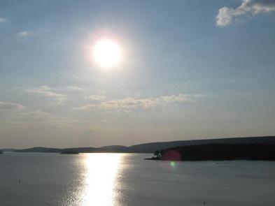
Waveland Park Campground is located on the beautiful Blue Mountain Lake near Waveland, Arkansas.
Visitors are greeted with shaded campsites, spectacular scenery and many outdoor recreation opportunities. Blue Mountain Lake provides the ideal spot to get away from it all, relax and enjoy fishing, boating, hunting, hiking and more.
Families, anglers, boaters, hikers, water skiers and hunters are drawn to the lake for its recreational activities. Forests around the lake are also open to hunting.
The lakeshore around Waveland Park Campground provides prime bank fishing opportunities for crappie, largemouth and white bass, bream and catfish.
Families can make use of the playground and the shady, cypress tree-lined swimming area, as well as the amphitheater, which provides educational programs.
The J. Perry Mikels Blue Mountain Special Use Area on the west end of the lake has a world-class bird dog field trial area that attracts visitors from throughout the United States and several other countries. Anyone may use the facilities to train dogs.
Visitors can select from 51 shaded campsites (44 reservable and 7 non-reservable) with electric and water hookups, as well as one group picnic shelter for day use that can accommodate up to 150 people.
Additional amenities include hot showers and a dump station. Anglers and boaters are attracted to the boat ramp and fish cleaning station.
Blue Mountain Lake is situated in the shadow of Mt. Magazine, the highest mountain in Arkansas and the tallest between the Rockies and Alleghenies.
Farmland, rolling green mountains and two national forests surround the lake, adding to the natural beauty of the area. The lake shore consists of mixed pine and hardwood forests, wetlands and grasslands, which provide habitat for many native wildlife species.
The lake is situated between the Ozark and Ouachita National Forest, and Mt. Magazine State Park is within a 30-minute drive. Additional information for local attractions is available at chambers of commerce in nearby towns.
From Booneville, Arkansas, follow State Highway 10 east for 17 miles to Waveland. Turn right on State Highway 309 and drive for one mile. Turn right again onto Waveland Park Road and continue another mile to Blue Mountain Dam, then follow signs into the park.
Latitude 35° 6′ 27.0000″ N
Longitude 93° 39′ 29.0002″ W
Please note that the sites have been renumbered on the pavement and have now been updated in the system.
Outlet Area Park is located on the beautiful Blue Mountain Lake near Waveland, Arkansas.
Visitors are greeted with shaded campsites, spectacular scenery and many outdoor recreation opportunities. Blue Mountain Lake provides the ideal spot to get away from it all, relax and enjoy fishing, boating, hunting, hiking and more.
Families, anglers, boaters, hikers, water skiers and hunters are drawn to the lake for its recreational activities. Forests around the lake are also open to hunting.
The river channel through Outlet Area Park provides prime bank fishing opportunities for crappie, largemouth and white bass, bream and catfish.
Families can make use of Outlet Area’s playground, and the shady, cypress tree-lined swimming area in nearby Waveland Park.
The J. Perry Mikels Blue Mountain Special Use Area on the west end of the lake has a world-class bird dog field trial area that attracts visitors from throughout the United States and several other countries. Anyone may use the facilities to train dogs.
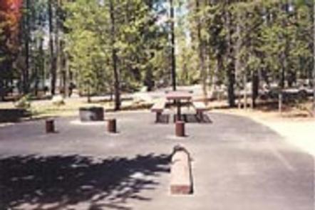
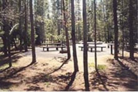
Visitors can choose from 26 reservable and 12 non-reservable campsites, with electricity and water hookups, including three multi-family sites.
Most sites are waterfront; a few are just a short walk away from the water. Anglers have the convenience of a fish cleaning station.
Blue Mountain Lake is situated in the shadow of Mt. Magazine, the highest mountain in Arkansas and the tallest between the Rockies and Alleghenies.
Farmland, rolling green mountains and two national forests surround the lake, adding to the natural beauty of the area. The lake shore consists of mixed pine and hardwood forests, wetlands and grasslands, which provide habitat for many native wildlife species.
Outlet Area Park is located just downstream of Blue Mountain Dam. Water flow from the dam travels down the river channel through the park as it heads further down in the Petit Jean River Valley.
The lake is situated between the Ozark and Ouachita National Forest, and Mt. Magazine State Park is within a 30-minute drive. Additional information for local attractions is available at chambers of commerce in nearby towns.
From Booneville, Arkansas, follow State Highway 10 east for 17 miles to Waveland. Turn right on State Highway 309 and drive for one mile. Turn right again onto Waveland Park Road and continue another mile. Turn left on Outlet Park Road near the Blue Mountain Lake Field Office. The park is located south of Blue Mountain Dam.
Latitude 35° 6′ 2.0002″ N
Longitude 93° 39′ 9.0000″ W
This recreation area is part of Beaver Lake
Latitude 36° 13′ 8.7420″ N
Longitude 94° 1′ 7.6440″ W
This recreation area is part of Beaver Lake
Latitude 36° 23′ 27.9027″ N
Longitude 93° 52′ 38.4654″ W