Categories
Uncategorized

WASHINGTON IRVING SOUTH

Overview

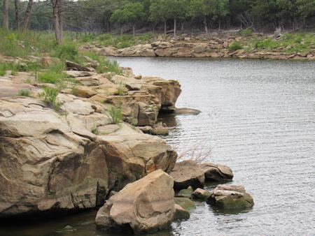
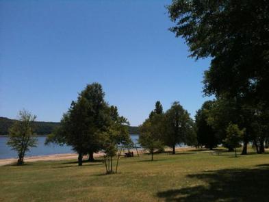
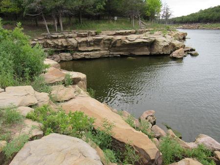
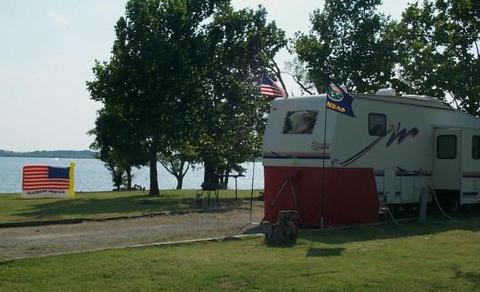
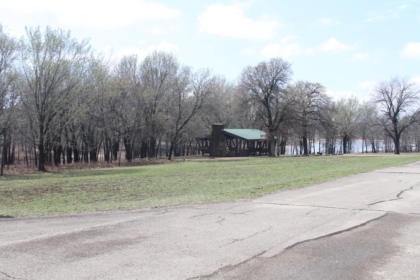
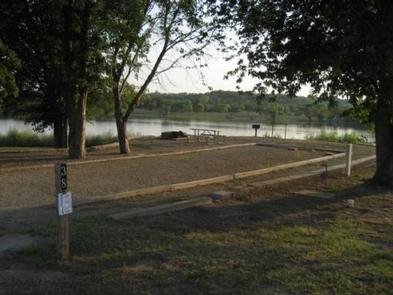
Washington Irving South is located on the Arkansas arm of Keystone Lake, just 30 minutes from Tulsa, Oklahoma. Local history has Washington Irving crossing the Arkansas River in this area during his expeditions west. The lake’s blue-green water, beautiful natural surroundings and wide variety of recreational opportunities make it a popular location for year-round fun.

Recreation

Keystone Lake is a prime location for boating, water skiing, swimming and fishing. The lake is noted for its striped, sand, black and smallmouth bass, crappie and catfish. Downstream fisheries are accessible at nearby Whitewater and Brush Creek Parks.

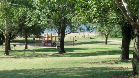
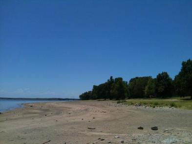
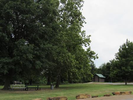
The park contains a boat ramp, dock, playground, swimming beach and a one-mile nature trail.

Facilities

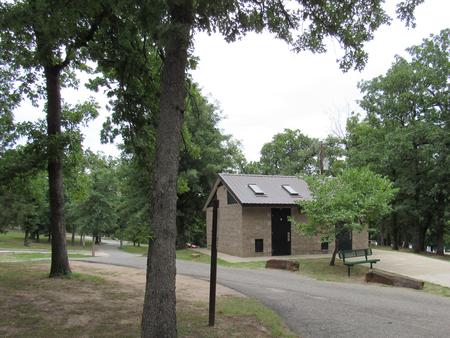
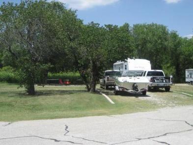
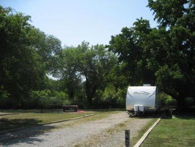
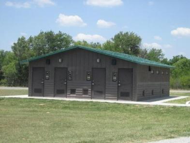
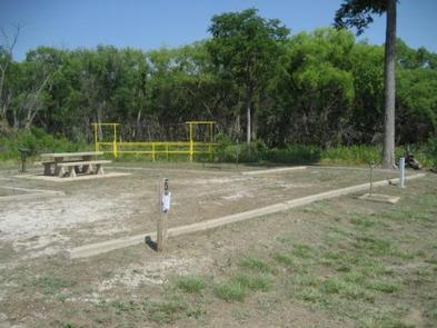
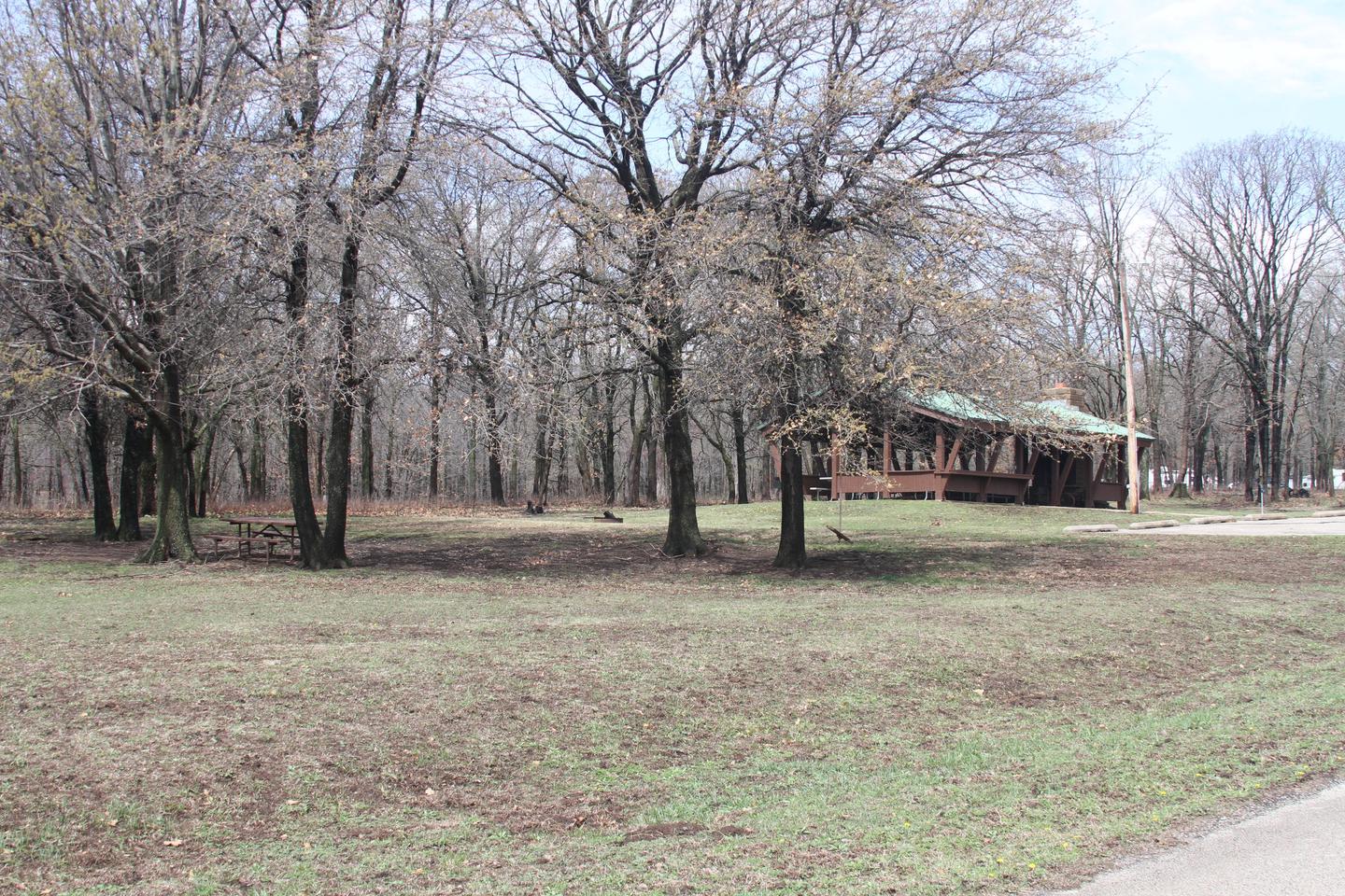
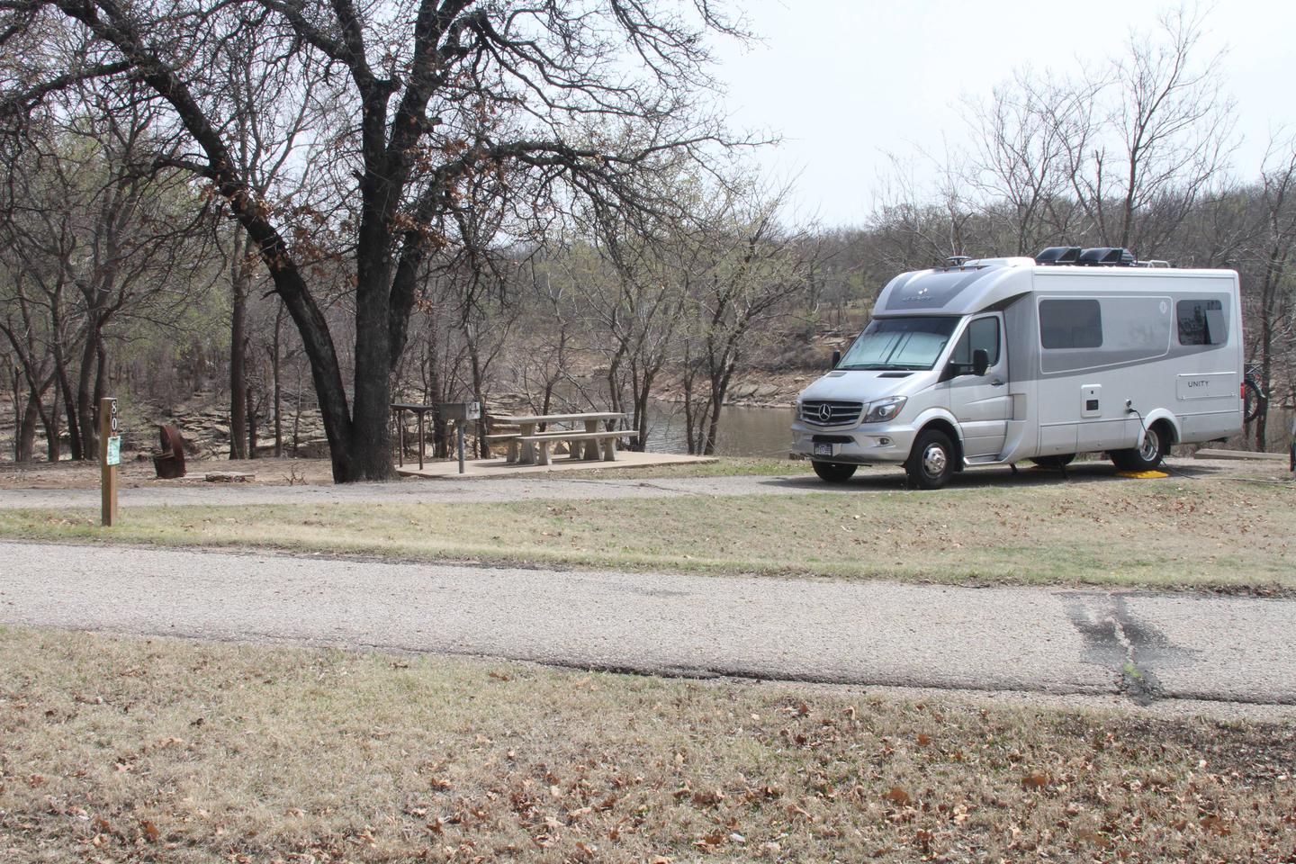
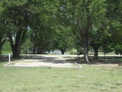
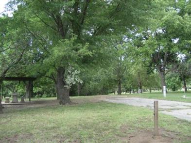
This well-shaded campground is separated into three loops with a total of 41 reservable campsites, many with water and electric hookups. Flush and pit toilets, showers, drinking water and a dump station are provided.

Natural Features

Keystone Lake is settled into many small valleys and contains almost 26,000 surface acres. Its 330 miles of shoreline are covered with bottomland timber and post oak, blackjack oak and prairie fields, which provide habitat for a variety of wildlife, including squirrel, rabbit, quail, dove and waterfowl.

Nearby Attractions

The 400-acre Appalachia Bay Recreation Area, locally referred to as Motorcycle Island, is just 10 minutes from the campground and is popular with off-road vehicle enthusiasts. Sandy trails crisscross the area’s beaches and wooded sections.

Whitewater Park is an 80-acre off-road vehicle area next to the dam, about 15 minutes from the campground.

Nearby Activities

  • Boating
  • Camping
  • Fishing
  • Hiking
  • Picnicking
  • Water sports
  • Wildlife viewing
  • Day use area
  • Swimming site
  • Photography
  • Swimming
  • Water activities
  • Birding
  • Water access
  • Scenic drive

Gallery

Directions

From Tulsa, Oklahoma, take Highway 412 west for 15 miles to Bears Glen exit. Turn left at stop sign onto the Frontage Road and drive 1 block. Turn right at first paved road and follow 2 miles to the campground entrance.

GPS Coordinates

Latitude 36° 11′ 54.7199″ N

Longitude 96° 15′ 32.5001″ W

Categories
Uncategorized

WASHUNGA BAY

Overview

Washunga Bay Campground is situated along the banks of Kaw Lake in north central Oklahoma.

Recreation

The lake and river are known for producing some of Oklahoma’s largest catfish, as well as crappie, white bass and walleye, making it a popular destination for anglers.

Hikers and horseback riders are attracted to the beautiful trails along the eastern shore. The Eagle View Hiking Trail is approximately 12 miles long and runs between Osage Cove and Burbank Landing. The Five Fingers Equestrian Trail extends from Burbank Landing to the Sarge Creek Cove Public Use Area.

Hunters’ skills are tested with excellent populations of whitetail deer, turkey, quail, rabbit and squirrel. During the fall waterfowl seasons Kaw Lake often attracts large numbers of migrating ducks and geese.

During the winter visitors are likely to spot migrating bald eagles, as Kaw Lake has one of the biggest populations in the state.

Facilities

Washunga Bay Campground offers 24 campsites with modern amenities like electric hookups, drinking water and flush toilets. A boat ramp provides easy access to the lake.

Natural Features

The lake covers 17,000 surface acres and has 168 miles of shoreline. Completed in 1976, the dam and lake help provide a recreational oasis for outdoor enthusiasts of all types.

Nearby Attractions

The area holds a number of historical sites, including several Native American settlements, archeological sites and the Pioneer Woman Museum.

Nearby Activities

  • Boating
  • Camping
  • Fishing
  • Wildlife viewing

Gallery

Directions

From Kaw City, Oklahoma, travel nearly 3 miles east on Highway 11, turn north onto County Road. Follow signs for about 5 miles to the campground.

GPS Coordinates

Latitude 36° 47′ 31.7400″ N

Longitude 96° 50′ 43.2600″ W

Categories
Uncategorized

SARGE CREEK

Overview

Sarge Creek Campground is situated along the banks of Kaw Lake in north central Oklahoma.

Most of the campsites here are shaded and visitors looking to camp with their horses or ride Kaw Lakes Five Fingers Equestrian Trail, will find Sarge Creek Campground to be very accommodating.

Recreation

The lake and river are known for producing some of Oklahoma’s largest catfish, as well as crappie, white bass and walleye, making it a popular destination for anglers.

Hikers and horseback riders are attracted to the beautiful trails along the eastern shore. The Eagle View Hiking Trail is approximately 12 miles long and runs between Osage Cove and Burbank Landing.

The Five Fingers Equestrian Trail extends from the Sarge Creek Cove Public Use Area to Burbank Landing.

Hunters’ skills are tested with excellent populations of whitetail deer, turkey, quail, rabbit and squirrel. During the fall waterfowl seasons Kaw Lake often attracts large numbers of migrating ducks and geese.

During the winter visitors are likely to spot migrating bald eagles, as Kaw Lake has one of the biggest populations in the state.

Facilities

Sarge Creek Campground offers 53 campsites with modern amenities like electric hookups, drinking water and flush toilets, including one large group campsite that can accommodate up to 60 guests. A boat ramp provides easy access to the lake.

Campsites 1-7 are available for equestrian camping, and horse pens are provided.

Natural Features

The lake covers 17,000 surface acres and has 168 miles of shoreline. Completed in 1976, the dam and lake help provide a recreational oasis for outdoor enthusiasts of all types.

Nearby Attractions

The area holds a number of historical sites, including several Native American settlements, archeological sites and the Pioneer Woman Museum.

Nearby Activities

  • Boating
  • Camping
  • Fishing
  • Hiking
  • Wildlife viewing
  • Day use area

Gallery

Directions

From Kaw City, Oklahoma, travel nearly 3 miles east on Highway 11, then follow signs to the campground.

GPS Coordinates

Latitude 36° 46′ 0.1801″ N

Longitude 96° 48′ 29.3400″ W

Categories
Uncategorized

OSAGE COVE

Overview

Osage Cove is a large campground situated along the banks of Kaw Lake in north central Oklahoma.

Most of the campsites here are shaded and some of the area’s best hiking and fishing is available on the grounds.

Recreation

Osage Cove provides ideal conditions for anglers, offering excellent bank fishing as well as a designated fishing dock and boat ramp area below the dam in the Arkansas River.

The lake and river are known for producing some of Oklahoma’s largest catfish, as well as crappie, white bass and walleye, making it a popular destination for anglers.

Hikers and horseback riders are attracted to the beautiful trails along the eastern shore. The Eagle View Hiking Trail is approximately 12 miles long and runs between Osage Cove and Burbank Landing. The Five Fingers Equestrian Trail extends from Burbank Landing to the Sarge Creek Cove Public Use Area.

Hunters’ skills are tested with excellent populations of whitetail deer, turkey, quail, rabbit and squirrel. During the fall waterfowl seasons Kaw Lake often attracts large numbers of migrating ducks and geese.

During the winter visitors are likely to spot migrating bald eagles, as Kaw Lake has one of the biggest populations in the state.

Facilities

Osage Cove Campground offers 97 campsites with modern amenities like electric hookups, drinking water and flush toilets, including three large group campsites that can accommodate up to 50 guests each. A boat ramp provides easy access to the lake.

Natural Features

The lake covers 17,000 surface acres and has 168 miles of shoreline. Completed in 1976, the dam and lake help provide a recreational oasis for outdoor enthusiasts of all types.

Nearby Attractions

The area holds a number of historical sites, including several Native American settlements, archeological sites and the Pioneer Woman Museum.

Nearby Activities

  • Boating
  • Camping
  • Fishing
  • Hiking

Gallery

Directions

From Ponca City, Oklahoma, travel 9 miles east. across Kaw Dam. Turn east on County Road and travel 2 miles to the park.

GPS Coordinates

Latitude 36° 42′ 47.4001″ N

Longitude 96° 53′ 54.0600″ W

Categories
Uncategorized

COON CREEK (OK)

Overview

Coon Creek Campground is situated on a peninsula that juts out over Kaw Lake in north central Oklahoma.

The campground is rural, quiet and wooded, providing both sunny and shaded sites with plenty of scenic lake views.

Recreation

The lake and river are known for producing some of Oklahoma’s largest catfish, as well as crappie, white bass and walleye, making it a popular destination for anglers.

Hikers and horseback riders are attracted to the beautiful trails along the eastern shore. The Eagle View Hiking Trail is approximately 12 miles long and runs between Osage Cove and Burbank Landing. The Five Fingers Equestrian Trail extends from Burbank Landing to the Sarge Creek Cove Public Use Area.

Hunters’ skills are tested with excellent populations of whitetail deer, turkey, quail, rabbit and squirrel. During the fall waterfowl seasons Kaw Lake often attracts large numbers of migrating ducks and geese.

During the winter visitors are likely to spot migrating bald eagles, as Kaw Lake has one of the biggest populations in the state.

Facilities

Coon Creek offers 54 campsites with modern amenities like electric hookups, drinking water and flush toilets. A boat ramp provides easy access to the lake.

Natural Features

The lake covers 17,000 surface acres and has 168 miles of shoreline. Completed in 1976, the dam and lake help provide a recreational oasis for outdoor enthusiasts of all types.

Nearby Attractions

The area holds a number of historical sites, including several Native American settlements, archeological sites and the Pioneer Woman Museum.

Nearby Activities

  • Boating
  • Camping
  • Fishing
  • Hiking
  • Wildlife viewing

Gallery

Directions

From Newkirk, Oklahoma, take Highway 77 south to Highway 11 east. Continue about 6 miles, then turn north onto County road and follow signs into the campground.

GPS Coordinates

Latitude 36° 47′ 5.7001″ N

Longitude 96° 55′ 22.6801″ W

Categories
Uncategorized

BEAR CREEK COVE

Overview

Bear Creek Cove Campground is situated along the banks of Kaw Lake in north central Oklahoma.

Recreation

The lake and river are known for producing some of Oklahoma’s largest catfish, as well as crappie, white bass and walleye, making it a popular destination for anglers.

Hikers and horseback riders are attracted to the beautiful trails along the eastern shore. The Eagle View Hiking Trail is approximately 12 miles long and runs between Osage Cove and Burbank Landing. The Five Fingers Equestrian Trail extends from Burbank Landing to the Sarge Creek Cove Public Use Area.

Hunters’ skills are tested with excellent populations of whitetail deer, turkey, quail, rabbit and squirrel. During the fall waterfowl seasons Kaw Lake often attracts large numbers of migrating ducks and geese.

During the winter visitors are likely to spot migrating bald eagles, as Kaw Lake has one of the biggest populations in the state.

Facilities

Bear Creek Cove offers 22 campsites with modern amenities like electric hookups, drinking water and flush toilets. A boat ramp provides easy access to the lake.

Natural Features

The lake covers 17,000 surface acres and has 168 miles of shoreline. Completed in 1976, the dam and lake help provide a recreational oasis for outdoor enthusiasts of all types.

Nearby Attractions

The area holds a number of historical sites, including several Native American settlements, archeological sites and the Pioneer Woman Museum.

Nearby Activities

  • Boating
  • Camping
  • Fishing
  • Wildlife viewing

Gallery

Directions

From Newkirk, Oklahoma, take Peckham Road and travel east for about 8 miles, turn right on Bear Creek Road and continue south for 3 miles. Campground will be on the right.

GPS Coordinates

Latitude 36° 50′ 23.9399″ N

Longitude 96° 54′ 38.9401″ W

Categories
Uncategorized

RIVERSIDE WEST

Overview

Riverside West Campground is located on the west bank of the Neosho River in the hills of Kansas.
This 168-acre park is part of the John Redmond Reservoir and offers countless water sports and activities for outdoor enthusiasts. 

Camping along the river or wingwall is not permitted.

Recreation

With nearly 10,000 acres of water and 30,000 acres of land, John Redmond Reservoir provides excellent opportunities for fishing and hunting. White crappie, white bass, channel catfish, flathead catfish and various sunfish species can be found in abundance.

Several trails wind through the hills and along the shore. The Otter Creek ATV area is located at the west end of the dam and provides 140 acres of trails for dirt bikes and ATVs. The area is open from sunrise to sunset.

The Hickory Creek Trail is a multi-use trail for the hiker, horseback rider and mountain biker, providing 11 miles of scenic trail, forging through the creek at several crossing locations.

Facilities

Riverside West Campground features 25 campsites, along with one large reservable picnic shelter.

Natural Features

John Redmond Reservoir sits in the broad Neosho River Valley. The rolling hills afford the visitor an opportunity to see acres of agriculture and grassland, with vast fields of wheat and corn.

Large areas of grasses including bluestem, Indian grass and switch grass can be seen from the rolling hilltops. The lower areas provide a wooded cover of elm, black walnut, hickory, ash, hackberry, cottonwood and cedar.

Nearby Attractions

The nearby town of Burlington, Kansas, provides gas, grocery and hospital services.

Nearby Activities

  • Biking
  • Camping
  • Fishing
  • Hiking
  • Birding

Directions

From Burlington, Kansas, take US 75 north for about 3.5 miles, then turn west onto Embankment Road and continue for 2.5 miles and follow signs to park entrance.

GPS Coordinates

Latitude 38° 13′ 45.0001″ N

Longitude 95° 46′ 0.0001″ W

Categories
Uncategorized

RIVERSIDE EAST

Overview

Riverside East Campground is located on the east bank of the Neosho River in the hills of Kansas.

This 168-acre park is part of the John Redmond Reservoir and offers countless water sports and activities for outdoor enthusiasts.

Recreation

John Redmond Reservoir, around 30,000 acres total, provides excellent opportunities for fishing and hunting. White crappie, white bass, channel catfish, flathead catfish and various sunfish species can be found in abundance.

Several trails wind through the hills and along the shore. The Otter Creek ATV area is located at the west end of the dam and provides 140 acres of trails for dirt bikes and ATVs. The area is open from sunrise to sunset.

The Hickory Creek Trail is a multi-use trail for the hiker, horseback rider and mountain biker, providing 12 miles of scenic trail, forging through the creek at several crossing locations.

Facilities

Riverside East Campground features 42 reservable campsites, along with two large picnic shelters that make the area ideal for large parties or family functions.

Natural Features

John Redmond Reservoir sits in the broad Neosho River Valley. The rolling hills afford the visitor an opportunity to see acres of agriculture and grassland, with vast fields of wheat and corn.

Large areas of grasses including bluestem, Indian grass and switch grass can be seen from the rolling hilltops. The lower areas provided a wooded cover of elm, black walnut, hickory, ash, hackberry, cottonwood and cedar.

Nearby Attractions

The nearby town of Burlington, Kansas, provides gas, grocery and hospital services.

Nearby Activities

  • Biking
  • Camping
  • Fishing
  • Hiking
  • Picnicking
  • Birding

Gallery

Directions

From Burlington, Kansas, take US 75 north for about 3.5 miles, then turn west onto Embankment Road and continue for 1.5 miles and follow signs to park entrance.

GPS Coordinates

Latitude 38° 13′ 59.9999″ N

Longitude 95° 45′ 0.0000″ W

Categories
Uncategorized

DAM SITE

Overview

Dam Site Campground is located on the upstream side of John Redmond Dam and Reservoir in the hills of Kansas. This 168-acre park offers countless water sports and activities for outdoor enthusiasts.

Recreation

John Redmond Reservoir is around 30,000 acres total, provides excellent opportunities for fishing and hunting. White crappie, white bass, channel catfish, flathead catfish and various sunfish species can be found in abundance.

Several trails wind through the hills and along the shore. The Otter Creek ATV area is located at the west end of the dam and provides 140 acres of trails for dirt bikes and ATVs. The area is open from sunrise to sunset.

The Hickory Creek Trail is a multi-use trail for the hiker, horseback rider and mountain biker, providing 11 miles of scenic trail, forging through the creek at several crossing locations.

Facilities

Dam Site Campground features 21 individual campsites, a playground, two day use shelter houses, a shower house and two CXTs. Also at Dam Site are two boat ramps; a single lane with courtesy dock and a double lane. 

Natural Features

John Redmond Reservoir sits in the broad Neosho River Valley. The rolling hills afford the visitor an opportunity to see acres of agriculture and grassland, with vast fields of wheat and corn.

Large areas of grasses including bluestem, Indian grass and switch grass can be seen from the rolling hilltops. The lower areas provided a wooded cover of elm, black walnut, hickory, ash, hackberry, cottonwood and cedar.

Nearby Attractions

The nearby town of Burlington, Kansas, provides gas, grocery and hospital services.

Nearby Activities

  • Biking
  • Boating
  • Camping
  • Fishing
  • Hiking
  • Picnicking
  • Wilderness
  • Day use area
  • Photography
  • Mountain biking
  • Kayaking
  • Birding

Directions

From Burlington, Kansas, take US 75 north for about 3.5 miles, then turn west onto Embankment Road and continue for .3 miles and follow signs to park entrance.

GPS Coordinates

Latitude 38° 15′ 0.0000″ N

Longitude 95° 45′ 0.0000″ W

Categories
Uncategorized

Turkey Creek

This recreation area is part of Hulah Lake

Directions

GPS Coordinates

Latitude 36° 56′ 21.3947″ N

Longitude 96° 6′ 22.2149″ W