Categories
Uncategorized

COYOTE POINT

Overview

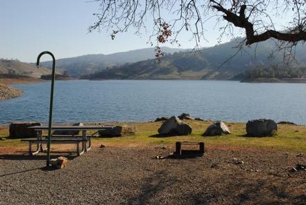
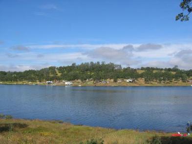
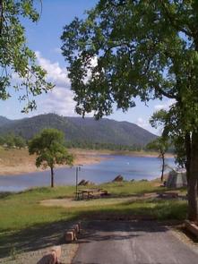
Coyote Point sits along New Hogan Lake in the brush-covered foothills of the Sierra Nevada Mountains.

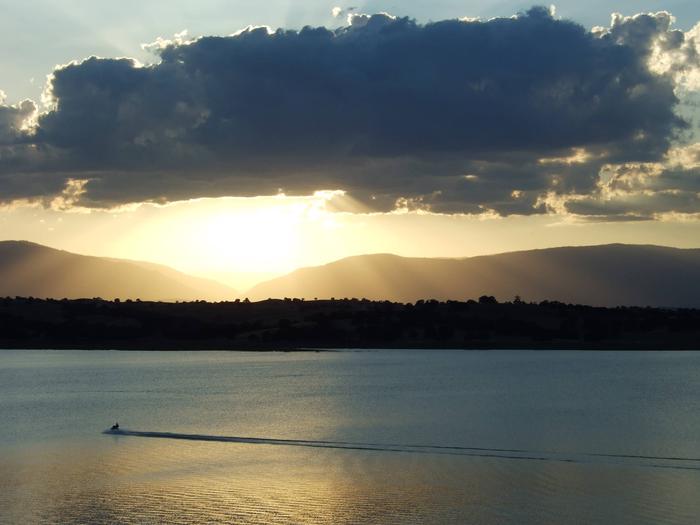
With summer temperatures regularly soaring above 90 degrees, visitors find comfort in the refreshing waters of New Hogan Lake, conveniently accessed from the campground.

Recreation

Boating is a popular pastime, with boat ramps conveniently located around the lake. The large surface area allows for plenty of water skiing, wake boarding, jet skiing and more.

Year-round fishing for stripers, bass, crappie, bluegill and catfish is perfect for experts and beginners alike. Some of the biggest fish are found in less than 25 feet of water.

The “River of Skulls” hiking trail is located below the dam at the Monte Vista Recreation Area. The trail also includes a staging area for an eight mile equestrian trail on a scenic loop that winds along the lake and through the foothill chaparral. Trail guides are available at the park office.

Bike trails suitable for the beginners as well as advanced riders are found on the west side of the lake and next to the group camping area. An easy 3-mile trail connects the park office with Acorn Campground.

Hunting with bow or shotgun during the open season is permitted in certain areas of the lake. Upland game such as turkey, quail and dove is available and waterfowl includes a variety of duck and geese.

Facilities

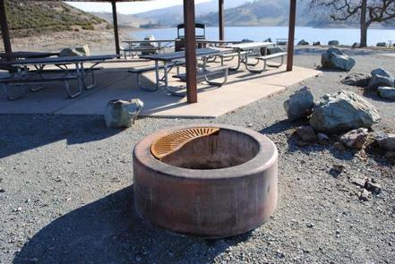
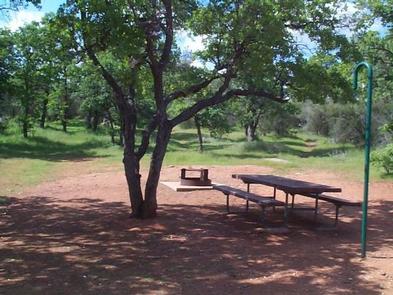
Coyote Point offers a spacious group campsite that can accommodate up to 50 guests. Campfire and interpretive programs offer additional recreation for visitors, as well as two 18-hole disc golf courses at a nearby recreation area.

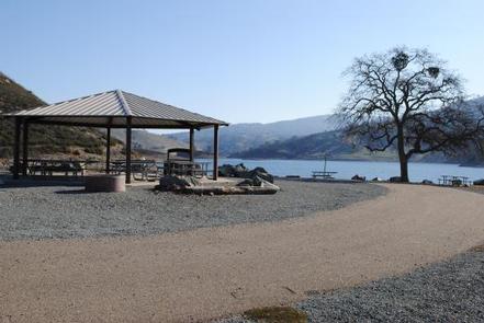
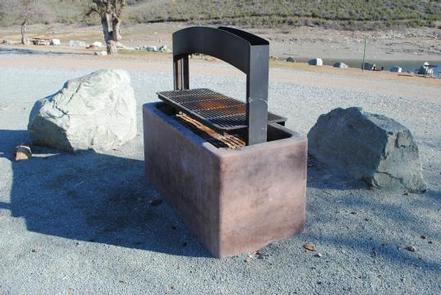
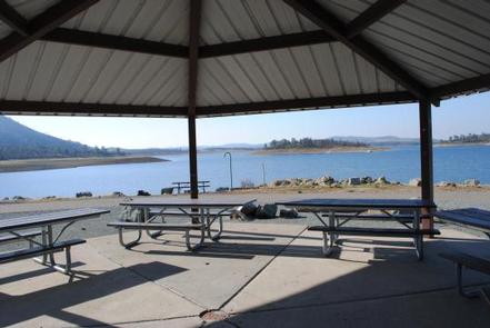
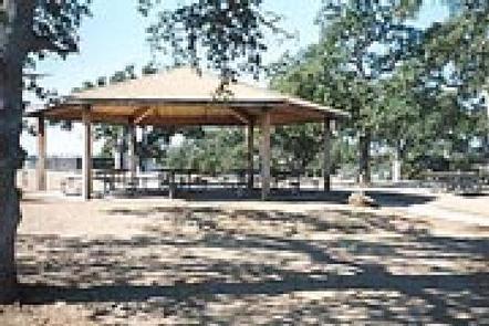
The campsite includes a large grill, picnic shelter, and vault restroom, making it perfect for group gatherings.

Natural Features

The 4,400 surface-acre lake was created in 1964 with the completion of New Hogan Dam. When full, the lake has 50 miles of shoreline and extends nearly 8 miles upstream to the confluence of the north and south forks of the Calaveras River.

The dam was built to provide flood protection to the city of Stockton and water for irrigation, drinking and hydroelectric power, and it now offers recreation opportunities for thousands of visitors each year.

The New Hogan area supports a wide variety of wildlife. The foothills are home to grey fox, mule deer, coyote, turkey, mountain lion, bobcat and rattlesnakes.

New Hogan is also a wintering home for bald eagles. The south shore of the lake has been designated as a wildlife viewing area.

Nearby Attractions

A number of historic sites are located nearby, including Carson Hill, the discovery site of the largest gold nugget ever found.

Groceries, gas, and camping supplies are available in the nearby town of Valley Springs, California.

Nearby Activities

  • Boating
  • Camping
  • Fishing
  • Hiking
  • Swimming
  • Mountain biking
  • Water access

Gallery

Directions

From Stockton California, take Highway 26 east for 30 miles. Turn right on Hogan Dam Road and continue for a mile, then follow signs to the campground.

Park Headquarters:
2713 Hogan Dam Road
Valley Springs, CA 95252
Coyote Point (located in Oak Knoll Campground):
3027 South Petersburg Road
Valley Springs, CA 95252

GPS Coordinates

Latitude 37° 59′ 3.9998″ N

Longitude 120° 50′ 40.9999″ W

Categories
Uncategorized

ACORN CAMPGROUND

Overview

Acorn Campground is a sunny campground in the brush-covered hills of the Sierra Nevada Mountains.

The area is generally characterized by a warm, dry climate with summer temperatures regularly soaring above 90 degrees.

With sites just a short walk from the shores of the popular New Hogan Lake, visitors will have no problem finding relief in the comfortable clear waters.

Recreation

Boating is a popular pastime, with boat ramps conveniently located around the lake. The large surface area allows for plenty of water skiing, wake boarding, jet skiing and more.

Year-round fishing for stripers, bass, crappie, bluegill and catfish is perfect for experts and beginners alike. Some of the largest fish are found in less than 25 feet of water.

The "River of Skulls" hiking trail is located below the dam at the Monte Vista Recreation Area. There is also a staging area for an eight mile equestrian trail on a scenic loop that winds along the lake and through the foothill chaparral. Trail guides are available at the park office.

Bicycle trails suitable for the beginner as well as the advanced rider are found on the west side of the lake and next to the group camping area. An easy 3-mile trail connects the park office with Acorn Campground.

Hunting with bow or shotgun during the open season is permitted in certain areas of the lake. Upland game such as turkey, quail and dove is available and waterfowl includes a variety of duck and geese.

Facilities

Acorn Campground offers 128 spacious campsites with modern amenities such as coin-operated showers and accessible flush toilets, as well as drinking water, an important part of staying hydrated in the summer sun.

Natural Features

The 4,400 surface-acre lake was created in 1964 with the completion of New Hogan Dam. When full, the lake has 50 miles of shoreline and extends nearly eight miles upstream to the confluence of the north and south forks of the Calaveras River.

The dam was built to provide flood protection to the city of Stockton and water for irrigation, drinking and hydroelectric power, and it now offers recreation opportunities for thousands of visitors each year.

The New Hogan area supports a wide variety of wildlife. The foothills location is home to grey fox, mule deer, coyote, turkey, mountain lion, bobcat and rattlesnakes. New Hogan is also a wintering home for bald eagles. The south shore of the lake has been designated as a wildlife viewing area.

Nearby Attractions

A number of historic sites are located nearby, including Carson Hill, the discovery site of the largest gold nugget ever found, and The Black Bart Inn, located in San Andreas, where the famous outlaw Black Bart was captured.

Groceries, gas, camping supplies and more can be found in the nearby town of Valley Springs, California.

Nearby Activities

  • Boating
  • Camping
  • Fishing
  • Hiking
  • Hunting
  • Day use area
  • Swimming

Gallery

Directions

From Stockton California, take Highway 26 east for 30 miles. Turn right on Hogan Dam Road and continue for a mile, then follow signs to the campground.

Park Headquarters:
2713 Hogan Dam Road
Valley Springs, CA 95252
Acorn Campground:
3027 South Petersburg Road
Valley Springs, CA 95252

GPS Coordinates

Latitude 38° 10′ 34.5400″ N

Longitude 120° 47′ 58.9999″ W

Categories
Uncategorized

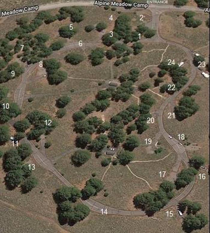
Alpine Meadow Campground

Overview

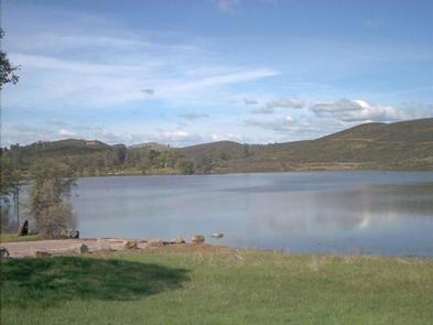
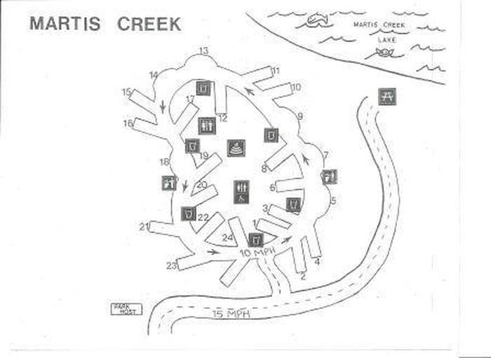
Located close to Lake Tahoe, Truckee, and Reno, Martis has a beautiful, peaceful campground off the beaten path. Martis Creek area features hiking, biking, canoeing, kayaking, and catch and release trout fishing.

Recreation

Fishing, kayaking, canoeing, walking, bicycling, picnicing. And of course camping.

Facilities

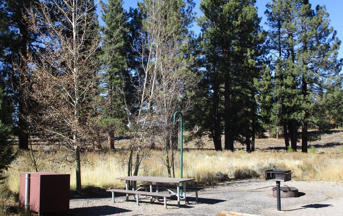
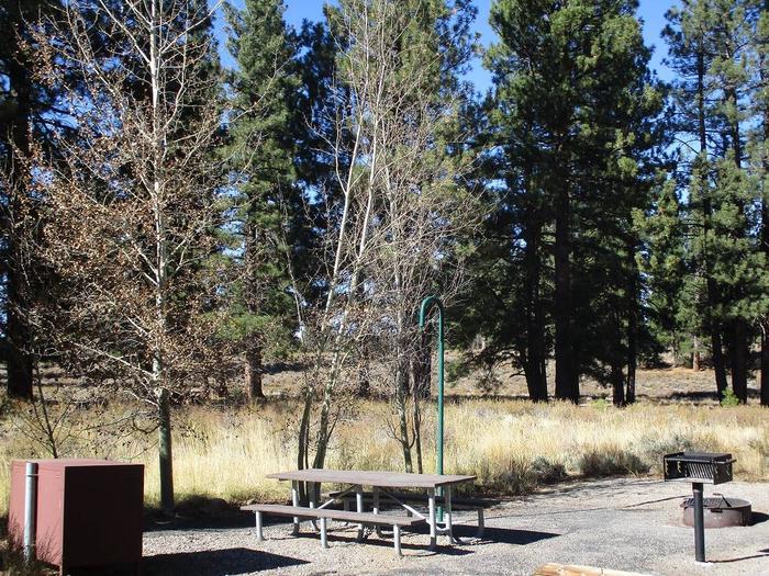
Vault toilets, potable water available at campground entrance, ampitheater.

Natural Features

Mountains, alpine valley, pine trees, lake, wild animals.

Nearby Attractions

Lake Tahoe, Truckee, Northstar, Reno, Virginia City

Charges & Cancellations

As per Recreation.gov policy.

Nearby Activities

  • Biking
  • Camping
  • Fishing
  • Picnicking
  • Wildlife viewing
  • Photography
  • Ranger station
  • Kayaking
  • Canoeing
  • Birding
  • Non-motorized boating
  • Amphitheater

Gallery

Directions

From State Highway 267, turn onto Martis Dam Road. Continue on Martis Dam Road for approximately 1.2 miles. Tur miles. Turn right a 0.2 miles to the campground entrance. You have now arrived at the entrance to Alpine Meadows Campground. 

GPS Coordinates

Latitude 39° 19′ 12.9684″ N

Longitude 120° 7′ 25.4208″ W

Categories
Uncategorized

ORLAND BUTTES

Overview

Orland Buttes Recreation Area is at Black Butte Lake, situated at the northern end of the Sacramento valley, 100 miles north of Sacramento, CA and 30 miles south of Red Bluff, CA. The lake is a popular meeting place for water sports and outdoor euthusiasts, so bring family and friends for an incredibly scenic getaway.

Recreation

Find excitement with wake boarding and sailing or explore the Paul Thomas trail for hiking. Black Butte is renowed fro its warm-water fishing, including catches such as crappie, channel catfinsh, and large and small mouth bass. Disc golf is also a popular activity here.

Facilities

The family-friendly campground offers 35 campsites and a group campground that fits 50. Conveniences include showers, a boat ramp complex, and a 18-hole disc golf course. No electric hookups or water hookups are available. The area is open seasonaly from 1 April through the second Monday in September.

Natural Features

Black Butte Lake was formed in 1963 with the completion of Black Butte Lake Dam on Stony Creek. The lake’s surface area measures 4460 acres when water levels are high. Black basalt buttes and blue oak woodland hug the lake’s 40 miles of shoreline.

Nearby Attractions

Horeseback riders can make use of the horse trails at Grizzly Flat and Burris Creek. Buckhorn Recreation Area has 13 miles of fitness trails for hiking, running, and biking.

Nearby Activities

  • Boating
  • Camping
  • Fishing
  • Hiking
  • Hunting
  • Wildlife viewing
  • Swimming site

Gallery

Directions

From Interstate 5, take the Black Butte Lake exit at Orland, CA. Travel west on County Road 200/Newville Road for 6 miles. Turn left on County Road 206 and drive 4 miles to the campground.

GPS Coordinates

Latitude 39° 46′ 19.9099″ N

Longitude 122° 21′ 10.2499″ W

Categories
Uncategorized

BUCKHORN

Overview

Buckhorn Recreation Area is at Black Butte Lake, situated at the northern end of the Sacramento valley, 100 miles north of Sacramento, CA and 30 minutes south of Red Bluff, CA.
The lake is a popular meeting place for water sports and outdoor enthusiasts, so bring family and friends for an incredibly scenic getaway.

Recreation

Find excitement with wake boarding and sailing or explore the shoreline’s 13 miles of fitness trails for hiking, running and biking.
Black Butte is renowned for its warm-water fishing, including catches such as crappie, channel catfish, and large and smallmouth bass.

Facilities

Buckhorn has 93 campsites, including a group campground and five walk-in sites. Conveniences include showers, a modern boat ramp complex, two playgrounds, an exercise area, and shoreline access. No sites have electric or water hookups. The area is open year-round.

Natural Features

Black Butte Lake was formed in 1963 with the completion of the Black Butte Dam on Stony Creek.

The lake’s surface area measures 4,460 acres when water levels are high. Black basalt buttes and blue oak woodland hug the lake’s 40 miles of shoreline.

Nearby Attractions

A 18 hole disc golf course can be accessed across from the Orland Buttes Campground. Horeseback riders can make use of the horse trails at Grizzly Flat and Burris Creek. Drive east to visit the Mendocino National Forest.

Nearby Activities

  • Biking
  • Boating
  • Camping
  • Fishing
  • Hiking
  • Wildlife viewing
  • Swimming site

Gallery

Directions

From Interstate 5, take the Black Butte Lake exit at Orland, CA. Travel west on County Road 200/Newville Road for 12 miles. Turn left on Buckhorn Road and enter the Buckhorn Recreation area.

GPS Coordinates

Latitude 39° 48′ 43.5499″ N

Longitude 122° 22′ 0.6200″ W

Categories
Uncategorized

Santa Margarita Lake Recreation Area

This recreation area is part of Santa Margarita Lake

Directions

GPS Coordinates

Latitude 35° 19′ 42.0784″ N

Longitude 120° 29′ 27.1871″ W

Categories
Uncategorized

San Bernanrdino County Recreation Area

This recreation area is part of Prado Dam

Directions

GPS Coordinates

Latitude 38° 40′ 7.5180″ N

Longitude 95° 33′ 44.8632″ W

Categories
Uncategorized

Mojave River Forks Regional Park

This recreation area is part of Mojave River Dam

Directions

GPS Coordinates

Latitude 34° 19′ 48.5040″ N

Longitude 117° 16′ 2.2361″ W

Categories
Uncategorized

Alamo State Park

This recreation area is part of Alamo Lake

Directions

GPS Coordinates

Latitude 34° 14′ 3.7752″ N

Longitude 113° 33′ 12.2184″ W

Categories
Uncategorized

W. Kerr Scott Visitor Assistance Center Conference Room

Overview

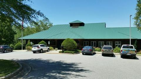
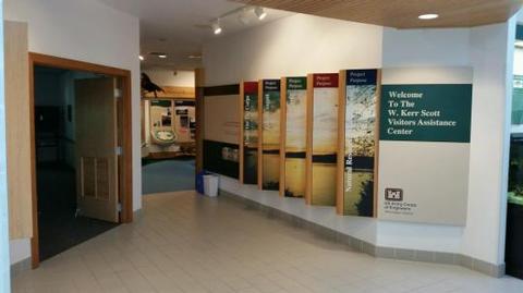
The Visitor Assistance Center conference room is located beside the dam at W. Kerr Scott Reservoir in northwestern North Carolina.

Recreation

The 1,475-acre reservoir offers excellent boating, canoeing, kayaking and swimming opportunities. Anglers will find channel catfish, large and smallmouth bass, bluegill, threadfin shad, spotted bass, striped bass, and hybrid striped bass.
Miles of multi-use trails, that allow hiking and mountain biking, surround the lake, including the Overmountain Victory National Historic Trail, which can be accessed from the parking lot outside the Visitor Center. An additional 25 miles of trails can be found at the Warrior Creek and Dark Mountain areas.

Facilities

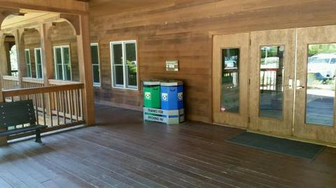
The conference room offers eight, 8-foot tables, 40 chairs, and is ADA-accessible. Flush bathrooms and a water fountain are located within the building. There is no kitchen available. The area around the Visitor Assistance Center has scenic views and is close to other park amenities which include a boat ramp, two reservable shelters, a museum and Environmental Education Center located in the Visitor Assistance Center, and access to the Overmountain Victory Trail and Native Tree Trail.

Natural Features

The gentle Yadkin River flows through its scenic namesake valley in the foothills of the eastern Blue Ridge Mountains. Forests of mixed hardwoods, including sycamore, poplar, oak and hickory, cover the region. Wildlife is abundant in the valley. White-tailed deer, black bear, eastern cottontails and more can be found among the hills. Birds in the area include wild turkey, woodpeckers, Carolina chickadees, red-eyed vireo, ovenbirds, mallards and wood ducks.

Nearby Activities

  • Visitor center
  • Environmental education
  • Ranger station

Gallery

Directions

From Charlotte, North Carolina, take I-77 North (approximately 60 miles) before merging into Highway 421 North towards Wilkesboro / Boone. Continue to Exit 286B (approximately 20 miles), turn left onto Highway 268, continue for approximately 4 miles and turn right on Reservoir Road. Turn left into the Visitor Assistance Center parking lot after 0.25 miles.

From Winston-Salem, North Carolina, take Highway 421 North (approximately 55 miles) to Exit 286B, turn left onto Highway 268, continue for approximately 4 miles and turn right on Reservoir Road. Turn left into the Visitor Assistance Center parking lot after 0.25 miles.

From Wilkesboro, North Carolina, head west on Main Street / Hwy 268 / Hwy 18 (approximately 4 miles) and turn right on Reservoir Road. Turn left into the Visitor Assistance Center parking lot after 0.25 miles.

GPS Coordinates

Latitude 36° 7′ 50.0002″ N

Longitude 81° 13′ 44.0000″ W